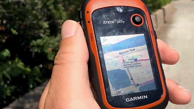

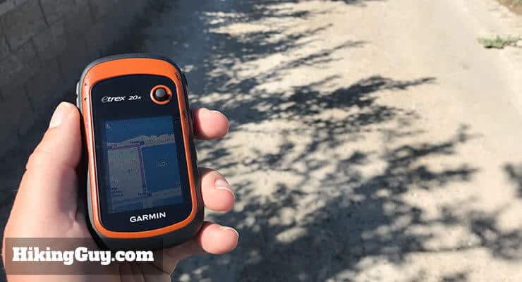
Garmin eTrex 20x Hiking GPS Review
The Garmin eTrex 20x is your best bet for an inexpensive, dedicated, outdoor ready hiking GPS. There are more expensive models, and smartphone alternatives, but for a lot of hikers, the eTrex 20x will give you the best bang for the buck. Here's why I recommend it.
- Why you should get the eTrex 20x
- How to get free maps for the eTrex 20x
- Using your eTrex 20x
I'm not using the eTrex 20x anymore. You can see which handheld GPS that I'm using on my latest gear page.
What the Garmin eTrex 20x Is and Is Not
The eTrex 20x is a small, outdoor ready mapping GPS unit. You can follow a pre-made track or route, or navigate to a waypoint. Or you can navigate by looking at the loaded maps on the small color screen. It's waterproof, rugged, and outdoor ready (so unlike most phones, you can drop it without shattering the screen).
If you read the reviews for the eTrex 20x (especially on Amazon), you'll see that many people give it low stars and complain about the maps. Garmin's marketing makes it seem like you can start mapping hikes out of the box with this thing, and it's not true.
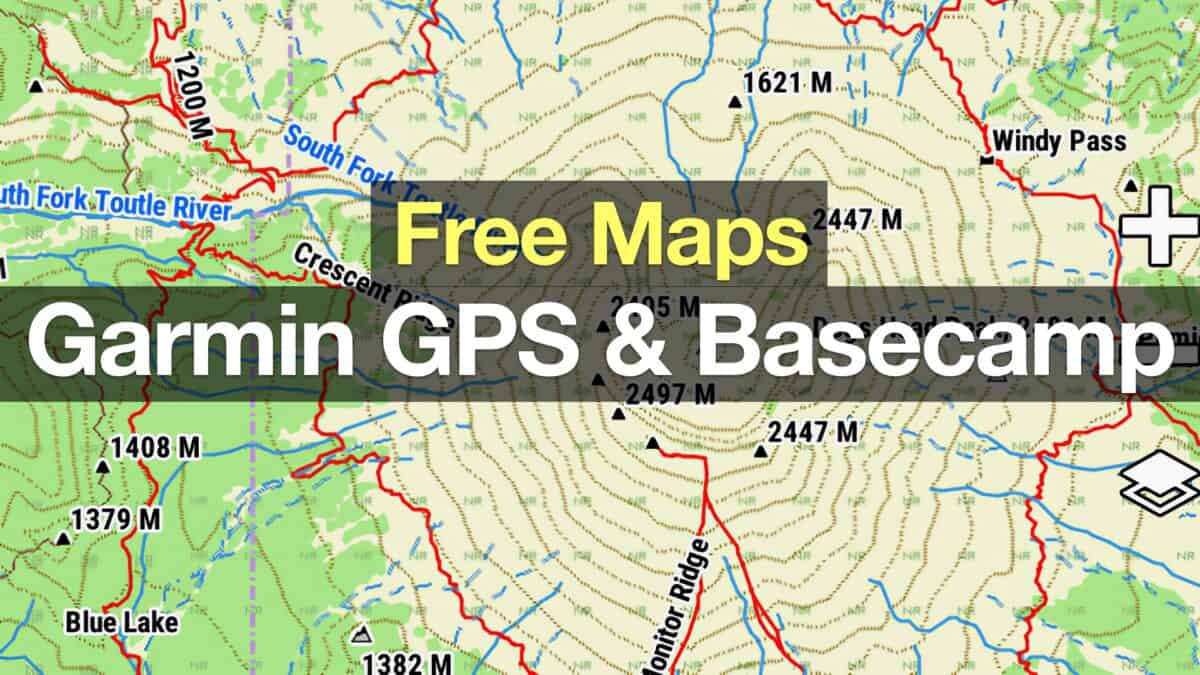
Garmin includes a base map, which will basically tell you what city you're in and what interstate is close to you. It's pretty worthless, BUT BUT BUT you can get free topographic maps and load them on the unit very easily. No need to buy expensive Garmin maps. And Garmin provides a free program called Basecamp (Windows and Mac) that's a great tool for planning routes and loading them onto the unit. I use it all the time.
So with the free maps, and Basecamp for planning, the Garmin eTrex 20x is powerful tool. It's small, rugged, and easily helps you navigate the trails. Whenever someone asks me for an inexpensive GPS recommendation, I tell them to get the eTrex 20x. I carry one myself and use it in addition for my Fenix and smartphone (because I'm a freak about having backups).
When I was younger I might've eschewed the use of something like this, but as I get older, I appreciate knowing exactly where I am at any given time. I wouldn't hit the trail without it. - REI Reviewer
Why the eTrex 20x Is a Great Hiking GPS
It Has the Crucial Navigation Features
There are some basic functions that I look for in a hiking GPS, and the eTrex does all of them well. Here's what it does:
- Allows you to follow a GPX tracks that you've downloaded off the internet
- Allows you to create your own hiking tracks and routes in (free) Garmin Basecamp and send them to the eTrex 20x
- Marks waypoints to save important places
- Navigates to a waypoint
- Tracks you progress, speed, time and distance
- Allows you to save your hikes to your computer or online on Garmin Connect
- Has map browsing and navigation capabilities
- Has 3.7gb of internal memory to hold plenty of maps
In addition to those basic functions, the eTrex 20x has some bells and whistles that I like.
- If you plan a route in Basecamp and send it to your eTrex 20x, the unit will alert you with a wake and chime when you need to turn or change your track (to stay on the route).
- It has a proximity alarm that will wake and chime the unit when you get close to a waypoint or coordinate.
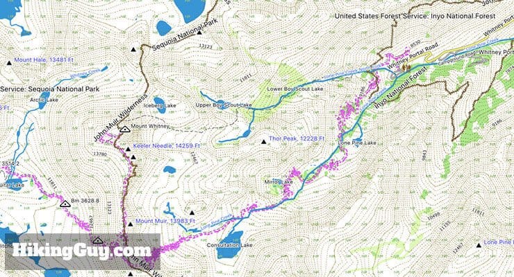
- It can accept a wide variety of free topographic (and other) maps. I use these great (free) topographic maps.
The GPS Is Solid
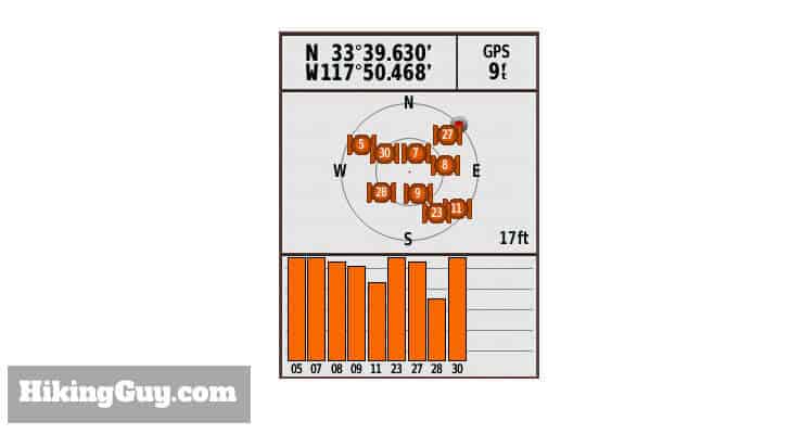
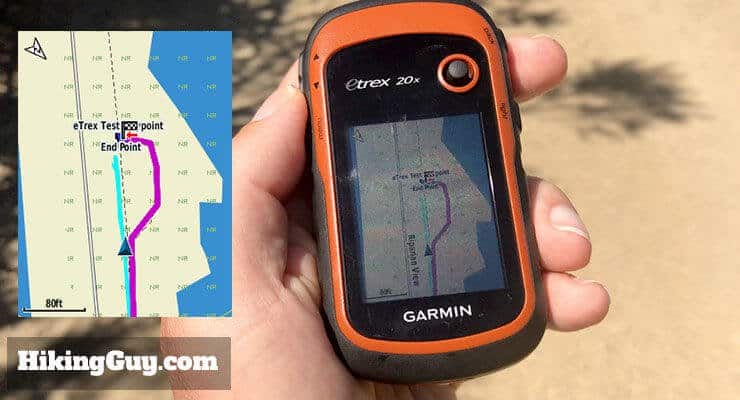
A hiking GPS is really only as good as the signal it can get, and the eTrex is solid in that department. It picks up a signal very quickly (actually quicker than some of the more expensive units that I tested). In addition to standard GPS signals, it also has WAAS, which can improve accuracy. You can also enable GLONASS support, which is Russia's version of GPS. Enabling GLONASS allegedly improves your accuracy by up to 20%. I enable GLONASS and WAAS and it works great. If you want to save battery, you can also turn those features off.
I didn't have scientific way of testing the GPS versus other units, but I did do dozens of real world hike spot checks on the eTrex 20x, Fenix 3HR, iPhone 7 Plus, and Oregon 700. Every time I checked, the eTrex 20x was within 20 feet or so of all the other positions, which is good. And I confirmed that GLONASS improved accuracy a bit. And just a reminder, unless you're geocaching, it's not that crucial to know exactly where you are. I generally use it to see if I'm on the right trail, and that's generally pretty obvious.
The Battery Works Well
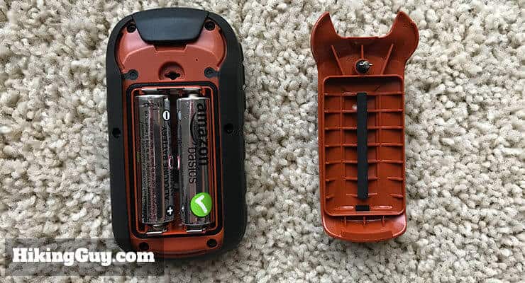
First off, I love that it uses AA batteries. That means you can just carry extra batteries when you need more juice. They can be rechargeable batteries, or the same old AA you can get in any gas station. No need for USB chargers, solar panels, or anything else fancy. Carry some extra AA batteries in your pack and call it a day.
With normal alkaline AA batteries I get about 22-24 hours of batteries depending on my backlight brightness and how much I use it. When I used Lithium batteries I got between 40-50 hours of use. The lower number seemed to be when I was in canyons where it had to work more to lock onto a signal. The 50 hours were in my "normal" hiking with better line-of-sight.
To maximize your battery life, turn off GLONASS, WAAS, and minimize the backlight.
Our eTrex 20x used only one set of AA lithium batteries to complete 93 miles in 9 days on the Wonderland Trail - REI Reviewer
Other Notable Features
- It's waterproof and durable. You can drop it and the screen won't shatter like a phone.
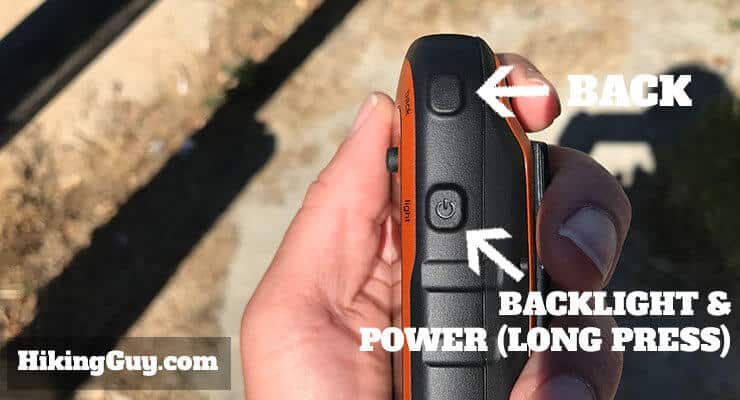
- The software and buttons are simple and easy to use.
- You can customize the data fields.
- It has sunrise and moonrise.
- The buttons are big enough to use when you have gloves on.
- The screen is easy to see in bright daylight.
- It's inexpensive. If you don't want to spend a ton on a GPS but you still want a solid unit, the eTrex 20x is your move.
What Could Be Better
- If you're used to an Android or iPhone, the software on this unit will feel like a step back to Windows 95. If you spend 5 minutes playing around with it, you'll figure it out.
- I get that Garmin sells maps, but in this day and age, they should be free. Garmin would probably be served better by having free maps and focusing on building great hardware. That said, you can get plenty of free maps to load onto the unit here.
- The screen is a bit small. I wouldn't use the eTrex 20x to plan all my routes, but you can use it to do that. It's much easier to plan your routes in Basecamp and send them to the device.
- It doesn't come with any mounts or a lanyard. Easy enough to buy for a few bucks. I carry mine in the side pocket of my daypack. It's small enough to fit in your pocket.
Great if your a hiker of any sorts - easy to use, multifunctional, I like that you can update it and load files on for trips and change them out for other trips, great that you can load hikes from where you never been, nice having peace of mind of not getting lost, batteries last a good long while, not heavy and easily packable - Amazon Reviewer
Comparing the eTrex 20x To Other GPS Options
There are a lot of GPS options, which is a great thing for us hikers. Here's how the eTrex 20x stacks up to the other GPS options on the market.
eTrex 20x or a Smartphone
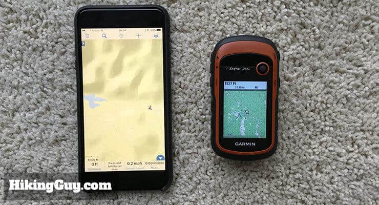
Your smartphone is probably thousands of times more powerful than the eTrex 20x. The screen resolution probably leaves the eTrex 20x in the dust. But phones are only good if they work, and most phones aren't as rugged as the eTrex 20x.
First, cell phones are notorious for going dead, especially in the backcountry. What typically happens is that you lose a cell signal, then your phone starts constantly searching for a signal, which quickly drains the battery. You can solve this problem by putting the phone in flight mode, but some phones don't allow the GPS to work in flight mode. So it can get tricky. I typically use my iPhone in offline mode with Gaia GPS in addition to a dedicated GPS unit like the eTrex 20x. If you're interested in a Gaia GPS premium membership, HikingGuy readers get 20-40% off with this link: https://www.gaiagps.com/discounts/#_r_hikingguy.
The other issue is the durability of a smartphone. If your phone isn't waterproof, you need to protect it from moisture (easily solved with a plastic sandwich bag). The bigger issue for me is the screen. Most phones aren't shatter-proof, and my sweaty hands have dropped a few phones, cracking the screen. I even tried rugged cases like the Otterbox, and still cracked them. The phone doesn't have to hit the ground with force to crack, it just has to hit at a certain angle or spot and a crack or shatter.
eTrex 20x or a Bigger/Better Handheld GPS
The nice thing about the eTrex 20x is that it gives you the basic, most useful GPS functions in a small, inexpensive package. If you look at the more expensive models from Garmin, etc., they bundle in extra features that aren't important for most hikers.
For example, take a look at the high end Garmin 750t, another handheld mapping GPS. For about $350 more than the eTrex 20x, you get: a bigger screen (maybe worth it), a camera (which you probably have anyway), topographic maps (which you can get for free), WiFi/Bluetooth connectivity (who cares on the trail), and some other minor features. Now maybe one of these features is important to you for whatever reason, in which case go for it. But if you just want a solid GPS for hikes, you don't really need all the bells and whistles.
eTrex 20x or a GPS Watch
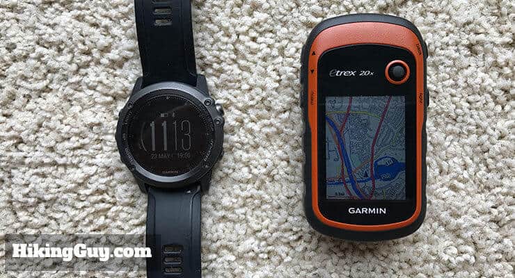
My main GPS device is a Garmin Fenix. I use it for basic navigation checks, and also as a powerful workout tracker (I use it for running, hiking, biking, swimming, etc.). I also use the eTrex 20x. The eTrex 20x has a bigger screen, and is easier read and navigate from. It's also a fraction of the cost of a GPS watch. If you're looking for a full featured device that lives on your wrist, the Garmin Fenix is the move. If you want a basic GPS for the trail, go with the eTrex 20x.
eTrex 20x or the eTrex 30x
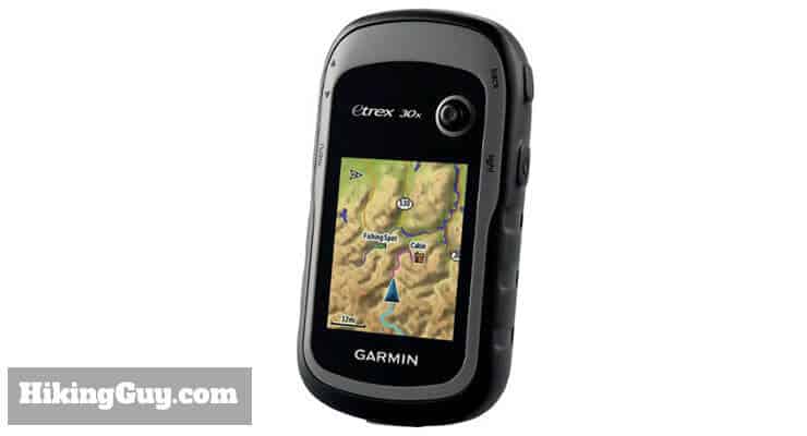
These two units are almost identical. The difference is that the eTrex 30x has a built in compass and altimeter, and the eTrex 20x does not. The eTrex 20x uses the GPS and movement to determine your compass heading. If you're standing still, you won't get an accurate compass reading. And the eTrex 20x uses GPS map data to determine your altitude, while the 30x actually uses a built in barometric altimeter. If those features are important to you, spend the extra few bucks for the eTrex 30x. Otherwise the units are identical.
There are also eTrex Touch devices that have touch screens. I found the buttons on the eTrex 20x to work better for me than the touch screen, especially when my hands were cold or wet.
Buying The eTrex 20x
I highly recommend ordering your eTrex 20x from REI. You can probably get it for a few dollars cheaper on Amazon, but that comes with a risk. Usually the eTrex 20x is sold through a third party on Amazon, and it's hard to return or get support on. With REI, there are no hassle returns, you can go to a store and get help using it, and you get the REI member dividend back.
5 star. Works great. Accurate. Great price for value. - Amazon Reviewer
If you’re thinking about buying the Garmin eTrex 20x, there’s something important you can do to help support this site. Simply click on the link below to REI and purchase the unit from REI online. I get a small percentage of the sale, which helps me keep the website alive and produce unbiased reviews and free hiking guides.
Check out eTrex 20x Reviews and Prices at REI
Setting Up Your eTrex 20x
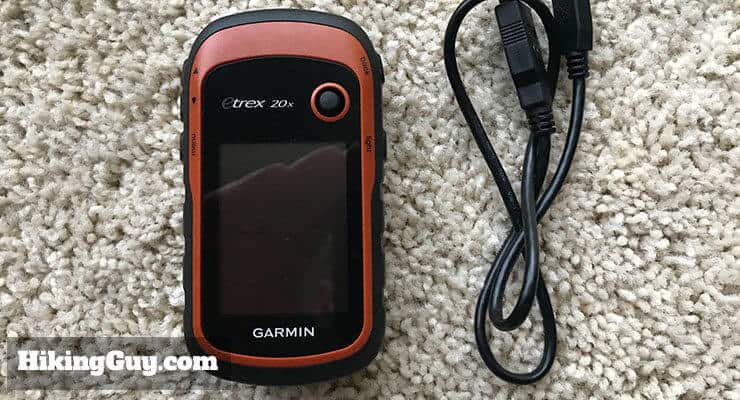
When you first get the eTrex, there's not much to it, just a unit and a USB cable (it uses a mini-USB connector on the unit). If you want a manual, check out the online version which is easier to read than the miniature version they package with the unit.
Here's how to get started.
- Head to Garmin Connect and setup an account if you don't have one yet.
- Install the free Garmin Express software on your computer (Windows and Mac).
- Start Garmin Express, put batteries in the unit, and plug in the USB cable.
- Garmin Express should recognize the unit and ask you to register it.
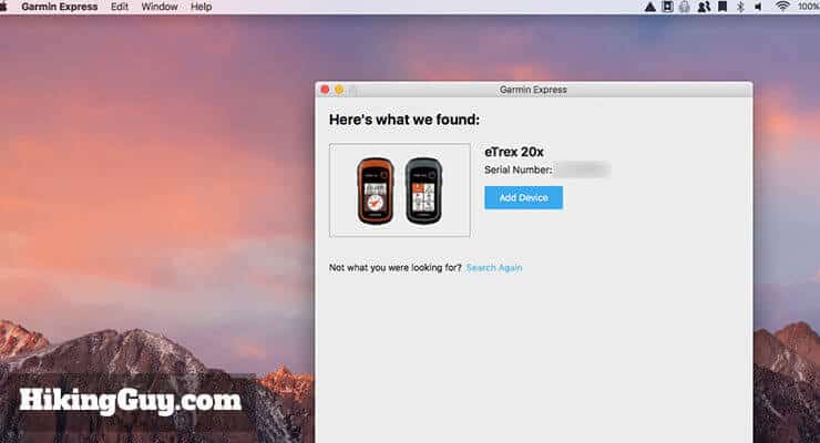
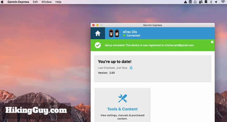
Garmin Express asking me to register my device. - Garmin Express will check for updates and make sure your device is up to date. Go through all these steps to update the software (if prompted).
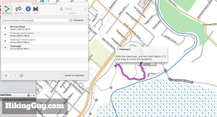
Use Garmin Express to check for updates. To send tracks and waypoints back and forth to the device, use Garmin Basecamp. - Download Garmin Basecamp and install on your machine.
- Download free topographic maps from your region from GPSFileDepot (or jump ahead to the topographic maps I use at GMapTool).
- Follow the directions on those sites to install the maps onto your device. It's different for Windows and Mac, and different for each map service.
- After you go through those steps to send the maps to your device, launch Basecamp, go to Setup > Maps and enable your new maps (and disable the default map if you don't want to see it).
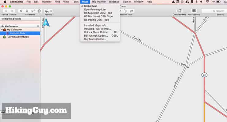
You can install multiple maps in Garmin Basecamp and easily switch between them. - Go through the eTrex 20x setup and customize other aspects of the device if you'd like. Here are some recommendations.
- Turn the Battery Saver on and set the screen timeout to 15 seconds.
- Turn off WAAS and GLONASS if you want to save your battery.
- Check that your units are set correctly (believe mine came as metric).
- Make sure your battery type is set correctly (alkaline, lithium, etc.)
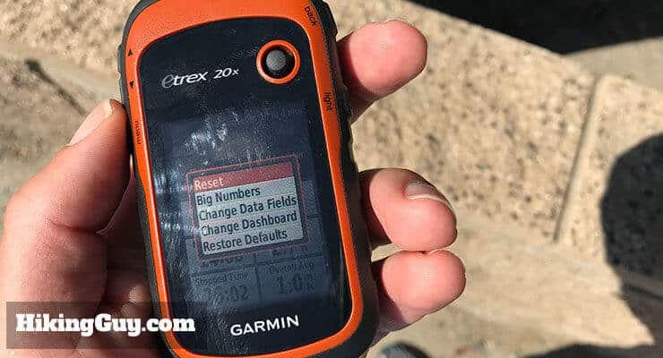
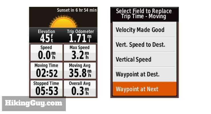
- Customize the data fields.
- Disable the default map and enable your new (free) maps
How to Use the eTrex 20x
Works great after it's setup and you actually learn how to use it. - Amazon Reviewer
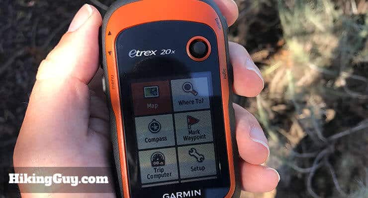
The Interface
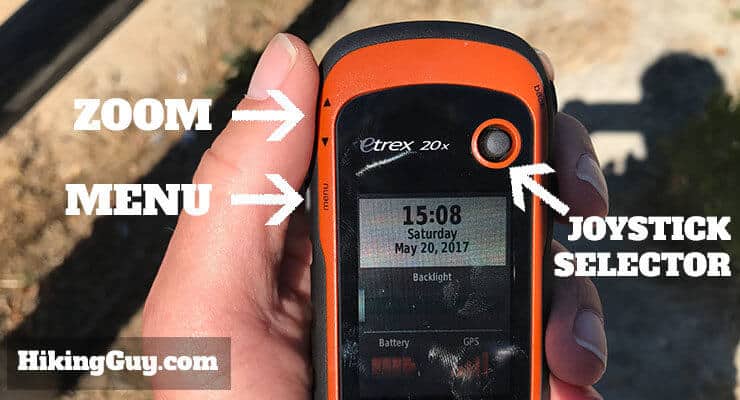
Not much to say here, aside that it's pretty simple to use once you get used to the buttons and menu. You can customize things like the menu order and data fields shown. Here's how it works.
To avoid accidental joystick touches, try this tip from Dan: Use a Bic pen body cut down to cover the stick when not in use. Fits tight and easily replaceable.
Planning Your Route
I highly recommend planning your route on your computer before you start. It's much easier than planning a route on the small screen of the eTrex 20x. I have a whole article on planning your hike here. Once you have your route or track, send it to your device.
It Works Like A Trip Computer
If you're used to a fitness model of the Garmin, the eTrex 20x works differently. On a fitness model like a Fenix, you hit start, and it tracks your activity like a stopwatch until you hit stop. The eTrex 20x works more like a car odometer. When you want to start a new hike, you reset the trip computer and it starts recording while the unit is on. When you're done, you save the track and reset the computer.
Following a Route
In Garmin Basecamp you can create routes, which are similar to turn by turn directions on an automotive GPS. You simply create it, send it to the eTrex 20x, and then navigate using the route. When there's a turn or change in the route, the unit will wake and chime to alert you. I wouldn't rely on this as your sole way to navigate, but it's handy.
Following a Track
You can also download GPX tracks (like the ones from this website) and view them on your device. Send the track to the device in Basecamp, and then simply bring it up on the device. If you're on the purple line, you're on the track. It's handy when you come to an intersection and need to figure out which way to turn. And (obviously) nice if you're navigating off trail as well.
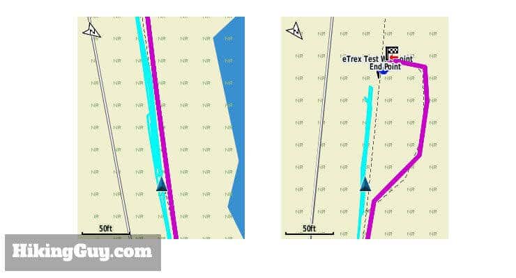
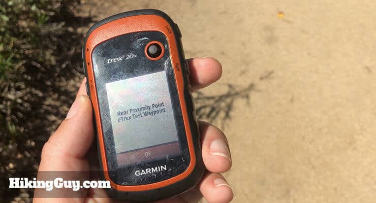
Waypoint Proximity
You can set a proximity alarm for a waypoint. When you get close to the waypoint, the unit will wake and chime. This is helpful for important locations on the trail, for example, and unmarked turn.
Marking and Navigating to Waypoints
This is a basic function on most GPS units, and the eTrex 20x supports it too. You can mark a waypoint where you are, or use the joystick to scroll around the map to mark a waypoint. You can then navigate to any waypoint, with the unit's compass pointing you in the right direction.
I have used by eTrex 20x for two hiking/hunting/fishing seasons. It has proved to be a very rugged and reliable GPS. I bought it to geocache and it also proved to be very accurate. For off-trail use in heavy PNW forest, it was indispensable. Got me back to the vehicle every time. - Amazon Reviewer
Getting Help With Your Garmin eTrex 20x
Unfortunately I'm not able to provide tech support for everyone who emails with an eTrex question. Here's where to go for help:
- Post on the Garmin Forum
- Check out the Garmin Reddit page
- Ask Garmin
Tips for Using the eTrex 20
Basic GPS Concepts in Use
Need More Info?
- Have a question about the guide or want to see what other people are saying/asking? View the Youtube comments for this video. Leave a comment and I will do my best to respond.
Related Guides
 How To Get Free Garmin GPS Maps For Hiking
 How to Create and Download Garmin Custom Maps
 In-Depth Garmin eTrex 32x Review & How-To Guide
 Hiking Gear & Outdoor Technology
Popular Guides
 Best Hiking Gear 2024
 Hiking Boots or Shoes: Do I Really Need Hiking Boots?
 When to Hit SOS on inReach
This Guide Was Written by Cris Hazzard

Hi, I'm Cris Hazzard, aka Hiking Guy, a professional outdoors guide, hiking expert, and author based in Southern California. I created this website to share all the great hikes I do with everyone else out there. This site is different because it gives detailed directions that even the beginning hiker can follow. I also share what hiking gear works and doesn't so you don't waste money. I don't do sponsored or promoted content; I share only the gear recommendations, hikes, and tips that I would with my family and friends. If you like the website and YouTube channel, please support these free guides (I couldn't do it without folks like you!). You can stay up to date with my new guides by following me on YouTube, Instagram, or by subscribing to my monthly newsletter.