
- Highs and lows of the GPSMAP 66i
- Should you get a 66i or another InReach?
- GPSMAP 66i walk though
- How to use the GPSMAP 66i
- Battery life, GPS performance, and other evaluations
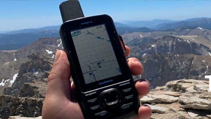
TheGPSMAP 66i is Garmin's top-of-the-line handheld GPS unit with InReach satellite communications built-in. It's a solid device built for outdoor use and navigation. I've logged months of testing and use for this Garmin GPSMAP 66i review, and while it's a solid unit, it's also isn't for everyone.
You can support this website and these independent reviews by using the links above to purchase this or anything. I receive a small commission that helps offset website costs; you pay nothing extra.
Important Update
Highs and Lows of the GPSMAP 66i

From a high level here's what I found out after using this for hundreds of miles and many hours on the trail.
Highlights
- The 66i is a professional level, rugged GPS built to withstand and outdoor environment. You can drop it, get it wet, sit on it, and it works.
- The unit is ergonomically well thought out and works well in your hand, in all conditions.
- The built-in InReach technology works pretty much the same (if not identical to) the other InReach devices.
- The GPSMAP 66i is fast. It boots up quickly and gets a GPS fix very fast. The software works well and mostly doesn't lag (unless you do a drastic zoom on the map).
- The topo maps that come preloaded on the device are much better than they used to be and have more trails than before. You can also load OSM and other maps onto the device easily. It even has a micro-SD card slot to supplement the 16gb of internal storage.
- The battery works as advertised and you can tweak some settings to get weeks of tracking out of it.
- The screen is big and bright, and easy to read in direct sunlight and rain.
- You can customize the unit so that you only see what is important to you.
- You can also download third-party apps and data fields from the Connect IQ store that allow you to customize the device even more.
The Not-So-Great
- It's expensive.
- The interface is the same old clunky interface that has been around on Garmin units for years. If you're used to using a smartphone app like Gaia GPS to navigate, using the GPSMAP 66i will feel like you picked up your grandmother's flip phone.
- The Garmin Explore website and app that you use this in conjunction with is not so slick. I'd expect this to improve as they enhance the site and experience.
- The Birdseye imagery is pretty worthless (UPDATE)
- There are some quality issues that have been getting better with newer firmware releases.
- Unless you've been using a Garmin handheld GPS for a while, it takes a little time to get used to using it.
I literally just returned from the Colorado Trail segments 2, 3, and 4 where this device performed flawlessly in a wide array of environmental conditions ranging from direct sun to snow and rain. I had no trouble getting messages out in canyons, I experienced quick satellite acquisition, and I had excellent navigation results with the high-resolution maps preloaded on the unit. - REI Reviewer
Is the GPSMAP 66i For Me?
If you're looking for the top of the line handheld GPS navigator, explicitly built for the outdoors and other harsh environments, the GPSMAP 66i is your move. People who I see using this are hiking power-users/geeks, backpackers on the trail for days to weeks, surveyors, hunters, and SAR teams.
If you are considering other options like the InReach Explorer, or are questioning the high price tag of the GPSMAP 66i, read on. In this section I'll run through how the GPSMAP 66i stacks up to the alternatives and when you should perhaps go with another option. If you want to dig into the walkthrough of the unit itself, skip ahead to the next section.
I'm not going to compare the 66i to the SPOT, because I don't think the devices in the same ballpark. If you want to compare the InReach (in general) to the SPOT, take a look at the SPOT comparison in myInReach Mini review.
GPSMAP 66i vs InReach Explorer
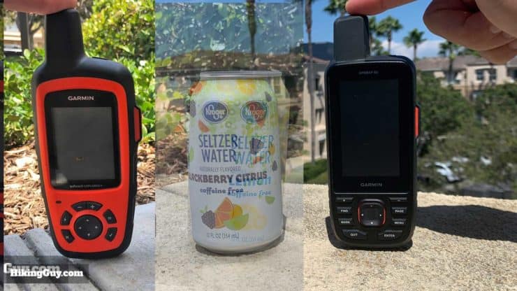
I've tested and reviewed the inReach Explorer and it's a solid unit. At first glance these two handheld GPS units look similar, and they do have things in common. But there are some differences. You can frame the comparison like this:
- The GPSMAP 66i is a full-featured navigation GPS with InReach capabilities added in.
- The InReach Explorer is an InReach satellite communicator with maps and limited navigation features added in.
The InReach Explorer has these strengths.
- It's cheaper than the GPSMAP 66i.
- The battery life is better (30 days in power-safe mode versus about 8 days when the 66i is in expedition mode).
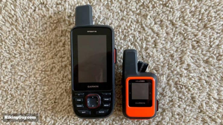
- It's 1.6oz lighter and a little smaller than the 66i.
You'll start seeing flaws in the Explorer once you try to use it for navigation, and that's where the GPSMAP 66i shines.
- The GPSMAP 66i can store 10,000 waypoints and 250 routes (versus 500 waypoints and 20 routes on the Explorer).
- The 66i can route you on trails, while the Explorer only does straight lines between points.
- The maps on the 66i are Garmin TopoActive, and have more detail and trails than the options for the Explorer. You can also load more maps onto the 66i with micro-SD cards or onto the 16gb internal memory.
- The screen on the 66i has almost twice as many pixels and reads better in daylight and rain. It's much easier to read the detail.
- Getting a GPS fix is much quicker. The 66i uses both the American GPS and European Galileo satellites to get a position fix.
So which one should you get? If you're just looking for a satellite communicator with long battery life, go with the InReach Explorer. I saw a decent amount on thru-hikers using the Explorer this year and I suspect this is why. You can tell friends and family that you're safe, and you can also take a look at your GPS position on a map. Just those two things alone are really powerful tools in a small package.
If you want a communicator and handheld GPS device that you can really navigate with, the GPSMAP 66i is a clear winner. Even if you are on an extended hike, the 66i might be a better option because you can probably load the full route and all waypoints onto one device (just once). The 66i has a 1 year battery life when off (with no use). Based on that spec I'd speculate that you could use it once a day to send a message and check your position for at least a month if not longer on one charge. And it charges with any old USB charger which is easy enough.
GPSMAP 66i vs InReach Mini
This one is more straightforward. If you just need a satellite communicator and already have a GPS or smartphone that you navigate with, then get the InReach Mini (full review here). It's a great unit that is cheaper, small, and light. You can perform navigation with it when you pair it with a smartphone and the Earthmate app. But you don't even really need to do that since most phones have a GPS built-in anyway.
If you want navigation with InReach and are not comfortable relying on a smartphone in the backcountry, then go with the 66i.
GPSMAP 66i vsGPSMAP64 Series
If you're considering upgrading from a GPSMAP 64 series, it might not make sense unless you're looking for a specific feature. The 66i offers InReach, a better screen, WiFi, and more memory, but otherwise they are very similar.
- If you need inReach communications and you love your 64, then upgrade to the 66i.
- If you find yourself running out of memory with your tracks, waypoints, etc. on the 64, get the 66i (or 66st if you don't need InReach).
- If you want a bigger screen, go with a 66.
Otherwise I'd say stick with your 64 and wait and see what the next iteration of handheld GPS offers.
GPSMAP 66i vsOther Garmin GPS Handhelds
The GPSMAP 66i is the top of the line. It doesn't have a touch screen, which I look at as a positive for outdoors use. But it does have the familiar interface that you're probably are used to using. The hardware and chipset on the unit is top of the line, and the 66i will likely be much quicker and more powerful than an older handheld Garmin GPS that you're using now.
So if you like the Garmin interface and want InReach, or if your current unit is slow/hurting, then a 66i might be the move.
GPSMAP 66i vs Smartphone
This is where it gets tough. Most smartphones paired with a good navigation app like Gaia GPS are incredibly powerful and leave the GPSMAP 66i in the dust. On a smartphone you can pinch and zoom, choose from dozens of map layers and sources, and store hundreds of thousands of waypoints, tracks, and routes.
So that seems that the phone is a no-brainer, but the one fatal flaw of the smartphone is that it's not built for rugged backcountry use. Try using a touchscreen in the rain. Try looking at the small writing on navigation app screens when you have mild snow or sun blindness. The big buttons and simple interface of the GPSMAP have their advantages in the right situation. What happens when the phone drops and the screen cracks? Or when the battery dies because you forgot to put it in flight mode?
And of course, a smartphone doesn't have satellite communicator capabilities (yet!).
But for most folks who don't do hardcore backcountry hiking and navigation, a good smartphone, Gaia GPS (or similar), and an InReach Mini will be the perfect pairing. It's lightweight, powerful, and inexpensive (assuming you have a smartphone already). And if you don't have a smartphone or want something that's backcountry-ready, you can get full-featured Android phones that are Military MIL-STD-810G ruggedand have a battery that lasts a week. If you're a power user you can tweak the battery settings to get even more life out of the phone. So there are some interesting options.
So why get a 66i over a smartphone?
- The GPSMAP 66i is a top-of-the-line handheld unit built for the outdoors. You don't have to worry about dropping it or breaking it. You're not stitching different systems and units together through Bluetooth to get backcountry navigation and InReach communications.
- You can customize the 66i with the default software and also by extending the unit through the Connect IQ Store. "Store" is a bit of a misnomer since the majority of apps are free. But overall you can tweak the interface and data to fit your needs. Many smartphone apps are limited in what customizations you can do to the interface.
So Who Should Get the GPSMAP 66i?
I think the number of alternatives to and price of the GPSMAP 66i make it a bit of a niche product. I'd say go for the GPSMAP 66i if:
- You want a rugged, outdoor-proof GPS navigator and InReach communicator in one device.
- You are a current Garmin handheld GPS user who wants to upgrade.
- You have Garmin 24k topo maps that you want to use.
- You want a good GPS navigation backup with InReach for your smartphone.
- You are going on an extended backcountry trip and you want to load lots of waypoints, tracks, etc.
Still interested in the GPSMAP 66i? Let's dive deeper and take a look. I've been using it extensively and have a lot to share.
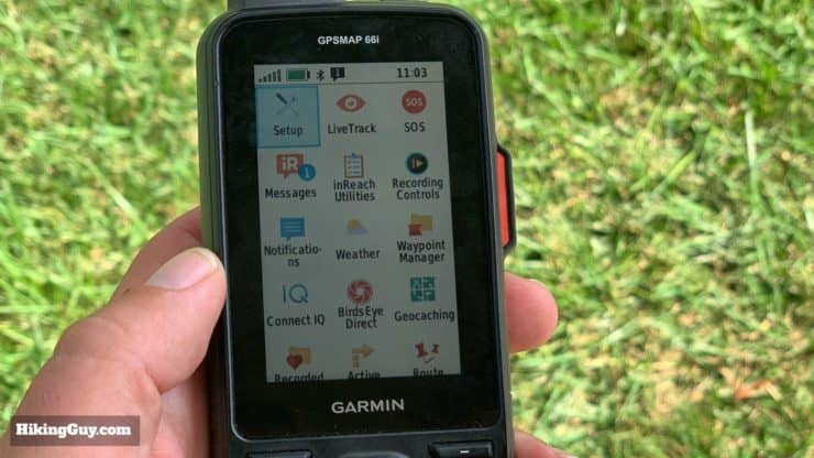
GPSMAP 66i Overview
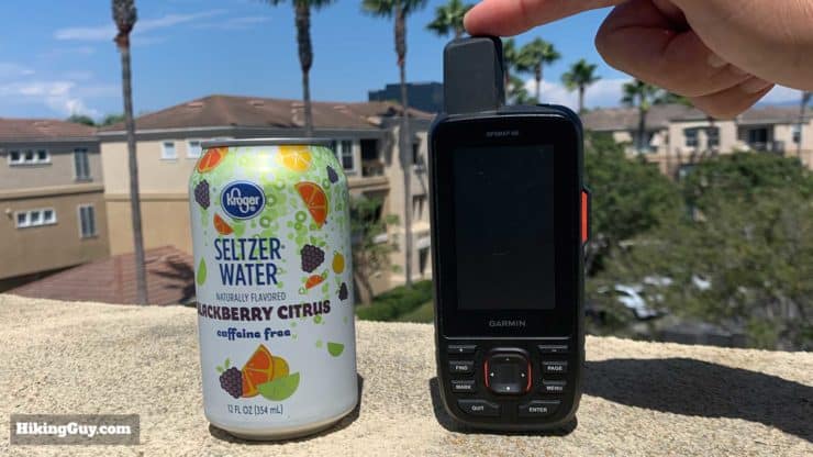
First off, this is a handheld GPS unit, and the rounded edges and sizing make it fit ergonomically into your palm. It's easy and natural to hold and use. Your thumb can reach around and hit all the buttons. The weight (8.5oz) makes it feel solid in your hand. Weight-wise it feels like holding a mango or a heavier piece of fruit. The sides of the unit are a rubber material that doesn't slip even when your hand is wet.
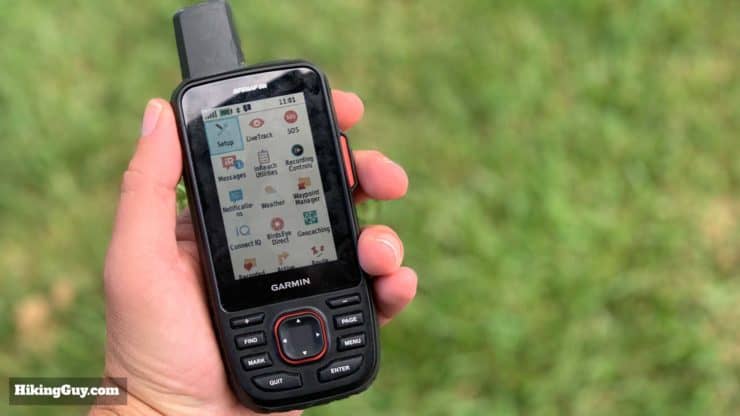
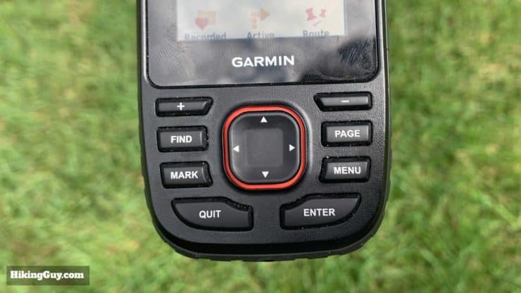
Here's what the buttons do:
- + - Zoom you in and out
- Find pops open a search menu that allows you to quickly navigate to a variety of destinations
- Mark quickly marks a waypoint.
- Page cycles through menu item shortcuts which you can customize.
- Menu gives you options for the current page you are on. Double clicking brings you to the main menu.
- Arrow keys move you around a menu or map.
- Enter selects a menu option, Quit backs you out of a menu.
Like previous Garmin GPS units, the screen is plastic and can scratch. I recommend getting a cheap tempered-glass screen protector.
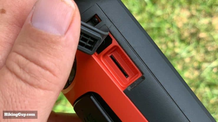
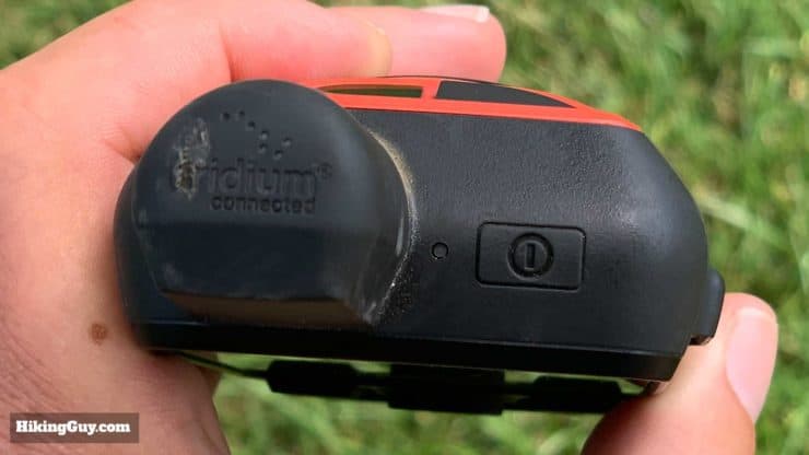
The GPSMAP 66i conforms to the IPX7 and MIL STD 810G standards of ruggedness. IPX7 means that you can submerge it 1 meter of water for 30 minutes, which in practical terms means you can get it wet without a problem. MIL STD 810G is a ruggedness guideline set by the US Department of Defense for outdoor tech gear. The spec has 24 areas of testing that a piece of gear has to pass, including fun ones like explosive atmosphere (explosions), fungus, and gunfire shock. There are also the standard ones like high/low temps and humidity, shock/drop, and fluids. I've used the 66i extensively for months and it's pretty bulletproof (aside from the screen). I've had it in rain, sand, saltwater. I've dropped it and sat on it. It's still ticking.
GPSMAP 66i Connections & Workflow
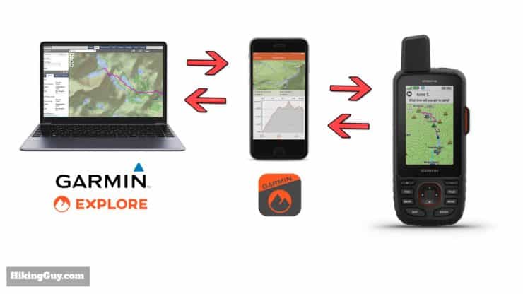
You can use all of the non-InReach functionality on the 66i right out of the box, but you'll get more if you tie it into the Garmin Explore ecosystem (free). I'll go into more detail later in the setup section but this is the high-level workflow breakdown.
- The Garmin Explore website is where you setup your InReach messages and subscription, your emergency information, and it also has a (limitted) map that you can plan trips with. You can import existing GPX files too.
- That website syncs with the Garmin Explore smartphone appwhich has a subset of the website features. The app connects to your 66i using Bluetooth and syncs contacts, messages, and navigation information. You have to sync with the app to get your routes, contacts, and messages transferred to the 66i.
- The GPSMAP 66i has WiFi and if you connect it you can update the firmware, download Birdseye imagery, and the latest satellite positions to the device directly. Otherwise it can also sync through the smartphone app.
- You can also update the firmware and maps using the Garmin Express program.
- The 66i can also sync navigation items like tracks and waypoints from the Basecamp app (more on that later).
I wish the overall setup was a little more coherent. I think Garmin is still in the stages of stitching together the old Delorme InReach system with the new Garmin world order and it's fractured and confusing if you don't know where to look. If the unit has WiFi I think everything (I mean everything) should just sync over WiFi or the Explore smartphone app.
And if you're not familiar with the Garmin Explore site, it lets you save your routes, tracks, and waypoints in the cloud, which is handy. The service is free with your Garmin device.
Unlike other InReach devices, the GPSMAP 66i does not work with the Earthmate app, only Garmin Explore.
May 2020 Update
You'll see me refer to "LiveTrack" in this guide. Garmin changing the name to "Tracking" because there wasn't enough confusion about track types already ?. To make it more clear:
- LiveTrack is now "Tracking" and refers to position points you broadcast using the satellite connection (to your MapShare page, more later).
- "Activity Tracking" is the current track log stored internally and not necessarily broadcast over the satellite network.
I wish they picked some better monikers for these features. Make sure you don't use "tracking" unless your plan includes location sharing, and make sure that "Setup > Tracking > Auto Track" is turned off.
InReach Communications on the 66i
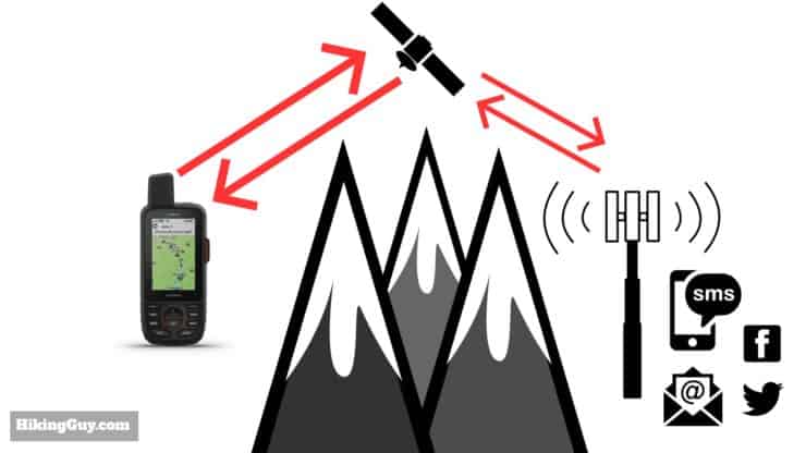
A big attraction of the GPSMAP 66i for folks, especially people upgrading from other Garmin handhelds, is the InReach satellite communicator functionality. With the InReach service enabled, you can send and receive text messages using the Iridium satellite network which works on 100% of the earth, including Antartica (confirmed by a reader!). This means that when you're out of cell phone range, the 66i will still allow you two-way communications with the outside world.
In order to use the InReach functionality, you need a subscription plan. They work like cell phone plans and vary in cost. I have a setup guide at the end of this article that tells you how to get sorted with your plan and setup when you have the device.
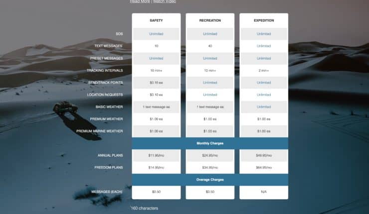
Here are the different InReach features that you could or could not get charged for.
- Preset Messages - You can define 3 preset messages (text and recipients) and send unlimited amounts of them on all plans.
- Text Messages - Send freeform text messages to any recipient (SMS, email, or social). Charges vary based on your plan. Outgoing and incoming text messages are charged the same.
- Tracking Points - If you are broadcasting your progress using LiveTrack these are location pings/updates to your map. You can change the update interval to cut down on costs or just not use it.
- Location Pings - If someone is on your MapShare webpage they can "ping" your device to get an updated position.
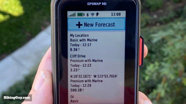
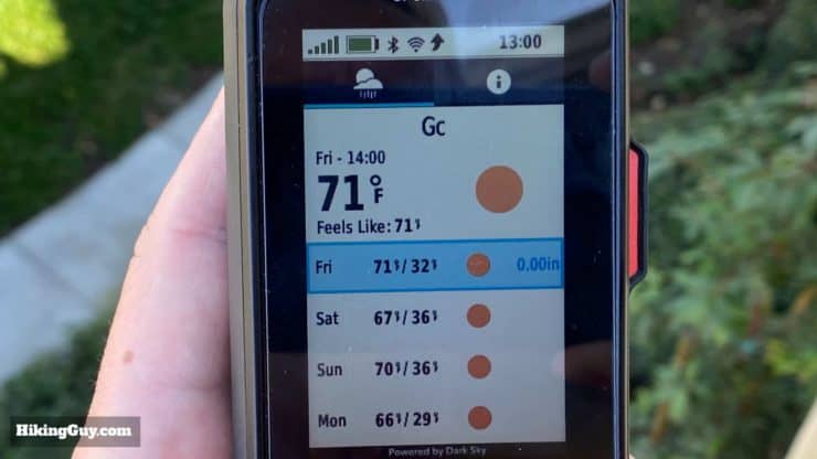
- Weather Reports - These are different variations of weather that you receive over the InReach network. More on that later.
Unlike the InReach Explorer, you can still use all the non-InReach functions on the GPSMAP66i without an InReach subscription.
66i Messaging
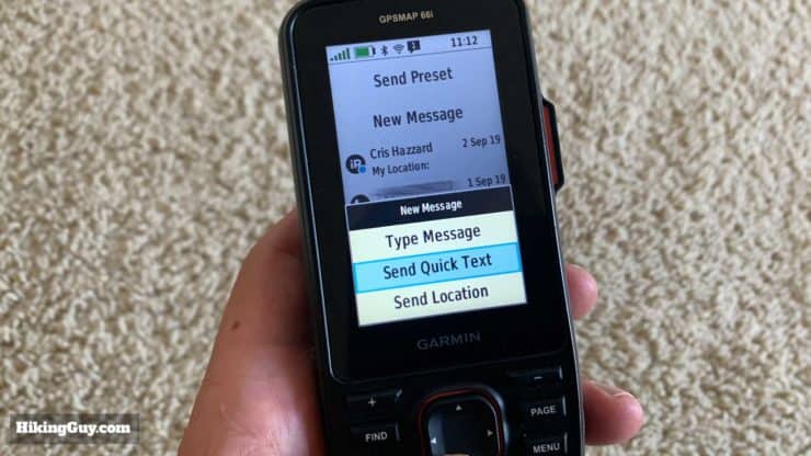
There are a few types of messages that you can send with the 66i.
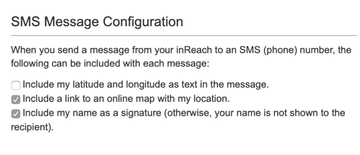
- Preset Messages are messages that you specify on the Explore website beforehand. You can have up to three of these messages with fixed text and fixed recipients. You can also include a link to your location with the message. You can send unlimited preset messages on any plan. I have the basic plan and use preset messages the most.
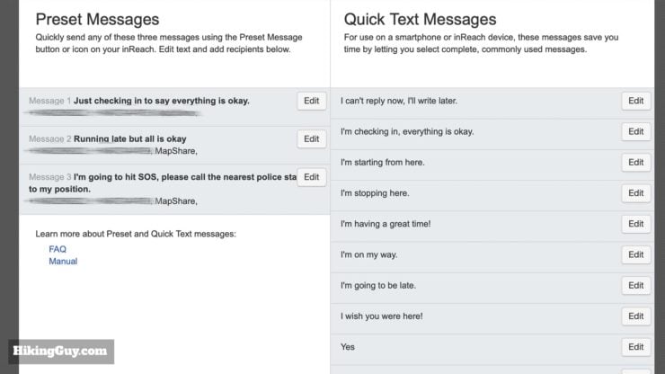
I setup my preset messages on the Garmin Explore website. I've found that these three messages serve me well, although I've never used the third one. 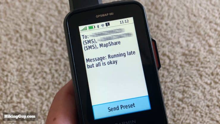
After you've synced the 66i the preset messages will be in the device. 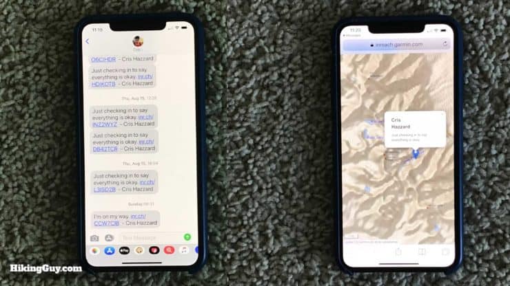
This is what it looks like when you get a preset message. The map on the right is what you get when you follow the link in the text message. - Text Messages are free-form messages that you can type and send from the 66i. They may be included in your subscription plan or there may be a separate charge for them. You can specify the recipients on the 66i when you type the message. Text messages also include a link to your position.
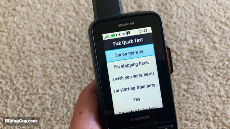
Quick text syncs to the 66i like the preset messages do. Unlike preset messages, you can send quick text to any recipient. 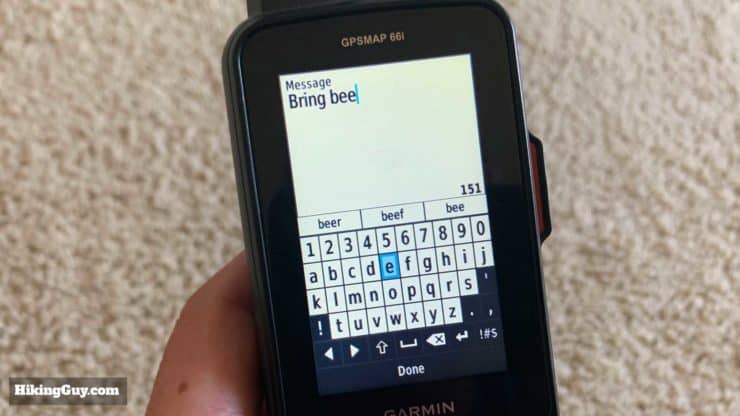
Freeform text isn't as slick as a smartphone but the word predictor (on top of keyboard) is very helpful. In this case I'd be excited if you send beer, beef, or bees. - Send Location allows you to just send details of your position with latitiude, longitude, and course.
- You can also reply to incoming messages as a text message.
- If you connect a Twitter or Facebook account on the Explore website, you can also post an update to those social media channels.
You can also tweak some of the settings for your messages which is helpful. These settings have no effect on the pricing or cost of messages. The last option is handy since the phone number of the InReach device isn't usually recognizable to a recipient.
Make sure you spend time setting up your presets, contacts, and quick text on the explore.garmin.comsite before you go out in the field. You also need to sync the device with the Garmin Explore smartphone app to send the messages and contacts to your 66i. It does not sync over the Iridium satellite network.
How Long Does a Message Take to Send?
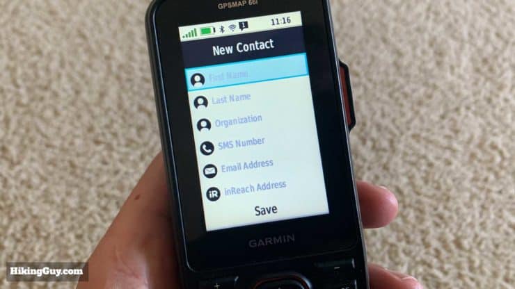
Contacts
When the GPSMAP 66i first came out the software didn't have a contact book. If you wanted to text someone outside of a preset message, you had to manually type their phone number in. So if you read about that in any reviews, know that the issue has been addressed and there's now a contacts book which you can access on it's own, or when you send a text message.
From your InReach you can message people using:
- Text message (SMS)
- InReach to InReach
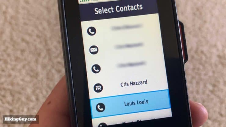
You can add a new contact on the 66i, including entering an InReach device address. When you sync your 66i with the Garmin Explore app the contact will sync back to your main account as well.
Receiving Messages
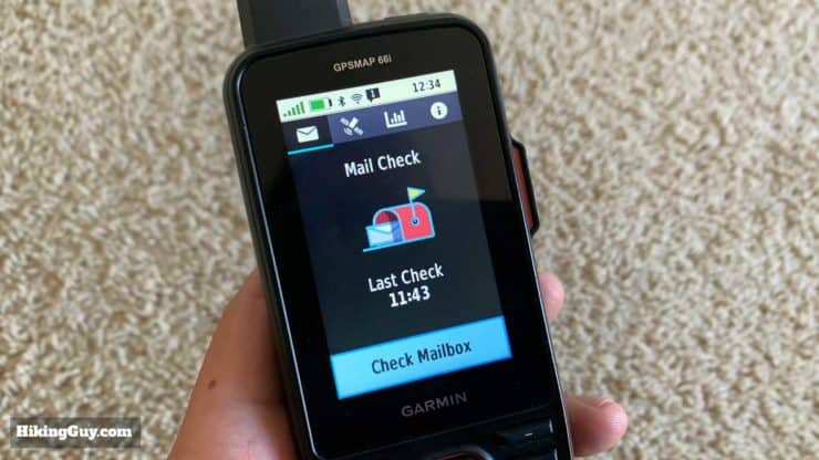
After you send a message the 66i will check for replies to your message for 10 minutes. After that it does a check for new messages every hour. If you have LiveTrack on, it checks for new messages every time that it broadcasts your position. You can also trigger a manual check.
Note that incoming text messages are charged as a text message.
Others can send messages to your InReach in a few ways:
- They can reply to the text message that you send from the InReach.
- They can click a "reply" link in an email message sent from your InReach.
- They can message you through your MapShare page if messaging is enabled.
- They can message your InReach directly from another InReach device using your InReach ID. You can get your InReach ID from your account page on the Explore website.
InReach to InReach Communications
One of the really powerful features if you hike with others is the InReach to InReach capability. If you wanted to communicate over long distances in the wilderness before, you usually would go for a GMRS radio, and there are some very cool options like the Garmin Rino (basically a 66i with radio instead of InReach). But the range is limited to a few miles and usually you need a decent line-of-sight to use them.
Since the InReach uses satellites, you can be as far away from other InReach users as you want. This comes in handy when you're with a group of hikers going at different speeds. I've used this before when I've been ahead, found a good place to camp, and wanted to message the location to others. We had set up presets beforehand and it was all done in a matter of seconds.
You can message any other InReach device (Mini, Explorer, etc.) from the GPSMAP 66i.
Navigating to a Message
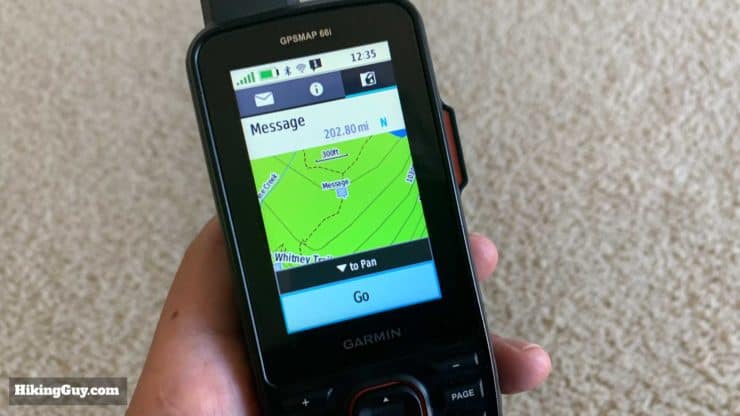
A cool new feature that ties into that last point is the ability to navigate to a location sent from another InReach. When you read a message you can tab and see the location info from where it was sent. There's a handy "go" button that will route you that location. And because it's a GPS navigator, it will route you on trails if possible; it doesn't just give you a straight line bearing.
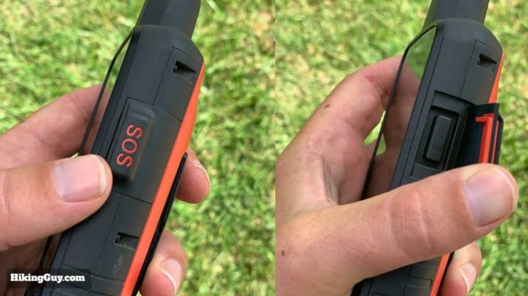
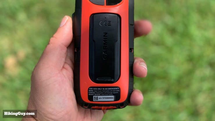
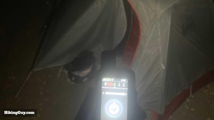
SOS Functionality
The SOS functionality is probably the main reason why most folks opt for an InReach device. To sum it up, you can trigger an SOS from your 66i and an emergency response team will coordinate a rescue. And unlike PLBs you can have a two-way conversation with the rescue team. If there's a medical condition, you can text back and forth to help diagnose and treat it while you wait for rescuers. Or maybe you smell smoke from a wildfire and need information on evacuation routes. You can do it with the InReach.
When do you know that it's okay to hit SOS? Read this.
Before I get into the details this is a good time to give you my disclaimer about hitting SOS. You should only trigger a rescue when you (or another) person is in danger of life or limb, or you absolutely can't self evacuate. The advent of affordable devices like the InReach has made many search & rescue organizations weary because of potential frivolous use. And there is definitely unwarranted use by those who are less experienced. But overall I'm all for devices like the InReach. For a few hundred bucks you can signal a rescue if something bad happens, and accidents happen to all of us regardless of experience level. One of the advantages of the InReach is that you can have a two-way conversation with rescuers, so hopefully that means that if your request is not urgent, they can give you advice on self-evacuating without putting search & rescue teams in danger. Okay, enough preaching, let's talk about how it works.
Here's how you set up SOS when you first activate the 66i.
- When you activate an InReach subscription you also get an (included) subscription to the GEOS emergency response team. GEOS is probably the leading private rescue coordination firm and has done rescues in over 160 countries, They are up 24/7, have relationships first-responders in 140 countries, and support 210 languages and dialects. Your subscription works worldwide.
- You can also opt-into an affordable search and rescue insurance plan (about $25/year) that kicks in if you get charged for a rescue. Will you get charged for a rescue? The answer is maybe. Since the cost isn't too much I opt-into this. It offers up to $100,000 in coverage. Note that it is only for the owner of the InReach and not anyone else using your InReach.
- Note that since Garmin acquired GEOS, they no longer offer the medical evacuation insurance option.
- On the Explore website you fill out details about yourself that GEOS will reference in case of an SOS. The best move is to describe yourself (age, condition, experience, gear) in the notes so that GEOS can best appraise your situation. If I'm doing something other than my normal routine or if I have hiking partners I'll update the notes accordingly. It just takes a minute or two.
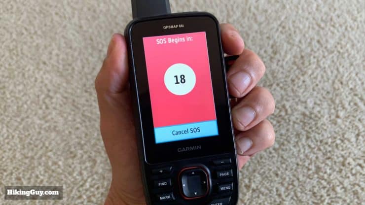
Once you're all setup and you actually hit the SOS button, here's what happens.
- You have the opportunity to cancel it.
- If it's not cancelled, you will get a message saying that your SOS was received.
- GEOS looks at your file and notes and texts you back asking about the nature of your emergency.
- You message GEOS back with whatever information you need to.
- GEOS contacts the appropriate first-responders and gives you instructions on what to do when they arrive.
- When you've been rescued, you cancel the SOS. GEOS stays on with you until the SOS is cancelled
You can also trigger an SOS from the Explore app.
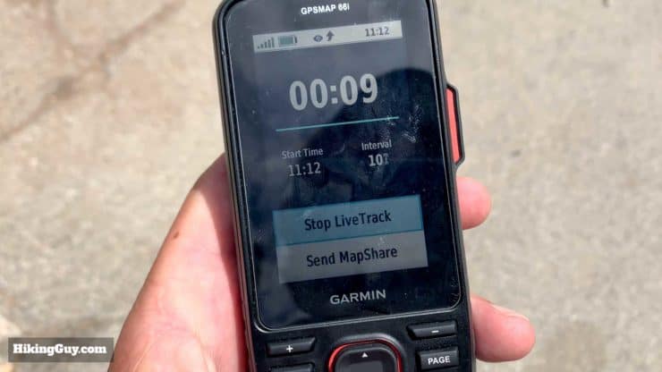
Tracking (Formerly LiveTrack)
I'll get more into the details of that later, but in a nutshell the GPSMAP 66i records a track of your movement. The LiveTrack feature allows you to broadcast snapshots of your position to your MapShare webpage.
What the hell is a MapShare page? Good question. It's a webpage that is automatically generated with your InReach subscription and lets you share your position with others. You can make the page public (those with the URL can find it) or password protected and private. You can also filter some of the data that shows on it. By default, all of your messages and tracks will show on the map. You can also allow visitors to ping your location or send you messages.
Some subscription plans include unlimited live tracking and others charge per tracking point. You can tweak how often tracking points get broadcast in the settings, anywhere from 10 minutes to 4 hours. The more expensive "Expedition" subscription also lets you send tracking points at 2 minute intervals.
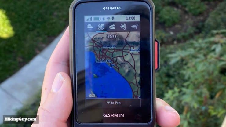
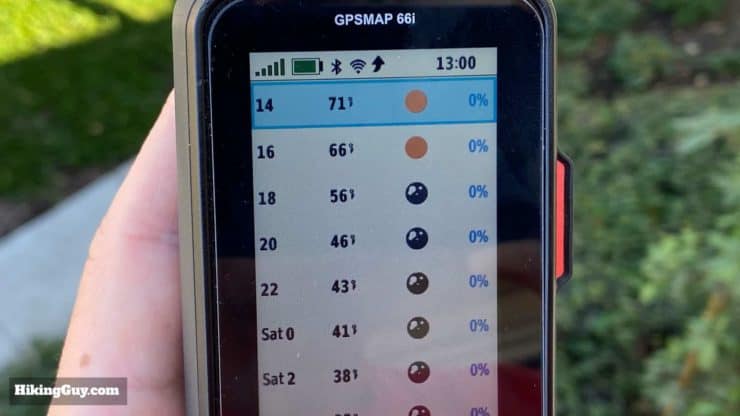
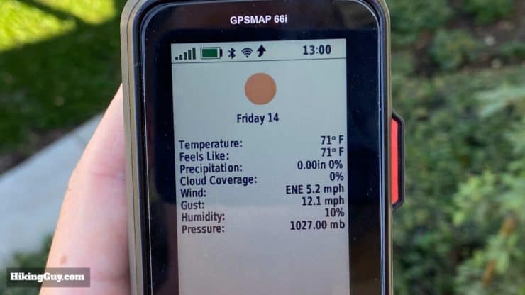
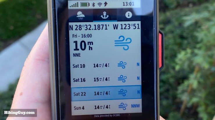
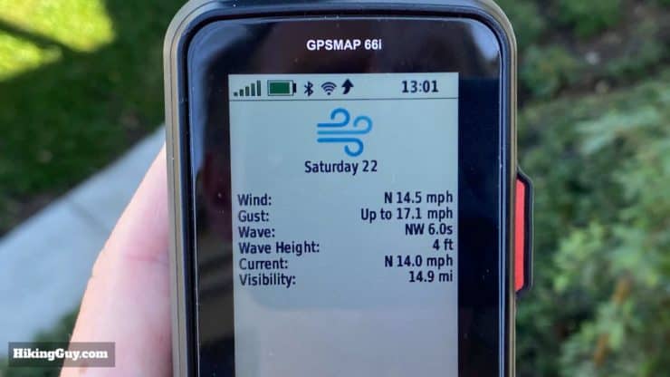
Weather
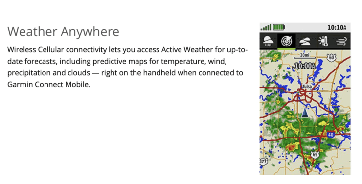
Unlike other Garmin InReach devices, the 66i does not offer satellite weather reports. This will be addressed in a future release of the firmware and I have to say this was a bit of a shocker. Other InReach devices all shipped initially with this feature working and enabled. It's a great feature of the InReach family and I don't know why the product was released without it.
The image that you see of the doppler radar on the product page is available when you are connected to a smartphone with a cell signal. The phone will grab the weather data for you and give you some nice readouts. Assuming my smartphone is with me and I have a cell connection, I could also of course get this same information in a much nicer form using an app like Dark Sky or Windy.
A firmware update released in November 2019 finally brought InReach weather to the GPSMAP 66i and it works similar to other InReach units.
For more detail on InReach weather billing, etc., I recommend reading this help article from Garmin.
InReach Performance
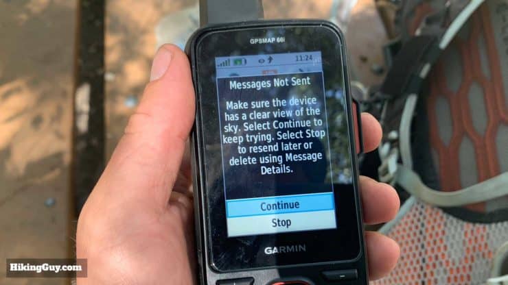
Whenever I'd get frustrated with (any of) my InReach, I have to remind myself that I'm communicating with a satellite in space using a small piece of plastic and metal in my hand. It doesn't work like a cell phone. That said, I've found wildly variable performance with the GPSMAP 66i, which is almost identical to the performance of the Explorer and Mini. For example, I've been on the top of Half Dome, clear line of sight in 360 degrees, and a message has failed to send. Then for this article I've been inside the middle of my house, in the bathroom, and the message has gone through in a couple of minutes. The best that I can tell you from lots of use is that it's variable and we don't know all the variants. I'd say being outside with a clear line of sight to the sky usually helps. I've been surprised by how fast some messages get sent. Usually the 66i will get them out within a few minutes.
Not sure if InReach is up? You can check the status of the InReach system here.
GPSMAP 66i Navigation
The GPSMAP 66i is a handheld navigation GPS and this is where it's most powerful. In a nutshell, you can find any destination on the map (including campgrounds, geographic features, etc.) hit the "GO" button, and it will route you on trails to that point. You can also do things like record tracks and waypoints with a very accurate GPS. In this section I'll walk you through some of the features, and then show you how I plan a hike, get it to the 66i, and then navigate with the 66i.
Routes, Recordings, Activities, and Tracks
There's a lot of different terminology on the 66i and I think Garmin would benefit from simplifying things in future releases of the software. Let's run through some of the monikers so that navigation makes more sense.
- A track is series of GPS fixes, like a breadcrumb trail, that are used to record your position.
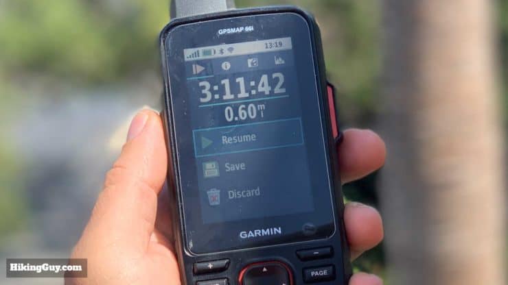
- You active track is the current track you are recording using the recording controls on the 66i. You can start, stop, save, or discard. You can also tweak settings to record points more or less often, auto start, auto pause, etc.
- Your recorded activities are active tracks that you've stopped and saved. You can convert a recorded activity to a track file in the 66i.
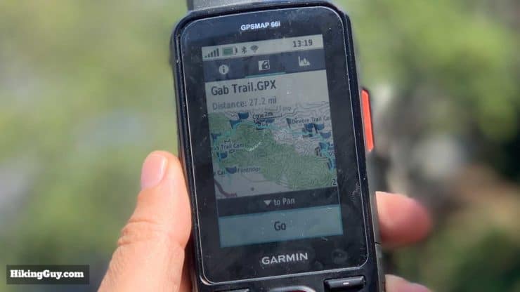
- Saved tracks are tracks that are created elsewhere and synced to the device, or recorded activities that have been converted. If you want to use the 66i's "share wirelessly" feature to send a track to another user, it has to be a saved track.
- A route is basically a series of sequenced waypoints that can actas guided directions. You can choose to route on trails or straight lines. You can think of a route like a series of directions on Google Maps. On the GPSMAP 66i you can create routes on the fly from waypoints and any geographic points-of-interest (POIs) that are loaded on the device. The 66i is pretty quick at creating routes. You can also create routes on a computer or with the Explore app, and then transfer them to the 66i.
- Last, there is also now RINEX logging (Receiver Independent Exchange Format), which is optional. RINEXrecords your track and all of the raw GPS data like distance to satellites, line of sight speed between the receiver and satellite and signal strength. It's more of an industrial / power-user feature that I never use because I'm not that powerful.
The GPSMAP 66i can save 250 routes and 250 saved tracks/recorded activities.
Waypoints
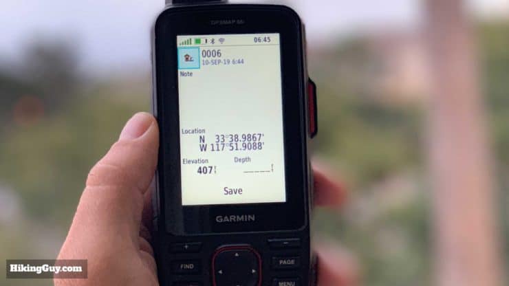
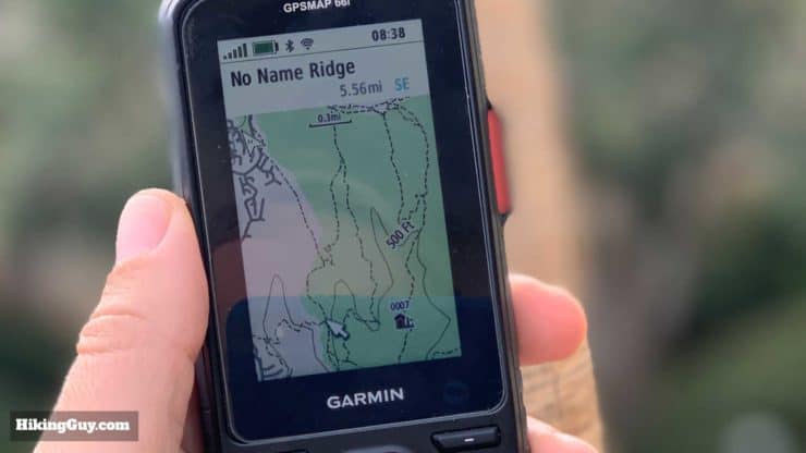
Waypoints are just recorded GPS positions. You can quickly record a waypoint of your current position by hitting the "Mark" button. Once a waypoint is recorded you can use it as a navigational destination and sync it back to your Explore account. You can also create waypoints on the Explore app, website, or other program and import them onto the 66i (through the Explore app).
When you have a waypoint saved, there are several things you can do with it:
- You can edit or delete it.
- You can navigate to it on routable tracks (trails, roads, etc.) or in a straight line
- You can set a proximity alarm that sets off a beep when you get within a (user-definable) radius of the waypoint.
- You can add a waypoint to a route as a stop (like adding a gas stop to a Google Maps direction).
You can store 10,000 waypoints to the 66i.
There's also a neat feature if you need to add more than 10,000 waypoints. You can load custom POI (points of interest) files. All of the geographic features preloaded on the 66i are POIs, and these custom POIs would get added to them. Garmin has a tutorial on loading POIs here and there are a ton of POI lists out on the internet like these.
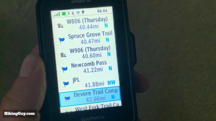
Navigating to a Destination
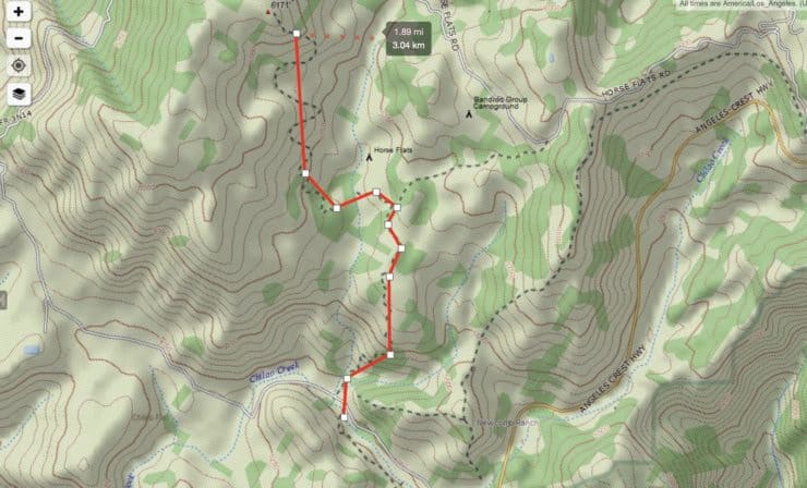
The GPSMAP 66i uses routes to navigate. Again, you can think of routes as a series of waypoints with a path in between. You can create routes beforehand in Explore or Basecamp and then load them onto the device, or create routes directly on the 66i.
In order for a route to not just be a series of straight lines between points, you need a routable map. The Garmin TopoActive maps preloaded on the 66i are routable, as are the free OSM maps that you can load on the 66i (more later). The GPSMAP calculates a route by looking at your current position, the end of the route, and then the routable paths in between. You have the option before you calculate a route to minimize time, ascent, or distance.
The 66i will route you on any routable path based on your preferences. So if a trail goes from A to B in 3 miles, you choose minimze distance, and a road intersects the route and can get you there in 2.9 miles, the road will be part of the route.
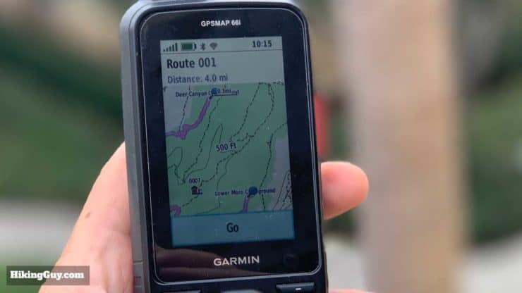
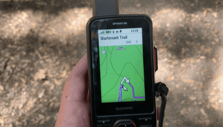
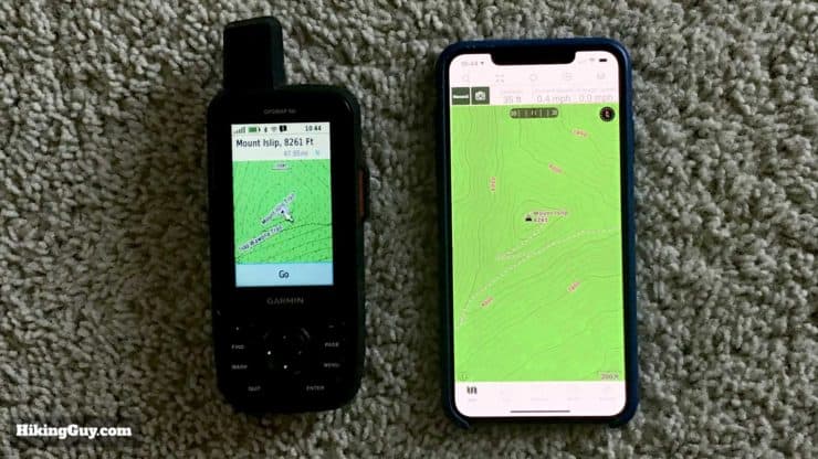
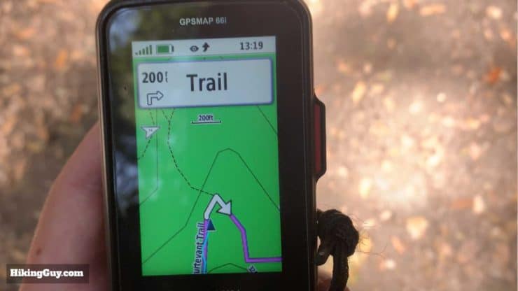
You can also use tracks to navigate, which is what I do most of the time. It's more basic and I find it's more useful when on trails, especially since I usually do my homework and am familiar with the route already. To use a track to navigate, you can create one online or download one (like the ones in my hike guides), load it onto your device, select it on the track manager, and hit "Go." When you look at the map you'll see your position on a purple line that is the track. If you wander off the track, you'll get an alert that tells you that you're off-course.
Lastly, you can use the "TrackBack" function to route you back on the path you've already taken.
My Navigation Workflow With the 66i
Everyone has a different situation and workflow when using a handheld GPS, but I'll share mine in case it's helpful. I plan my hikes beforehand (using online and paper maps, and also guides and recent conditions) and then create a GPX track. I also have important features in the GPX file marked as waypoints. I load that GPX file into the Garmin Explore website, sync with the Explore app, and then sync to the 66i.
Then I simply go to the track manager when I'm at the trailhead, select the track, and hit go. I use a paper map as I hike, but when I need to check my position, I can look at the 66i. Or if I take a wrong turn, the 66i will alert me. If plans change (bad weather, getting tired, etc.) I can use the onboard routing to bail me out on a shorter trail, find a campground, etc.
Note that you can also execute this same workflow with a Fenix watch which is what I do when not testing the 66i.
GPS Performance
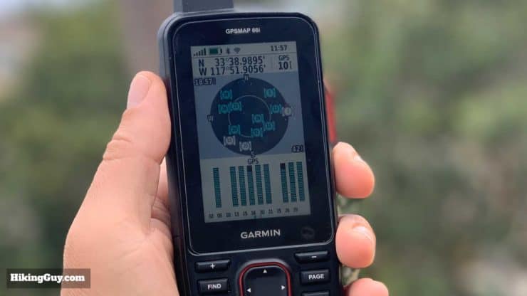
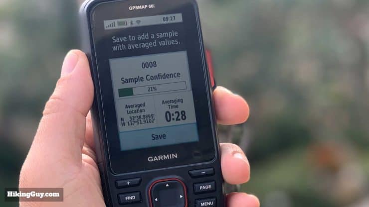
GPS performance really shines on the GPSMAP 66i. I find that I can get a GPS fix within seconds after (a quick) power-on. I often have about a 8-12 foot accuracy. The positioning system uses the standard 24 (USA-run) GPS satellites and also the European Galileo satellite constellation, with 20 satellites currently online and an expected total of 30 in 2020. So the GPSMAP 66i can potentially access 40-50 satellites to get a position fix. In general the more satellites you can fix, the more accurate your position.
The 66i also has WAAS/EGNOS. What is that you ask? It's a supplemental signal thatcorrects for GPS signal errors caused by ionospheric disturbances, timing and satellite orbit errors. It adds another level of accuracy to the unit. You can also switch it off if you don't want to use it.
The GPSMAP 66i does not support the Russian GLONASS satellites.
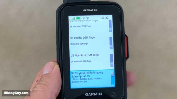
Preloaded TopoActive Maps
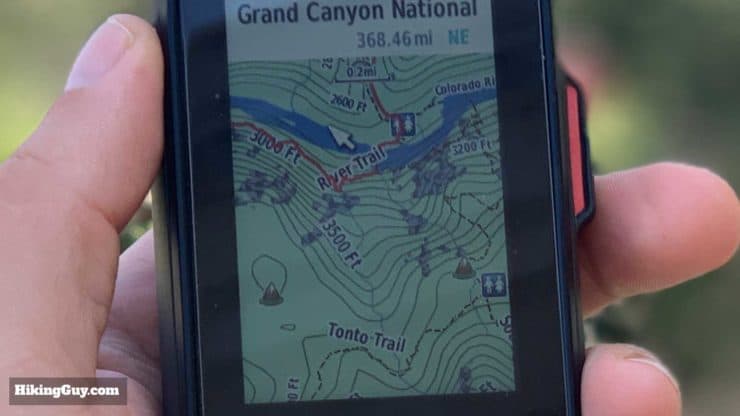
The GPSMAP 66i comes loaded with Garmin TopoActive (100k) maps and also comes with a (free) subscription to Garmin Birdseye imagery (satellite photos). These maps are routable and include decent trail coverage, much better than they were just a few years ago. But TopoActive maps definitely don't include all the trails that are out there. The preloaded map also includes thousands of points-of-interest like campgrounds, geographic features, restaurants, etc.
The level of detail on the maps varies. Some areas are more detailed than others. Some trails are there and some are not. The Garmin TopoActive team uses the Open Street Map (OSM) project as a source, and I think that's contributed the improved quality of the trails in the TopoActive map set. If you're a map power-user (like with CalTopo or Gaia GPS) and are used to having a suite of layers available to you, the preloaded maps will seem primitive. If you're just looking for a decent topo map loaded on a GPS built for the outdoors, then you're getting a decent map that will get the job done.
One thing that can be annoying is that drilling down into a POI category, say campgrounds, will only list the closest ones. So If you want to check out a campground farther away, maybe planning for a trip, doing it on the 66i is not the easiest. You have to go to the map, zoom way out, find your destination, then zoom back in. But if you're in the field and you need to navigate to something within striking distance, it's great.
Topo map coverage is based on where you purchase the unit. A GPSMAP 66i in the United States will come with maps of North America pre-loaded. You can also purchase Garmin 24k maps on a memory card and load them. You can also create custom maps and load them with an SD card (it'll take up to a 32GB Class 10 card).
I just spent the past week in the Dolly Sods Wilderness with this device. I’m not sure where all the negative reviews have come from because I found the unit to work basically as advertised. The preloaded 100k naps are more detailed than I expected, having all the trails in Dolly Sods marked (not even the 7.5 minute maps have that). Add 24k maps and the unit really shines as a navigational tool. - REI Reviewer
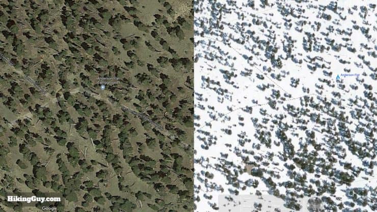
Birdseye Imagery
The Birdseye Maps are disappointing. It's hard to understand how some users would pay for a subscription to this. The good news is that if you have a GPSMAP 66i the subscription is "free." You don't have to use the Birdseye maps, but they're there if you need them.
I used the Birdseye maps in the field a few times to see what they were like and satellite imagery just isn't great on a small screen like this. Satellite imagery is much better when planning, and if you're planning, I found the Google satellite photos to be a much higher resolution and more up to date. And if you use a tool like CalTopo, you can even download recent satellite photos to get current conditions.
To get Birdseye Imagery onto the 66i, you must be connected to WiFi. Then you go the Birdseye app, select a point to download imagery for, select a radius around that point, and then download it. You can't select a track or route and download the imagery for that entire journey, the imagery is a radius around a point like a POI or waypoint.
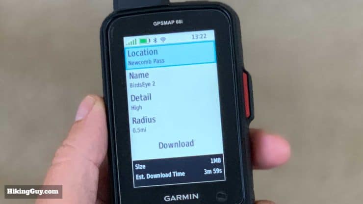
Birdseye Update
In February of 2020 Garmin improved the Birdseye imagery, but it's not at the same level as Google Maps.
GPSMAP 66i With Open Street Maps (OSM)
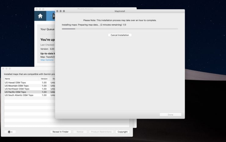
The good news is that you're not stuck with the preloaded maps, and you don't have to spend money on Garmin's 24k maps if you don't want to. The GPSMAP 66i can accept transferred OSM maps just like other Garmin units. These free OSM maps are routable and work just like the bundled maps. I have a whole article on loading free OSM maps here.
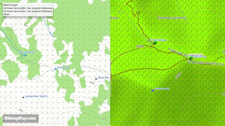
One thing to note is that while Garmin TopoActive maps might be missing some trails, OSM maps can include trails that are barely trails. Since the OSM project is open source, contributors can add any kind of track that they want. So I've seen paths listed as trails that were barely more than an animal run through dense brush. And I've also seen trails on OSM maps that were clearly not there. If you route on the GPSMAP 66i and those OSM trails are routable, it might take you on a "less than optimal" route. That's why pre-planning is key. It is nice to have those trails on map though so at least you can check them out when you're nearby.
GPSMAP 66i & Garmin Basecamp
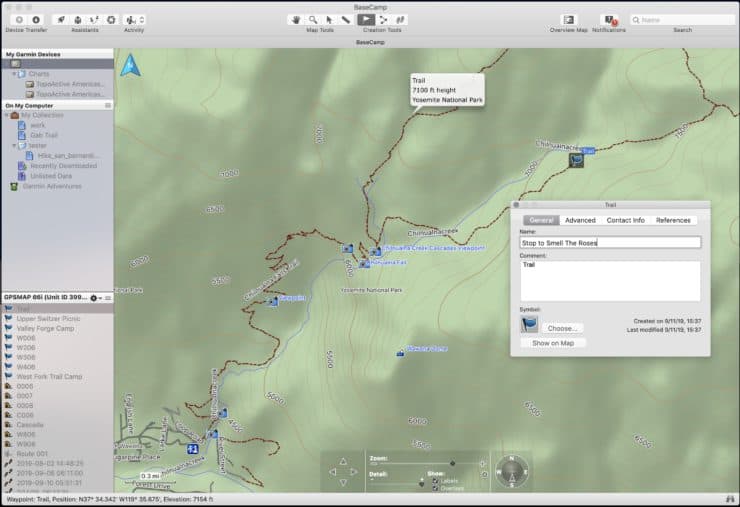
One piece of great news is that the 66i works with Garmin Basecamp, the desktop planning tool for Windows and Mac. Once you plug the GPSMAP 66i in, you can access the maps and Birdseye imagery. You can see your existing navigation information (tracks, waypoints, etc,) within Basecamp, and you can create routes, tracks, and waypoints in Basecamp and transfer them directly to the 66i.
I'm a big fan of Basecamp and I haven't found another program out there that can replicate it, although CalTopo and Gaia GPS are similar and better in some ways, but not setup specifically to work with a Garmin unit. And of course, because Basecamp is so great, Garmin has decided to discontinue it. You can still download and use it, but there are no more planned updates to Basecamp.
Basecamp is being discontinued because Garmin wants you to use...
GPSMAP 66i & Garmin Explore
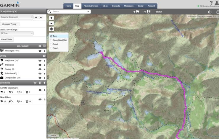
The Garmin Explore (map) website is where Garmin wants you to manage your navigation data on the GPSMAP 66i. It's a far cry from Basecamp or an online tool like CalTopo and Gaia GPS. On Explore you have some basic layers and basic route planning tools. I'm assuming that the features will only get better on Explore over time but right now it has some limitations (outside of the lack of layers).
- You can only create a route with straight lines; it will not "snap" the route to trails.
- You can't view an elevation profile of a route or track.
- You can't view any detailed statistics about a route or track.
So for me at this point Garmin Explore is more of a middleman. I use other tools (more below) to plan, export a GPX file, then import it to Garmin Explore and sync to my device.
One newer concept in the Garmin outdoors workflow is Collections. Collections allow you to organize your navigation data into folders (groups) so that you don't have a million waypoints and tracks flying around. You can selectively choose which Collections to sync to your GPSMAP 66i.
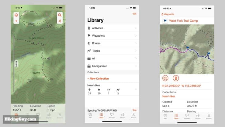
There is also a Garmin Explore mobile app which largely has the same limitations as the online version. There is no routing on trails but you can create waypoints and routes and then sync them to your device. The Garmin Explore app also lets you write messages and trigger an SOS on the device when you're connected with Bluetooth.
The GPSMAP 66i does not work with the Earthmate app like other InReach devices.
GPSMAP 66i & Other Tools
As I mentioned earlier, there are better tools out there for navigation planning for the 66i (or whatever GPS you are using). But they don't sync with the 66i, so you need to create your GPX file in the other tool, export, and then import into Garmin Explore (and then sync with your device). Again, I'll give a shout out to CalTopo and Gaia GPSwhich are my goto tools for planning with the GPSMAP 66i.
You can import any valid GPX file onto the 66i, which can contain tracks, routes, and waypoints. You are not limited by Garmin's tools.
GPSMAP 66i Sensors
Lastly, the GPSMAP 66i comes with a few sensors that can aid in navigation.
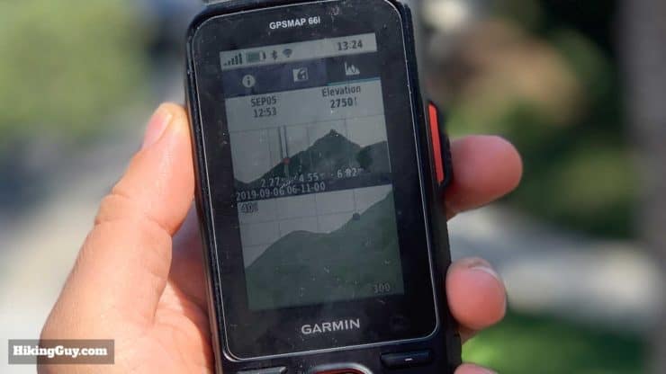
A barometric altimeter gives you your elevation based on the barometric pressure. According to Garmin the accuracy is plus or minus 50 feet when calibrated correctly. If you know your current elevation or the sea level pressure you can manually calibrate it. In practical terms I'd calibrate when I was at a pass or peak where i knew the elevation. You can also calibrate it based on your GPS fix. I checked the barometer readings on my 66i against my local airport several times and it was always pretty close.
But my experience with elevation in the field was that it not very accurate and fluctuated but a few hundred feet at times. My advice is to calibrate often, use the altimeter as a rough guide and if you need a very accurate altitude you should get a professional tool.
The 66i also has a 3-axis electronic compass that can tell your direction when standing still, unlike a GPS compass which relies on movement. First off, you should calibrate the compass away from magnetic fields or electronics. When I compared to a regular compass at several points, the readings were within 6-24 degrees. If I need an accurate compass reading I'll use my regular compass. If I want a rough guide at my heading, the compass on the 66i is acceptable.
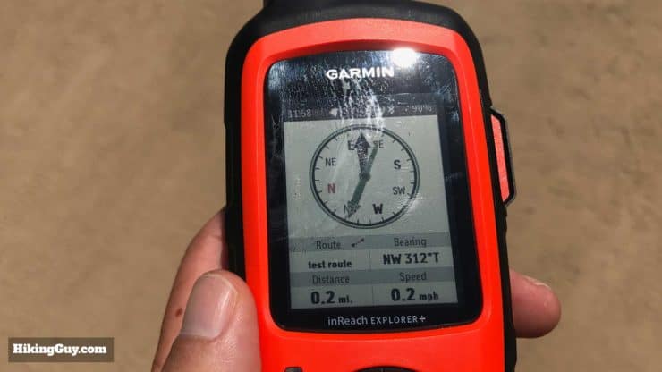
There is also a "Sight and Go" function that lets you take a bearing and then project a waypoint at a variable distance away, then navigate to it. I used it on some overland hikes in Joshua Tree NP and it works as you would expect.
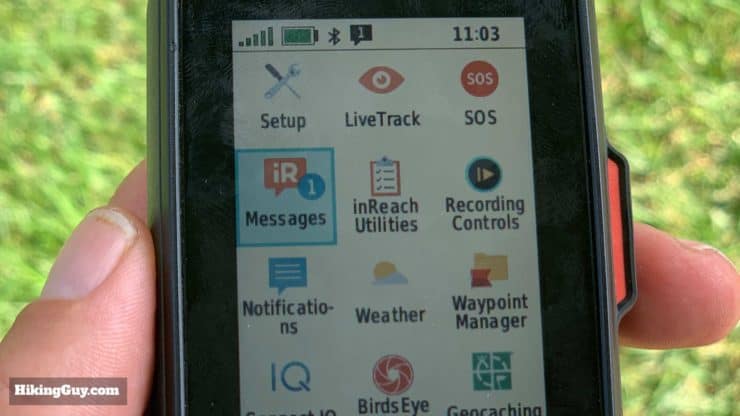
Other Useful 66i Features
- The 66i has a decent flashlight, but there's no quick on/off hardware button. You have to navigate to a menu and then click a button to turn it on. Good in a pinch but otherwise meh.
- Unlike older GPSMAP models, you can download third-party apps from the Connect IQ app store. There are apps for most everything, but most are fitness based. One app to note is WikiLoc, which will sync your hikes to the device and then show you a map an elevation plot. It has a a decent following, but I don't use it. Again, just an example, there are a ton of different apps you can use to customize your 66i.
- If you're into geocaching, the 66i integrates with Geocaching.com and allows you to update lists over WiFi.
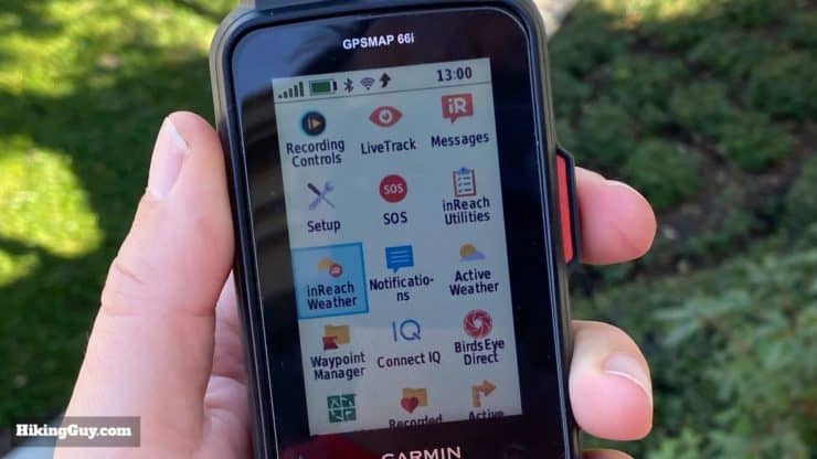
- You can customize the screens and menus so that you're putting what's important to you first.
- There are multiple profiles (hike, hunt, etc.) where you can customize the screens and menus for each.
- You can get the sunrise, sunset, moonrise, and moonset. But not dusk or dawn (which are usually pretty easy to ballpark when you know the rise and set).
- There's a calculator, stopwatch, alarm clock, and photo viewer.
- You can calculate the area of land by walking around the perimeter.
- You can use it as a VIRB camera remote.
- You can connect it with external sensors like a heart rate monitor, thermometer, and the Xero bow sight.
GPSMAP 66i Battery Life
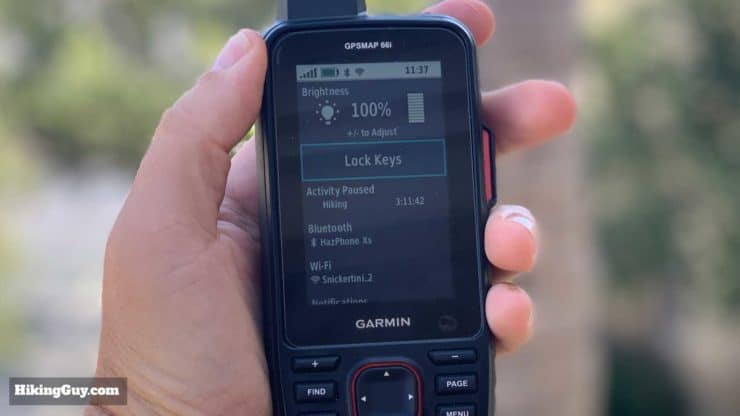
The internal3100 mAh battery in the GPSMAP 66i works well for me. I get about 30-36 hours using the default settings and a 10 minute LiveTrac interval. When have LiveTrac, Bluetooth, and all the extras turned off I can get almost double that. You can minimize the battery drain by:
- Turning off Bluetooth and Wifi
- Dimming the backlight and having it timeout quickly
- Extending the recording and transmitting log on LiveTrac
- Extend the InReach listen interval
- Turning off Galileo
- Decreasing the track record interval
If I'm using it to send an occasional InReach message and not for navigation, I'll just turn the 66i off after my message is sent. The battery will last 1 year while off and sending 1 message once and while barely puts a dent in it.
One thing that's odd is that there is no battery percentage display unless the unit is plugged into the wall. You just see the crude battery icon with a green fill. I think Garmin should offer a percentage (workaround here) or better yet an estimated time left like this Connect IQ app does.
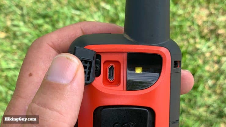
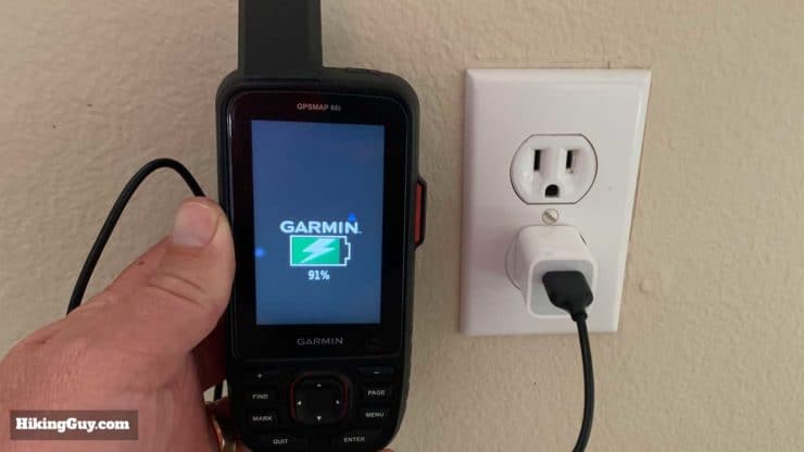
The battery isn't replaceable but you can charge it with any old USB chargerusing the Micro USB port. It comes with a MicroUSB cable but no USB to AC charger. You can also charge and use it at the same time. It charges from dead to 100% in about an hour.
The battery in the unit is as advertised. I can get more than 30 hours on a single charge and that was with 10min live tracking activated. -REI Reviewer
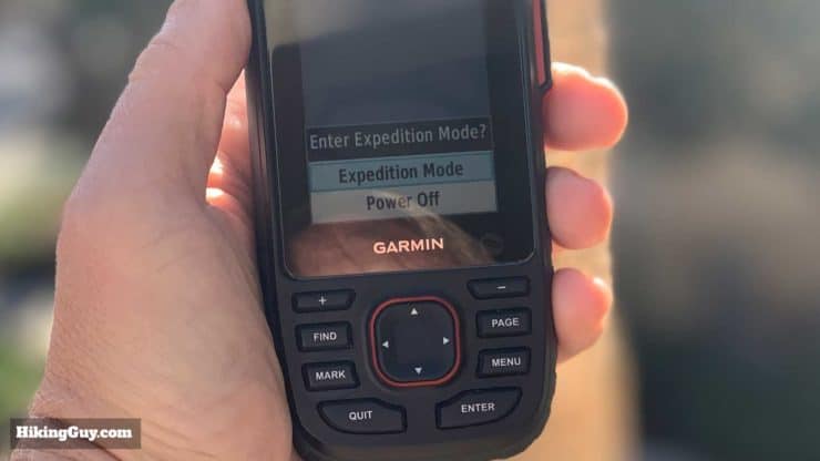
The 66i comes with a battery saving mode called "expedition mode" where it can put itself into a hibernation mode with reduced activity and reduced tracking points. There is a setting that allows you to be prompted to put the 66i into expedition mode when you turn off, or automatically after 2 minutes of inactivity, or never. With expedition mode on and a 30 minute LiveTrac interval you can allegedly get 200 hours of use. When you wake the 66i from expedition mode it goes through the boot screen and takes a few seconds. It's not an instant power-on like in normal use.
In my tests WITHOUT using LiveTrack I was able to get about 2.6-3 hours per battery percentage point, bringing me to about 280-300 hours of theoretical tracking. One thing to note is that the reduced GPS fixes will give you a much less accurate recorded path.
GPSMAP 66i Quality Issues
If you read the reviews on REI, Amazon, etc. for the GPSMAP 66i there are some bad ones. Some of these you can chalk up to user error, but there are definitely valid ones. It's clear that Garmin rushed this out the door before it was ready for primetime. That said, I've seen many of the issues mentioned resolved with the several firmware updates they've released, and I expect that to continue. After having many Garmin devices for years I can confirm that they actively update the firmware and often add in new features that weren't even advertised, so that's a good thing. Time is on your side.
After using it for months I've had two issues. One time it froze on me while doing a route calculation. I held the power button in and did a hard reset and it was fine. The other thing that happened twice is that it mysteriously shut off. Again, this might be once in about 200 hours of usage, it wasn't common, and is most likely a firmware problem.
If you have problems, make sure your firmware is up to date. And if you suspect it's a hardware problem, Garmin is generally good about replacing units. For this price we shouldn't have to deal with these kinds of issues but it is what it is. There's not a lot of alternatives to the 66i if you need a rugged handheld GPS.
GPSMAP 66i Bottom Line
The GPSMAP 66i is not for everyone. And the initial models and firmware had issues. But as time goes on and as Garmin addresses the software bugs, I can confidently say that the 66i is probably the best handheld GPS out there for the outdoors. If you need something more rugged than a smartphone, something that's built for the outdoors that has InReach capabilities, the 66i is for you.
I recommend buying the GPSMAP from REI. If you do have an issue their customer support is great, you get free shipping, and a membership dividend back. Your purchase is also an easy way to say thank you for this review; I get a small percentage of the sale.
And if you're using the 66i and you have any experiences to share that readers might benefit from, please contact me so that I can incorporate your feedback into the guide.
GPSMAP 66i Setup Guide
Here's how I recommend setting up your GPSMAP 66i.
- Log in (or create an account) at Garmin Explore
- Know which subscription plan you will go with
- Power on your GPSMAP 66i
- Follow the prompts to activate an InReach subscription
- After activation your 66i will go to the map page and you can use it, but don't do that yet.
- Turn the 66i off
- Install Garmin Express on your computer
- Plug your 66i in and update the firmware, maps, etc.
- Power off the 66i then power it back on
- Install Garmin Connect on your phone and create an account / sign in
- Sync your 66 with Garmin Connect
- Go to the Explore website and enter your preset messages, contacts, etc.
- Install the Garmin Explore app on your phone
- Login to your Garmin account on the Explore smartphone app
- Pair the 66i with your phone through instructions on Garmin Explore app
- Sync your 66i with the Garmin Explore app
- All of your presets and information from the website should now be synced on the 66i
- Log into your WiFi network on the 66i
- Customize your 66i by ordering the icons you use most at the top and by changing the data fields on screens like the trip computer to suit your needs. You can customize most screens by hitting the "Menu" button.
- Browse the Connect IQ store and download any apps you may want using Garmin Express
There's also this video with a groovy soundtrack from Garmin.
Tips for Using the GPSMAP 66i
GPSMAP 66i Unboxing
GPSMAP 66i Resources
- Online GPSMAP 66i Manual
- PDF GPSMAP 66i Manual
- GPSMAP 66i Support Articles
- GPSMAP 66i Forum on Garmin
- Garmin Discussion on Reddit
- GPSMAP 66i Firmware Updates
- InReach System Status
Basic GPS Concepts in Use
Copying Device Maps to Computer
Need More Info?
- Have a question about the guide or want to see what other people are saying/asking? View the Youtube comments for this video. Leave a comment and I will do my best to respond.
Related Guides
 In-Depth Garmin Montana 750i, 700i, 700 Review
 Garmin GPSMAP 66sr Review & Test
 Hiking Gear & Outdoor Technology
 Garmin inReach
Popular Guides
 Best Hiking Gear 2024
 Hiking Boots or Shoes: Do I Really Need Hiking Boots?
 When to Hit SOS on inReach
This Guide Was Written by Cris Hazzard

Hi, I'm Cris Hazzard, aka Hiking Guy, a professional outdoors guide, hiking expert, and author based in Southern California. I created this website to share all the great hikes I do with everyone else out there. This site is different because it gives detailed directions that even the beginning hiker can follow. I also share what hiking gear works and doesn't so you don't waste money. I don't do sponsored or promoted content; I share only the gear recommendations, hikes, and tips that I would with my family and friends. If you like the website and YouTube channel, please support these free guides (I couldn't do it without folks like you!). You can stay up to date with my new guides by following me on YouTube, Instagram, or by subscribing to my monthly newsletter.