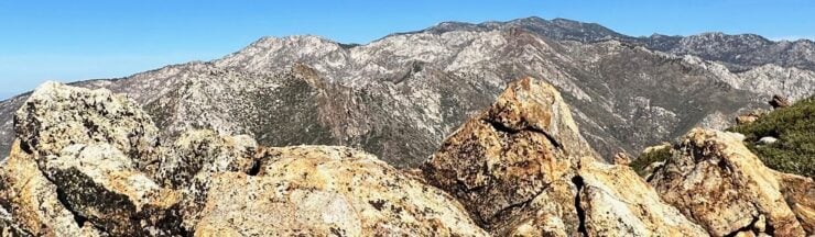

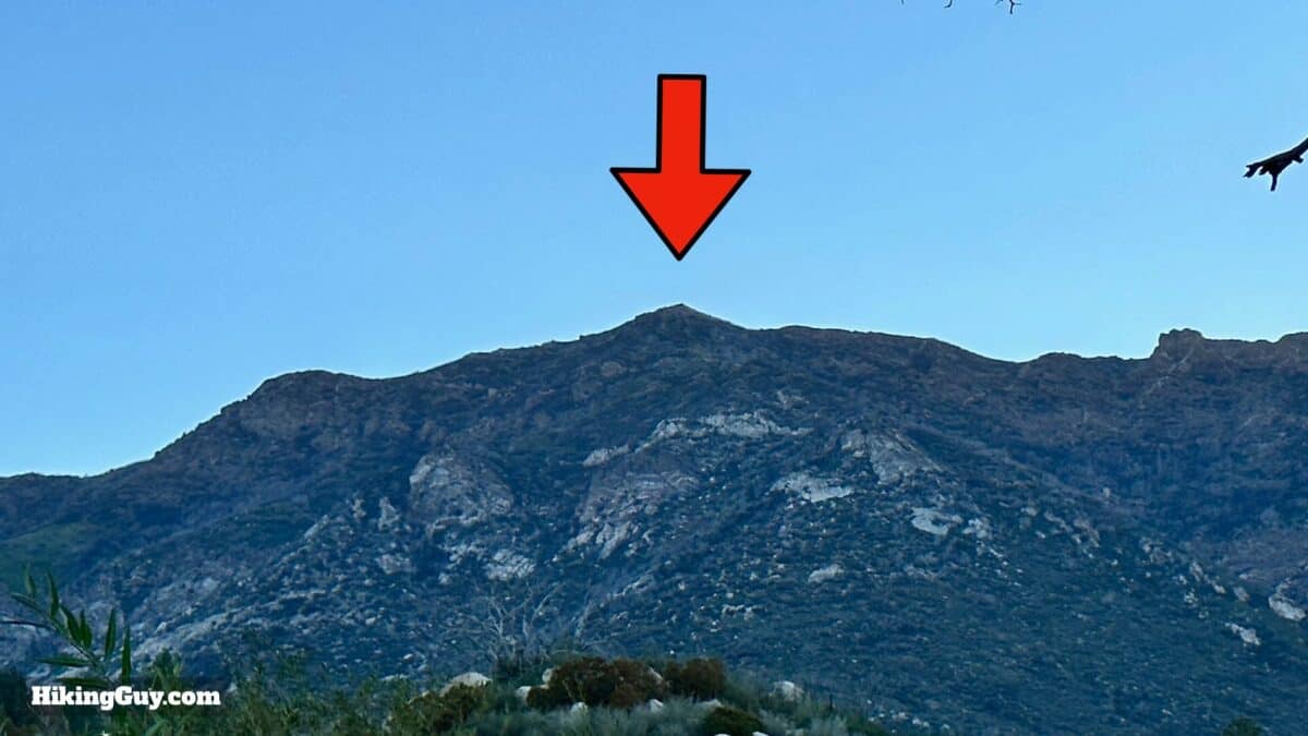
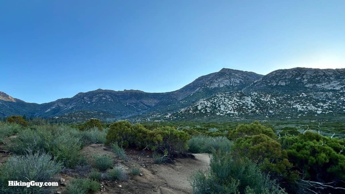
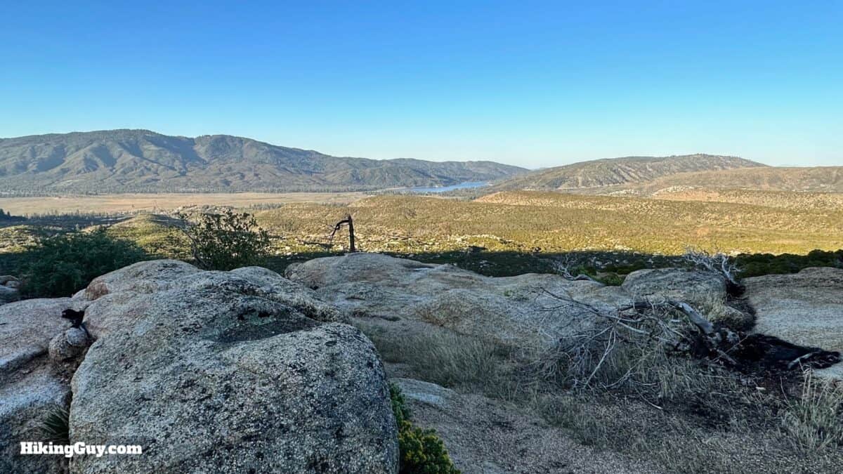
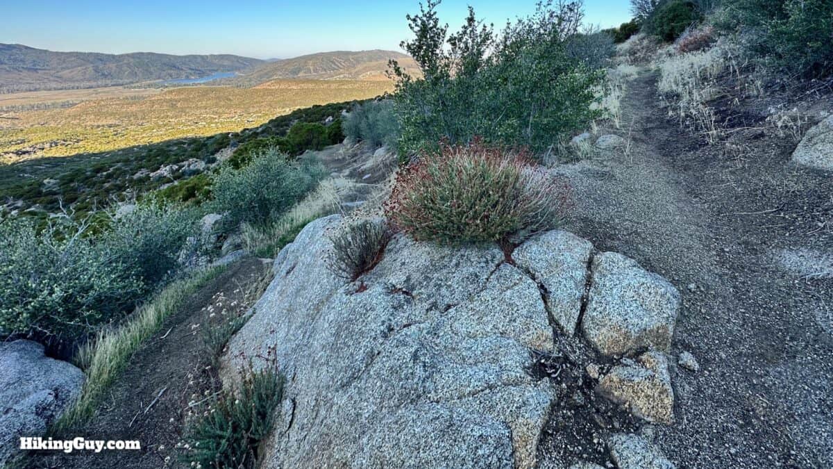
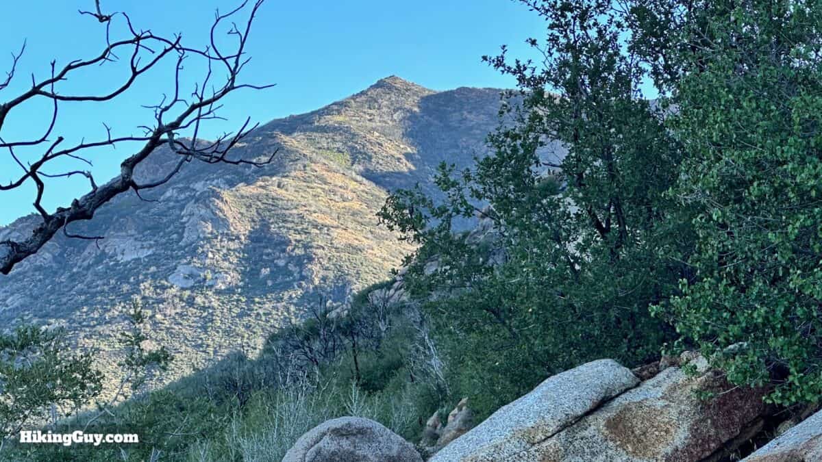
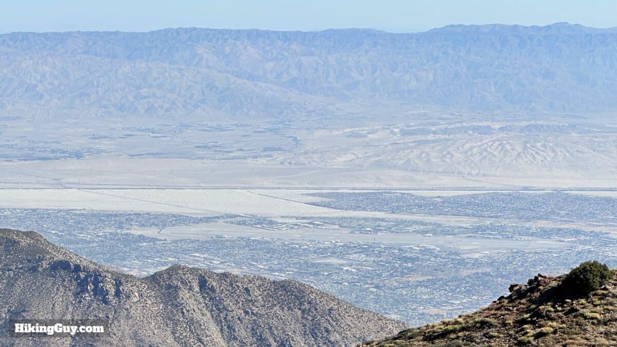
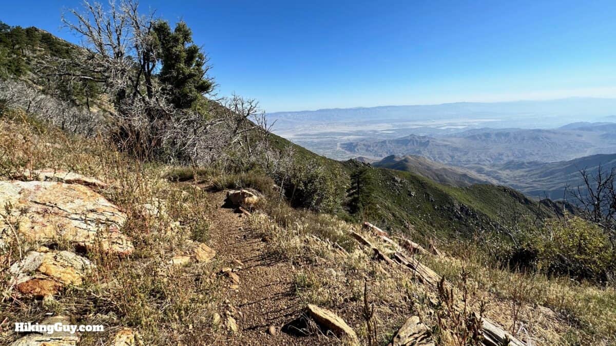
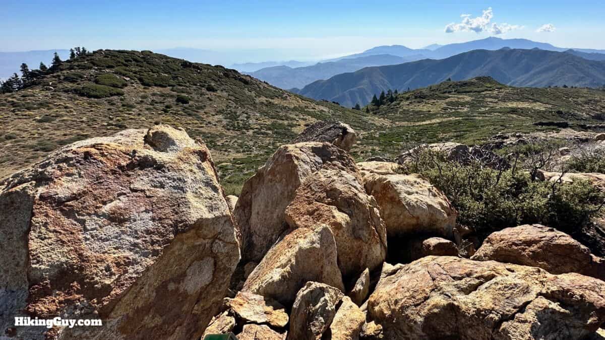
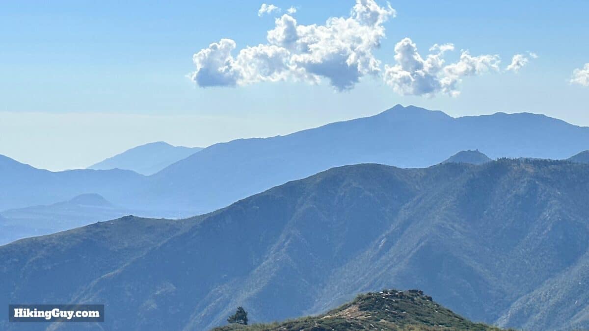
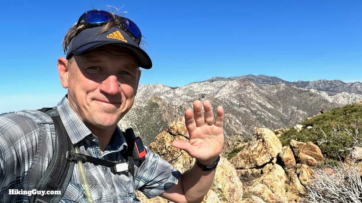
Apache Peak is not on most hiker's radars, but it should be. It offers a little bit of the best of everything in SoCal hikes. First, you have a mellow 2600-foot climb on the Spitler Peak Trail, which you'll probably have all to yourself. Then a short stretch on the PCT brings you to Apache Peak, with spectacular views from the "desert divide." You'll see from Palm Desert to Saddleback Mountain, to San Jacinto Peak, and Rabbit Peak to the south. And it's also on the Sierra Club's 100-Peak list if you're a peak-bagger.
- Video and Turn-by-Turn Directions to Hike Apache Peak (CA)
- Where to Park for the Spitler Peak Trail Hike Start
- Insider Tips and Recommendations
Where is Apache Peak?
The hike to Apache Peak starts south of Idyllwild in Mountain Center, CA, at the Spitler Peak trailhead. Use this trailhead address:
Spliter Peak Trail, Mountain Center, CA 92561
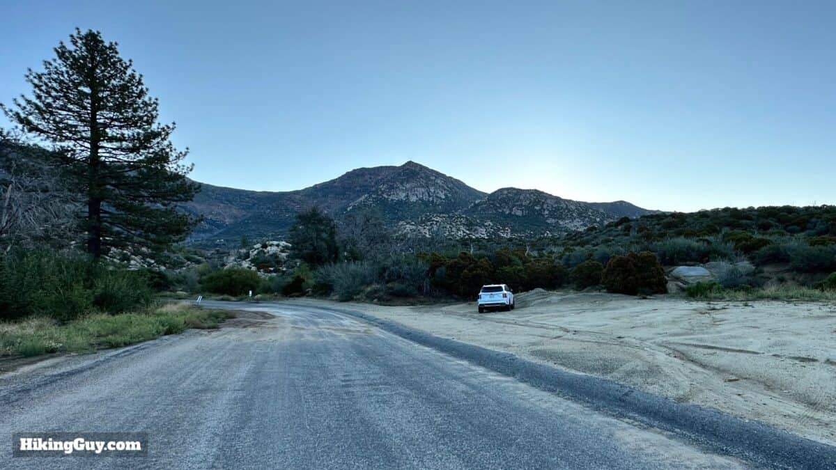
Some websites indicate that you need a parks pass or Adventure Pass to park here, but there are no facilities, so there is no need for a pass.
Apache Peak Permits
There's conflicting information on whether a wilderness permit is required or optional. Completing the permit only takes a few minutes and helps the park service, so I recommend doing it. You can get the PDF form online, fill it out, and fax it in (you can find free fax services if you Google them). You can also visit the San Jacinto Ranger Station in Idyllwild and fill out a permit outside the entrance. Or not.
Gear For the Hike
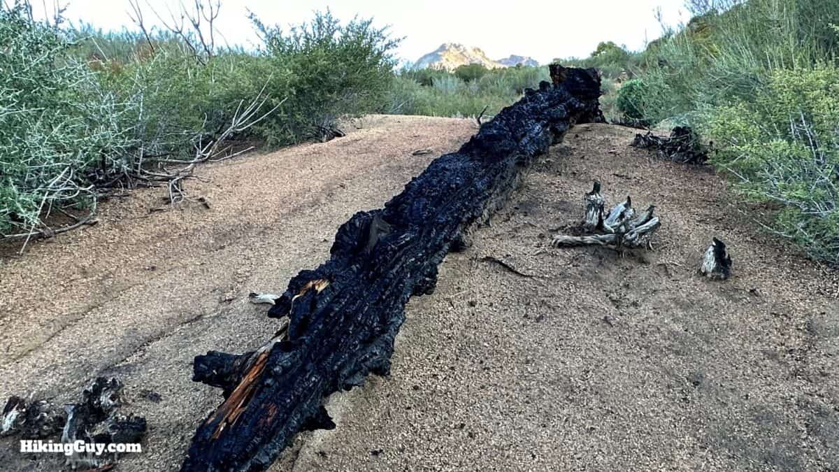
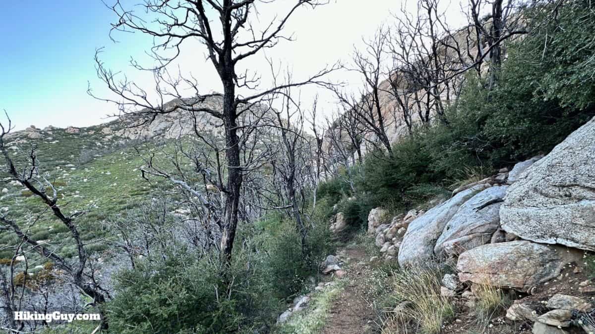
This is a backcountry hike in the mountains; you should prepare accordingly. In the winter, the trail, especially the PCT section, can be covered in snow and dangerous to traverse. In the summer, thunderstorms can pop up over this transitional area at the edge of the desert.
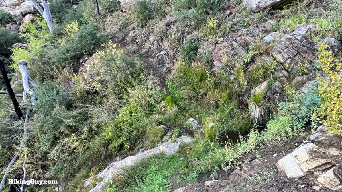
- There's a reliable water source halfway up the climb; otherwise if you take 2L or so of water you'll be fine. There's also water at Apache Spring, but it's a steep trail down and back.
- The trail can be overgrown in spots, so wear long pants if that's a problem.
- Trekking poles are handy on the slopes and can help push the brush back.
Gear That I Love Right Now
Nothing is sponsored or promoted, just the actual gear that I use.


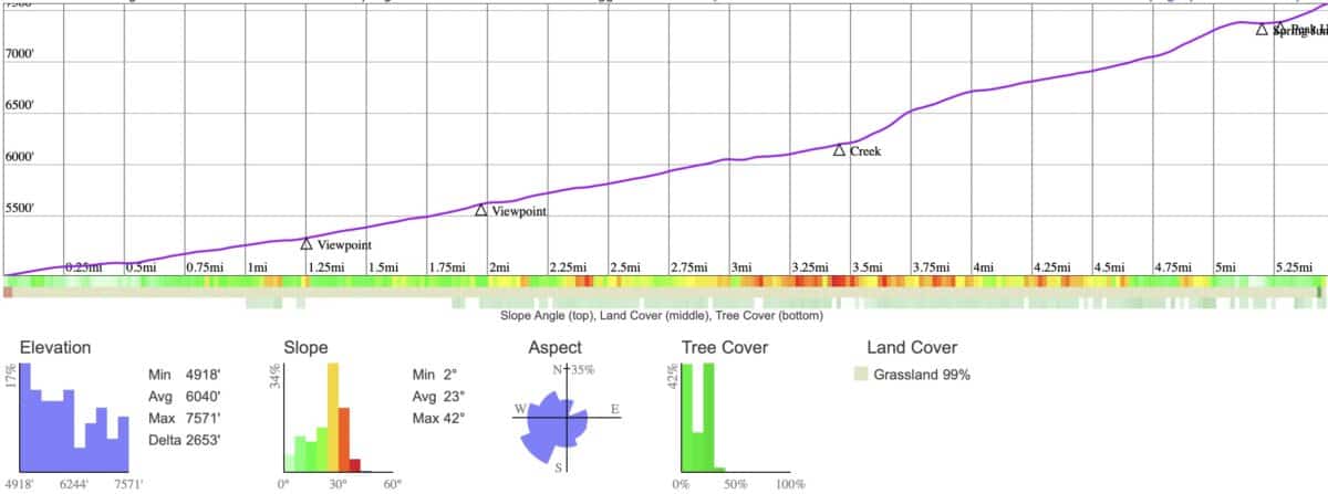
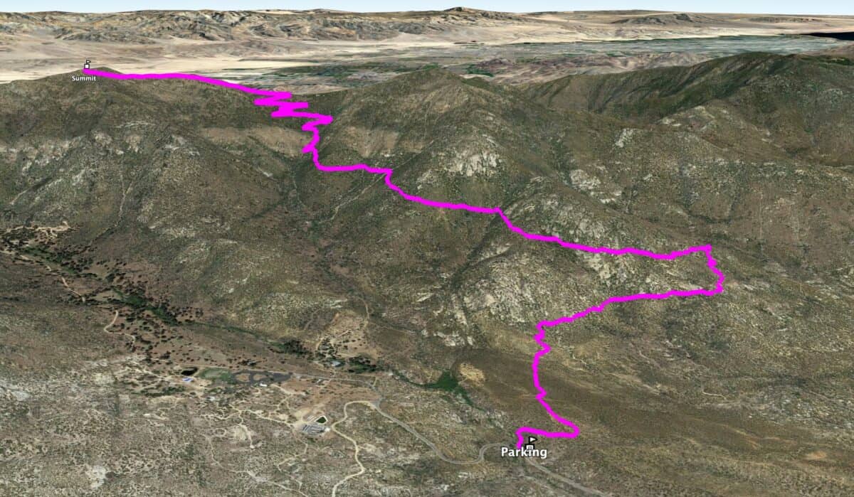
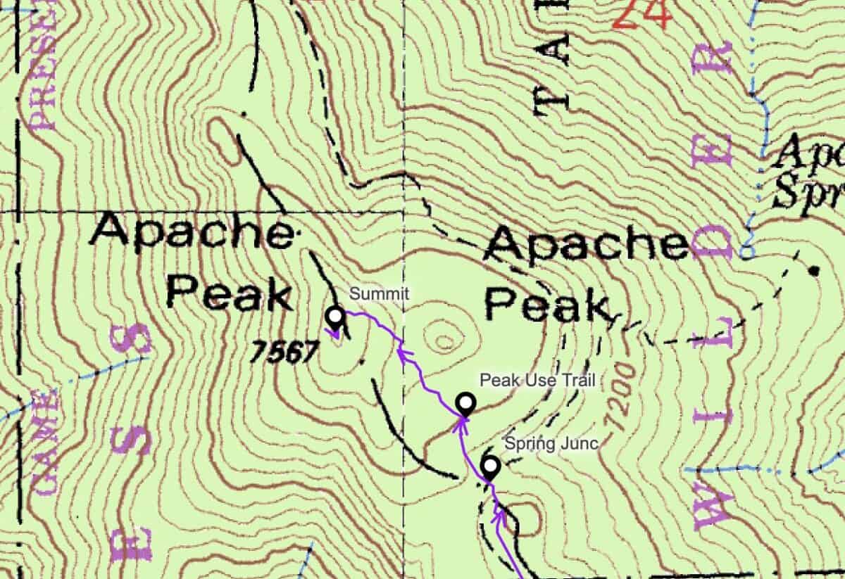
Apache Peak Trail Maps
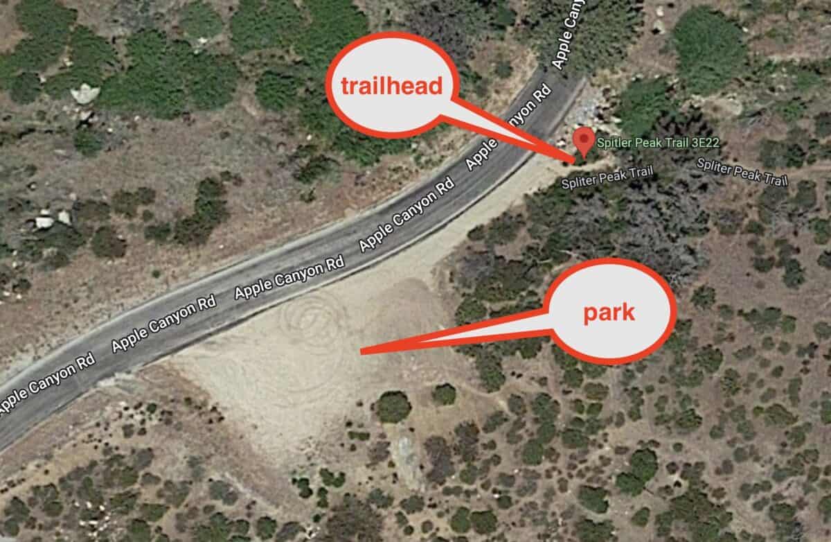
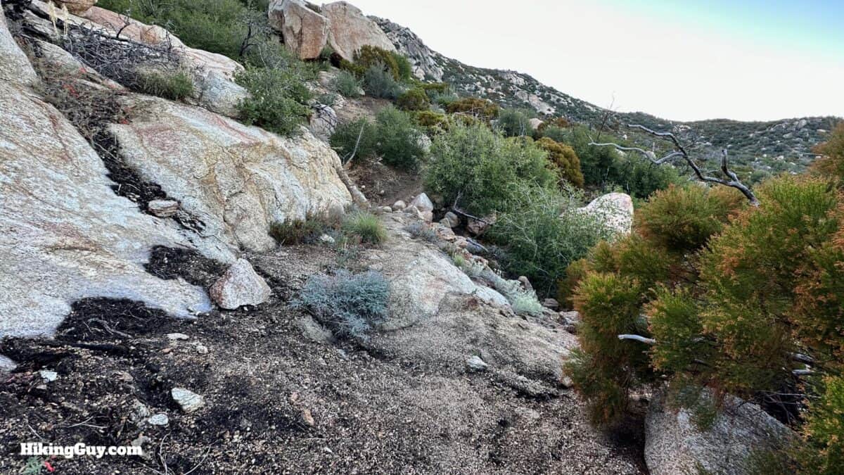
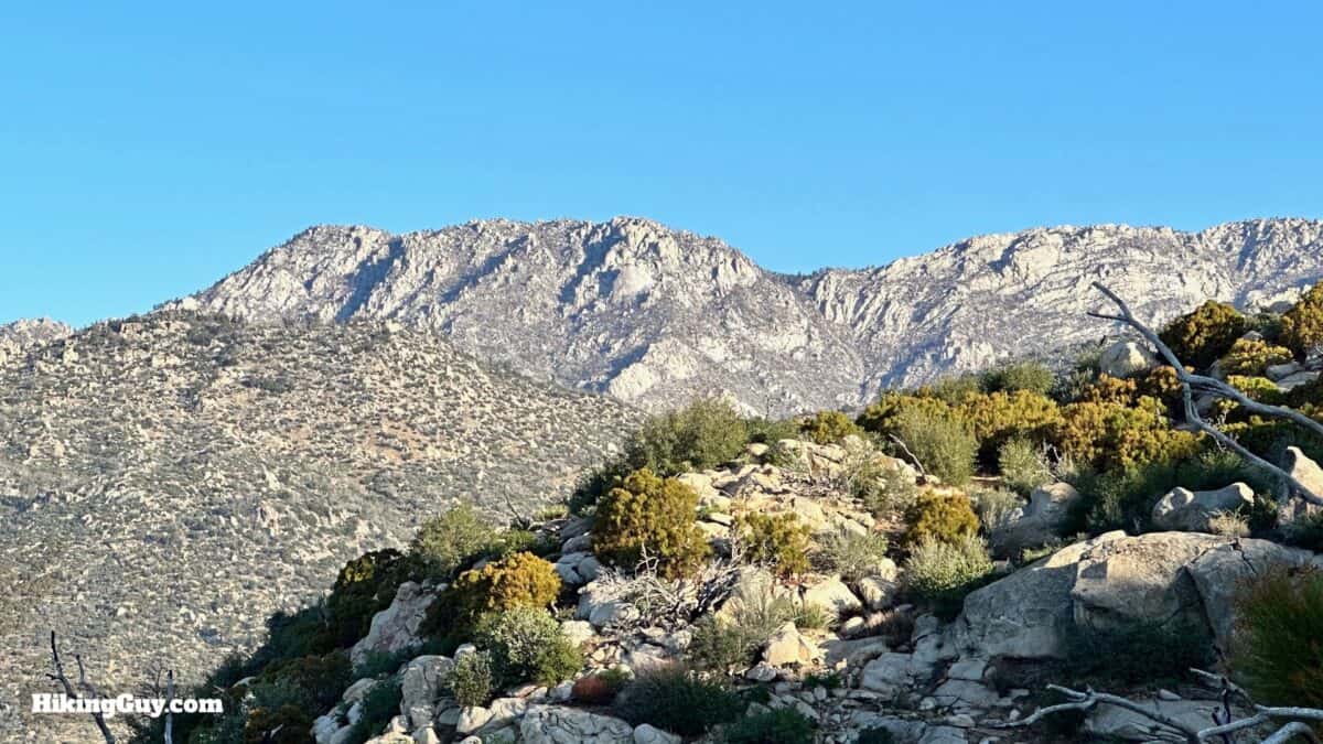
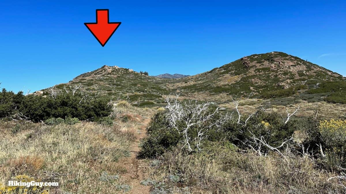
You'll take the Spitler Peak Trail 3E22 from the parking area to the PCT. After a short stretch on the PCT we'll branch off on a short use-trail to the summit of Apache Peak.
How Will You Navigate?
 Using the Apple Watch for Hiking
 Garmin Fenix 7 & Epix Review For Hikers
 How To Read a Topographic Map
 Garmin GPSMAP 67i Review
Elevation Profile
3D Map
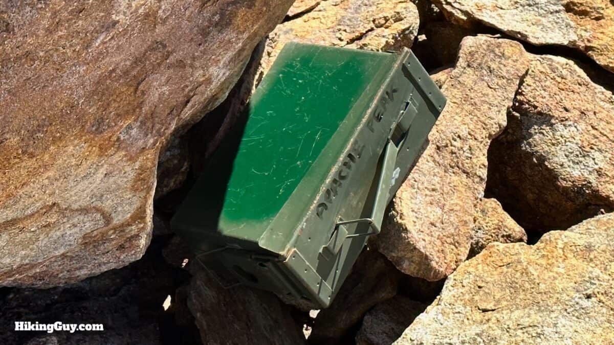
Did Apaches Live Here?
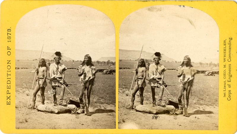
Although Apache lived over 100 miles east of this hike in what is now Arizona, they were famous for their long-range raids that spread as far as Utah, Colorado, and the Pacific Ocean. The Chumash people of Southern California have an oral history of battles between them and the Apache. Apache arrowheads were found at what is now Apache Springs, and the peak got its name shortly after that. Perhaps the raiding Apache used the area around the mountain as a place to camp and hideout. I've no proof that Apache stayed around the peak, but it's not hard to envision.
And although Afghanistan is often touted as the USA's longest war, the war against the Apache lasted longer, from 1849 to 1886. The US government continued fighting isolated Apache until the 1920s. Many Apache fled to the northern Sierra Madre in Mexico, raiding ranchers and Mormon settlers until the 1930s.
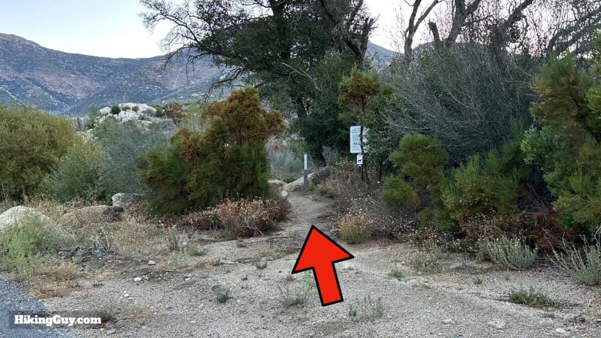
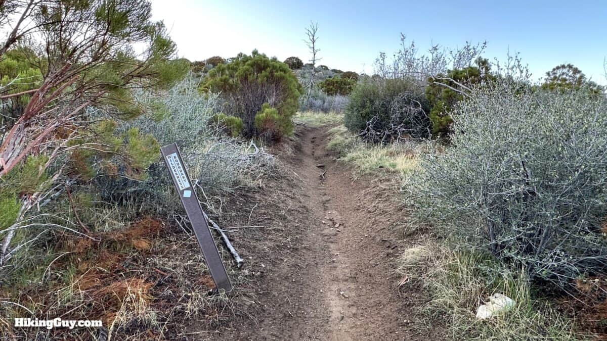
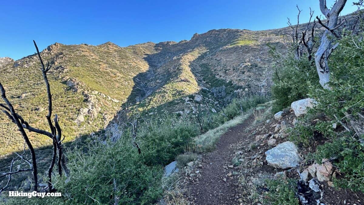
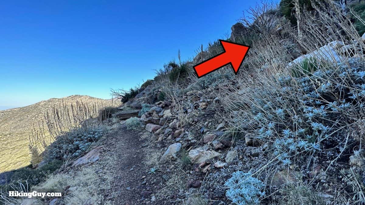
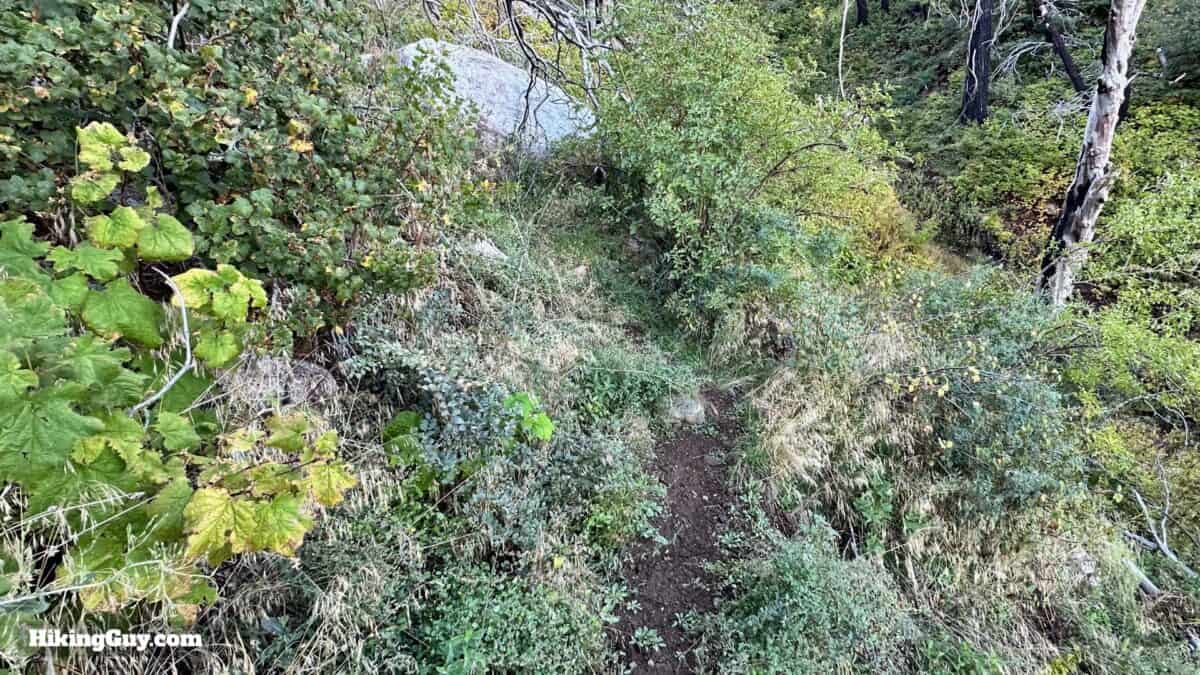
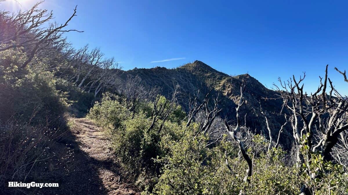
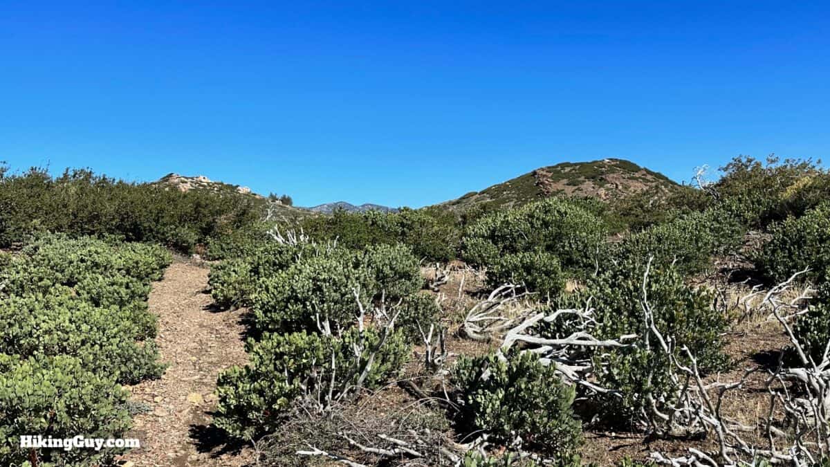
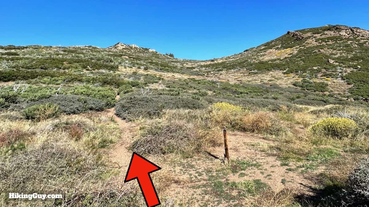
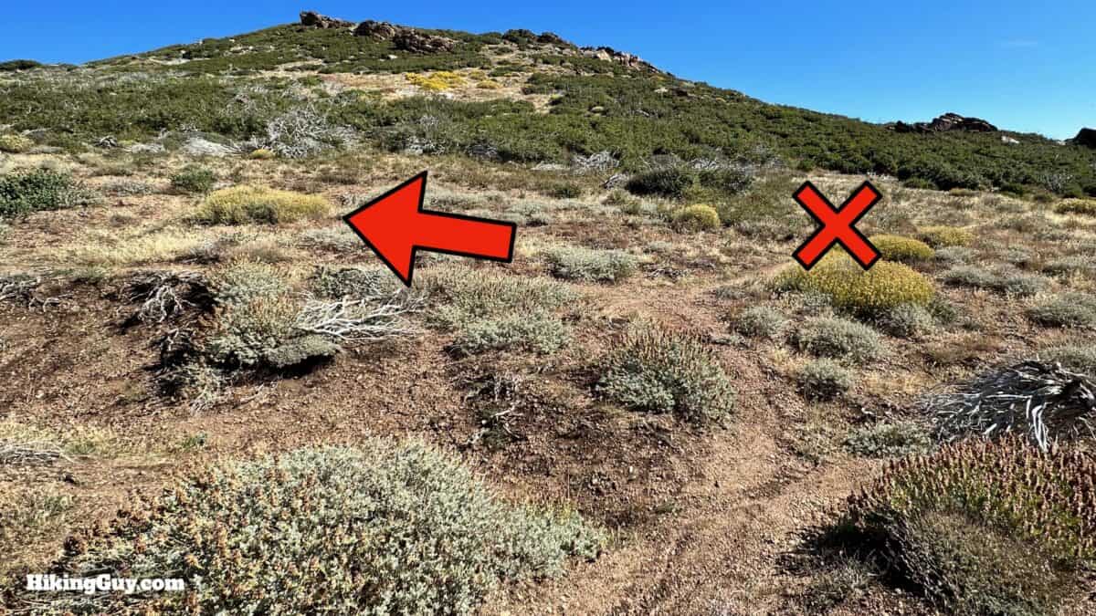
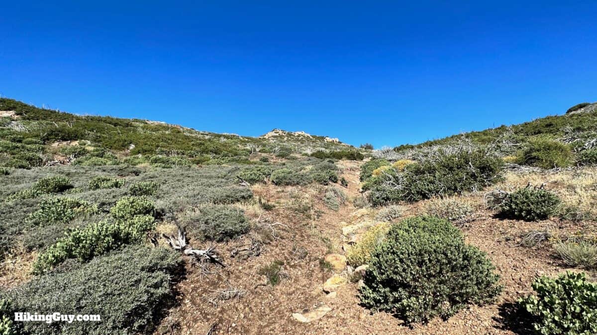
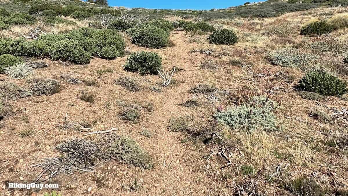
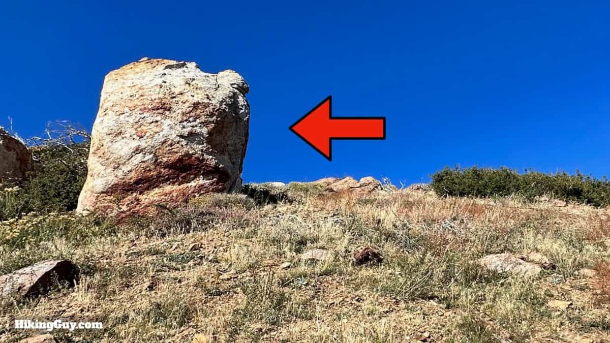
Apache Peak Hike Directions
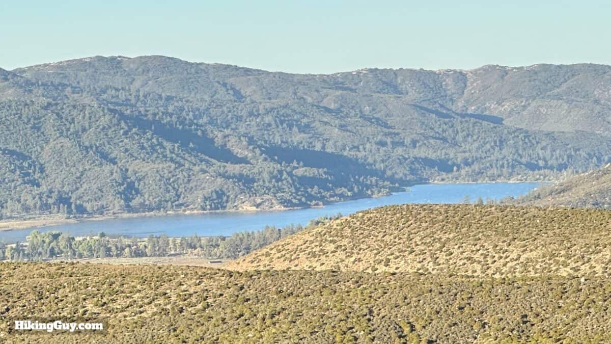
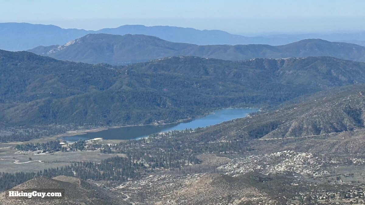
Lake Hemet was formed in 1895 when the Lake Hemet Dam was completed. At the time, it was the largest solid masonry dam in the world. And if you ever watched the 1980s show Airwolf, the main character lived in a cabin on its shores. At least in the b-roll.
The story behind Spitler Peak is an interesting one with many bizarre intersections. Spitler was a squatter who lived on the nearby Forbes Ranch in the 1890s. He was driven off the property, but his name appeared on this peak when the 1944 topographic map was published. Then in the 1960s, Forbes Ranch became the epicenter of LSD production when Timothy Leary and Brotherhood of Eternal Love set up shop there. Today Forbes Ranch is owned by YouTuber Logan Paul, who became infamous for joking around after finding a suicide victim in one of his videos.
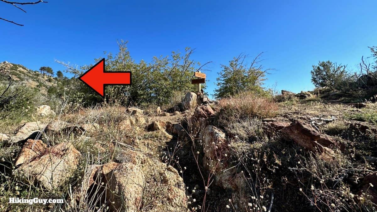
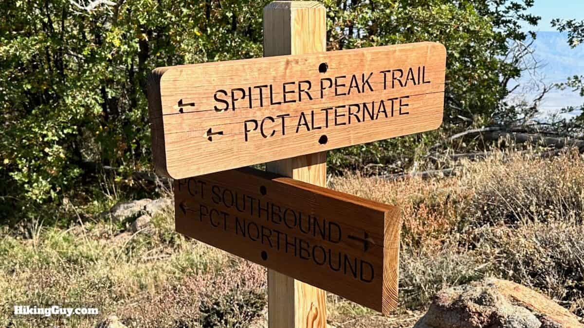
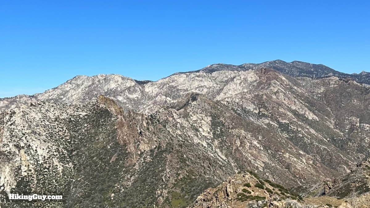
You'll see Spitler Peak Trail (which you just ascended) listed as a PCT alternative. After a PCT hiker died near Apache Peak after slipping on ice in 2020, the PCT Association established this alternative route between here and Black Mountain, which skips the sometimes snowy and icy higher peaks.
Need More Info?
- Have a question about the guide or want to see what other people are saying/asking? View the Youtube comments for this video. Leave a comment and I will do my best to respond.
- When planning, always check the park website and social media to make sure the trails are open. Similarly, check the weather and road conditions.
Related Guides
 Tahquitz Peak via Devil's Slide Trail Hike
 Black Mountain Trail to the Fire Lookout (Idyllwild, CA)
 Los Angeles Hikes
 Hikes In and Around Riverside County
 LA Mountain Hikes
 San Bernardino National Forest Hiking Trails
Popular Guides
 Best Hiking Gear 2024
 Hiking Boots or Shoes: Do I Really Need Hiking Boots?
 When to Hit SOS on inReach
This Guide Was Written by Cris Hazzard

Hi, I'm Cris Hazzard, aka Hiking Guy, a professional outdoors guide, hiking expert, and author based in Southern California. I created this website to share all the great hikes I do with everyone else out there. This site is different because it gives detailed directions that even the beginning hiker can follow. I also share what hiking gear works and doesn't so you don't waste money. I don't do sponsored or promoted content; I share only the gear recommendations, hikes, and tips that I would with my family and friends. If you like the website and YouTube channel, please support these free guides (I couldn't do it without folks like you!). You can stay up to date with my new guides by following me on YouTube, Instagram, or by subscribing to my monthly newsletter.