
Hiking & Camping Channel Islands National Park (Santa Cruz)
- 7.5 miles - Easy Effort
- Or: 5.2 miles
- 2 Days (Total)
- Expect to See Some Other Hikers
- No Dogs Allowed
Figuring out how to camp, backpack, and hike Channel Islands National Park can be intimidating. Each island has its own deal, and it can be overwhelming between permit regulations, water supplies, and boat schedules. In this guide, I'll show you the easiest way to make your first visit to the Channel Islands National Park and experience all it has to offer.
- The Easiest Way To Visit
- How to Book & Plan
- Best Camping & Hikes
Before You Start Planning
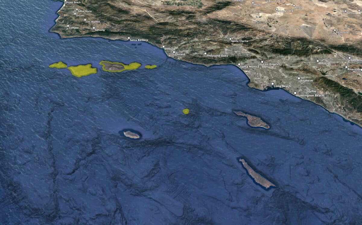
If it's your first time planning a trip to Channel Islands National Park, understanding which island to visit when can be very confusing. There's a reason why, despite its proximity to LA, Channel Islands NP is one of the least visited National Parks in the USA. Some challenges include:
- Each island has its own ferry schedule and service.
- Some islands and trails are closed at different parts of the year.
- Campgrounds can have different permitting rules.
- Water and bathrooms are rare at any campground.
- Maritime weather sometimes shuts down access when docks get damaged.
Based on the challenges involved, I recommend a two-day itinerary that makes planning as easy as possible and minimizes the possibility of closures (but just know they can happen anytime, anywhere, blame Mother Nature). We'll be visiting Santa Cruz Island, the largest and most popular destination and an excellent place for a first visit. Some advantages of this itinerary are:
- Santa Cruz has a frequent ferry schedule.
- As the most popular destination, any repairs (dock, etc.) are usually expedited compared to the other islands.
- There are many miles of hiking trails. I'll show you two of my favorites in this guide.
- The island and campground are open all year.
- There are enough tentsites that you can usally book it without dealing with
- There are enough tent sites that you can usually book your pick when acting in advance. There's no lottery or other hassles.
- The campground has running water and bathrooms—no need to lug liters of water or poop into a hole in the ground.
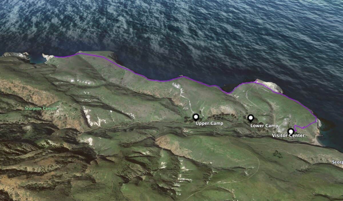
The Best Itinerary
Day 1
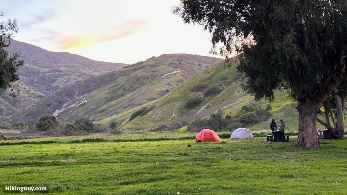
- In the morning, take the ferry from Ventura to Scorpion Cove on Santa Cruz Island
- Set up your camp, eat lunch
- Hike to Smuggler's Cove and back
- Overnight at Scorpion campground
Day 2
- Enjoy breakfast at the campsite
- Break down camp
- Store your gear in lockers by the ferry landing
- Hike to Potato Harbor Overlook and back
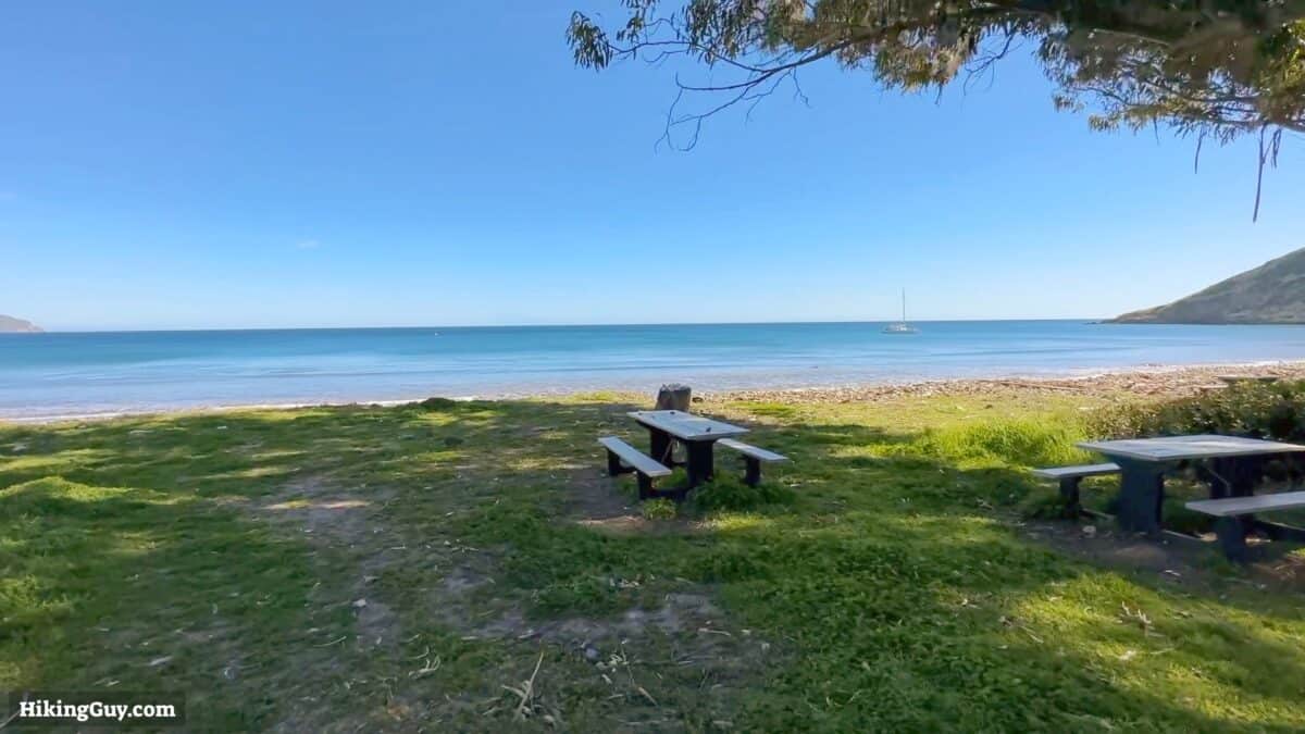
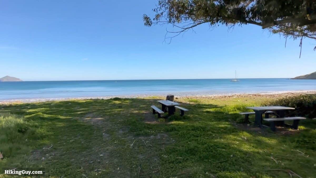
- Eat your lunch by the visitor center area, maybe go for a swim
- Take the ferry back
Booking & Logistics
It's simple to make this itinerary work:
- Check the boat schedule
- Book the campground
- Book the ferry ticket
Check the Boat Schedule
First, go to the ferry page and ensure boats leave and return for the dates you want. Look for the ferry to Santa Cruz Island and then for Scorpion Anchorage overnight. If you click on a departure, it will show you the return times of the boat.
Generally, if you're booking in advance, grabbing the campsite first and then the boat ticket makes sense. If it's a last-minute booking, you must do both as quickly as possible.
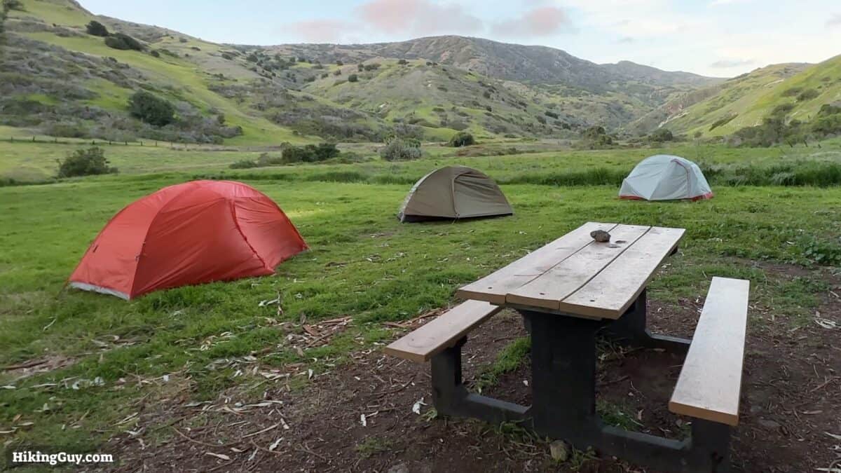
Booking Santa Cruz Scorpion Campground
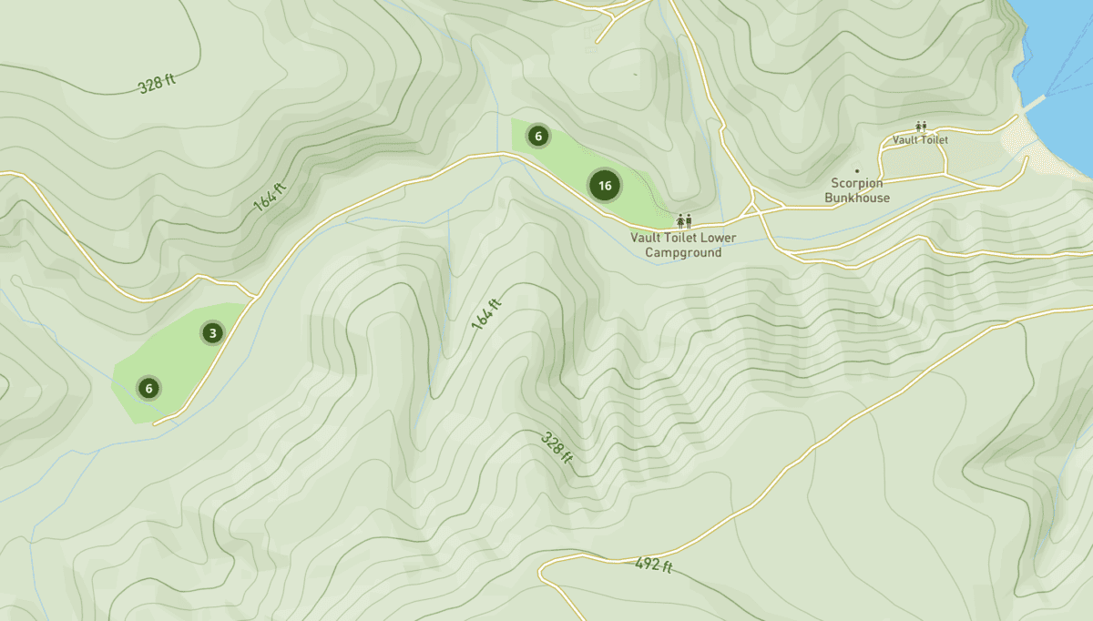
To book a tent site at Scorpion Cove, visit the reservation page at Recreation.gov. Reservations open up six months in advance on a rolling basis. So on January 1, you can book for July 1. And while this is not the easiest campsite to book, it's nowhere near as challenging as securing a permit for Half Dome or Whitney. Usually, spots linger open for a while.
If you can't get the date you want, I'd recommend using the Outdoor Status service, which, for a small fee, will check for cancellations every 30 minutes and text you with the link to the reservation page if a spot opens up.
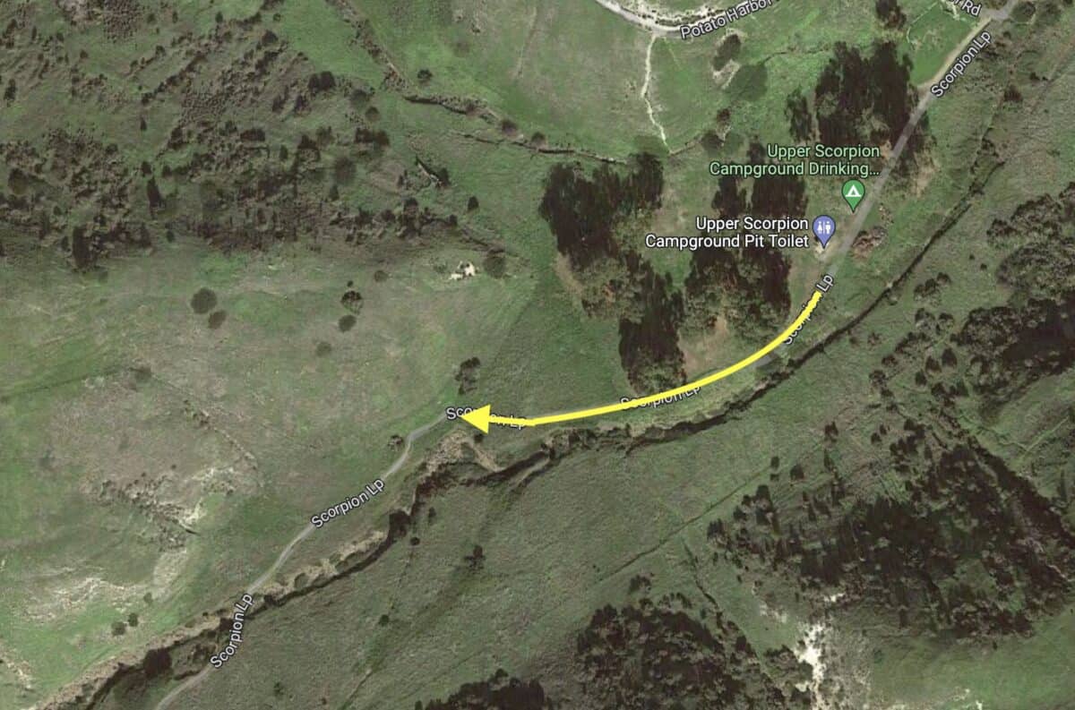
There are two camping areas, the upper and the lower. I prefer spots 24 and 25 in the upper area, which offers more solitude. Both sites provide bathrooms with toilet paper and a running water spigot.
- The ranger will check you in when you get off the ferry.
- You do not need to treat or filter the water.
- Use the fox boxes to protect your food, trash, and any scented items from wildlife.
- Check out by 11 am.
- There are no stores or facilities at the campgrounds; you must bring everything you need.
- There are no trashcans; you must pack everything you bring in. I get a gallon Ziploc bag for my trash.
- Bring food for an extra day if the ferry is canceled for bad weather.
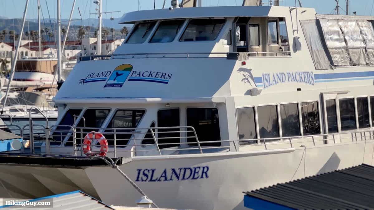
Booking Your Ferry Ticket
Once the campsite is confirmed, return to the ferry page and pull the trigger on the boat tickets. You'll get an email confirmation with the next steps. As your departure date gets closer, Island Packers with follow up with another email or two.
- Eat breakfast in Ventura before getting to the harbor.
- Plan on arriving at the office an hour before your departure.
- You'll check in at the office before getting on the boat.
- The office will tell you which area of the parking lot to use for an overnight visit.
- You'll be asked to check your fuel canisters in before getting in line. They go into a protective box and you can pick them up once you arrive.
- You'll also hand your bigger backpacks over before getting in line. These will be stored and then unloaded on the ferry dock in Santa Cruz.
- The boat usually has a small bar with snacks, soda, and beer. If you want some last-minute treats for your stay, buy them onboard. Or better yet, at a supermarket in Ventura.
Gear Recommendations
Gear for this trip is pretty simple. Here's what I'd recommend (for specific gear recommendations, check the camping section on my gear page).
- A tent, sleeping pad, inflatable pillow, and quilt or sleeping bag. Check the forecast for the low temperatures. Usually lows are in the 40s-50s. Make sure to bring tent stakes, it can get windy.
- You'll want layers and shells in case of rain. Weather isn't as variable as some other coastal islands, but it can change, especially from November to March. There can also be multi-day rain storms during this period, usually a few each year.
- Bring a water bottle. You can refill it at the campgrounds.
- Have enough food to last another day or two. Occasionally the weather or sea conditions will cancel the ferry, and you might have another day on the island.
- Some cell phones work at the end of the ferry dock, but otherwise there isn't a connection with the outside world. If you have a satellite communicator like an inReach, you should bring it.
- I bring a small and light backpack for the hikes so I don't have to lug my camping backpack.
Gear That I Love Right Now
Nothing is sponsored or promoted, just the actual gear that I use.


Santa Cruz Trail Maps
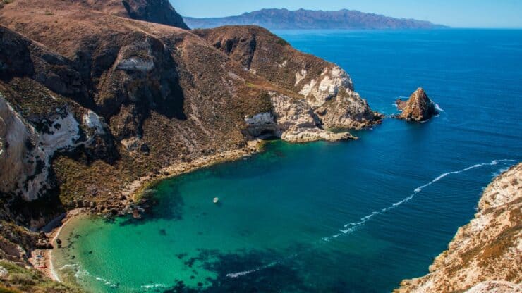
There are several trails and off-trail adventures on the island, and I recommend doing the Smuggler's Cove and Potato Harbor Overlook hikes. They're both unique and offer a variation of scenery that you won't find anywhere else on earth.
How Will You Navigate?
 Using the Apple Watch for Hiking
 Garmin Fenix 7 & Epix Review For Hikers
 How To Read a Topographic Map
 Garmin GPSMAP 67i Review
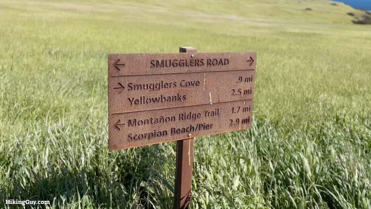
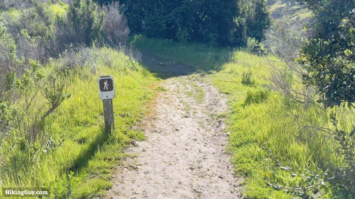
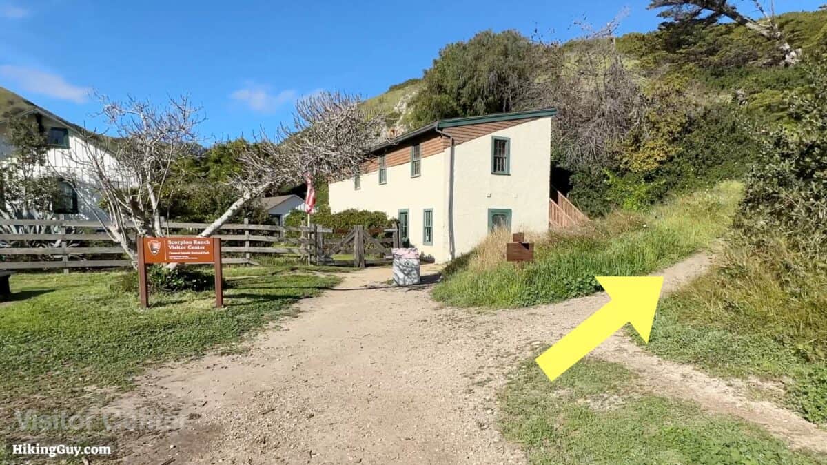
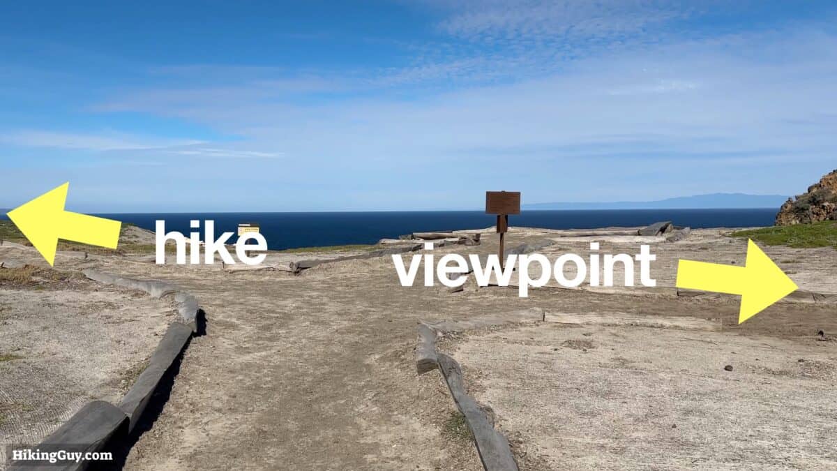
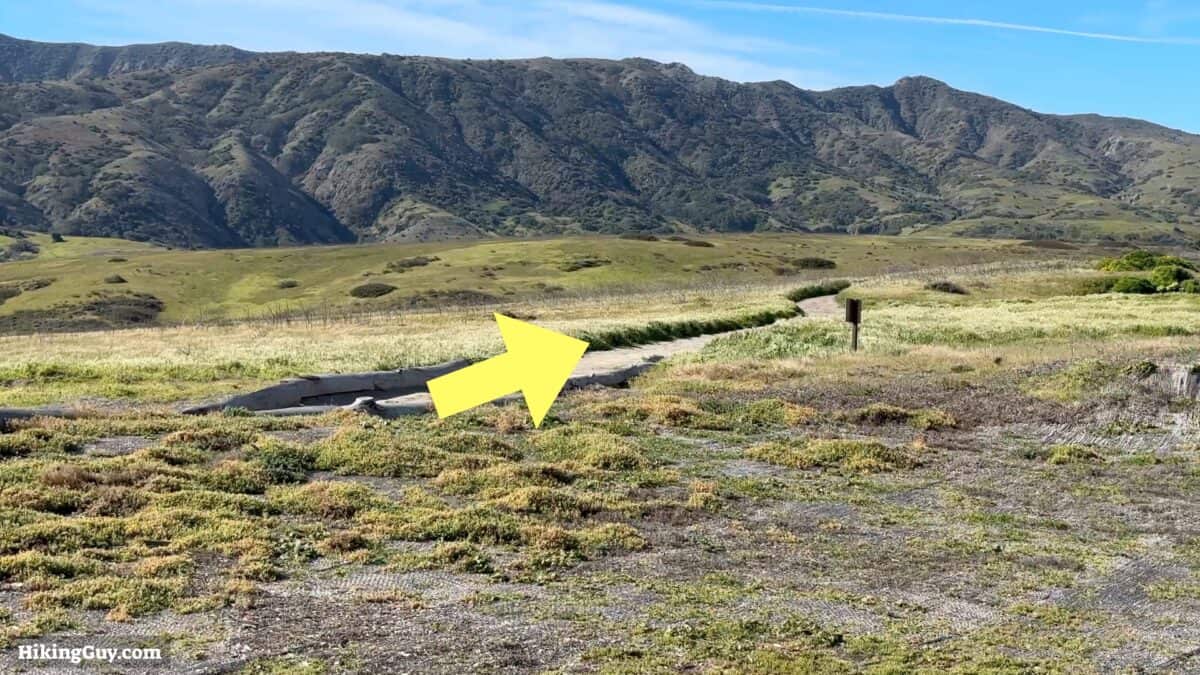
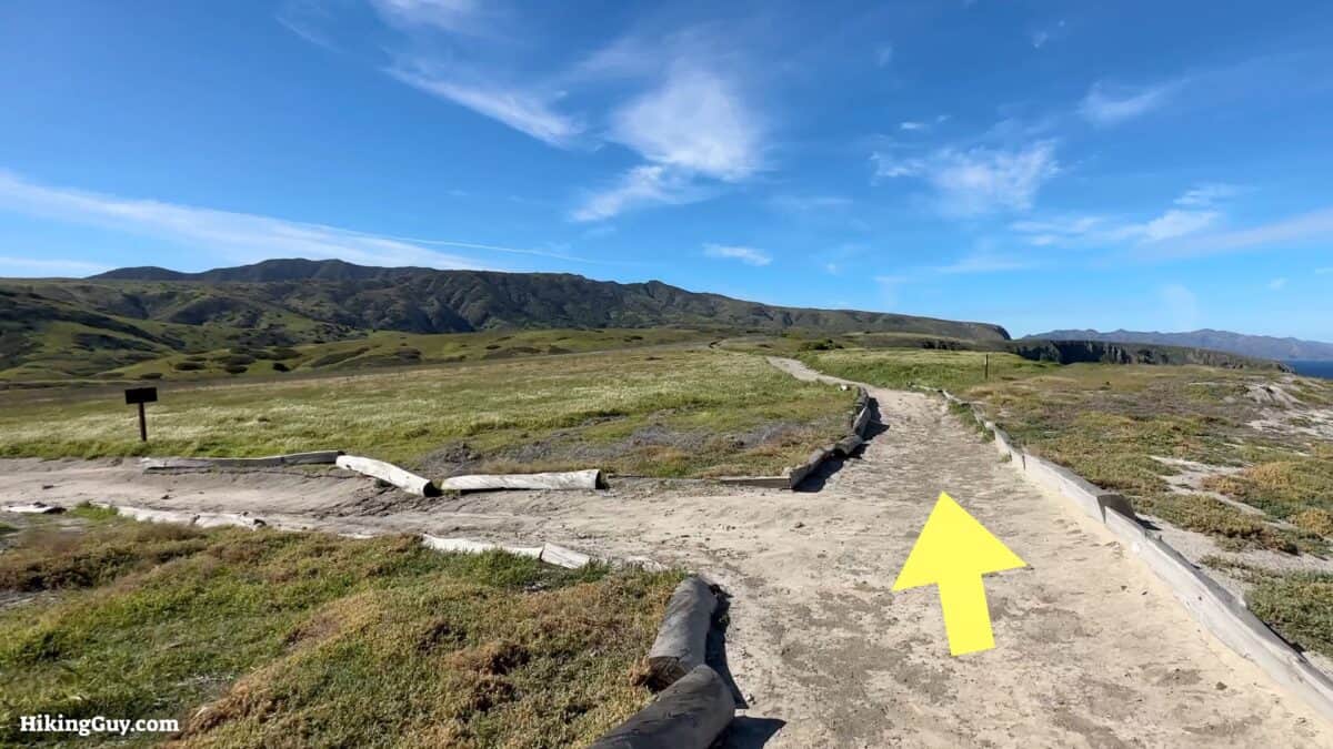
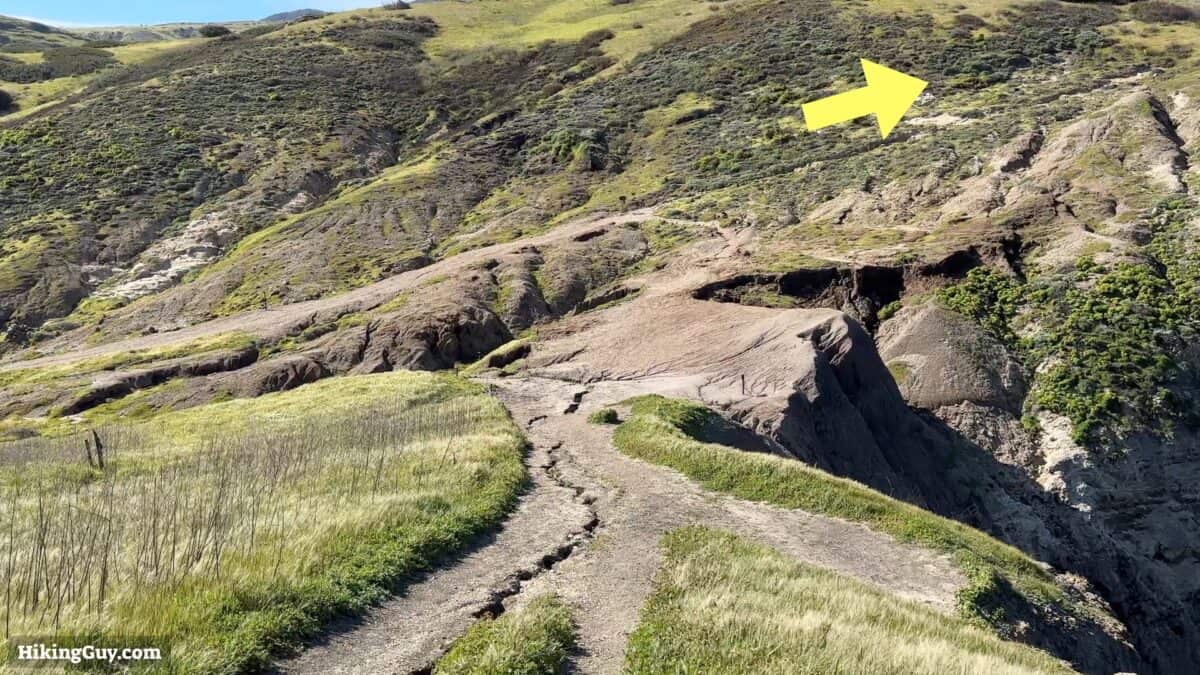
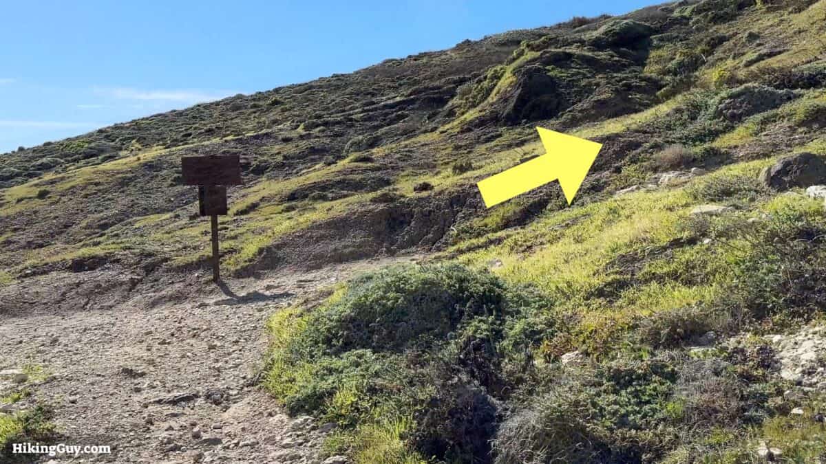
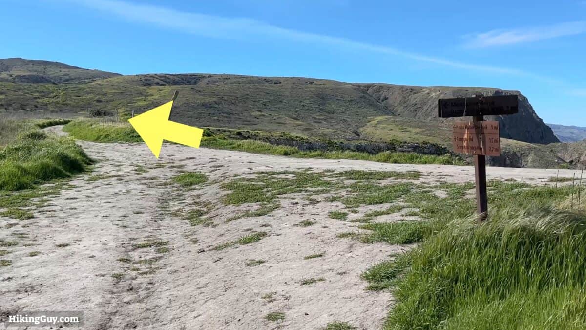
Smuggler's Cove Hike Directions
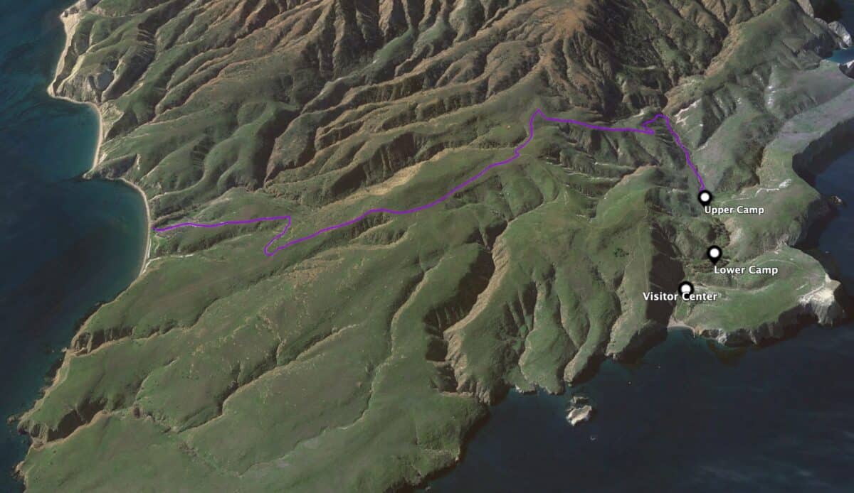
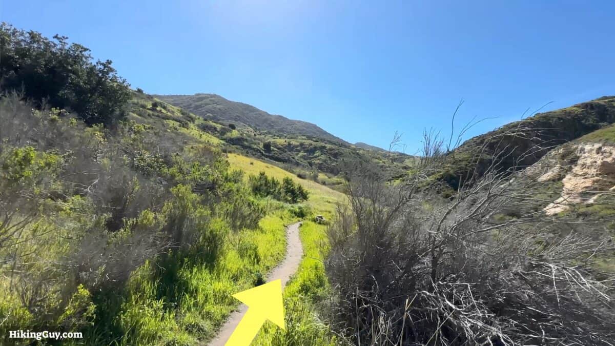
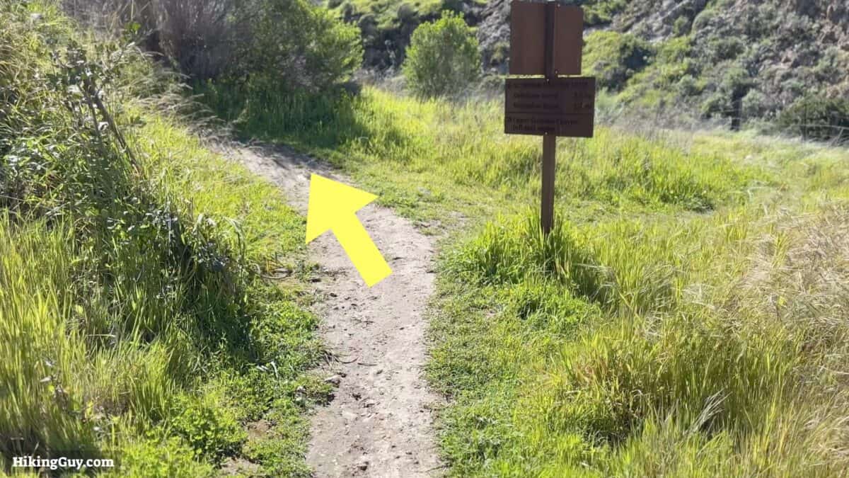
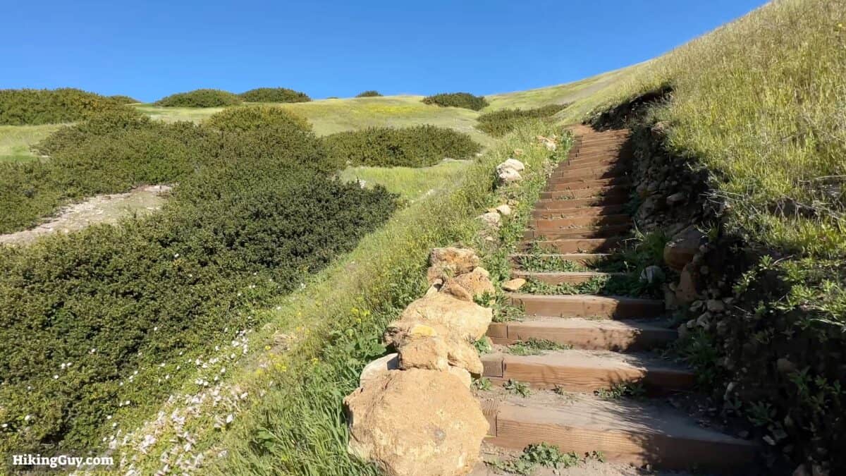
The hike to Smuggler's Cove is a perfect way to get a feel for Santa Cruz Island, stretch your legs, and work up an appetite for dinner. This version of the hike starts on the Scorpion Canyon Loop Trail, which is a quiet single track that climbs a few hundred feet and eventually joins Smugglers Road. We'll take Smuggler Road downhill, through the old ranch and grazing lands, to the secluded Smuggler's Cove. From there, just return the way you came.
- 7.5 miles
- 1400 feet of climbing
- 3-4 hours
- Moderate (some ups and downs)
The area we are hiking through has been used for ranching from 1844 until 1998 when the NPS bought the ranch and incorporated it into the park. Why was it used for ranching? The ocean is your fence, and there are no predators.
The Channel Islands have been used for smuggling since when the Mexicans owned California. Before the federal income tax was introduced in 1913, the primary source of government income was import tax, and smugglers would use this protected cove to transfer their cargo to smaller boats that would take contraband to the mainland. Later, during prohibition, it was used to smuggle alcohol into the USA. Even today, the odd smuggler is found in the area, usually a panga (an open fishing boat) used for human trafficking. In 2012 a Coast Guardsman was killed off Santa Cruz when a panga rammed his vessel during a stop.
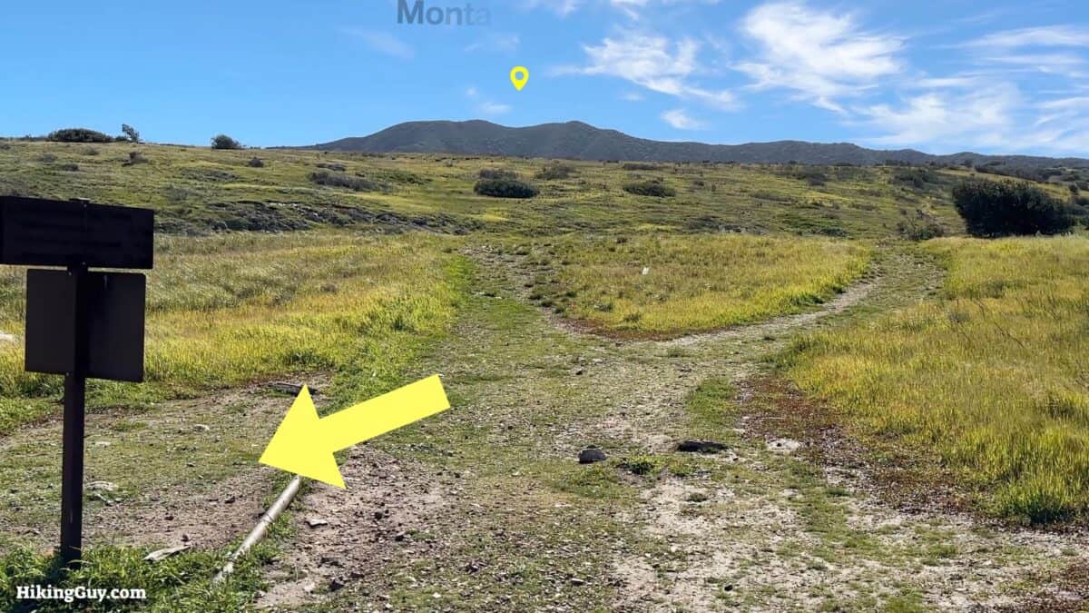
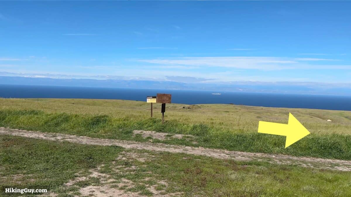
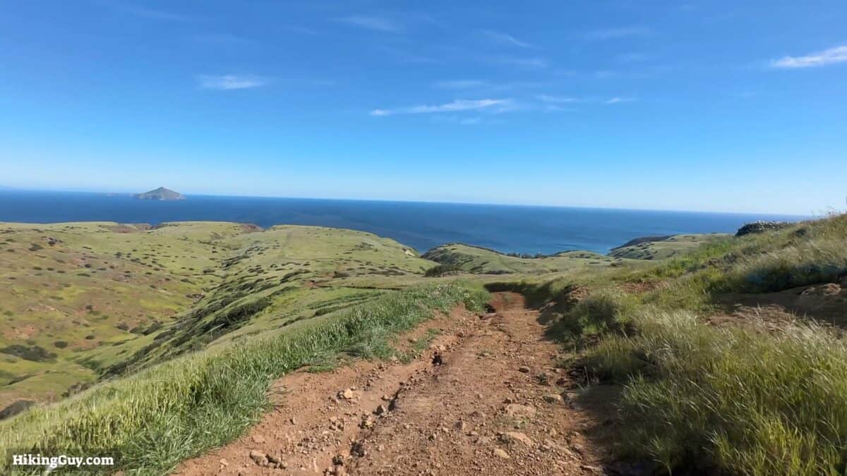
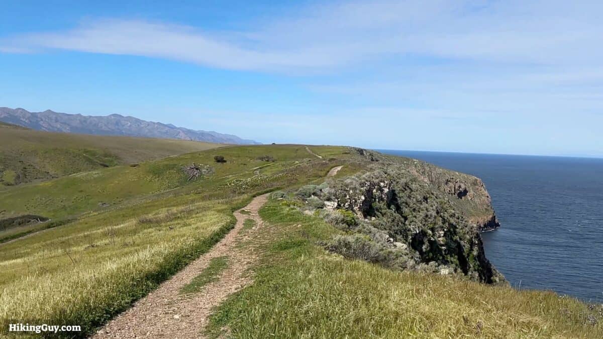
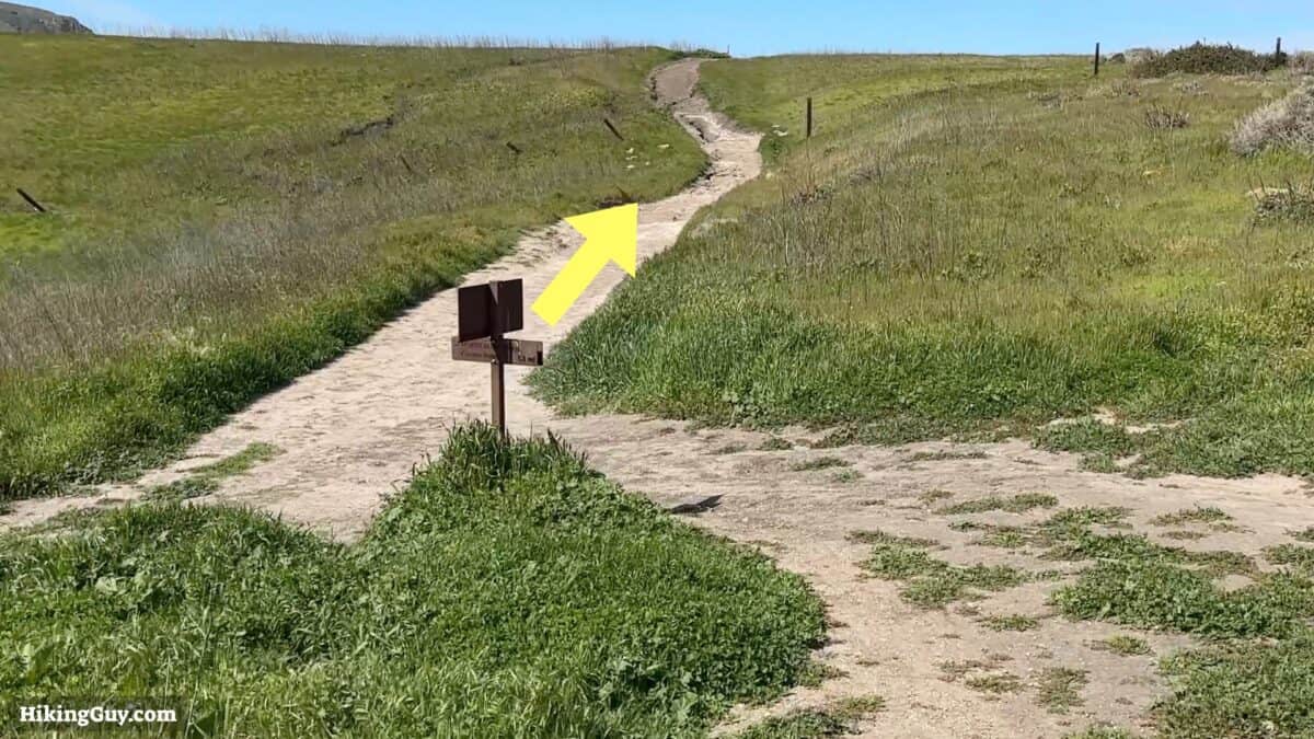
Potato Harbor Overlook Hike Directions
This 5.2-mile route combines a few popular shorter routes into one spectacular cliffside hike. Starting at the Visitor Center, we'll do a short climb and then spend the rest of the hike along the bluffs, enjoying ocean views and dramatic cliffs. We'll take in Cavern Point and then continue to the Potato Harbor overlook, with postcard-perfect views of the secluded cove.
- 5.2 miles
- 2-3 hours
- 600 feet of climbing
- Easy (initial climb and then rolling or flat)
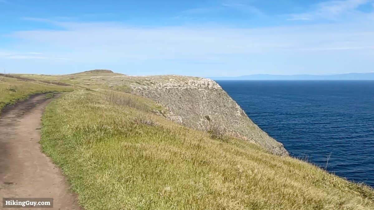
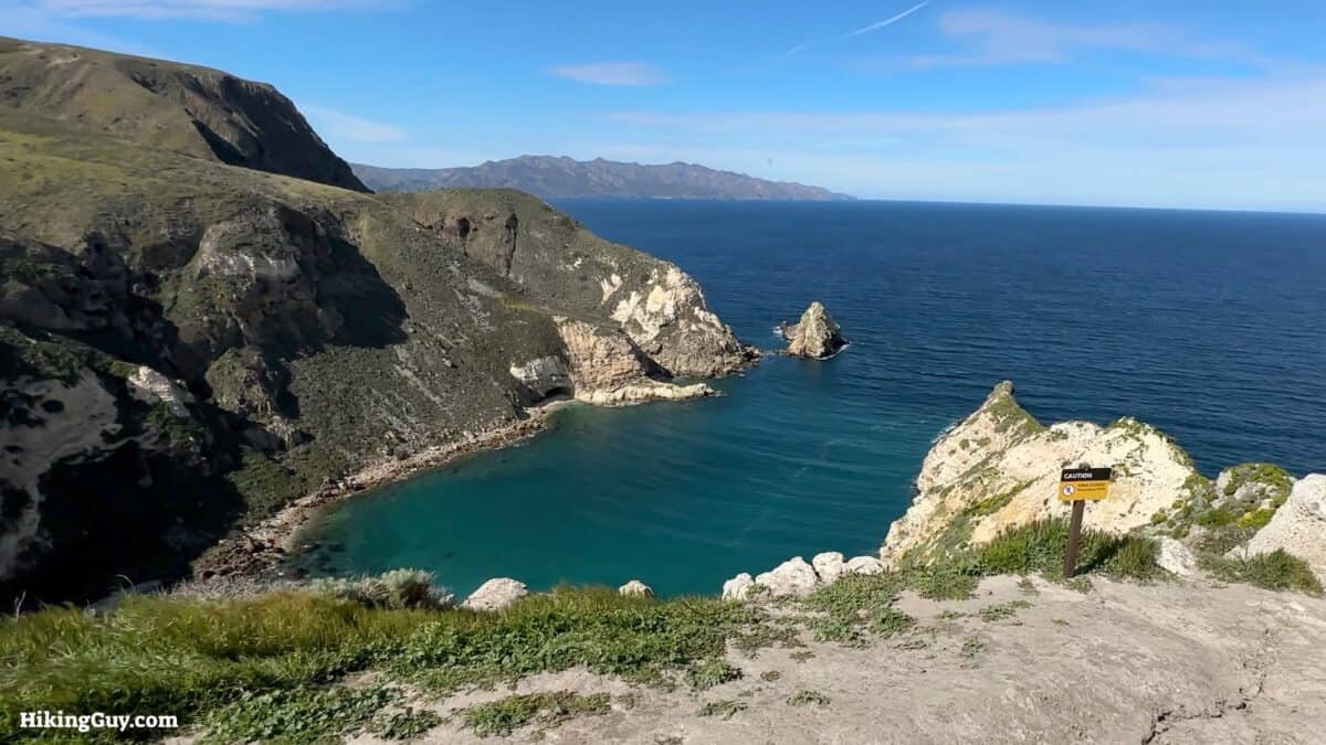
Why is it called Potato Harbor? Because it's shaped like a potato.
Need More Info?
- Have a question about the guide or want to see what other people are saying/asking? View the Youtube comments for this video. Leave a comment and I will do my best to respond.
- When planning, always check the park website and social media to make sure the trails are open. Similarly, check the weather and road conditions.
Related Guides
 Trans Catalina Trail (TCT) Hike Guide
 California Riding and Hiking Trail (Joshua Tree)
 Los Angeles Hikes
 Backpacking Trips
 Best Hikes in the World
Popular Guides
 Best Hiking Gear 2024
 Hiking Boots or Shoes: Do I Really Need Hiking Boots?
 When to Hit SOS on inReach
This Guide Was Written by Cris Hazzard

Hi, I'm Cris Hazzard, aka Hiking Guy, a professional outdoors guide, hiking expert, and author based in Southern California. I created this website to share all the great hikes I do with everyone else out there. This site is different because it gives detailed directions that even the beginning hiker can follow. I also share what hiking gear works and doesn't so you don't waste money. I don't do sponsored or promoted content; I share only the gear recommendations, hikes, and tips that I would with my family and friends. If you like the website and YouTube channel, please support these free guides (I couldn't do it without folks like you!). You can stay up to date with my new guides by following me on YouTube, Instagram, or by subscribing to my monthly newsletter.