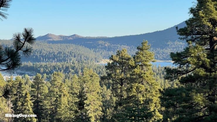
While it isn't a hike to a high mountain summit, taking the serene and scenic Pineknot Trail up to Grand View Point offers you a similar payoff, but without a big effort. The trail climbs gently through the pine forest, with glimpses down to Big Bear Lake, and then ends at Grand View Point, which has sweeping views of the San Bernardino high peaks. Overall it's a pleasant hike that offers something nice for hikers of all ability levels.
In this Guide:
Video and Turn-by-Turn Directions to Grand View Point
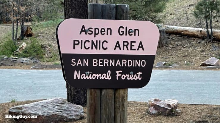
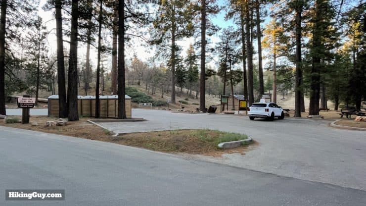
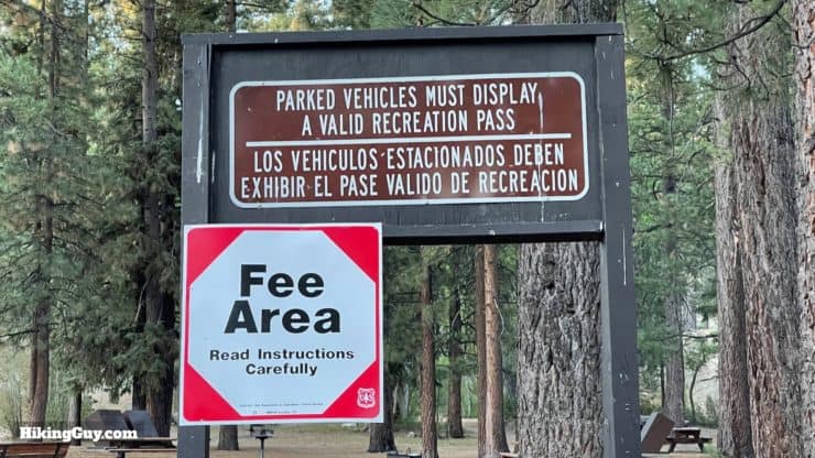
Look for the Aspen Glen Picnic Area nestled in the middle of a residential area.There's a moderate amount of parking, but I've never seen the lot full early in the morning.Since Aspen Glen offers picnic benches and a bathroom, there is a fee. You can use an Adventure Pass or a national parks pass, which I highly recommend investing in.
Gear For the Hike
Like most of the area, it can get hot in the summer and cold and icy in the winter. There's no real mountain summit, so what you wear at the start is usually fine for what you need at Grand View Point.
I'd bring at least 1L of water.
The hike is shady and the sun isn't a problem.
There are no real steep parts and trekking poles are probably overkill, but if you like hiking with them, they'll work fine here too.
Gear That I Love Right Now
Nothing is sponsored or promoted, just the actual gear that I use.
Overall the trail is in great condition, and a local cycling club has even adopted some new trail signs. There are several cutoffs, trail updates, and use trails initially, and I'll tell you how to navigate them below. You'll share the trail with mountain bikers.
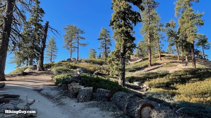
You'll climb about 300-400 feet every mile, which is a gradual gradient. Some sections are uphill, none steep, some rolling, and there are many flat sections in between.
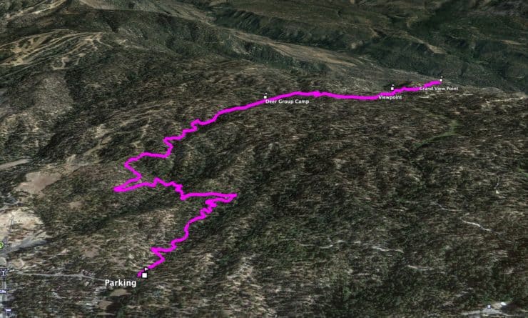
3D Map
From the parking area you'll wind your way up Red Ant Canyon (yup) to Skyline Road. Just past that is Grand View Point.
Pineknot to Grand View Hike Directions
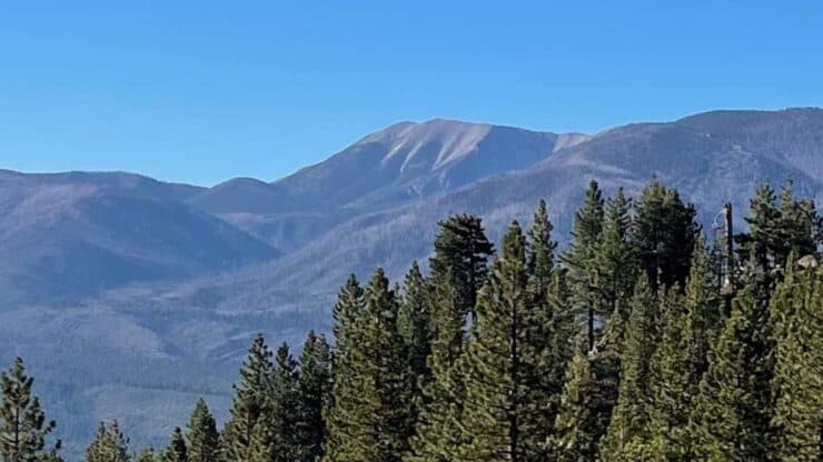
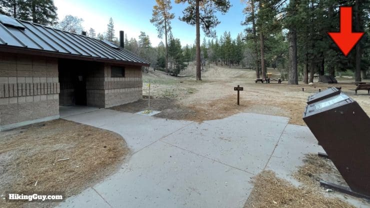
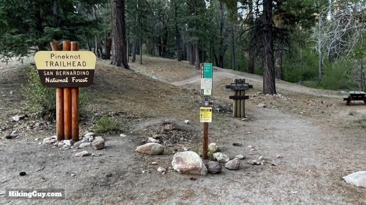
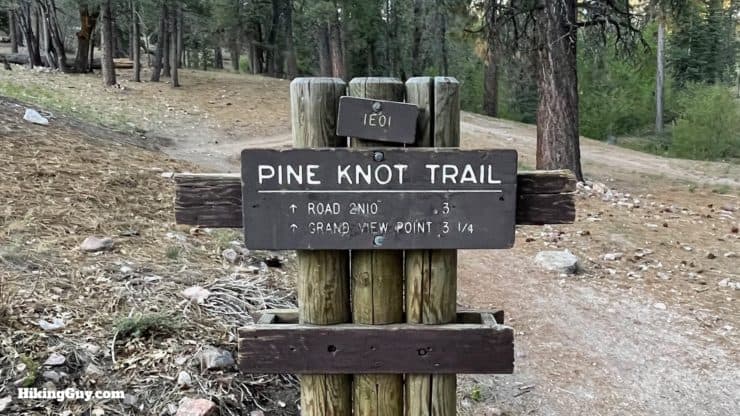
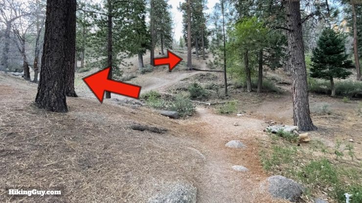
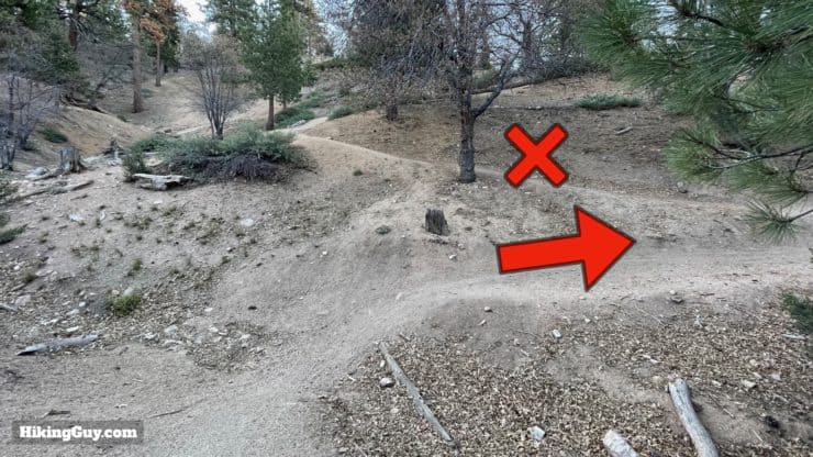
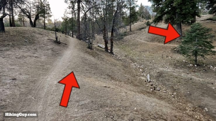
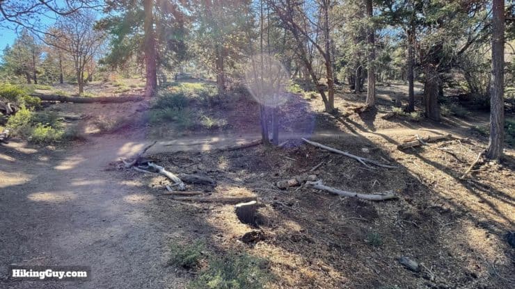
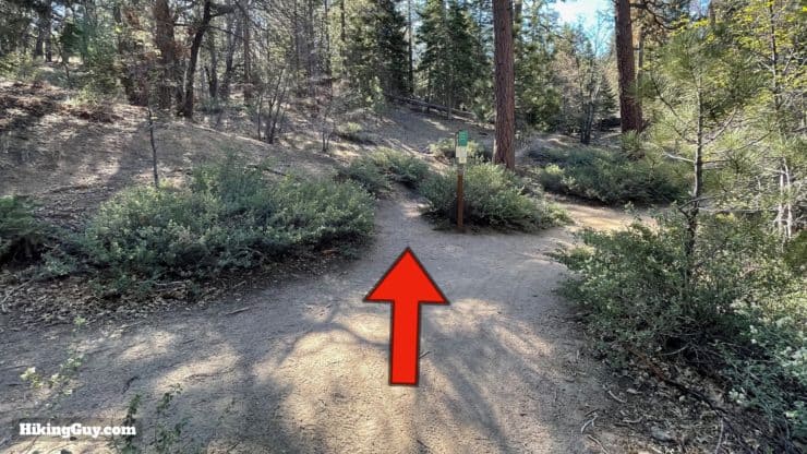
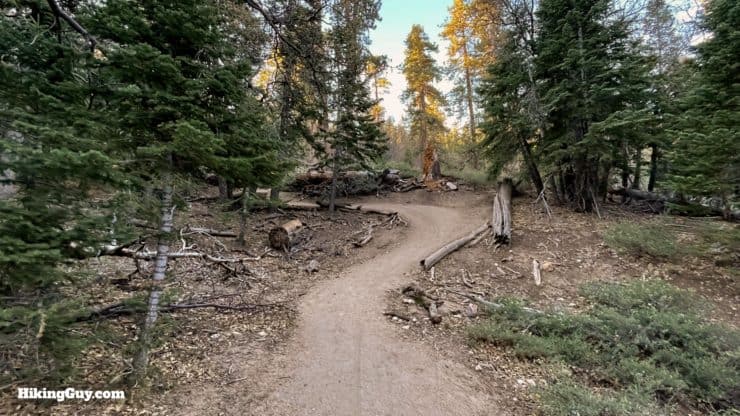
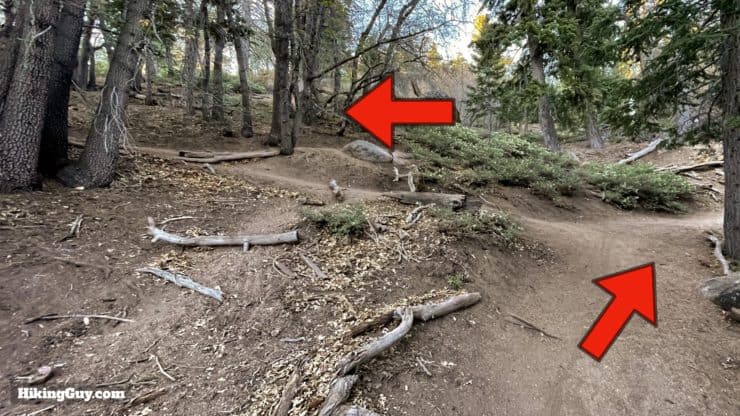
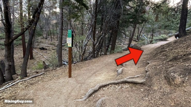
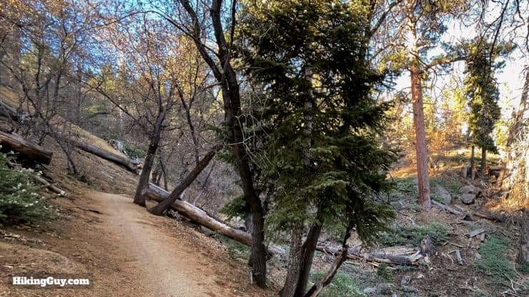
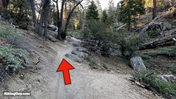
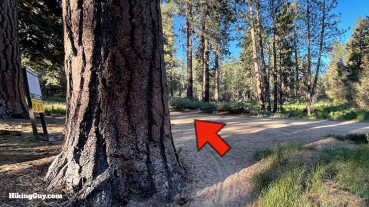
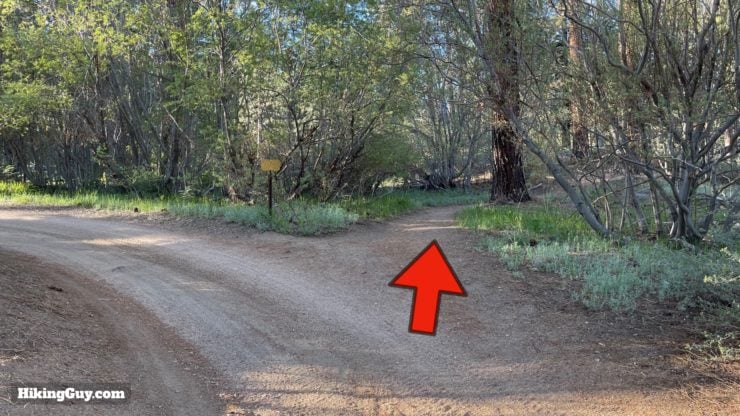
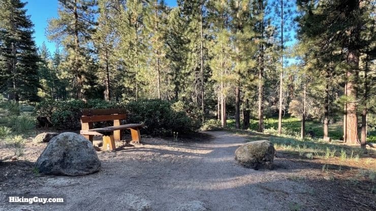
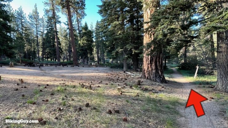
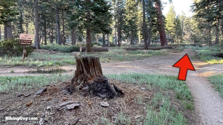
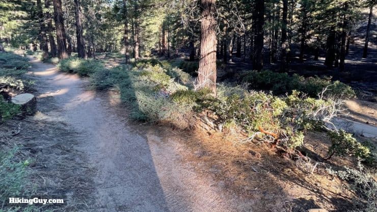
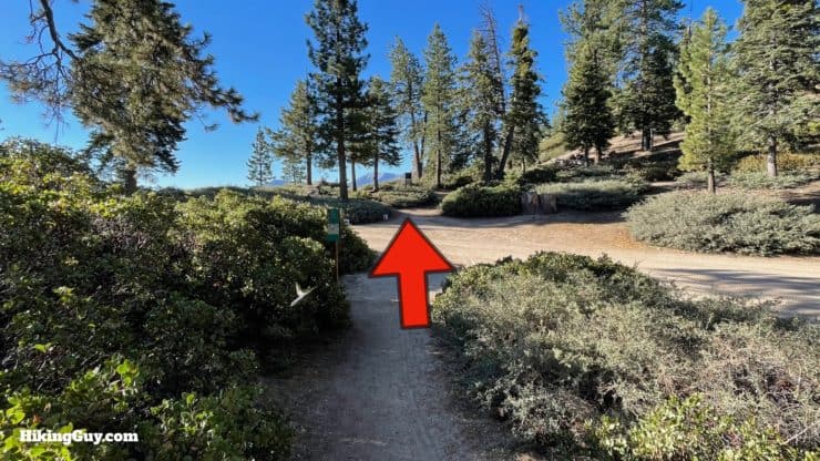
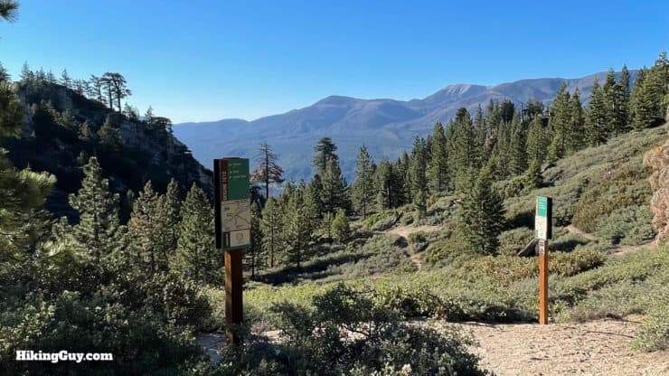
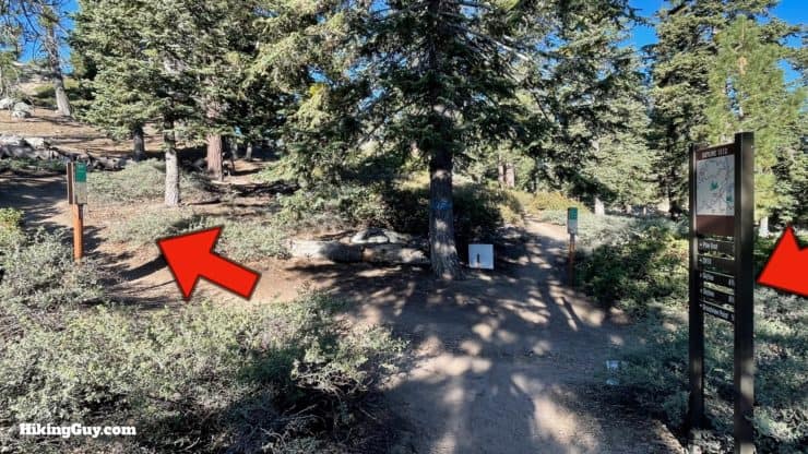
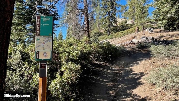
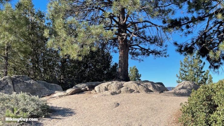
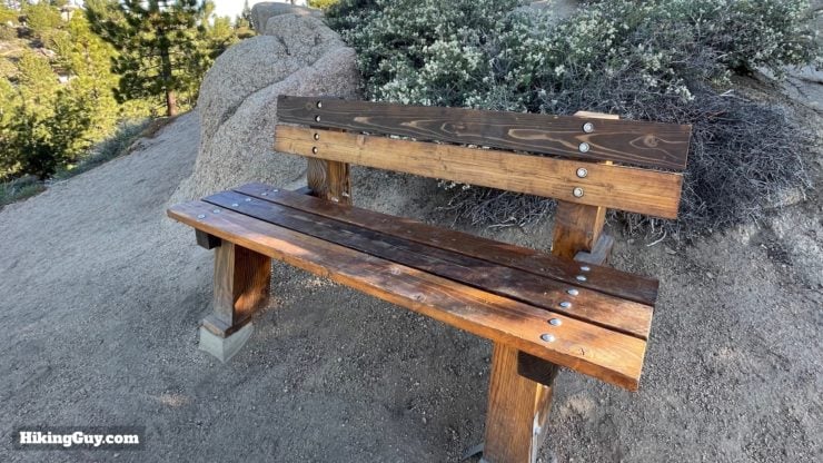
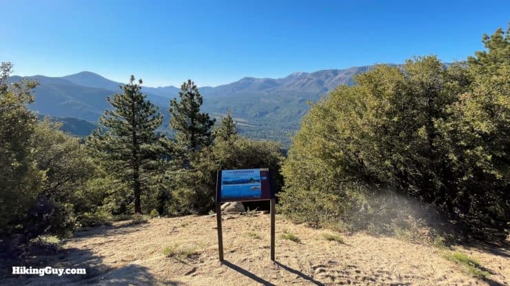
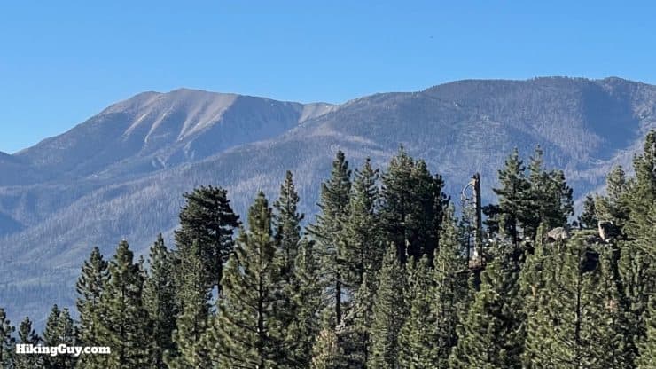
The trailhead is on the other side of day use area, past the picnic benches.Look for the official trailhead where the clearing ends.It's a little farther than this. You'll see a mix of the old a new signs along the way.The beginning of the hike is the most confusing, with lots of cutoff trails. The official trail goes left along the gully, and up along the other side of the gully.When you come around the bend on end of the gully, stay straight on the new trail, not back to the left.Once around the bend hike straight on the trail.Soon you'll hike around a corner and leave the confusing start behind.At the intersection, go straight through.Here's the sign at intersection. We're heading to Skyline (before continuing to Grand View). Also note that the new signs refer to the trail as the "Pine Knot" and not the "Pineknot" which is the official spelling.Now you have a nice long gradual uphill through the pines.Avoid several cutoffs which you'll see on this stretch.As you ascend you'll get some views down to Big Bear Lake.At the junction stay right and continue on the Pineknot Trail, which goes downhill for a short stretch.Just past the junction there's a nice bench with views to Big Bear Lake.Now you have a long cruise uphill toward Skyline Road.Go straight past a side trail that joins from the right.When you get to Knickerbocker Road (2N08), cross and bear left for a hot second.And then look for the Pineknot Trail to continue across the road.The trail levels off and there's another bench.And then you'll see Deer Group Campground on the left.Hike across the access road to Deer Group Campground.And then the trail follows the dirt road down to the right.And soon you'll arrive at Skyline Road. Cross the road and visit the viewpoint.From the viewpoint you'll get a preview of Grand View. The tallest mountain in the distance is San Gorgonio, the highest peak in Southern California.Once you've enjoyed the view, head back to the trail and continue about 0.25 miles to Grand View Point.There's another sign right there confirming that you are on the trail to Grand View Point.You have a little climbing left to do.And then you'll arrive at the hilltop at Grand View Point.There's a nice bench to take in the views.And an interpretive display that explains what you are looking at. You have a sweeping panoramic view of the San Bernardino Mountain high peaks, also known as "10,000 foot ridge" since all the peaks are above that attitude.The peak in the middle without any trees is San Gorgonio at 11,499 feet. In the winter this range is usually covered in snow.
From here, just hike back the way you came up.
Need More Info?
Have a question about the guide or want to see what other people are saying/asking? View the Youtube comments for this video. Leave a comment and I will do my best to respond.
When planning, always check the park website and social media to make sure the trails are open. Similarly, check the weather and road conditions.


 Using the Apple Watch for Hiking
 Garmin Fenix 7 & Epix Review For Hikers
 How To Read a Topographic Map
 Garmin GPSMAP 67i Review
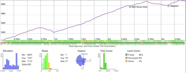


 Big Bear Aspen Grove Trail Hike
 Cougar Crest Trail to Bertha Peak Hike Guide
 Hike the Castle Rock Trail (Big Bear) + Bluff Lake
 Sugarloaf Mountain Trail Guide - Big Bear
 Hike Keller Peak on the Exploration Trail
 Hike Grays Peak Trail (Big Bear)
 Los Angeles Hikes
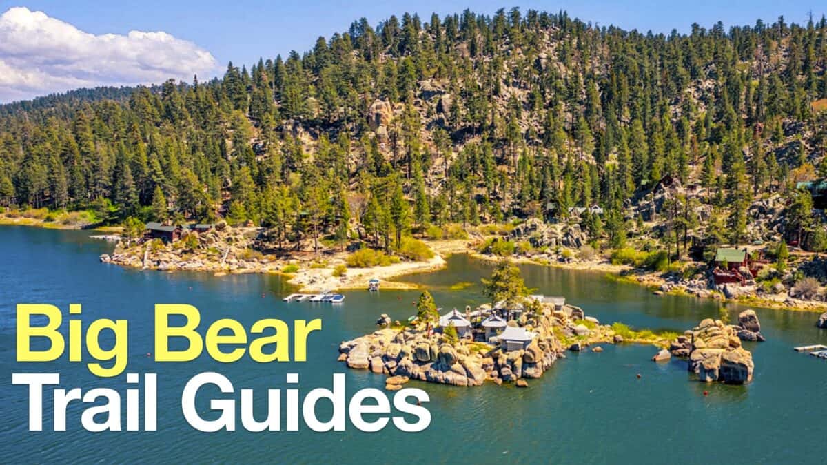 Big Bear Hikes
 LA Mountain Hikes
 San Bernardino National Forest Hiking Trails
 Best Hiking Gear 2024
 Hiking Boots or Shoes: Do I Really Need Hiking Boots?
 When to Hit SOS on inReach