Stoddard Peak stands guard over the front range of the San Gabriels, with a unique view stretching from Mt Baldy to the LA suburbs. The hike to Stoddard Peak is challenging but not too tough; it's perfect for beginners, with a great summit payoff. In this guide, I'll show you how to hike to Stoddard Peak safely and enjoy all it has to offer.
In this Guide:
Video and Turn-by-Turn Directions for Stoddard Peak
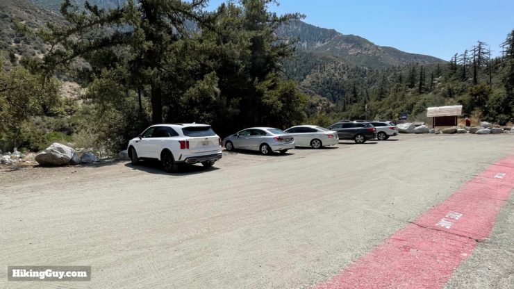
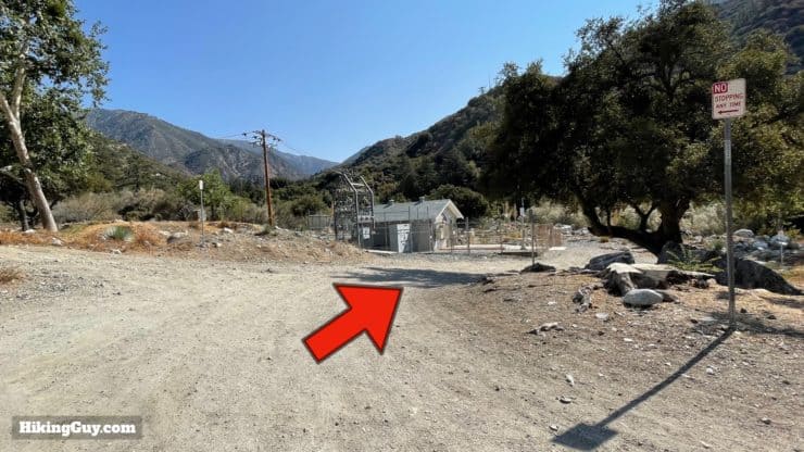
Parking for Stoddard Peak is on the right side of the road as you travel up Mt Baldy road, about 1.5 miles before you reach Mt Baldy Village. When you get to the destination, look for a small power sub-station, and go downhill on the paved driveway to the right to find a parking area below the road.
You're looking for the intersection of the Barret Stoddard (dirt) road and Mt Baldy Road.
The parking area isn't huge, but there's usually somewhere to grab a spot. Parking is free, and there are no toilets or water fills.
Gear For the Hike
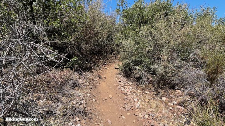
Most of the hike is on a (small) dirt road, and then the last half-mile is a steep and narrow trail. Trekking poles will be helpful on this last section. And while there's some shade, most of the hike is exposed. I bring at least 1L of water. The brush on the last section can scratch your legs a bit; wear long pants if you want the protection.
Gear That I Love Right Now
Nothing is sponsored or promoted, just the actual gear that I use.
The majority of the hike is a gradual uphill, and then the last part is a steep climb to a false summit, and then a small down and up to Stoddard Peak.
3D Map
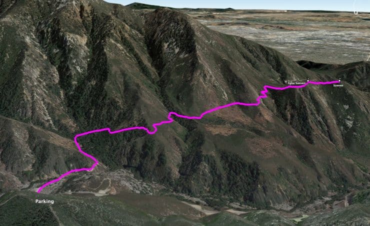
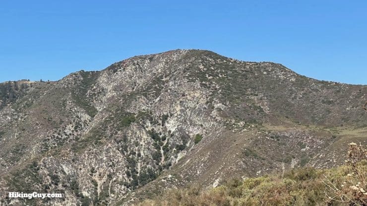
From the canyon along Mt Baldy Road, we climb up in the shadow of a bigger peak called Turtle's Beak (6857 feet) around to the south where we end up at Stoddard Peak.
Hike Brief
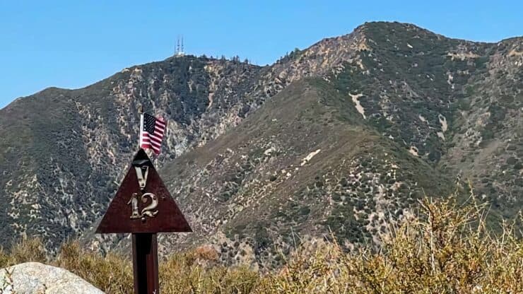
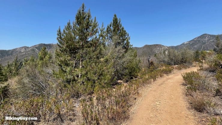
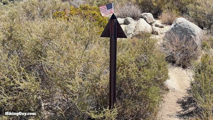
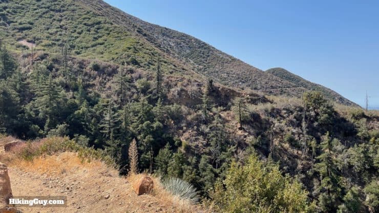
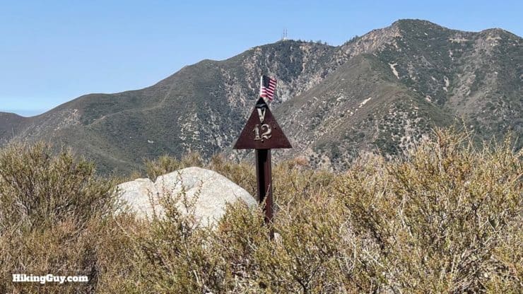
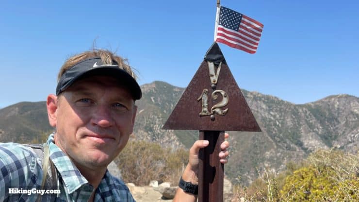
Stoddard Peak is named after WH Stoddard, who in 1880 opened one of the first resorts here in the San Gabriels. Stoddard was the brother-in-law of railroad tycoon Collis Potter Huntington, and moved to the mountains from Sacramento attempting to alleviate his asthma. He was also a spiritualist who left dinner out for his dead wife every night. Stoddard's Camp burned down in December of 1953.The area that you hike through was devastated by the 2003 Padua Fire. Trees like these small pines have grown since then.The sign at the summit is called a "witness post," and was used by early surveyors to triangulate and measure the peaks in San Gabriels.
Stoddard Peak Hike Directions
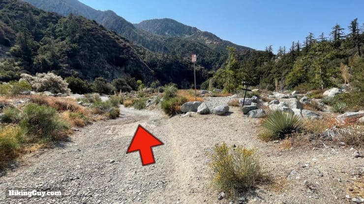
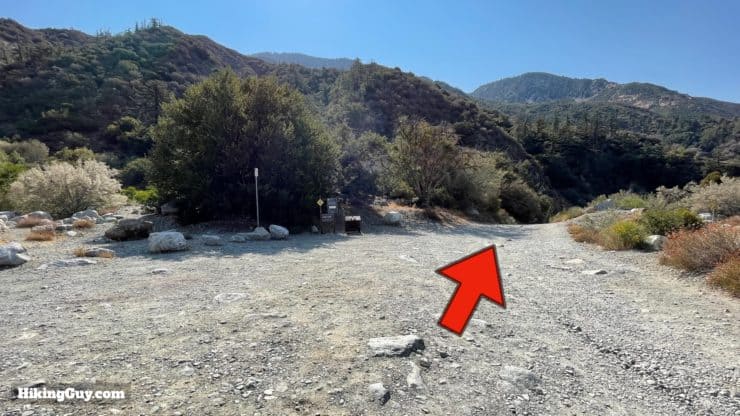
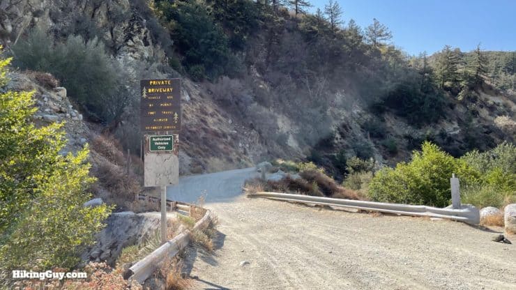
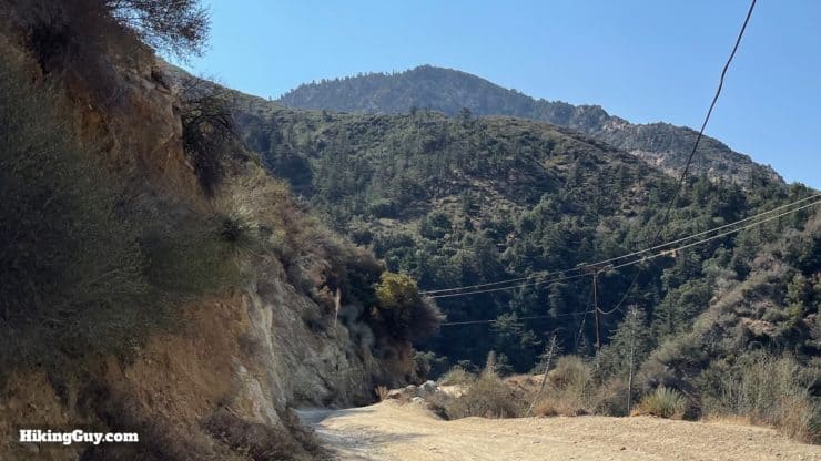
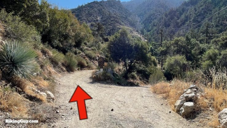
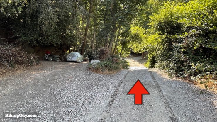
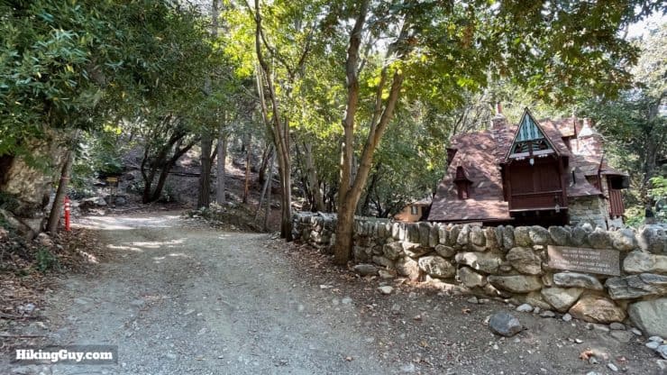
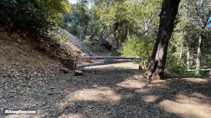
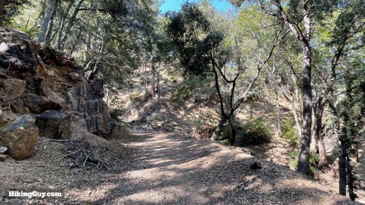
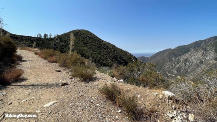
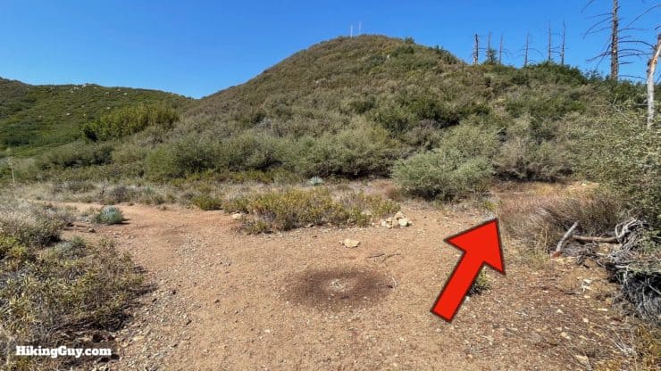
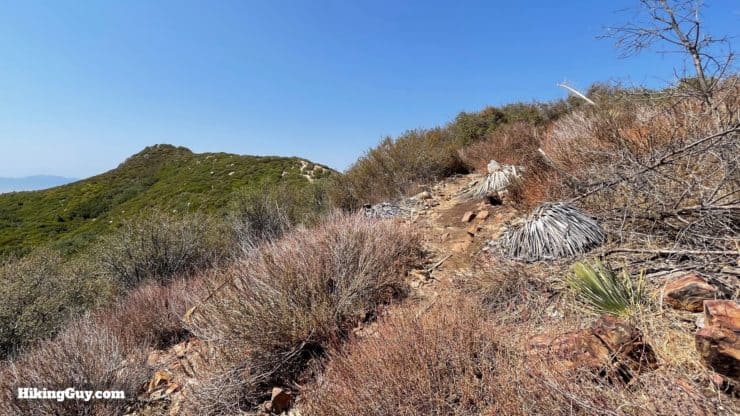
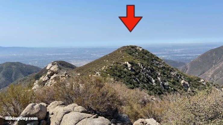
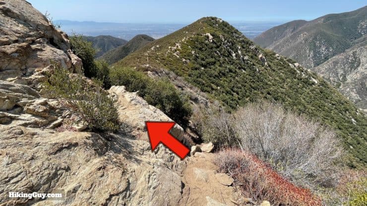
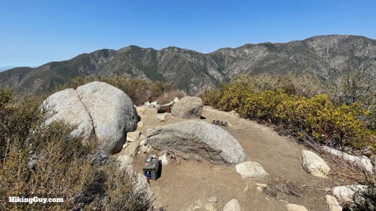
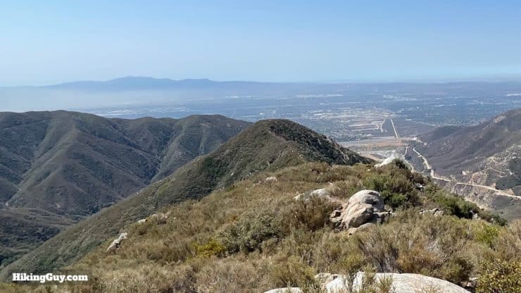
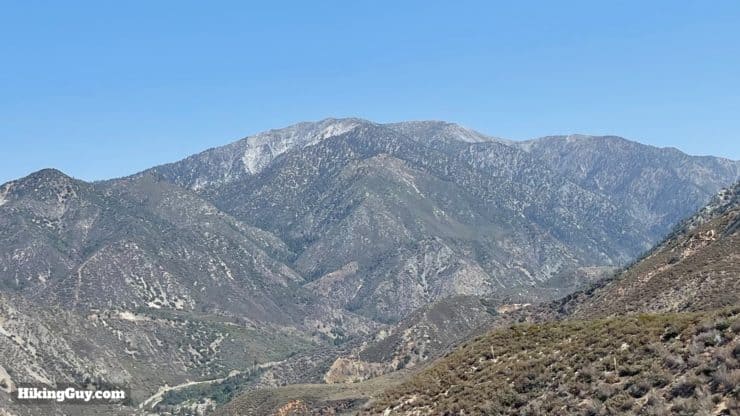
From the parking area, start the trail by the power station. Don't start it on the south side trailhead.At the power station, go straight down the dirt road.Then at the wide clearing, continue on the road straight / right.You'll see a "private driveway" sign. This is just for vehicles. The road is open for hikers and you are not trespassing. The beginning of this road leads to a handful of private cabins and there can be vehicles.The road starts heading uphill. In front of you is Turtle's Beak (not Stoddard Peak).Continue uphill and straight.Stay on the road, avoiding any private driveways on either side.Head past the funky private cabins. One of these sold for $240k in 2018.And then at about a mile in, you'll go through a gate and leave the larger dirt road behind.Now you'll climb up through shaded sections on the old road, which is closed to motor vehicles.To the right is Lookout Mountain #2, also known as Baldy Lookout.The trail leaves the shade, makes a sharp turn to cross Cascade Canyon, and then continues on in the distance (you can see the trail on the hillside in the right of the picture).Across the valley Sunset Peak dominates the range.Just over two miles in and a bump appears in front of you. This is a false summit, but it's in the right direction.When you reach Stoddard Flat at about 2.5 miles in, look for the small trail off to the right.And you'll start a steep and loose climb.At the top of that climb, you'll see a false summit in the distance to the left. Hike over to it along the ridge.When you reach the false summit, you'll see Stoddard Peak in front of you. You'll have to climb down and then back up to it.As you descend, look for the turn off to the left, instead of a steep and loose downhill on the right.And at about 3 miles, you reach the witness post and the summit.There's a nice summit area with a register and boulder to stand on.In front of you is the suburban LA sprawl with Saddleback Mountain in the distance.Behind you is Mt Baldy.That's the hike! When you're done, just turn around and go back the way you came.
Need More Info?
Have a question about the guide or want to see what other people are saying/asking? View the Youtube comments for this video. Leave a comment and I will do my best to respond.
When planning, always check the park website and social media to make sure the trails are open. Similarly, check the weather and road conditions.


 Using the Apple Watch for Hiking
 Garmin Fenix 7 & Epix Review For Hikers
 How To Read a Topographic Map
 Garmin GPSMAP 67i Review
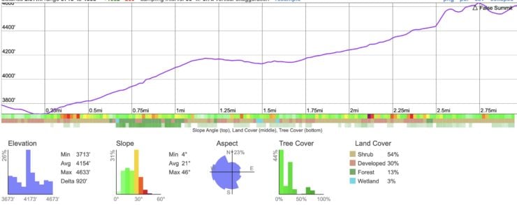


 Strawberry Peak Hike
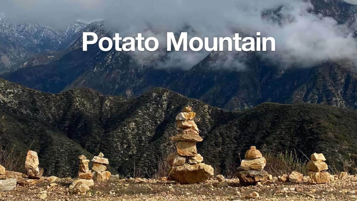 Potato Mountain Hike (Angeles National Forest)
 Hike Jones Peak on the Bailey Canyon Trail
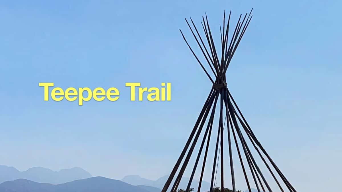 Hike the Teepee Trail (La Cañada Flintridge)
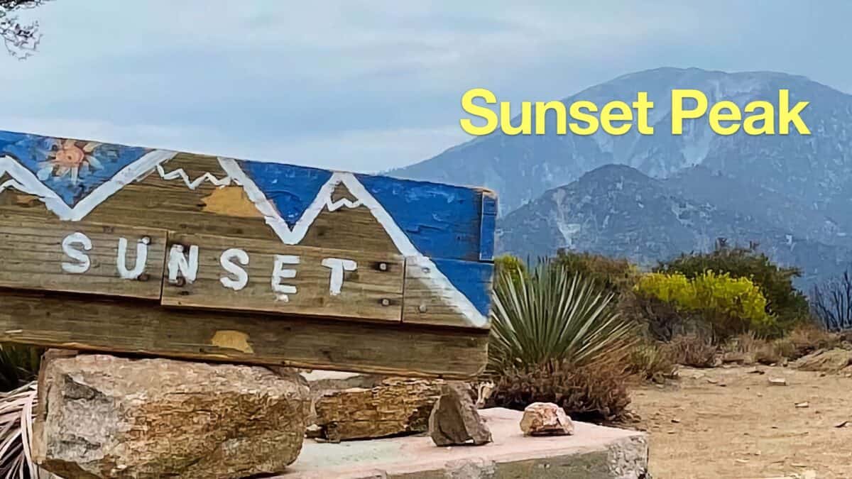 Sunset Peak Trail Hike (Angeles National Forest)
 Los Angeles Hikes
 Angeles National Forest Hikes
 LA Mountain Hikes
 Best Hiking Gear 2024
 Hiking Boots or Shoes: Do I Really Need Hiking Boots?
 When to Hit SOS on inReach