If you'd like an off the beaten path adventure in Angeles National Forest, this hike is for you. We'll ascend Stone Canyon Trail to Mt Lukens, the highest point in the City of Los Angeles, then loop back down into Big Tujunga Canyon on the Grizzly Flat Trail, which darts back and forth over Big Tujunga Creek. The hike is tougher than it looks on paper, primitive in spots, and lots of fun.
In this Guide:
Video and Turn By Turn Directions for the Stone Canyon Trail
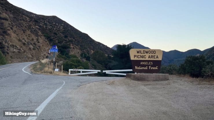
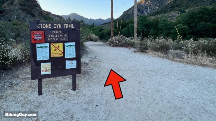
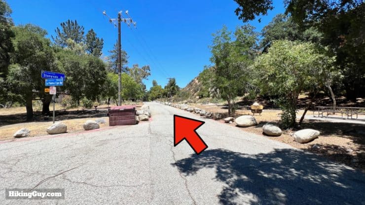
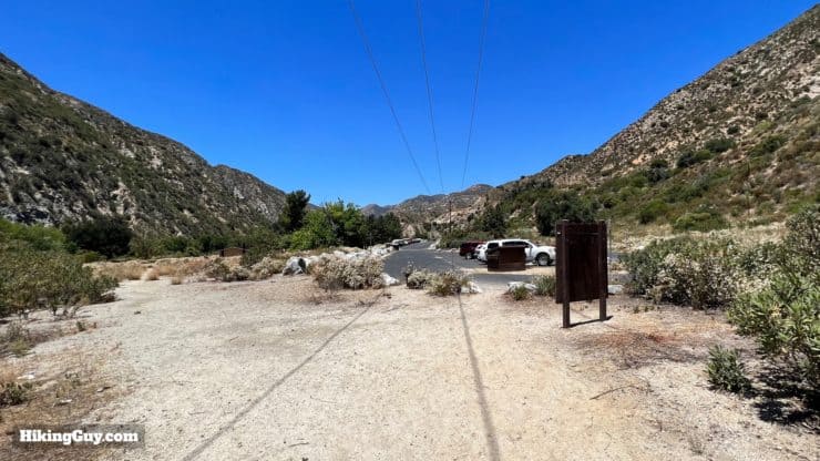
The hike starts at the Wildwood Picnic Area, which unfortunately isn't the nicest spot in Angeles National Forest. Being one of the closest developed picnic areas in the Forest with good swimming holes, it's often crowded on hot weekends and littered with trash. Don't let this deter you; we'll quickly leave civilization behind on this hike. Use this trailhead address: Wildwood Picnic Site, 3299 Big Tujunga Canyon Rd, Tujunga, CA 91042
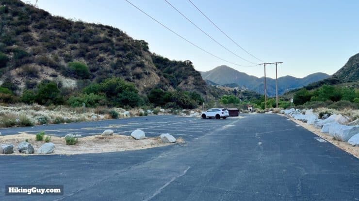
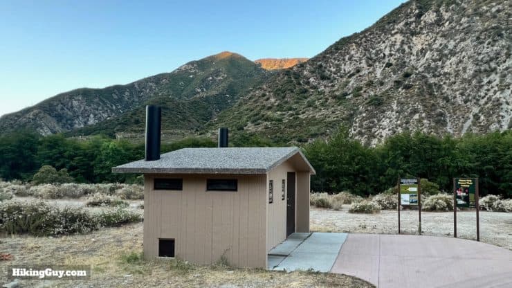
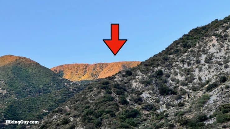
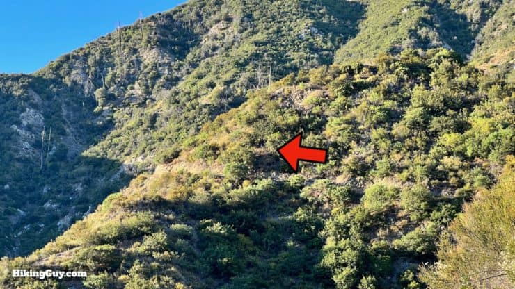
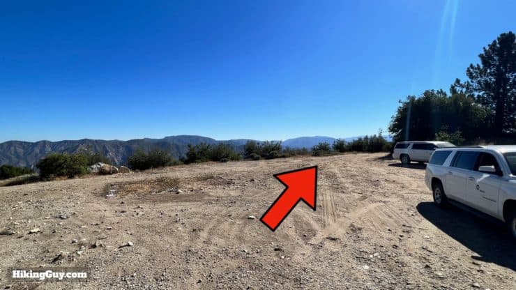
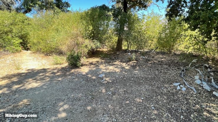
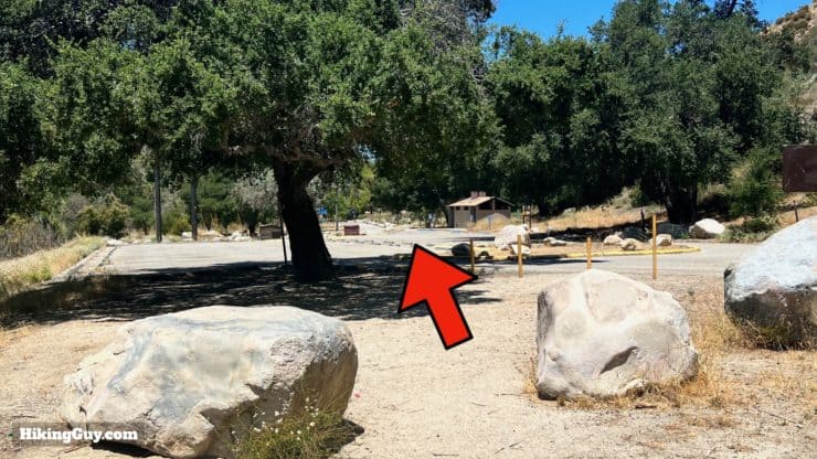
The gate to Wildwood officially opens at 6am, but is sometimes not open by then. If you find it closed, check closely to see if it's actually locked; sometimes you can just push it open. If you can't drive in, try parking at a nearby wide shoulder on Angeles Crest Highway. You are technically allowed to park as long as you are not on private property (like one of the houses) and not in a no-parking zone.Drive through the picnic area to the end and park in the big lot. The trailhead is at the end of the parking lot.There are primitive toilets here.If you look up from the parking area, you can see the slopes close to Mt Lukens. This will give you an idea of the climbing that we have to do.
Gear For the Hike
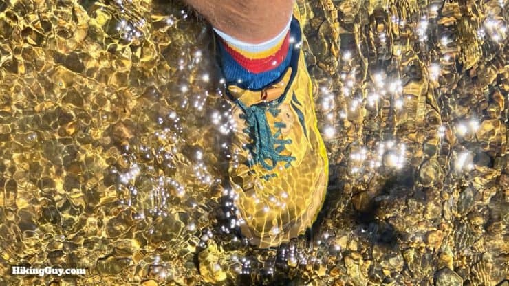
This hike is best done when cooler (or very early). The low altitudes of the hike can get very hot in the summer. I bring 3L of water, and you can fill up after filtering in Big Tujunga Creek. There are several stream crossings that you can rock-hop across, but I use quick-drying trail runners and plow through if needed. Trekking poles can help on the stream crossings and the steeper slopes. Many sections of the hike are overgrown. Wear insect repellant, long pants, and long sleeves if you dislike brushing against your skin. Overgrown poison oak can be by the stream crossings, but you can usually push it aside with a trekking pole.
I find it easiest to wear trail runners that I can get wet. Big Tujunga Creek flows all year and can be knee-high at points.
Gear That I Love Right Now
Nothing is sponsored or promoted, just the actual gear that I use.
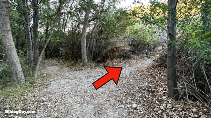
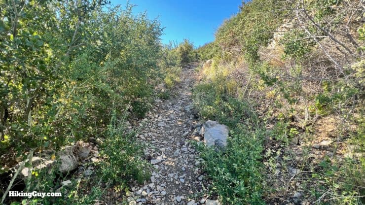
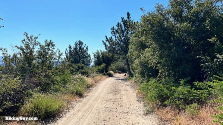
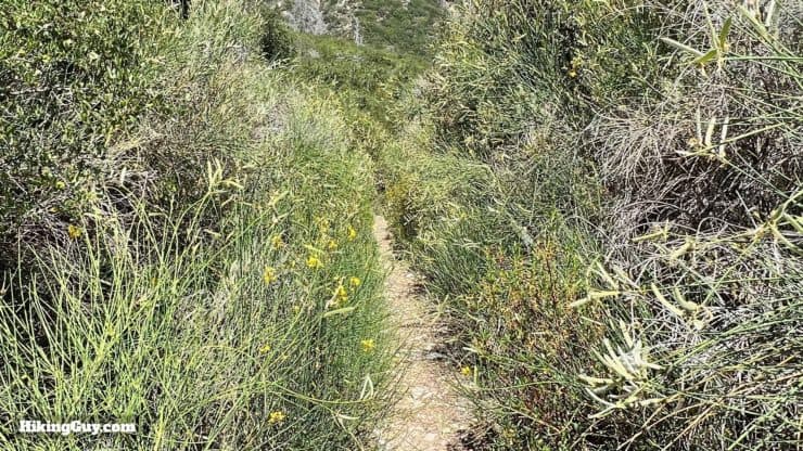
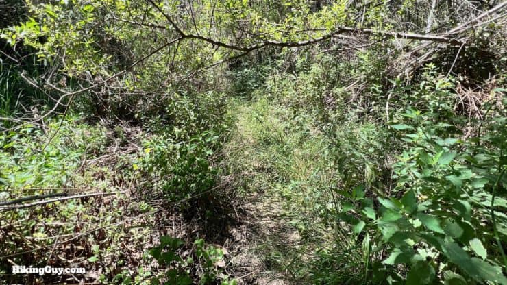
I mentioned earlier that there are overgrown sections on this hike. Although the plants grown tall and into the trail, there's always a trail there and it's in good shape for the most part.
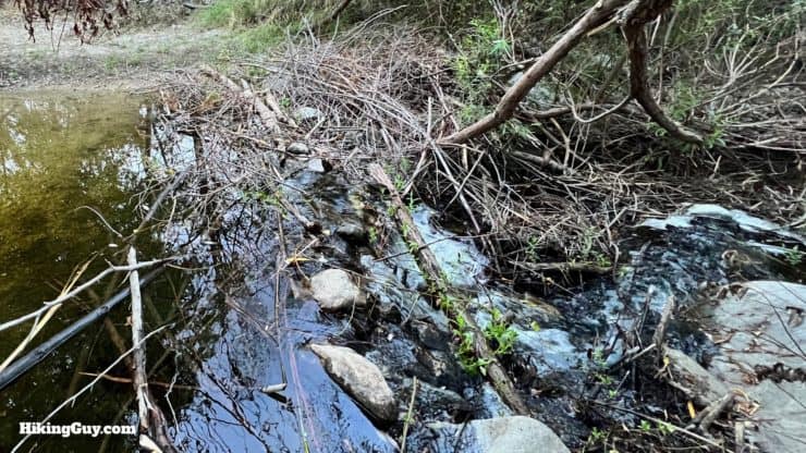
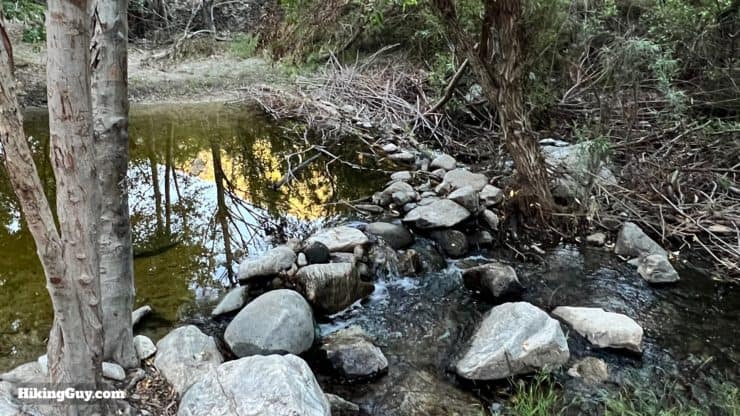
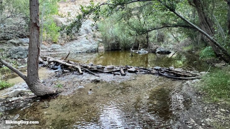
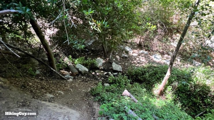
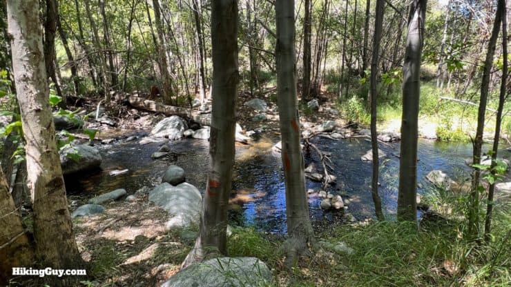
When the trail comes out at a crossing of the Big Tujunga Creek, look for a rock bridge or crossing. If there's not one right in front of you, there is generally one up or downstream. The crossings can be on the sketchy side, as you see here. They sometimes combine rocks and logs to complete the crossing.
The climb up Stone Canyon Trail is no joke. You'll do about 3000 feet in 3 miles. After that, it's all downhill until you reach Big Tujunga Creek again.
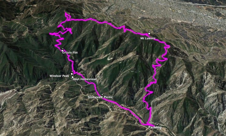
3D Map
This is a counter-clockwise loop. We'll climb up to Mt Lukens from the Wildwood Picnic Area on the Stone Canyon Trail. Then we'll cruise down the Mt. Lukens Truck Trail 3N27 until we reach the primitive Grizzly Flat Trail, which will take us down to Big Tujunga Creek. From there, we follow the creek back to the start.
Stone Canyon Trail Hike Directions
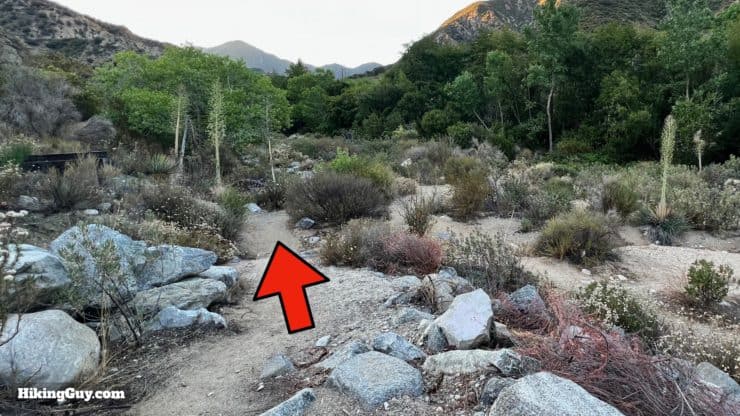
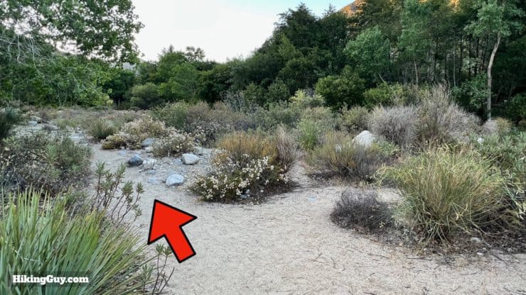
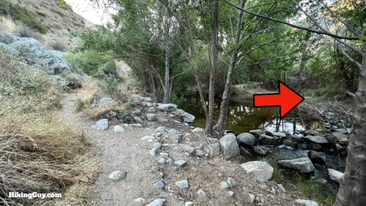
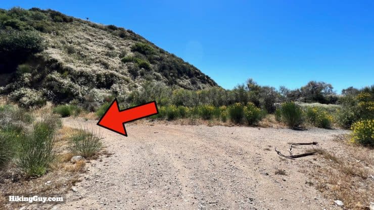
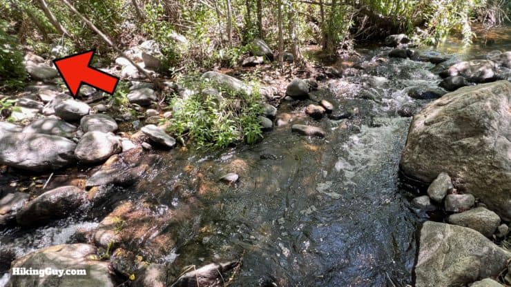
Start down the trailhead for the Stone Canyon Trail.Hike down into the lower area.There are lots of small use trails here that day-use visitors use to access the water. Stay left and continue upstream.When the path approaches the stream, cross over.There's a rock bridge right at the trail, but it can be sketchy without poles.As is the case in all of the crossings, there are some rock bridges up and downstream.
If you get to this point and the creek is raging with water over your knees, it's not the day to do this hike. The stream is not safe to cross. It doesn't happen often, but it sometimes does. Instead try a nearby hike to Condor Peak or Josephine Peak.
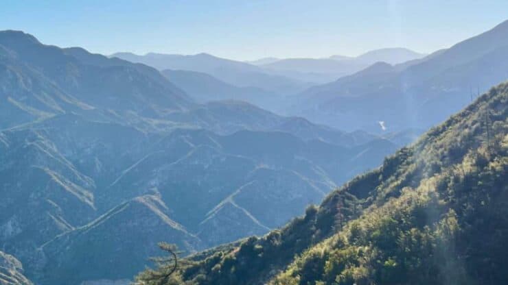
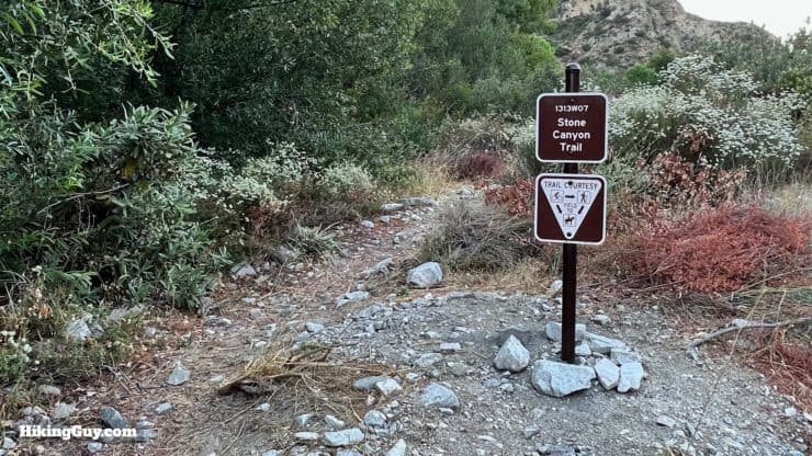
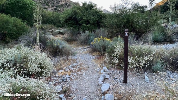
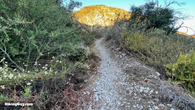
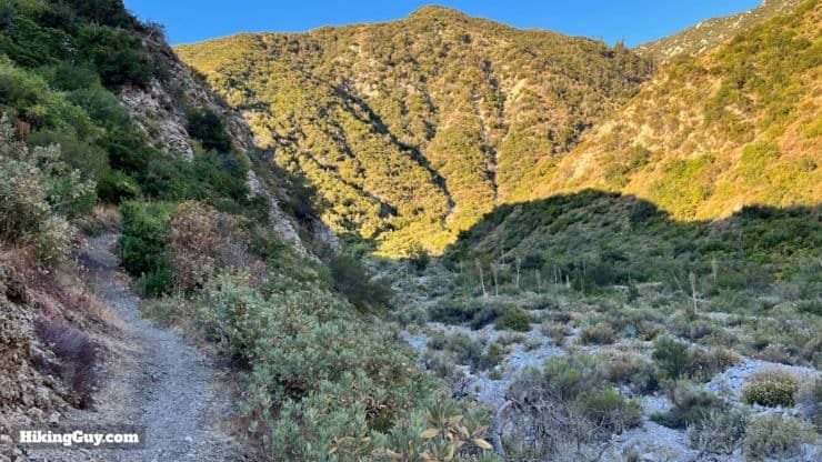
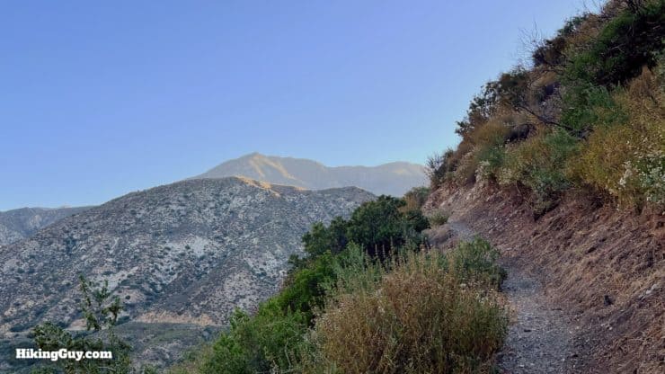
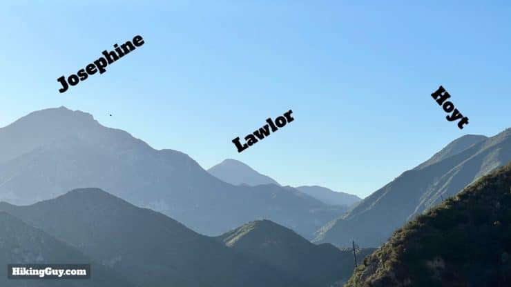
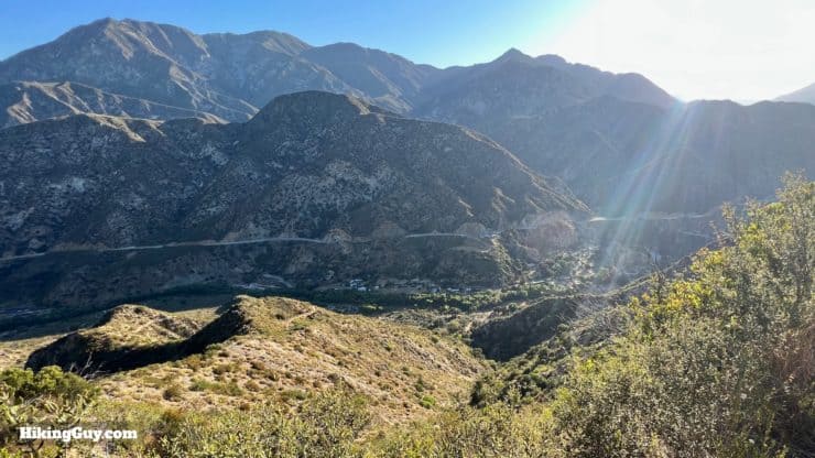
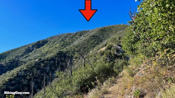
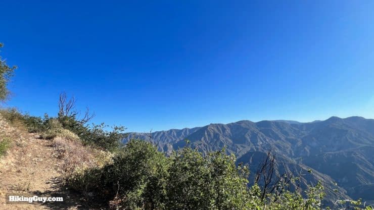
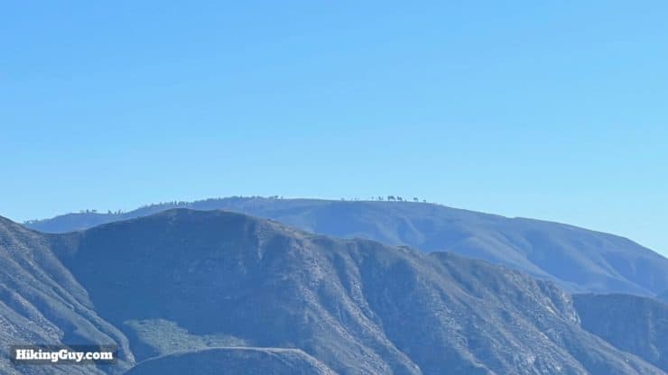
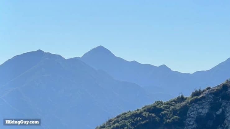
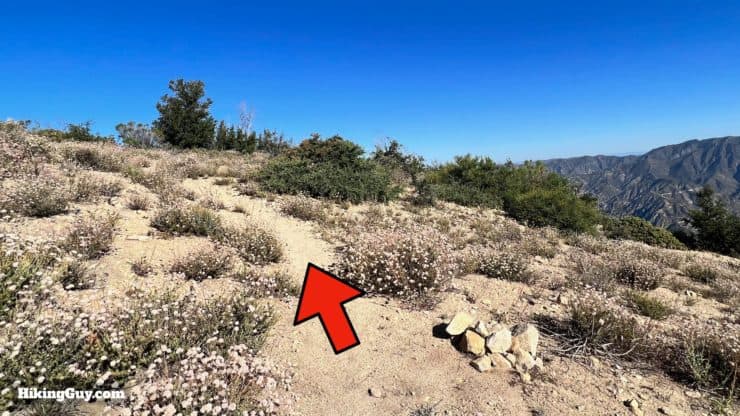
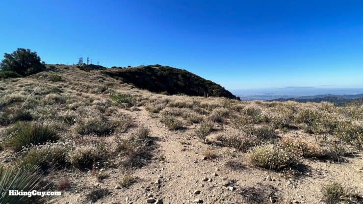
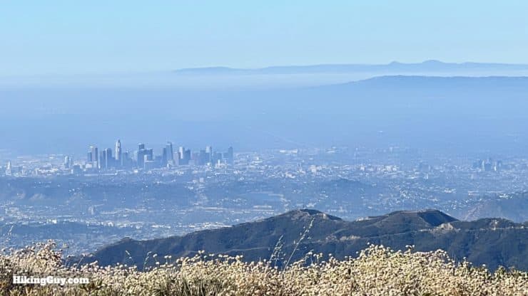
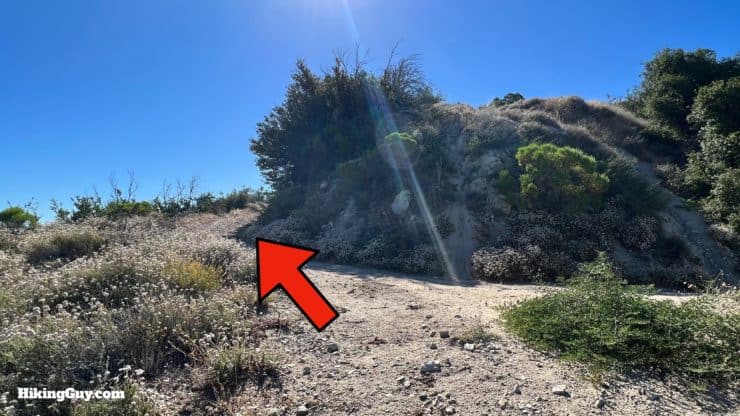
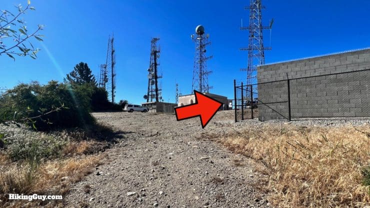
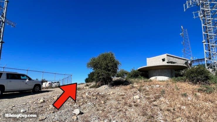
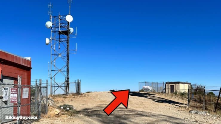
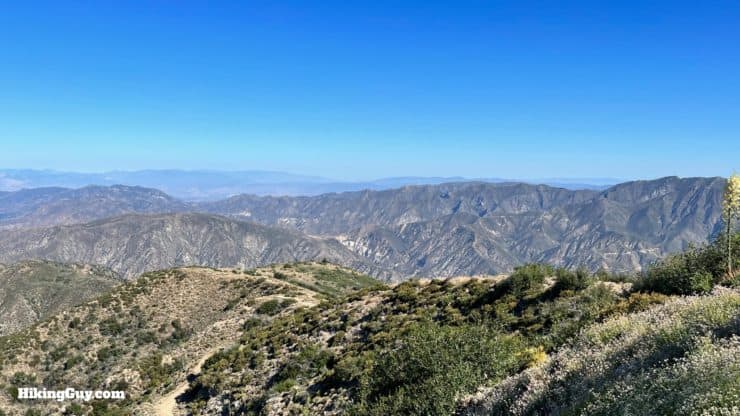
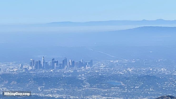
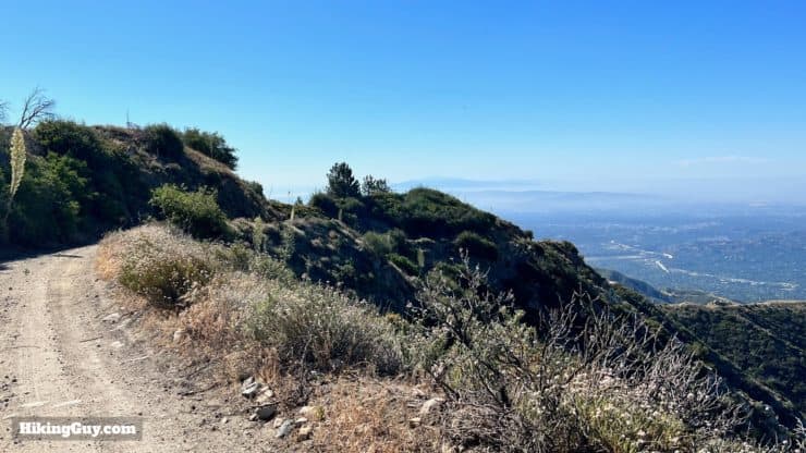
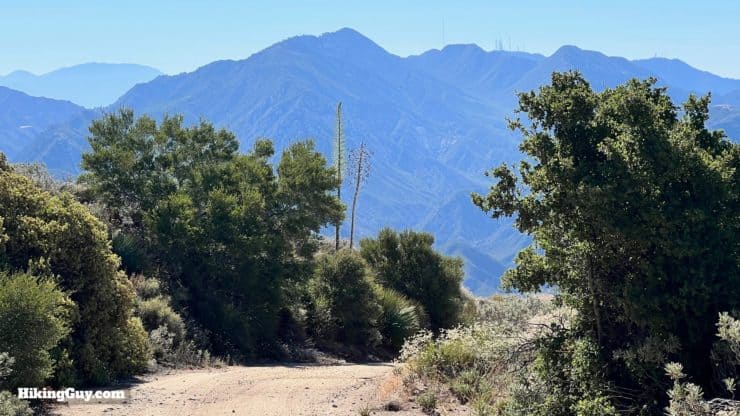
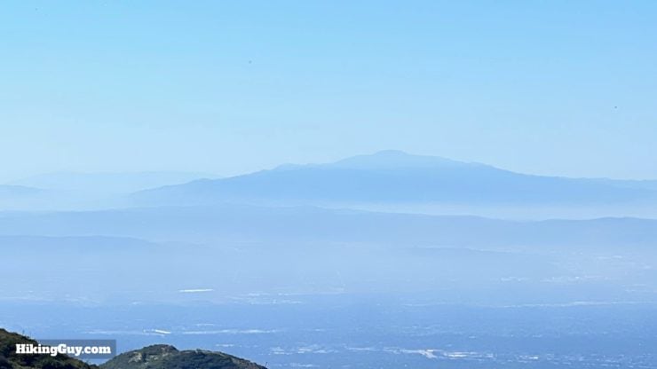
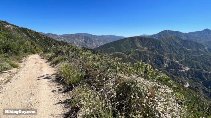
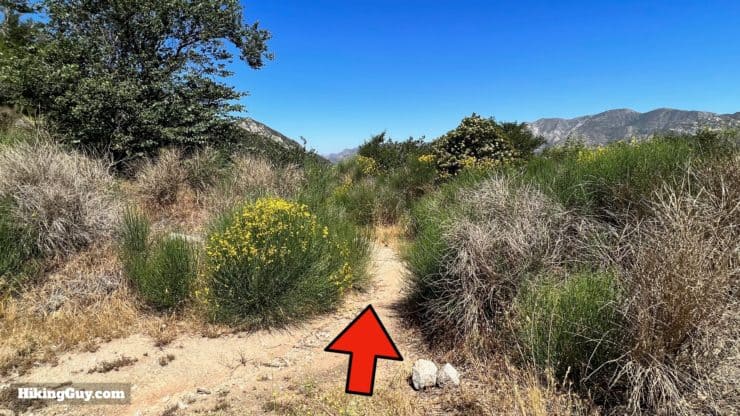
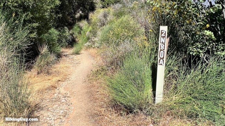
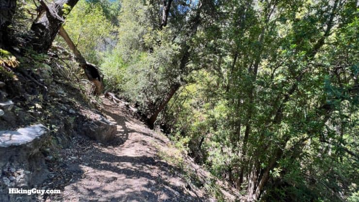
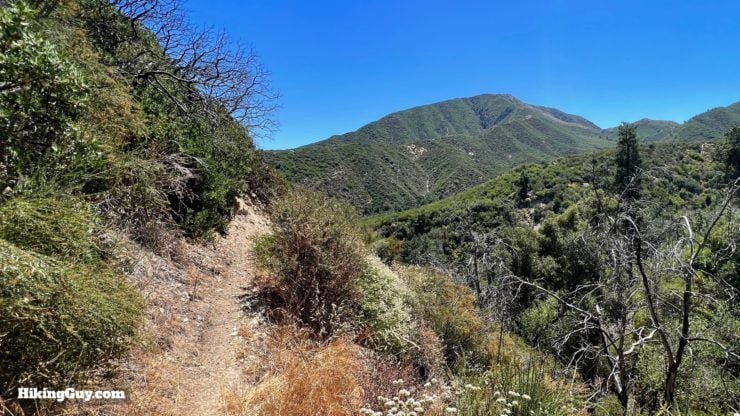
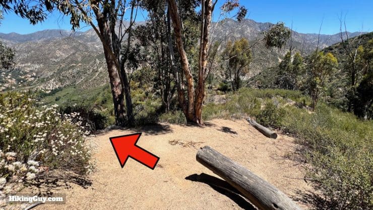
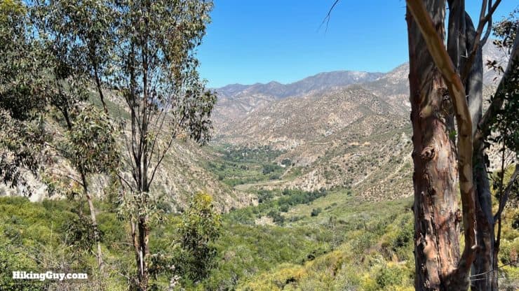
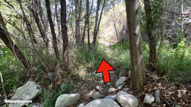
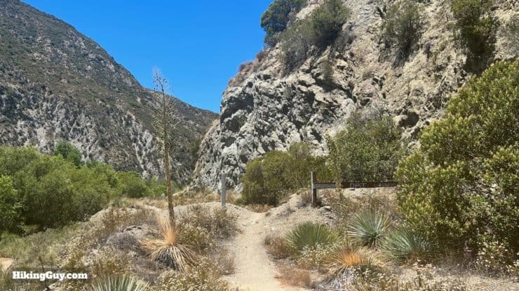
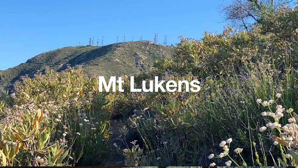
Look for an opening on the other side of the creek.And soon you'll see the official start of the Stone Canyon Trail.The trail is easy to follow and has some trail markers.And then you turn toward the mountains and start a rocky ramp up toward Stone Canyon.The trail continues above Stone Canyon, down to your right.And then starts winding up switchbacks hugging the side of the slopes. You'll get nice views of Condor Point (left) and Condor Peak (right).And as you continue to climb, you can look up Big Tujunga Canyon and see Josephine Peak, Mt Lawlor, and Hoyt Mountain.In most places you can see the trail wind up in front of you.The views into Big Tujunga Canyon, often abbreviated as "Big T" are amazing.It''s a steep climb and there are periodic switchbacks to help ease the gradient.As you climb you'll see the ridge we spotted from the parking lot. Mt Lukens is hiding behind there.One of the hard things about the Stone Canyon Trail is that it gets steeper as it approaches the top. At least you have nice views.Mt Gleason comes into view behind Condor Peak as you climb higher.As does the pointy summit of Strawberry Peak.And before you reach the top, it gets even steeper. Almost there.And then you're out on the ridge. Continue straight. The tough climbing is done for the day!The trail does a wide u-turn toward the summit of Mt Lukens.From the ridge you can see downtown LA and Catalina in the distance.The mountain range closest to you is the Verdugos.When the trail ends at the road, make the left.And then when you get to the towers, make the hard right.Continue uphill to the summit area of Mt Lukens.
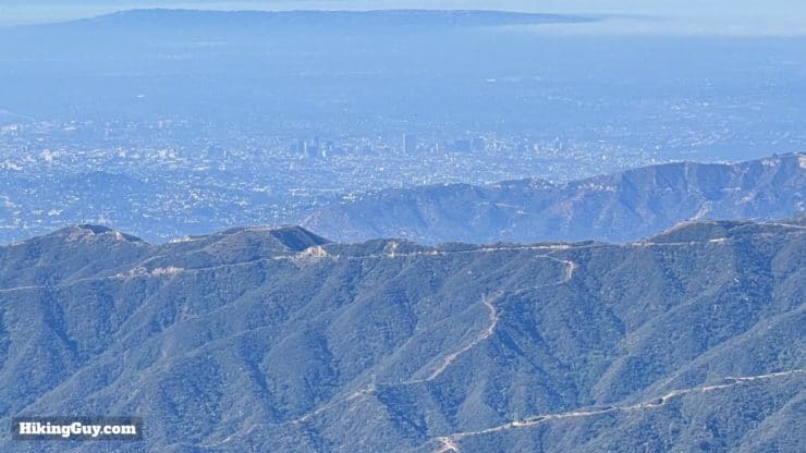
The actual USGS marker is behind the fence, inlaid in concrete, at 5074 feet.Although it's covered in antenna, the are nice views from Mt Lukens, including down into Big Tujunga Canyon where we started.And on the other side, down into LA.
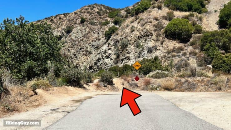
If you want to do the 8 mile version of this hike, just head back downhill the way you came up. Otherwise continue on the loop.
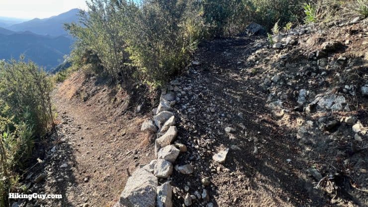
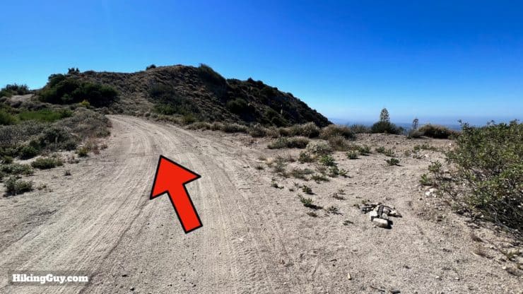
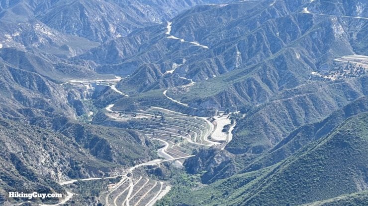
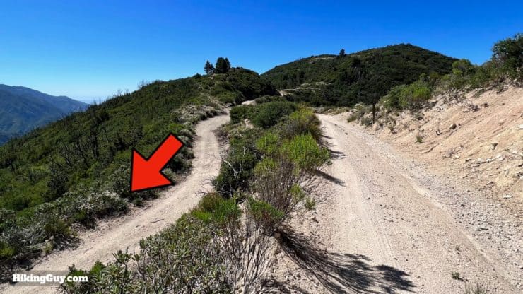
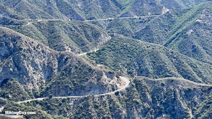
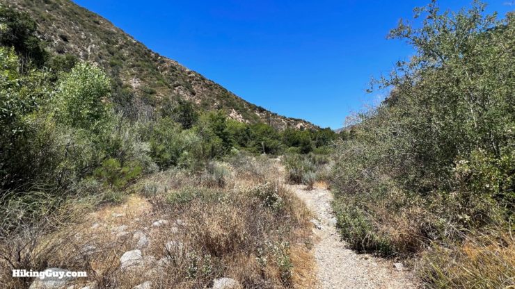
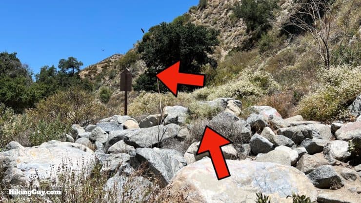
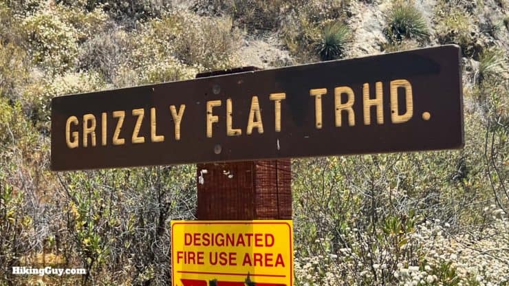
Head back to the junction where we turned in for the summit and continue straight on Mt Lukens Truck Trail.We'll be cruising down Mt Lukens Truck Trail, a wide dirt road, for the next 3 miles or so.The truck trail bridges both sides of the ridge, offering great views.The closer peaks in front are Mount Deception and San Gabriel Peak, with Mt Wilson in the back to the right.You'll also get nice views of Saddleback Mountain farther south.When you reach Silver Saddle, stay on the Mt Lukens Truck Trail at the intersection of the Cresentia View Trail on the right. If you hiked up to Mt Lukens in my other guide, you came up this trail.There are nice views into the canyon and of the Big Tujunga Dam. The terraced areas are debris dredged from the dam and compacted.Just after 7 miles in, look for the sharp left turn to continue down the mountain.Start the downhill section on the Grizzly/Lukens connector road, which is much less used than the trail you were just on.You'll see the Grizzly/Lukens road unwind below you.There are some shaded sections along the way.Just after 9 miles in you'll reach a wide junction. Make the hard left on the Grizzly Flat Trail.The Grizzly Flat Trail is a singletrack.
While you may occasionally see a black bear in Angeles National Forest, you'll never see a grizzly. That's because the last known California Grizzly roaming Southern California was shot and killed nearby here in 1916 by a local farmer. It was to be the second to last ever sighting of the California Grizzly. The last one was killed near Fresno in 1922 and it was officially declared extinct in 1924. The area around Grizzly Flat was known to be an active area for the grizzly before they were all killed.
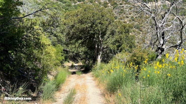
You'll see a marker for the Grizzly Flat Trail as you continue downhill.There's a nice picnic spot on some logs under a tree. It's a good place to refuel before the last stretch.The Grizzly Flat trail is the beginning of the overgrown sections of this hike. Usually the overgrown sections only last for a few hundred feet at most.
The Grizzly Flat Trail was built by early fire crews.
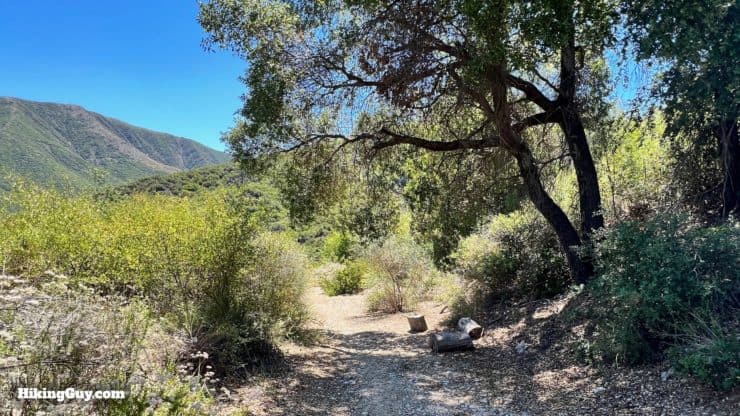
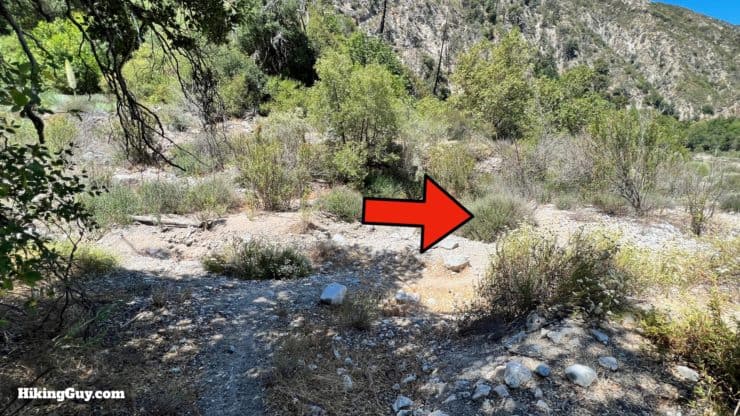
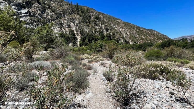
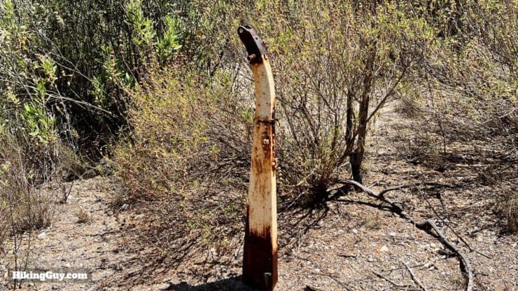
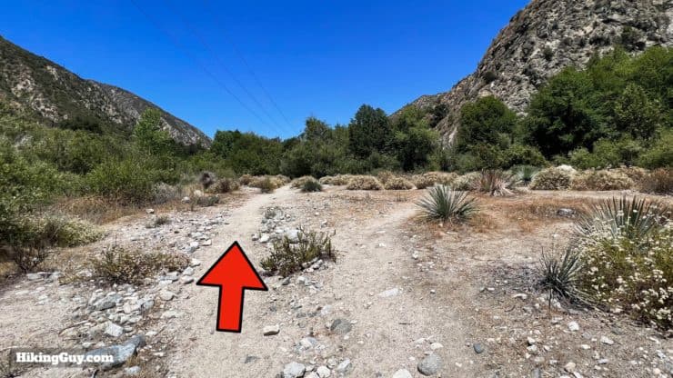
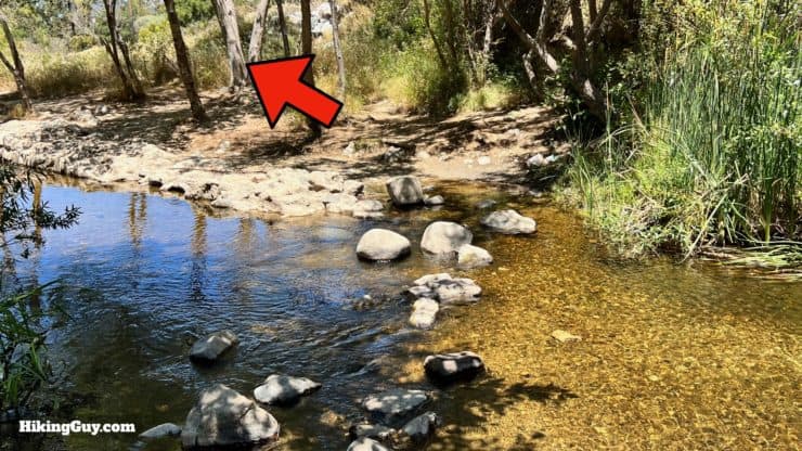
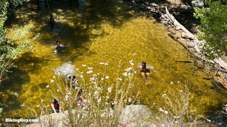
At around 10.2 miles in you'll arrive at Grizzly Flat. You'll see some flat areas that people have camped in, and there's a hidden water cistern too.Continue downhill as the trail gets wooded.There are a few small feeder streams to cross.You'll continue down along Vasquez Creek, named after the outlaw Tiburcio Vasquez (1835-1875), the bandit who the character Zorro is loosely based on.Stay left when a use trail branches off to the right.There are postcard-worthy views into Big Tujunga Canyon from here.At the bottom of the climb you'll reach Silver Creek. Make the right toward Big Tujunga Creek.Follow the trail through the wash.And you'll reach the rushing shores of Big Tujunga Creek, which we crossed at the start of the hike. Enjoy the shade and then cross over again.Look for the trail on the other side of the creek. The trail is usually overgrown in the sections closest to all the crossings.Once away from the creek the trail is easy to follow.You'll pass some old remnants of ranches and camps along the way.Another stream crossing. There will be several on this stretch. Just keep following the trail and the creek and you're going in the right direction.There are some very overgrown sections along the creek, but the trail is always there.Stay left when you reach the wide section with use trails.And then one last crossing into Stonyvale Picnic Area.Fish! Today the creek is stocked with Rainbow Trout, but in the old days, Steelhead would swim up the creek from the ocean, which is probably why it was popular with grizzlies.Once over the creek climb the stairs on the boulder pile.And here you are at Stonyvale Picnic Area.As you leave the dirt, you'll see the sign for the start of the Grizzly Flat Trail that you just descended.For the next mile you're going straight down Stonyvale Road.At the end of Stonyvale Road, hop back onto a trail.Follow the trail through the gorge.You'll be up above the creek.And then you're back where you started. That's the hike!
Need More Info?
Have a question about the guide or want to see what other people are saying/asking? View the Youtube comments for this video. Leave a comment and I will do my best to respond.
When planning, always check the park website and social media to make sure the trails are open. Similarly, check the weather and road conditions.


 Using the Apple Watch for Hiking
 Garmin Fenix 7 & Epix Review For Hikers
 How To Read a Topographic Map
 Garmin GPSMAP 67i Review
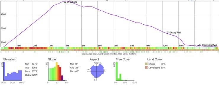
 Hike Mt Lukens From Deukmejian Wilderness Park
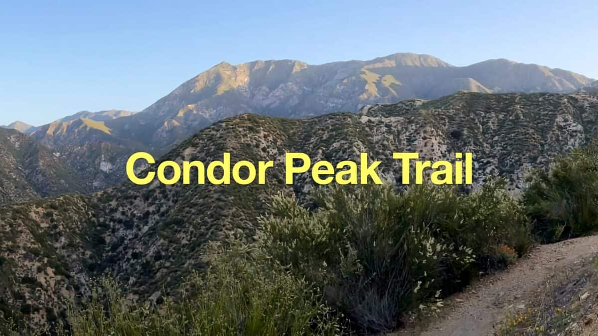 Condor Peak Trail
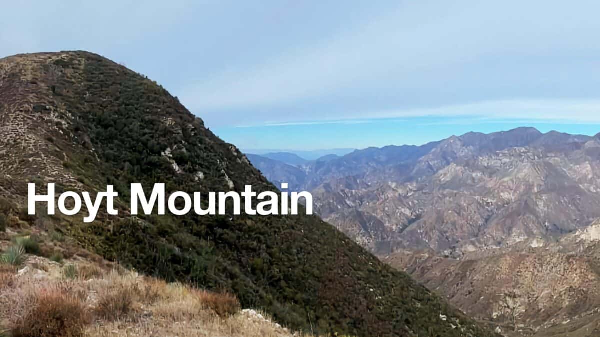 Hoyt Mountain Hike
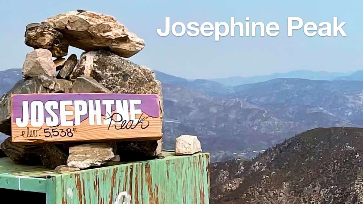 Hike Josephine Peak From Colby Canyon
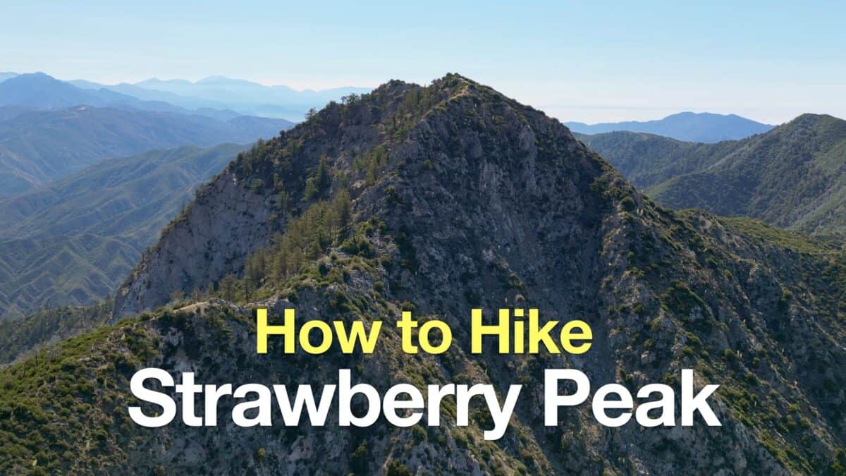 Strawberry Peak Hike
 Los Angeles Hikes
 Angeles National Forest Hikes
 LA Mountain Hikes
 Sierra Club 100 Peaks
 Best Hiking Gear 2024
 Hiking Boots or Shoes: Do I Really Need Hiking Boots?
 When to Hit SOS on inReach