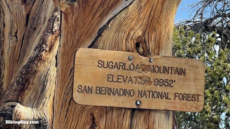
Although Sugarloaf Mountain, at 9952 feet, is the highest point in Big Bear Valley, this mountain peak is often overlooked by hikers today. That's good news for you because the Sugarloaf Mountain Trail is rarely crowded, offers a good climb with excellent views, an old-growth forest, and another peak to add to your list. And while the summit doesn't have a viewpoint, you do get some of the best panoramas of the San Bernardino high peaks along the way.
In this Guide:
Video and Turn-by-Turn Directions for the Sugarloaf Mountain Trail
How to Get the Start of the Sugarloaf Mountain Trail
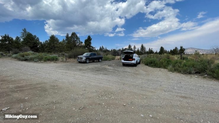
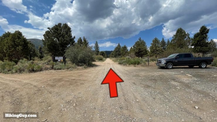
Sugarloaf Trail is set back from the paved road by about a mile or so, up a rocky Forest Service road which is tough on most cars. So the safe bet is to park just off the (paved) Rt-38 at the beginning of the Forest Service Road 2N93, and then walk up the road to the official start of the trail.
There's not an address for the parking area, so use this lat/lon: 34.231438, -116.806414
There are some wide shoulder areas when you first pull onto the dirt road where you can park. Pull off the side of the road so that you don't block other traffic.
Gear For the Hike
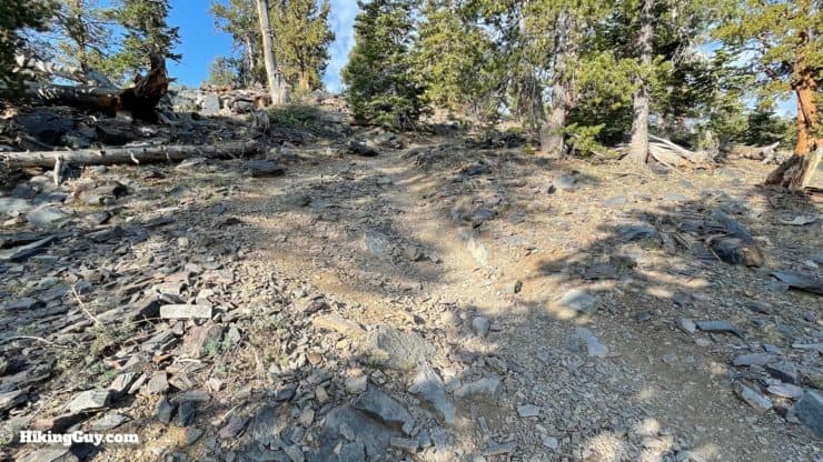
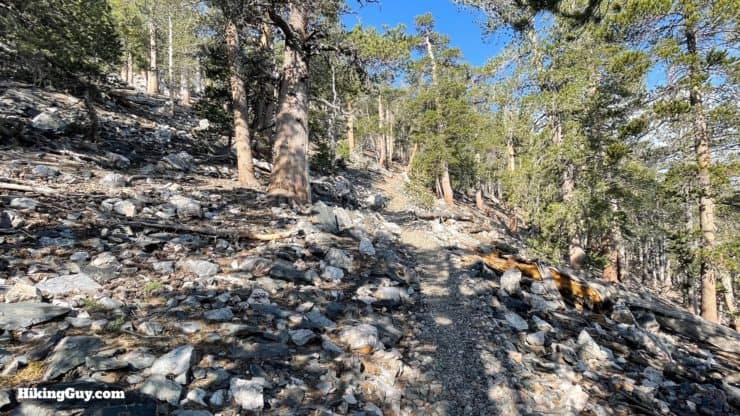
The trail is very rocky. A shoe with a thicker or stronger sole will do well here. Some of the upper sections are 100% small rocks.
This is a mountain hike so bring clothing and a shell for changing conditions.
I bring 3L of water which is on the conservative side.
Trekking poles will help on the steep sections.
In the winter the trail can be covered and ice and snow. If you're familiar with the trail already, it's best not to do the hike in those conditions.
Gear That I Love Right Now
Nothing is sponsored or promoted, just the actual gear that I use.
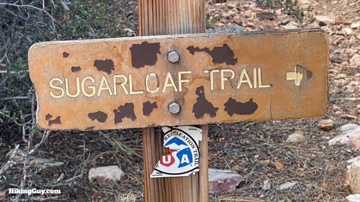
One of the neat things about this hike is that once you leave the Forest Service Road, you are actually on the Sugarloaf National Recreation Trail (NRT). NRT Trails are part of the National Trails System Act of 1968, the same one that created the (official) PCT and AT. You can read a more about the history of the NRT trail system in my guide to the Gabrielino NRT.
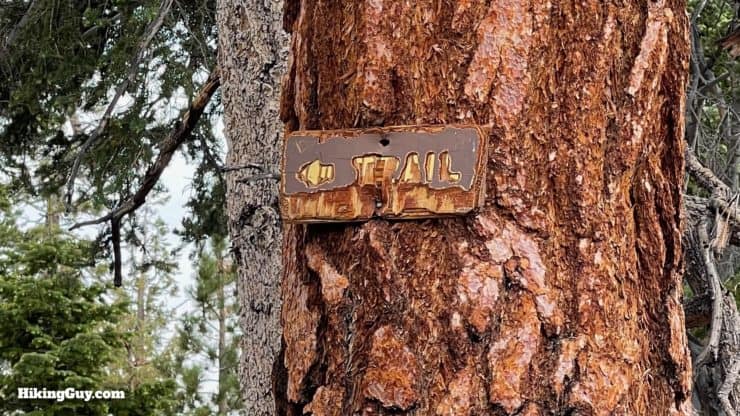
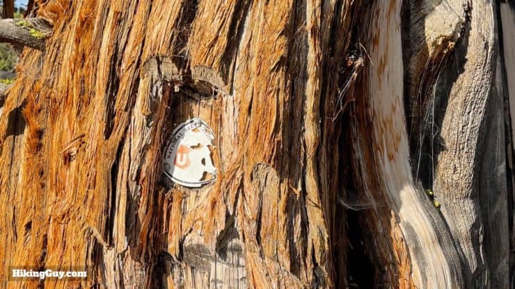
You'll see some old trail signs, but otherwise the trail is largely unmarked.On the upper elevations you'll see these old-school notch trail markers in the trees. Follow the notches and you'll be good.
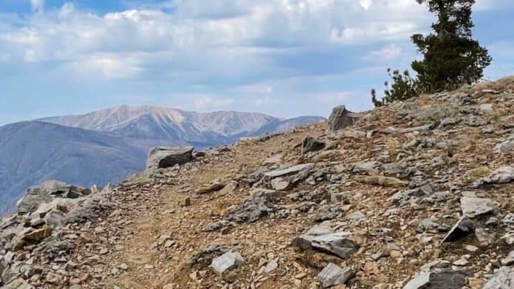
As you might have guessed, you're going to be climbing to reach Sugarloaf Mountain. The trail is consistently uphill until the end, where you have a short downhill before climbing again. The undulations near the top create a few false summits.
3D Map
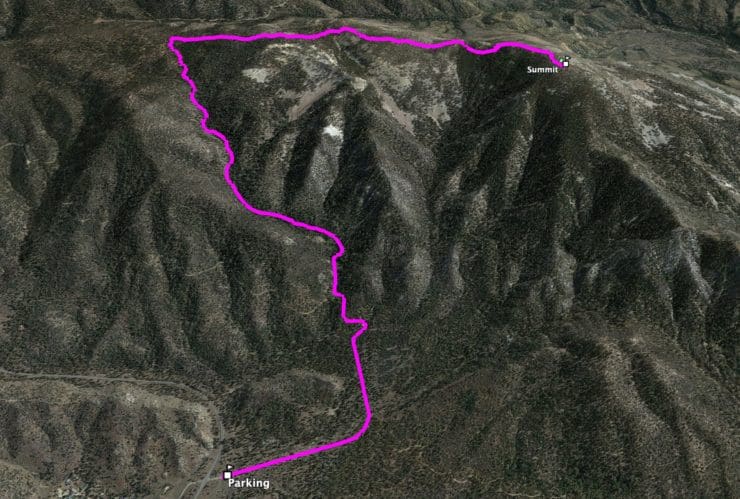
Once you leave the Forest Service road, the Sugarloaf Trail takes you up Green Canyon to the ridge, which you then follow up to the Sugarloaf summit.
Sugarloaf Mountain Hike Directions
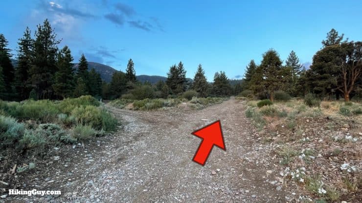
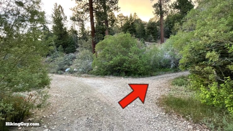
Go straight up road 2N93, also known as Wildhorse Meadow Road, from the parking area. On the left is 2N93B; don't get confused.
Wildhorse Meadow, where this road goes, was named after World War 1 when the US Cavalry realized that modern warfare made fighting on horseback obsolete. They decided to let their horses go, and the herd settled in the meadow southeast of Sugarloaf Mountain.
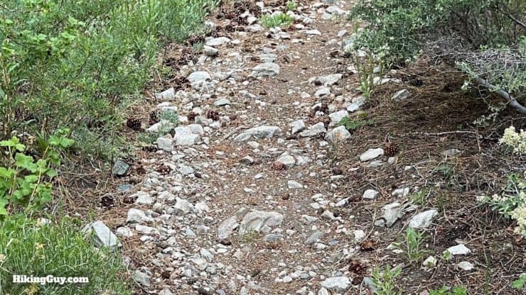
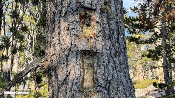
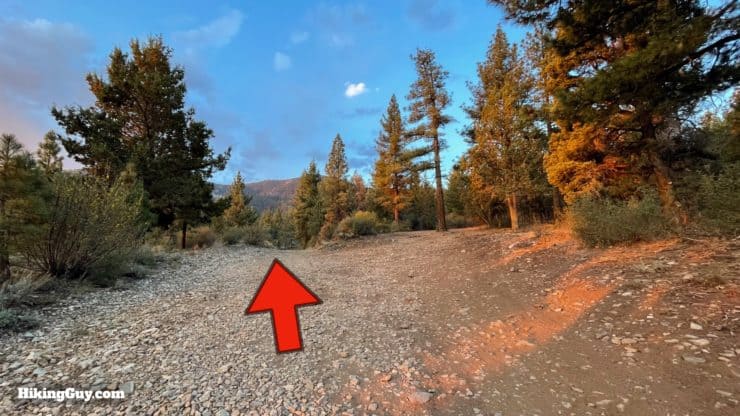
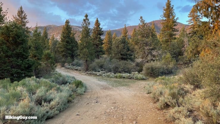
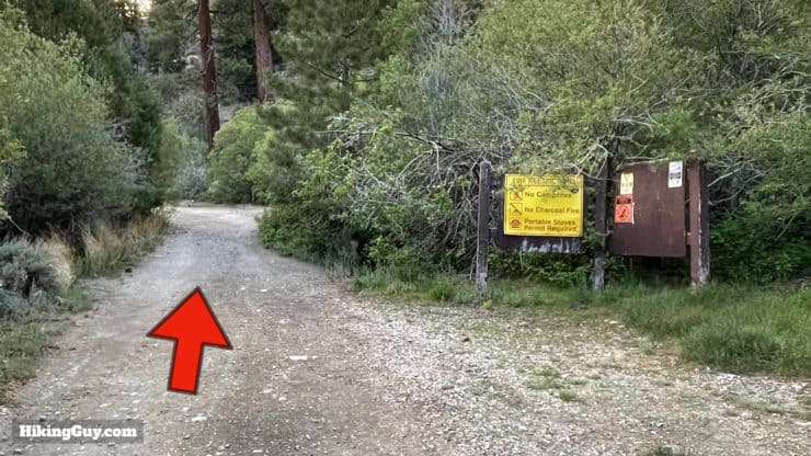
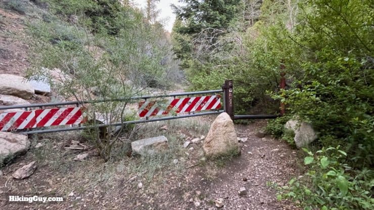
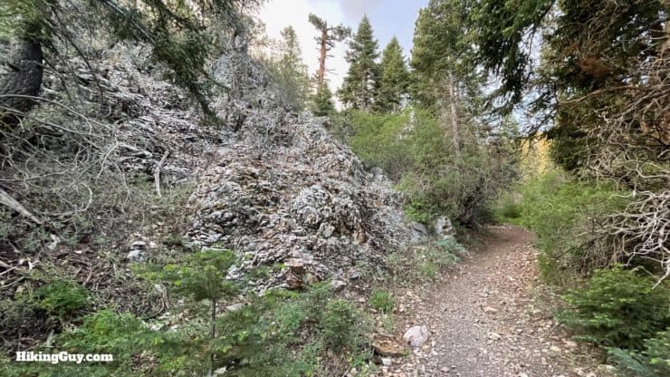
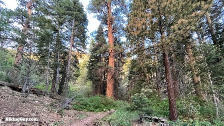
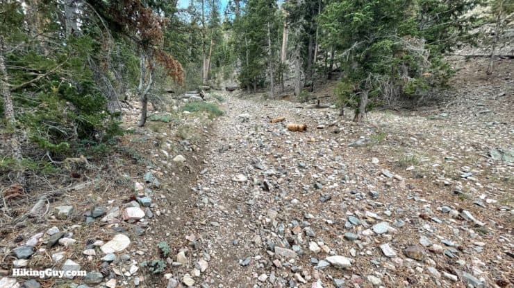
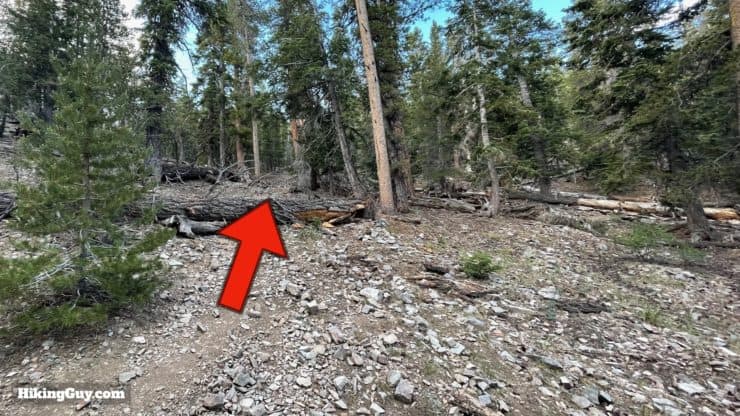
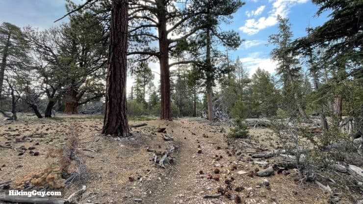
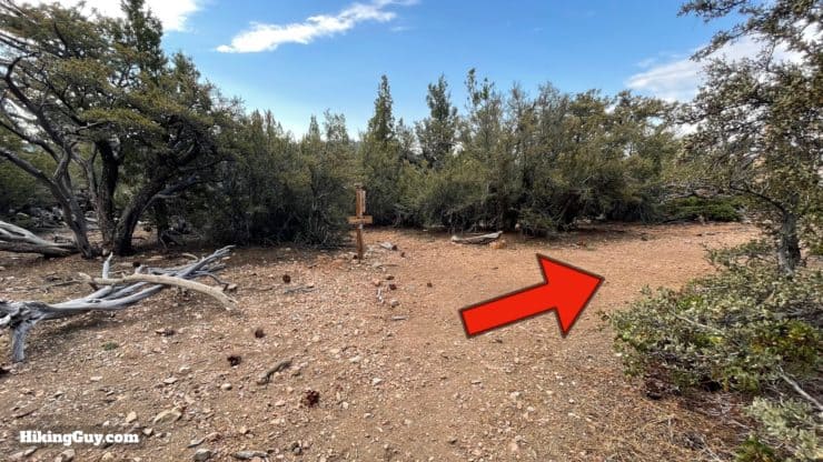
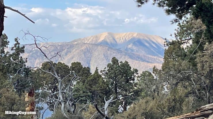
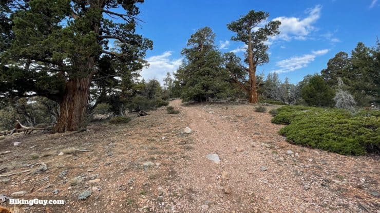
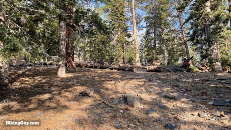
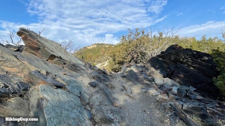
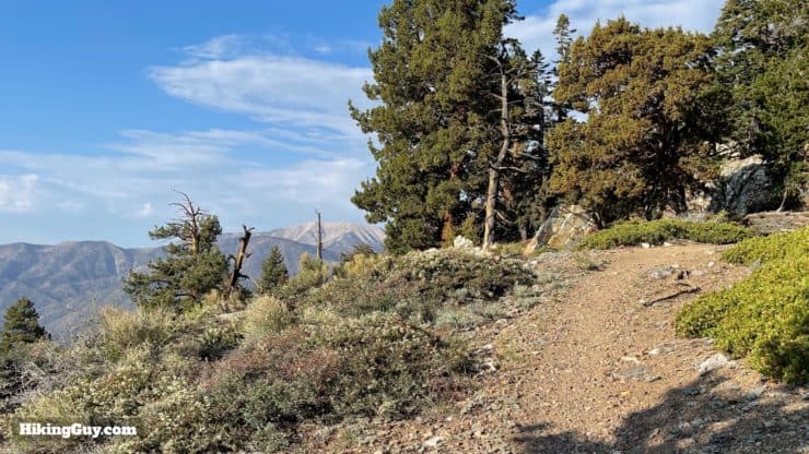
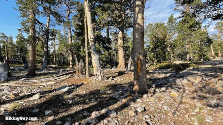
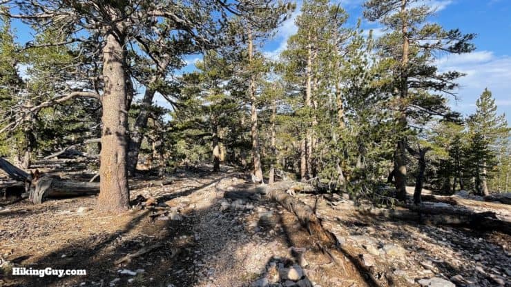
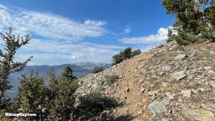
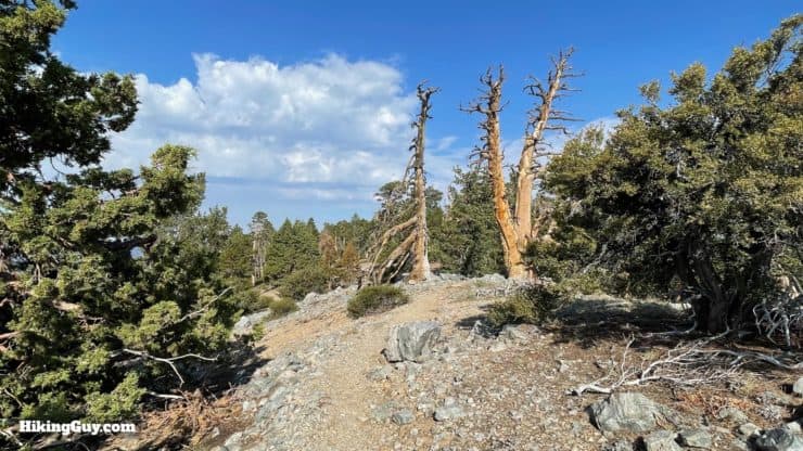
Keep going straight on 2N93. There are a few turn-offs to picnic areas.2N27 splits off to the right, bear left to continue on 2N93.The road dips down and loops to the left.And soon you'll see the official trailhead parking area and sign. If you want to shave some miles off and have a high-clearance vehicle, you can also just drive here and park.Just past the last sign, look for the turn to the right. This is the official start of the Sugarloaf National Recreation Trail.Hike through the gate. No more motorized vehicles past here.Right after the start is this unique rock formation, and I'm just showing it to you because it's cool. There are several abandoned mines off the route of this hike.The hike up Green Canyon is, well, green. Enjoy the old-growth forest and small stream crossings as it winds up along Green Creek.Soon the trail gets steeper, wider, and rockier. Before this was designated as a National Recreation Trail, it was open to 4WD vehicles.Go straight over the log. There's a small trail back to the left, which is the abandoned 2N92 road, now largely overgrown.At the top of the climb the trail levels out.And soon you'll come to an intersection. Make the hard right to continue up the ridge to Sugarloaf Mountain.You can see the old NRT marker on the trail sign here.As soon as you make the last turn, look off to the left for an incredible view of San Gorgonio Mountain. You'll get more of these views in a mile or so.The trail is uphill but not as steep as the last section.And you'll wind through some lodgepole pines and shaded areas.The flat sections are periodically interrupted by short, steep climbs.You crest a high point by some exposed rock, the first of the false summits. And that bump in the distance is another false summit.As you follow the ridge you'll get more great views of the high peaks in San Gorgonio Wilderness.There are no trail signs, just notches, except for this old NRT marker getting overtaken by bark.You crest another false summit (Peak 9775) and the trail levels out.And then you have a short descent to a saddle The bump in the distance is another false summit, but a closer one.After descending to the saddle, you'll climb again towards the real Sugarloaf Mountain summit.Catch you last nice views of the high peaks.The trail levels off and you hike through some gnarled and twisted pines and junipers.And then the summit appears. There are no views here, but there are lots of trees and a peaceful vibe.
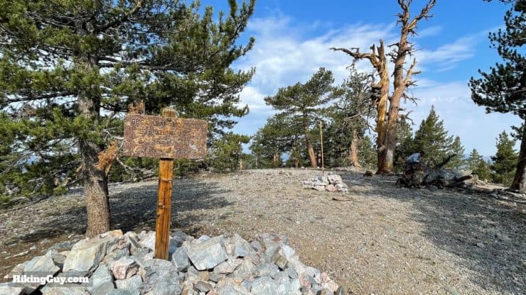
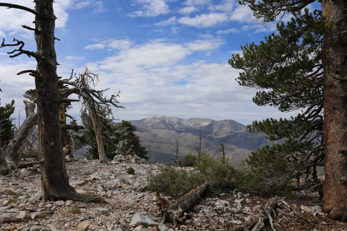
There are several markers at the summit. The summit register usually sits in the rock pile by the survey marker.If you walk about 30 yards south from the summit you'll get great views of San Gorgonio! Thanks to Robert D for the pic and recommendation!From here, just go back the way you came. Remember that you have a small climb pack up to Peak 9775 (behind me here).
Need More Info?
Have a question about the guide or want to see what other people are saying/asking? View the Youtube comments for this video. Leave a comment and I will do my best to respond.
When planning, always check the park website and social media to make sure the trails are open. Similarly, check the weather and road conditions.


 Using the Apple Watch for Hiking
 Garmin Fenix 7 & Epix Review For Hikers
 How To Read a Topographic Map
 Garmin GPSMAP 67i Review
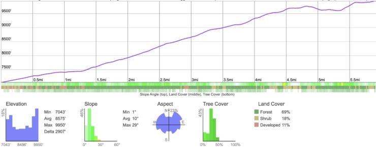
 Cougar Crest Trail to Bertha Peak Hike Guide
 Pineknot Trail to Grand View Point (Big Bear)
 Hike Keller Peak on the Exploration Trail
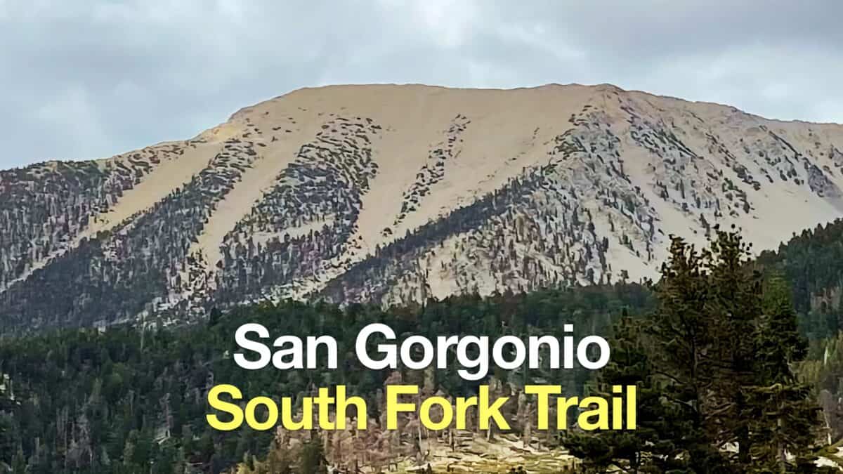 South Fork Trail to San Gorgonio Mountain
 Big Bear Wild Burro Territory Hike
 Los Angeles Hikes
 Backpacking Trips
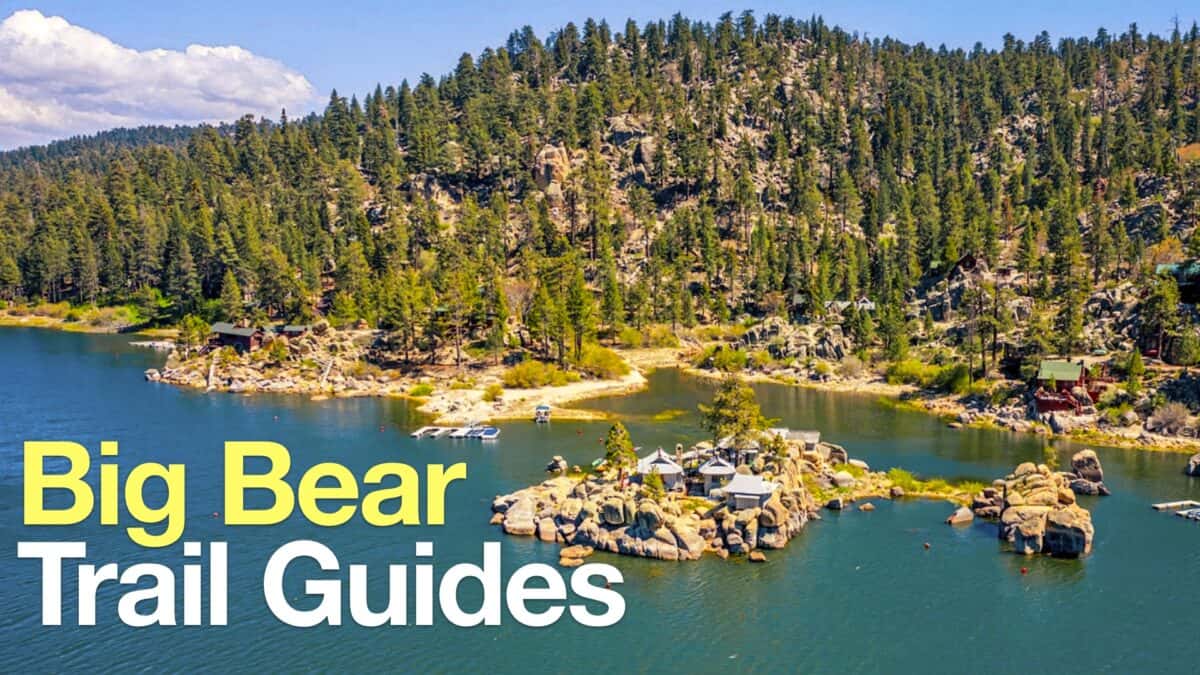 Big Bear Hikes
 LA Mountain Hikes
 San Bernardino National Forest Hiking Trails
 Sierra Club 100 Peaks
 Best Hiking Gear 2024
 Hiking Boots or Shoes: Do I Really Need Hiking Boots?
 When to Hit SOS on inReach