The Sunset Peak hike, with its gentle yet steady uphill, offers lots of beauty for all levels of hiker. For beginners, Sunset Peak lets you dip your toe into the high peaks of Angeles National Forest without anything too hairy. And for the experienced hiker, the sweeping panoramic views give you a unique perspective of all the big-name peaks. Overall Sunset Peak is a great hike that I recommend for everyone to enjoy.
In this Guide:
Video and Turn-by-Turn Directions for the Sunset Peak Trail
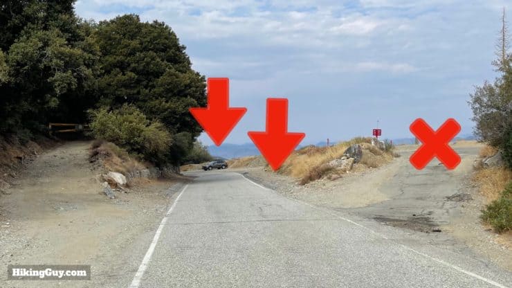
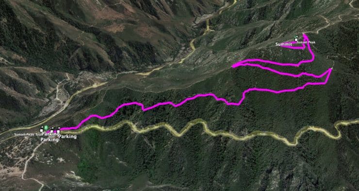
There are a few routes to Sunset Peak, and I'll show you the most common (and easiest) from Cow Canyon Saddle. The only downside is that parking is limited to the side of the road. Use this trailhead address: Sunset Peak Trail, Glendora Ridge Rd, Mt Baldy, CA 91759
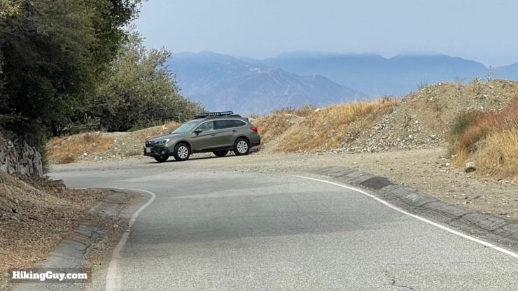
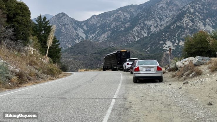
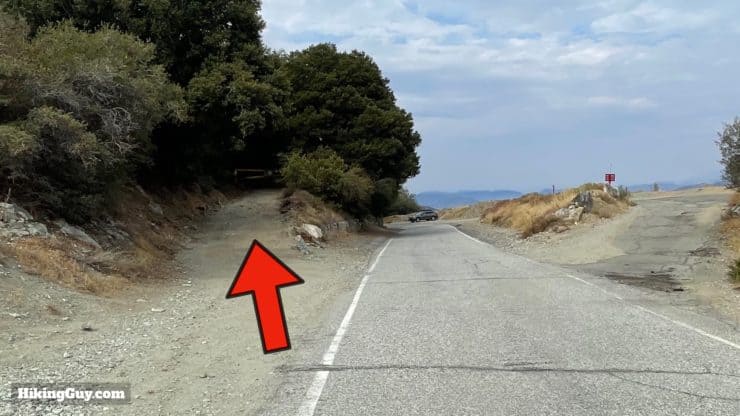
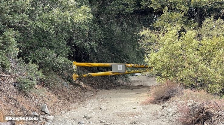
The trail starts by the yellow gate on the left. You can't park in the lot on the right, but you can park anywhere on the side of the road outside of the white road lines.Here's a closeup of the car in the distance.And there's parking just before the trailhead too.
Three are no facilities at the trailhead, and also no fee or pass is needed to park here.
Gear For the Hike
Although the hike is not technical, you are in the mountains, and I recommend light hiking gear. 1-2L of water will be fine depending on the conditions, and there's intermittent shade on the route. Insects can be a problem on this lower peak, so prepare accordingly.
Gear That I Love Right Now
Nothing is sponsored or promoted, just the actual gear that I use.
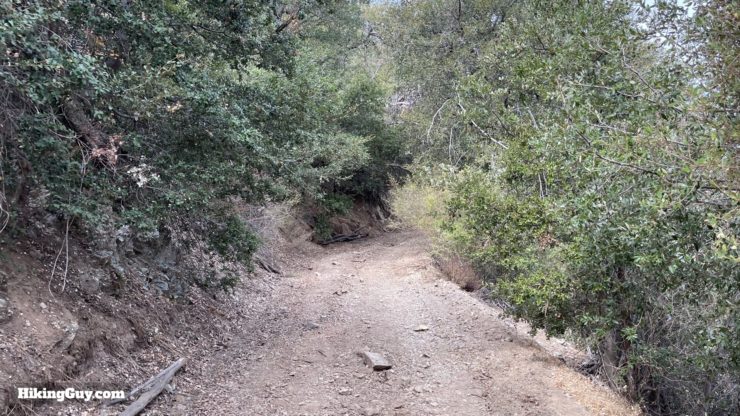
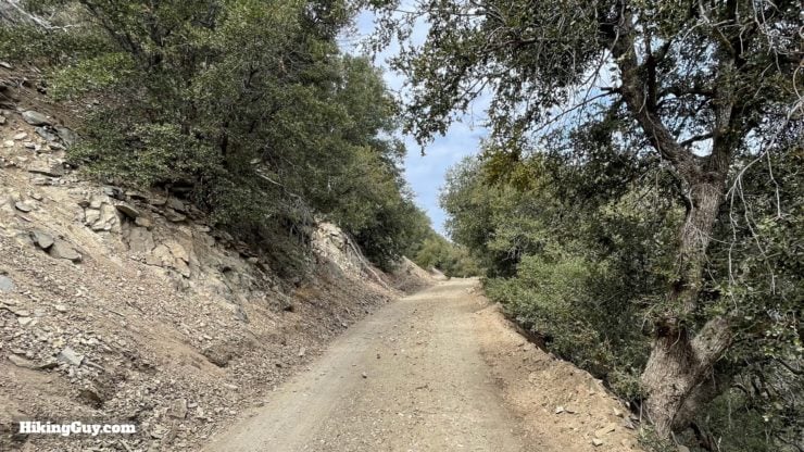
This hike takes the Sunset Ridge Fire Road, also known as the Sunset Ridge Trail, up to Sunset Peak, and is very easy to follow. The fire road is pleasant and peaceful.
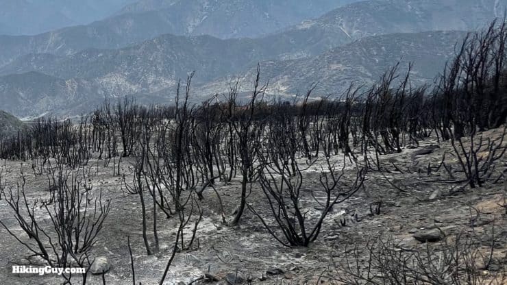
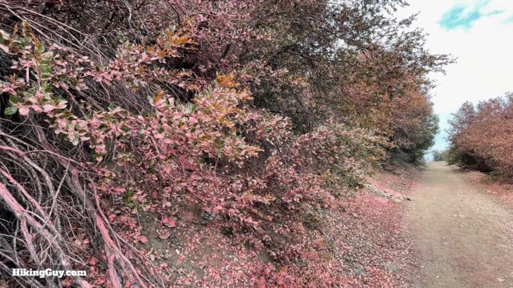
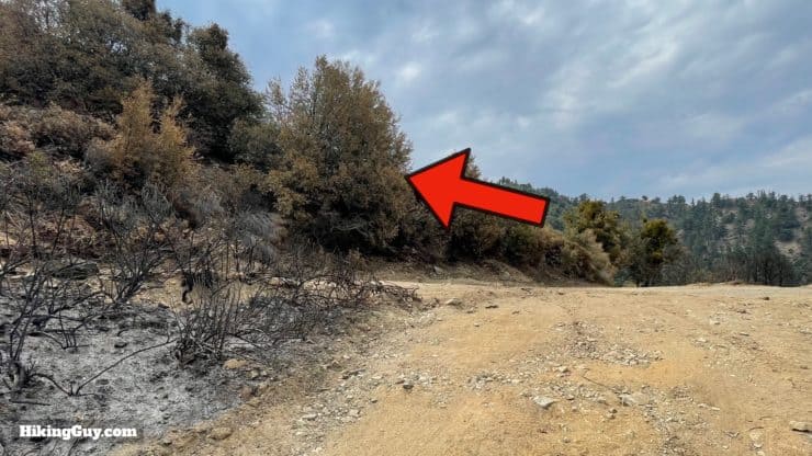
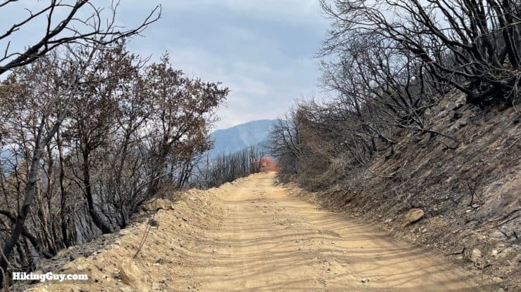
This hike passes through remnants of the Antonio Fire, which burned 50 acres in 2021. Only portions of the hike look like this. There's plenty of land that survived.
The climb to Sunset Peak is very gradual and easy to cruise up.
3D Map
The trail parallels Glendora Ridge Road in the beginning, and then does a couple of wide switchbacks toward the top.
Sunset Peak Trail Hike Directions
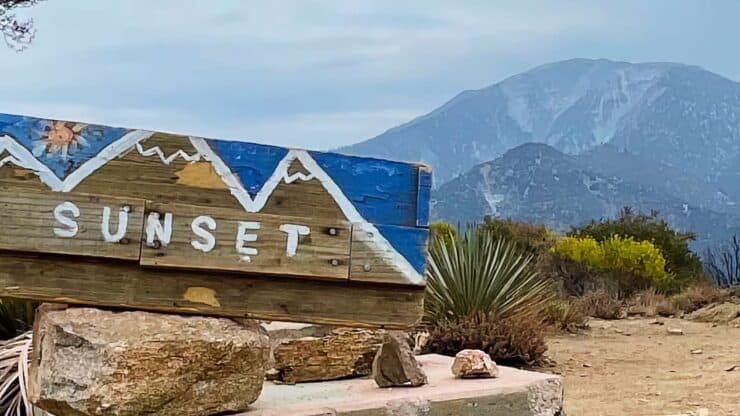
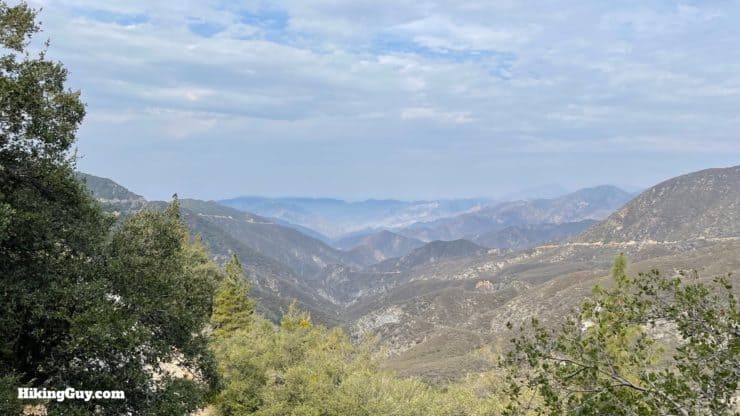
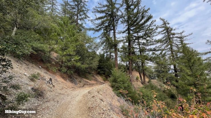
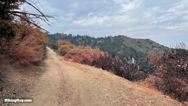
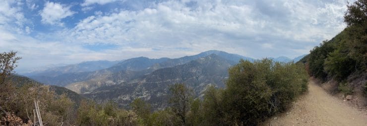
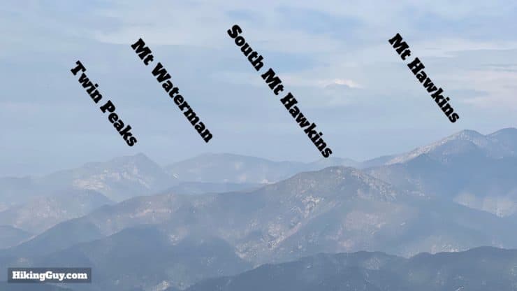
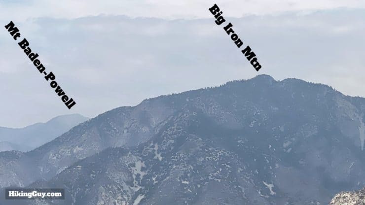
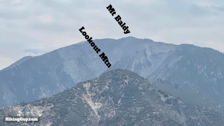
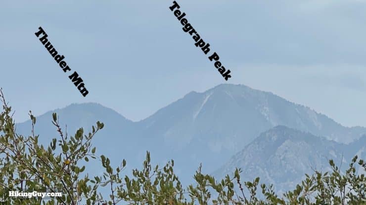
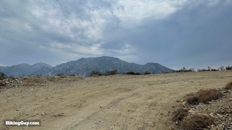
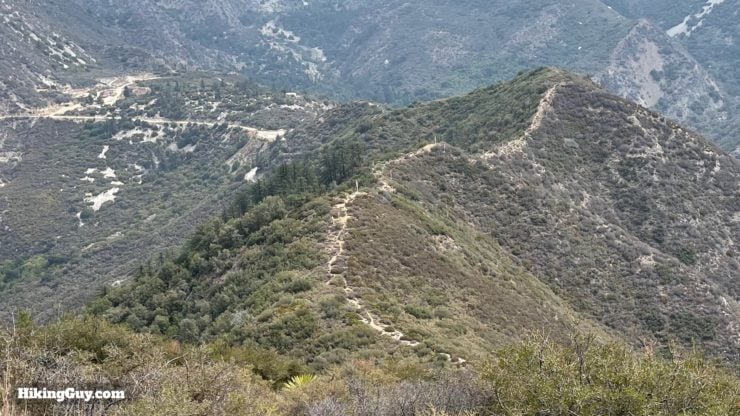
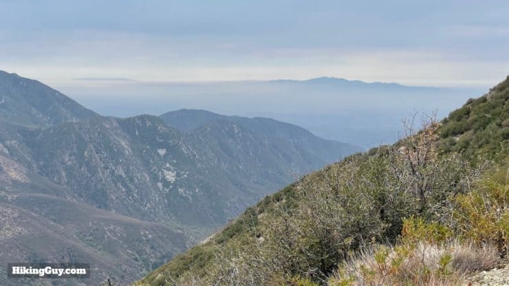
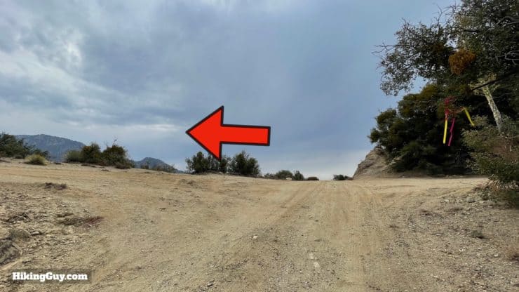
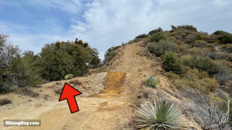
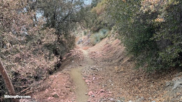
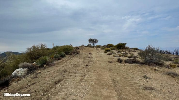
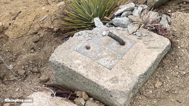
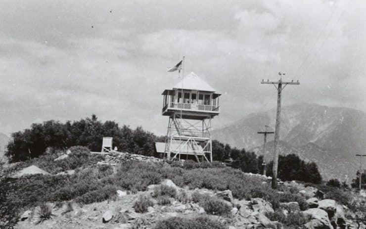
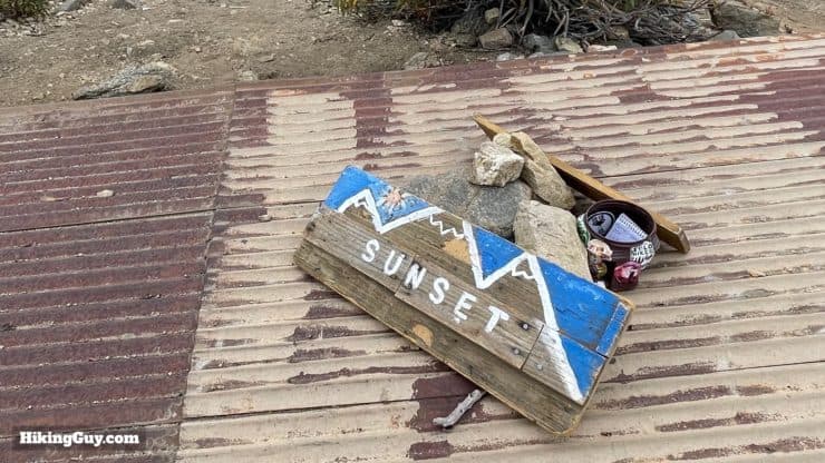
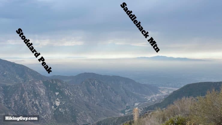
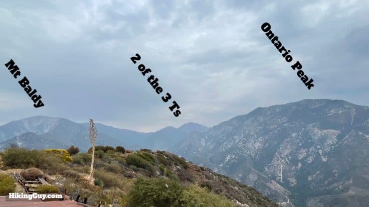
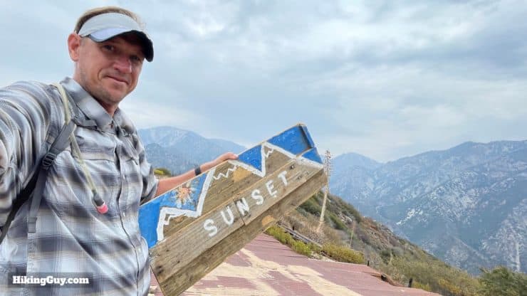
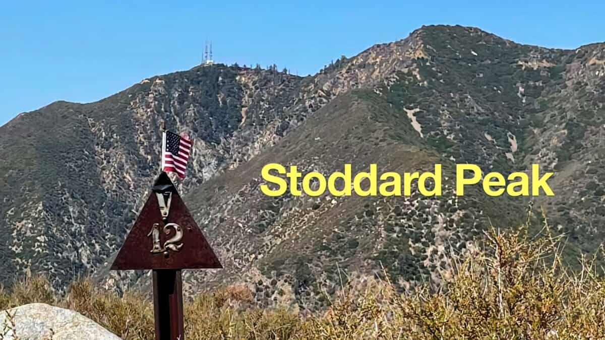
From the Glendora Ridge Road, hike up toward the yellow gate.And go around the gate onto the Sunset Ridge Trail.The fire road is very pleasant, isn't open to OHV use, and feels like you're walking down an abandoned road from 100 years ago.As you climb you'll start getting glimpses into Cow Canyon and Cattle Canon (yup, that's what they're called).The trail becomes surrounded with nice tall pines as you climb.At about a mile or so in, you'll start to notice fire damage. Here you can still see some red fire retardant that was dropped from an aircraft.When you get to the first sweeping bend in the trail, go to the edge for some spectacular views into the San Gabriels.Here's what it looks like. I've listed out some of the prominent peaks below in detail.On the left is the tough hike of Twin Peaks, then Mt Waterman, then a big ridge with Mt Hawkins and South Mount Hawkins.Continuing right, you'll see Mt Baden-Powell in the distance, and then "Big" Iron Mountain dominating the foreground. Big Iron is considered one of the hardest hikes in Southern California.The mountain in the back that dominates the skyline is Mt Baldy, and the smaller Lookout Mountain sits in front of it.To the far right you'll see Thunder and Telegraph, part of the "3 Ts Trail" hike.Make the hard left up the switchback at about 2 miles in. Forest Service Road 2N07 joins from the right.The road is a bit wider here and loses some of the charm of the lower road, but makes up for it with expansive views.At about 2.5 miles in, the road does another sharp curve as it climbs. Ontario Peak is the big mountain ahead.If you look down from that last curve, you'll see the smaller trail winding up the ridge. This trail starts just before the gate at the parking area and is much more difficult. If you do attempt this route, I highly recommend trekking poles for the steep and loose terrain.As you wind on the last curve you'll also see down San Antonio Canyon, which you drove up to get to the trailhead.Continue up the fire road, which has a nice level section.And at the saddle, look for the turn off on the left to the Sunset Peak Summit.Instead of going up the steep dozed path, bear left and we'll loop around the peak.The trail is much smaller, mellow, and loops up and around Sunset Peak.Soon you'll arrive at a big open area of the peak. Go straight across the corrugated metal to reach the marker.On the way to the summit area, look for these concrete squares, which used to support a fire tower that sat here.Here's what the fire tower looked like in 1940. It was built in 1927 and dismantled in 1974, when the smog became so bad that it was no longer useful.And here you are at the summit. There's usually a sign or two around here to grab a photo with.
Why is it called Sunset Peak? Aside from the obvious one (it's a nice place to watch the sunset), I can share this. Until the late 1940s, Mt Baldy Village used to be Camp Baldy, a resort that was (at one point) run by the Curry family, who you might know from Curry Village in Yosemite. In the 1920s Camp Baldy Resort visitors would hike up here on the old "Sunset Trail" to view the sun going down. The name "Sunset Peak" appeared soon after on official maps in 1926.
Have a question about the guide or want to see what other people are saying/asking? View the Youtube comments for this video. Leave a comment and I will do my best to respond.
When planning, always check the park website and social media to make sure the trails are open. Similarly, check the weather and road conditions.


 Using the Apple Watch for Hiking
 Garmin Fenix 7 & Epix Review For Hikers
 How To Read a Topographic Map
 Garmin GPSMAP 67i Review
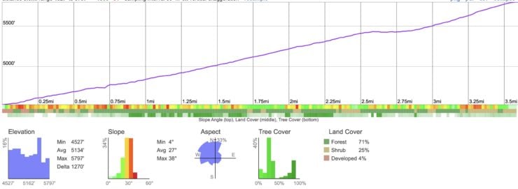
 Stoddard Peak Hike
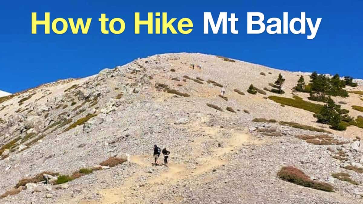 Mt Baldy Hike
 Los Angeles Hikes
 Angeles National Forest Hikes
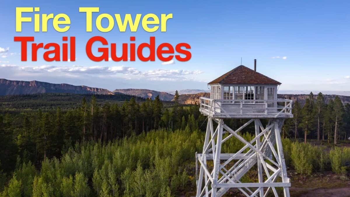 Fire Tower Hikes
 LA Mountain Hikes
 San Gabriel Mountains National Monument Hiking
 Sierra Club 100 Peaks
 Best Hiking Gear 2024
 Hiking Boots or Shoes: Do I Really Need Hiking Boots?
 When to Hit SOS on inReach