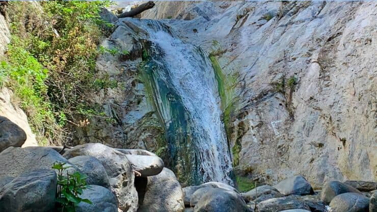

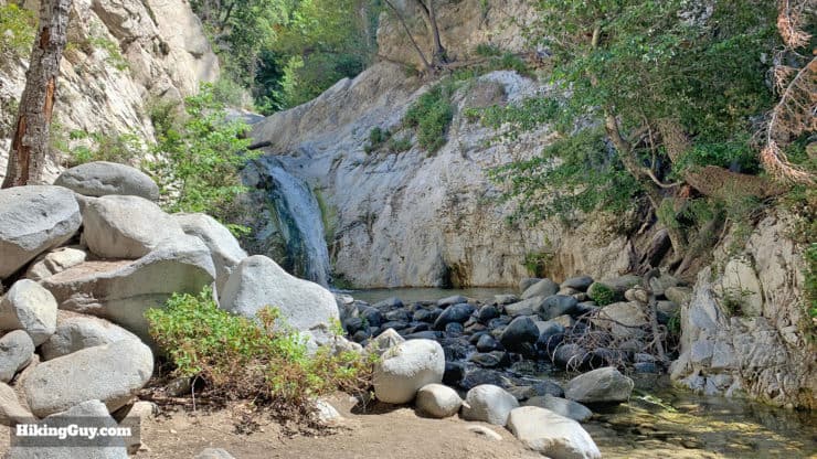
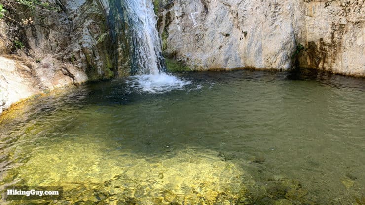
The Switzer Falls hike is so much more than just a waterfall. In about 2 miles the trail to Switzer Falls takes you along a babbling brook, through historic ruins, on the side of a spectacular gorge, and then finally, to a pristine waterfall. Although I've listed the Switzer Falls hike as moderate because there's a bit of climbing, overall it's a very doable hike that offers many rewards for a small effort. It's also a popular hike so it's best done very early before the crowds show up.
- Turn by Turn Hike Directions & Hike Video
- Switzer Falls Trail Maps
- How to Get to the Switzer Falls Hike
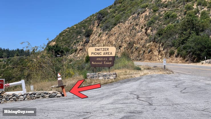
How To Get To Switzer Falls
Use this trailhead address:
Switzer Picnic Area, Altadena, CA 91001
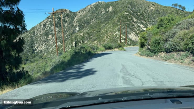
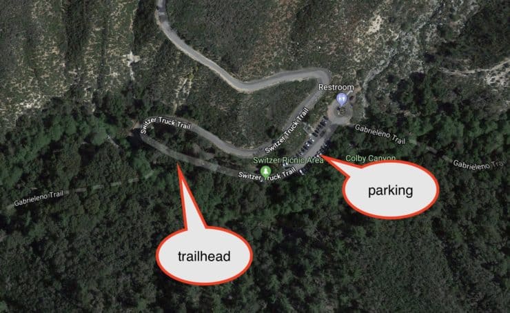
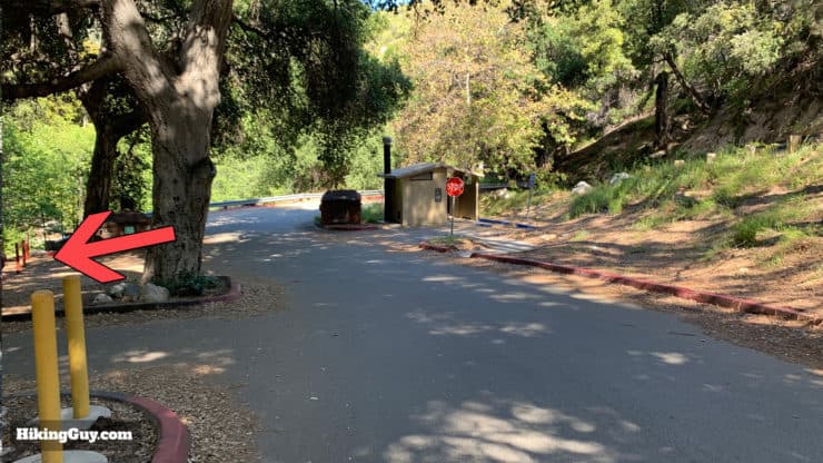
The Switzer Falls hike starts at the Switzer Picnic area, which can be a little tricky. When you see the sign for the picnic area from the highway, you need to drive all the way down the hill to the last parking area. If that parking area is full (it won't be if you get there early) you can park in one of the lots in the upper areas.
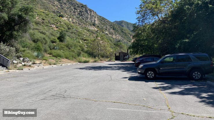
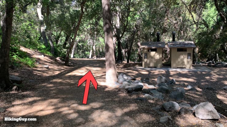
There are primitive bathrooms in the parking area.
You'll need a National Parks Pass or Adventure Pass to park here.
This hike is best done very early to avoid the crowds.
Gear for the Hike
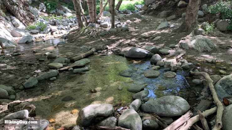
You don't really need any special hiking gear for Switzer Falls, you can get away with fitness gear if you want to. Every time I do this hike I see people in jeans and t-shirts. Personally I wear hiking gear including water-resistant boots that help on the stream crossings. Trekking poles will help too if you are not comfortable hopping across rocks and logs. The trail is mostly shaded so sun exposure is not a huge issue.
Gear That I Love Right Now
Nothing is sponsored or promoted, just the actual gear that I use.


Switzer Falls Trail Maps
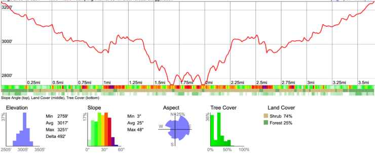
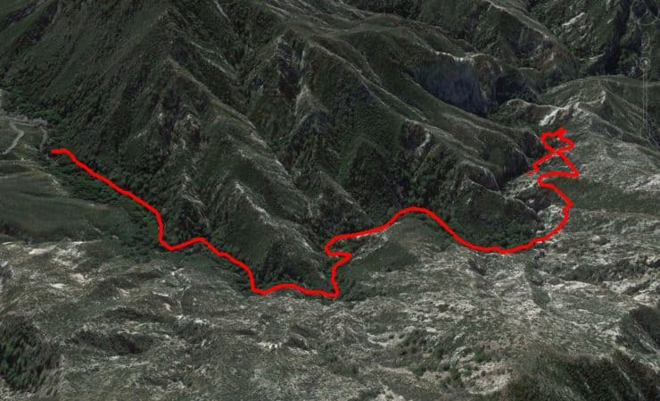
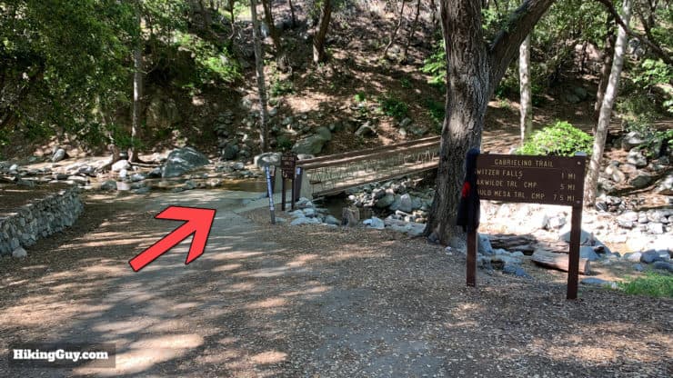
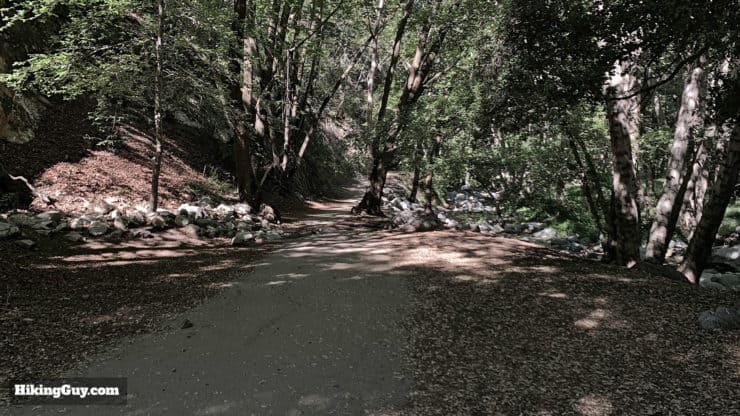
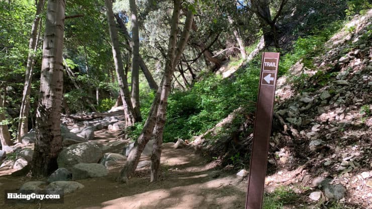
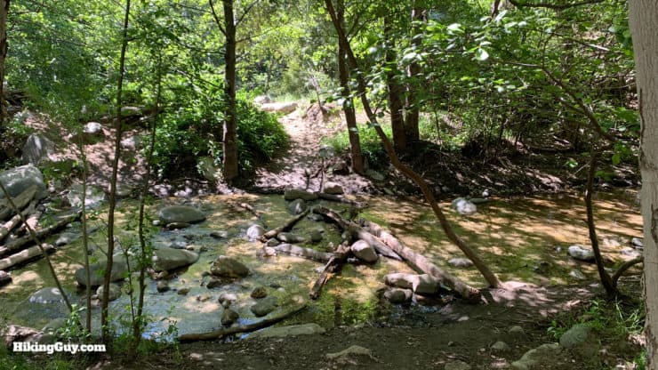
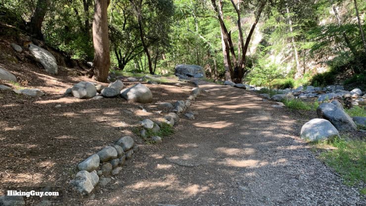
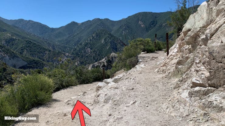
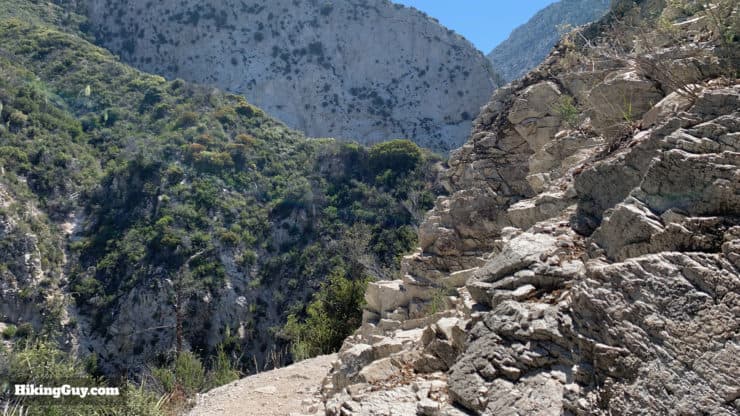
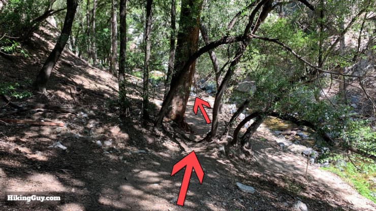
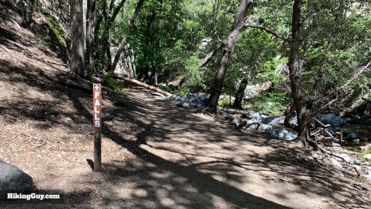
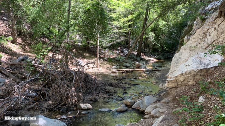
The hike to Switzer Falls follows the Gabrielino Trail for most of the way, and overall is very easy to follow. Some sections in the beginning and end involve stream crossings; often there are multiple options to cross. In general everything that splits apart joins together again.
How Will You Navigate?
 Using the Apple Watch for Hiking
 Garmin Fenix 7 & Epix Review For Hikers
 How To Read a Topographic Map
 Garmin GPSMAP 67i Review
Switzer History
- Hiking and enjoying the outdoors boomed in the 1880s and is known as "the Great Hiking Era." Think John Muir, big beards, and skirts down to the ankle.
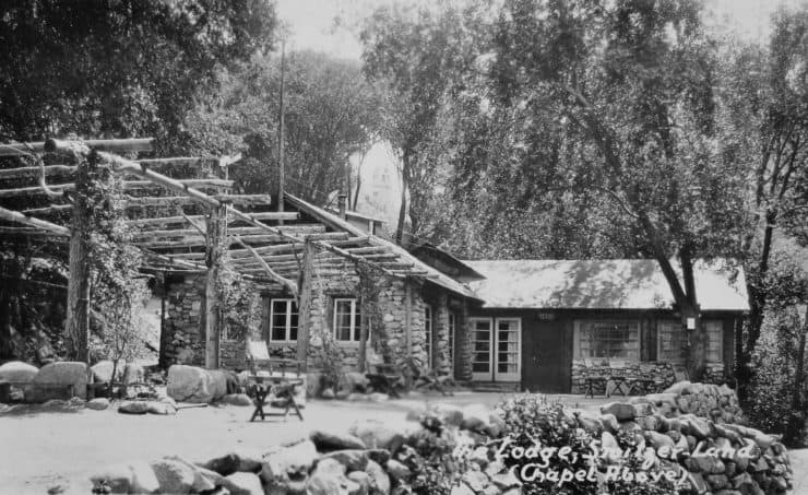
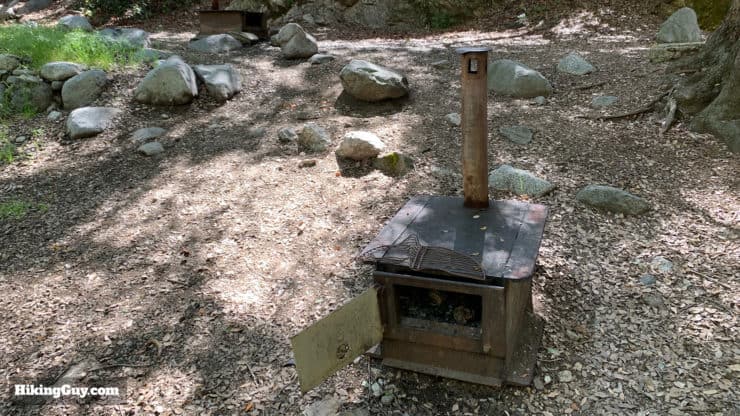
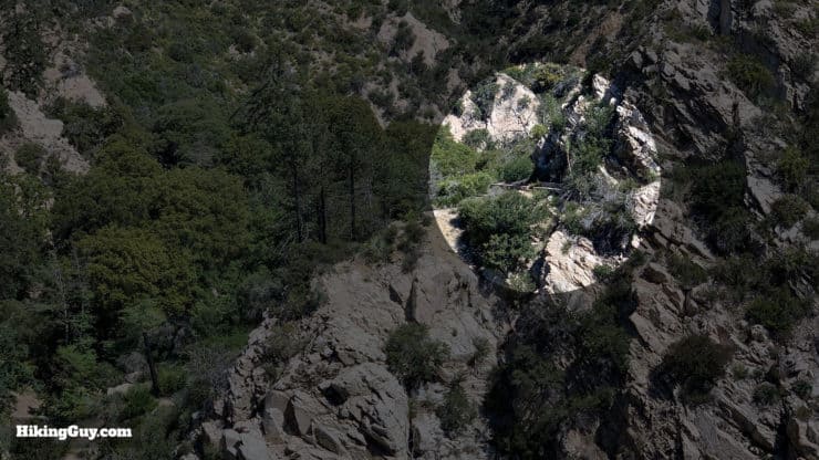
- Halfway on the hike you'll arrive at what's left of Switzer Trail Camp, started in 1884 by Commodore Perry Switzer, a Pasadena carpenter. At one point there were a series of these mountain resorts all through Angeles National Forest and hikers would often through-hike from one to another.
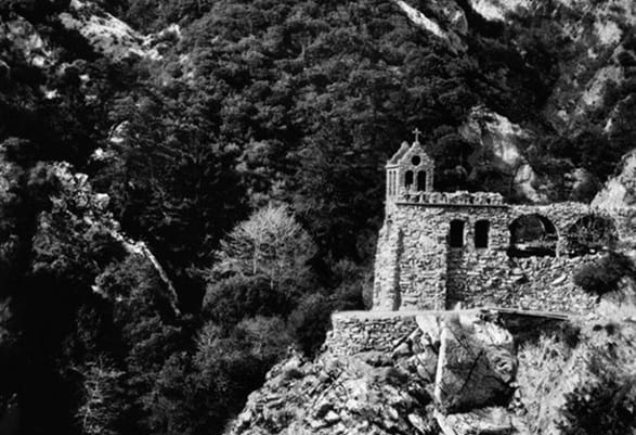
- The camp went through several owners and rebuilds, at one point being named "Switzer-land." New owners added tennis courts, a dance hall, and even a chapel perched on a cliff above the Arroyo Seco (more on that in the directions).
- The depression and WW2 took the wind out of the sails of the great hiking era, but many of the resorts continued on but eventually fizzled out. Switzer's was open until a fire destroyed it in 1959. After a brief stint with the Boy Scouts, the Forest Service realized that they couldn't ensure people's safety and demolished Switzer Camp and the chapel. At the end of the guide I'll share an email from Ken, whose family ran Switzer's for a while.
- Today you can still see some walls, stoves, and ruins of the old Switzer Camp. More about that later in the directions.
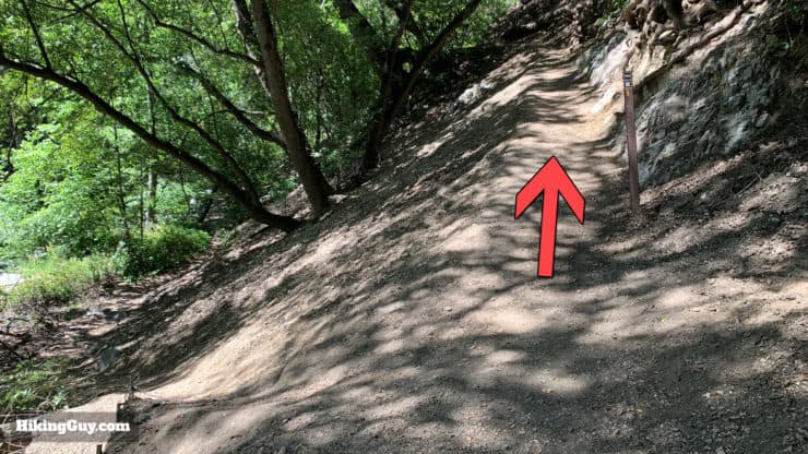
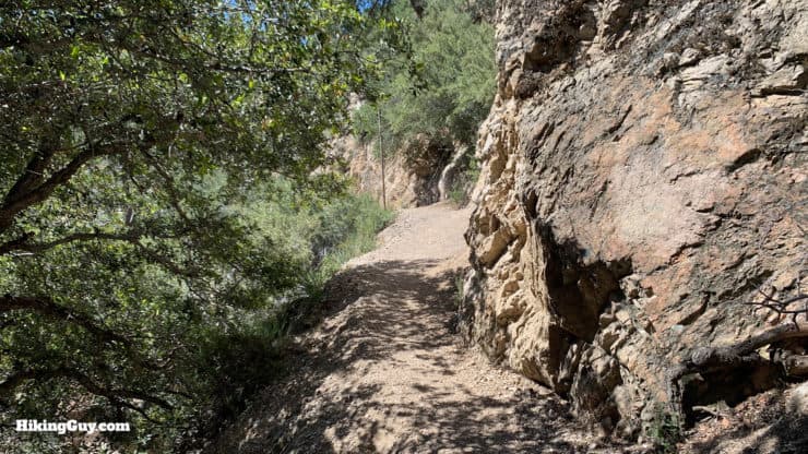
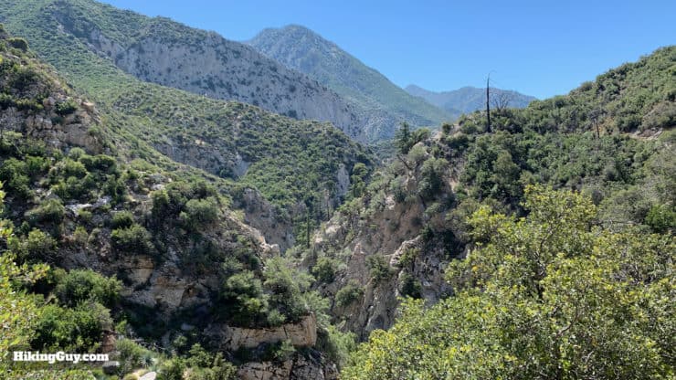
Switzer Falls Hike Directions

Optional Extensions
Upper Switzer Falls
The taller 50' Upper Switzer Falls are a short trip upstream from here. The only problem is that it's not a "trail trail," you have to climb up over the lower falls and then pick your way up the stream. If it's doable by kids with vape pens, it's doable by you.
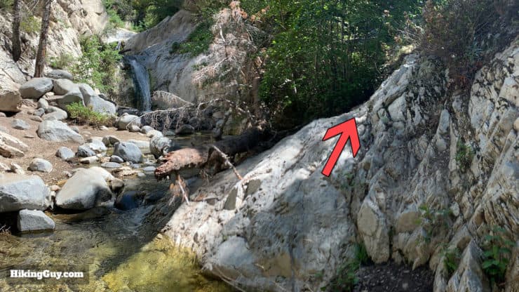
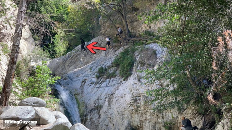
Once you're over the lower falls, follow the stream to the upper falls.There are some decent swimming holes on this stretch.
Please don't cliff dive or do other stupid things here. Rescues are fairly frequent because of bozo behavior.
Bear Canyon Trail Camp
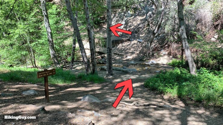
If you want to add another 3 miles (round trip) to the hike, you can continue down the trail to Bear Canyon Trail Camp. When you get back to the intersection at the bottom of the gorge, instead of going uphill back to the cliff-side trail, continue straight on the Bear Canyon trail.
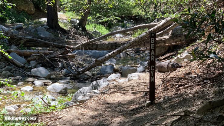
It's a nice trail that gets rough at times but is largely free of crowds. If you're looking for some more miles and want to escape the crowds, it's a nice extension. There's also some decent swimming spots along the trail.
Ken Fitzgerald on Switzer's Later History
Here's an email (shared with permission) from a reader whose family ran the resort for a while.
My grandparents (Edgar & Libby Swanson) began operating the resort (which had been neglected for years) in 1945, when my mother was 10 years old. My two uncles were born while at the resort over the next five years. My father met my mother during his visits as a band member entertaining guests on the weekend in the lodge. They (Leo & Norma Fitzgetald) ended up marrying in 1956... in the chapel.
With parents married... my grandparents moved up the hill to Mt. Wilson, and operated that resort until 1965 when the Forest Service leased the land to MetroMedia (KTTV) and bulldozed the hotel, cabins and swimming pool. My parents continued operating Switzers, raising the first three of my siblings there. A horrible fire in 1959 made the Forest Service realize they could not protect the people at the resort. The resort was forced to close, and the Boy Scouts were allowed to use the resort as of 1960. It didn't take long to realize the scouts were vandalizing the property... so the Forest Service bulldozed the cabins and lodge, and dynamited the chapel.
Three was a restaurant up where the existing parking/picnic area now are, called the "Inlet." My mother and brother walked the mile from the lodge to the inlet most days to catch the bus to school in La Canada. There are retaining walls along the hike down from the parking area, that have my family's name scribed. There is a spring 100 yards upstream from the lodge, where pipes carried the water downstream for the lodge. And yes... lots of famous people visited the resort on weekend getaways from the city. We still have the guestbook.
Need More Info?
- Have a question about the guide or want to see what other people are saying/asking? View the Youtube comments for this video. Leave a comment and I will do my best to respond.
- When planning, always check the park website and social media to make sure the trails are open. Similarly, check the weather and road conditions.
Related Guides
 Strawberry Peak Hike
 Hike the Etiwanda Falls Trail
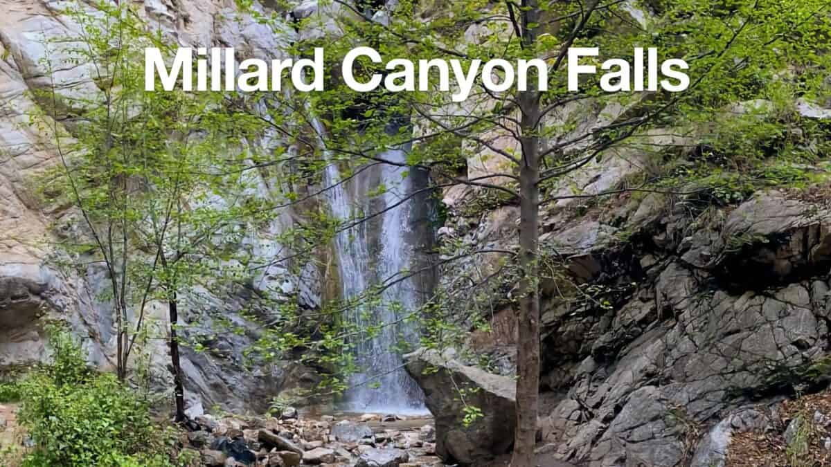 Millard Canyon Falls Hike
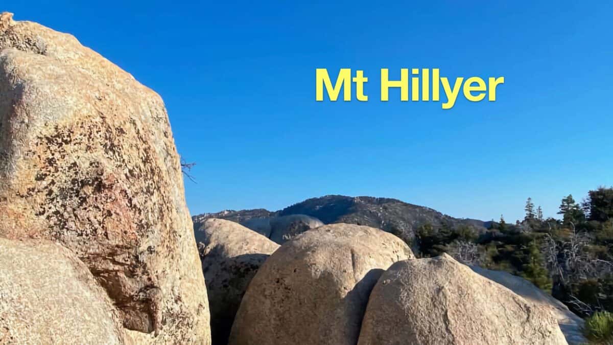 Mt Hillyer Trail Hike
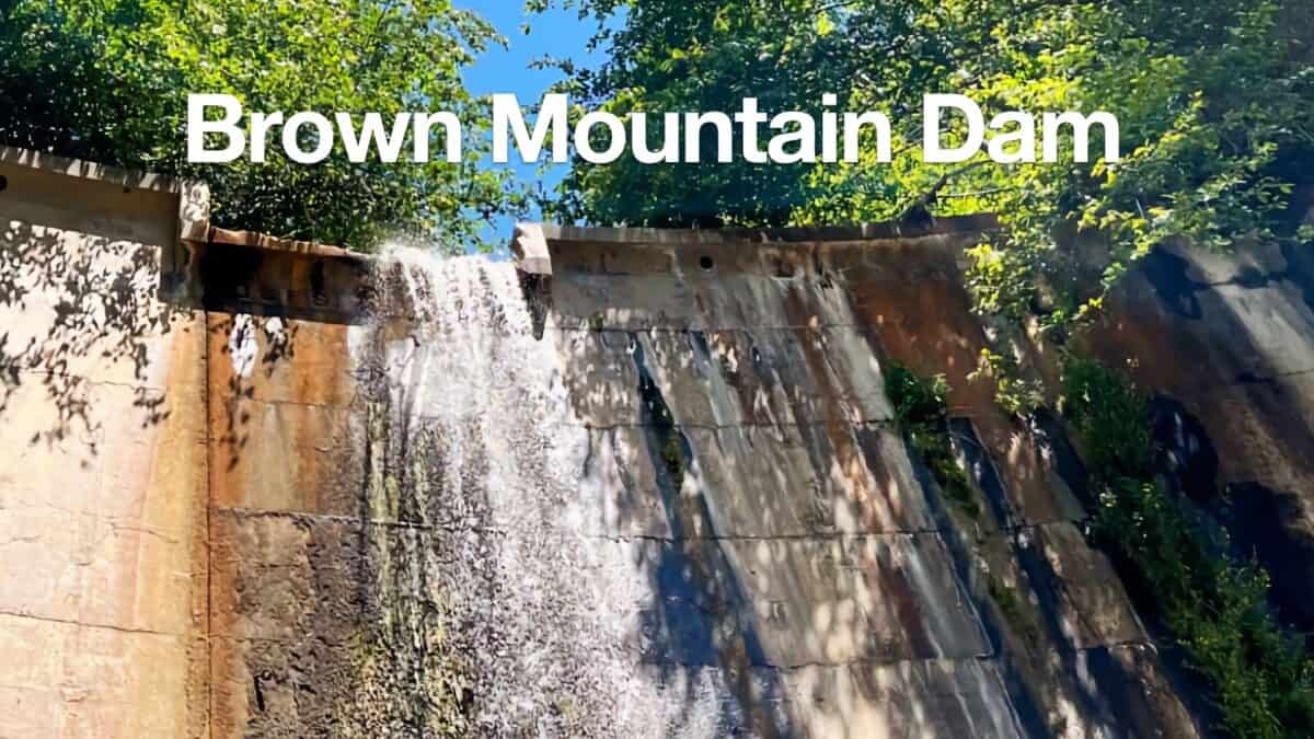 Hike Brown Mountain Dam (Arroyo Seco)
 Los Angeles Hikes
 Angeles National Forest Hikes
 San Gabriel Mountains National Monument Hiking
Popular Guides
 Best Hiking Gear 2024
 Hiking Boots or Shoes: Do I Really Need Hiking Boots?
 When to Hit SOS on inReach
This Guide Was Written by Cris Hazzard

Hi, I'm Cris Hazzard, aka Hiking Guy, a professional outdoors guide, hiking expert, and author based in Southern California. I created this website to share all the great hikes I do with everyone else out there. This site is different because it gives detailed directions that even the beginning hiker can follow. I also share what hiking gear works and doesn't so you don't waste money. I don't do sponsored or promoted content; I share only the gear recommendations, hikes, and tips that I would with my family and friends. If you like the website and YouTube channel, please support these free guides (I couldn't do it without folks like you!). You can stay up to date with my new guides by following me on YouTube, Instagram, or by subscribing to my monthly newsletter.