Throop Peak + Mount Burnham + Baden-Powell From Dawson Saddle
9 miles - Moderate Effort
4-5 Hours (Total)
2,700 Total Feet of Climbing
Max Elevation of 9,399 feet
Leashed Dogs Allowed
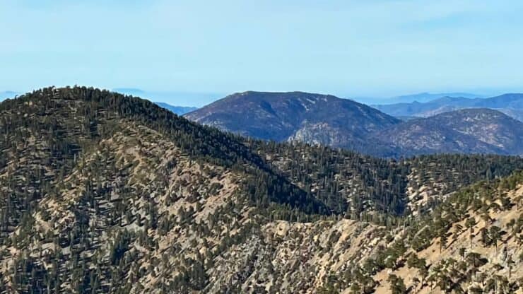
This hike, which takes in Throop Peak, Mount Burnham, and Mount Baden-Powell from Dawson Saddle, has dramatic high-mountain scenery and interesting history. This ridge of peaks was initially referred to as "North Baldy Mountain," with Throop Peak being the "West Twin" and Baden-Powell being the "East Twin." Whatever you want to call it now, this is a great hike, with three peaks to bag, expansive views, and well-groomed trails, including the PCT.
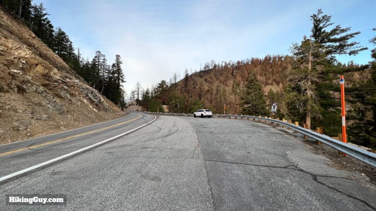
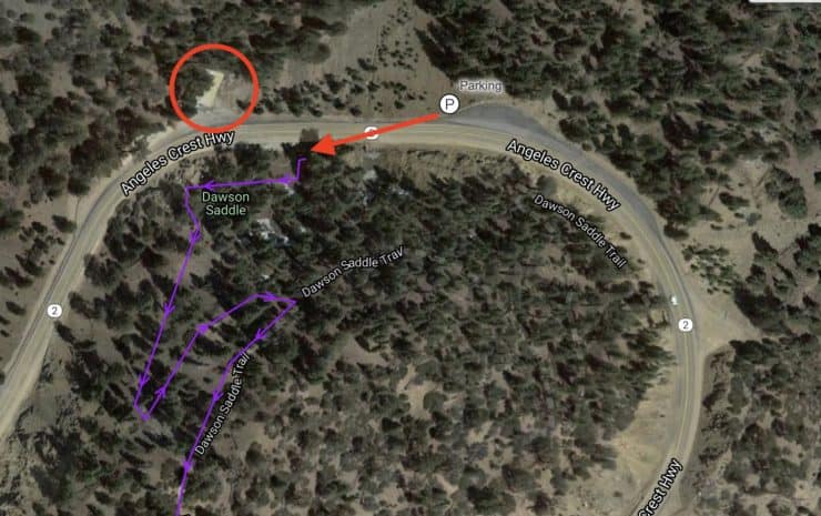
Look for this big turnout on the side of the road and park here. We're going to start the hike just west of here, about 100 feet further down the road at the Caltrans structure.
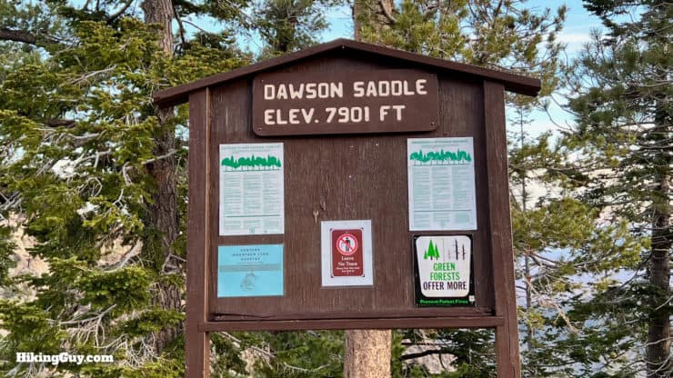
You do not need a parking pass or permit at Dawson Saddle.
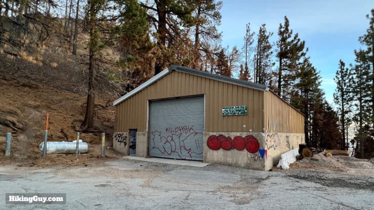
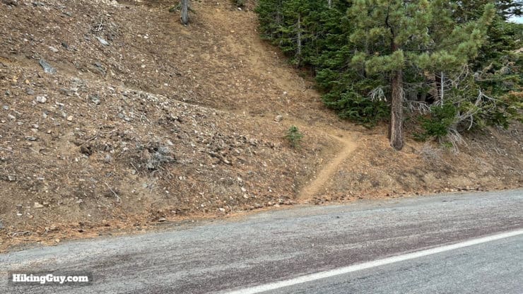
There's a trail board by the parking area. Dawson Saddle is the highest point on the Angeles Crest Highway.There are two trailheads, one about 100 east of the trailhead, and one about 100 west of the trailhead. We'll start this hike at the one west of the trailhead, a 2 minute walk along the road, directly across from the Caltrans maintenance shed. The trail starts right across CA-2 from this shed. Also note the burn by the shed, which was on the eastern edge of the 2020 Bobcat Fire.Here's the parking area, shed, and trailhead on a map.
Gear For the Hike
This is a high-altitude hike in the mountains, and you should be prepared accordingly. I find that 2L of water is usually enough, and that trekking poles are helpful on some of the steeper slopes.
Gear That I Love Right Now
Nothing is sponsored or promoted, just the actual gear that I use.
This hike will take a combination of established trails, and smaller (yet well-trodden) unofficial trails. If you have a GPS and load the GPX file, these smaller trail turnoffs should be obvious. And if not, there are plenty of footprints to go by.
This hike has some up and down, which can make it feel tougher than a single long climb. On the way back you can skip the climbs to Burnham and Throop and just cruise (mostly) downhill.
3D Map
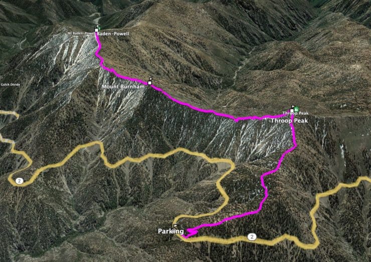
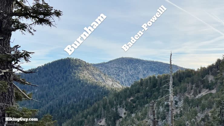
From CA-2 we'll climb up to Throop Peak, and then follow the ridge along to Baden-Powell, traversing what was once known as North Baldy Mountain.
Hike Brief
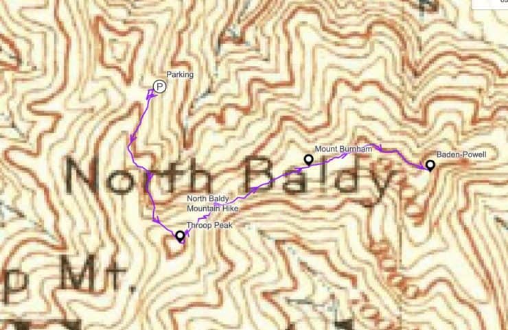
If you look at this 1901 USGS topographic map, you can see that peaks (like Mt Islip in the lower-left) have a black dot marking the summit. Here "North Baldy" marks the entire ridge, with no summit point. You can see the hike route along the North Baldy ridge in purple.
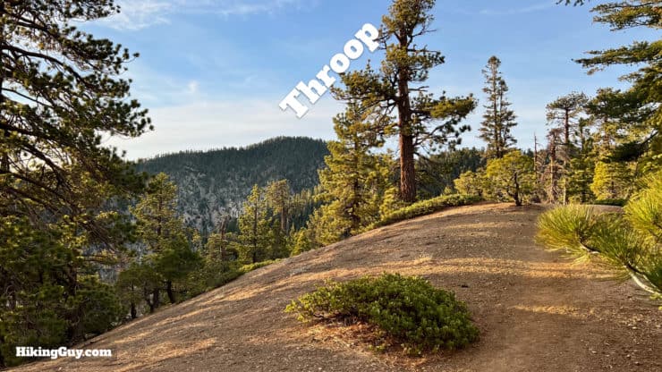
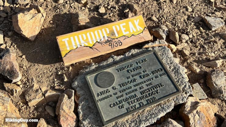
Throop Peak is pronounced "troop," but I've also heard USFS personnel pronounce it "throop."
Originally Throop Peak was called Dougherty Peak, after mountain man Charles Vincent Dougherty, aka Charles Vincent. Nearby Vincent Gap is named after him and you can visit his cabin.
In 1916 an early hiker named the peak after his alma mater, Throop Polytechnic Institute in Pasadena, later becoming the California Institute of Technology. Today a summit marker denotes that the peak is named after Amos Throop, founder of the school. I guess that all works out.
If you're doing this hike, you've probably already hiked to Baden-Powell from Vincent Gap and know that Baden-Powell was the founder of the Boy Scouts. You may not know that he never actually stepped foot on the peak of Baden-Powell or hiked around here. He was a don of the British Empire who managed to get around the globe quite a bit. He's buried by Mount Kenya.
Mount Burnham was named after Major Frederick Russell Burnham, a buddy of Baden-Powell and another guy active in the Boy Scout movement.
From 1906 to 1911 the SoCal event that people went crazy for was the "North Baldy Race" or "Baldy Race" for short, an automobile race from LA to Big Horn Mine by way of North Baldy. When the North Baldy Race was run, Angeles Crest Highway hadn't been built yet. Racers drove over dirt and rough tracks to climb thousands of feet into the San Gabriels. Photo LA Times, 1 Aug 1908.
North Baldy Ridge Hike Directions
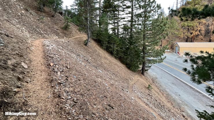
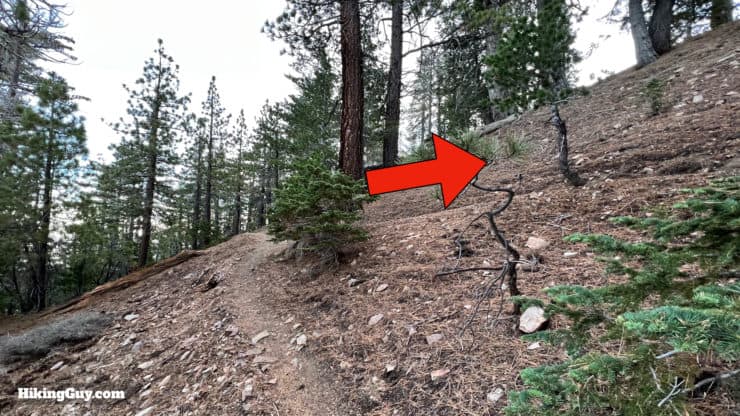
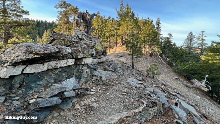
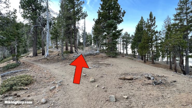
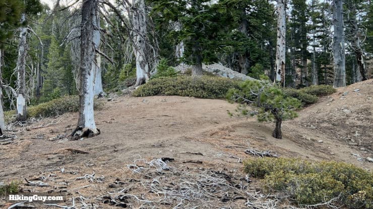
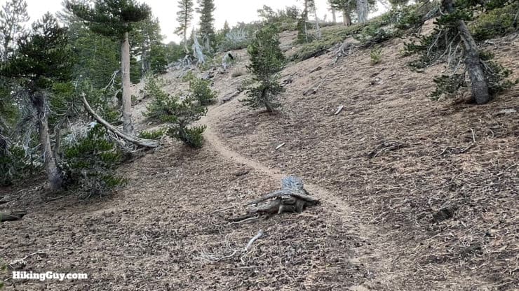
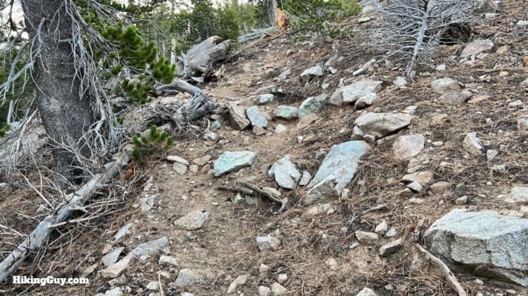
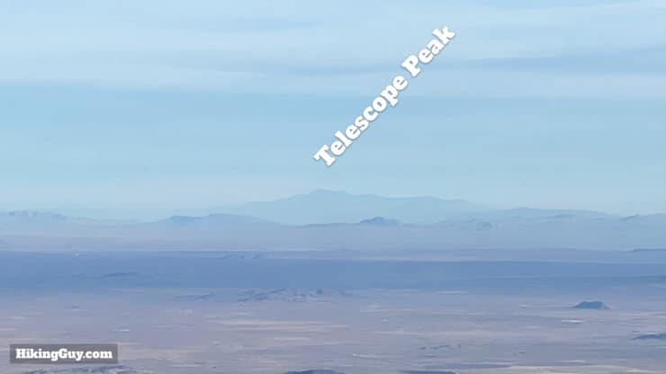
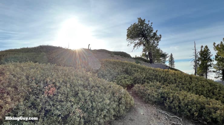
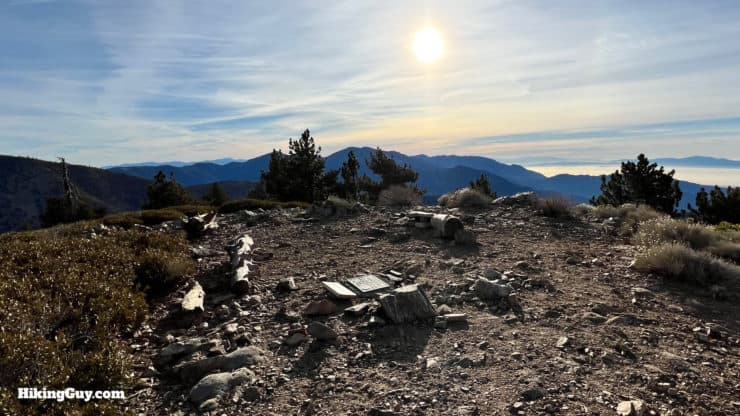
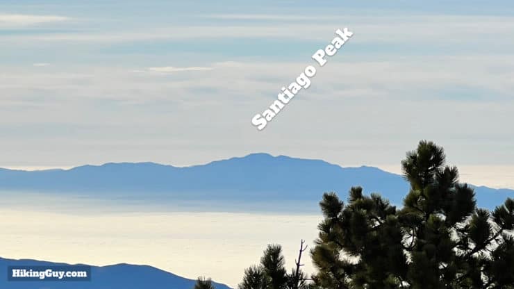
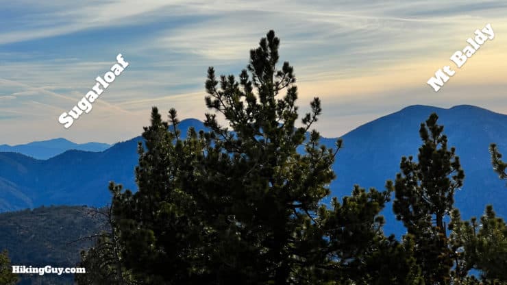
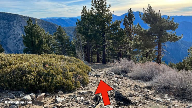
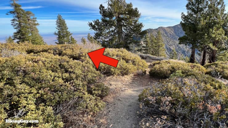
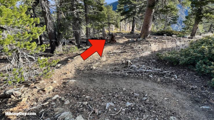
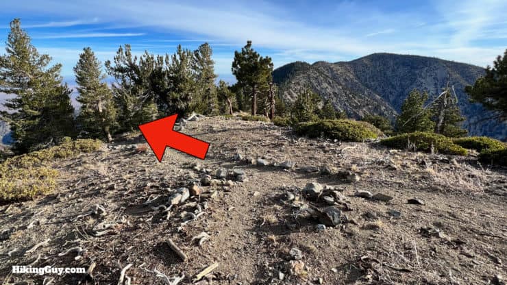
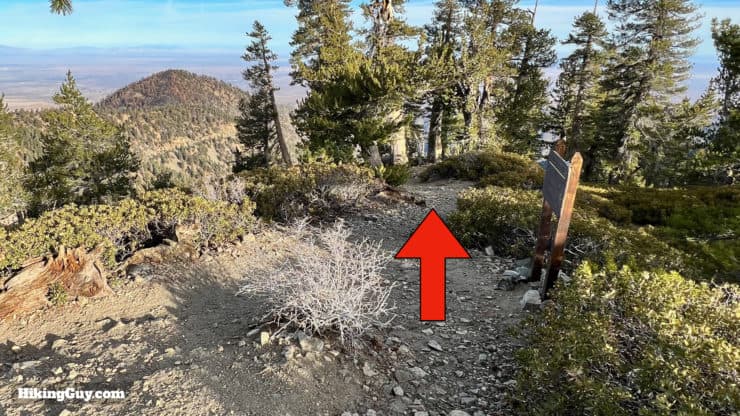
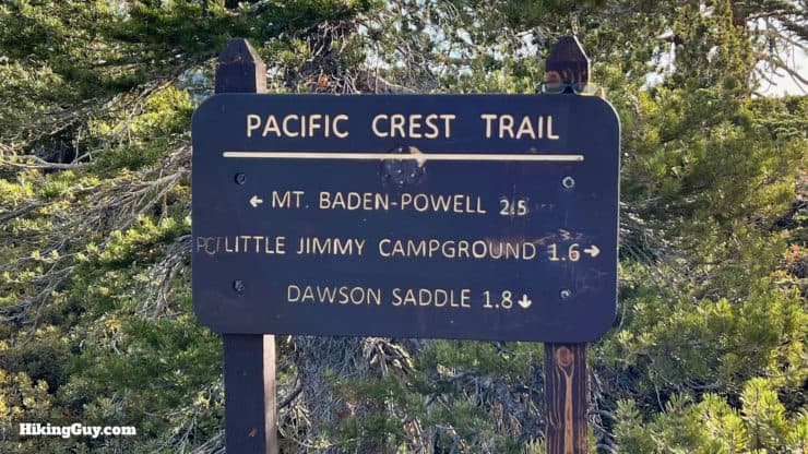
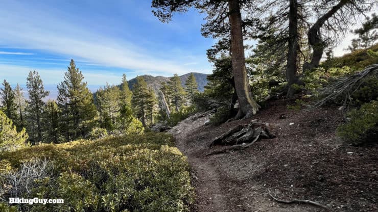
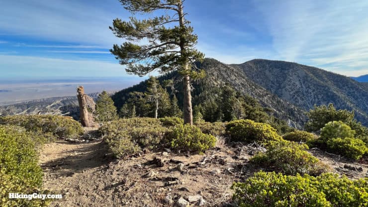
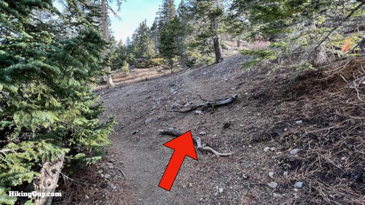
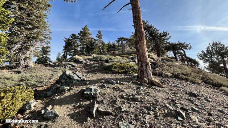
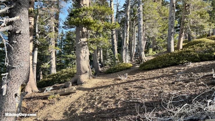
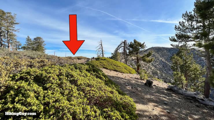
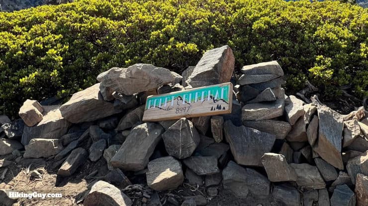
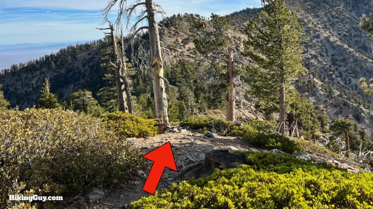
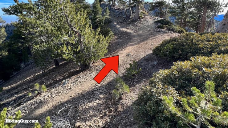
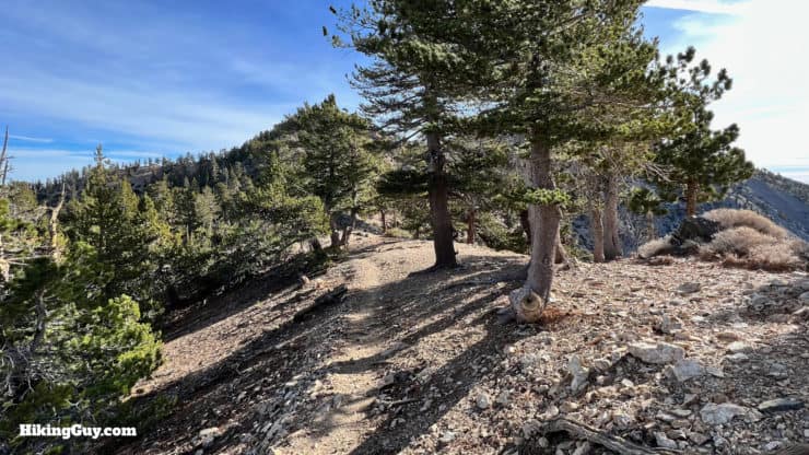
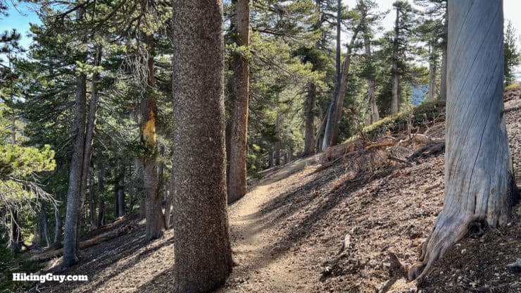
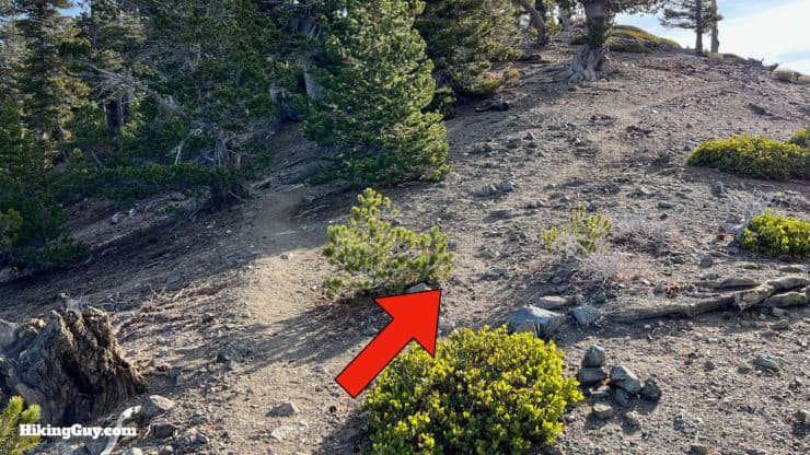
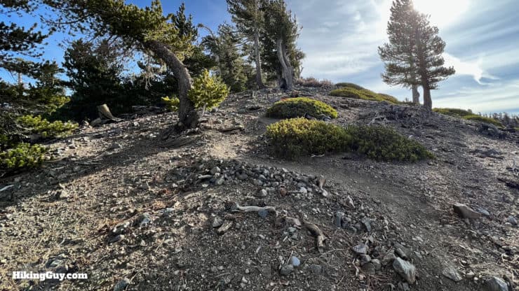
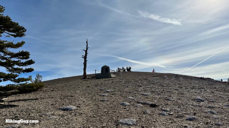
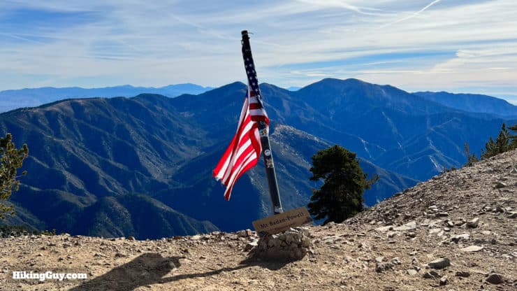
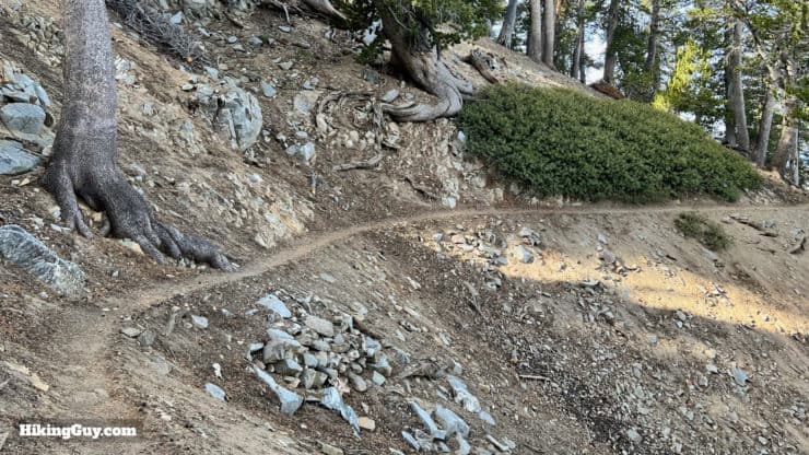
Start the trail, across the road from the Caltrans shed. The beginning is steep but it gets better.You'll start climbing up above CA-2.Make the hard right at the intersection of the trail to the other side of the parking area.You'll get nice views to the west of Mt Lawlor, Twin Peaks & Mt Waterman.When you gain the ridge and turn the corner, Throop Peak is right in front of you.You have a nice straight trail that climbs up along the ridge.To the right you'll see the antennas on top of Mt Wilson.And also see back to the distinctive Strawberry Peak. For great views of the other side of Strawberry Peak, try hiking to Josephine Peak.And then on the left you'll eventually see the peaks we'll be hiking later, Mount Burnham and Baden-Powell. We'll be following the ridge.When you get to an area with lots of campsites on your right, look for a small side trail heading up Throop Peak.The beginning can be confusing because of the tent sites, but you should be able to see a distinct trail climbing toward Throop.The trail winds up the spine.And does have a few steep and rocky parts.Take a break on the steep climb and look east toward the Mojave. On a clear day you can see Telescope Peak, the highest point in Death Valley NP.Eventually the top comes into view.And here you are at the summit area of Throop Peak.There's a memorial placard and if you're lucky, a summit sign.From Throop Peak you'll get great views, including Santiago Peak to the south.And to the east, you can see Mt Baldy and even Sugarloaf, which is close to Big Bear.Head down the other side of the summit.The trail down will bear to the left.Follow the steep path downhill toward the ridge.Make the left onto the PCT.And then continue to the right along the ridge on the PCT. When you come back, just go straight here to bypass the climb to Throop Peak.Here's the massive sign at the PCT junction. We're heading toward Mt Baden-Powell.This part of the hike is beautiful as it follows the ridge.Eventually you'll get views of Burnham and Baden-Powell ahead.When you reach the base of Mount Burnham, look for a small trail climbing to the right.The climb to Burnham is steep at first.But then mellows out a bit.Look for the marker to the right of the summit area.Here you are, Mt Burnham.Similar to Throop, we're going to continue down the other side of the summit to rejoin the PCT.When you reach the PCT, bear right to continue towards Baden-Powell.Then you'll have another spectacular hike along the spine of the mountain.The PCT heads to the left side of the ridge.And then at the base of Baden-Powell, look for a small side trail heading uphill.It's a short but steep climb to the summit.But soon you'll see the Baden-Powell monument ahead.And then past that, the summit!
From here, just turn around and head back.
You can skip the use trails to Burnham and Throop summits if you just follow the PCT and Dawson Saddle Trails straight. The trail will wind along the east side of the ridge, skipping the summits.
Need More Info?
Have a question about the guide or want to see what other people are saying/asking? View the Youtube comments for this video. Leave a comment and I will do my best to respond.
When planning, always check the park website and social media to make sure the trails are open. Similarly, check the weather and road conditions.


 Using the Apple Watch for Hiking
 Garmin Fenix 7 & Epix Review For Hikers
 How To Read a Topographic Map
 Garmin GPSMAP 67i Review
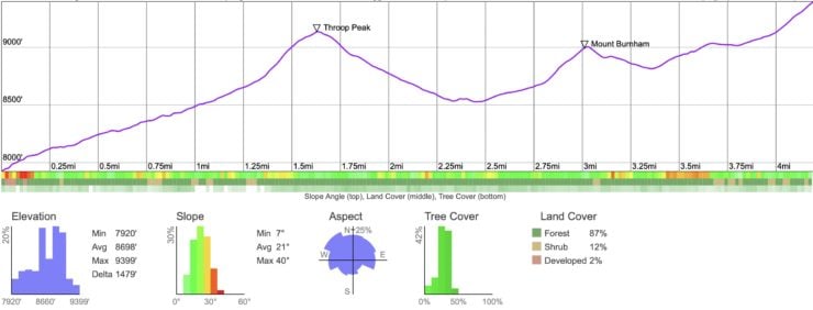


 Hike Mt Waterman & Twin Peaks
 Mt Hawkins Loop Hike (Hawkins, Middle, and South Mount Hawkins)
 Mt Baden-Powell Hike
 Hike Wright Mountain From Inspiration Point
 Los Angeles Hikes
 Angeles National Forest Hikes
 Backpacking Trips
 LA Mountain Hikes
 San Gabriel Mountains National Monument Hiking
 Sierra Club 100 Peaks
 Best Hiking Gear 2024
 Hiking Boots or Shoes: Do I Really Need Hiking Boots?
 When to Hit SOS on inReach