The Verdugo Mountains, often overshadowed by their bigger neighbors, offer great hiking and trails right in the middle of LA. This hike on the popular Vital Link Trail takes you to the highest point in the range, Verdugo Peak. The Vital Link Trail is a tough one, but you're rewarded along the way with panoramic views from the ocean to the San Gabriels. And the Burbank trailhead makes it convenient to most of LA.
In this Guide:
Video & Turn by Turn Vital Link Trail Directions
How to Get to the Vital Link Trail
Everything You Need to Know To Prepare for the Hike
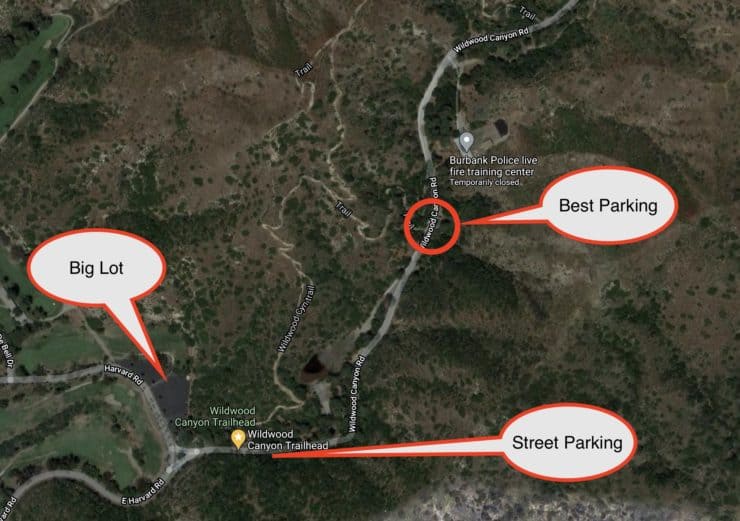
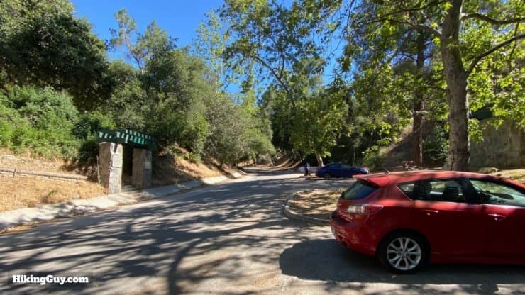
The hike starts at Burbank's Wildwood Canyon Park. There are several trails in the park, which can get confusing, so make sure you pay attention to the starting directions below. There is plenty of free parking at the hike.
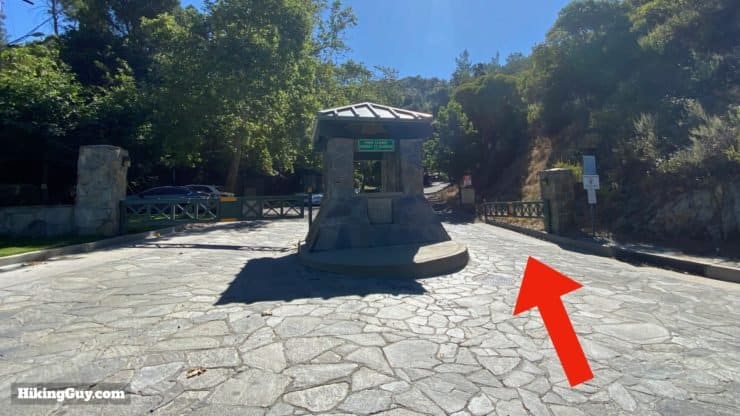
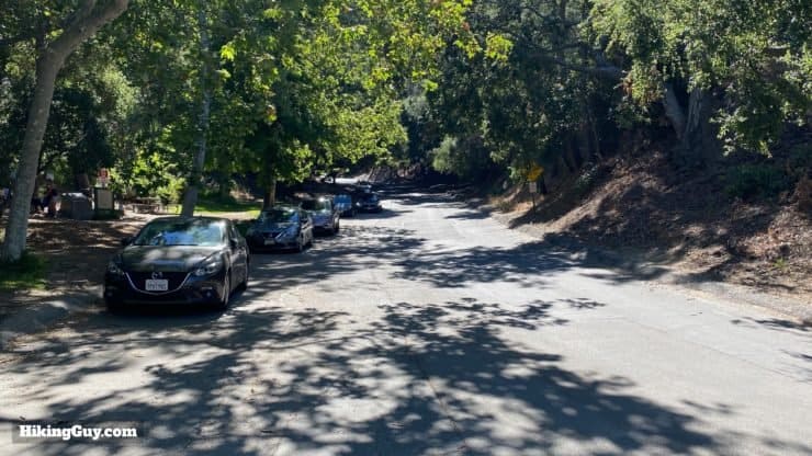
When you pull into the park, drive up the paved road until you get to the trailhead. If there are no parking spots, you can park further down and walk up the park roadEnter the park at the gate.There is some street parking when you first go through the gate. Otherwise keep going up the road.When you get to the 2nd big stone arch (on the left), park. If you can't park here, just park further down the road.
There are a few use-trails in the park that all lead to the Vital Link Trail. These hike directions use the trailhead described here.
The park has port-a-potties and water fountains (that don't always work). I'd take care of your business and fill up with water before you get here.
Gear for the Hike
The main thing to be aware of is the lack of shade and the heat. If you are doing this hike when it's hot out, use sun protection and bring plenty of water. I usually bring 2L. The trail is steep and sandy, so good hiking footwear and trekking poles will help on the steeper slope.
Gear That I Love Right Now
Nothing is sponsored or promoted, just the actual gear that I use.
The trails to Verdugo Peak are not well marked, but are relatively easy to follow. The Vital Link Trail has lots of cut-offs, and it can be hard to know what is a trail cut-off and which is a trail junction. If you have a GPS, loading the GPX file helps.
If you look at the OSM map, you'll see lots of trails that (as of me writing this) are not there. They might have been at one point, or are small use trails, but in general there is a lot in the OSM map that's not hike-able.
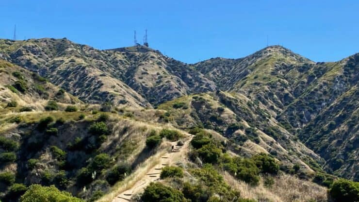
The brunt of the climbing is in the first half of the hike. There's no warmup. It's pretty much straight up. At the end of the Vital Link Trail you reach the Verdugo Motorway (dirt) and then it's just a cruise to Verdugo Peak.
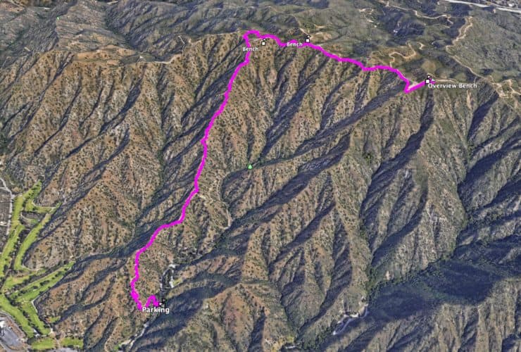
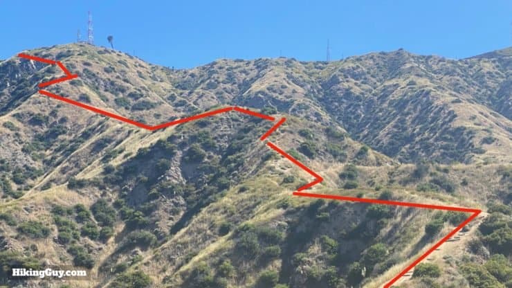
3D Map
From this view you can see how the Vital Link Trail heads straight up the ridge. Once at the top, you follow the spine to Verdugo Peak.
Vital Link Trail to Verdugo Peak Hike Directions
FYI "Verdugo" means executioner or hangman in Spanish.
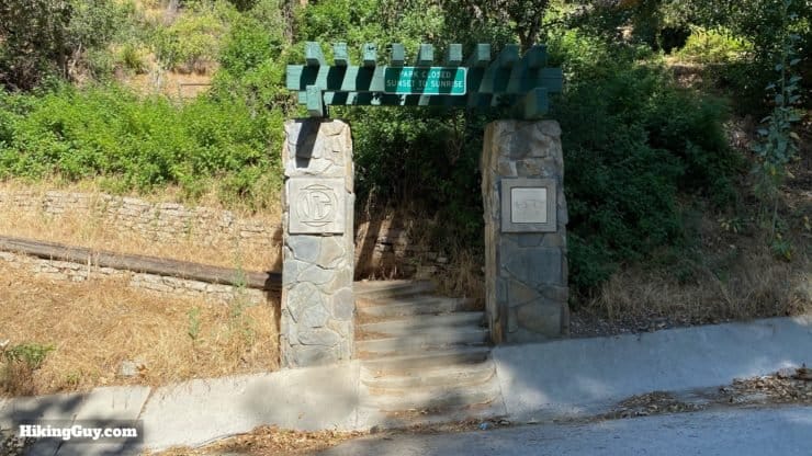
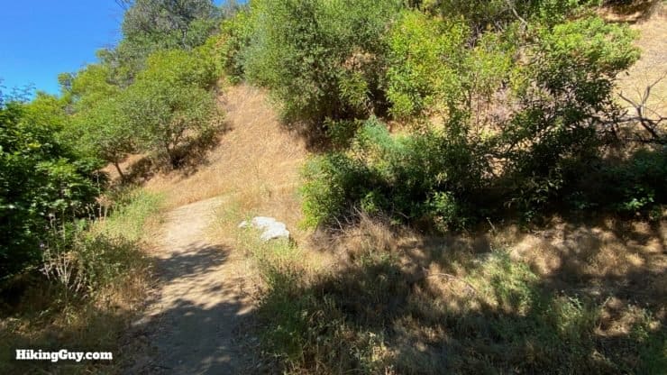
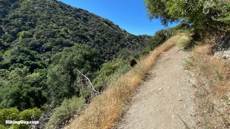
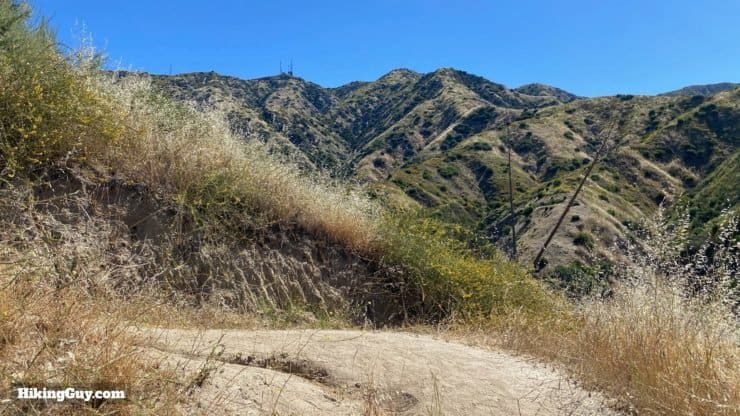
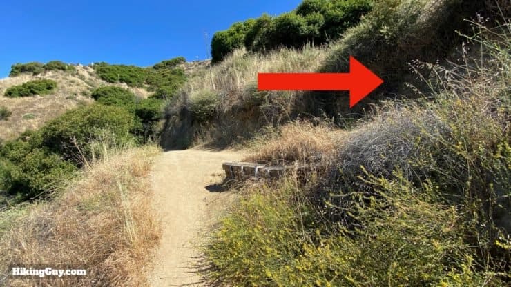
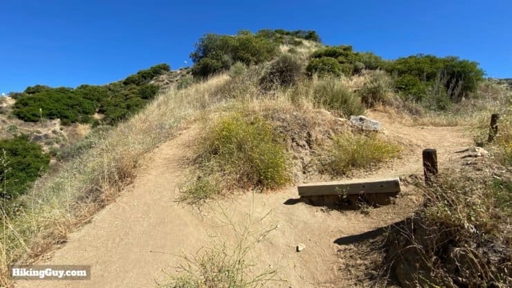
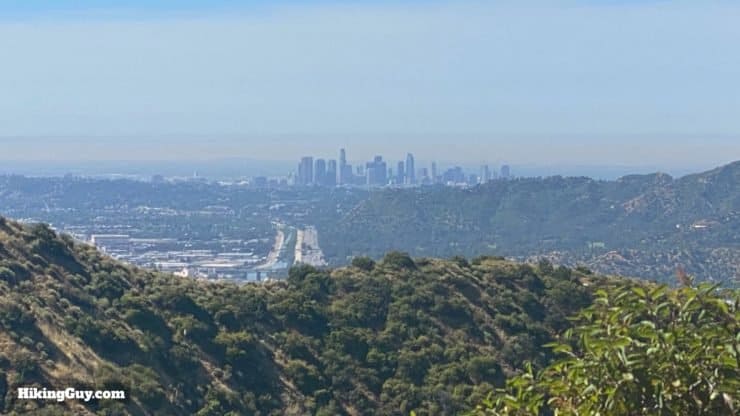
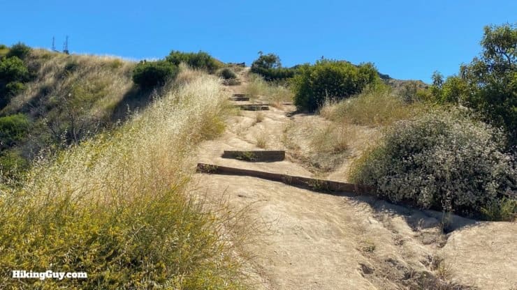
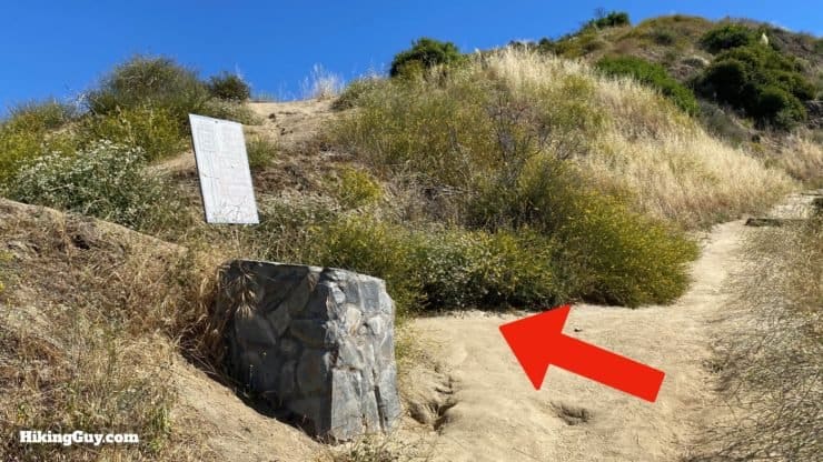
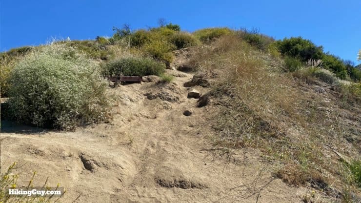
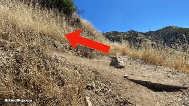
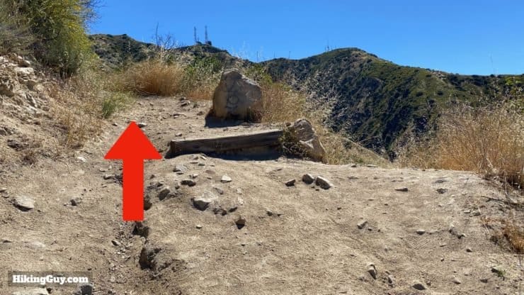
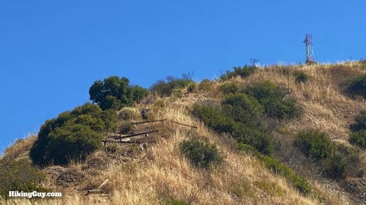
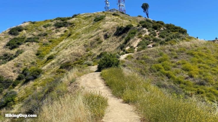
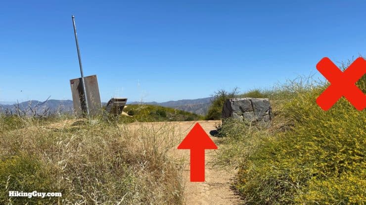
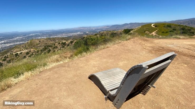
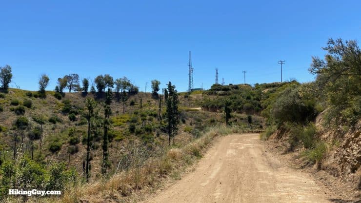
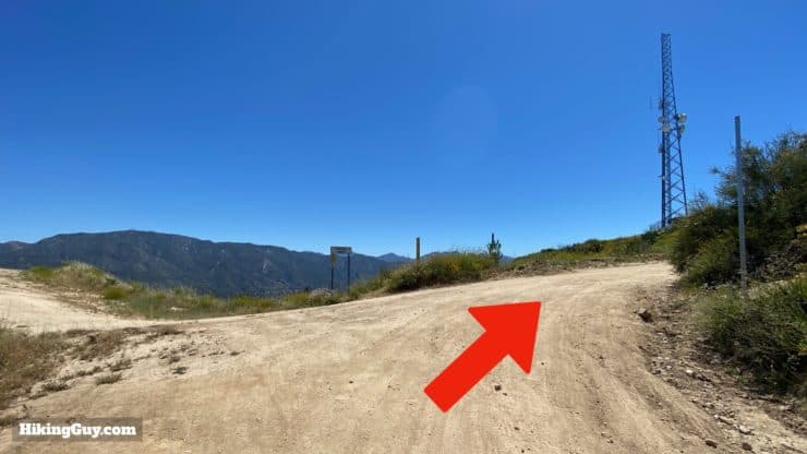
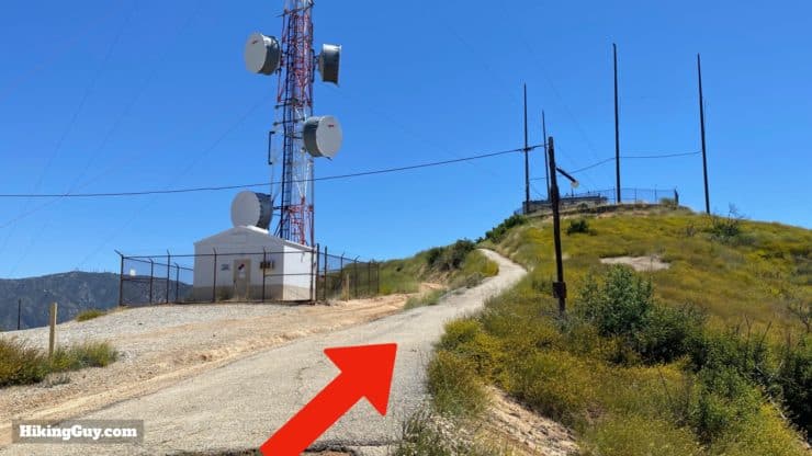
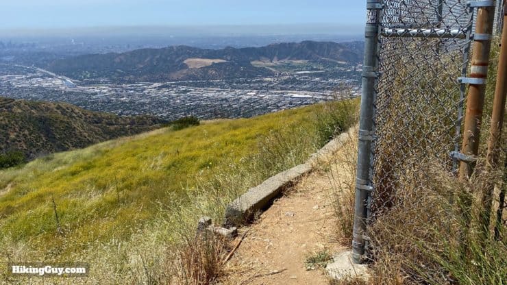
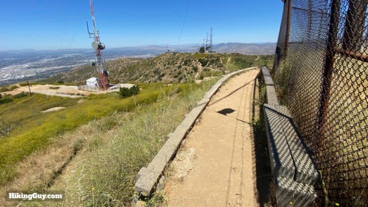
Start by hiking through the stone archway. Such a grand entrance!You immediately start hiking up some short, steep switchbacks.And soon you'll start getting great views as the switchbacks leave the tree cover. That's it for the shade.When you come around a bend you'll be able to see Verdugo Peak in the distance. It's the peak with one big tower to the right.When you get to this junction, make the hard right. The trail to the left is the connector trail that came in from the lower part of Wildwood Canyon Park.After that you really start going up. This photo gives you an idea of how steep it is. Also notice the cutoffs. There are so many cutoffs that it's hard to know which is the official trail. A good rule of thumb here is that you'll never being going downhill. If you are, you're probably on the wrong trail.When you need to catch your breath, turn around to enjoy some sweet views of downtown LA.There are a small handful of trail sections that are level, but they're few and far between.After that last flat section, you'll be able to see the Vital Link Trail snake up the ridge to the radio towers.Keep climbing....And when you see this stone column, make the left onto the Vital Link Trail. This stone column marks the official start of the Vital Link Trail.And you guessed it, more climbing!Make the left at the next junction.And stay left at the following junction.The last stretch might be the toughest. You'll see the trail climbing above you.Soon you'll approach the communications towers, which is where Vital Link Trail ends.The big climb is over! When you get out to the fire road, go STRAIGHT, away from Verdugo Peak, not right, which is what your intuition will tell you to do.There's a very cool chair at this junction.
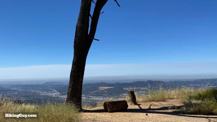
If you go right, there is a dead end at some communications equipment, but there's also a hidden, shady bench. I marked the waypoint in the GPX file. It's a nice place to catch your breath before continuing.
Here's what that bench looks like to the right.
Okay, back to the directions to Verdugo Peak.
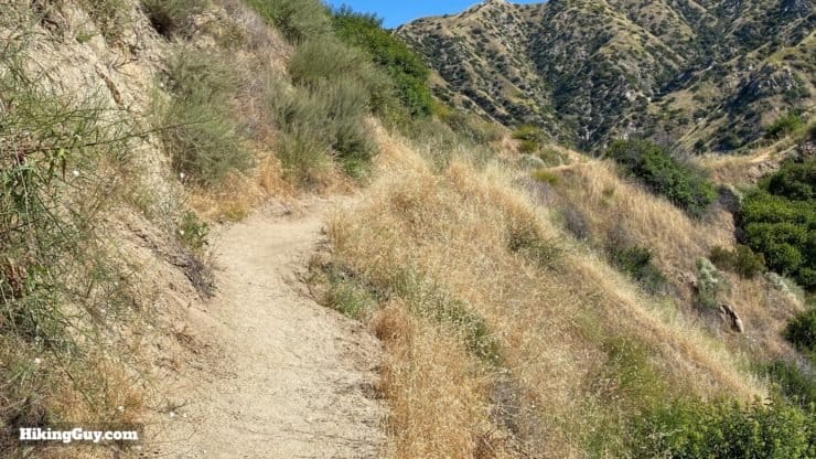
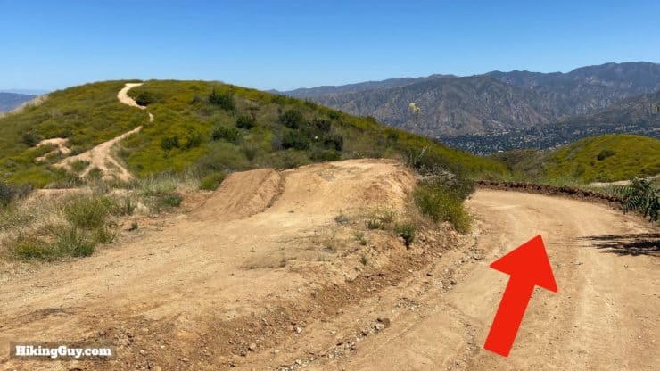
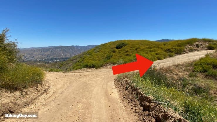
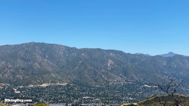
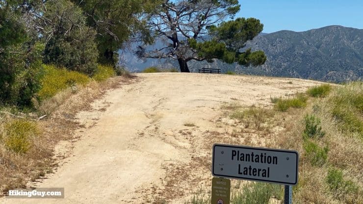
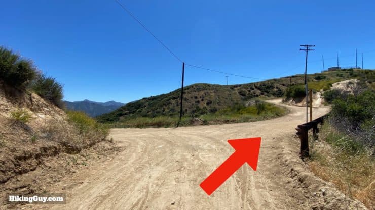
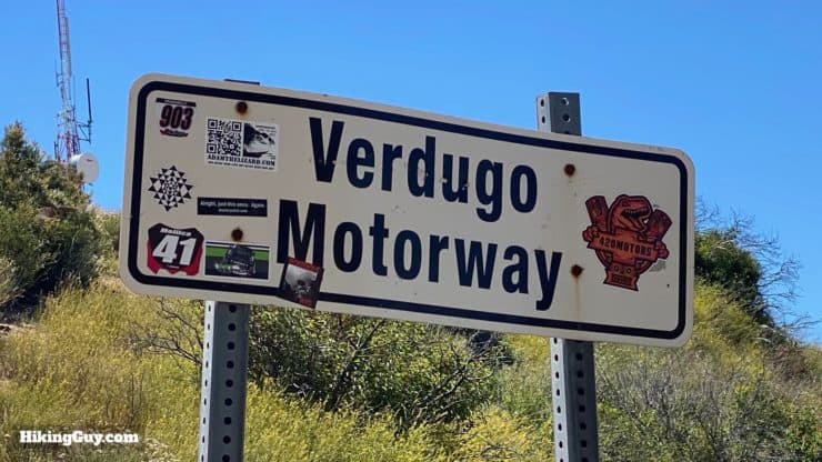
Once coming out on the fire road, head straight, away from Verdugo Peak. The road will twist back to the right.When you get to the intersection, make the right. From here on out you'll be heading in the direction Verdugo Peak on the Verdugo Motorway.You'll get some incredible views of Angeles National Forest as you hike along the Vedugo Motorway. The big mountain with the antennas on it is Mt Lukens and the pointy one on the right is Strawberry Peak.Keep heading straight on the fire road.You can still see evidence of the 2017 La Tuna fire.At the intersection with Plantation Lateral, make the right.There's a nice bench if you want to make a 2 minute detour at the Plantation Lateral junction. There's also a swing there, but it's easy to hit your head, so be careful!Keep hiking and make the right at the next junction for the Hostetter Fire Road.Soon after that you'll see the Verdugo Motorway sign that lots of people pose with on their social media posts.Follow the paved path up to Verdugo Peak.The top is fenced in, but you can walk around the fence for the views.If you keep walking around the fence you'll find some benches.Verdugo Peak has great prominence and on a clear day, you can see the Santa Monica Mountains, Catalina, Long Beach and the San Gabriels.
From here you just turn around and go back the way you came!
Need More Info?
Have a question about the guide or want to see what other people are saying/asking? View the Youtube comments for this video. Leave a comment and I will do my best to respond.
When planning, always check the park website and social media to make sure the trails are open. Similarly, check the weather and road conditions.


 Using the Apple Watch for Hiking
 Garmin Fenix 7 & Epix Review For Hikers
 How To Read a Topographic Map
 Garmin GPSMAP 67i Review
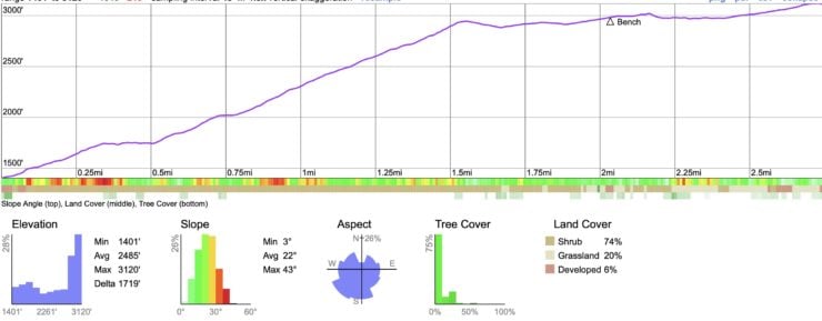

 Echo Mountain & Inspiration Point Hike
 Potato Mountain Hike (Angeles National Forest)
 Los Angeles Hikes
 LA Mountain Hikes
 Best Hiking Gear 2024
 Hiking Boots or Shoes: Do I Really Need Hiking Boots?
 When to Hit SOS on inReach