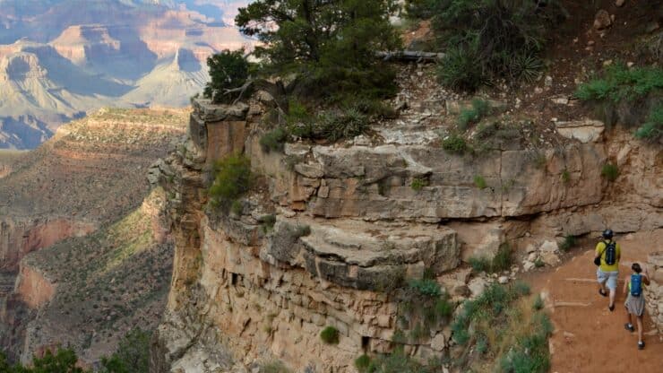

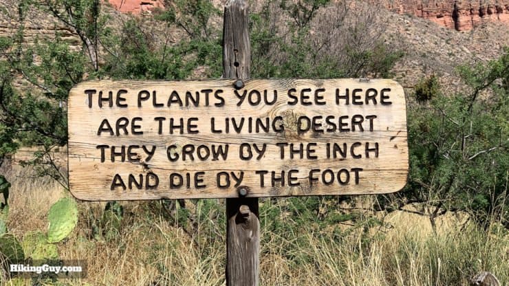
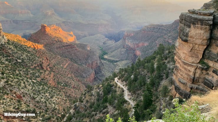
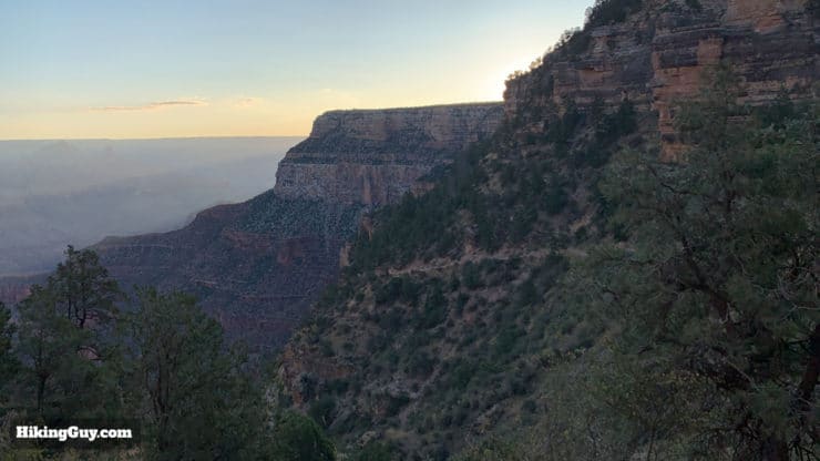
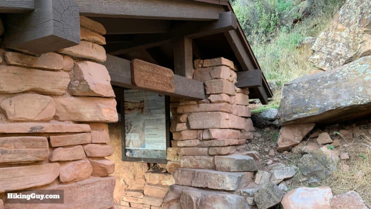
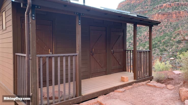
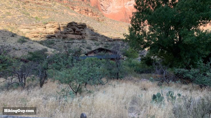
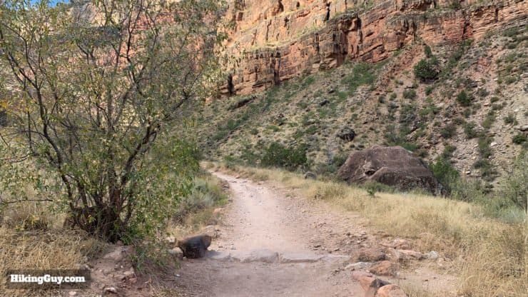
If you had to pick a "must-do" hike in the Grand Canyon, hiking to Indian Garden on the Bright Angel Trail is the one. The trail is considered the Grand Canyon's premier hiking trail; it's very well maintained, safe, and spectacularly beautiful. You'll hike down into the Grand Canyon, experiencing all the wonders it has to offer without any hardships aside from the climb back up. The trail has water stations and bathrooms, making it very beginner-friendly. And Indian Garden is an oasis in the depths of the Grand Canyon where you can relax in the shade, talk to a ranger, and have a picnic.
- Turn-by-Turn Hike Directions & Video
- Fitness Level and Gear to Hike to Indian Garden
- Tips on Weather, Parking, and Planning
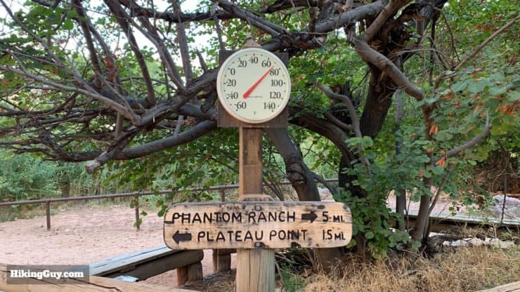
A shorter option is the hike to 3 Mile Resthouse. Want a longer hike? Try the hike to Plateau Point.
Don't forget to check out my Grand Canyon hiking tips here!
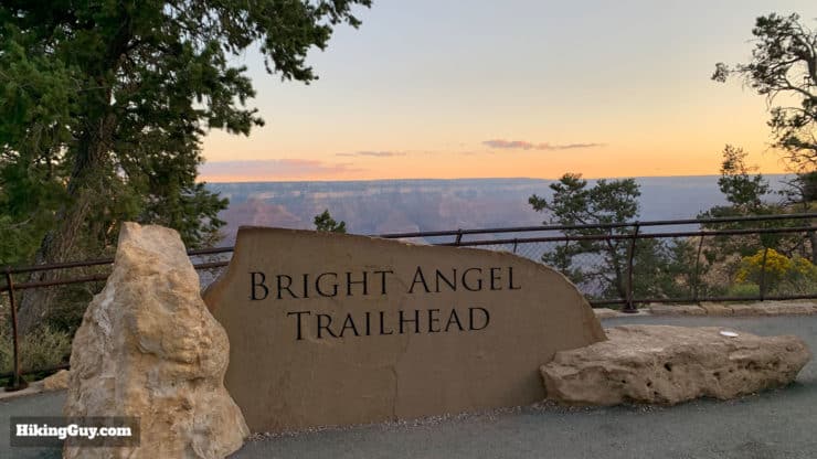
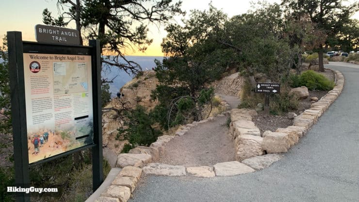
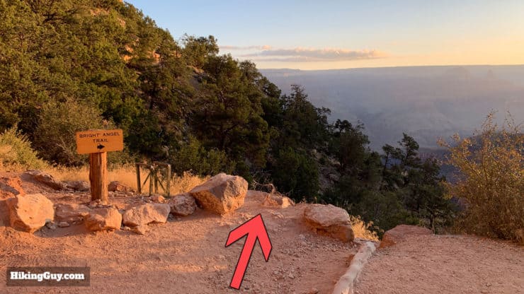
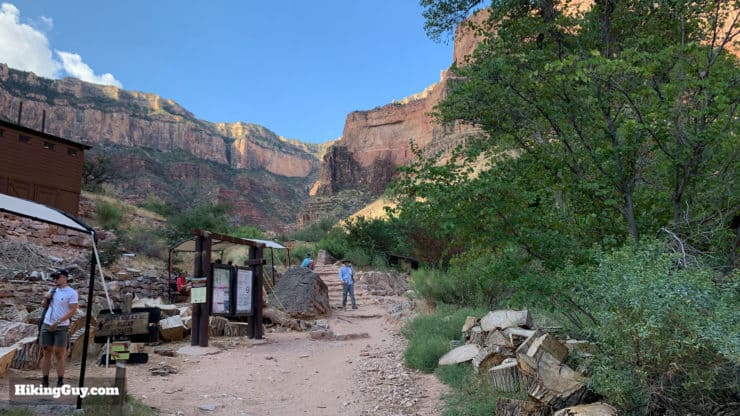
How to Get to the Bright Angel Trail
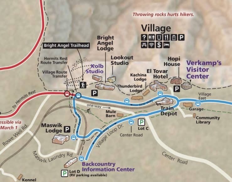
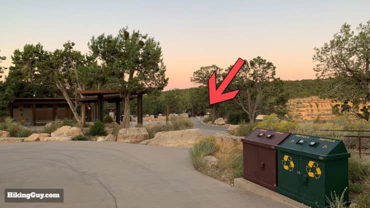
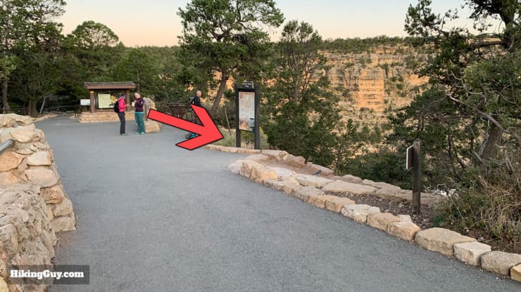
The Bright Angel Trail might be the most popular trail in Grand Canyon National Park, but it's still tricky to find. I recommend navigating to the Bright Angel Lodge, and then from there, following the maps below to the parking areas.
Use this navigation address:
Bright Angel Lodge, 9 Village Loop Drive, Grand Canyon Village, AZ 86023
If you're using Google Maps, the actual trailhead is on there too:
Bright Angel Trailhead, 15 Bright Angel Trail, Grand Canyon Village, AZ 86023
Once you are in the lodge area, you can park anywhere that you don't see a no-parking sign or staff parking sign. The parking lots are shared with visitors staying in accommodations such as Bright Angel Lodge.
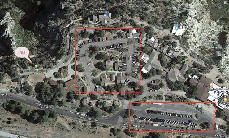

The Blue Line Shuttle Bus is a good option to get to the trailhead if you're parked or staying somewhere else in the park. The bus runs year-round. The Hermit's Rest Route Transfer stop is closer to the trailhead than the Bright Angel Lodge stop, but either one will be fine.
I've hiked Bright Angel many times and I've never had a problem parking by the trailhead when I get there just before sunrise.
Gear For the Indian Garden Hike
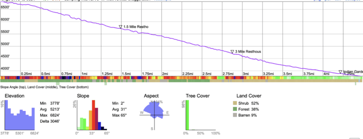
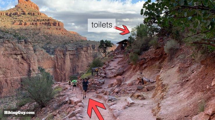
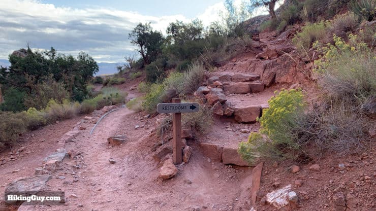
The hike to Indian Garden is 9 miles with 3,000 feet of climbing. It's a "hike hike" and I recommend having proper hiking gear when doing it. That means trail runners or hiking boots, trekking poles, and at least 1 liter of water, preferably 3L. That said, if you only have fitness clothes, sneakers, and a backpack with water bottle(s), the great condition of the Bright Angel Trail and frequent water sources make it doable like this. Just don't skimp on the water.
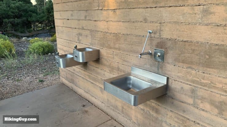
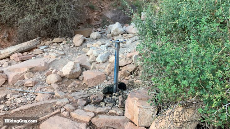
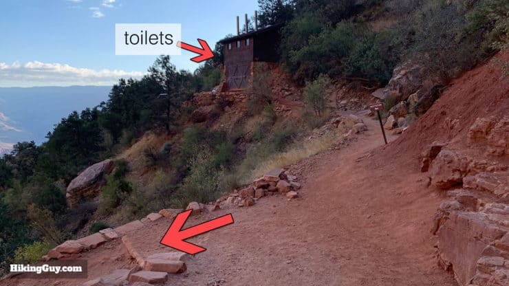
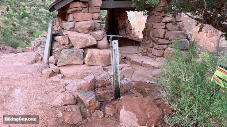
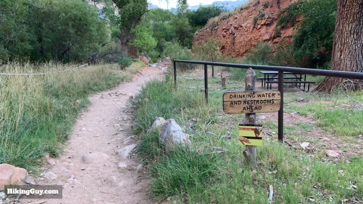
Taking some snacks will help keep your energy up for the trip back. If it's hot out, try some energy gels which are easier to get down in high temperatures. You can refill your water at many points along the trail (see the directions later). Water is available year-round at Indian Garden but only seasonally at the other points. Sometimes there are water station closures, so make sure you check the alerts page before you go.
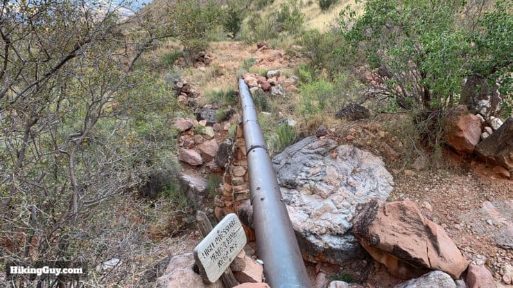
The water you see on the Bright Angel Trail (and most of the South Rim) is pumped up from Roaring Springs, 3,100 feet below the North Rim. The Parks Service has an interesting video about it here.
The weather in the Grand Canyon can be extreme. In the winter, bitter cold, ice, and snow is not uncommon. So pay close attention to the weather for Grand Canyon Village. If there is snow, the Bright Angel Trail can be covered. In those conditions micro-spikes and trekking poles are a must. There can be ice on the upper parts of the trail.
And of course, in the summer, it gets hot. You'll feel the heat the most when you descend into the canyon to Indian Garden. The canyon walls offer some shade at the right part of the day, but there are sections exposed to the sun, so protect yourself. The temperature rises about 5.5F for every 1,000 feet that you descend. So you can expect Indian Garden to be about 16-17F warmer than the trailhead at the South Rim. In the warm months of summer, this hike is not a good idea during mid-day.
Gear That I Love Right Now
Nothing is sponsored or promoted, just the actual gear that I use.


Fitness To Hike To Indian Garden
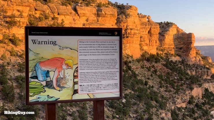
Grand Canyon hikes are deceiving. Unlike mountain hikes where you do the climb and then get an easy hike back down, in the Grand Canyon it's oh-so-easy hiking miles downhill, but then you have to turn around and go back up. As the park rangers like to say, there's no shuttle bus from the bottom of the canyon to the top. So even if you are comfortable hiking for 12-13 miles, you need to be prepared to hike over 3,000 feet on the way back out, after having hiked over 6 miles down. 3,000 feet is just over a half a vertical mile.
The best training is to hike 7-9 mile mountain trail with at least 3,000 feet of climbing. That can be tough if you don't live near the mountains. But if you exercise regularly and are in good shape, you can approximate the effort by using a stair machine or treadmill. The approximate gradient between Indian Garden and the South Rim is around 14%, and it should take you about 2 hours. So dial in that gradient and time into your machine and give it a try. It doesn't have to be fast, and you can pause for breaks as you normally would on the trail, but that should get you close to the effort.
It's not uncommon to climb back out at half the pace that you descended. Most folks go down at between 2-3mph, and climb back out between 1-2mph.
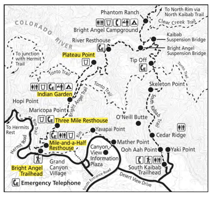
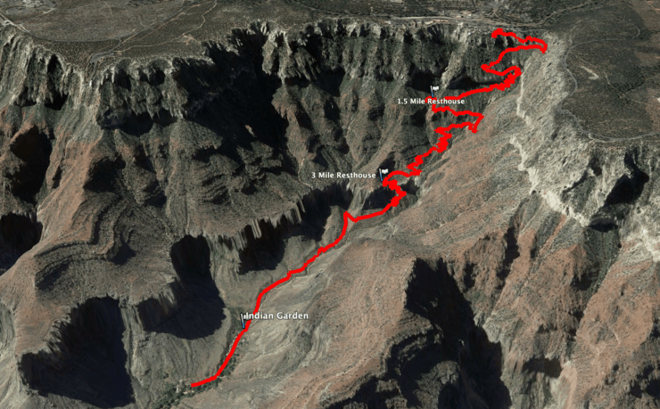
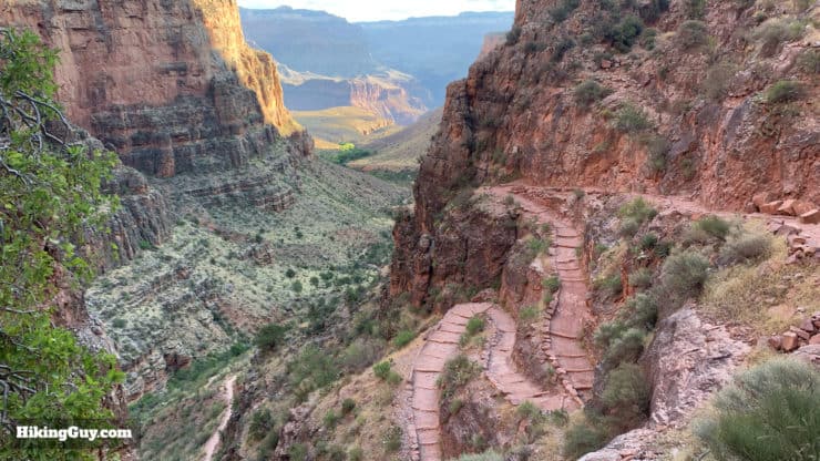
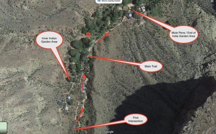
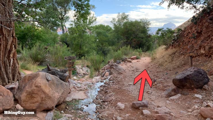
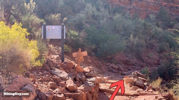
Bright Angel Trail To Indian Garden Maps
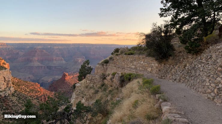
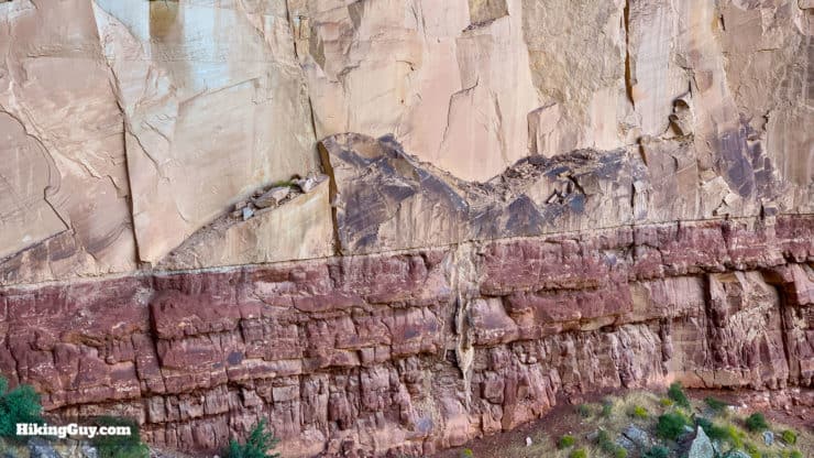
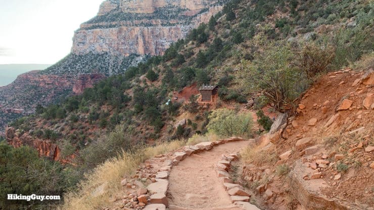
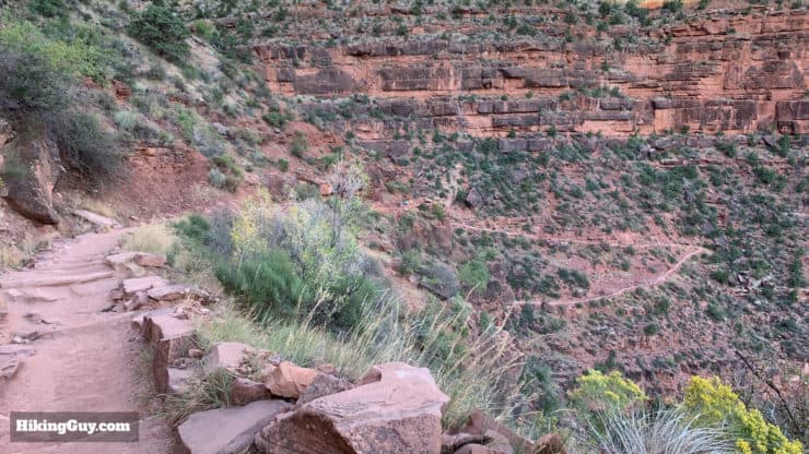
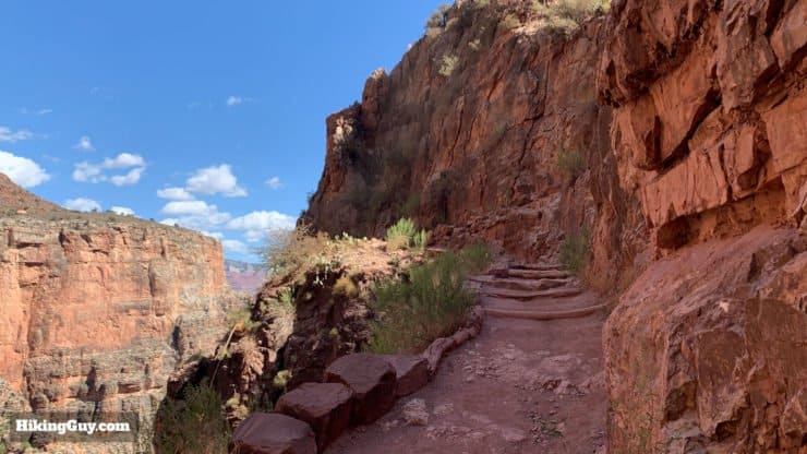
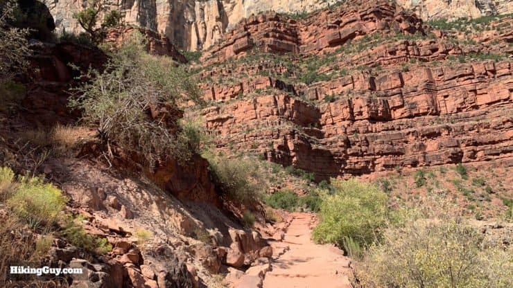
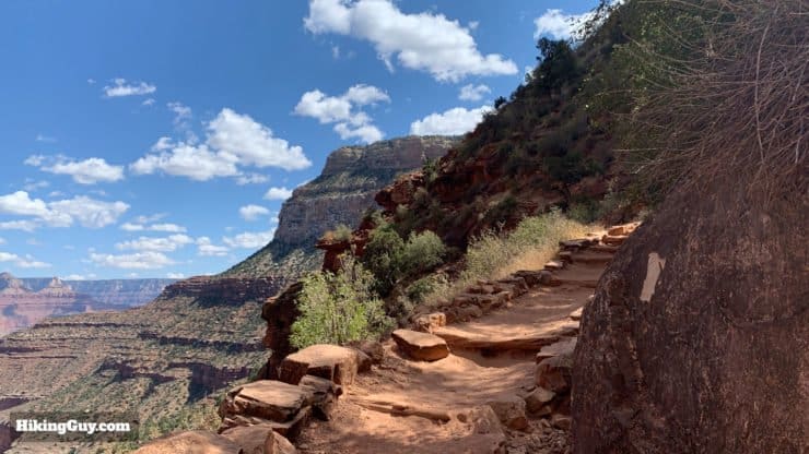
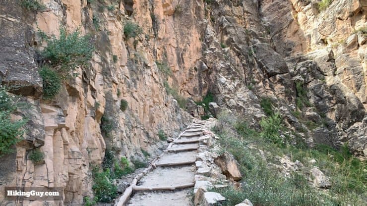
The Bright Angel trail is what the Parks Service calls a corridor trail. The corridor trails are heavily used and actively maintained. The Bright Angel Trail is the most used trail in the park. It's built with a standard gradient (overall) of 10% and has a standard width of 4 feet wide. What that means in practical terms is that, while it's a tough trail, it's never too steep and never so narrow that you're walking on a precipice.
Overview Map
Interactive Map
How Will You Navigate?
 Using the Apple Watch for Hiking
 Garmin Fenix 7 & Epix Review For Hikers
 How To Read a Topographic Map
 Garmin GPSMAP 67i Review
Landmarks on Indian Garden Hike
| Landmark | Distance | Elevation | Water |
|---|---|---|---|
| Trailhead | 0 | 6850 | yes |
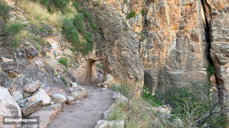
| 1st Tunnel | 0.18 | 6708 | no |
| 2nd Tunnel | 0.75 | 6240 | no |
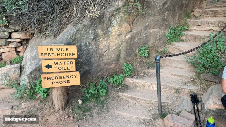
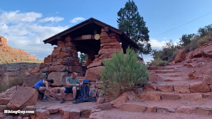
| 1.5 Mile Resthouse | 1.5 | 5730 | Spring to Fall |
| 3 Mile Resthouse | 3 | 4750 | Spring to Fall |
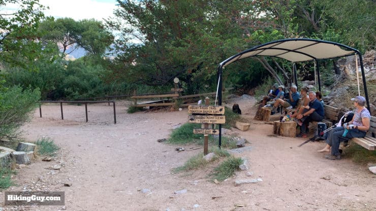
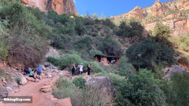
| Indian Garden | 4.5 | 3800 | yes |
3D Map
Elevation Profile
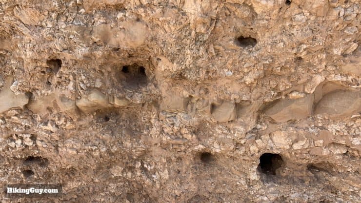
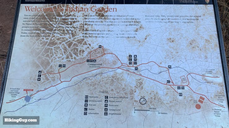
Mules on the Trail
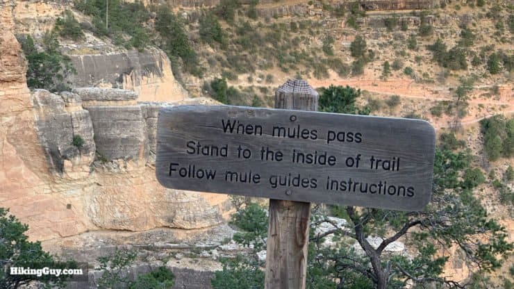
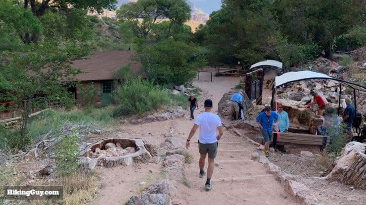
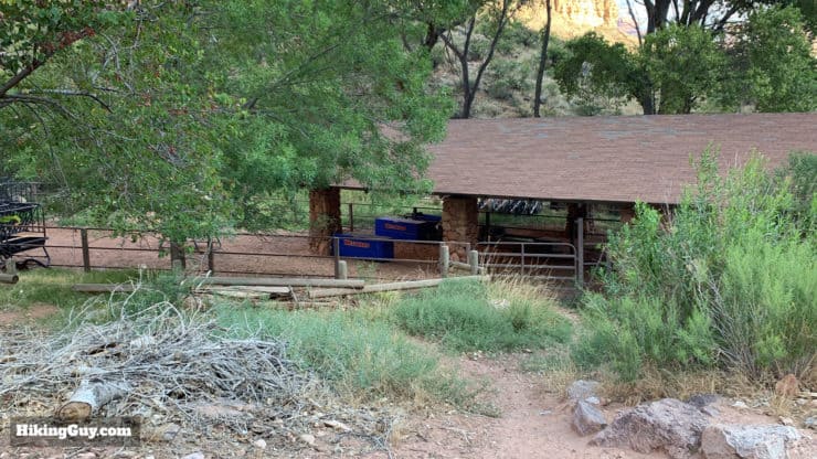
For over a century ,mules have been hauling gear, supplies, and people in and out of the Grand Canyon. Right behind the Bright Angel Trailhead is a mule pen used on the trail. These mules take people down to Indian Garden for a day trip and to Phantom Ranch for an overnight trip. Mule trips are very popular, can be booked 15 months in advance, and fill up quickly.
As a hiker on the Bright Angel Trail, the mules can be a pain. If you get stuck behind them, you'll be stuck behind them for a while, until the mule handler allows you to pass. Oh, and they'll be crapping too. If you are going in the opposite direction as the mules, you should stand as close to the inside of the trail as possible and let them pass as you heed the mule handler's instructions.
Mules aren't aggressive, but they can bite. Keep your hands to yourself. Don't try to pet or feed the mules.
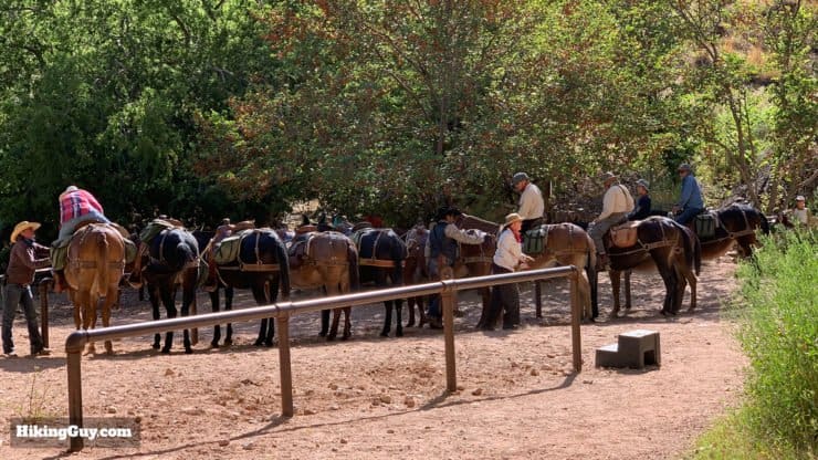
My tip is to leave at sunrise before the first mules leave. By the time you head back up from Indian Garden, you should pass them head-on, which is much better than getting stuck behind them on the climb out. And many times you can pass them while they're on their break in the corral at Indian Garden.
Bright Angel Trail FAQ
- Do I need a permit for the hike? You don't need any permit to hike the Bright Angel Trail as a day hike.
- Can I camp on the trail? You can't just pitch a tent and camp on the Bright Angel Trail, but you can camp at Indian Garden with a (hard to get) backcountry permit.
- Is the Bright Angel Trail dangerous? The Bright Angel Trail is statistically the safest trail in the park. Heat exhaustion is the most common danger on the trail, so make sure you prepare accordingly. There are no animals that will attack you, and mules won't kick you off the trail. You probably have a better chance of falling by bumping into another hiker.
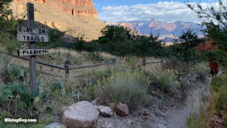
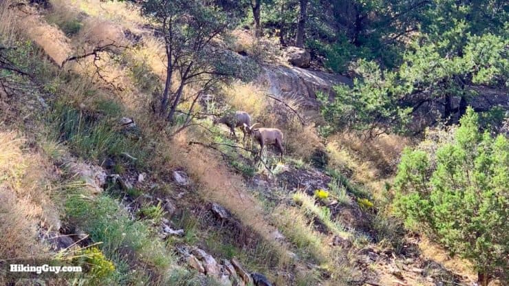
- Can I explore off of the trail? No, please stay on the trail and respect the fragile environment. Do not take any bones or organic material that you may find. Do not approach any wildlife you see.
A Quick Bright Angel Trail History
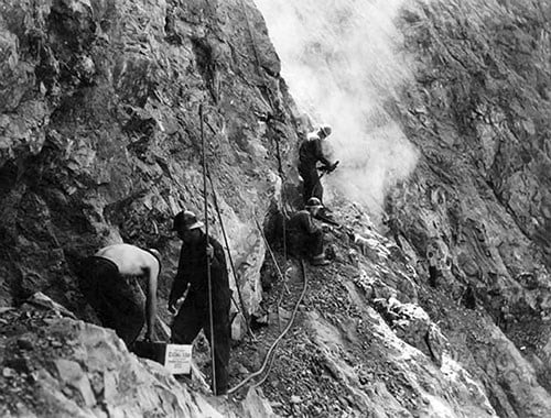
The Bright Angel Trail has been used for centuries to access the reliable water source at Indian Garden. The trail is named after the Bright Angel Fault, which provided a way to climb down the canyon walls to the water. When prospectors arrived here in the 1800s, native Havasupai were actively using the route and planting crops at Indian Garden
In the 1890s, Ralph Cameron arrived and started mining in the area. The railroad arrived at the Grand Canyon, and he realized that tourism was more profitable than mining. Cameron "registered" and improved the Bright Angel Trail, set up camping at Indian Garden and the South Rim, and then charged visitors $1 to use the trail. His claims to the area were dubious, and he was in a constant battle with the government over the trail and land. Even after the Grand Canyon became a National Park in 1919, he still fought against giving up control. In 1928 he lost the battle and the trail was handed over to the Parks Service, who improved it and made it what it is today.
Of course, the native Havasupai were the ones who lost the most. Theodore Roosevelt (who rode down the Bright Angel Trail on a horse) ordered them to leave in 1901 in order to make way for the park. Some left and some stayed, but in 1928 the Parks Service forced the last Havasupai out of the Bright Angel area and onto a 518-acre reservation in Havasu Canyon. In 1975 after a long battle, the US Government created the 188,077 acre Havasupai Indian Reservation in the park. The capital, Supai, is considered "the most remote community" in the lower-48 and is only accessible by foot, mule, or helicopter.
Havasupai means "people of the blue-green waters," referring to the color of the Colorado River, which runs through the Grand Canyon. In the early 1900s they worked as laborers here and created much of what you see at Grand Canyon National Park.
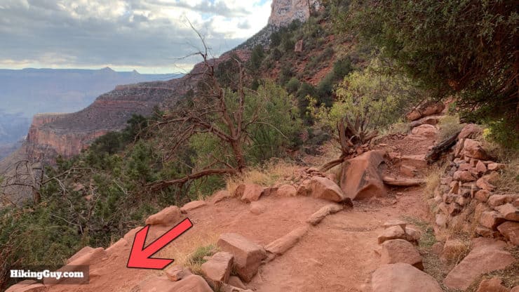
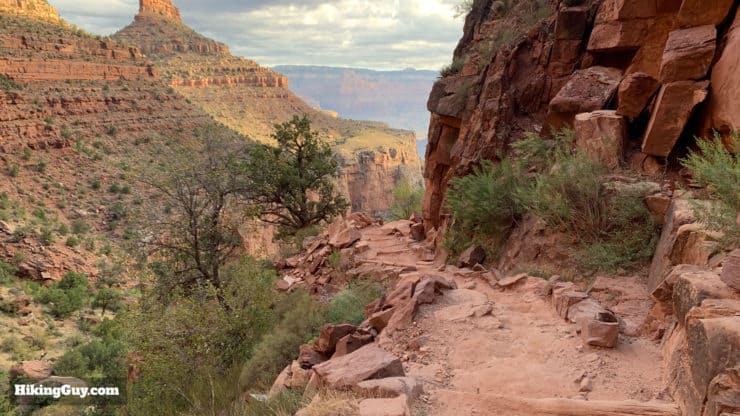
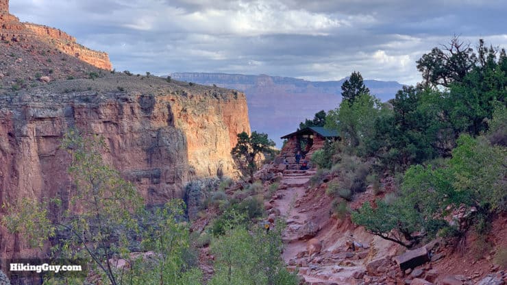
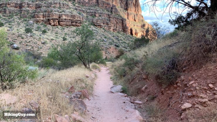
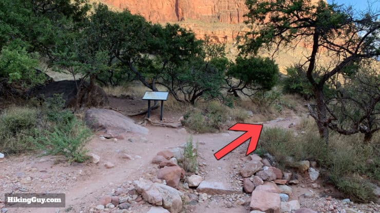
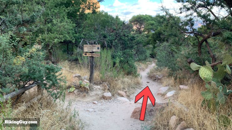
How to Hike to Indian Garden

Hiking Back To the South Rim
You've got over 4 miles under your belt, but the hard part is yet to come. Unless you're going to float down the river, you'll have to walk back up to leave the inside of the Canyon.
Need More Info?
- Have a question about the guide or want to see what other people are saying/asking? View the Youtube comments for this video. Leave a comment and I will do my best to respond.
- When planning, always check the park website and social media to make sure the trails are open. Similarly, check the weather and road conditions.
Related Guides
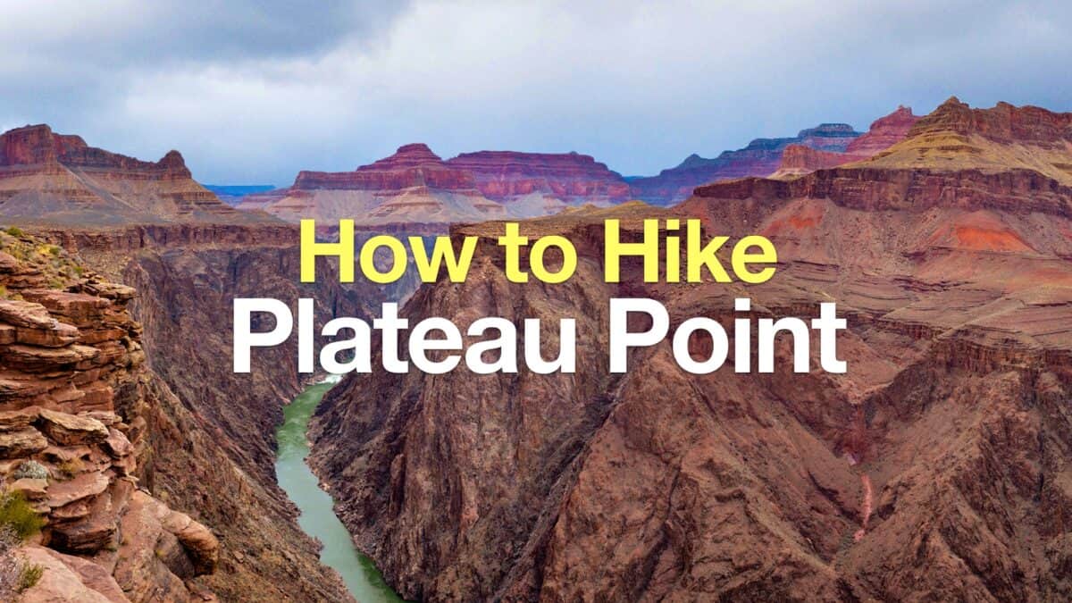 Bright Angel Trail to Plateau Point Hike
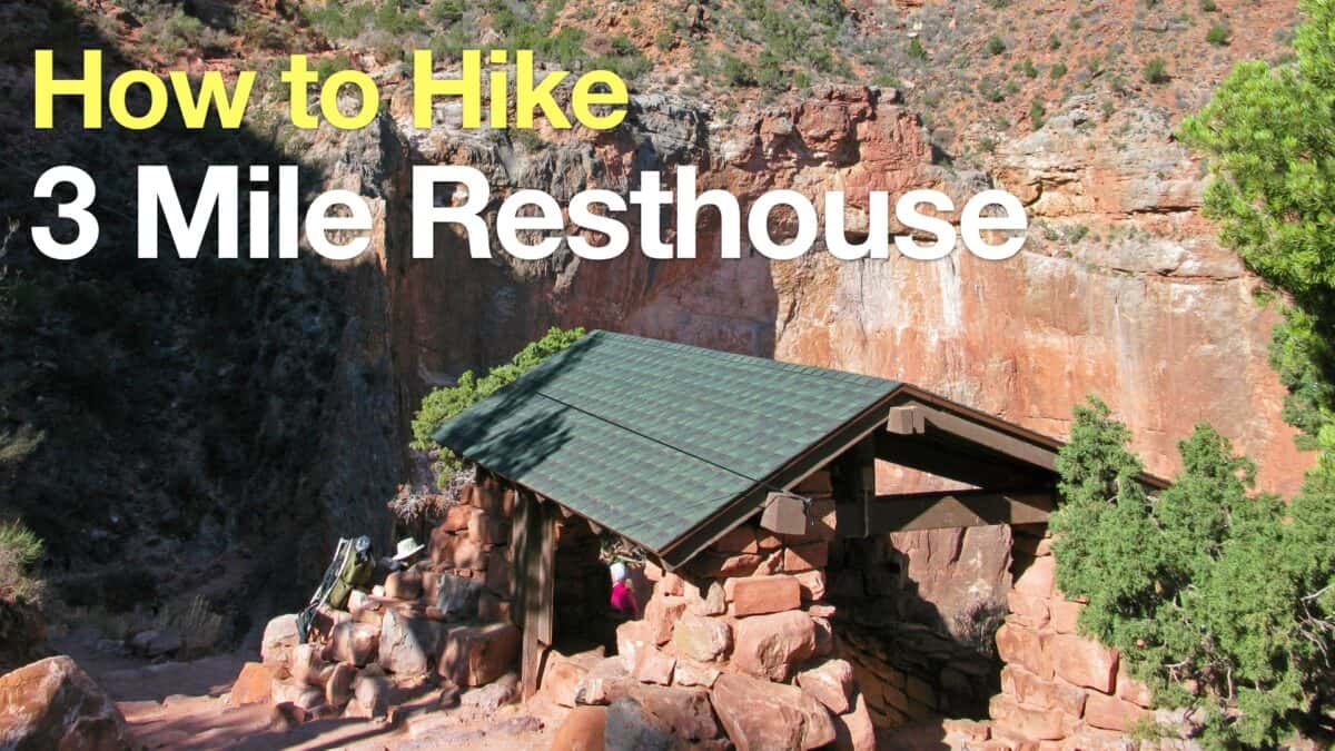 Hike 3 Mile Resthouse on the Bright Angel Trail
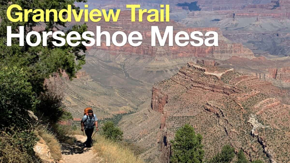 Grandview Trail To Horseshoe Mesa Hike
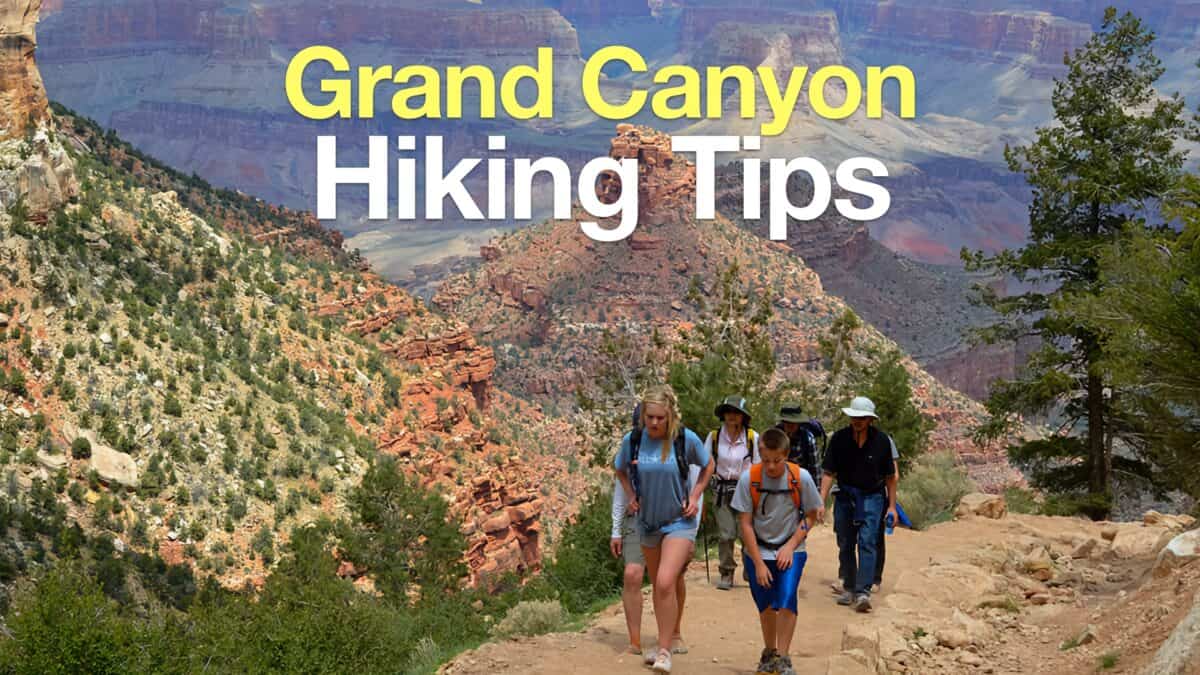 Grand Canyon Hiking Tips
 Grand Canyon Hikes
Popular Guides
 Best Hiking Gear 2024
 Hiking Boots or Shoes: Do I Really Need Hiking Boots?
 When to Hit SOS on inReach
This Guide Was Written by Cris Hazzard

Hi, I'm Cris Hazzard, aka Hiking Guy, a professional outdoors guide, hiking expert, and author based in Southern California. I created this website to share all the great hikes I do with everyone else out there. This site is different because it gives detailed directions that even the beginning hiker can follow. I also share what hiking gear works and doesn't so you don't waste money. I don't do sponsored or promoted content; I share only the gear recommendations, hikes, and tips that I would with my family and friends. If you like the website and YouTube channel, please support these free guides (I couldn't do it without folks like you!). You can stay up to date with my new guides by following me on YouTube, Instagram, or by subscribing to my monthly newsletter.