If you want a great Angeles National Forest mountain hike without the crowds, hike Ontario Peak (8,696 ft) and Bighorn Peak. The hike begins on the popular Icehouse Canyon trail but soon moves off to the much less traveled Ontario Peak Trail, where you might see more bighorn sheep than people. The Ontario Peak Trail roughly follows a ridge line, offering great views culminating in the "rock nest" summit of Ontario Peak. There's also a short spur trip to Bighorn Peak, because, why not? This is a tough hike but worth the effort–one of my favorites.
There is a big parking lot, but it fills up by 7am, and you need a parking pass. I use the affordable National Parks Pass, which gets me in every park, monument, and national forest. You can also use an (Southern California only) Adventure Pass, or buy a $5 day permit from the ranger’s office.
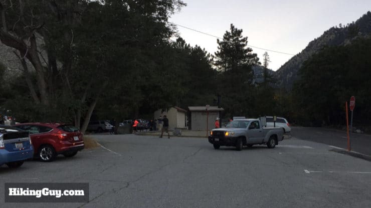
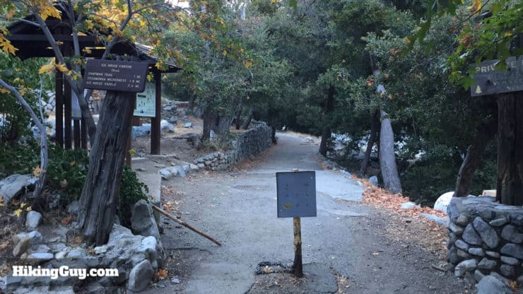
There is plenty of parking at the Icehouse Canyon trailhead, but it fills up quickly on weekends. There are also primitive bathrooms here, the only ones on the hike.
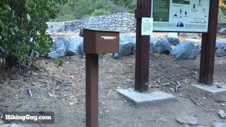
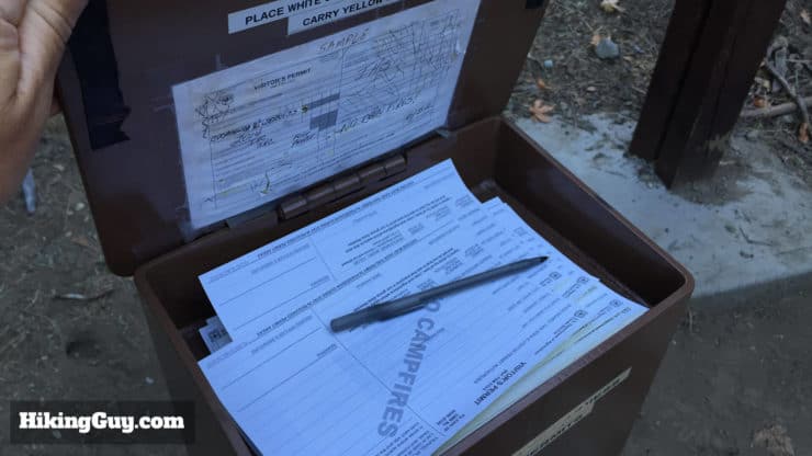
You need a permit to hike in the Cucamonga Wilderness, and it's easy and free. A box at the trailhead has permit forms for you to fill out. Bring a pen. If there are no forms, fill out your info on a piece of paper and leave it.
Gear for the Hike
This is a long and challenging hike. Make sure you pack plenty of water, snacks, and layers. In the winter, there can be snow and ice. Check this summit weather and call the ranger office for the latest conditions and don't take any risks. This is not a hike to do when there is snow or ice.
If you want to check if there's snow on your hike, read this guide.
Gear That I Love Right Now
Nothing is sponsored or promoted, just the actual gear that I use.
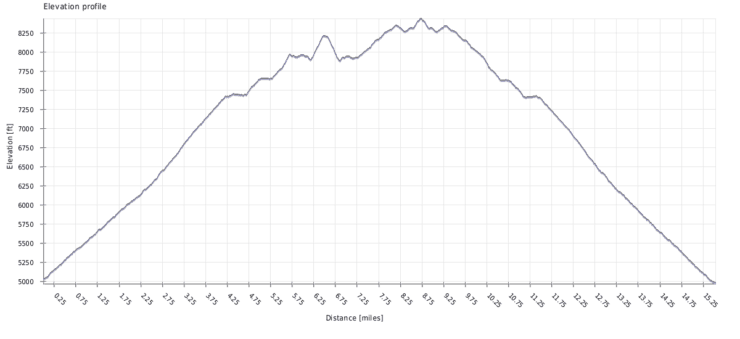
You hike up to Icehouse Saddle, then up to a higher ridge where you hike Bighorn Peak to the left, then Ontario Peak to the right.The hike is a steady uphill effort, with a small dip in-between Bighorn Peak and Ontario Peak.
Ontario Peak & Bighorn Peak Hike Directions
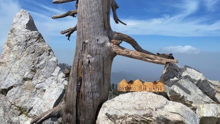
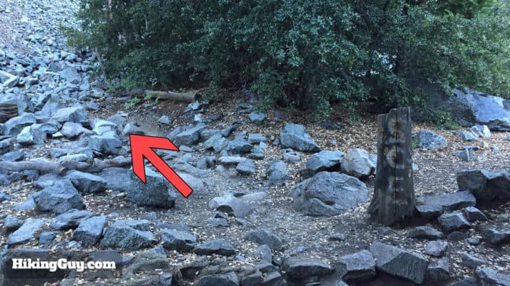
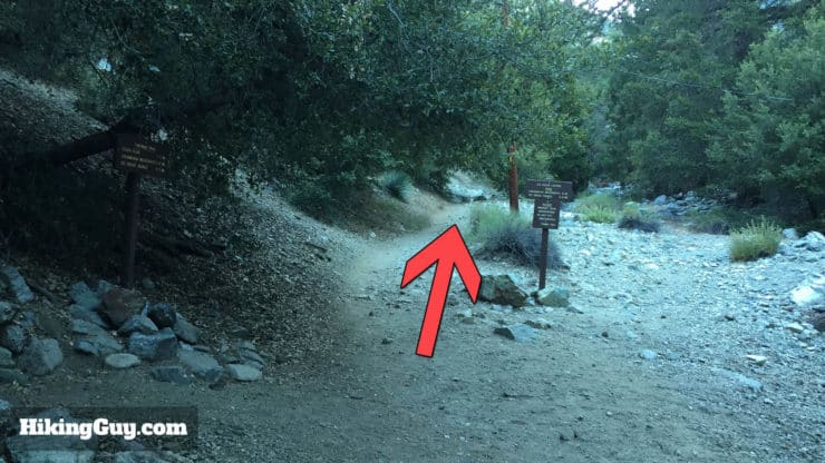
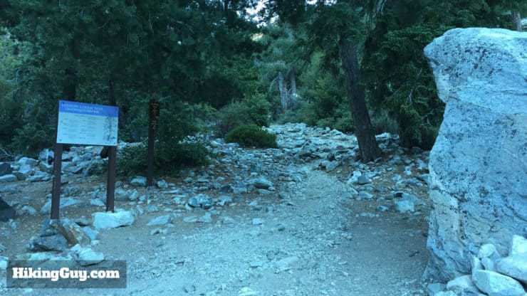
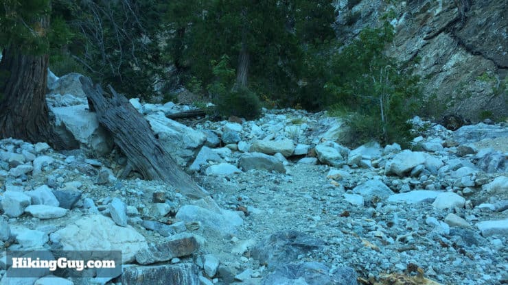
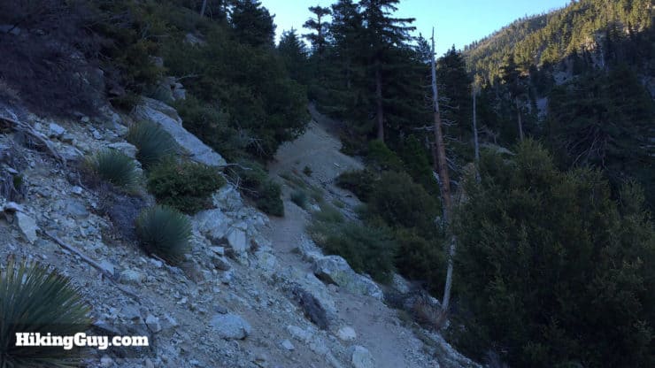
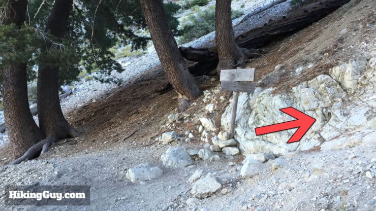
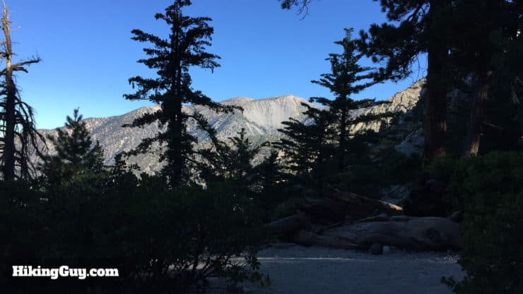
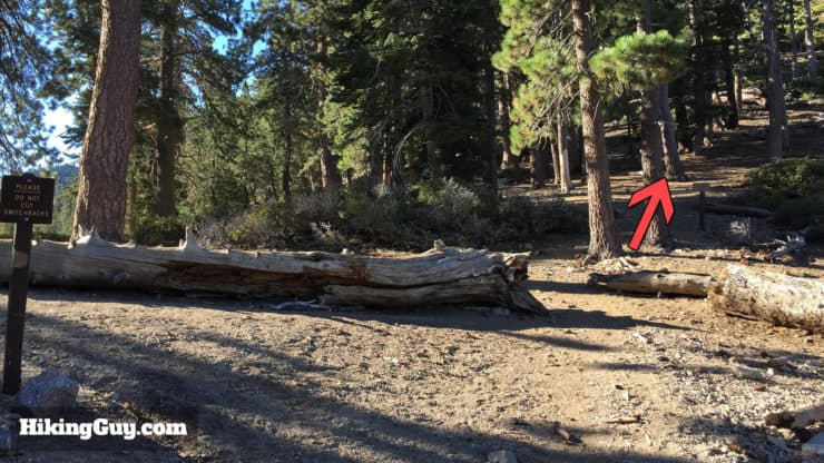
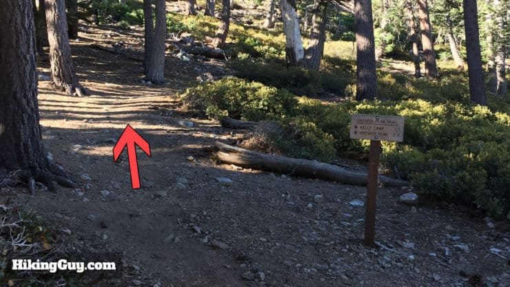
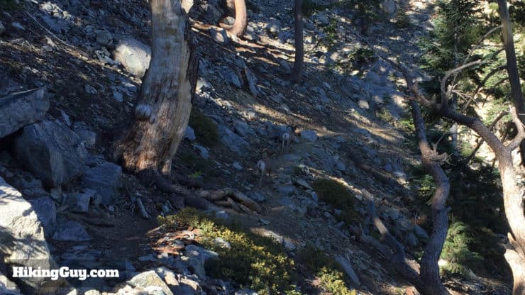
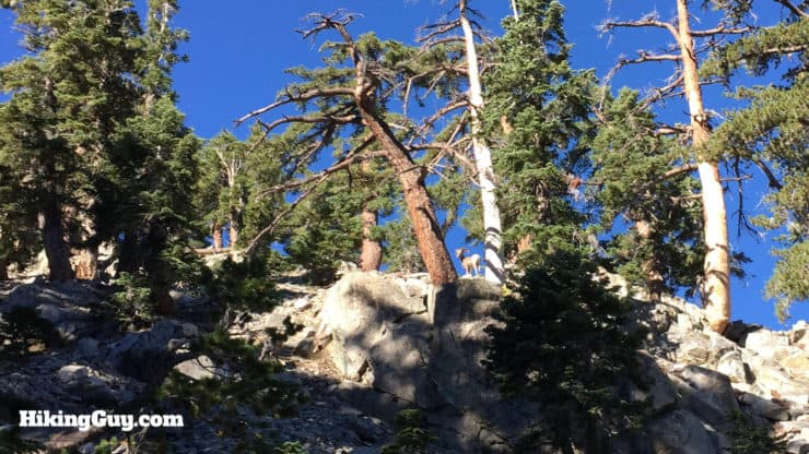
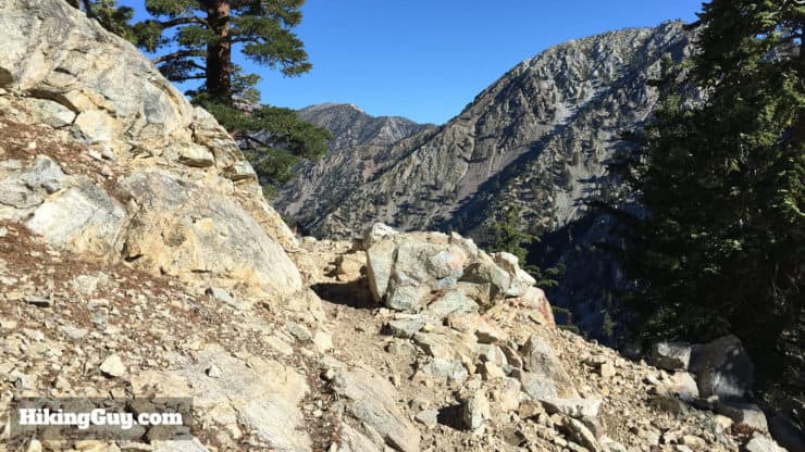
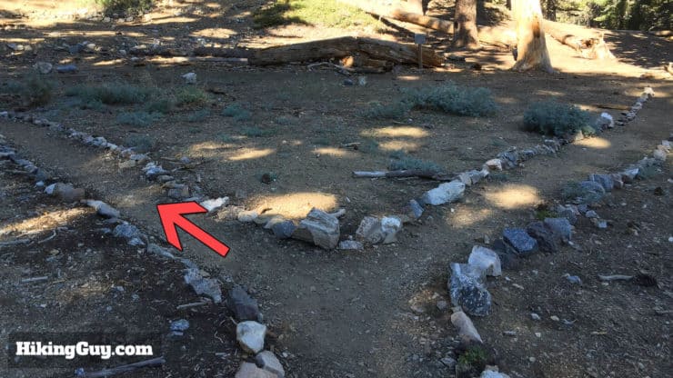
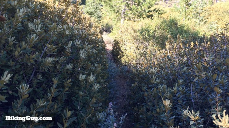
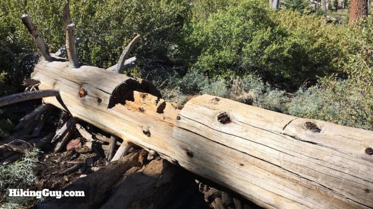
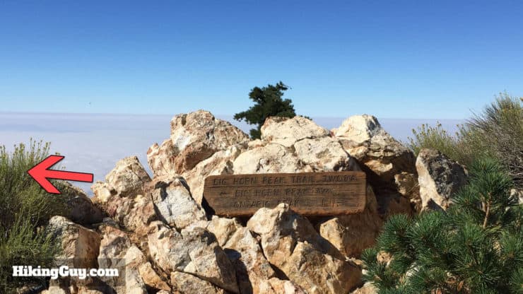
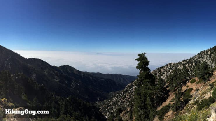
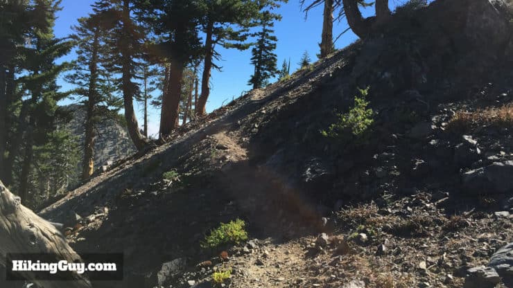
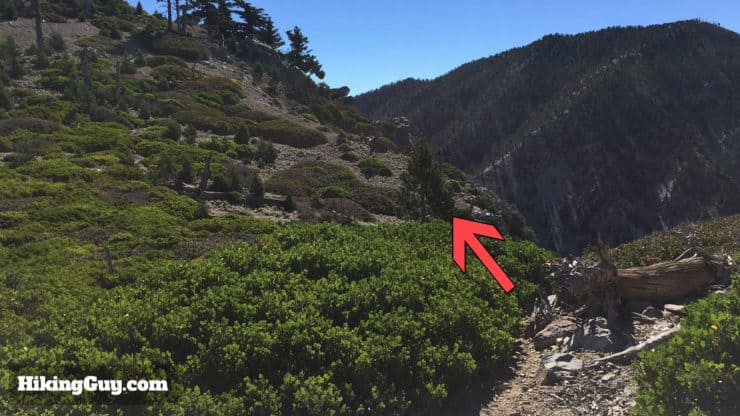
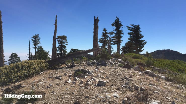
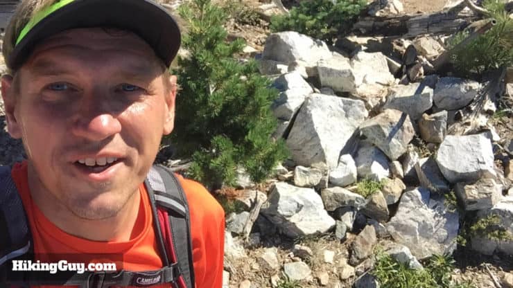
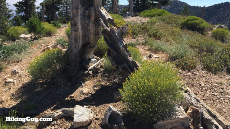
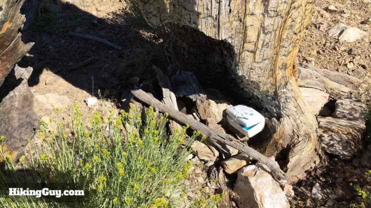
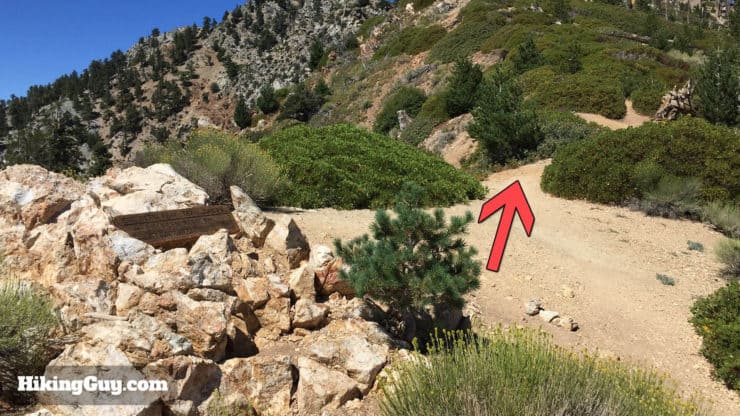
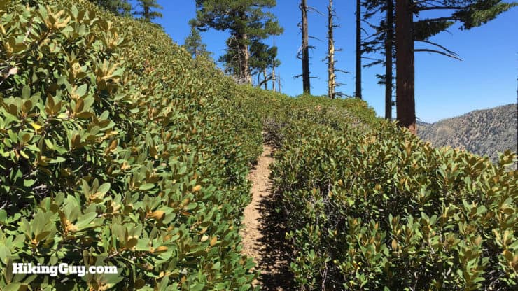
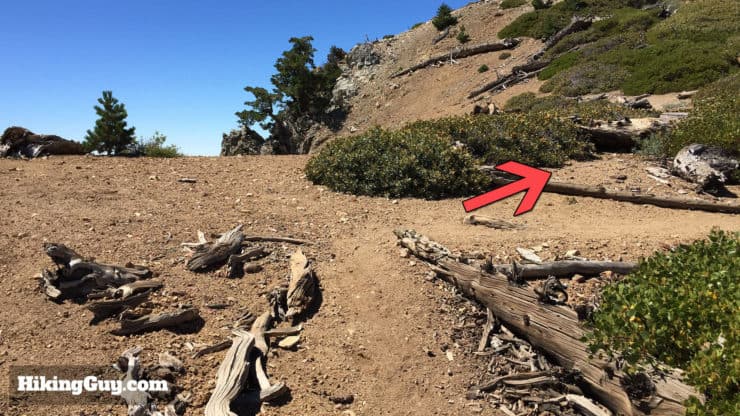
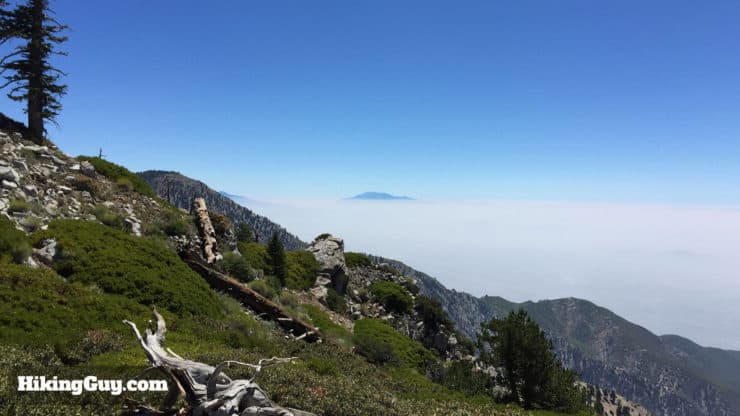
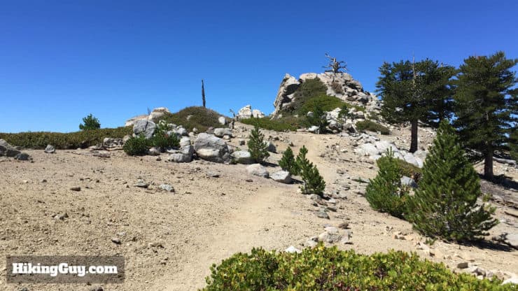
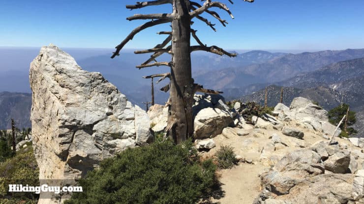
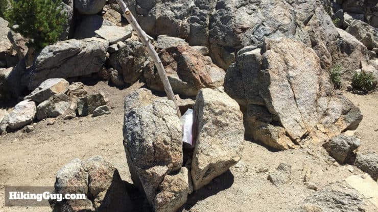
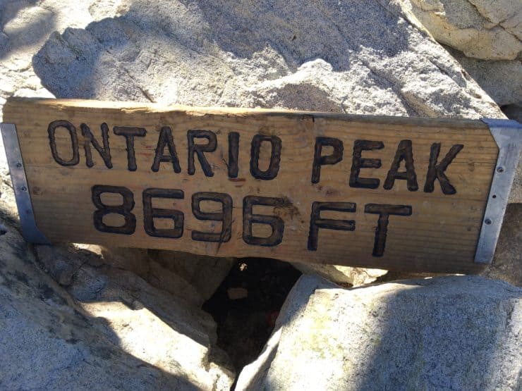
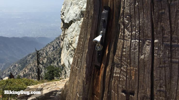
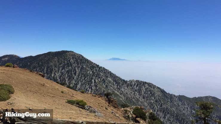
The trailhead is at the far corner of the lot and has notices and updates for the Cucamonga Wilderness.The hiking permit box is to your left by the board.Fill out a hiking permit, save the yellow copy, and put the white copy in the slot on the side of the box.Start hiking on the Icehouse Canyon trail as it gently climbs along Icehouse Creek. You’ll pass some cabins and ruins as you go. The ruin of the big fireplace is the old Icehouse Canyon Resort, a tavern built in 1921 that burned down in 1980. At about 0.5 miles, take the left.After climbing past the cabins, continue straight through the junction. Going left brings you to Icehouse Saddle but adds some miles onto the hike. So yea, just go straight.At about 1.7 miles, you officially enter the Cucamonga Wilderness area.The trail can get tricky as it goes through the stream bed. Look for cairns and footprints if you aren’t sure.After leaving the creek bed, the trail starts to climb up the slopes.At about 3.2 miles, continue to the right towards Icehouse Saddle.As you climb, you'll get nice views of Mt Baldy appear.At around 3.8 miles you should reach Icehouse Saddle junction. The trail to Ontario Peak is to the right as you enter the saddle area.Icehouse Saddle is a great place to take a break and fuel up for the hike to Ontario Peak.Head on the trail to Kelly Camp and Ontario Peak from Icehouse Saddle.This part of the trail is incredibly beautiful. You’ll have views of Mt Baldy and down into Icehouse Canyon. It’s also pretty remote. It’s not uncommon to be the only hiker here. On this day, I shared the trail with a few bighorn sheep who were meandering ahead of me (look closely at the picture!).If you want to see bighorn sheep, don’t forget to look up on the slopes above the trail. There’s no guarantee you’ll see any, but who knows? In this picture, a bighorn stares down at me as I struggle up the trail.It’s a scenic mile or so from Icehouse Saddle to Kelly Camp.After about 4.8 miles, you’ll reach Kelly Camp, which used to be a resort. These days you can camp here among the old stone ruins. Hike to the left at the fork.The trail heads up through dead trees and manzanita. Keep your eyes peeled, the trail twists and turns here.There are also some logs to hop over in this section of the trail.After you clear the dead forest, you reach the ridge line, the Bighorn Peak trail goes to the left. Head left to hike to Bighorn Peak. Update from Will M: The sign is missing and there's a small cairn now.From here on out, as the trail winds on the ridge line, the views are spectacular. Here you can see Saddleback Mountain rising above the clouds in Orange County.The trail to Bighorn Peak winds it’s way around the ridge. The trail is small, so keep your eyes open.At the small saddle, start climbing up the final stretch to Bighorn Peak, winding up the small switchbacks.You made it! Welcome to Bighorn Peak.This pile of stones marks the official peak.There’s a trail register hidden around the summit.Add your name and notes to the trail register if it strikes your fancy.Soak in the views of Cucamonga Peak and Mt Baldy, take a picture or two, and head back to the trail intersection on the ridge.Back at the intersection, head straight towards Ontario Peak.The trail continues for a while, going through some sections of manzanita. There are a few peaks that look like the summit as you go. Keep on hiking.At about 7.8 miles, make the right in the little backcountry camping area.As the trail goes along the ridge line, the views are jaw-dropping!This pile of rocks is the Ontario Peak summit. Almost there.Climb to the middle of the rock pile to reach the summit of Ontario Peak. There’s a bigger pile of rocks you can scramble up for even better views.The Ontario Peak trail register is in a pile of rocks.If you're lucky, you'll have a summit sign at the top too (thanks to LC for the image).If you brought a bottle of beer, someone has been nice enough to install a bottle opener up here!Grab your pictures, have a bite to eat, and head back the way you came. You can skip the side trip to Bighorn Peak on the way back down unless you’re feeling particularly energetic.The trip back down along the ridge line offers new views from the other direction. It’s an incredible section of trail. I hope you love the hike as much as I do!
Need More Info?
Have a question about the guide or want to see what other people are saying/asking? View the Youtube comments for this video. Leave a comment and I will do my best to respond.
When planning, always check the park website and social media to make sure the trails are open. Similarly, check the weather and road conditions.


 Using the Apple Watch for Hiking
 Garmin Fenix 7 & Epix Review For Hikers
 How To Read a Topographic Map
 Garmin GPSMAP 67i Review
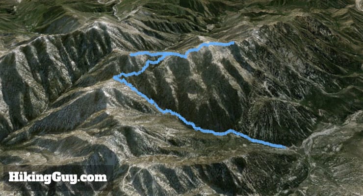


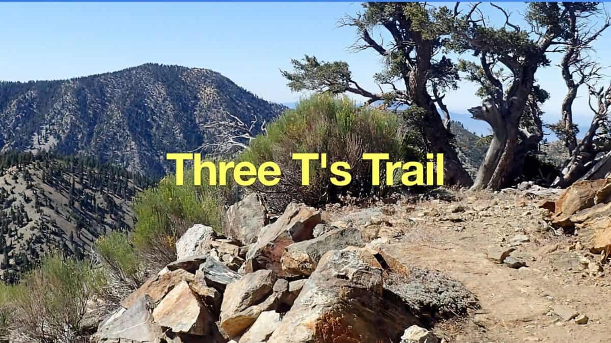 Hike the Three T's Trail
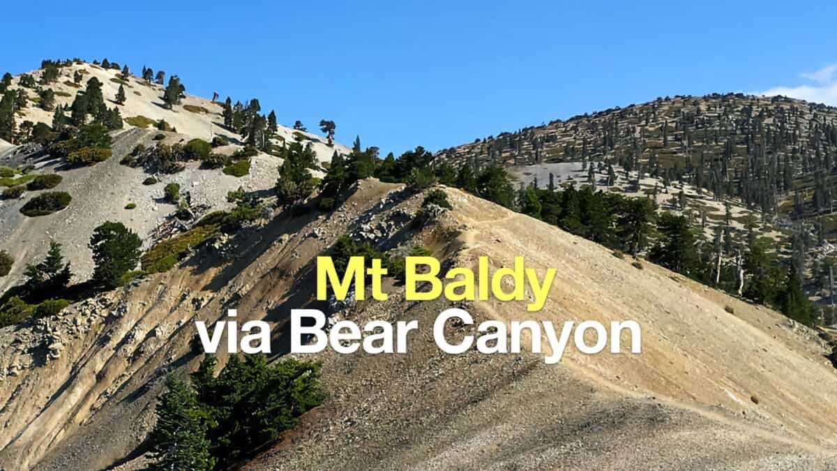 Hike Mt Baldy on the Bear Canyon Trail
 Hike Mt Waterman & Twin Peaks
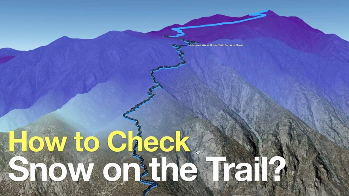 How to Check If There Is Snow On the Trail
 Middle Fork Trail (Lytle Creek)
 Los Angeles Hikes
 Angeles National Forest Hikes
 Backpacking Trips
 LA Mountain Hikes
 Sierra Club 100 Peaks
 Best Hiking Gear 2024
 Hiking Boots or Shoes: Do I Really Need Hiking Boots?
 When to Hit SOS on inReach