With great opportunities for wildlife spotting, this easy Bolsa Chica Ecological Reserve hike takes you on a scenic loop through the 1,300+ acres of protected wetlands just minutes from the Huntington Beach. The scenery includes seabird nesting islands, fresh and saltwater marsh, mudflats, active riparian river banks, and water. Over 200 species of birds have been spotted here, and it's a popular stopover on bird migration routes. The hike is great for families with opportunities to shorten the route if 4.5 miles is too long.
The hike starts at the north parking area of Bolsa Chica Ecological Reserve, which is easier to get to from all directions. There is also a south parking area, but you can only access it when going north on the Pacific Coast Highway. Make sure you have the right parking area in your GPS.
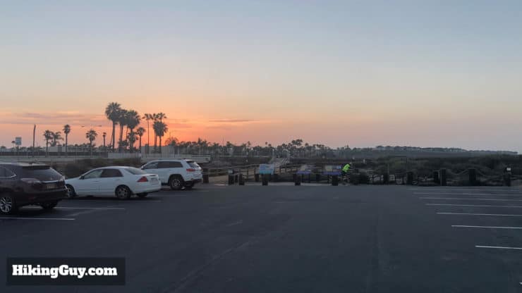
If the lot is full, there are a few parking lots across the street. I'm not telling you to park there because they're for the folks that use the stores there, but just so you know...
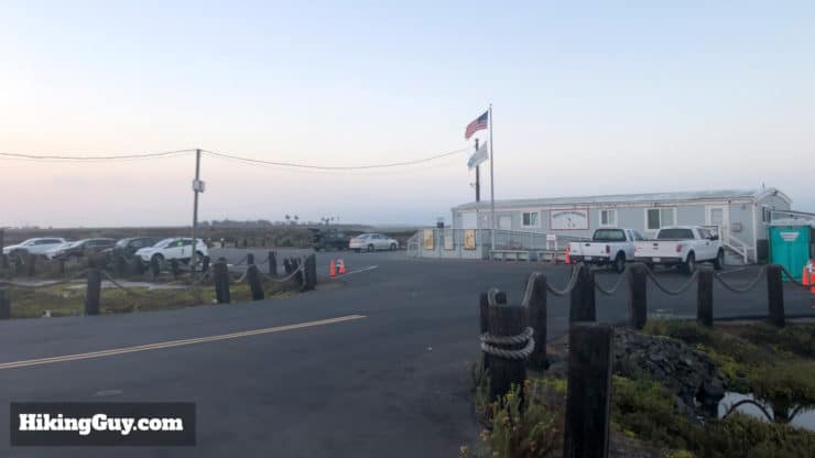
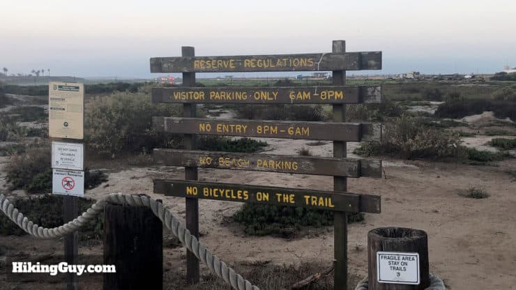
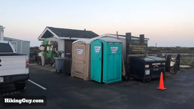
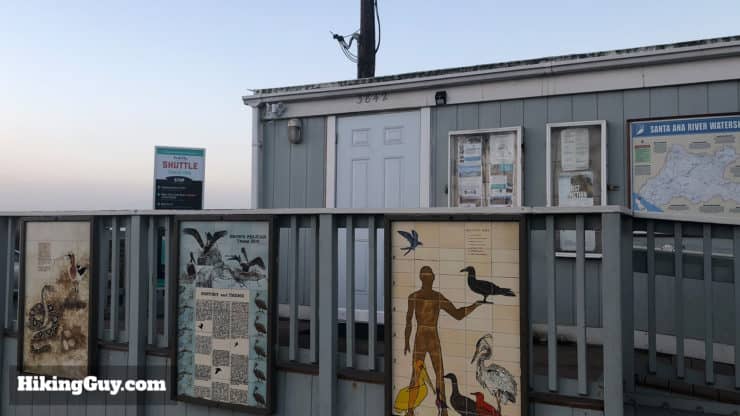
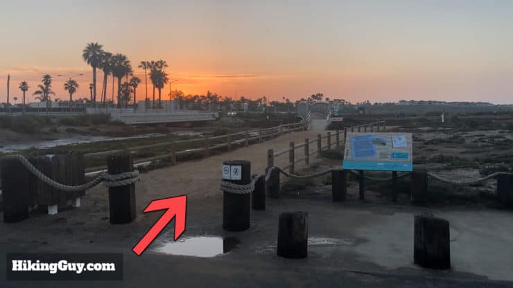
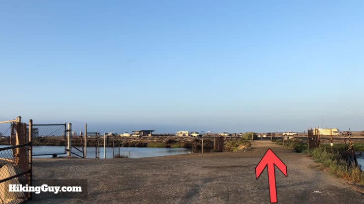
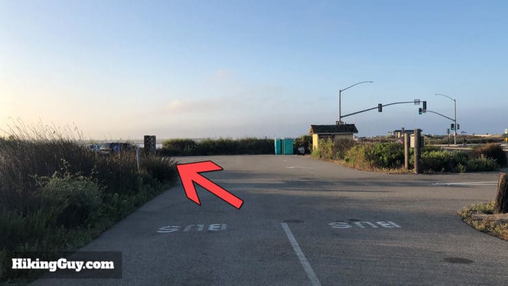
Here's the entrance to the trailhead parking lot.The park is open from 6am to 8pm. I recommend getting there as close to 6am as you can to secure a spot and see the most wildlife.There's a decent amount of parking but it fills up quickly.The bathroom has porta-potties. There are also porta-potties about half-way into the hike.Stop into the interpretive center for a visit if it's open. The people who work here are very friendly and love sharing their love of Bolsa Chica.
Gear For the Hike
None of the trails here are rough or hardcore, it's all very smooth and easy. You can do this hike in fitness gear or even jeans in a pinch. If you do the hike around midday it can get hot, there is no shade on the hike. Bring lots of water if that's the case. There are no drinking fountains.
Gear That I Love Right Now
Nothing is sponsored or promoted, just the actual gear that I use.
Babe Ruth and Lou Gehrig hunting at the Bolsa Chica Gun Club. They came here to enjoy the wildlife and then kill it. Different times... Photo Bolsa Chica Land Trust
The Bolsa Chica Ecological Reserve has an interesting history that's worth briefly understanding about before you hike the trails.
Native Americans have been a presence in the wetlands from 8,000 years ago, taking advantage of the rich food sources.
When California was part of Mexico, ranchers owned this area. This area was named Rancho La Bolsa Chica or “The Little Purse” because the mesas and hills of the area looked like purses stacked next to one another, with the smallest one here.
Gringos made their way here and in 1900 the Bolsa Chica Gun Club was started. With all the wildlife in the area, you can see why they'd want to go duck hunting. The gun club dammed up the wetlands to form freshwater ponds that were more attractive to ducks. There's an interesting history of the gun club and drama surrounding it here.
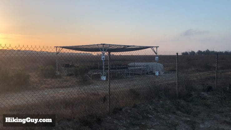
In the 1920s Standard Oil started drilling here. You can still see some oil pumps on the hike today.
In the 1960s developers owned by the oil company wanted to build houses at Bolsa Chica because that's what they do. The local community started to push back, and in 1976 the League of Women Voters and the American Association of University Women created the Amigos de Bolsa Chica. Over the next 30 years, the Amigos and later the Bolsa Chica Land Trust battled with the developers to protect the land, and in 2006 the area became roughly the 1300+ acres you see today.
Wildlife of Bolsa Chica Ecological Reserve
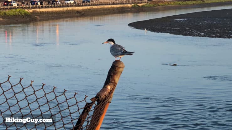
There are over 200 species of wildlife that you can find in the park. In general, you can expect to see lots of ducks and waterfowl, shorebirds, herons and egrets, hawks, owls, lizards, and maybe a rabbit. Keep your eyes open for the endangered western snowy plover and California least tern. You'll also probably see birdwatchers with their massive thousand dollar lenses. Pay attention to where they're pointing their cameras, there's probably something worth seeing there.
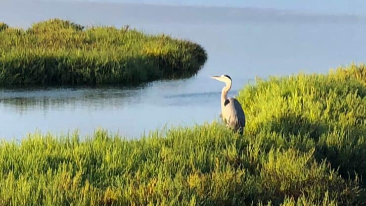
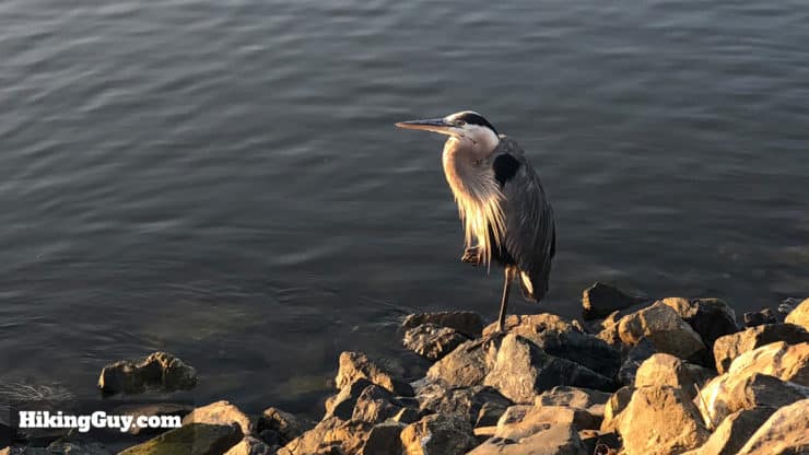
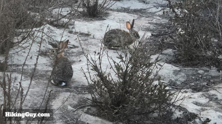
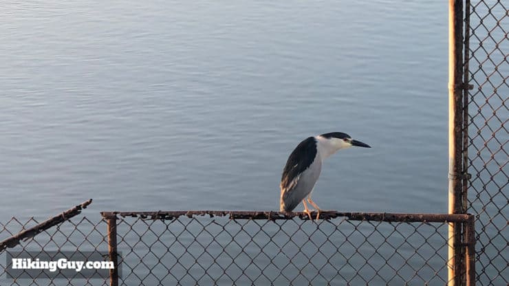
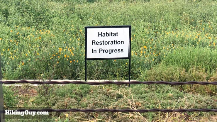
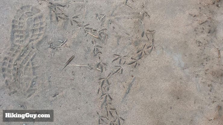
A great blue heron in the Bolsa Chica Inner Bay.You might find that rabbits are not scared of humans. When you're around them, they are generally safe from hawks and raptors, who are scared of you.A black-crowned night heron perched on a fence. Some of the hike has fences along it, but don't let that detract from your experience, there's still plenty to see.It's important to stay on the marked trails, even if you see another trail not listed on the official map. The Bolsa Chica Conservancy is actively restoring habits within the park. You wouldn't want to step on a burrowing owl, which is fairly common in the park and found on the ground.It's not uncommon to see more animal footprints that human.
Bolsa Chica Ecological Reserve Hike Directions
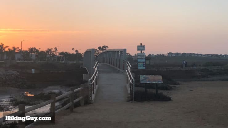
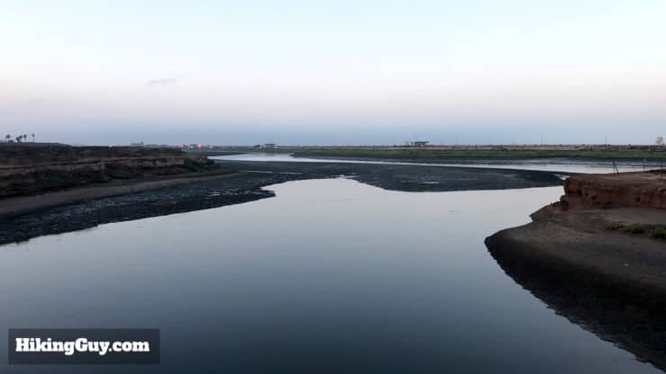
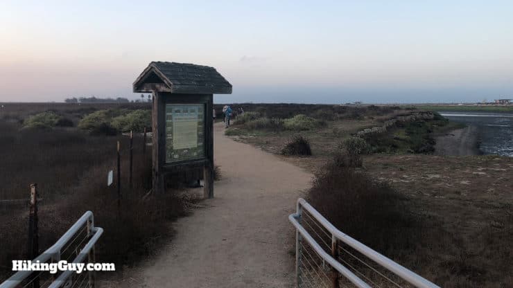
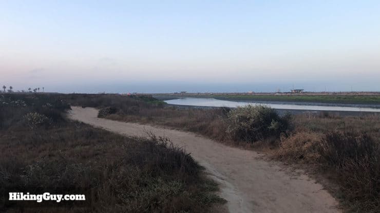
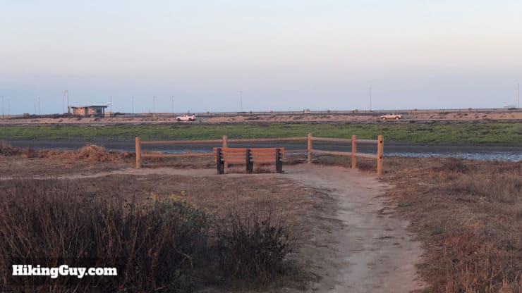
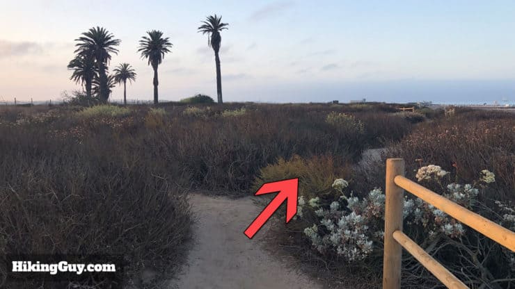
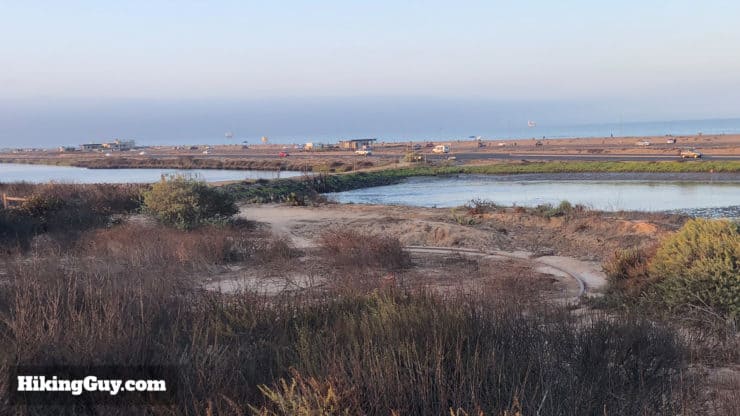
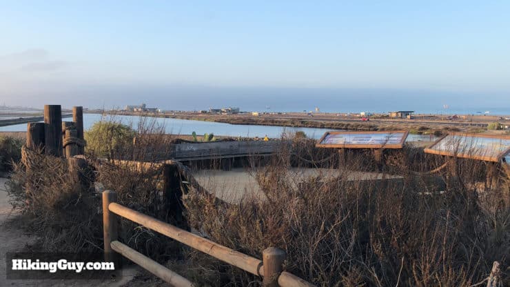
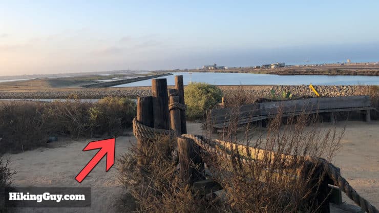
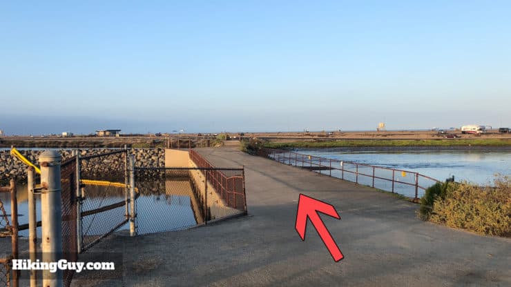
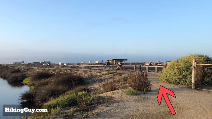
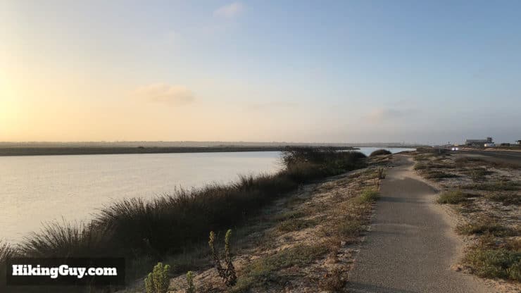
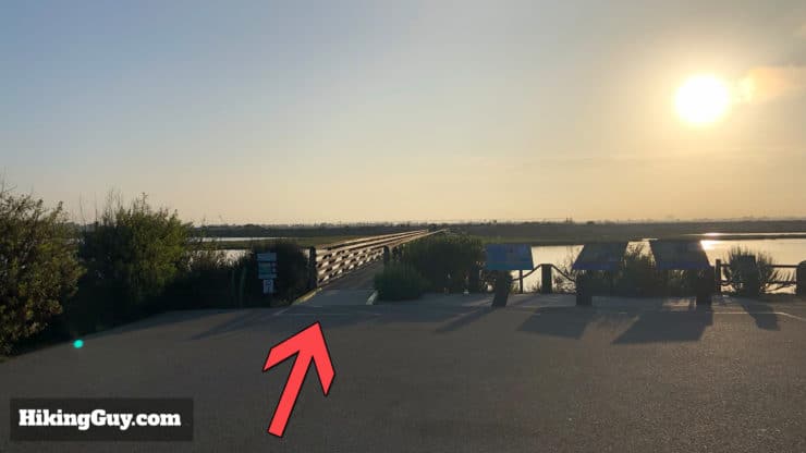
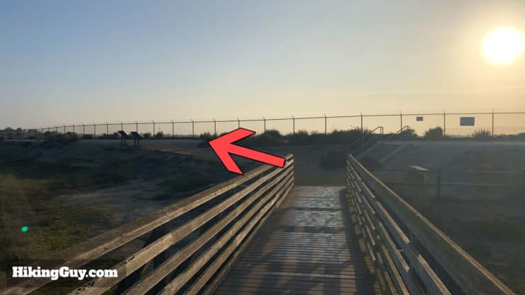
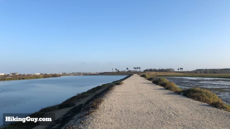
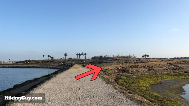
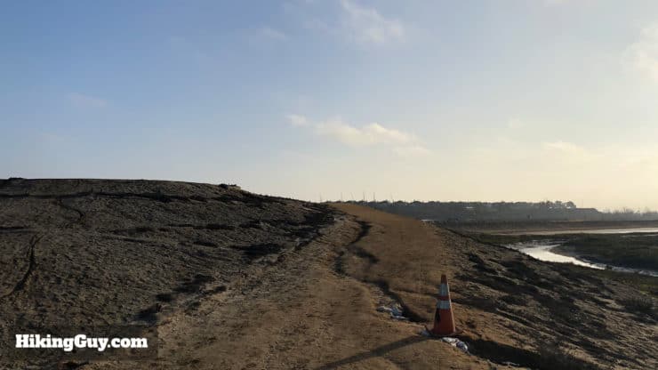
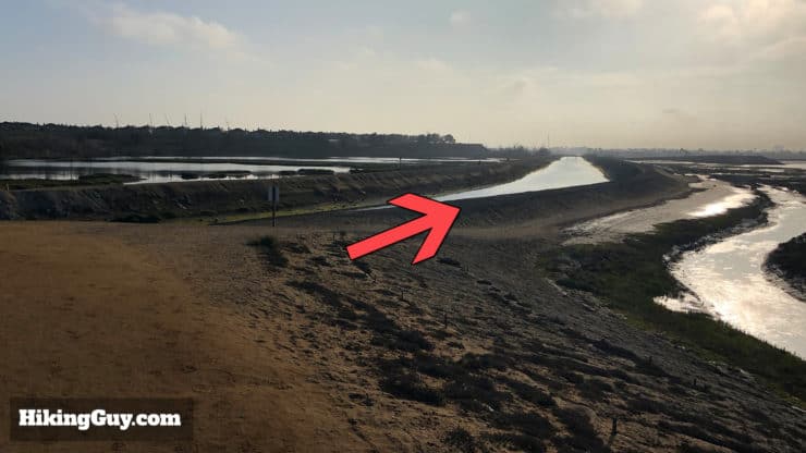
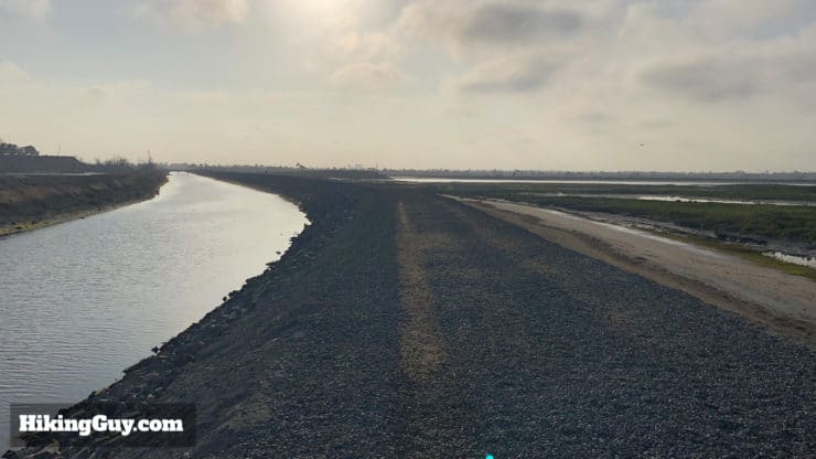
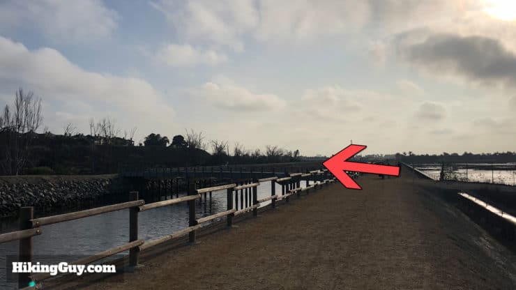
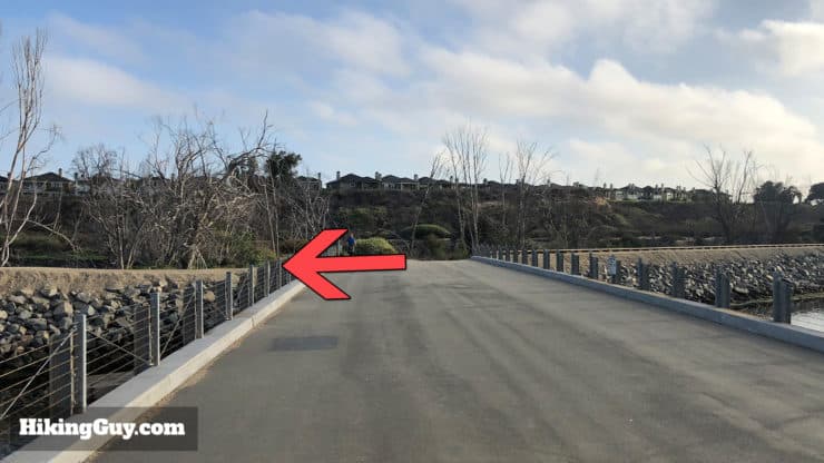
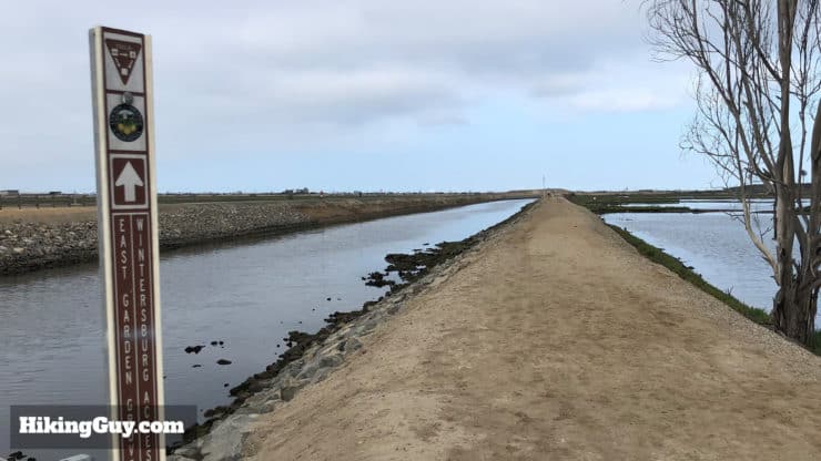
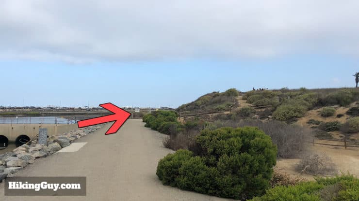
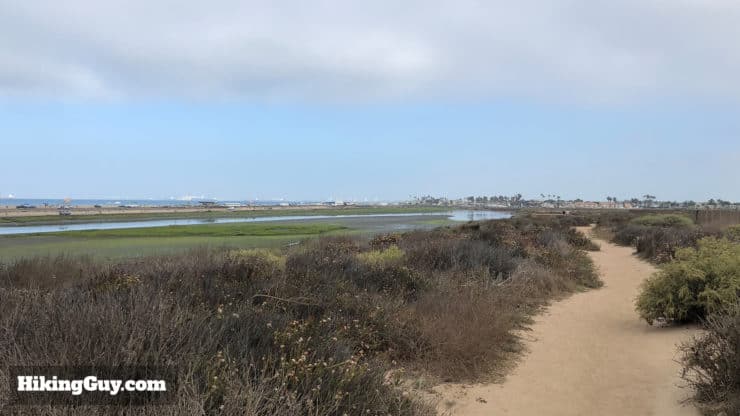
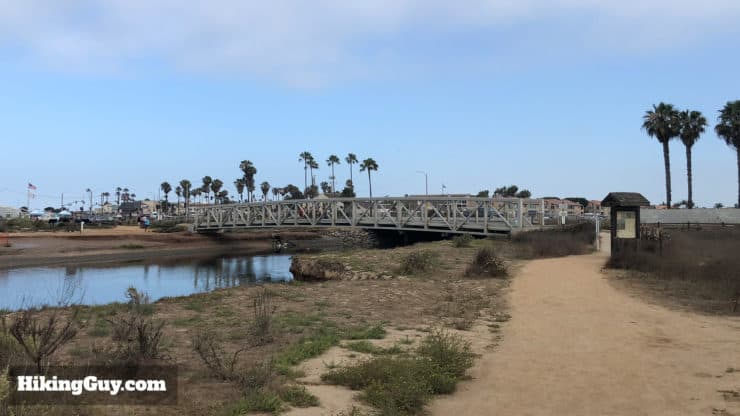
Start the hike on the well-marked trail at the end of the parking lot.Cross over the bridge to the other side of Bolsa Chica Outer Bay. Don't forget to look down in the water for stingrays, sharks, shovelnose guitarfish, crabs, and all kinds of other fish.You'll get some nice sweeping views of the Outer Bay from the middle of the bridge.Once across the bridge, follow the Mesa Trail along the Bolsa Chica Outer Bay.The Mesa Trail is easy to follow, just keep going straight.There are a couple of small cutoffs from the Mesa Trail with scenic overlooks. If the tide is low, you'll see mud flats with lots of foraging shorebirds. If it's high, the incoming tide brings fish and wildlife in that in turn attracts predators like raptors and sometimes even a sea lion or two. Check them out and return back to the Mesa Trail.On the left side as you head down the Mesa Trail are native plant and bird nesting areas. This is an active habitat restoration area where volunteers are planting native species and removing invasive ones. Many of the native species survive from the water found in the morning fog.At the split, bear to the right.Keep your eyes open for the remains of a few WW2 gun emplacements. After Pearl Harbor in 1941, the Army constructed 155mm gun emplacements here to protect the Port of Los Angeles. The guns were massive and could shoot up to 26 miles. You can read all about them here. From 1941-1945 this area was known as the Bolsa Chica Military Reservation.Keep hiking to the second overlook area by the gun emplacement. There are good interpretive displays here.From the last overlook, head down the stairs to the big trail junction.At the bottom of the stairs head across the paved bridge over the tide gate.The water bottlenecks through the tide gates, and the abundance of marine life here means that you'll usually see some birds hunting.Keep going straight across the bridge until you reach the PCH highway.Bear left onto the trail the goes between the PCH and Bolsa Chica Inner Bay. This is the Inner Bay Loop Trail.The Inner Bay Loop Trail is easy to follow, just go straight.When you reach the South Parking Lot, bear left along the edge of the lot. If you need to use the bathroom, there are porta-potties here.Head over the footbridge at the end of the parking lot.Make a left at the end of the bridge.Continue back on the other side of the Bolsa Chica Inner Bay. This is still the Inner Bay Loop Trail.When the trail splits, bear to the right.You can stop for a rest on the Rabbit Island Overlook to your left. There are benches to sit down. Otherwise go straight.Merge onto the trail along the East Garden Grove-Wintersburg (EGGW) Flood Control Channel on the left hand side of the trail. Build in the 1960s, the EGGW Channel drains the floodwaters from inland environs such as Santa Ana, Orange, and Anaheim.The path heads between the EGGW Channel and the full tidal basin to the right. The tidal basin connects with the ocean at the Bolsa Chica Inlet, which was re-opened in 2006 after being closed by silting and development. Since then the basin has become the home to over 50 species of fish and 22 endangered and sensitive species of plants and animals.When you reach the bridge over the EGGW Channel, make the left and go over it.Once over the bridge, make the left turn and head back along the other side of the EGGW Channel. There were once trails open straight ahead that connected with the Pocket Loop Trail, but they are now closed to protect bird nesting areas (such as the burrowing owl). Please respect the rules and stay on the official trails.Head back down the other side of the channel.At the end of the path you'll reach the big intersection that you came through earlier. Make the right and head back to the Mesa Trail.Follow the Mesa Trail back the way you came at the beginning of the hike.Soon you'll reach the footbridge and your car. That's the hike! Hope you had fun!
If you'd like to get more involved with the Bolsa Chica wetlands, check out the Bolsa Chica Conservancy. They offer group tours and opportunities to volunteer.
Need More Info?
Have a question about the guide or want to see what other people are saying/asking? View the Youtube comments for this video. Leave a comment and I will do my best to respond.
When planning, always check the park website and social media to make sure the trails are open. Similarly, check the weather and road conditions.


 Using the Apple Watch for Hiking
 Garmin Fenix 7 & Epix Review For Hikers
 How To Read a Topographic Map
 Garmin GPSMAP 67i Review
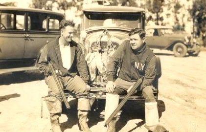
 Upper Newport Bay Nature Preserve Hike
 Whiting Ranch Hiking: Red Rock Canyon
 Hike Holy Jim Falls Trail
 Redwood Grove Hike Guide (Carbon Canyon - Brea)
 Hikes In and Around Orange County
 Best Hiking Gear 2024
 Hiking Boots or Shoes: Do I Really Need Hiking Boots?
 When to Hit SOS on inReach