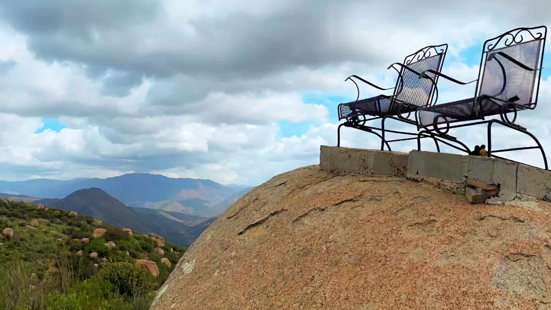
The South Clevenger Trail has gained popularity because of a unique attraction: a pair of lawn chairs perched on a boulder, offering epic views down into San Pasqual Canyon. Visiting the chairs is fun, but there's also much more to enjoy on this hike in the San Pasqual - Clevenger Canyon Open Space Park. You have a moderate climb that provides spectacular views of the valley and then the final summit, where you get sweeping views of high peaks like El Cajon and Cuyamaca Peak. It's a fun hike with lots of natural eye candy and photo opportunities.
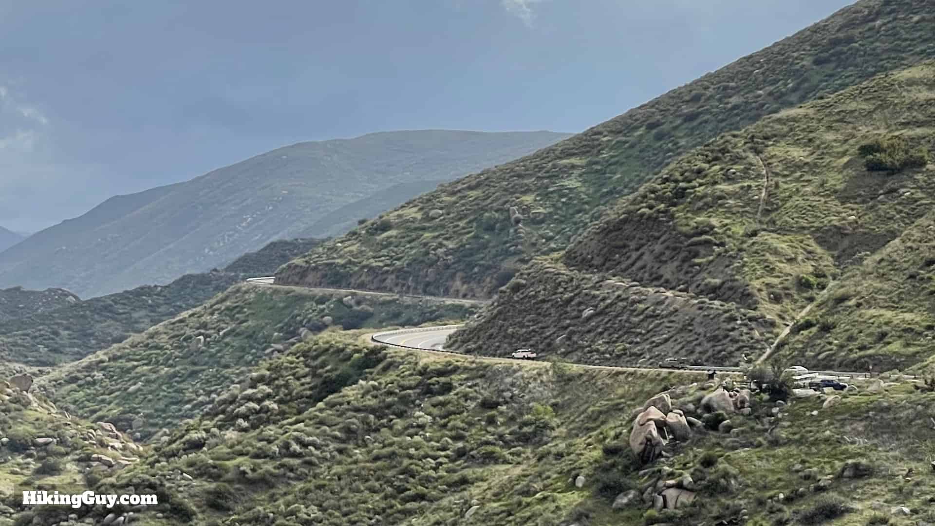
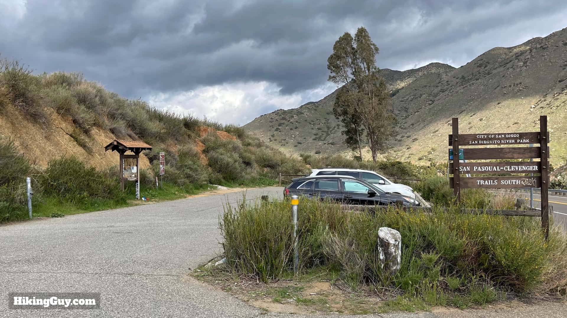
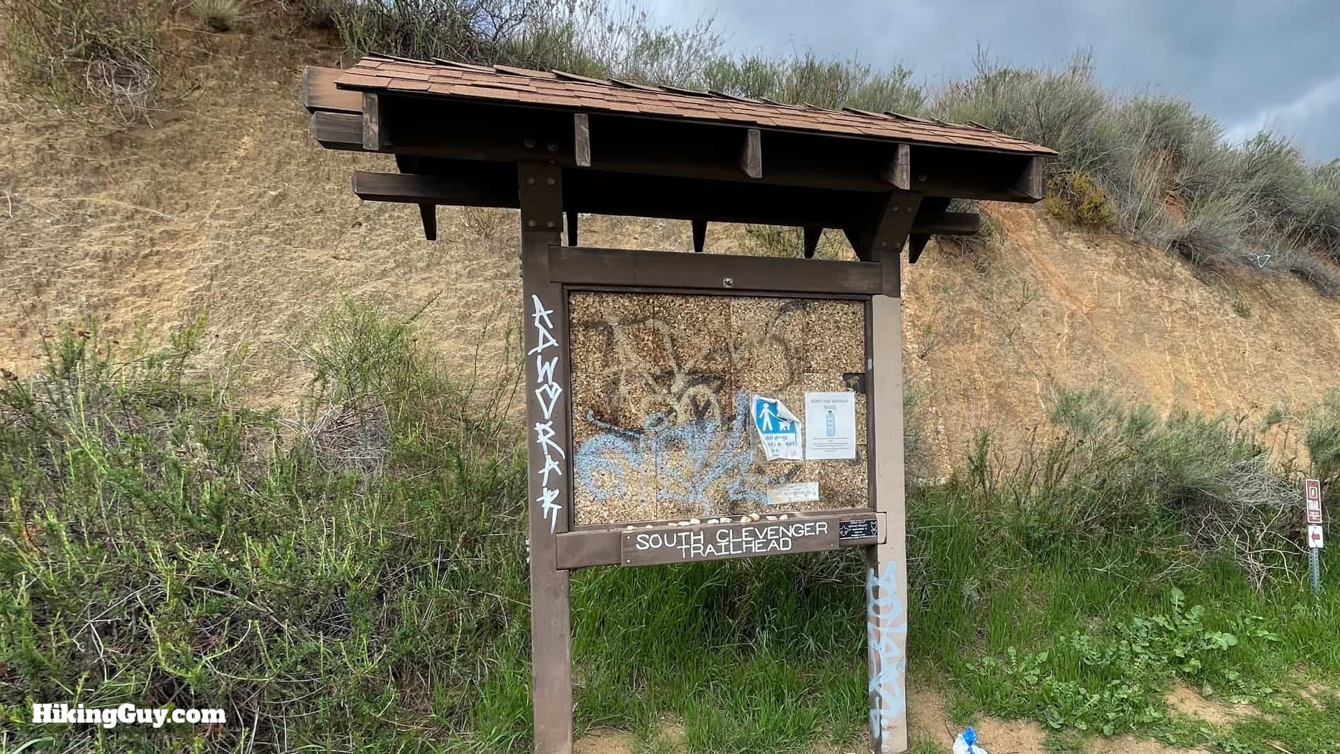
The drive to the trailhead is spectacular. The only downside is that this road is usually busy.There's a small parking area on the south side of the road.Theoretically you'd get trail information from the board here, but today I only get gang tags.
There are no toilets or water fills at the trailhead.
Gear For the Hike
This is a "hike hike" and I recommend using hiking clothing. You can also hike in fitness clothes.
This hike is on a trail in a City of San Diego Park and Recreation Department's park and is actively maintained. Yes, you are in the City of San Diego here! The trail is in decent condition and easy to follow.
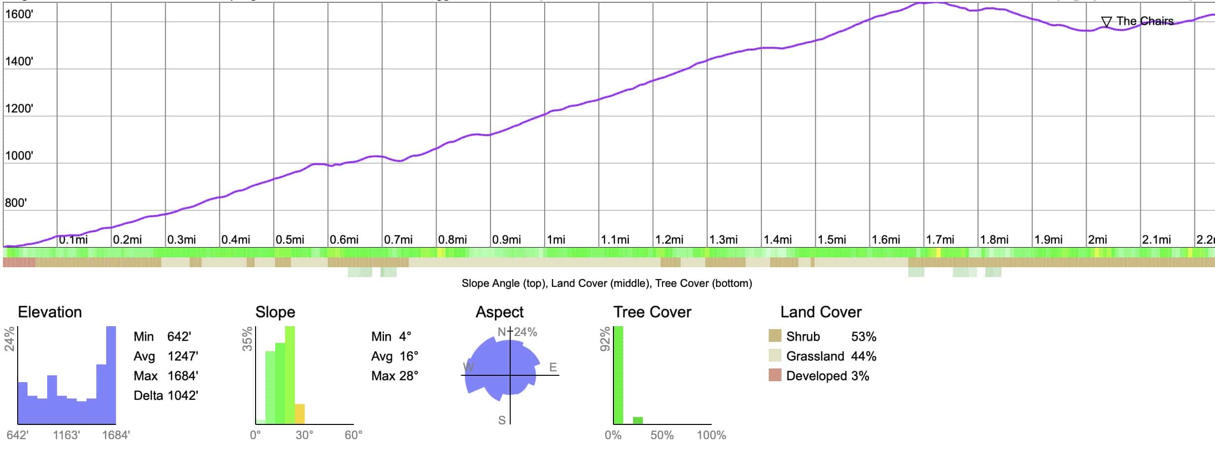
Here's the one-way profile to the top. It's a steady climb to the high point by Peak 1755, then you'll follow the ridge to the chairs and Peak 1635.
3D Map
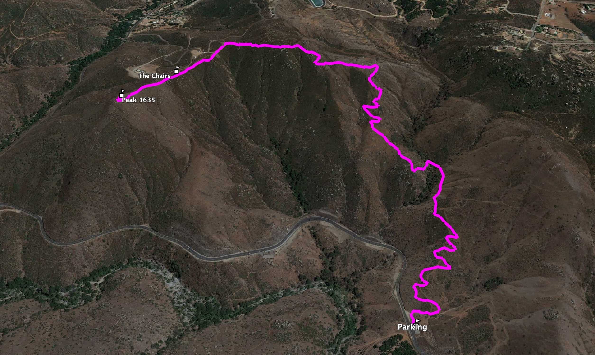
From the start you'll climb up the ridge, and then wind around to the left where the ridge ends at Peak 1635.
Hike Brief
Clevenger Canyon is home to the rare Engelmann Oak, found primarily in San Diego County's hill country. This oak's range once extended into Arizona but today is confined to San Diego / Northern Baja because of climate change. Fire damage from the 2018 Pasqual Fire along this hiking route means that you probably won't see Engelmanns, but you might spot a few as you glance around the surrounding landscape. Photo Wikipedia
This fertile canyon was initially home to the Kumueyaay, who harvested over 12,000 varieties of plants for food, medicine, and materials. They used the acorns of the Engelmann Oak to make porridge and even chewing gum.
The park is named after John Leslie Clevenger Sr. (1832-1918), the first gringo to settle here and start a dairy and wheat farm. Today most of the farms here in the San Pasqual Valley focus on citrus and avocado; you can see them on the drive in.
Who put the chairs on the boulder? No one is positive, but a park official suspects they were placed there by construction workers who were clearing a nearby housing plot which you'll pass on the hike.
Most of this hike goes through an area destroyed by the 2018 Pasqual Fire. Today the fauna is growing back.
South Clevenger Trail Hike Directions
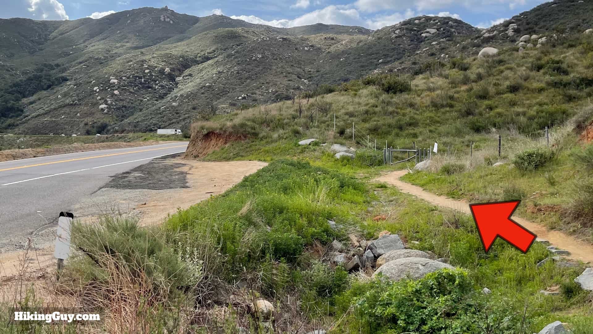
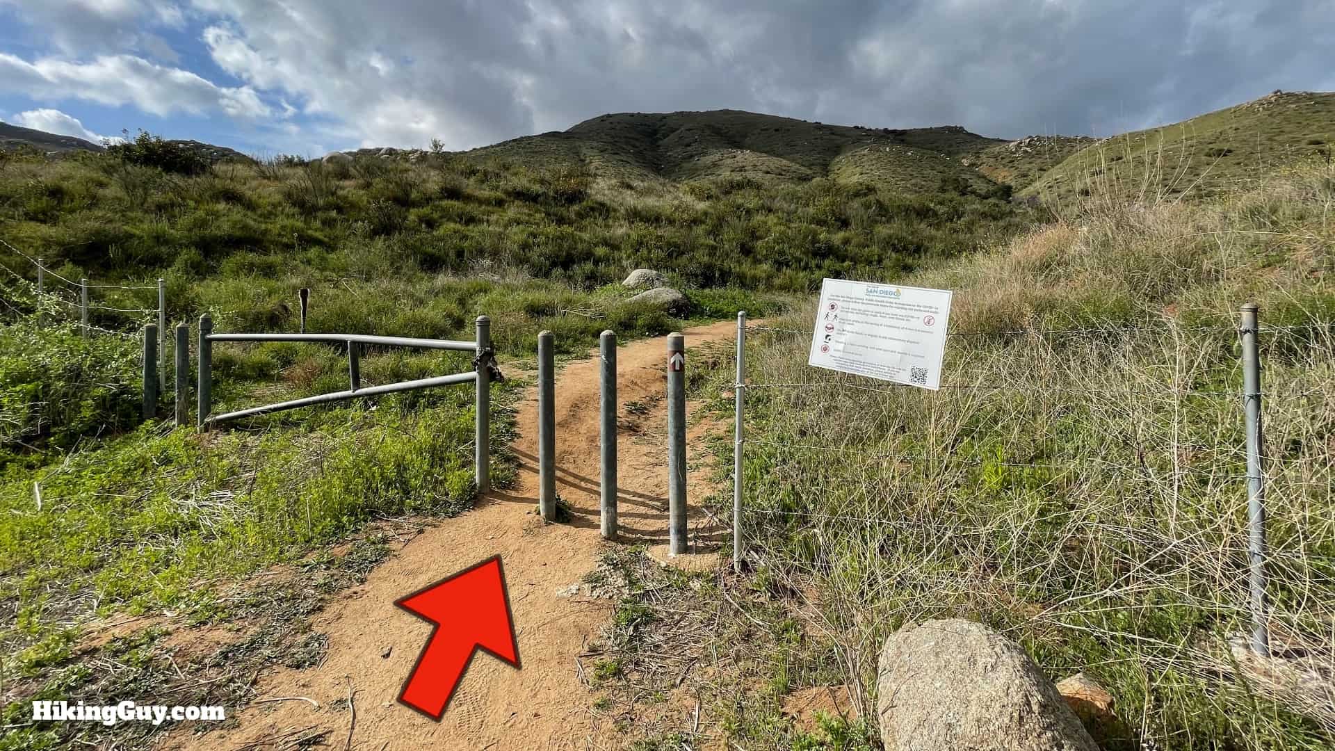
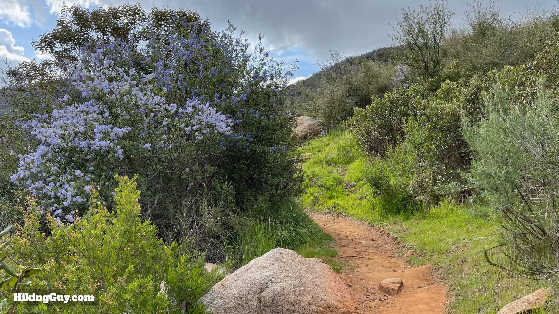
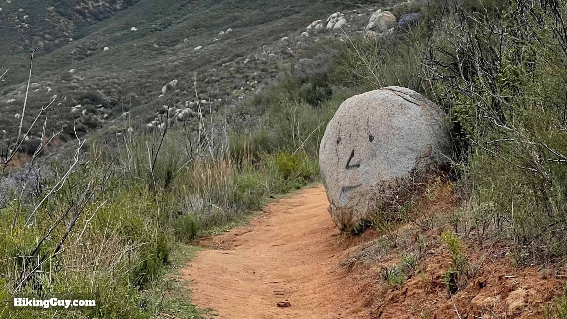
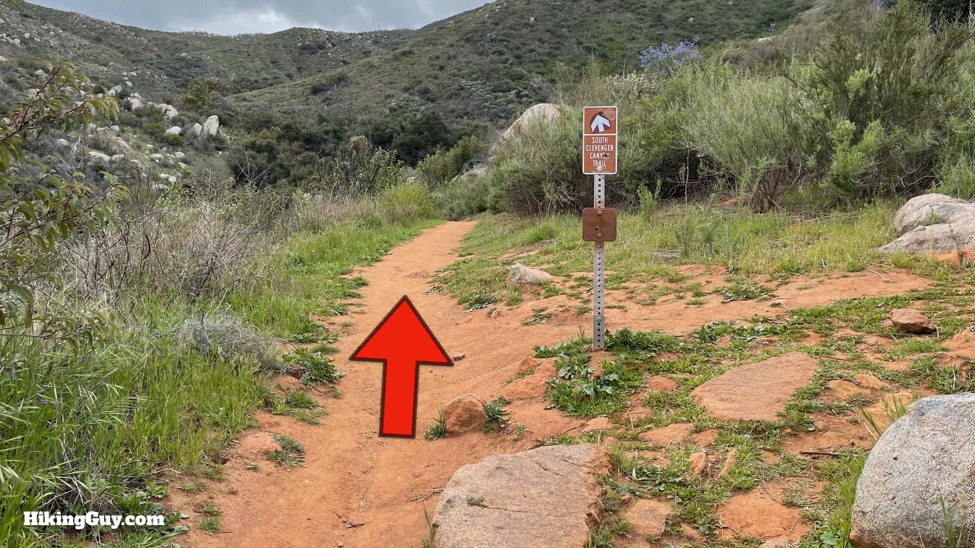
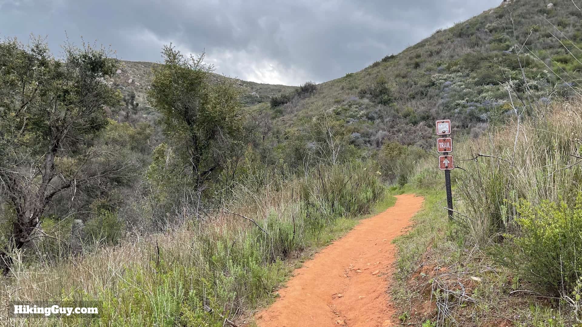
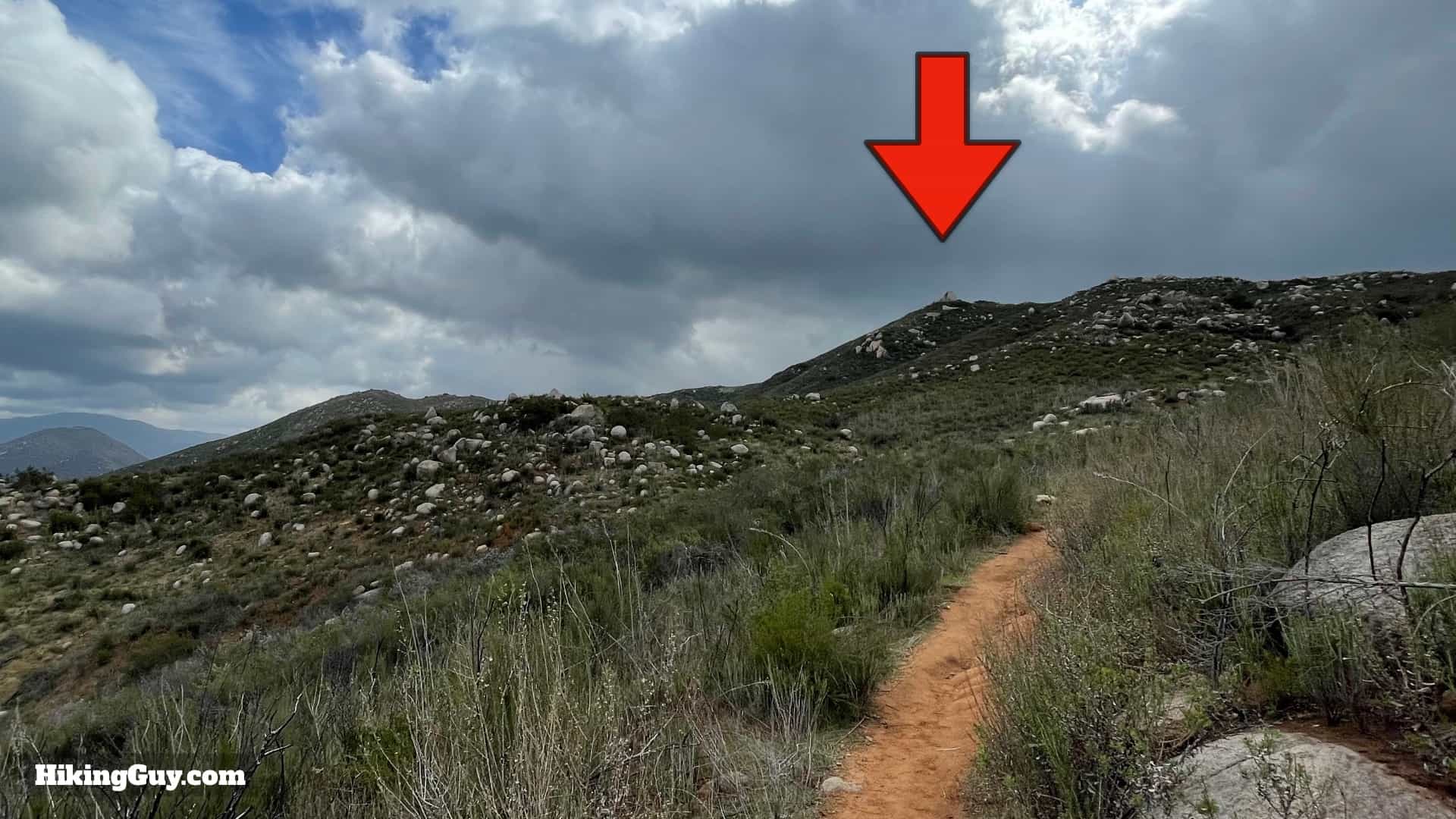
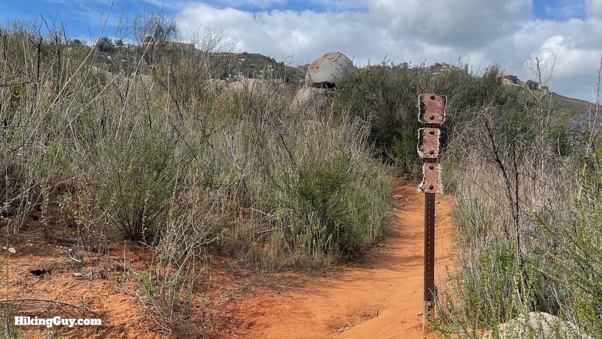
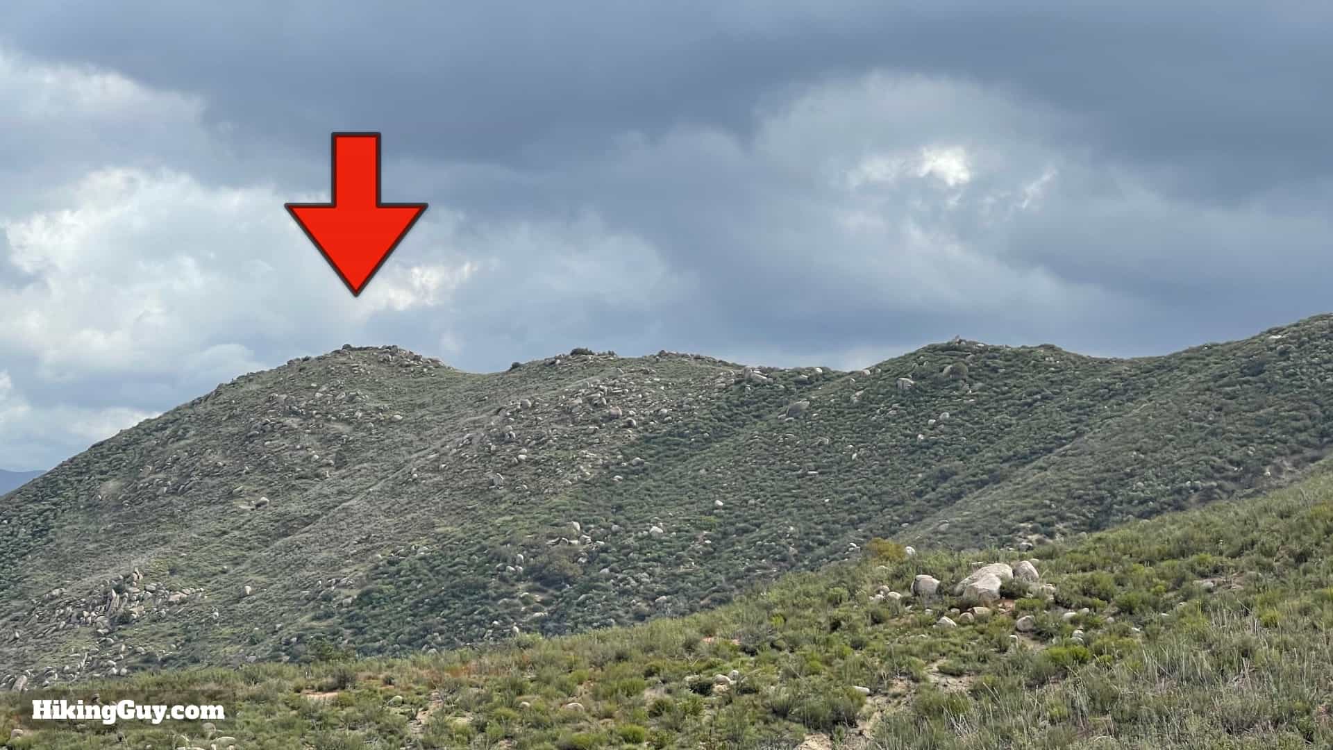
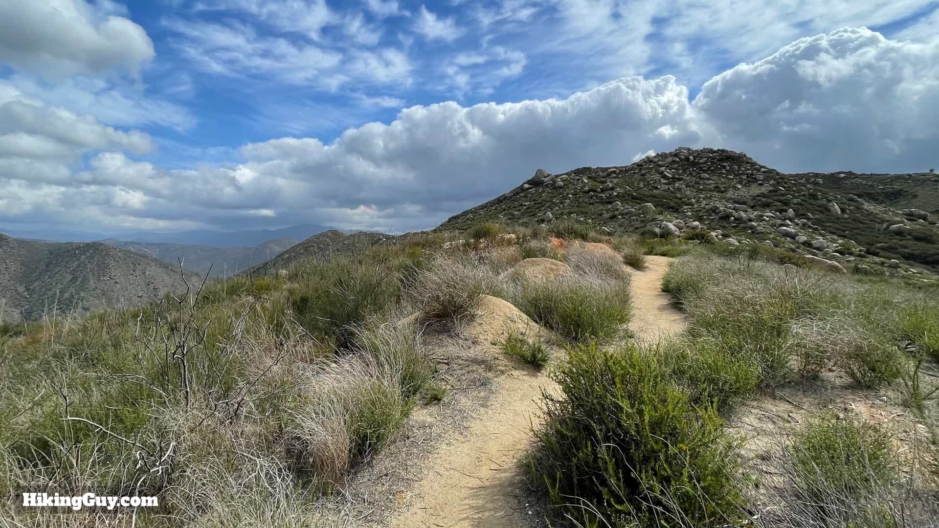
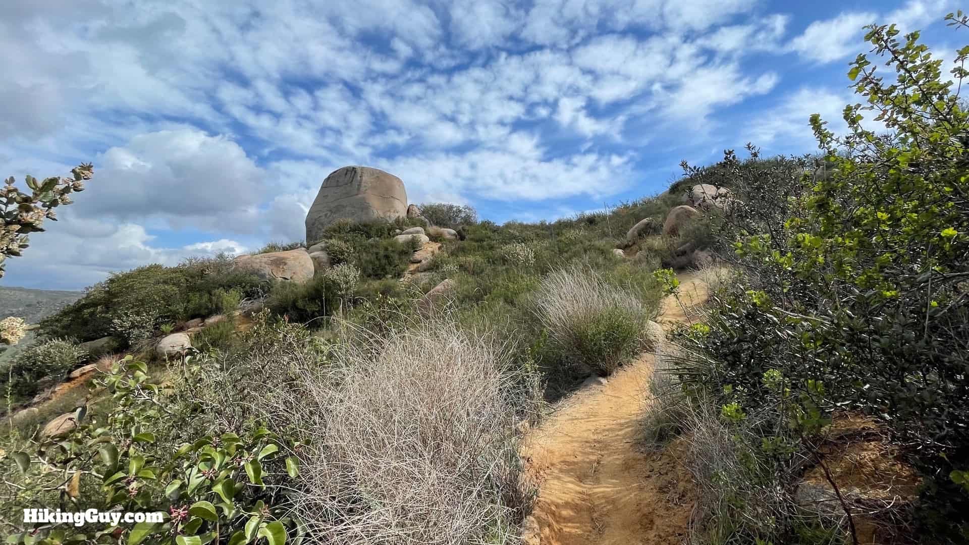
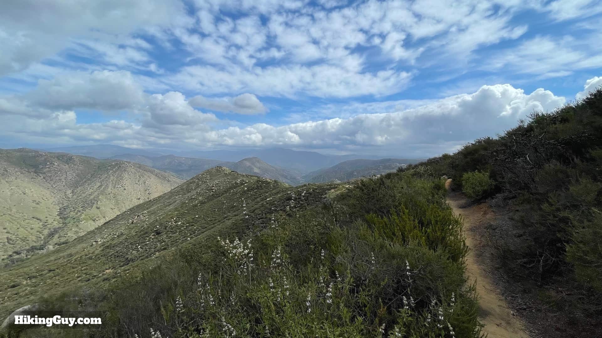
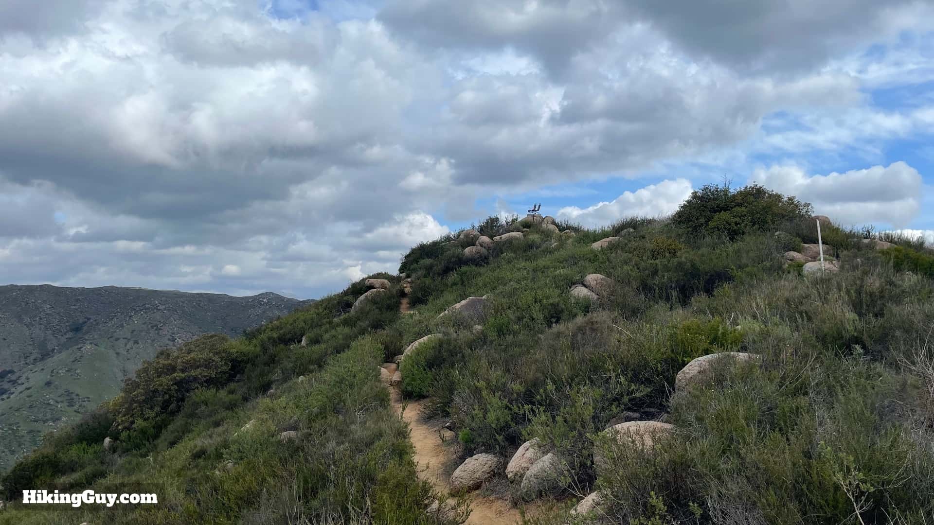
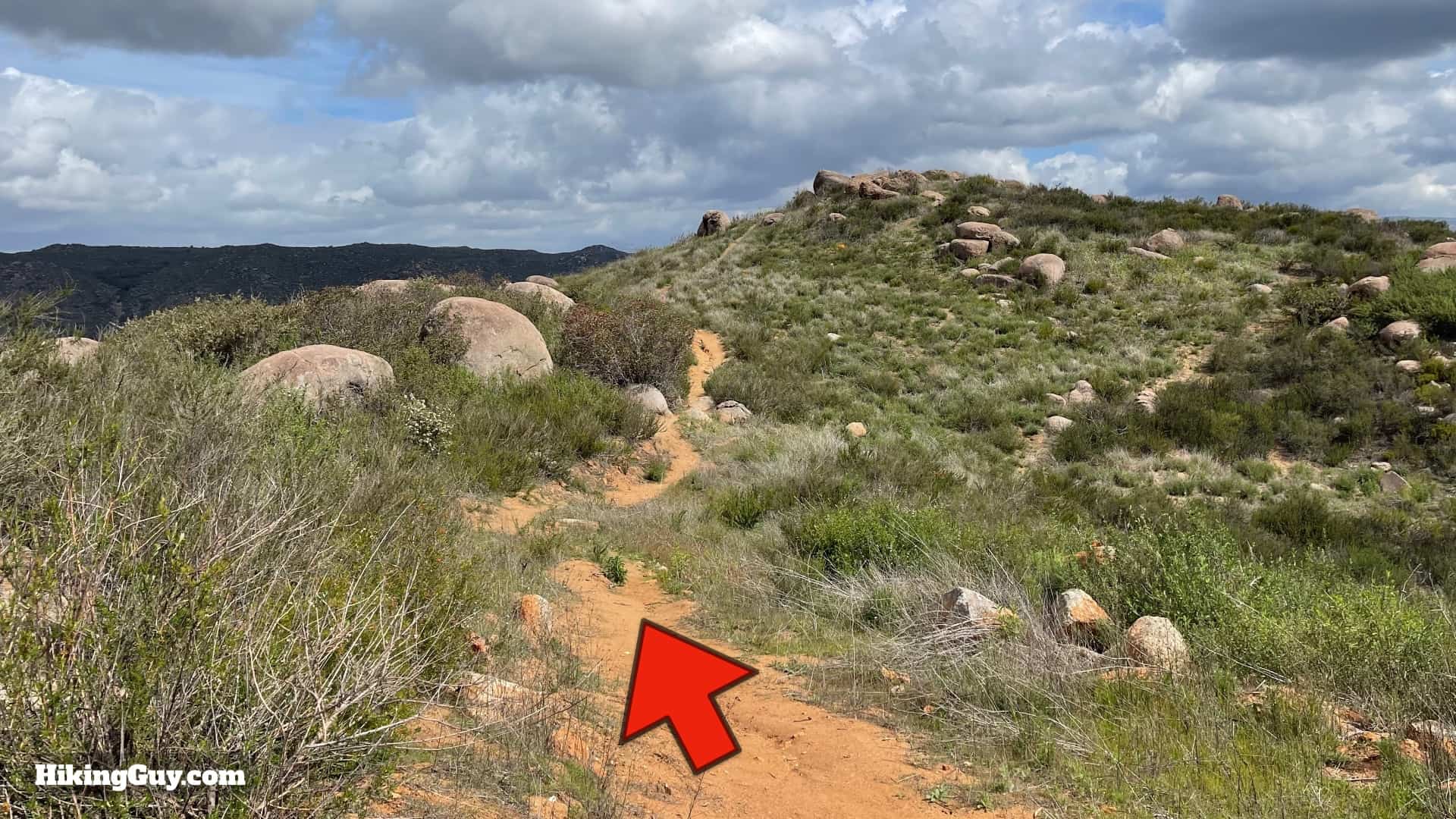
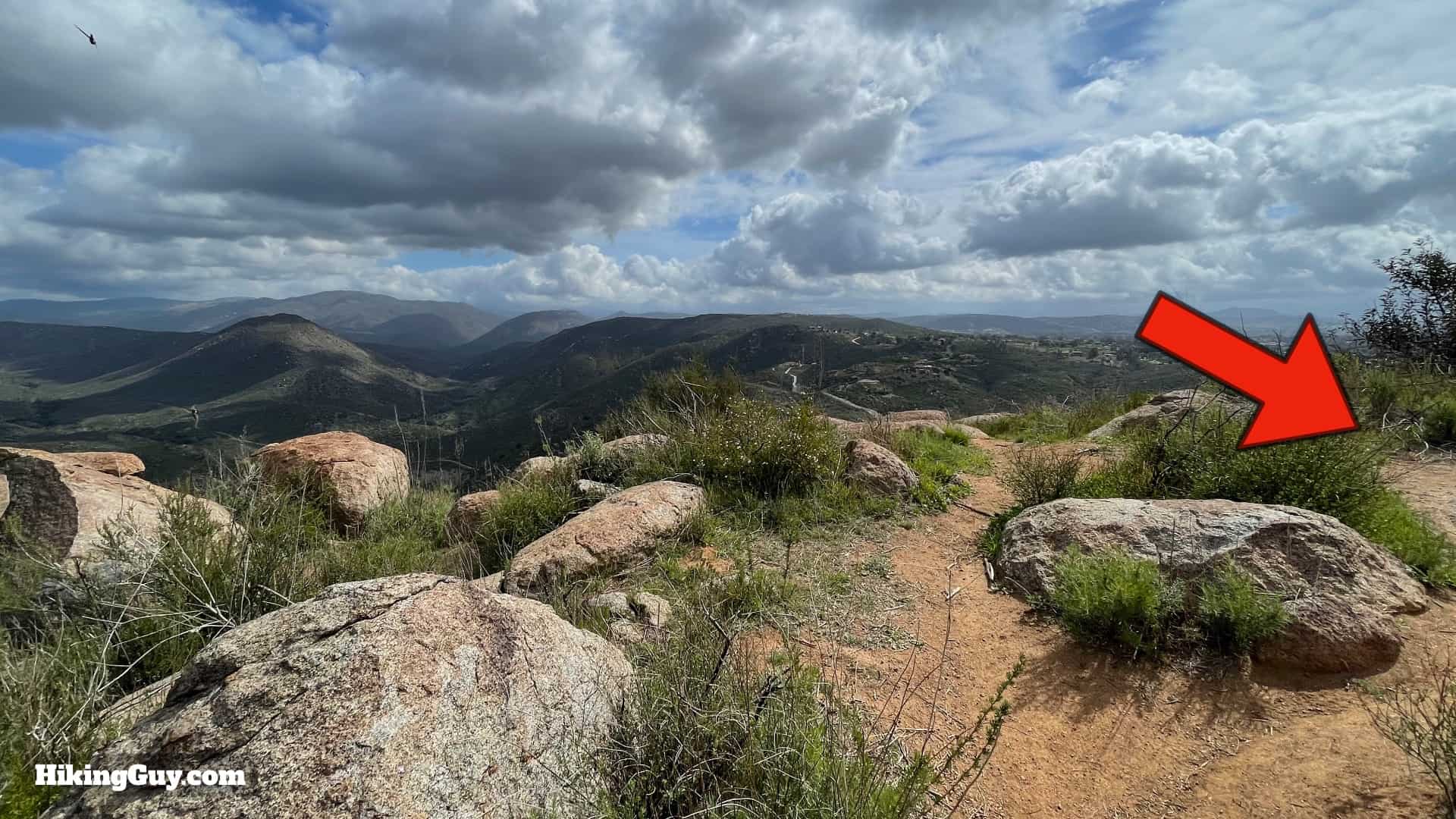
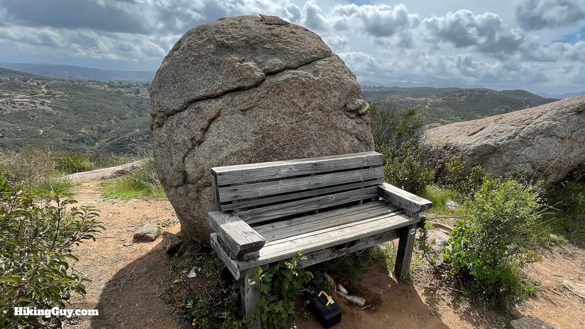
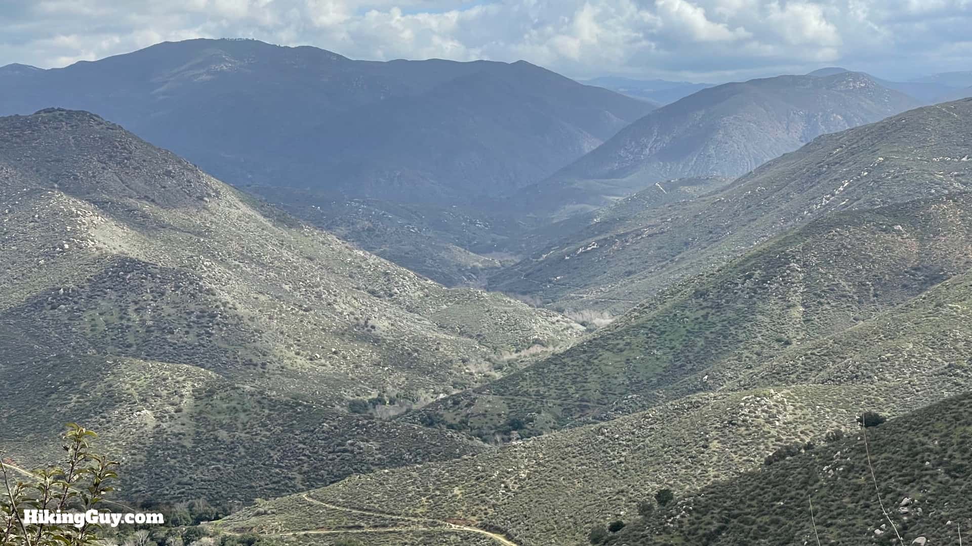
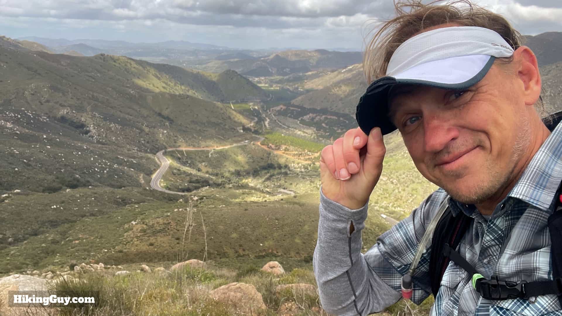
The trail starts a short way up from the parking area.Head through the gate to start the hike.After passing the gate you'll get the usual warning signs.The trail starts off as a gradual uphill with some wide switchbacks.Some sections get steep, but the trail doesn't have any long steep sections.In the spring the trail can get colorful. I recommend doing the hike in the winter and spring when it's green and lush.Pass the face rock.At the junction, go straight. To the right is what people call the Clevenger Canyon South-West Trail.The trail levels off and you hike into the gully, which has some trees that survived the 2018 Pasqual Fire. Maybe there's an Engelmann Oak in there somewhere.The vegetation in this section can be overgrown as you cross the middle of the canyon, which also has an intermittent stream.Now you start to climb again. That boulder in the distance is where you're going, and will be the high point on this hike.There are some steep switchbacks that wind up before the trail levels out as you approach the high point.You'll start to get some views along the ridge here. The final peak, Peak 1635, is the end of the trail.The major climbing is over and you just have some small rises as you approach the high point.Some sections here have stairs as you tackle a few short uphills.And soon you'll pass by the big boulder that you've seen for the last mile or so.Now it's downhill to Peak 1635.When you get to the big clearing by the building site (will be off to the right), follow the trail to the left.And shortly you'll see the chairs in the distance.Look for the hard right turn just below the chairs.And here you are at the chairs.Climb up the boulder and have a seat. The chairs rock and move a bit, which can be a little unnerving until you get used to it.This is the view that you get from the chairs. Not too shabby....When you're done, head toward the final peak on the trail that continues from the back of the chairs.Soon the end of the trail, Peak 1635 is in front of you.There are a few areas with boulders to climb around, but the official peak is a hard right.You'll find a bench and trail register here.You get great views into the San Pasqual Valley.And views up Boden and Clevenger Canyons. In the distance on a clear day you'll see Cuyamaca Peak and El Cajon.From here, just turn around and head back down the way you came. That's the hike, thanks for using my guide!
