The Indian Truck Trail offers an alternate way to hike Santiago Peak (Saddleback Mountain). It's not a rustic single-track trail like the Santiago Peak hike from Lower Holy Jim Trail, but instead includes some wider Forest Service dirt roads (Indian Truck Trail is also known as forest road 5S01). You might see a few 4x4s or mountain bikes, but otherwise it's very mellow. It's a beautiful hike, so don't let this stop you.
The Indian Truck Trail offers an alternate way to hike Santiago Peak (Saddleback Mountain). It's not a rustic single-track trail like the Santiago Peak hike from Lower Holy Jim Trail, but instead includes some wider Forest Service dirt roads (Indian Truck Trail is also known as forest road 5S01). You might see a few 4x4s or mountain bikes, but otherwise it's very mellow. It's a beautiful hike, so don't let this stop you.
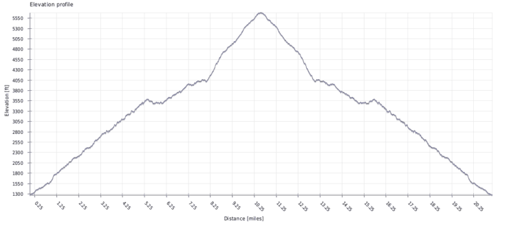
If you're training for the Mt Whitney hike, Indian Truck Trail is a good training option. It's roughly the same distance and climbing. The hike is a good way to get the miles in and get your body and gear prepped for a long day. What it doesn't have is the thin air and high altitude.
Getting to the Indian Truck Trail
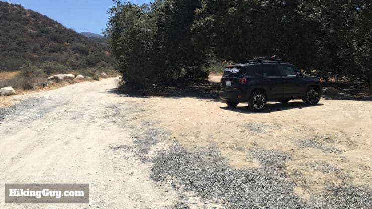
Thank you to my friend Sam whose updated me on the parking situation. It looks like they've started building a housing development where the old trailhead was, but there's still plenty of free parking. The new streets are not on some maps services yet, but the trailhead address here should get you close enough on Google Maps, and the following update from Sam should fill in the rest.
Trailhead starts from 1 street south of Towhee, and NOT from Towhee as indicated by the Google Map. There's construction activity for new houses in the area and trail now starts from Peony Dr, specifically at Peony Dr / Kingbird Dr intersection . According to Google Maps, the builder extended Kingbird west a few blocks. Peony runs parallel 1 block west of Towhee. There're ample street parking at the intersection.
In the summer this hike has very little shade and can be very hot. One time I did this in summer and the temperature at 2pm as 106F. Be prepared and leave before dawn if you want to beat the heat. And if it's cool out, expect the temperature to drop significantly as you climb.
Gear That I Love Right Now
Nothing is sponsored or promoted, just the actual gear that I use.
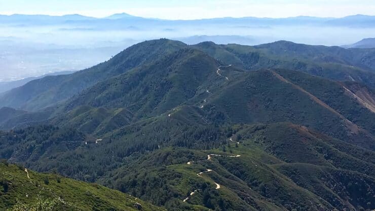
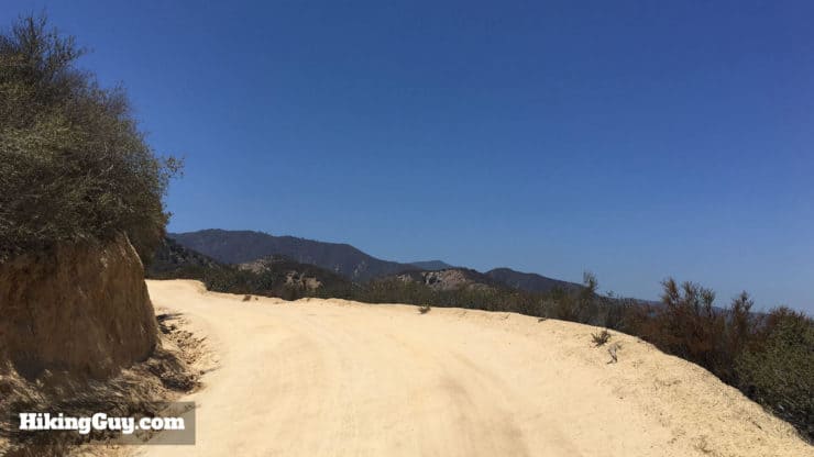
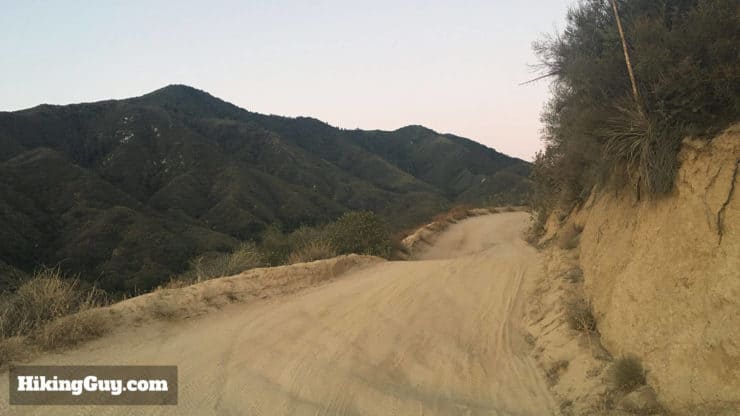
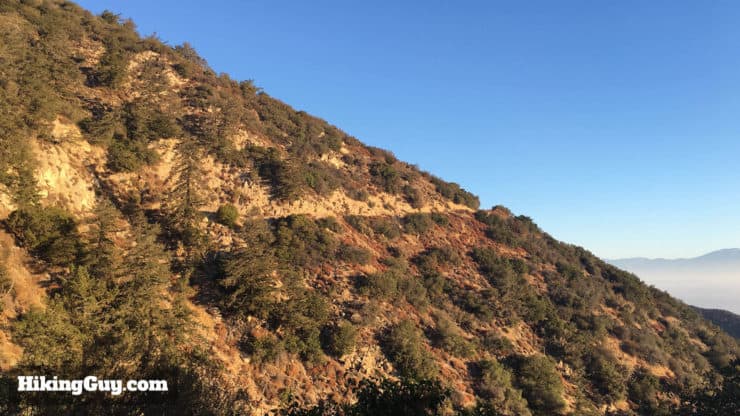
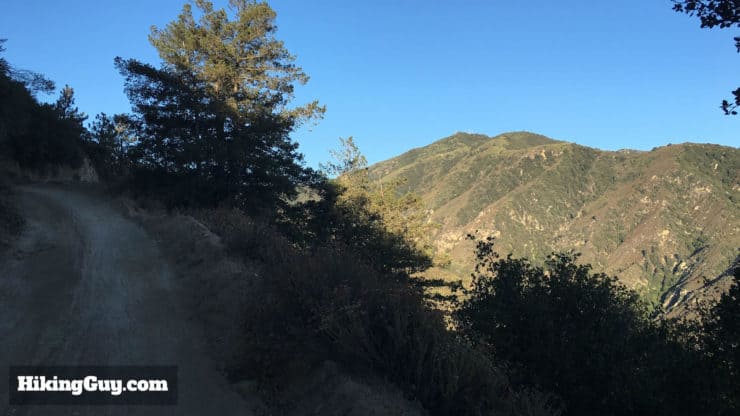
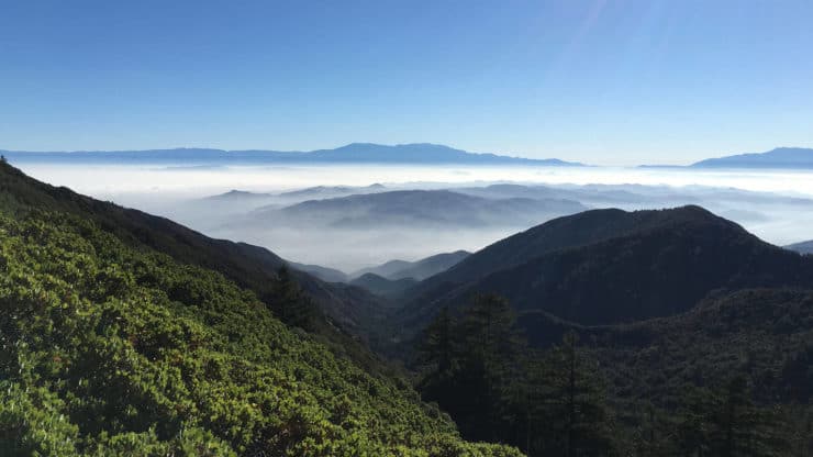
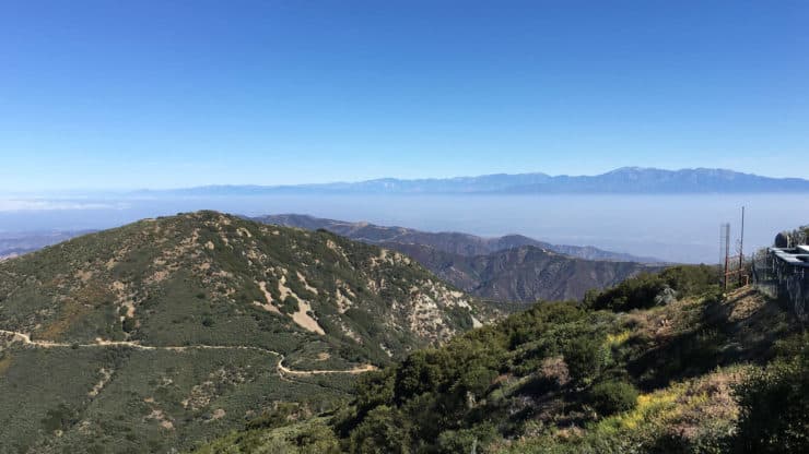
This route to Santiago Peak takes the eastern slope up through the Cleveland National Forest. As you climb, you'll have views east to San Jacinto.Indian Truck Trail pretty much goes straight up. The majority of the hike is on wide dirt roads, so the gradient is usually as easy as it can get given where you're going.
Indian Truck Trail to Santiago Peak Hike Directions
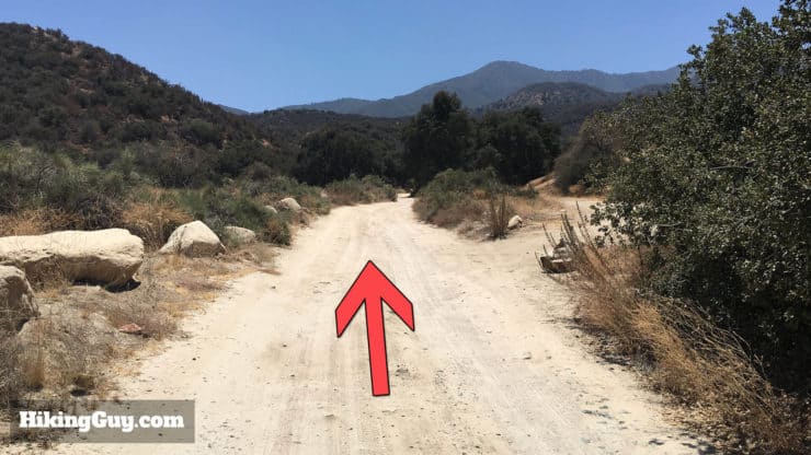
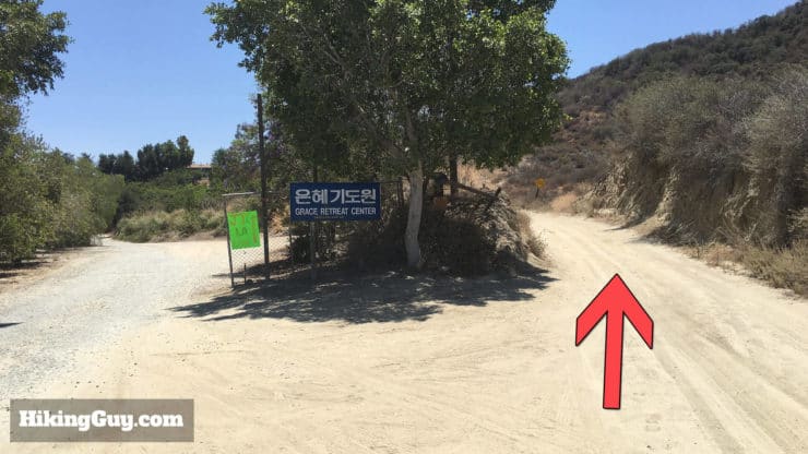
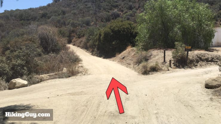
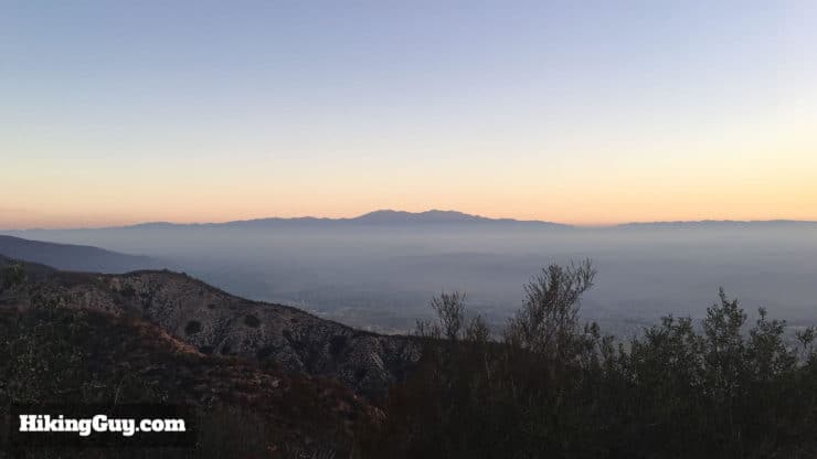
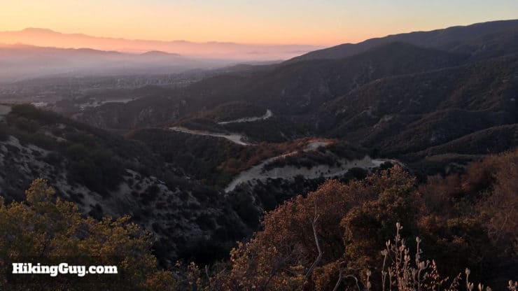
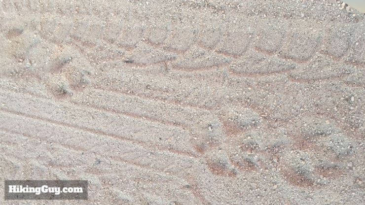
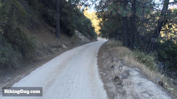
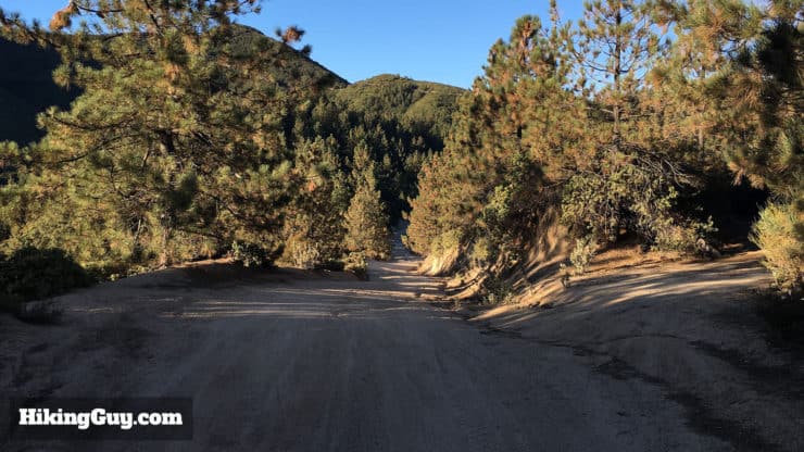
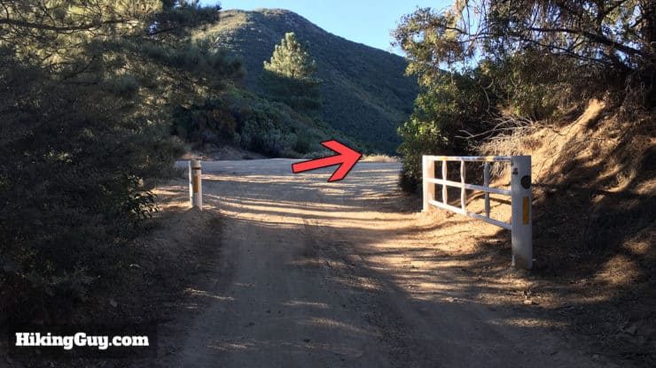
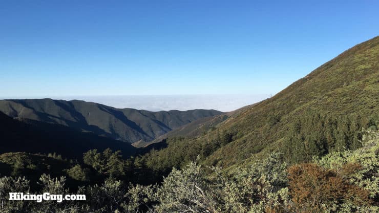
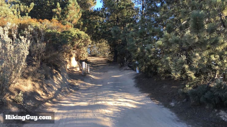
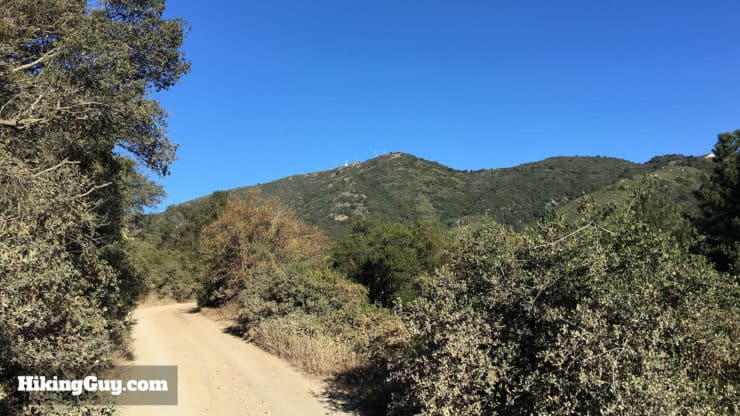
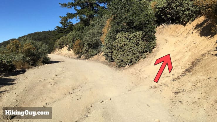
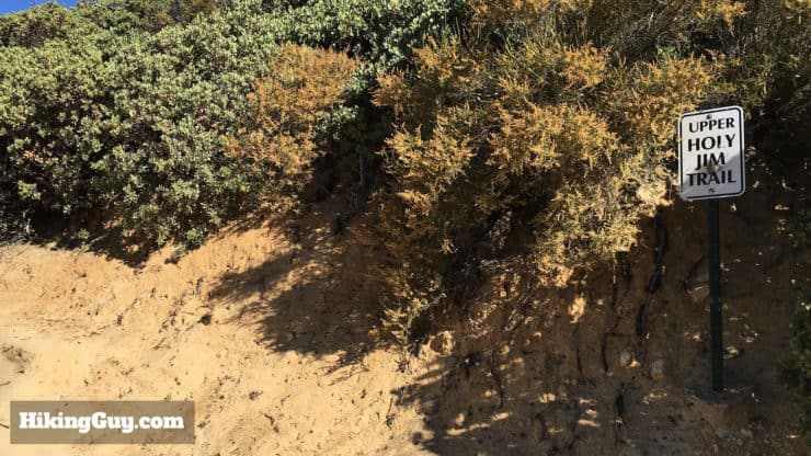
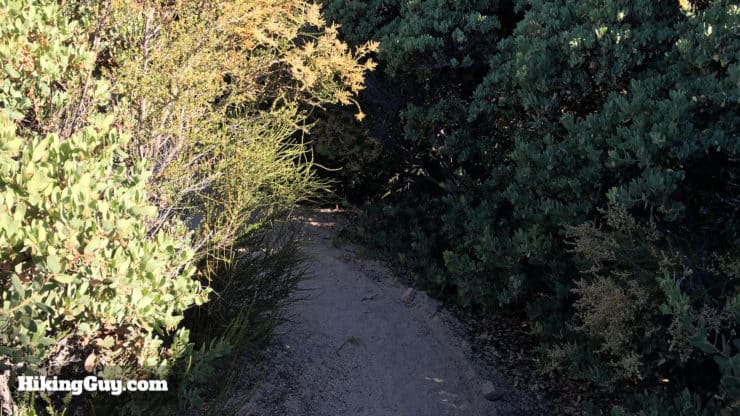
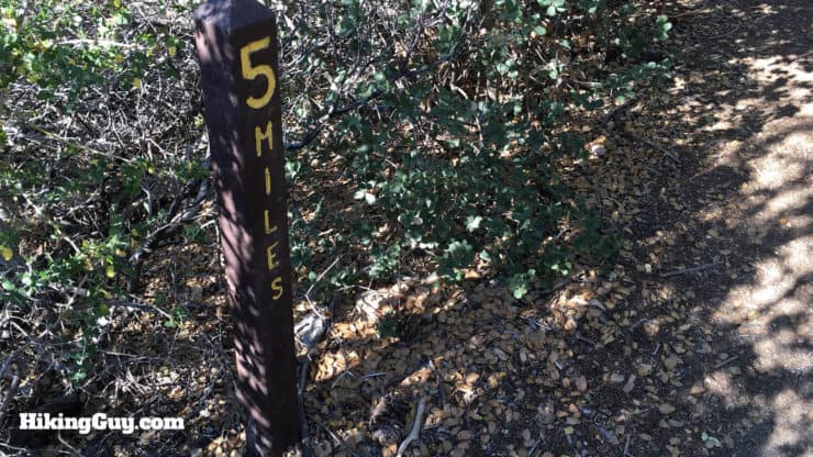
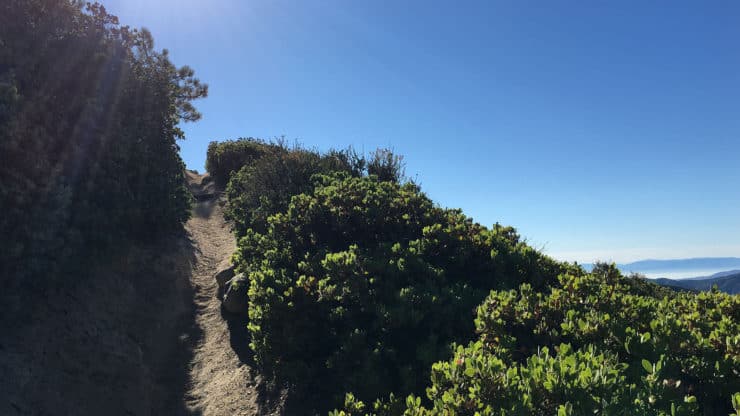
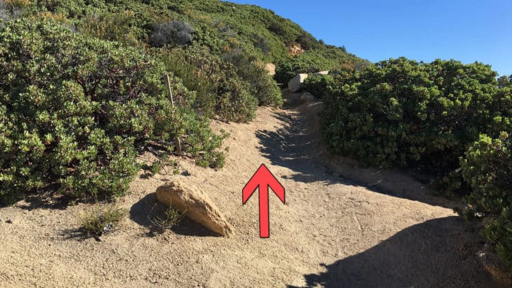
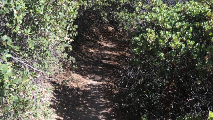
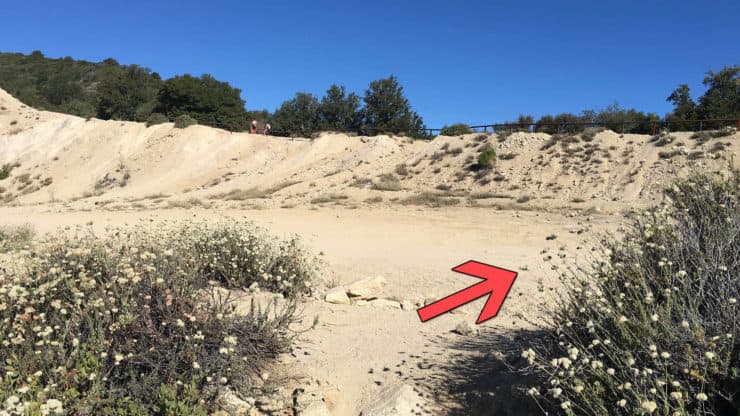
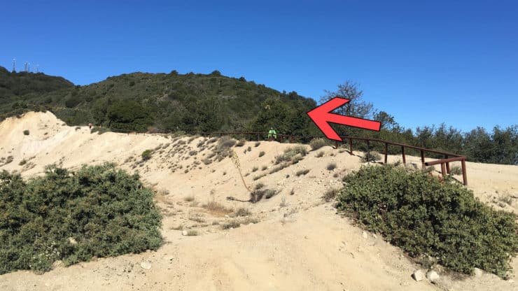
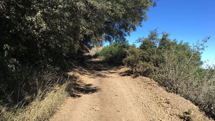
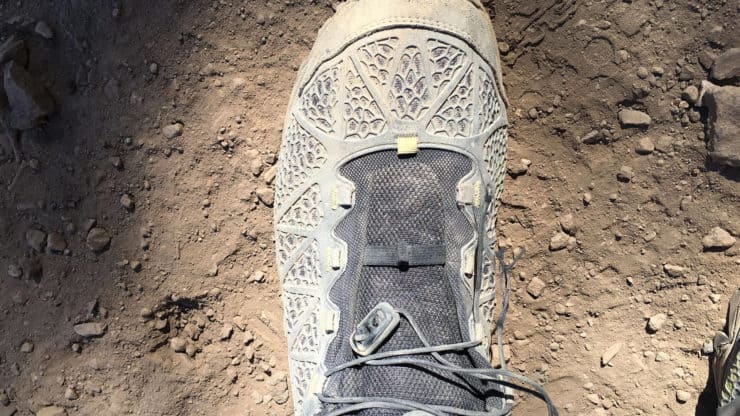
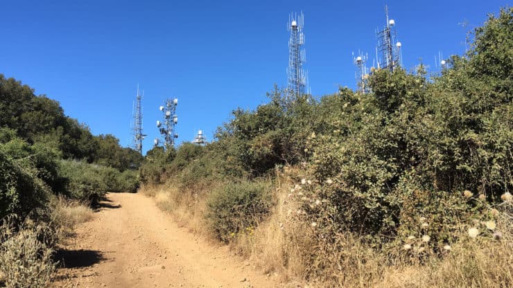
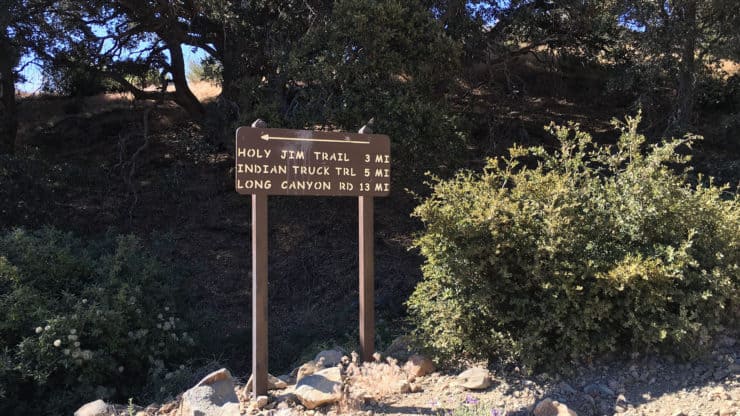
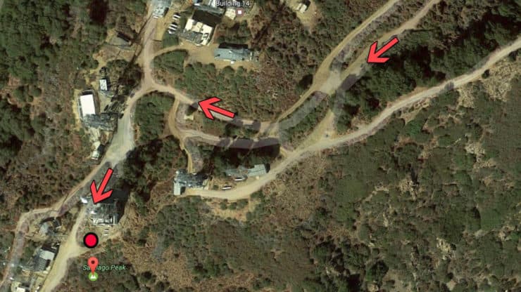
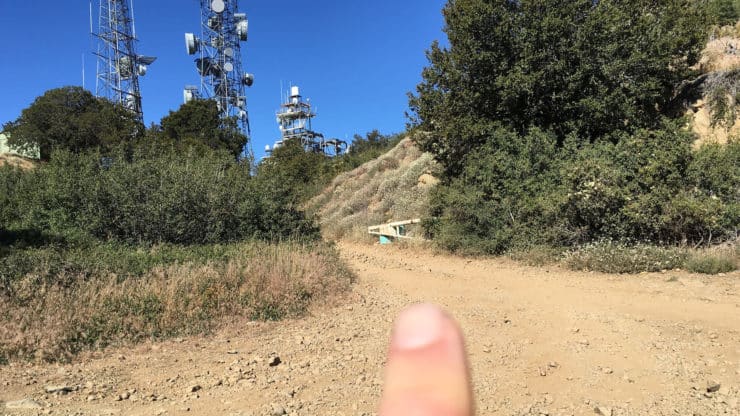
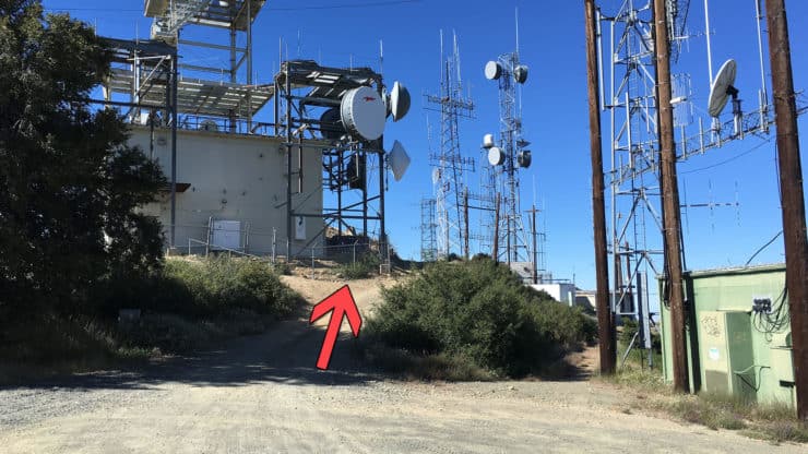
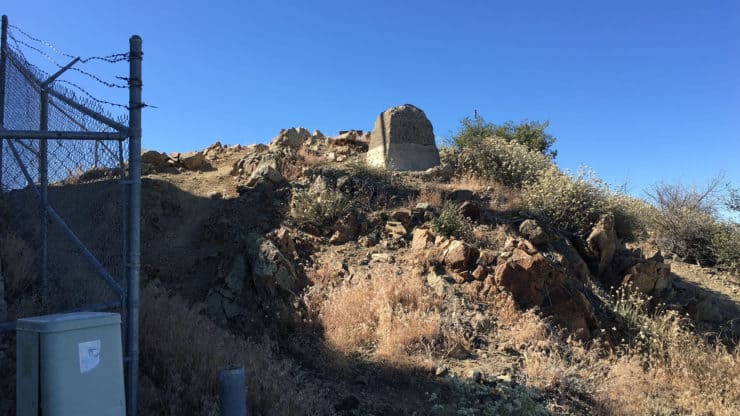
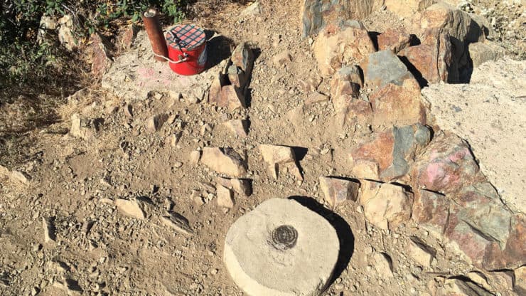
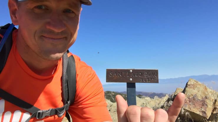
Here's the old parking lot.Right away the trail splits. Keep left and go straight. The area on the right has trash and old sofas where teens drink beers. This is from the old parking, can't confirm that this is the same on the new route.Shortly after starting you'll see the turn-off for the Grace Korean Church Retreat. Stay right and keep hiking uphill.You'll be hiking through a residential area here, and there are some driveways. Keep straight at the junction.Soon after that, the houses end and your on the trail to the summit.The trail is wide and climbs steadily. You'll start getting glimpses of the peaks in Cleveland National Forest as you climb.Don't forget to take breaks and look backwards. If it's clear you'll have great views of San Jacinto.You'll also get nice views of the twisty-turny Indian Truck Trail behind you.I spotted these big tracks on the sand. No claws, so could be a mountain lion. Anyone have any ideas?The Indian Truck Trail winds it's way up the side of the mountain.At about 4.5 miles you'll start getting glimpses of Santiago Peak. It's the one with all the antennas on it.The Indian Truck Trail steadily climbs and is always very easy to follow.You'll notice that the fauna starts to change around 5 miles in, with more pine trees. There's also an ease in the gradient on the hike at this section.At about 7 miles, you reach the end of the Indian Truck Trail. Make the right onto Main Divide Road.Once you past that gate you'll be able to see west, and on a clear day, see the Pacific Ocean.Continue up Main Divide Road, which is wide like the Indian Truck Trail and has a similar feel.You'll get views of the antennas on Santiago Peak as you make your way on the hike. So close, yet so far...Okay, this part is tricky. At around 8.2 miles, you'll see the Upper Holy Jim trail to your right. It's small and easy to miss. Hike up the Upper Holy Jim trail.You'll see this sign when you turn onto the Upper Holy Jim trail, but it's easy to miss when you're hiking up Main Divide Road. UPDATE: I got a report that the sign is gone, so be extra aware when you're looking for this turnoff, it's easy to miss.The Upper Holy Jim trail condition is the opposite of the rest of the hike. It's narrow, twisty, and turny. One of my favorites.You'll see a 5 mile post, which is the distance if you took the Lower Holy Jim trail up. I have directions for that hike too.The views from the Upper Holy Jim trail are pretty awesome. You'll see San Jacinto, I-15 and the Inland Empire below you.The trail is small but easy to follow.At around 9 miles you'll see an junction with the Coldwater Trail. If you took a right here, you could theoretically head back to Corona, close to where you started. Coldwater Trail is washed out at the bottom, is very overgrown, and requires a detour through a private quarry to get back onto public streets. This hike recommends that you just go back the way you came up, avoiding this trail.The end of Upper Holy Jim has some nice shady spots if you want to take a snack break.The Upper Holy Jim trail dead ends back on Main Divide Road. Hike to the right.Once you are back on Main Divide Road, it sweeps around and heads up. Keep hiking up. Sections are pretty steep here. Not too far from here!This last part of the hike is a steep dirt road.At this point on my hike the lace on my boot broke. It seems that a small pebble got wedged inside the hoop where the lace passes through, and it ground through the lace with every step. Surprisingly the boots still fit snugly and I was able to do the last 12 miles of the hike without the lace. Otherwise I would have improvised with duct tape.HOLY MOLY YOU MADE IT! The last part can feel like it goes on forever.There's a sign here with some mileages. The 5 miles to Indian Truck Road is if you take Main Divide Road all the way. The Upper Holy Jim trail is a shortcut.Okay, so the summit at Santiago Peak can be confusing. This satellite view will be helpful in making your way to the actual summit marker. The first arrow is at the last picture.Hike right up towards the higher towers. You'll hear the hum of electricity. It's not the most scenic of summits. If you want a similar experience without all the development, I'd recommend Modjeska Peak, the other hump of Saddleback Mountain.After the large antennas, there's a little building with another array of antennas. Head just past it.Right after the building there's a small trail to the top of the hill. This is the summit!Look down to find the USGS marker and trail register.Unless it's been stolen, there's usually a summit sign here that you can grab some shots with. From the summit you'll have 360 views of all of Orange and Riverside counties. On a clear day you can see from Catalina to San Gorgonio.After you enjoy the summit, you just head back the way you came. It's a long hike, so don't forget to take breaks to eat and hydrate on the way down. 21 miles is a long, long day, and if you did this hike, you're a tough cookie. Happy trails!
If you're considering descending down Coldwater Canyon, which is on some topo maps, know that most of the trail disappears at some point and you end up bushwhacking. This hike guide has you going donw the same way you came up, avoiding Coldwater Canyon.
Need More Info?
Have a question about the guide or want to see what other people are saying/asking? View the Youtube comments for this video. Leave a comment and I will do my best to respond.
When planning, always check the park website and social media to make sure the trails are open. Similarly, check the weather and road conditions.


 Using the Apple Watch for Hiking
 Garmin Fenix 7 & Epix Review For Hikers
 How To Read a Topographic Map
 Garmin GPSMAP 67i Review
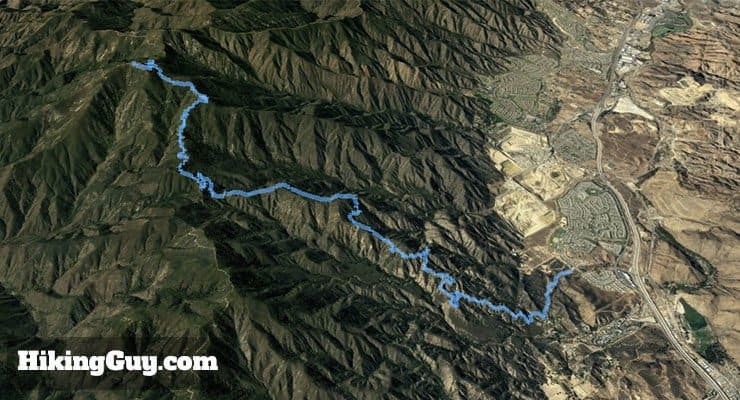
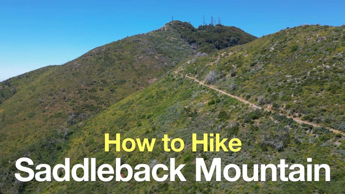 Saddleback Mountain Hike (Santiago Peak)
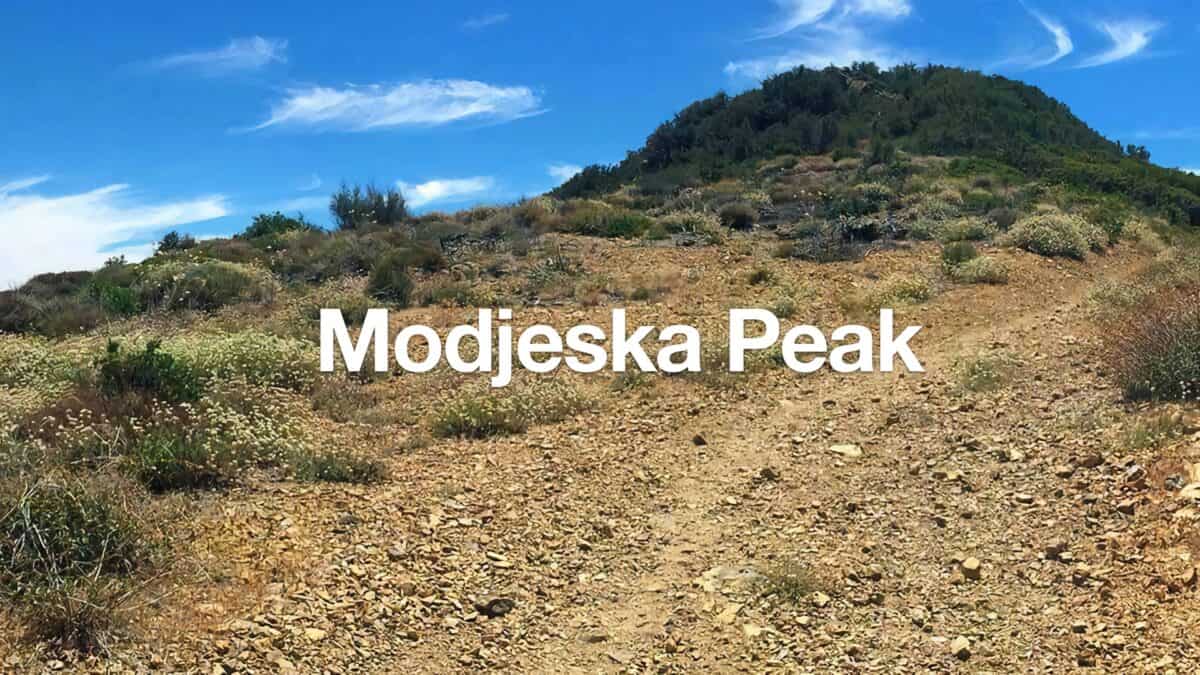 Modjeska Peak Hike
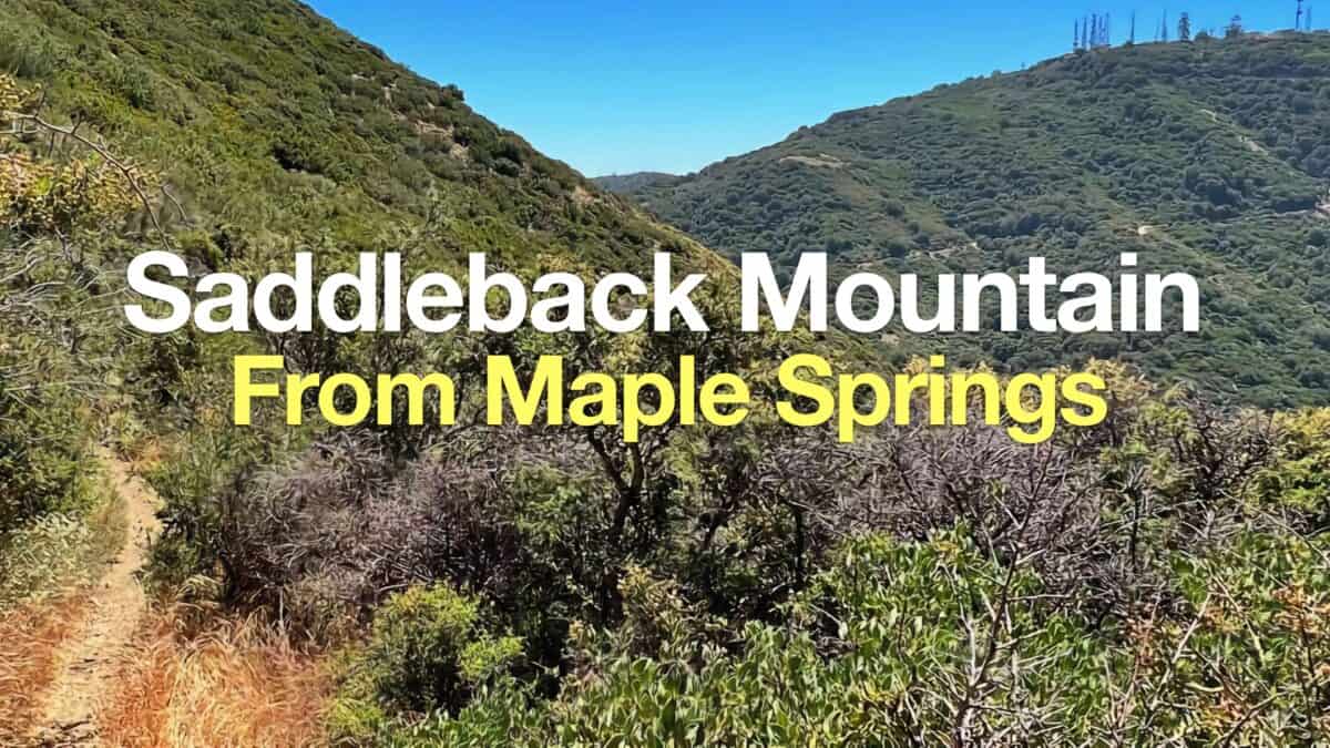 Hike Santiago Peak & Modjeska Peak From Maple Springs
 Hikes In and Around Orange County
 Cleveland National Forest Hiking
 LA Mountain Hikes
 Sierra Club 100 Peaks
 Best Hiking Gear 2024
 Hiking Boots or Shoes: Do I Really Need Hiking Boots?
 When to Hit SOS on inReach