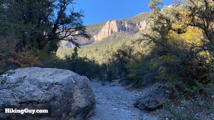
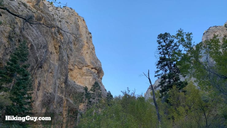
The Fletcher Canyon Trail is a beautiful hike nestled in the Mt. Charleston Wilderness Area, within an hour of the Las Vegas Strip. The hike is a gradual uphill through a pine forest along a (mainly dormant) stream and ends in Fletcher Canyon, a beautiful slot canyon with 200 feet walls, water-polished rocks, and great views of Mummy Mountain. The hike is uphill but relatively easy, and is good for all levels of hikers and families too.
The Fletcher Canyon Trailhead is in the Mount Charleston area, about 45 minutes from downtown Las Vegas. The drive to the trailhead is spectacular as you transition from the desert to the alpine scenery of Spring Mountains National Recreation Area.
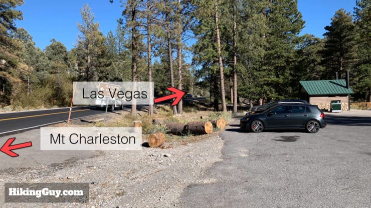
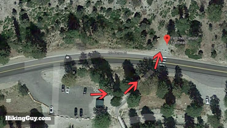
The trailhead parking is on the left shortly after you pass the intersection with Rt 158.
There is plenty of parking but it does fill up quickly on weekends.
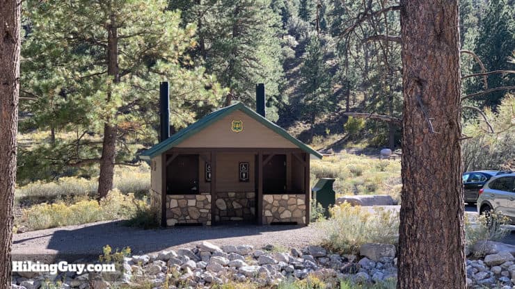
The parking lot is on the left side as you go up Route 157 toward Mt CharlestonThere are primitive bathrooms at the trailhead.
Gear For the Hike
Bring a camera and keep your eyes out for the abundant wildlife here, including the endangered Palmer's Chipmunk, which is only found in this area and is pretty easy to spot. Photo Chris Lowrey/USGS
This is a mellow hike and you don't need any special hiking gear here, but hiking boots will definitely help. Fitness or casual outdoor clothing will suffice in pinch. Bring at least 1L of water. In the winter there can be snow, in the summer it can get very hot (but not as hot as Vegas which is a few thousand feet below).
Gear That I Love Right Now
Nothing is sponsored or promoted, just the actual gear that I use.
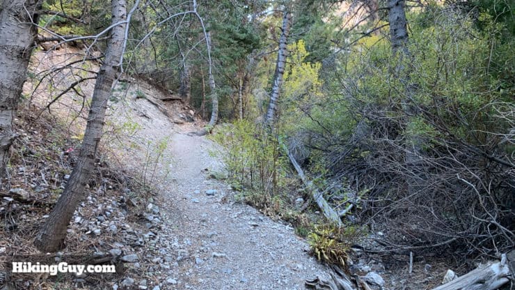
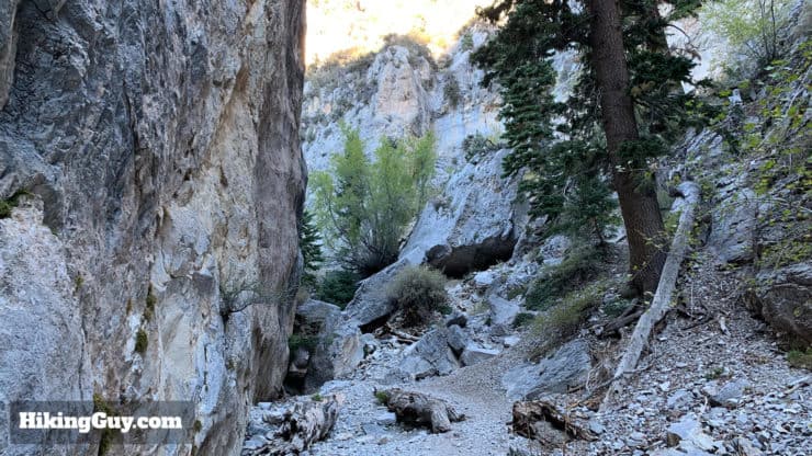
The Fletcher Canyon Trail winds up the canyon in the shadow of the bigger mountains around it.It's a steady uphill grade with some very short steep sections, but overall very gradual.
Fletcher Canyon Trail Hike Directions
Do not attempt this hike if there are thunderstorms in the forecast. Flash floods can wash down Fletcher Canyon quickly.
There can be water running in the stream depending on when you're here. Generally it's only in the upper reaches of the canyon/hike if at all.
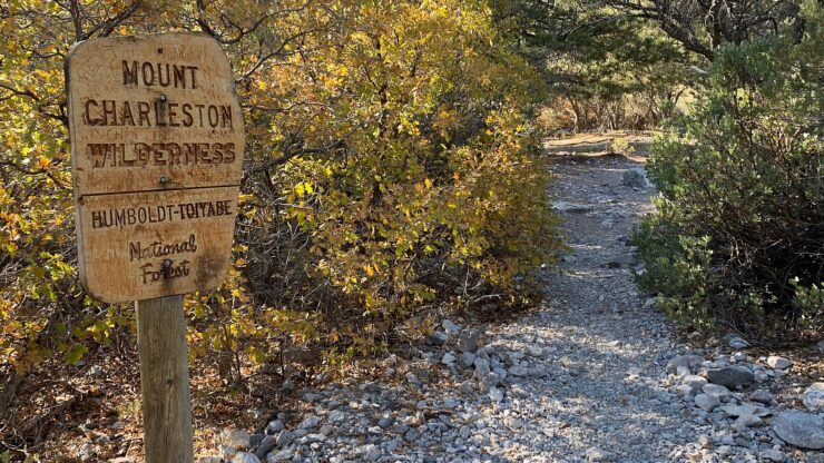
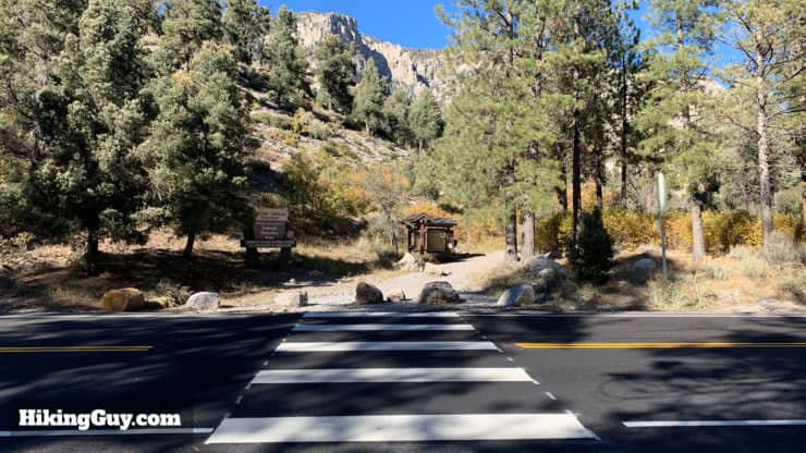
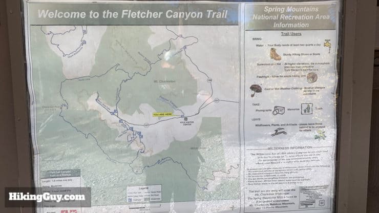
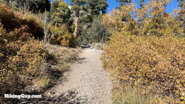
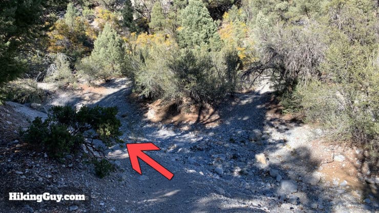
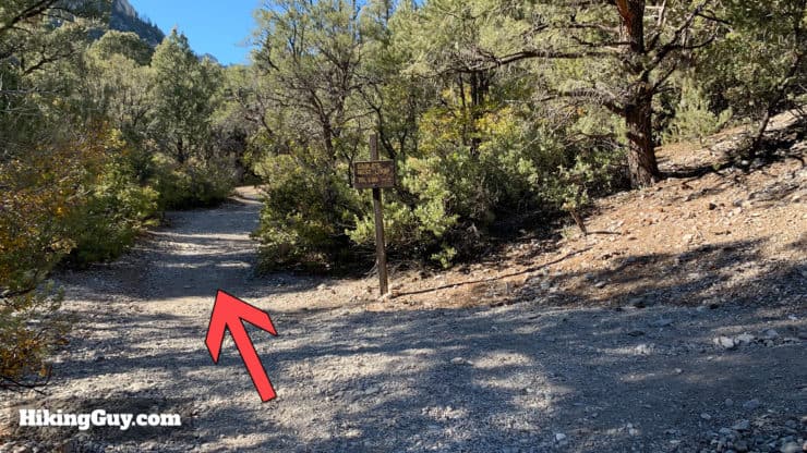
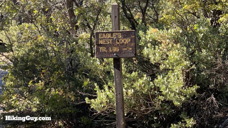
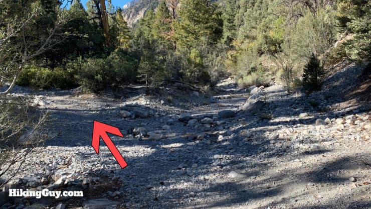
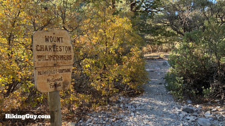
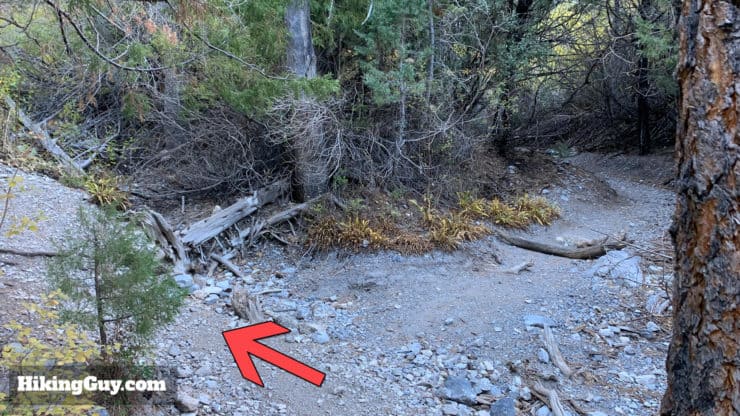
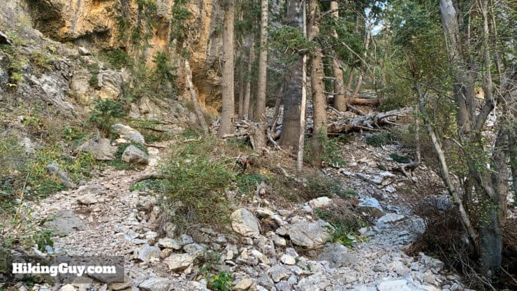
Head past the bathrooms and across Rt 157 to get to the trailhead from the parking area.There's a big sign marking the trailhead, along with some basic trail information on the trail board.There's a basic map on the trail board.After the trail board the trail is well defined, easy to follow, and gradually climbs.The trail bends around to the left, with the stream on the right. The trail will go back and forth over the stream a few times.Right away you're greeted with nice views of the surrounding mountains. There's lots of fauna including pinyon pine, ponderosa pine, manzanita and mountain mahogany trees.Shortly after the start you'll see a turnoff for the Eagle's Nest Loop Trail. Keep going straight on Fletcher Canyon Trail.Here's a closeup of that trail sign. If you want to add some distance onto the hike, you can do the 2.75 mile Eagle's Nest Loop trail. It's steep in the beginning but then gentle, and offers nice views into Kyle Canyon (the canyon you drove up).The trail crosses over a wide wash back to left side of the stream.Shortly after the wash there's a (marked-up) Mt Charleston Wilderness sign that's good for a photo.
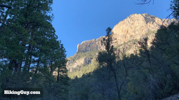
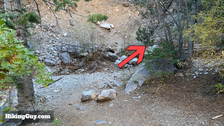
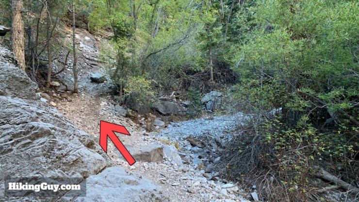
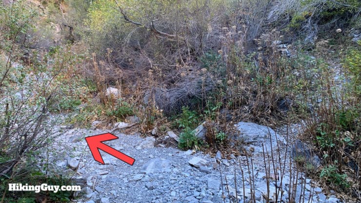
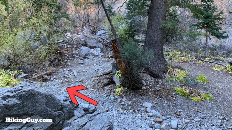
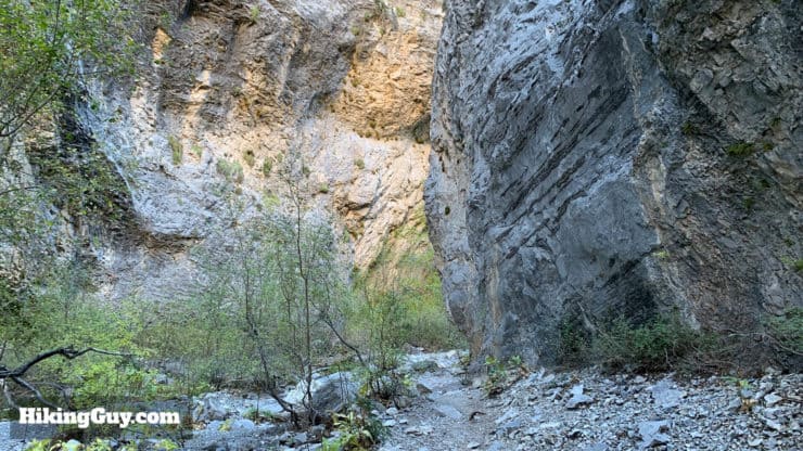
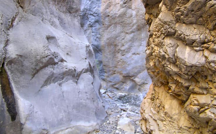
The limestone cliffs tower above you as you make your way through the pine forest. This lush section attracts lots of birds.This next section can get a little tricky; it's not the wide trail like before. The trail often splits and comes back together along the stream. If you hit a dead end, heavy brush, or boulder scramble, just turn back and take the other option. In general the side trails to the left climb up and over many boulder scrambles.Keep left and avoid the streambed.You'll go up a steep little section bypassing a scramble, then back down.Continue on the left bypass, avoiding the stream bed.Keep left again on the well-worn path.You'll start to see the canyon walls closing in around you as you reach the end. The cliffs on either side are above 200 feet above you.There's one more little uphill section.After the climb there's a flat area, do a hard left here.Almost there! The trail winds it's way along the canyon.And here you are, the end of the trail, which dead ends at Obstacle Rock. You can scramble up the boulders and rocks if you want to keep exploring. If you do, just be careful, the smooth rocks get very slippery, especially if there's moisture around.If you keep climbing up the canyon gets very narrow. You can explore but be prepared to scramble.Once you're done enjoying the beauty of the canyon, simply head back down the way you came to end the hike.
Need More Info?
Have a question about the guide or want to see what other people are saying/asking? View the Youtube comments for this video. Leave a comment and I will do my best to respond.
When planning, always check the park website and social media to make sure the trails are open. Similarly, check the weather and road conditions.


 Using the Apple Watch for Hiking
 Garmin Fenix 7 & Epix Review For Hikers
 How To Read a Topographic Map
 Garmin GPSMAP 67i Review
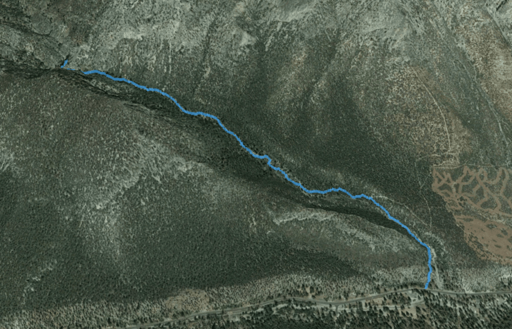

 Calico Tanks Trail
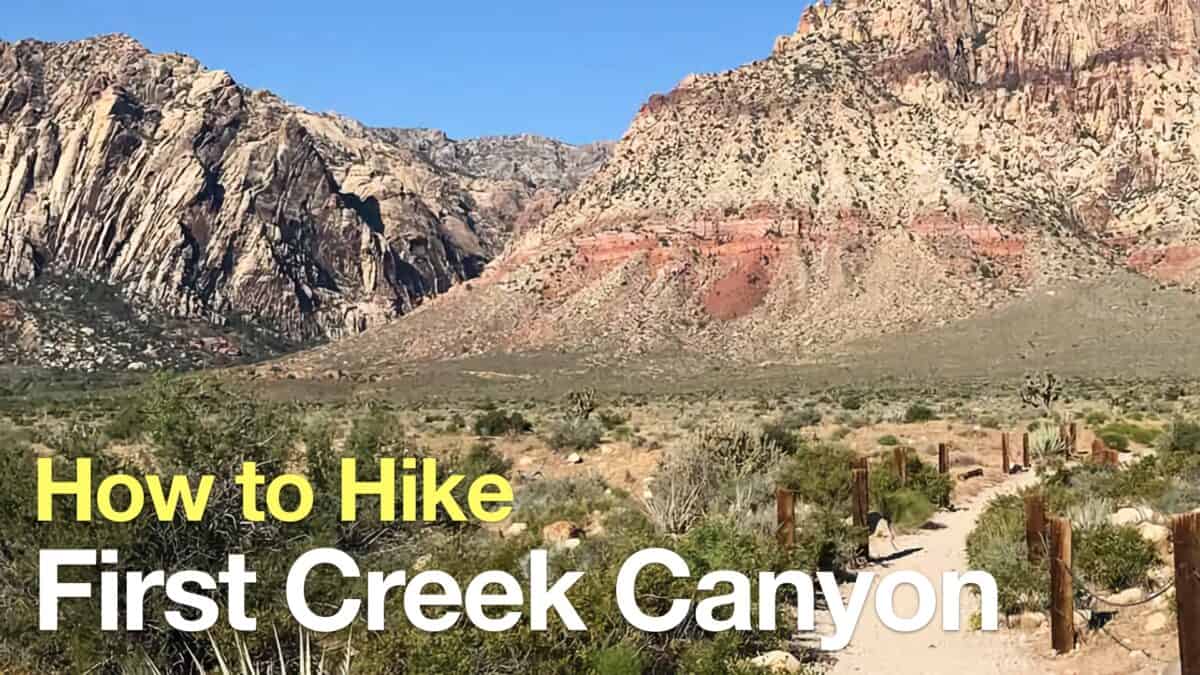 Hike First Creek Canyon Trail
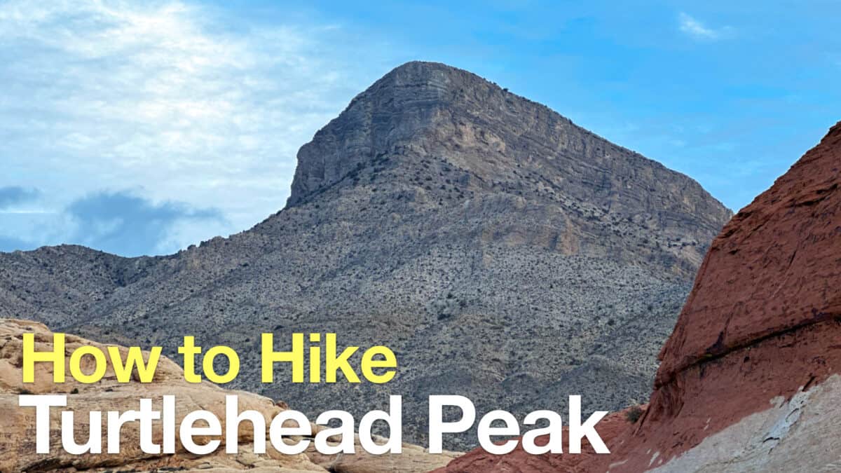 Turtlehead Peak Trail
 Las Vegas Hikes
 Best Hiking Gear 2024
 Hiking Boots or Shoes: Do I Really Need Hiking Boots?
 When to Hit SOS on inReach