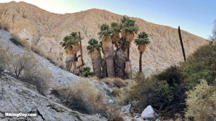
The hike to Pushawalla Palms in the Coachella Valley Preserve is a must-do hike in the Palm Springs area. You'll follow a ridge on top of the San Andreas Fault to the hidden Pushawalla Palms grove, fed by water that has risen to the surface through cracks in the fault. On the way back, you'll hike through Hidden Palms, full of thick growth fan palms. The Pushawalla Palms loop is a spectacular hike and not to be missed.
In this Guide:
Video and Turn-by-Turn Directions for the Pushawalla Palms Trail Loop
Where to Park for the Pushawalla Palms Trail
Insider Tips and Gear Recommendations for the Hike
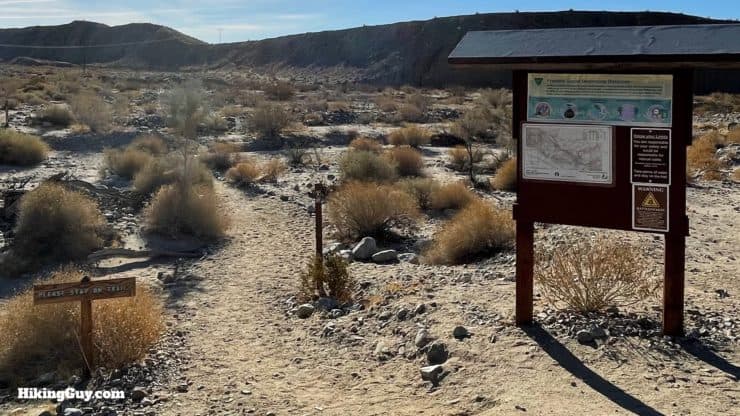
The Pushawalla Palms Trail is located in the Coachella Valley Preserve. Unlike other trails that start at the gated visitor center and are closed some days, the Pushawalla Palms trailhead is just off the road outside of the visitor center, and is generally open all the time. Check the park website link at the beginning of the guide to confirm.
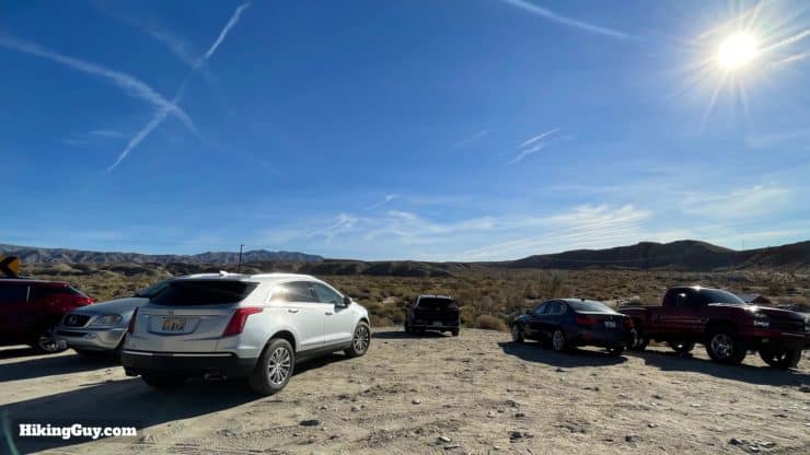
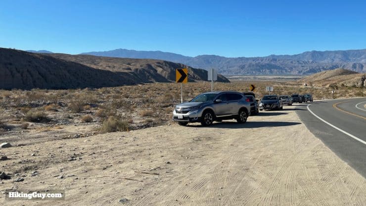
There's a small dirt parking area around the trailhead.And when the parking area fills up, you can park in the dirt along the road.
Gear For the Hike
This is an exposed desert hike, and you should plan accordingly. I bring 2L of water and plenty of sun protection. It's not a summer hike, ass it's almost completely exposed (except for the oasis areas). Some folks find trekking poles helpful on the sandy slopes.
Gear That I Love Right Now
Nothing is sponsored or promoted, just the actual gear that I use.
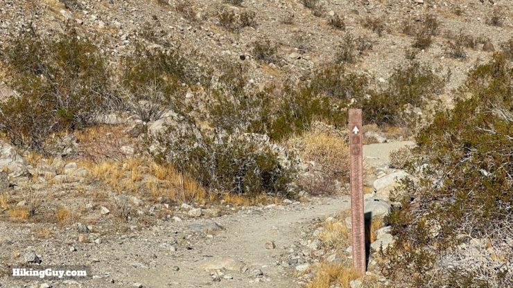
Overall the trail is well-marked, with some spots that are a little confusing if you don't look at my turn-by-turn directions below. The trail is a mix of hard-packed sand and loose sand.
Another thing to note is that there are a fair amount of other trails and unmarked trails. If you look at other guides, you'll see that many of them are different variations of some of these trails. I picked this routing and loop because I think it's the most scenic and fun. But it's easy enough to choose your own adventure if the fancy strikes you. I included an alternate route to the palms in the map and GPX below. Also note that many of the trails are not shown on OSM and similar trail maps. I'd highly recommend using my GPX file on your GPS device to confirm your position, and knowing how to read a topographic map is a great skill to navigate this desert hike.
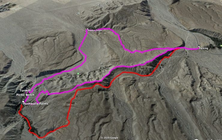
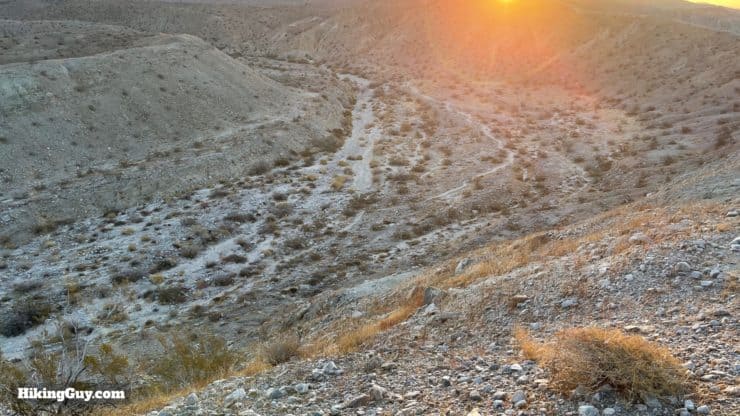
In the beginning you'll climb up the ridge, and then descend back down to Pushawalla Palms and then to Hidden Palms. From there it's a very gradual climb back to the start.
3D Map
The purple line is the recommended loop, the red line the alternate. On the purple line you'll hike along the ridge and then descend to Pushawalla Palms. From there, you'll cross the flat desert to the Hidden Palms grove, then climb back to the start.
Hike Brief
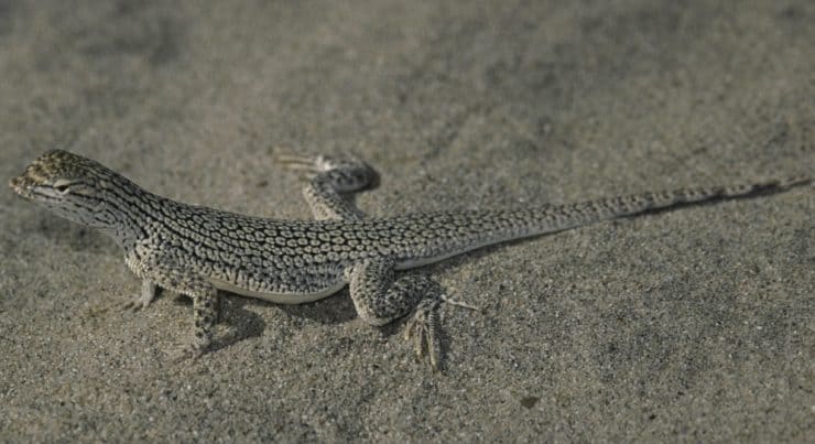
While you may see the usual variety of lizards and snakes out here, keep your eye open for ones that look like this (it's about 6-9 inches long). This is the Coachella Valley Fringe-toed Lizard, which is endangered and is only found in a 19-square mile range here now (down from 270 square miles). Unlike most other lizards, these guys can use their wedge-shaped noses to burrow under the sand to escape the heat and predators.
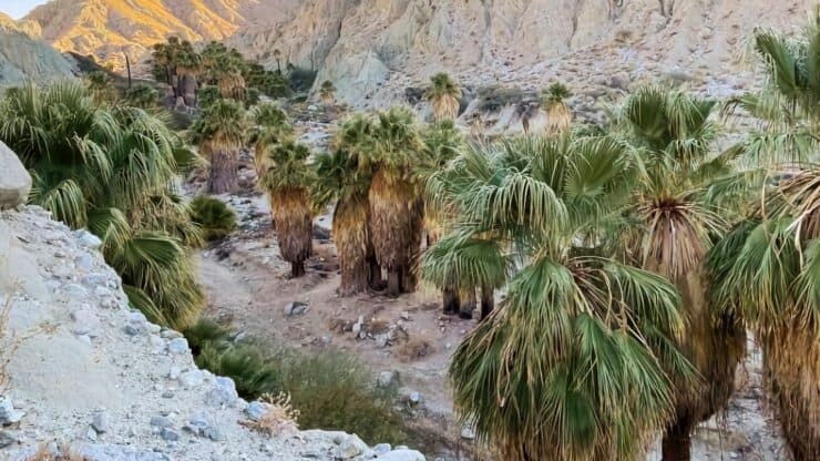
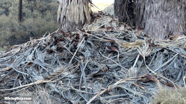
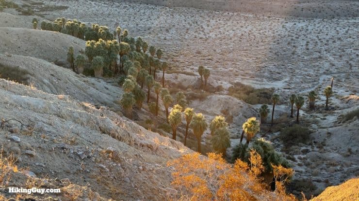
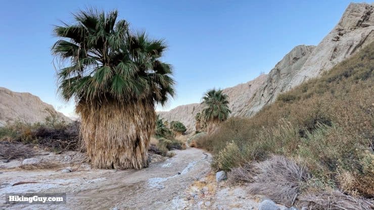
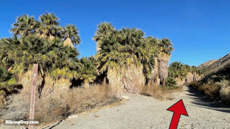
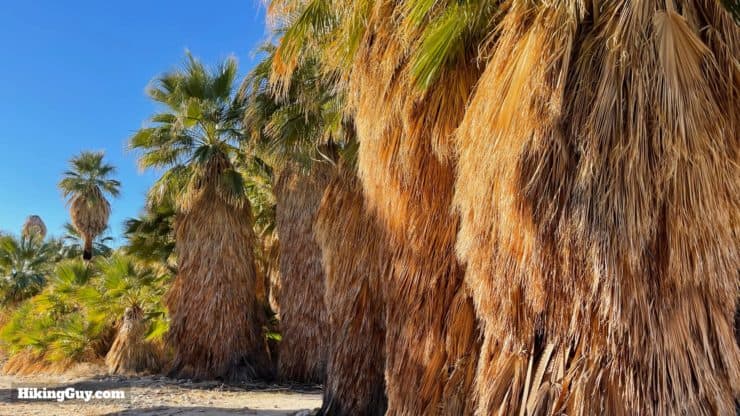
The palms you see on this hike are native California Fan Palms, not the ornamental palm trees you'll see in planned landscaping. California Fan Palms usually have a thick "skirt" of dead palm fronds attached to them.
When you visit the oasis, you might notice water flowing on the ground. That's because the groves are near the San Andreas Fault, and the movement on the fault line has let groundwater rise to the surface. If you see a white powder on the water, it's alkaline and salt deposits.
Why is it called Pushawalla? Legend has it that Pushawalla was the name of a local Native American who lived to be over 100 years old. Allegedly he died when a summer cloudburst flooded the canyon he was in and swept him away. The canyon where he was found (and where the grove is) is called Pushawalla Canyon.
Be careful are the fallen palm fronds, there often used by rattlesnakes for cover and shade. People have been bit by rattlesnakes at Pushawalla Palms and have needed a helicopter evacuation.
Pushawalla Palms Trail Directions
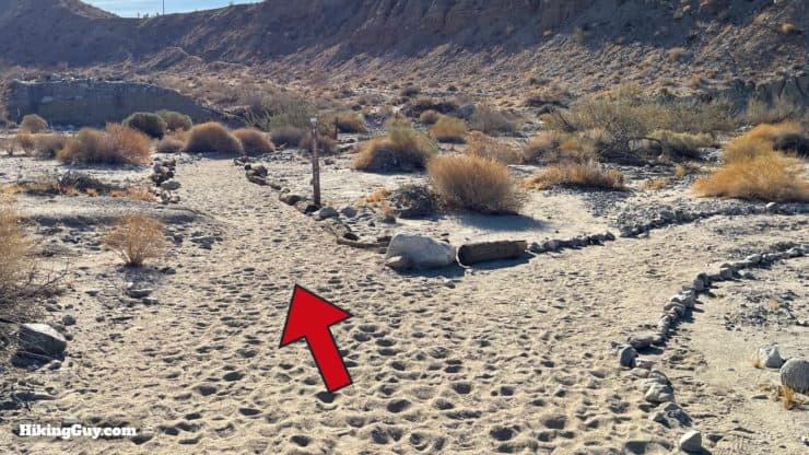
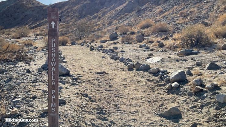
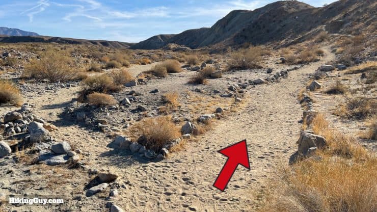
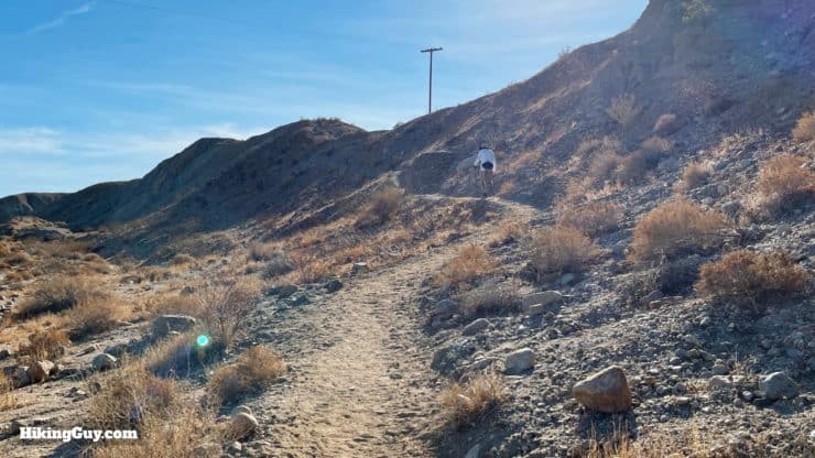
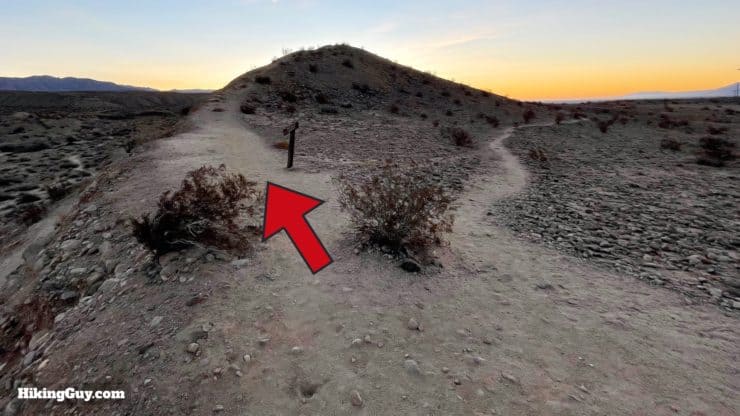
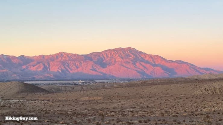
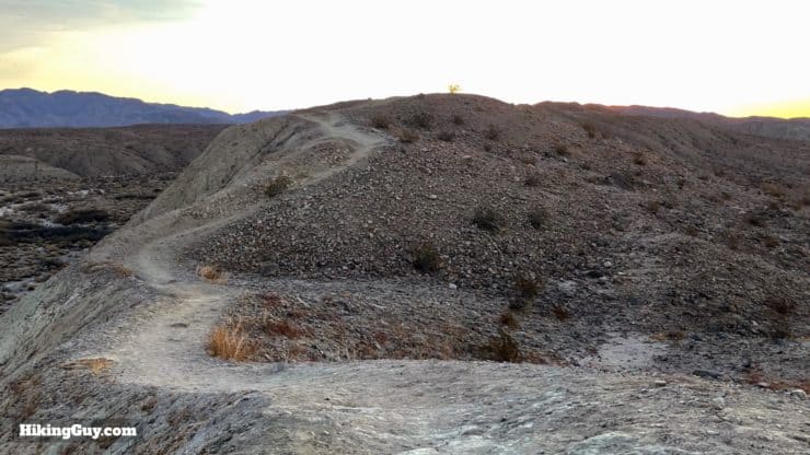
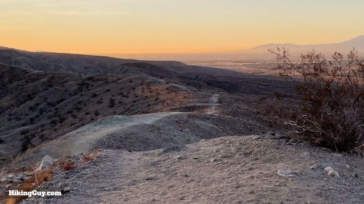
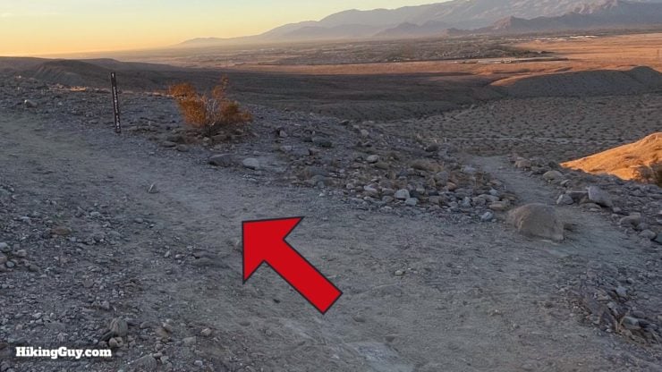
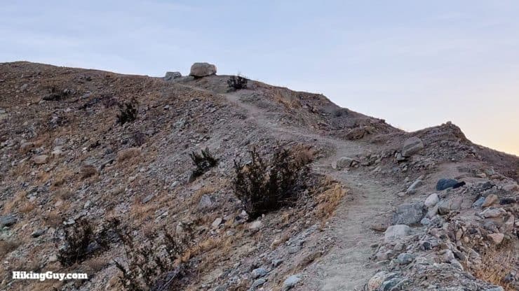
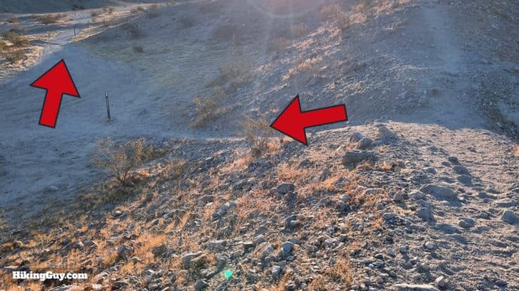
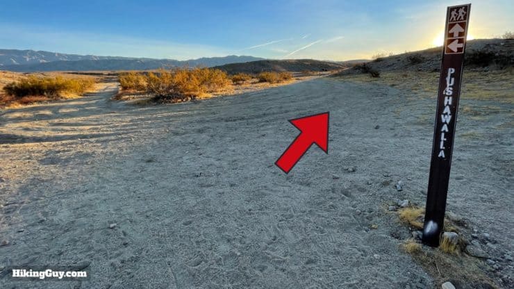
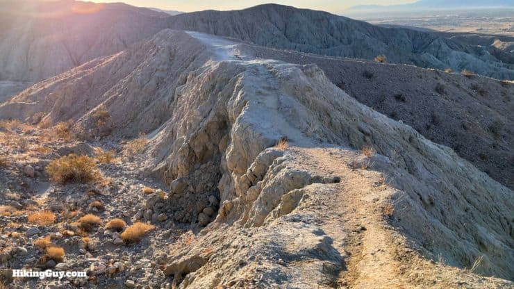
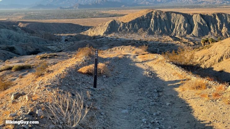
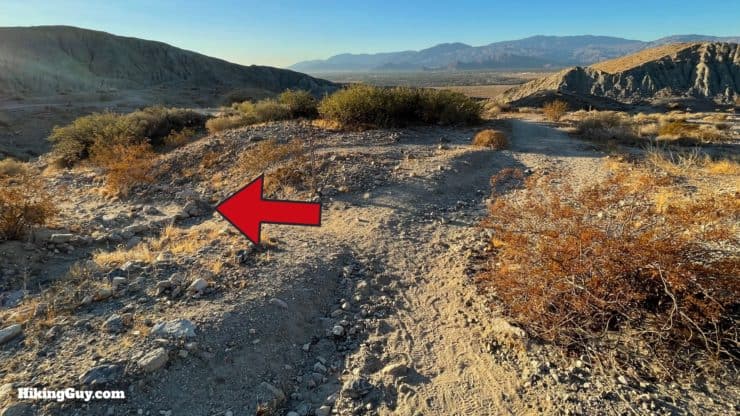
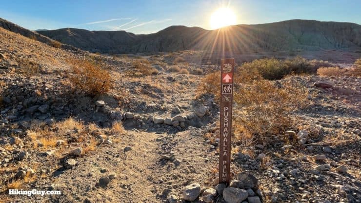
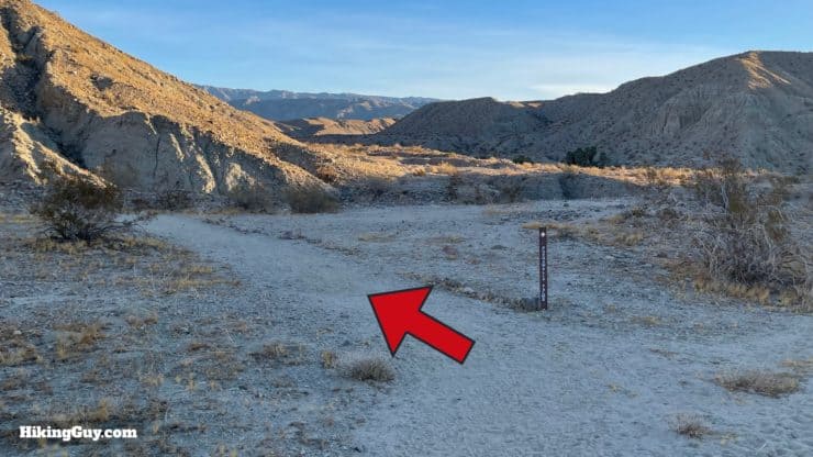
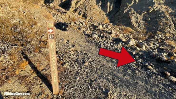
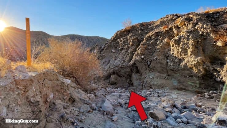
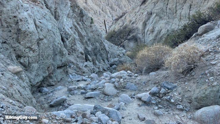
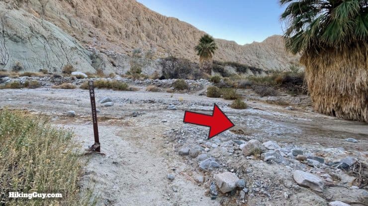
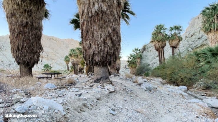
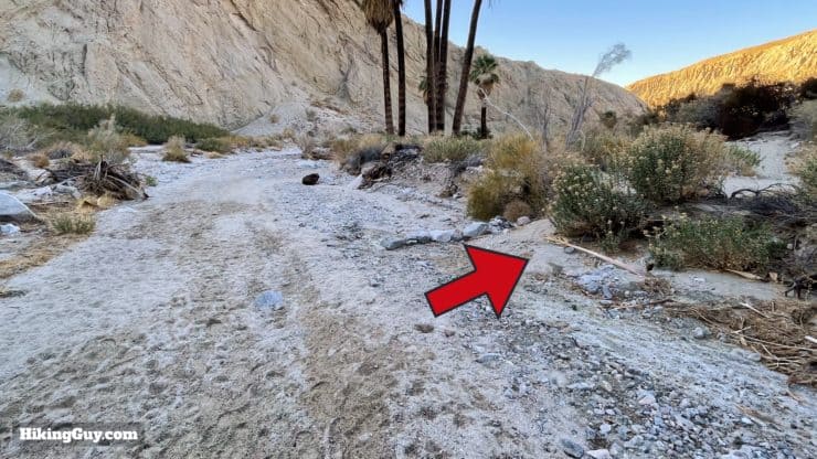
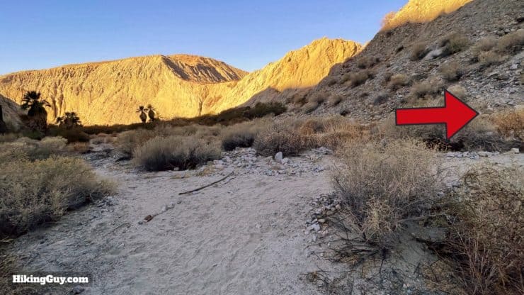
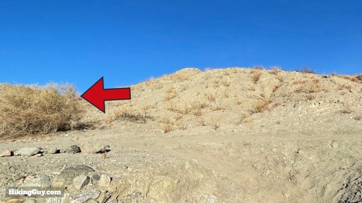
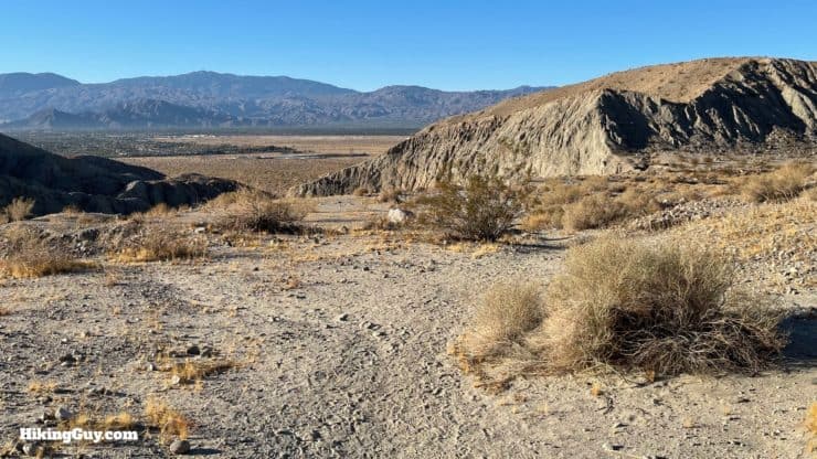
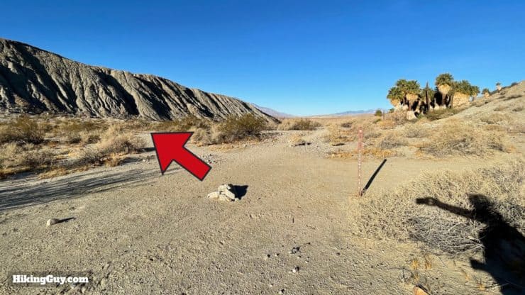
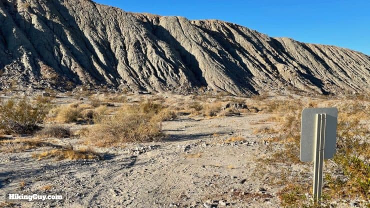
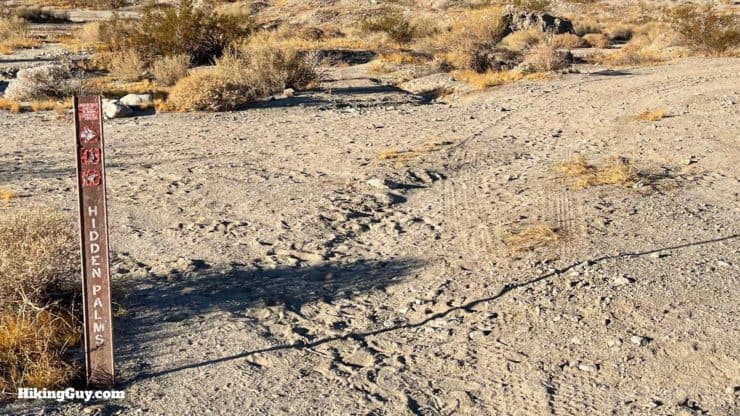
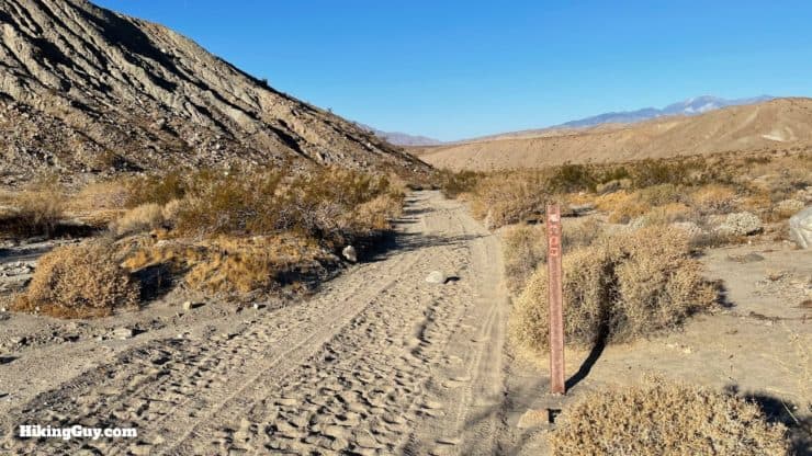
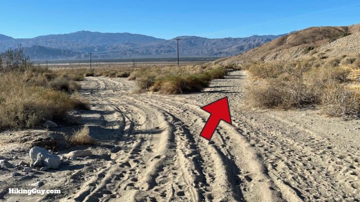
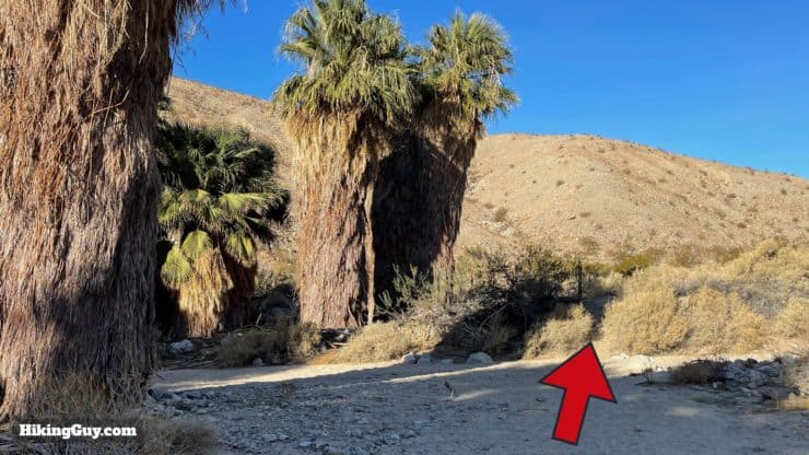
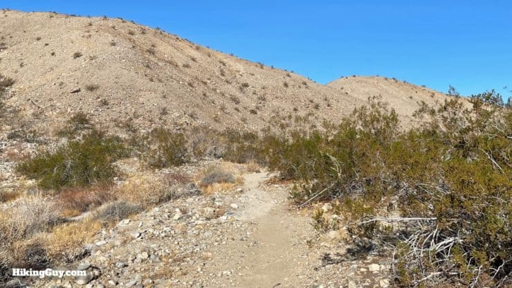
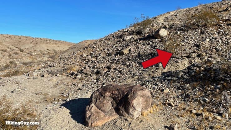
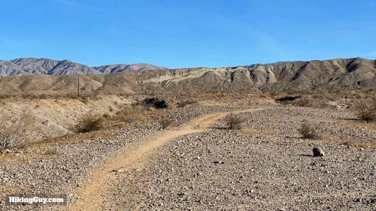
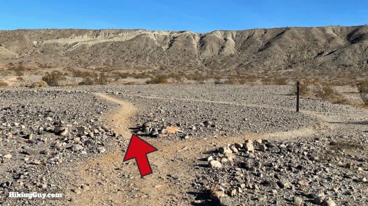
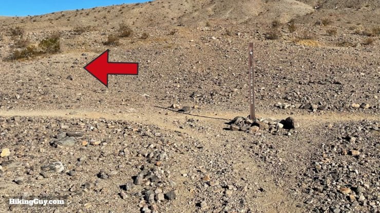
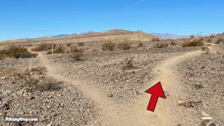
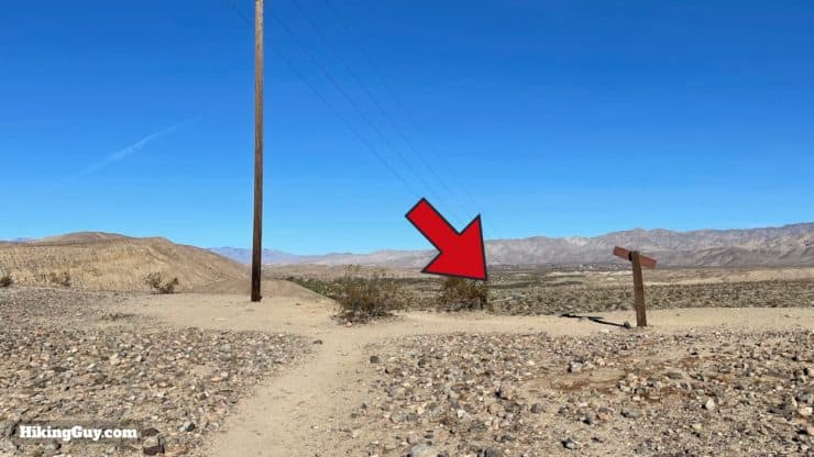
Start heading down the trail from the parking lot.Keep straight and avoid the turnoff to the right.You'll see a good amount of these trail markers for Pushawalla Palms along the route.Go straight toward the hill. To the left is the alternate route, on my map in red.Start climbing up the hill, known as Bee Rock Mesa.At the top of Bee Rock Mesa, make the hard left to continue uphill on the ridge.If you look behind you to the right up here, you'll get some incredible views of Mt San Jacinto.The trail winds its way along the spine of the hill. You're actually hiking on the top of a fault line here. You can explore the fault line locations on the USGS website..Keep going past a wide flat point where folks often leave rock drawings. Note that cairns are not encouraged in the Coachella Valley Preserve.Continue along the ridge.If you look down to your left, you'll be able to see the alternate trail. It's nice, but you don't get these incredible ridge views. The mountains to the left in the distance are in Joshua Tree National Park.Keep straight and avoid the trail down the hill to the right.Soon you'll see Horseshoe Palms down to your right, at the bottom of the hill.Continue hiking on the ridge.When the trail descends from the ridge, make the left and then the first right at the bottom.Here's the right turn at the bottom.From there the trail descends through a little gully and over some spectacular rock formations.Then you'll descend some wide switchbacks.When you get to the bottom of the switchbacks, keep your eyes open for this intersection and left turn. Make the left.There's a trail marker after you make the left confirming that you're heading to Pushawalla Palms.Follow the trail as it heads to a gully.Then make the hard right turn into the gully and descend.Head down in the gully to the end, avoiding any side trails out of the gully.You'll wind around in the gully.And soon the Pushawalla Palms will emerge in front of you.When you get into Pushawalla Canyon, make a right to continue the trail. You can also explore up to the left, where there are more trees.Head down Pushawalla Canyon. Note the small stream of groundwater. The water makes the area popular for wildlife. Don't be surprised to see rabbits, coyotes, snakes and all kinds of birds. Owls often nest in the palms.If you keep heading down the canyon you'll come to a nice picnic bench where you can take a break in the shade of the palms.Keep heading down the canyon until you see this turnoff to the right. It's easy to miss so keep your eyes open.And once on that trail, make the right to continue up the canyon wall.The trail winds up through a gully.And when you get to the top, make the hard left.There are small trail splits, but they all join back up together. I walk on the one closest to the edge to enjoy the views.When you get to the big intersection, make the left / forward turn. There's a hard left turn back that leads to a viewpoint, but that's not the one you want.You'll pass the back of a Coachella Valley Preserve sign.And then you'll see a marker for Hidden Palms as the trail turns into a wide jeep track.From here on out you're on this wide track for about a mile. On your right will be the Horseshoe Palms. Note that there are many unofficial trails that parallel this jeep track. You might see the footprints. I stay on the jeep track to minimize my impact on the fragile ecosystem.After about a mile on the track, look for the right turnoff.And then make the immediate right when you see the Hidden Palms.The trail goes to the right of the Hidden Palms Oasis.The palms here are pretty massive with huge skirts.The trail continues out the back of the grove when the big, wider trail ends.Now you'll be back on a smaller trail.Like before, there are a decent amount of trail markers pointing you in the right direction.When you get to the mound, hike uphill.And from here to the end, most of the hike looks like this.Keep straight at the junction.And when the trail dead-ends, make the left.At the split, keep right.And then you'll be back at the Bee Rock Mesa area that you climbed at the beginning of the hike. Head back down on the trail you took up and you'll be back at the parking area in a couple of minutes.
Need More Info?
Have a question about the guide or want to see what other people are saying/asking? View the Youtube comments for this video. Leave a comment and I will do my best to respond.
When planning, always check the park website and social media to make sure the trails are open. Similarly, check the weather and road conditions.


 Using the Apple Watch for Hiking
 Garmin Fenix 7 & Epix Review For Hikers
 How To Read a Topographic Map
 Garmin GPSMAP 67i Review
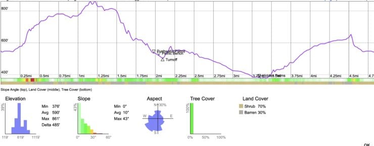


 Hike Lost Palms Oasis Trail
 Hike the 49 Palms Oasis Trail
 Whitewater Preserve Hike - Canyon View Loop Trail
 McCallum Trail Hike Guide
 Bear Creek Oasis Trail Guide
 Ladder Canyon Trail & Painted Canyon Loop Hike
 East Indio Badlands Trail Guide
 Tim's Ladder Trail
 Palm Springs Hiking Trails
 Hikes In and Around Riverside County
 Best Hiking Gear 2024
 Hiking Boots or Shoes: Do I Really Need Hiking Boots?
 When to Hit SOS on inReach