This hike through Peters Canyon Regional Park is one of the most popular hikes in Orange County for a good reason. The hike has everything: well-maintained trails, climbs and flats, panoramic views, and wildlife spotting opportunities. This Peters Canyon hike takes you on a very-doable 2:30 hour loop of the park. Lots of side trails offer opportunities to make it shorter if you'd like.
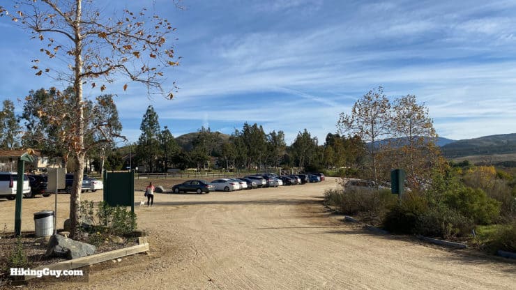
This hiking guide starts in the main parking lot (on the north side), which has plenty of room and bathrooms, but also a small fee. There are other areas where you can park on the street and access the park if you want to save the fee.
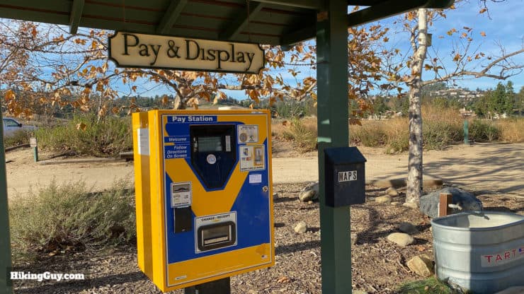
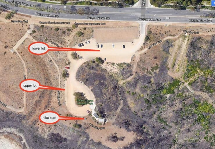
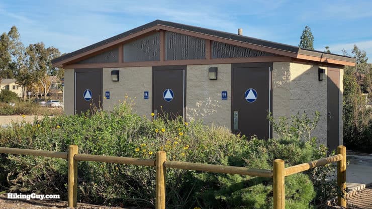
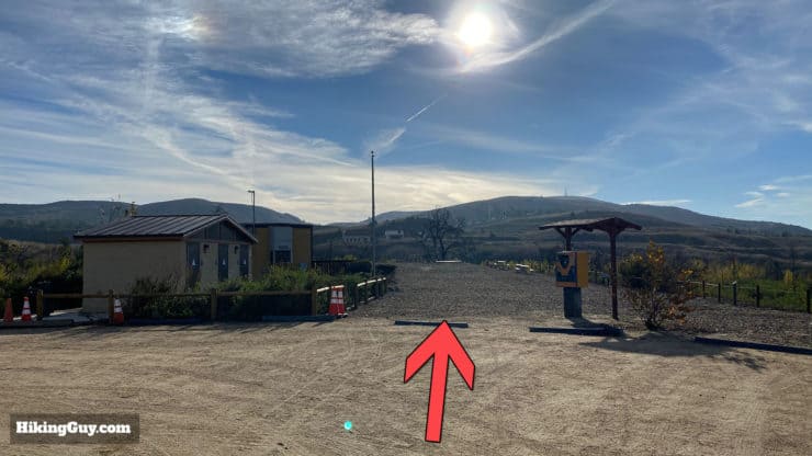
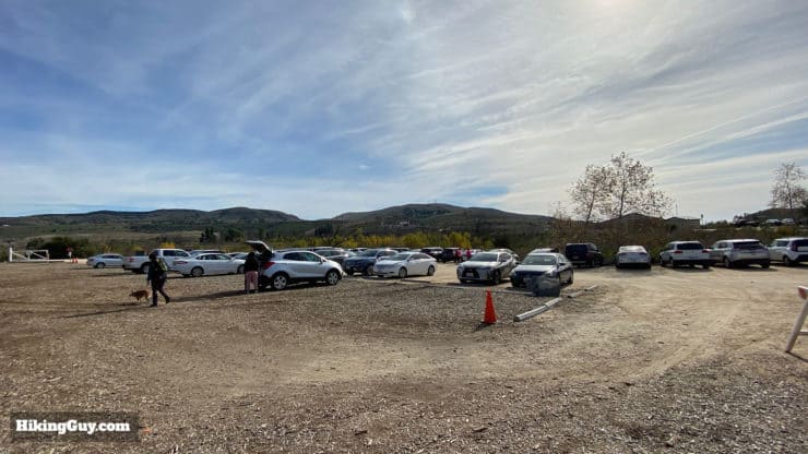
There are two parking lots at Peters Canyon. A large one when you first pull in, and then a smaller one next to the trailhead and bathrooms. Try to park at the smaller one, which is closer to the hike start. The park is popular and the lots fill up during the day.There's a small fee to park. Print a ticket out at the kiosks in the parking lot, and leave it on your dashboard.The hike starts at the bathrooms and ranger station at the far end of the parking lots.There are good bathrooms at the start of the hike. There are also porta-potties at the mid-way point (see the directions below).
Gear for the Hike
This is a hike you can do in workout gear or hiking gear. It can get very hot in the summer, so bring plenty of water. I generally bring 2L in a hydration bladder. Trekking poles are helpful on the steep sections.
Gear That I Love Right Now
Nothing is sponsored or promoted, just the actual gear that I use.
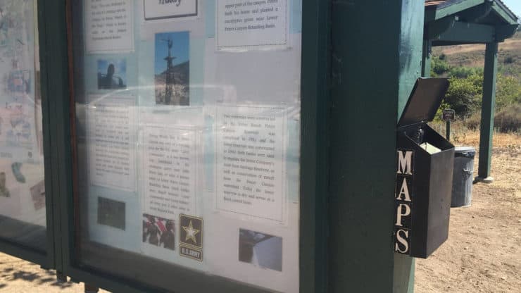
There are usually official Peters Canyon hiking trail maps at the trailhead, and you can also print one out here. If you want to do a shorter hike, the map will give you plenty of hiking options. Otherwise my guide and maps will do the trick. We'll be taking the East Ridge Loop route, and there are signs along the trails to point you in the right direction.
There are free hiking maps at the hiking board. Take one in case you get lost. Keep it in good shape and return it when you’re done.
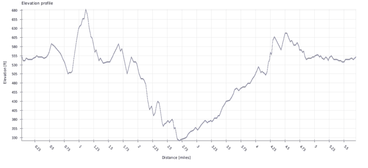
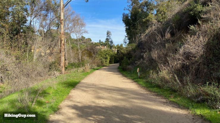
The hike covers the entire park, which is wedged nicely in between a residential area. Peters Canyon is really an oasis within suburbia.There's one really steep hill, and then the rest of the hike is pretty gradual up and down.
Quick Hike History
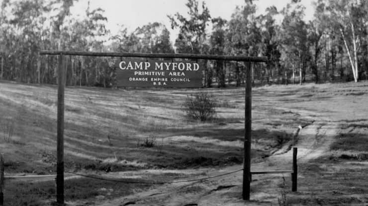
At one point, this area was a Boy Scout camp named after James Irvine's youngest son, Myford Irvine. Photo Tustin Historical Society
In 1899 one of the first golf clubs in Orange County, the Santiago Golf Club, was built here.
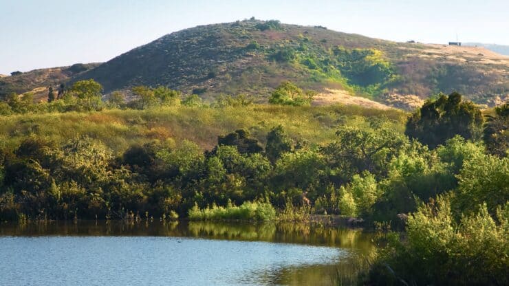
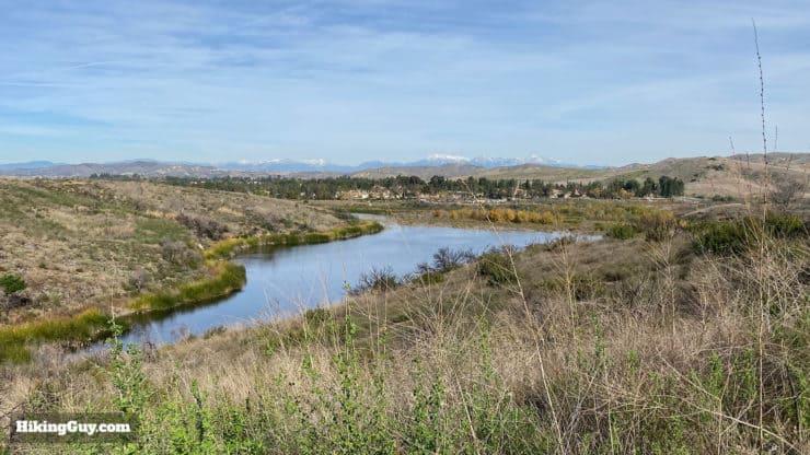
The lake in the park, human-made and built in 1931, was once a reservoir used to irrigate James Irvine's orange groves.
During World War II there was an Army base at Peters Canyon, and after the war the Boy Scouts took it over.
In 1992 the area became an Orange County park when the Irvine Company donated the land for public use.
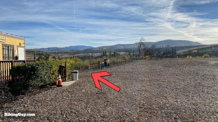
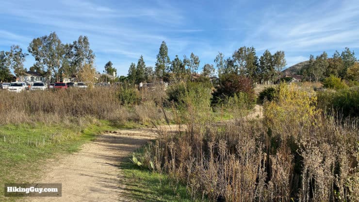
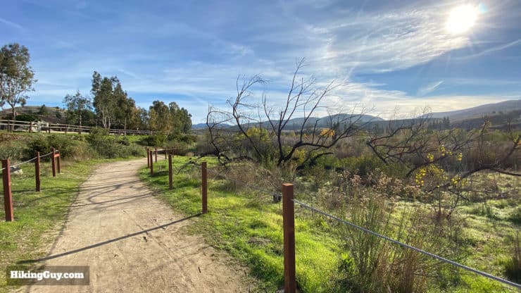
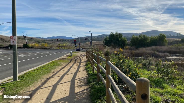
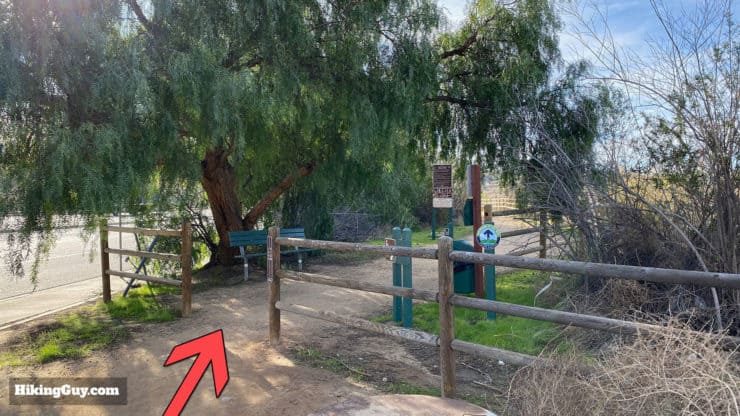
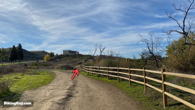
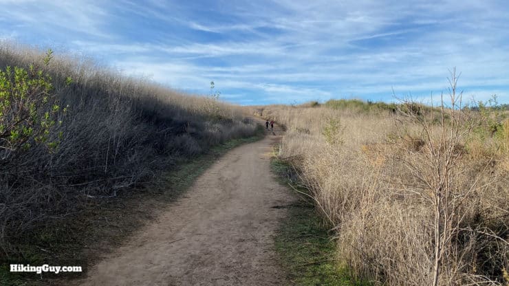
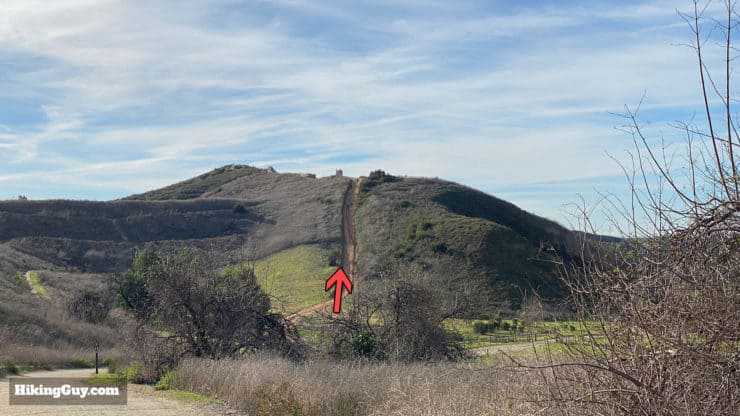
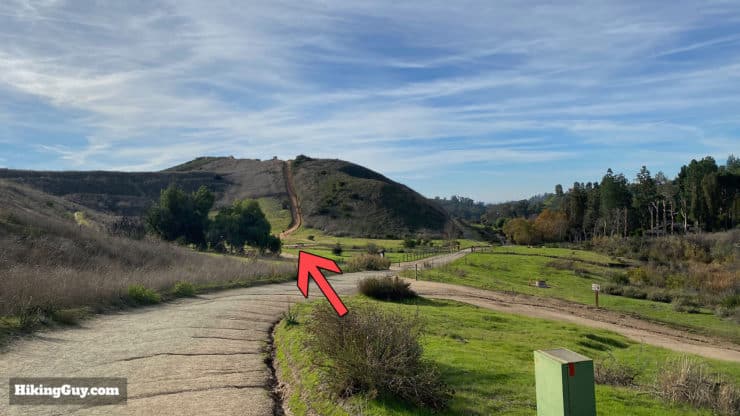
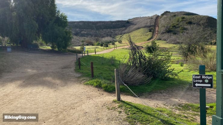
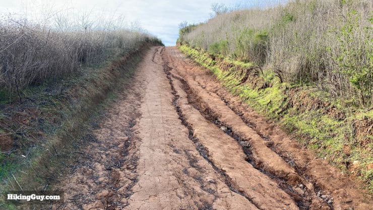
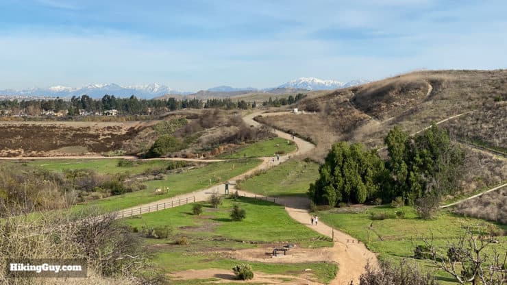
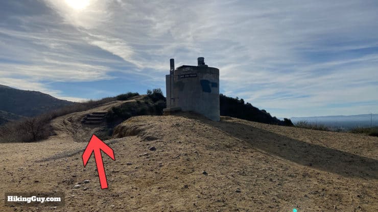
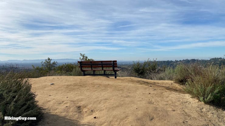
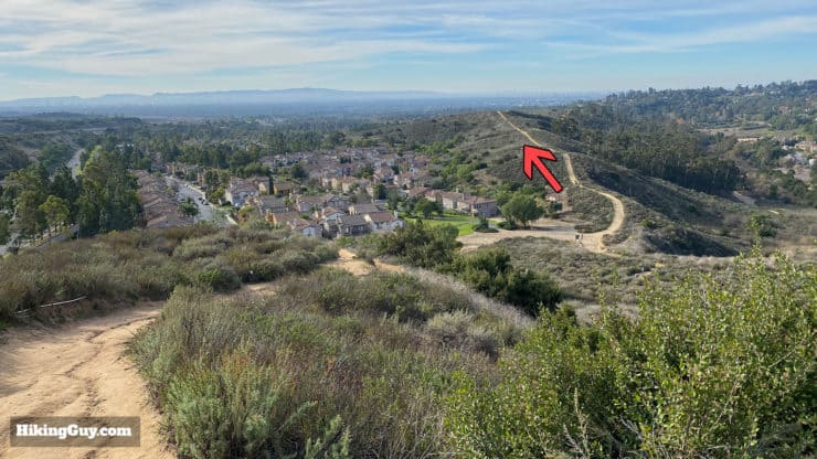
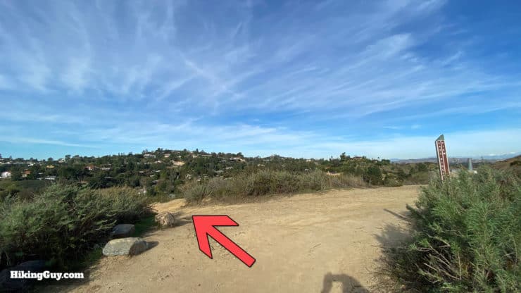
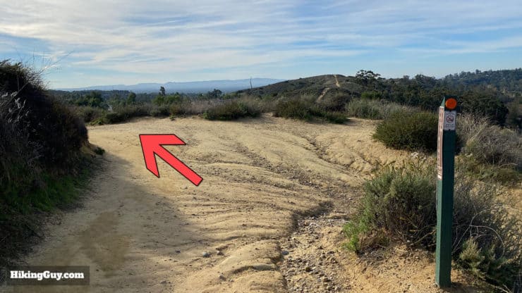
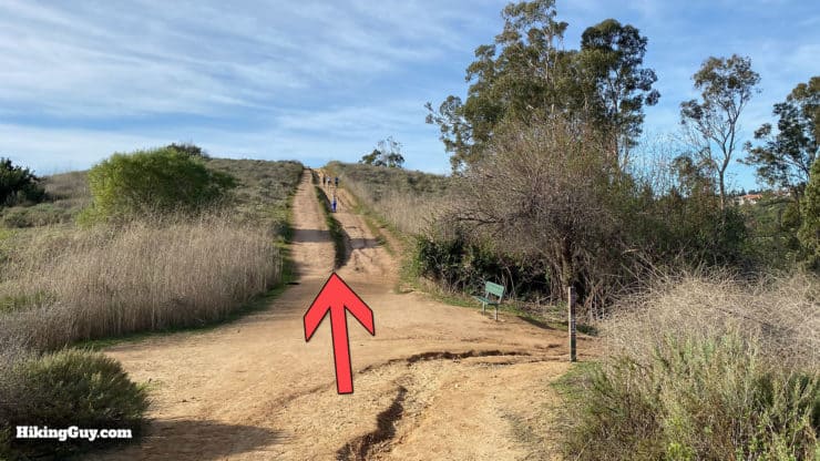
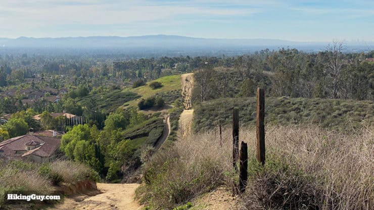
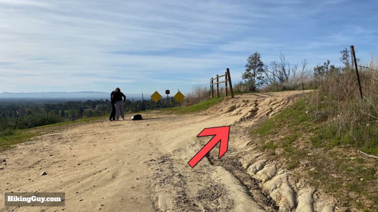
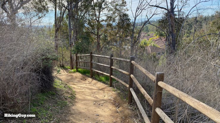
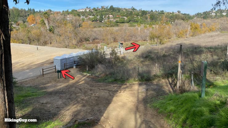
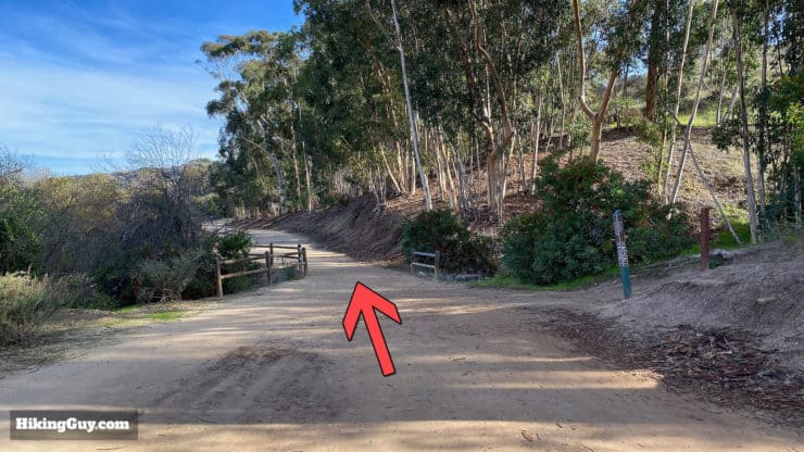
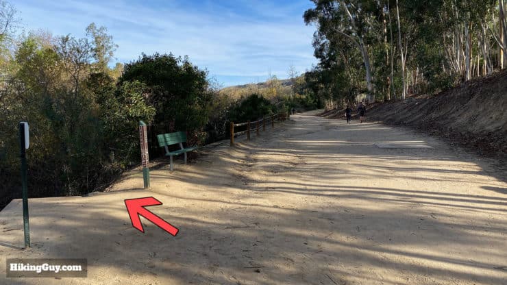
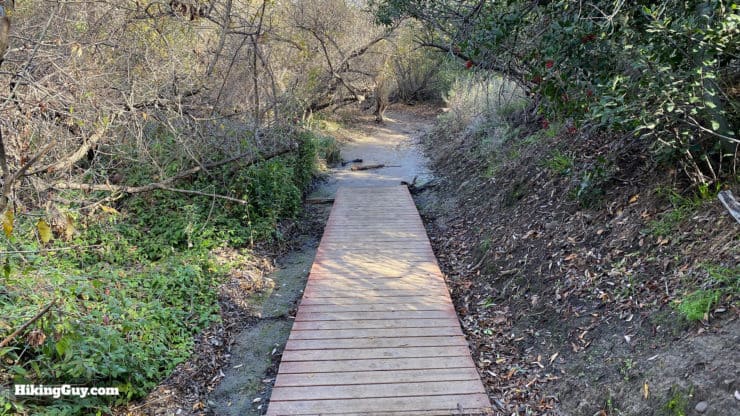
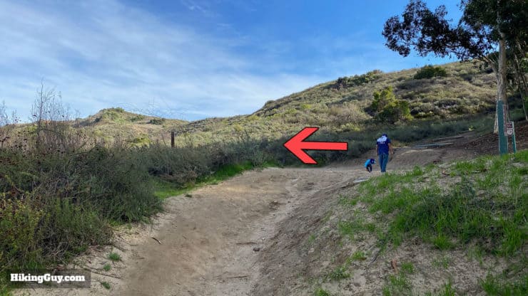
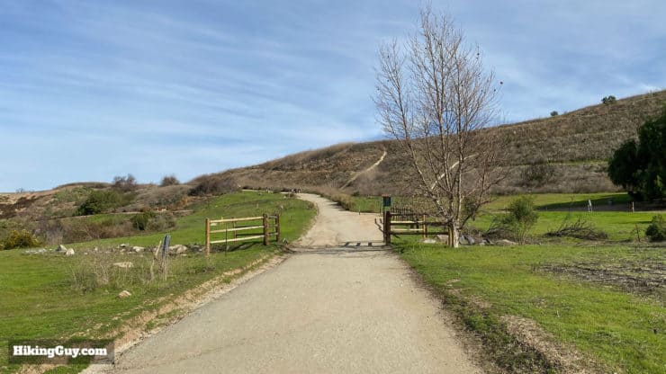
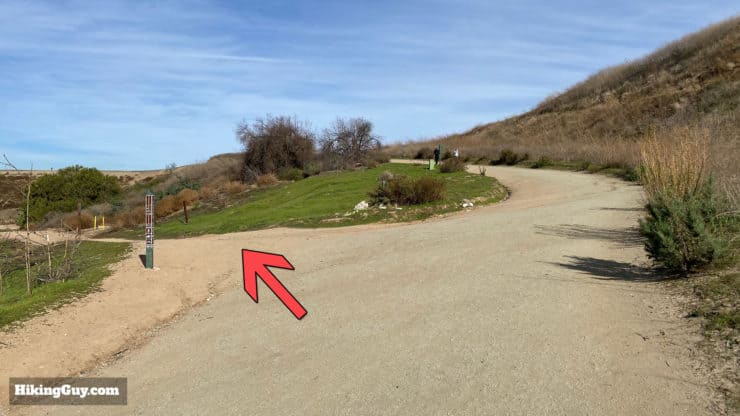
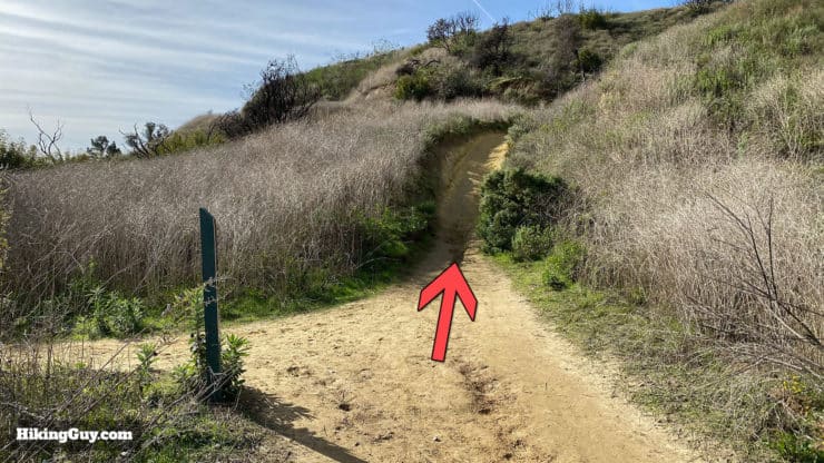
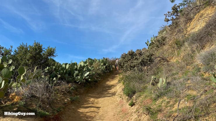
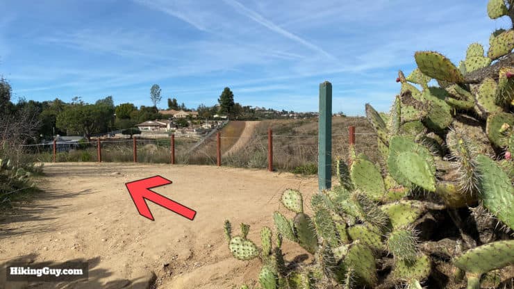
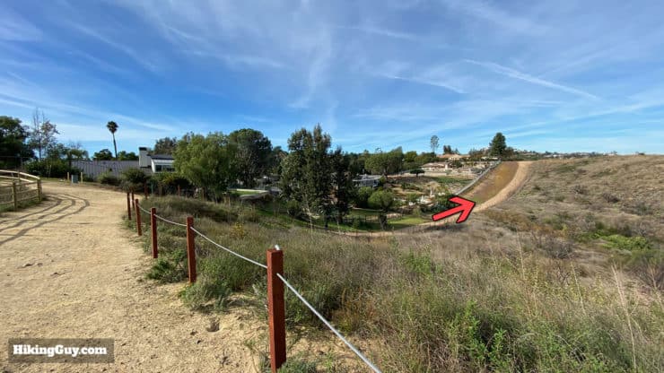
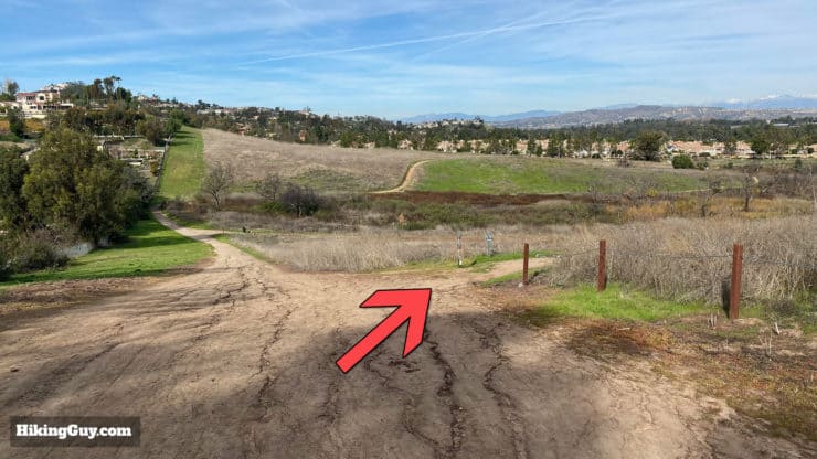
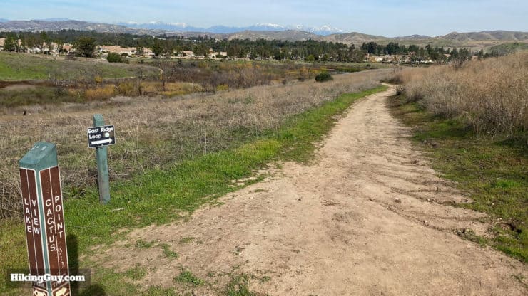
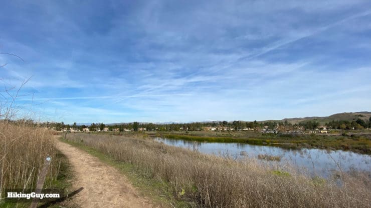
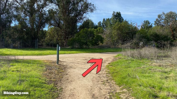
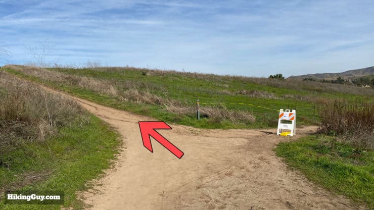
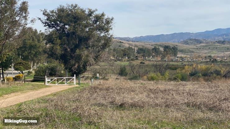
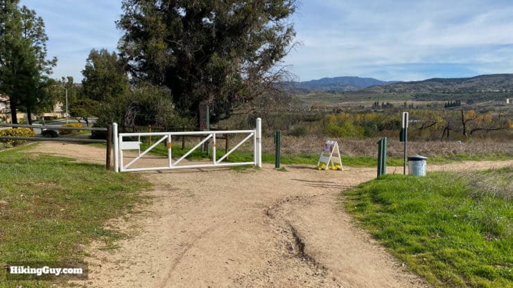
Hike past the bathrooms and ranger station.The trail starts right after the ranger station.The trail winds its way around the first parking lot.Continue hiking as the trail follows Canyon View Avenue. You can see the fire damage off to the right. The area to the right was a seasonal nesting area for rare birds before the fire.The trail climbs up and is next to the road for a short stretch.And then turns right to follow Jamboree Road.Follow the trail down along the fence, keeping right. There is a service road to a park facility off to the left.The trail climbs away from the road.And soon you'll see the big climb ahead. The reservoir will be off to your right.There's a little downhill here; stay left to hit the trail climbing the hill. It looks tough from here, but isn't so bad, just less than 200 feet of climbing. If you want to do a shorter 2.7 mile route without the climb, make the right here and rejoin the hike directions later.Head left onto the East Ridge View Trail to climb to the viewpoint. The East Ridge Loop sign is what you want to follow to do the whole loop hike of Peters Canyon.The trail is steep but not that long.Don't forget to turn around and take in the views. On a clear day you can see the high mountains of Angeles National Forest.When you get to the first little viewpoint, continue up to the left for the high point.Here you are, the highest point of the hike at 683ft.From the summit we're going to continue hiking straight and down along the rolling features of the East Ridge View Trail.At the bottom of the hill, bear left.Which is followed by another quick left that puts you on the main drag along the ridge line.There are a lot of ups and downs on the East Ridge View Trail, with each one offering another great viewpoint. Here you can see the coastal mountains and buildings of Fashion Island in the distance.At the junction with the Scout Trail (to the right), continue straight.Hit the last few ups and downs of this trail before arriving at the lower end of the park.At the end of the East View Ridge Trail, bear right.The trail now turns into the Eucalyptus Trail and gently goes downhill in the shade.Soon you'll see the Peters Canyon Trail in the distance below you. This is about the half-way point on the hike, and there are bathrooms here. At the bottom of the hill, make the right and hike up the Peters Canyon Trail.The Peters Canyon Trail is wide and gradual; there are no ups and downs here. You'll also find some shade.At the intersection with the Scout Trail, go straight.And shortly after that make the left onto the Creek Trail.The Creek Trail crisscrosses Peters Canyon Creek on several boardwalks. It's a great place for shade, quiet, and potential wildlife spotting.When the Creek Trail ends, rejoin the Peters Canyon Trail to the left.Continue straight on the Peters Canyon Trail. You'll see the high point that climbed earlier off to the right.Make the left onto the Lake View Trail.Keep right and climb the short hill.You'll go through a cool section of prickly pear cactus on the climb.At the top of the climb you're rewarded with views of the reservoir. There's a small viewpoint to the right but otherwise continue to the left.Soak in the views of the reservoir here, which is often filled with ducks and waterfowl.Continue on as the Lake View Trail winds to the right with a down and uphill section.On the downhill make the right onto the Cactus Point Trail.As the Cactus Point Trail starts, you'll still see a sign for the East Ridge Loop, which is the overall trail that we're following.This section of the hike offers some more views of the reservoir.The Cactus Point Trail comes back to the Lake View Trail; make the right here.From here until the end you can basically take any trail and finish. All the trails from here end in the parking lot.Soon you'll see the parking lot in the distance.At the gate, once again, you can take the right or the left to continue on to the parking lot.And shortly you'll be back where you started. That's the hike!
Need More Info?
Have a question about the guide or want to see what other people are saying/asking? View the Youtube comments for this video. Leave a comment and I will do my best to respond.
When planning, always check the park website and social media to make sure the trails are open. Similarly, check the weather and road conditions.


 Using the Apple Watch for Hiking
 Garmin Fenix 7 & Epix Review For Hikers
 How To Read a Topographic Map
 Garmin GPSMAP 67i Review
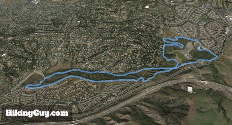

 Whiting Ranch Hiking: Red Rock Canyon
 Hike the Bedford Peak Trail (Orange County)
 Hikes In and Around Orange County
 Best Hiking Gear 2024
 Hiking Boots or Shoes: Do I Really Need Hiking Boots?
 When to Hit SOS on inReach