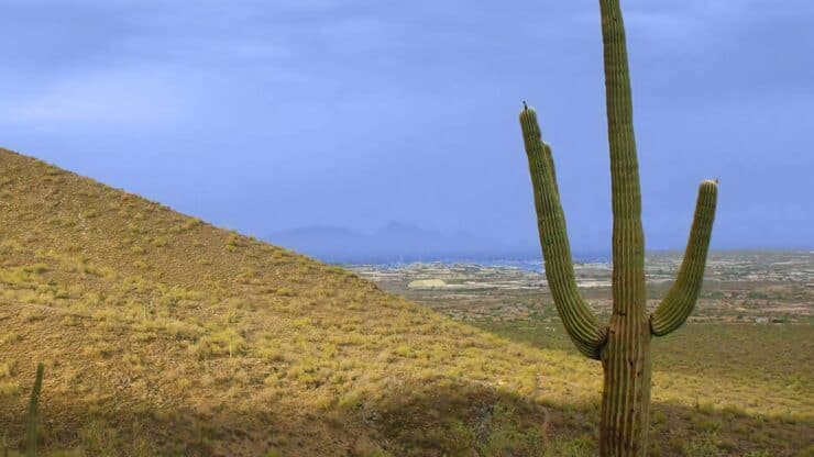
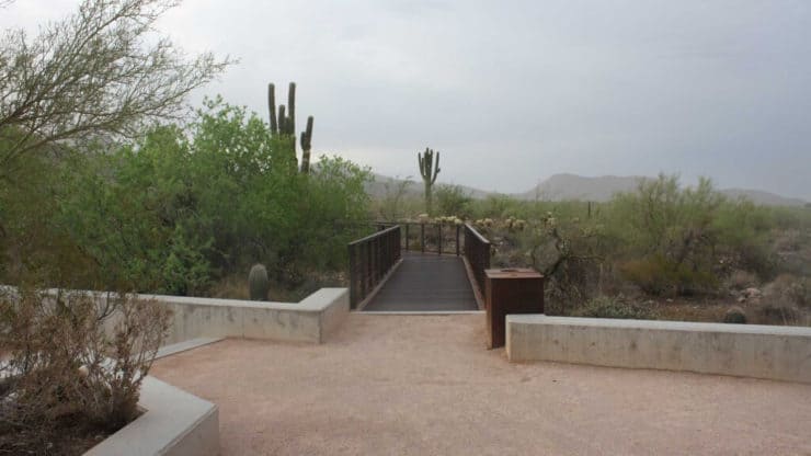
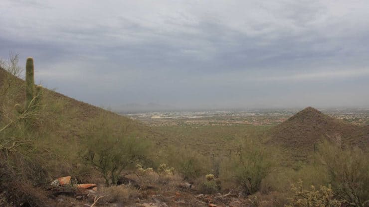
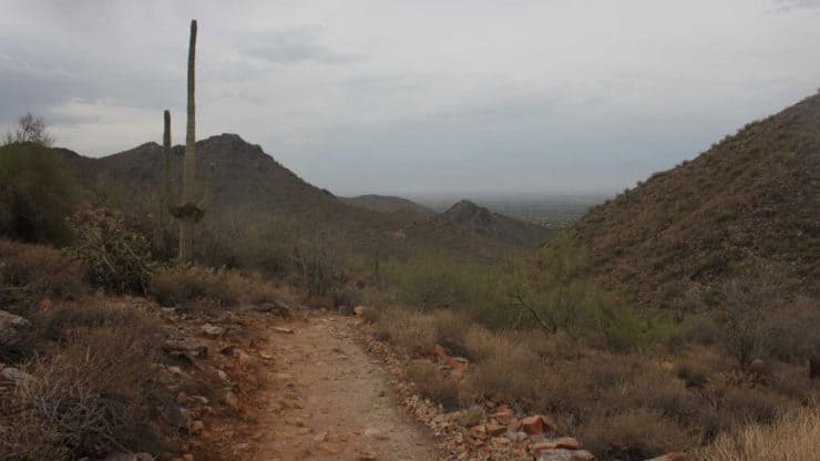
This "best of" McDowell Sonoran Preserve hike offers well-marked trails, easy climbs, nice views, and classic Sonoran desert scenery on the Gateway Loop Trail. The hike is a great intro hike to McDowell Sonoran Preserve and is suitable for all levels of hikers. And unlike Camelback Mountain, McDowell Sonoran Preserve is a peaceful oasis where you can connect with nature and unwind.
- Turn by Turn Hike Directions
- McDowell Sonoran Preserve Trail Maps
- How to Get to McDowell Sonoran Preserve
The McDowell Sonoran Preserve was created in 1990 when private citizens and the city of Scottsdale realized that they had to protect this pristine nature from development. They formed the McDowell Sonoran Conservancy, a public-private partnership. The preserve is run by and cared for by private volunteers. Very awesome.
Getting to McDowell Sonoran Preserve
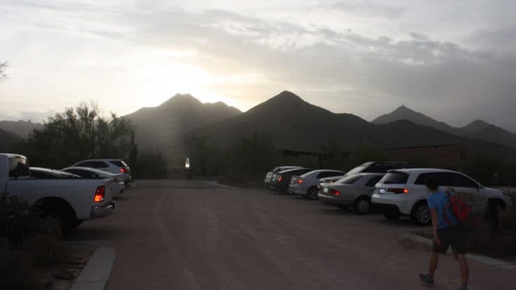
Use this trailhead address: 18333 N Thompson Peak Pkwy, Scottsdale, AZ, 85255, USA
The parking lot is huge and you should be okay to find a spot.
Gear for the Hike
You can get away with fitness gear here, but hiking gear works too. Bring lots of water, it can get very hot.
Gear That I Love Right Now
Nothing is sponsored or promoted, just the actual gear that I use.


McDowell Sonoran Preserve Trail Maps
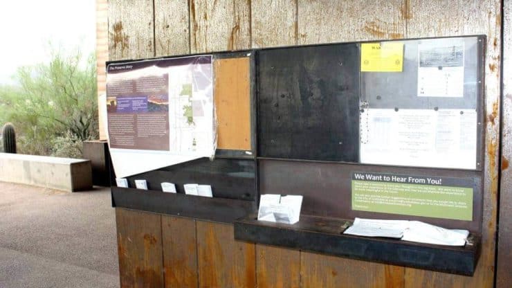
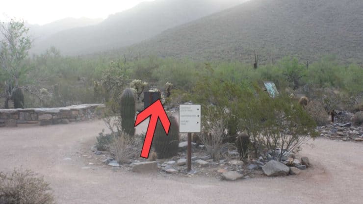
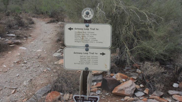
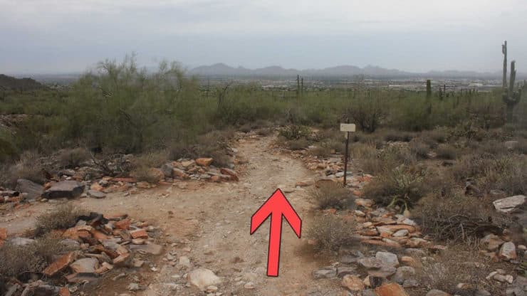
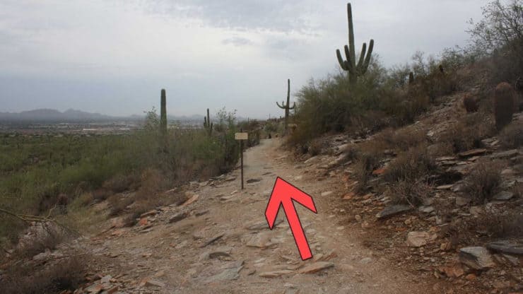
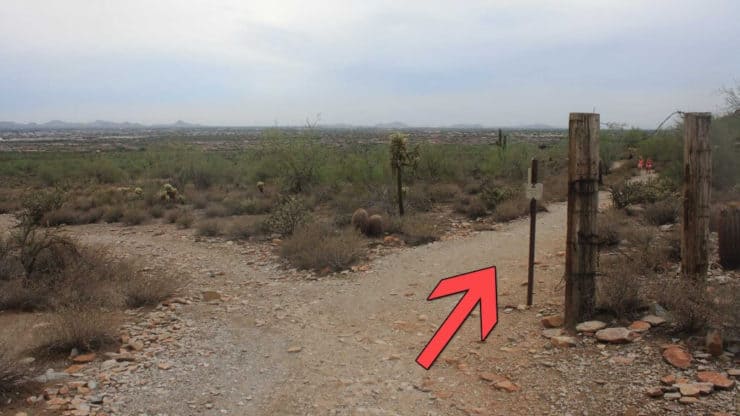
The trail system is well marked and there are free trail maps at the Gateway Trailhead. The Gateway Trailhead also has water, bathrooms, and volunteers who will answer questions.
How Will You Navigate?
 Using the Apple Watch for Hiking
 Garmin Fenix 7 & Epix Review For Hikers
 How To Read a Topographic Map
 Garmin GPSMAP 67i Review
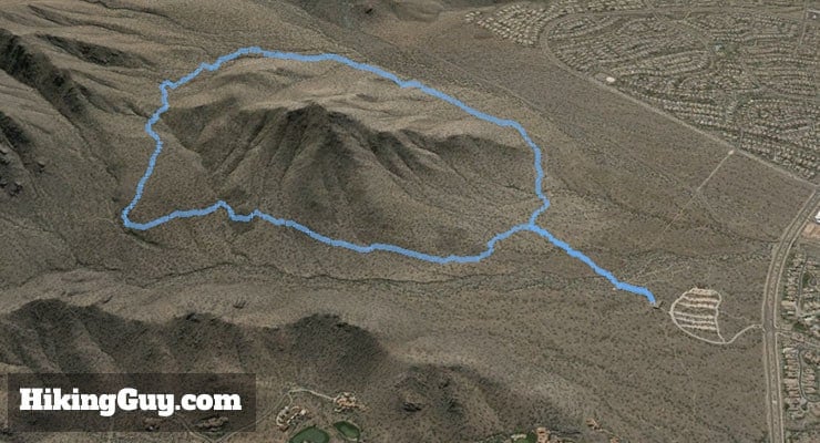
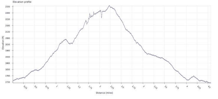
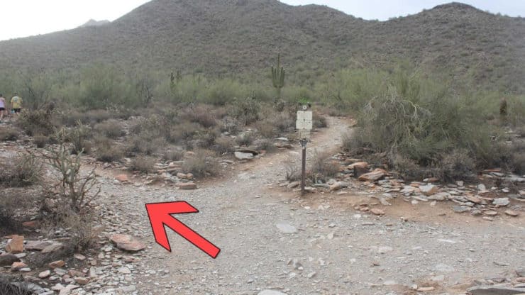
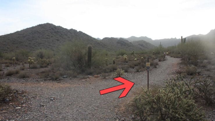
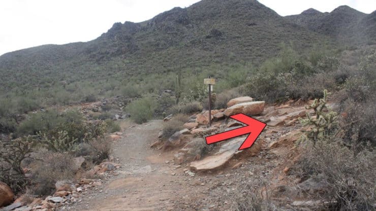
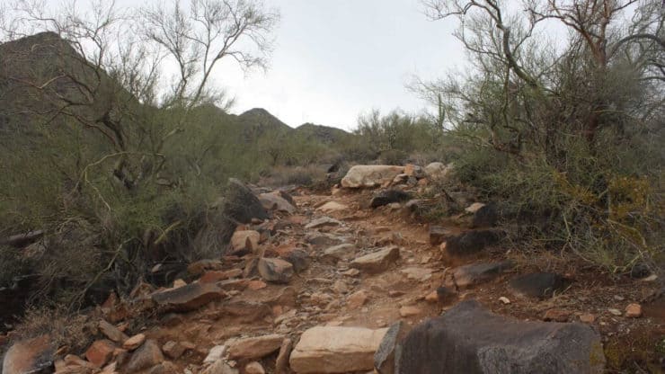
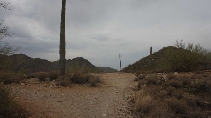
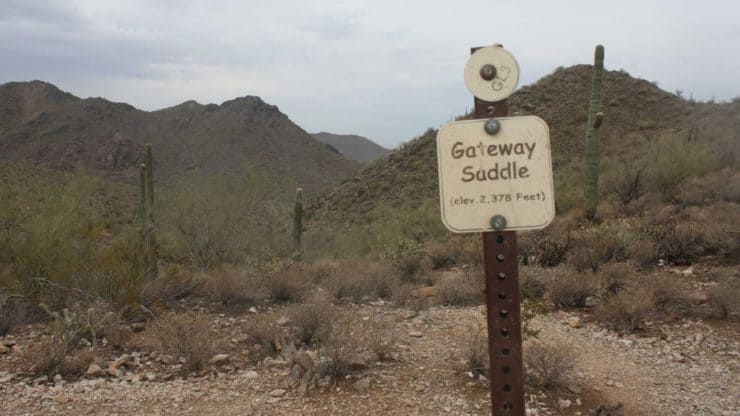
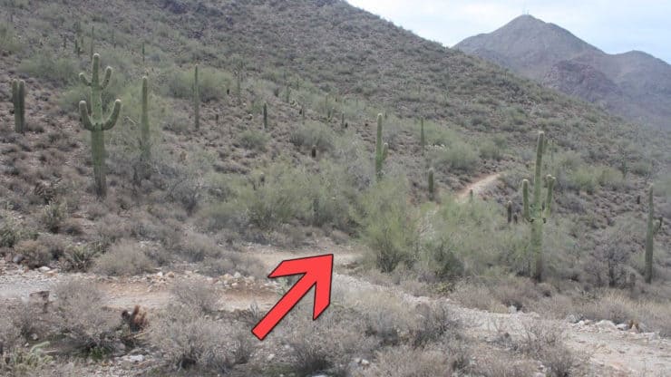
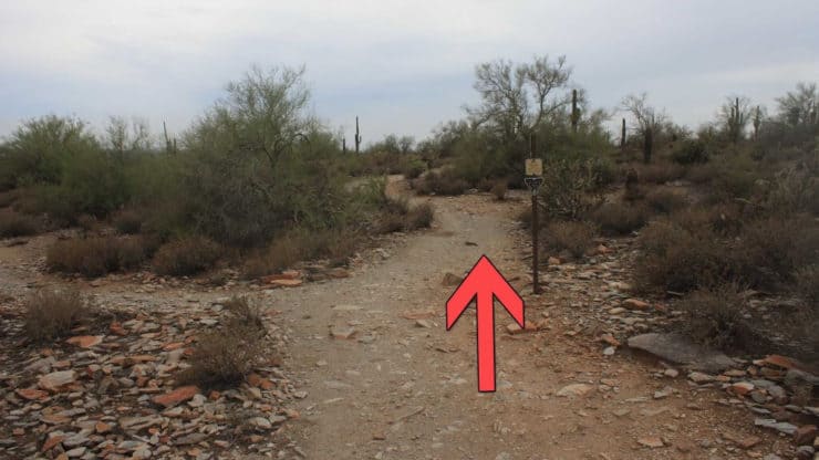
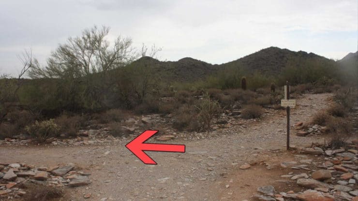
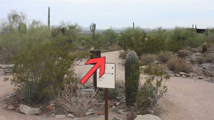
McDowell Sonoran Preserve Hike Directions
Related Guides
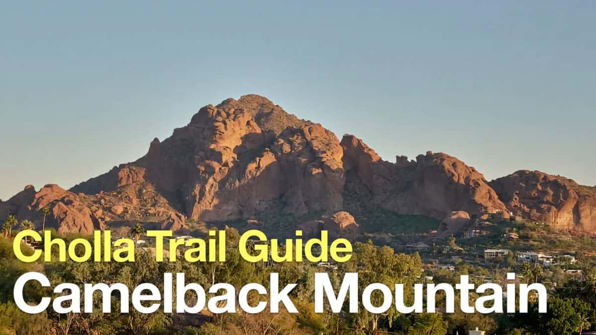 Camelback Mountain Hike - Cholla Trail
 Phoenix Hiking
Popular Guides
 Best Hiking Gear 2024
 Hiking Boots or Shoes: Do I Really Need Hiking Boots?
 When to Hit SOS on inReach
This Guide Was Written by Cris Hazzard

Hi, I'm Cris Hazzard, aka Hiking Guy, a professional outdoors guide, hiking expert, and author based in Southern California. I created this website to share all the great hikes I do with everyone else out there. This site is different because it gives detailed directions that even the beginning hiker can follow. I also share what hiking gear works and doesn't so you don't waste money. I don't do sponsored or promoted content; I share only the gear recommendations, hikes, and tips that I would with my family and friends. If you like the website and YouTube channel, please support these free guides (I couldn't do it without folks like you!). You can stay up to date with my new guides by following me on YouTube, Instagram, or by subscribing to my monthly newsletter.