State High Points You Can Actually Hike
Highpointing, or reaching every state high point, is a fun bucket-list project, but once you dig into the list you realize fast that not all of those summits are safe. Some require mountaineering skills, and others have scrambles where a bad move could mean serious trouble. So for those of us who want the highpointing experience without the hazards, here are the highest points in each state that you can reasonably reach on a maybe tough, yet non-technical hiking route.
High Point Criteria

I’ve been researching this project for a year trying to find alternatives that actually make sense. The alternative peaks weren’t obvious. I pored over maps, trip reports, videos, and talked to rangers and hikers from all over the country. Everyone’s comfort and experience level is different, so in the end I settled on a simple core criteria. The route has to be a hike I’d feel comfortable recommending to most prepared hikers, the same benchmark I use for all the guides on my site.
Practically, that means if you’re prepared, have solid fitness, and use good judgment, you should be able to reach these high points safely. Anything that requires mountaineering gear, long stretches over snow, dangerous scrambling, narrow unofficial ridges, or off-route navigation isn’t included here. Some of the alternate peaks have a short late-summer window where they transform from mountaineering routes into straightforward hikes. Others have short Class 2 sections where you’ll use your hands, but nothing where one bad step would be catastrophic. The idea is simple: these peaks can be tough, but they stay reasonably safe and firmly in hiking territory.
Hikeable State High Points List
| Category | Description | States in This Group |
|---|---|---|
| Technical | Mountaineering or challenging scrambling or off-trail nav | AK • WA • WY • NV • MT • ID • OR |
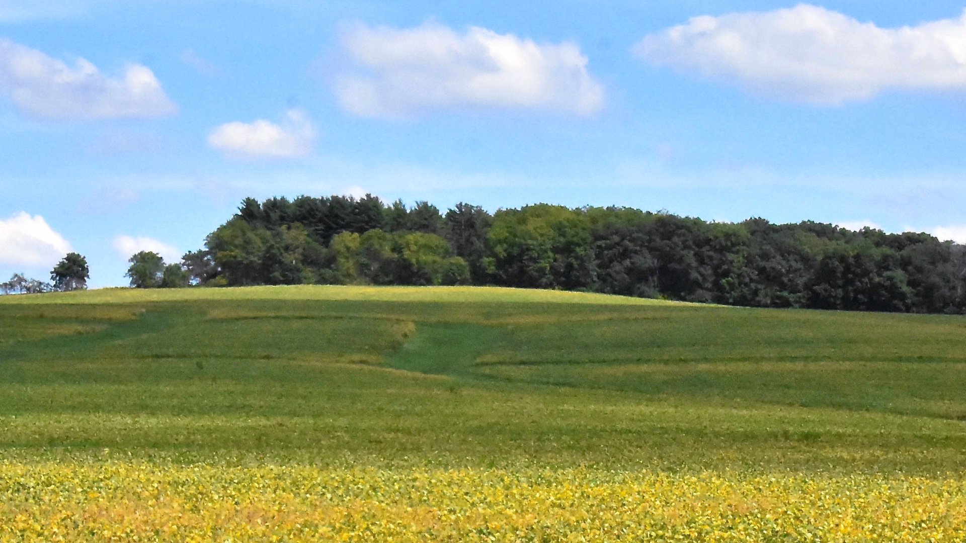
| Hikes | Standard hiking trails requiring some effort | CA • CO • UT • NM • AZ • TX • SD • VA • NY • ME • VT • CT |
| Easy | Easy hikes or drive-ups | HI • NC • TN • NH • NE • OK • WV • GA • KY • KS • SC • ND • MA • MD • PA • AR • AL • MN • MI • WI • NJ • MO • IA • OH • IN • IL • RI • MS • LA • DE • FL |
Technical
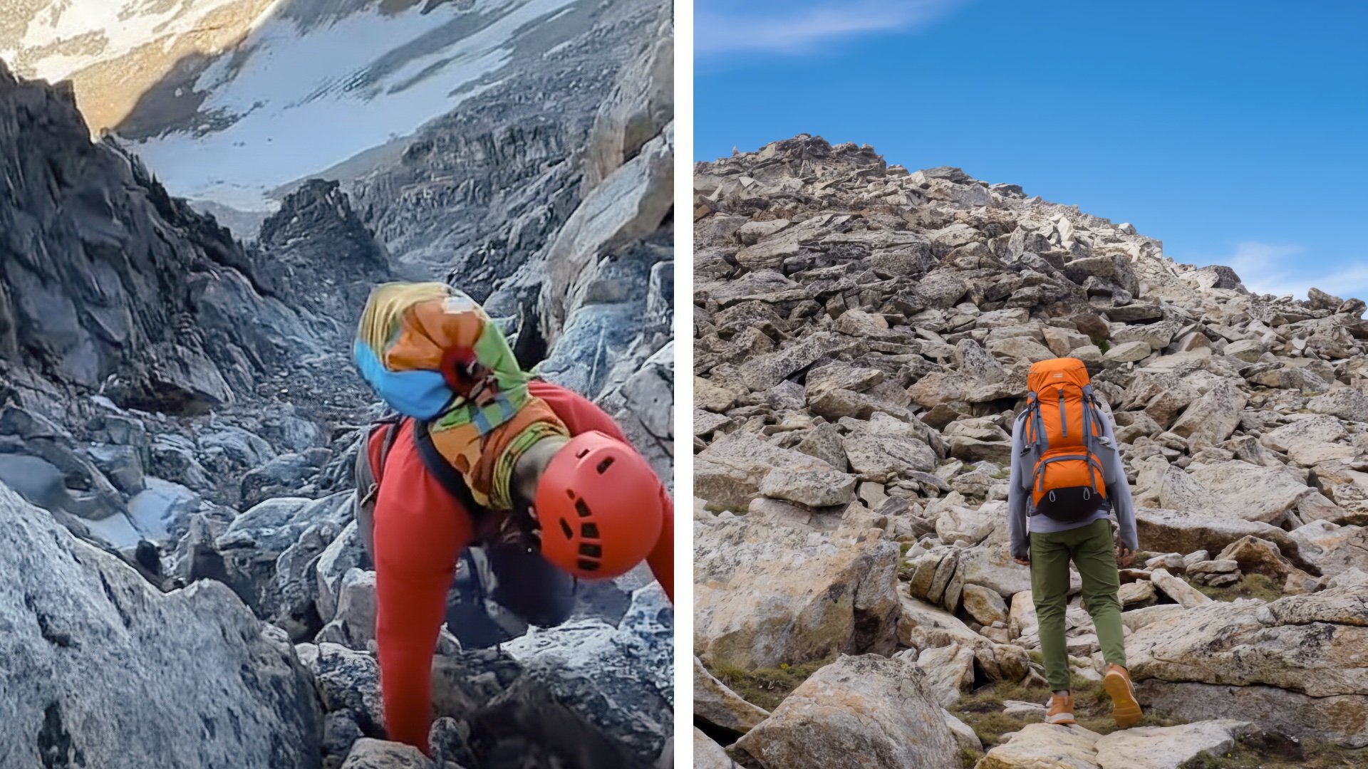
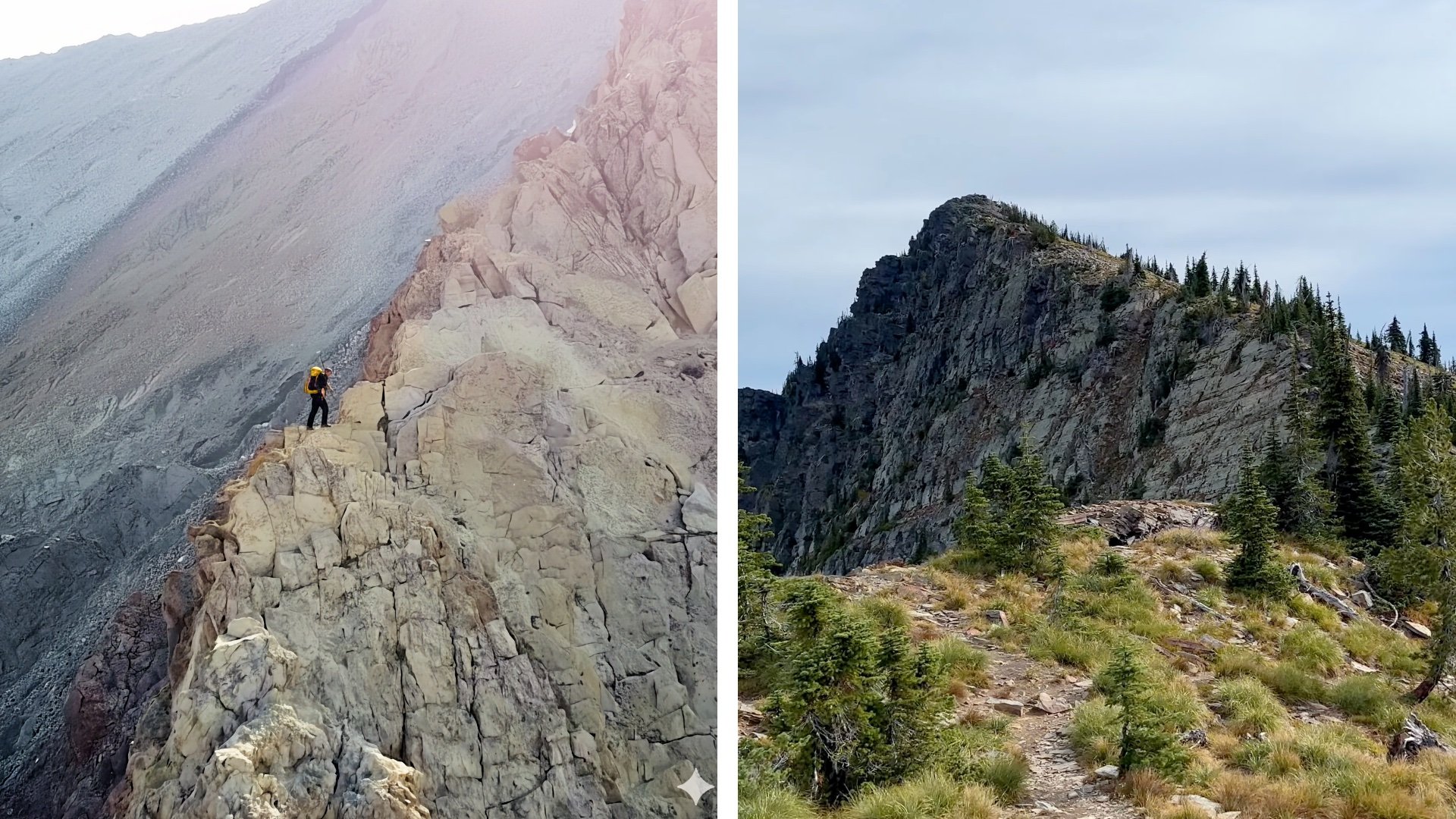
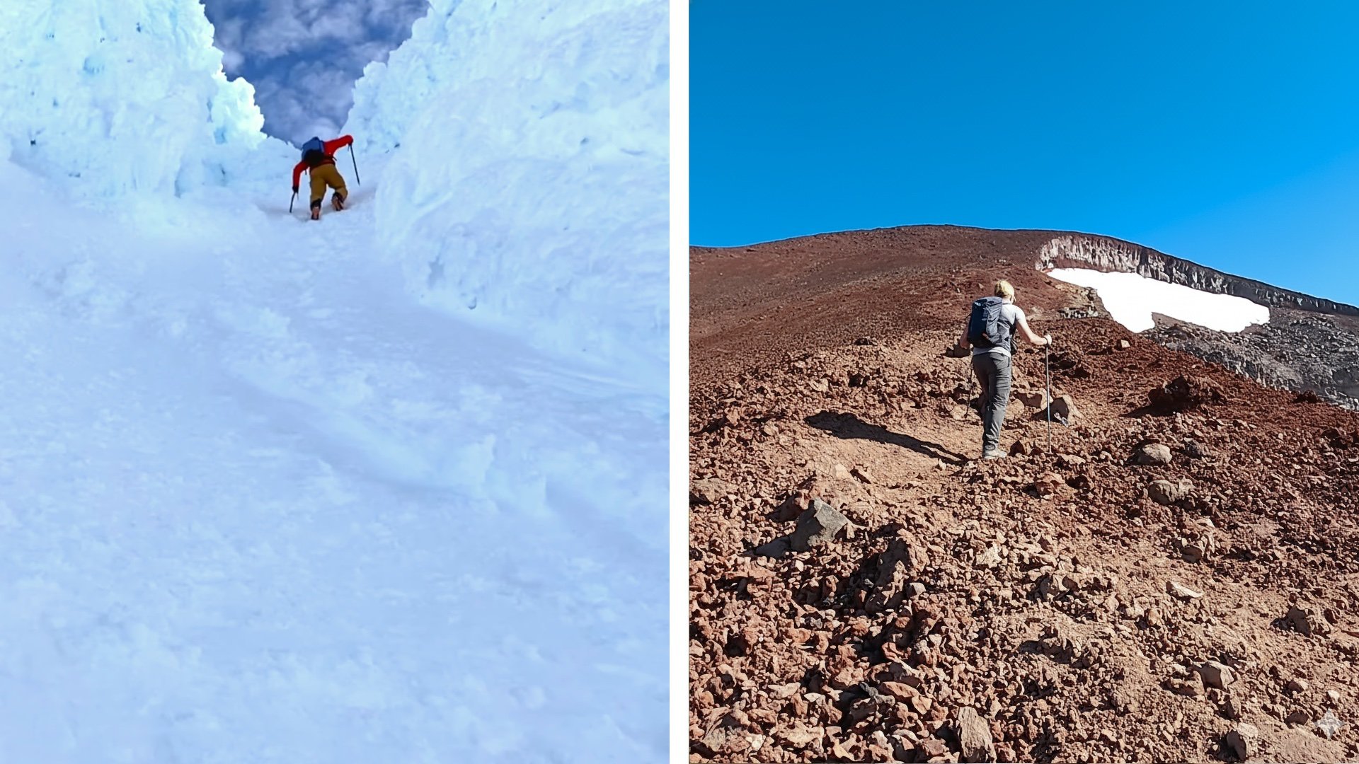
These high points aren’t hikes. Reaching the true summits requires mountaineering skills, exposed rock climbing, and the ability to handle off-route navigation on steep, unforgiving terrain. If you want to climb them safely, take a proper mountaineering or climbing course, practice on easier peaks, and go with experienced partners or a guide service that can teach you the skills and manage the objective hazards.
Alaska
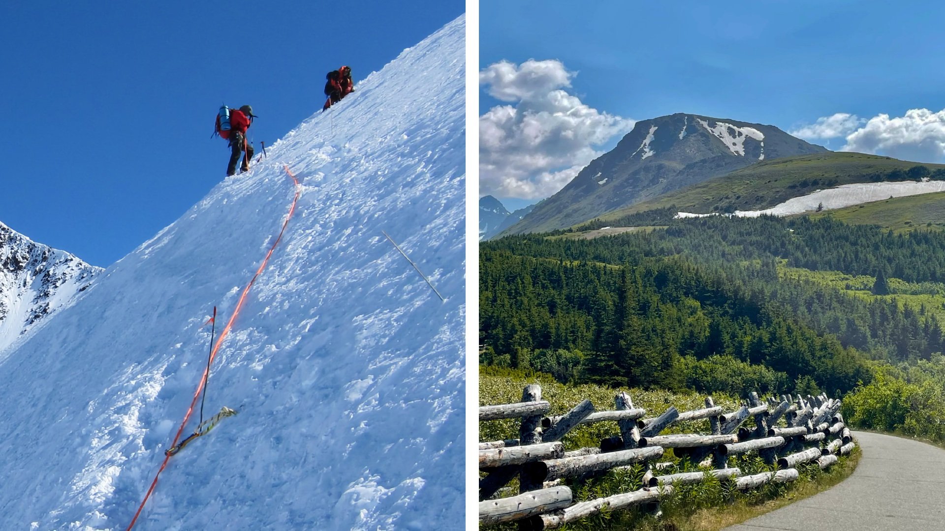
There are 3,844 named mountains in Alaska but finding one with a normal hike to the summit is a challenge. Even the mid-elevation summits in the 4,000 to 7,000-foot range, like South Pioneer or Matanuska Peak, have exposed sections that I wouldn’t recommend to a casual hiker. That leaves Flattop Mountain, just outside Anchorage, as the next best option. On a clear day you can see everything from Denali to the ocean. It’s a well-maintained trail, the most popular hike in the state, but does have a short scramble section before the summit. I've seen children do it and I wouldn't consider it dangerous if you take your time.
Denali rises about 18,000 feet above the surrounding terrain, making it the tallest "base to peak" mountain fully above sea level. If you count the underwater portion, Mauna Kea beats it.
Washington
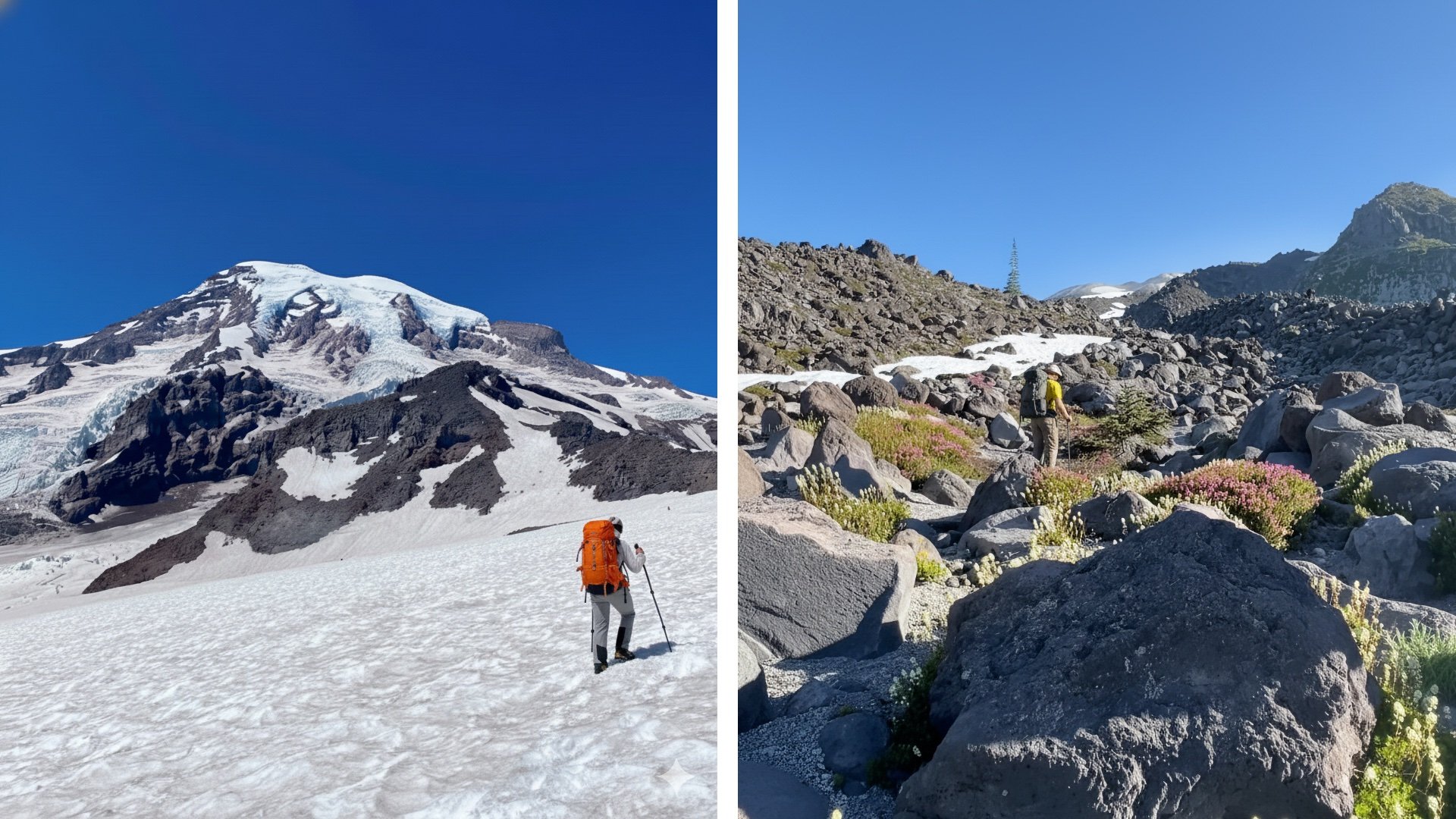
Mount Rainier, Washington’s highest point, requires mountaineering all year. The best alternative is the popular Mount St Helens, which you can hike once the snow melts in late summer. After a mellow forest trail start, the challenge comes as you grind your way up a marked boulder field, and finish on a steep, sandy ash slope that feels like climbing a giant treadmill. With solid fitness and favorable weather, it’s a big Cascade summit you can bag as an alternative.
Not only is Mount Rainier the largest single-mountain glacial system in the lower 48 states with 26 major glaciers, but it's also an active volcano, with its last minor eruption happening in 1884.
Wyoming
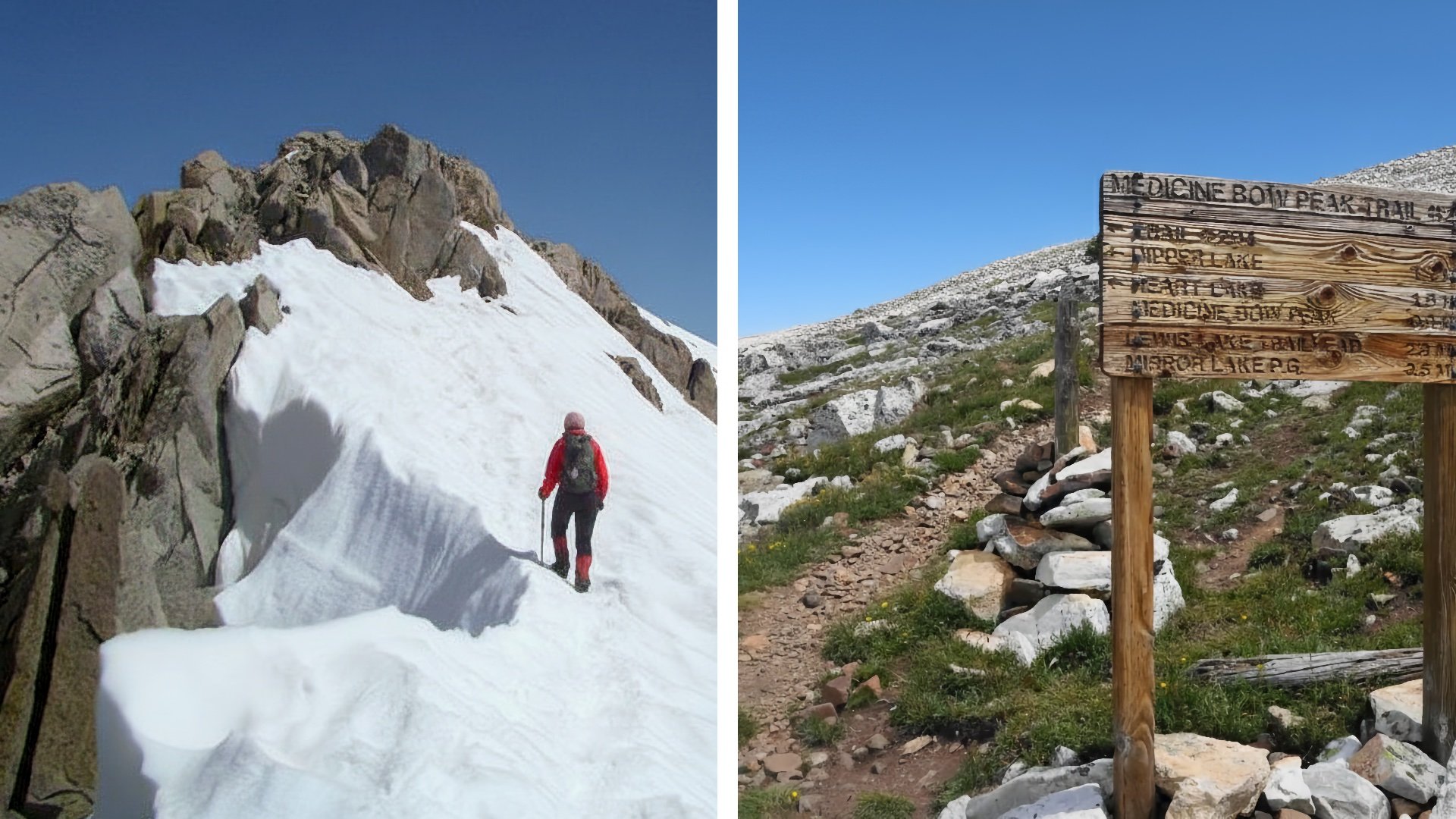
Gannett Peak is the top of Wyoming, is generally considered the hardest peak to bag after Denali. The alternative here is Medicine Bow Peak, where the official USFS Medicine Bow Peak Trail (#295) takes you to the top on popular and scenic maintained trail. Some close alternatives without official trails were Cloud Peak and Fremont Peak, which are probably doable by most fit hikers, but not ones I would universally recommend.
Medicine Bow Peak on AllTrails
Gannett Peak is named after the father of mapmaking in America, Henry Gannett, who also was a founding member of the National Geographic Society.
Nevada
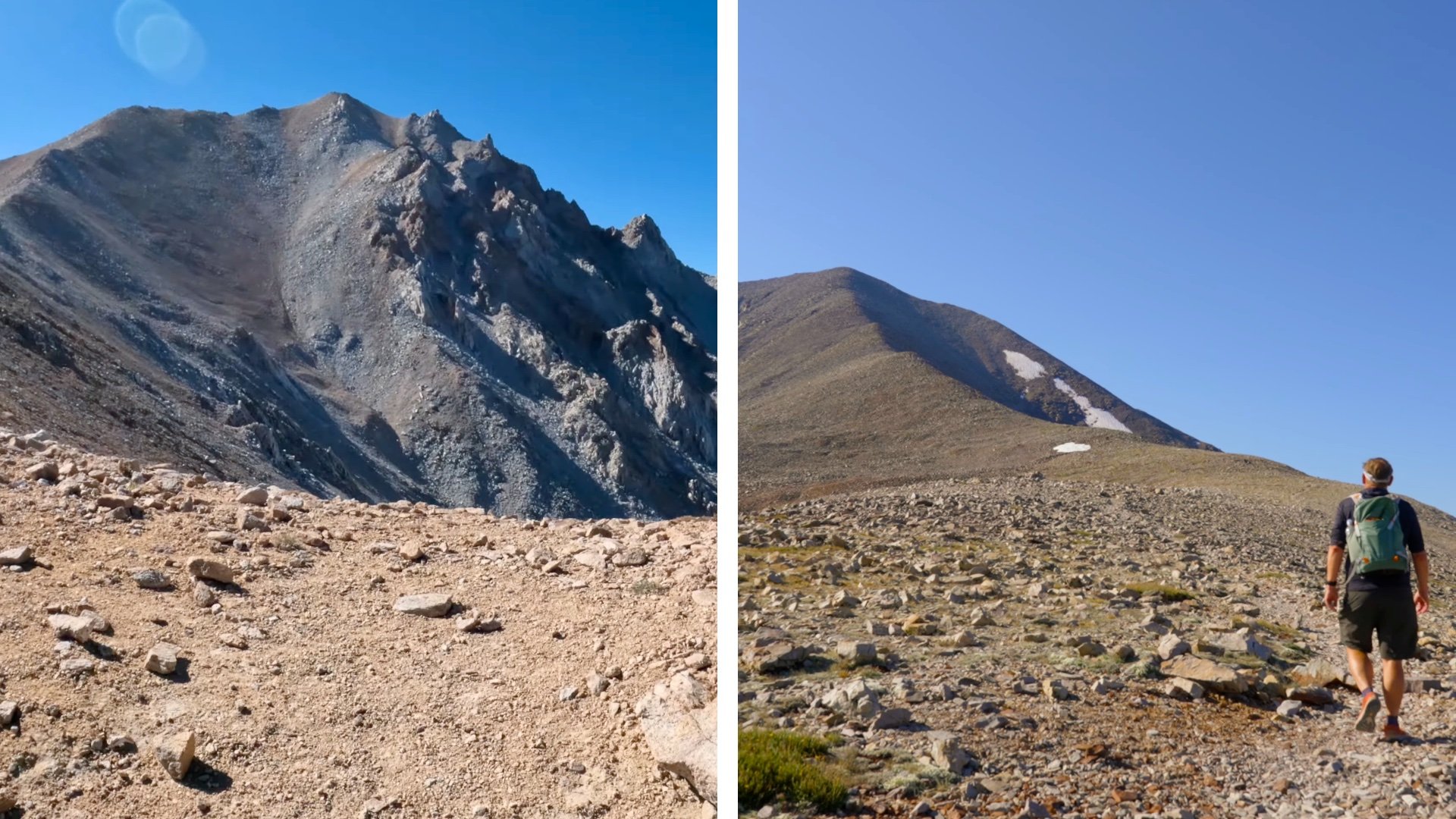
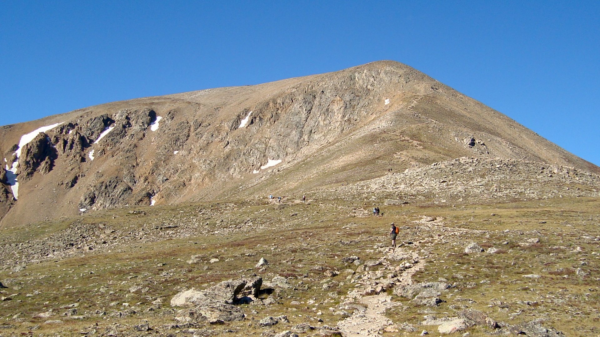
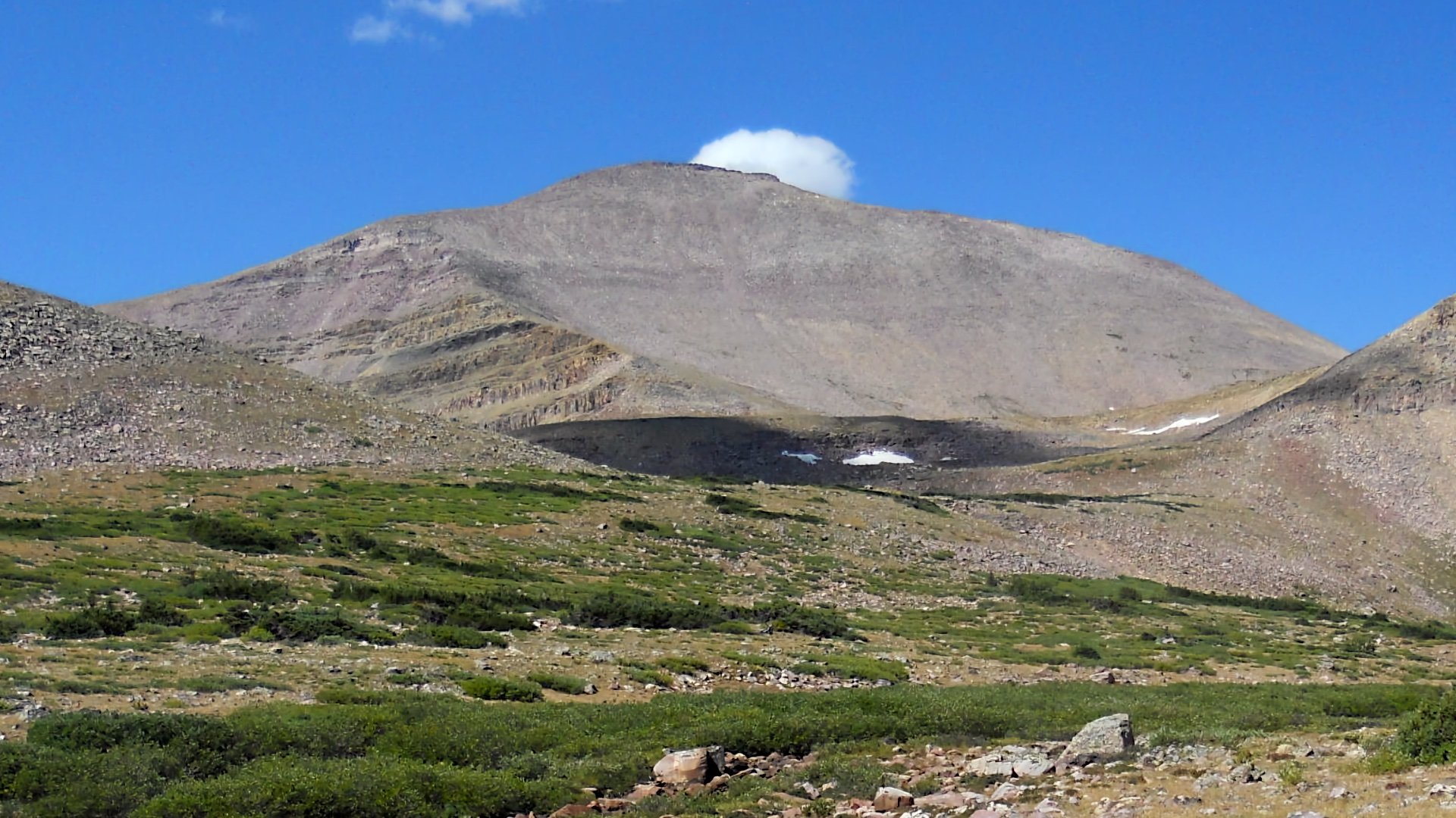
Boundary Peak is the highest point in Nevada, but the Forest Service page for the trailhead is clear that the climb requires route finding and cross-country navigation, although there is a decent unofficial trail in most places. That said, I think Wheeler Peak in Great Basin National Park is the better choice and not much lower than Boundary. There's a NPS maintained trail that is tough but beautiful, and doable by most folks with good fitness and luck with the weather.
Boundary Peak is only 84 feet taller than Wheeler Peak, but because it’s essentially a shoulder of California’s Montgomery Peak, many geologists consider Wheeler the state’s true high mountain.
Montana
Granite Peak requires some technical rock climbing, including exposed Class 4/5 sections, giving it a reputation as one of the hardest state high points to reach. The alternative is Trapper Peak, the highest point in the Bitterroot Mountains, close to the Idaho border. There's an official USFS trail to the summit, but still a steep and tough day.
Granite Peak is so tough it didn’t see its first recorded ascent until 1923, making it one of the latest U.S. state high points to be summited.
Idaho
You don't have to be a rocket scientist to figure out that Borah Peak's "Chicken-Out Ridge" implies there is some technical challenge here beyond a normal hike. So Scotchman Peak, close to the Montana border, is the safer alternative. It has an official USFS trail which is one of the most popular and well-traveled trails in northern Idaho. "Idaho: A Climbing Guide" calls Scotchman Peak the hardest Class 1 peak in the state. Alternatives like Hyndman, Castle and Iron Creek Point exist, but they generally require more intense scrambling and/or route finding.
Borah Peak rose about 7 inches in the 1983 Borah Peak earthquake, one of the largest quakes in Idaho history.
Oregon
Mount Hood is the true high point of Oregon, but every route to the summit requires mountaineering. South Sister, another Cascades peak, is the next highest summit in the state that you can reach on a non-technical hike. There’s a short window in late summer when the route is snow-free and hikeable. As one local hiker put it: “It’s definitely hikeable in late summer without stepping on snow at all. No scrambling, great trail the whole way except maybe the last half-mile, where it gets soft and gravel-y. The tread braids into a few parallel paths, but they stay within about twenty feet of each other—no routefinding and no dangerous scree.”
Mount Hood is the second most climbed glaciated peak in the world, behind Japan’s Mount Fuji.
Hikes
These high points are real hikes, not climbs. They can be long, steep, or alpine, but the routes stay non-technical and follow established trails the whole way. You’ll need solid fitness, good judgment, and the usual mountain essentials, especially on peaks with weather exposure, but you won’t need mountaineering or scrambling skills. If you’re comfortable with bigger trail days and paying attention to conditions, these are straightforward, rewarding summits.
California
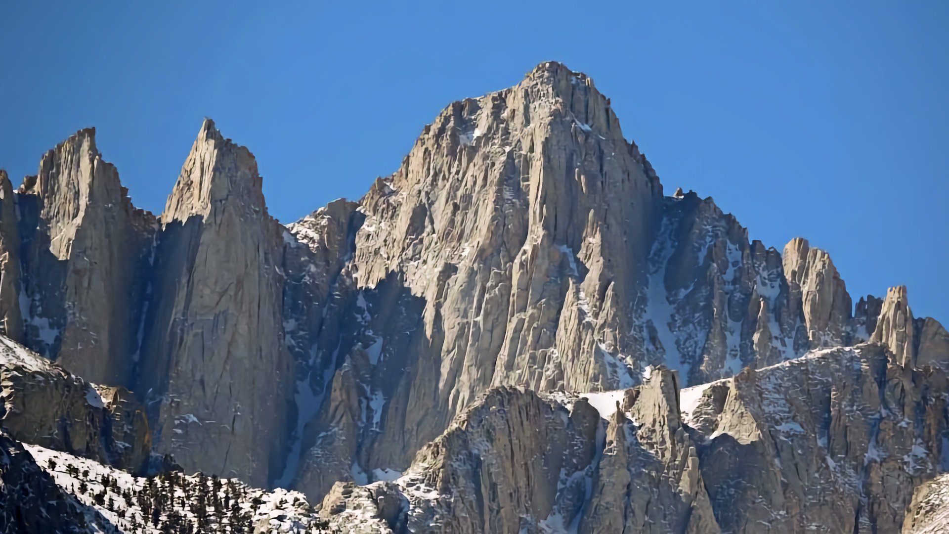
Mount Whitney is the highest point in California and the highest summit in the lower 48, and it’s one of the rare high-altitude state high points you can reach on a true Class 1 trail. The standard Mount Whitney Trail climbs out of Whitney Portal and works its way through classic Sierra terrain to the summit. It’s a long day with challenges like the weather, permits and altitude, but with good judgement and preparation, very doable.
Mount Whitney and the lowest point in North America, Badwater Basin, are only 85 miles apart.
Colorado
Mount Elbert is Colorado’s high point and the second-highest summit in the lower 48, and the standard North Mount Elbert Trail makes it one of the most approachable big peaks in the Rockies. It’s a steady Class 1 climb through forest and then open tundra, with a wide ridge and a clear path all the way to the top. No scrambling, no exposure, just a long uphill walk at altitude.
Mount Elbert sits just west of the Continental Divide, and snowmelt on its slopes ultimately drains to both the Pacific and Atlantic Oceans.
Utah
Kings Peak is the highest point in Utah and one of the tougher ones. It's 25+ miles and does have some boulder hopping near the summit, but nothing I would consider dangerous or challenging from a navigations standpoint. The biggest challenge here is probably fitness and the weather.
Kings Peak is named after Clarence King, a prominent white geologist who secretly lived as a black Pullman porter in the 1880s for more than a decade so he could marry Ada Copeland, a formerly enslaved woman.
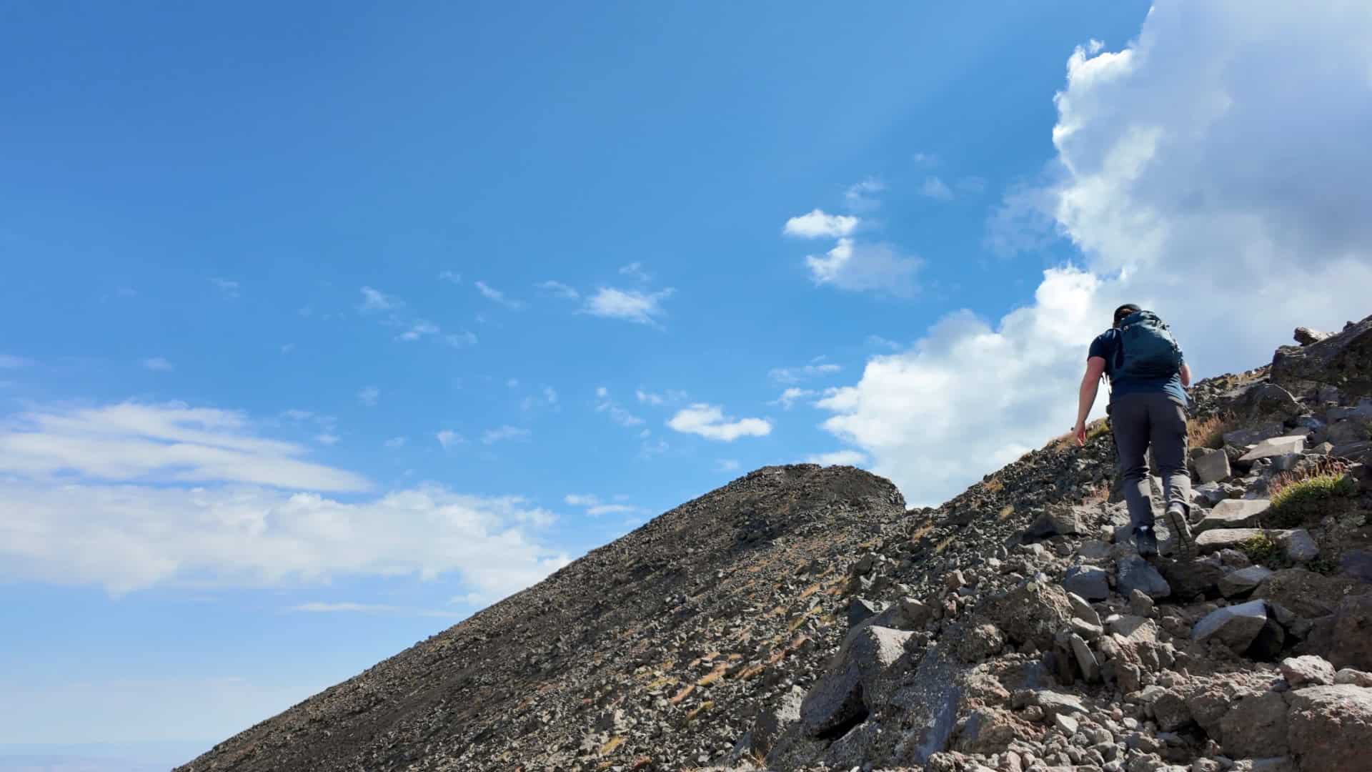
New Mexico
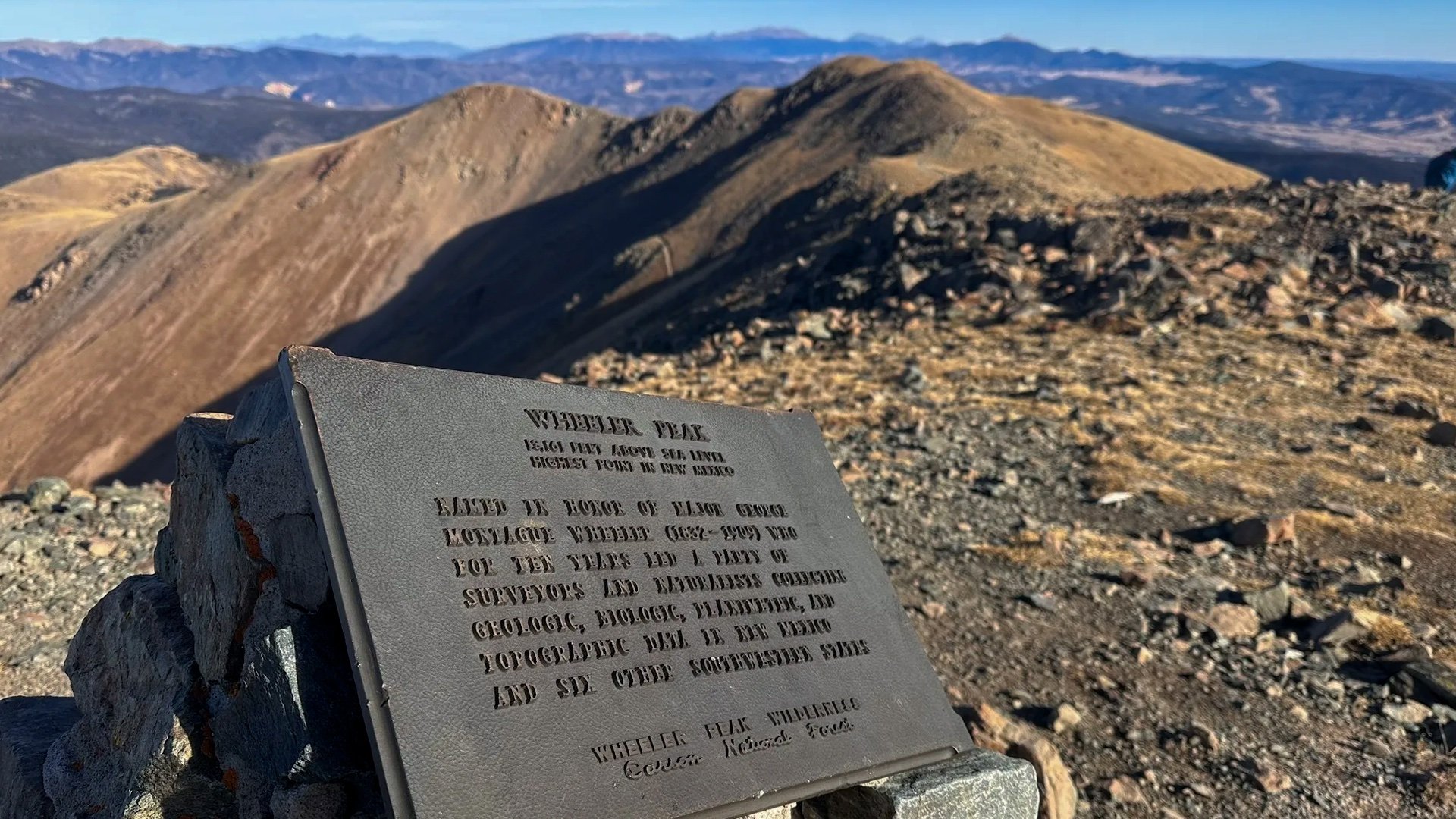
Wheeler Peak is the highest point in New Mexico and it has a well-marked and popular route to the top on the Williams Lake Trail. It starts in Taos Ski Resort and makes it way above the tree line to the summit. There's a scree field toward the top but nothing I'd call challenging navigation.
Wheeler Peak sits at the southern edge of the Rocky Mountains, and its summit is built from some of the oldest rock in New Mexico, about 1.7 billion years old.
Arizona
Humphreys Peak is the highest point in Arizona and has a nice (but tough) USFS trail to the summit. The standard route climbs from the Arizona Snowbowl trailhead, passing through high-altitude forest before breaking out above the tree line for the final push.
Humphreys Peak is part of the San Francisco Volcanic Field, which contains over 600 volcanoes and domes, the last of which erupted 1000 years ago and is also worth a visit.
Texas
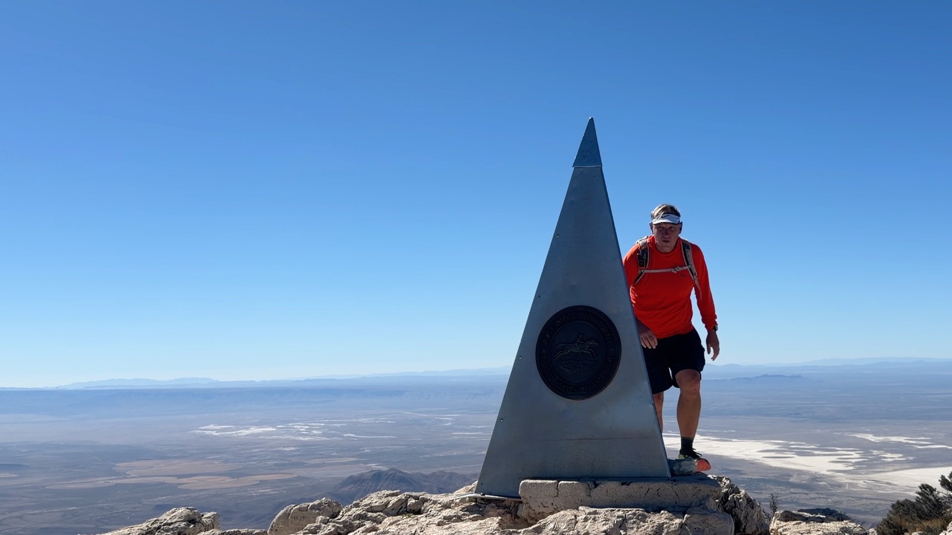
Guadalupe Peak is the highest point in Texas, and the standard trail from Pine Springs is a straightforward, well-built Class 1 route the entire way to the summit. One of the biggest challenges here is the weather, the summit can be extremely windy and even can get snow. Here's how my trip went to bag this peak.
Guadalupe Peak’s summit is marked by a stainless-steel pyramid placed there in 1958 by American Airlines to commemorate the 100th anniversary of a stagecoach route.
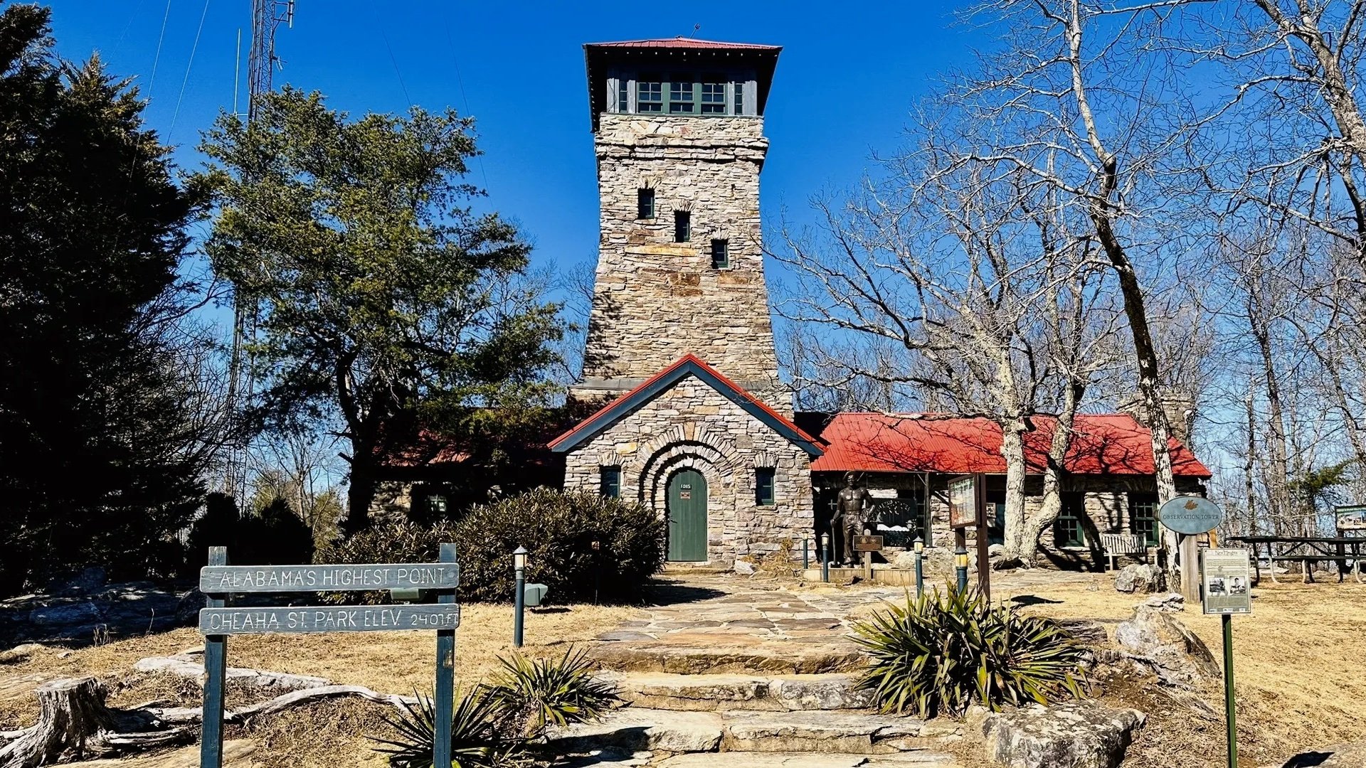
South Dakota

Black Elk Peak is the highest point in South Dakota and it has one of the best summit trails in the entire high point list. The route is well built, easy to follow, and has an incredible summit tower. One of my favorite hikes of all time.
The summit's historic stone tower, built by the Civilian Conservation Corps (CCC) between 1935 and 1938, served both as a fire tower and as a post office!
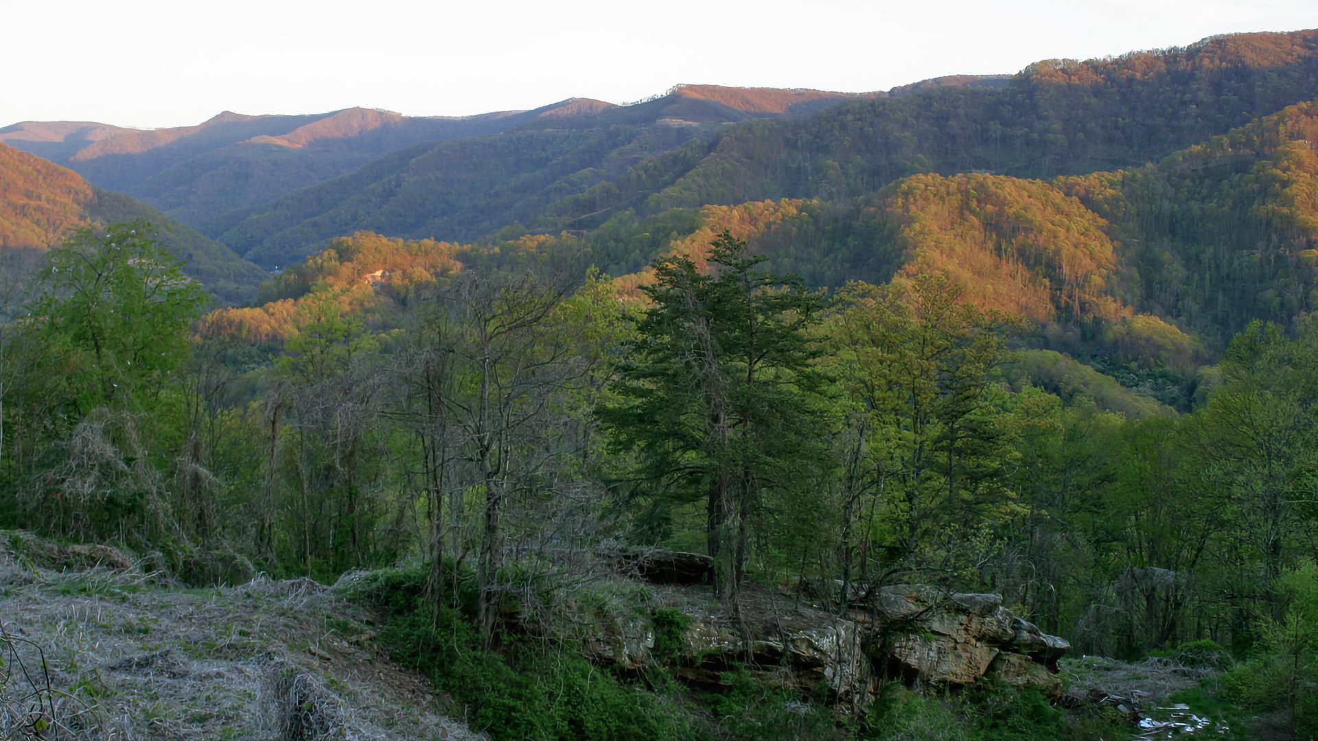
Virginia
There are a few ways to approach the hike up to Mount Rogers, and my favorite is from Grayson Highlands State Park up the Appalachian Trail. It's got enough distance and ascent to make it feel like an honest effort, but the summit of Mount Rogers is covered in trees, so don't expect views. But maybe you'll spot some of the wild ponies that are common in the area.
The area around Mount Rogers is home to free-roaming wild ponies introduced in the 1970s to manage vegetation.
New York

Mount Marcy is the highest point in New York and a classic Adirondack summit. The most popular and recommended route is on the Van Hoevenberg Trail. Even though the stats don't look too tough compared to some of the bigger state high points, this is a tough hike, don't underestimate it.
Vice President Theodore Roosevelt was hiking Mount Marcy in September 1901 when he got news that President William McKinley was dying. Roosevelt hustled back down the mountain to become president.
Maine
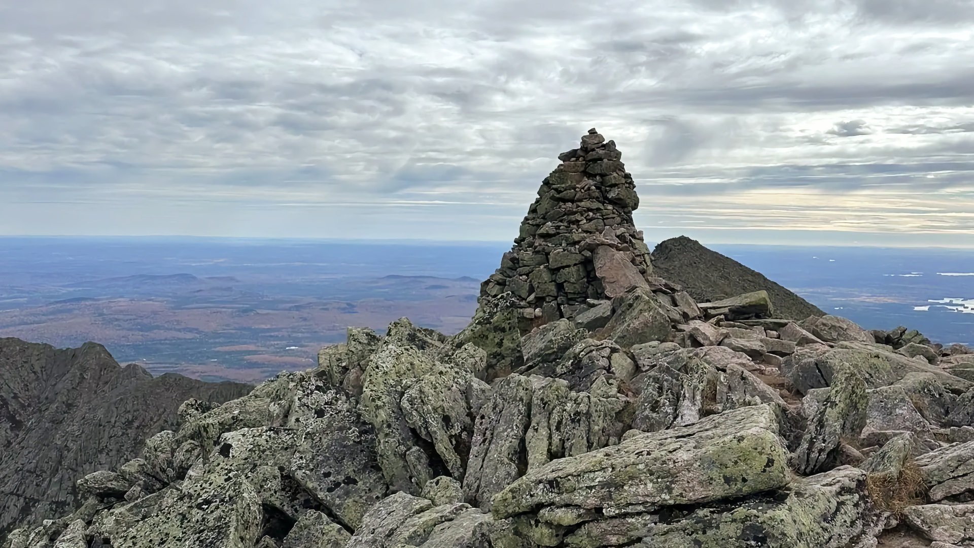
Katahdin is the highest point in Maine, and every route to Baxter Peak involves some hands-on Class 2 movement. The cleanest option is the Hunt Trail, which follows the Appalachian Trail up the mountain and avoids the exposed sections on routes like the Knife Edge.
Katahdin marks the northern terminus of the 2,200 mile (approx.) Appalachian Trail, the finish line for thousands of thru-hikers each year.
Vermont
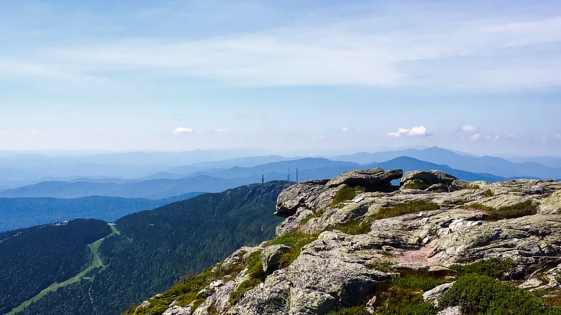
Mount Mansfield is the highest mountain in Vermont, rising above the Green Mountains in Chittenden County. Even though you get to drive relatively close to the summit in Underhill State Park, there's still 2.5 miles and 2500 feet of climbing, making it very tough but doable.
Mount Mansfield’s summit ridge resembles a human face, with features named the Forehead, Nose, Lips, and Chin.
Connecticut
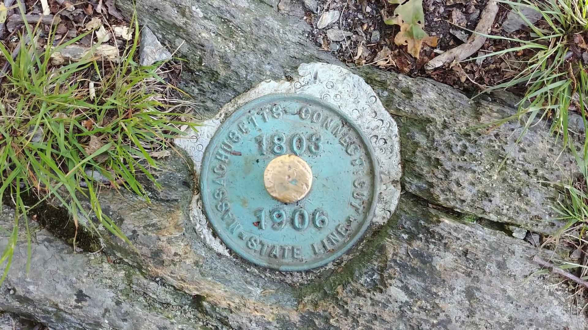
Connecticut’s high point sits on the south slope of Mount Frissell, and the best way to reach it is by starting in Massachusetts. The Mount Frissell Trail gives you a straightforward hike over the summit and down to the high point marker on the Connecticut side. It’s not a peak in the true sense, but it is the official high point and a solid little hike to tag the spot.
Bear Mountain, just 1.5 miles away, was long thought to be the state's high point and is the highest summit entirely within Connecticut, and there's still marker there from 1885 declaring it as the highest.
Easy
These high points are mostly drive-ups or short walk-ups, though a few have slightly longer but still straightforward trails. There’s no scrambling or technical terrain, and most people can reach these summits with basic preparation. When a state’s true high point is extremely short, I also include a longer hiking alternative if it's available so you can turn it into more of a real outing if you want.
Hawaii
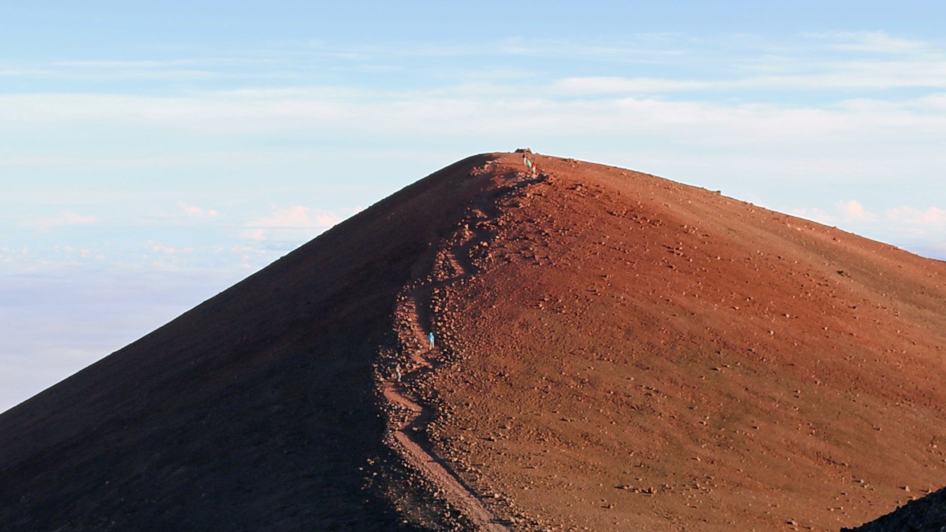
You can drive to the summit area of Mauna Kea, but the Humuʻula Trail is the nicer way to bag Mauna Kea from the Visitor Center, and it gives you a direct, meaningful ascent to the highest point in Hawaii. The scenery is probably unlike anything else you'd experience on any of the other state high points.
Mauna Kea extends 19,700 feet below the ocean surface, making its total height over 33,500 feet, the tallest mountain on earth if you're counting the part below sea level.
North Carolina
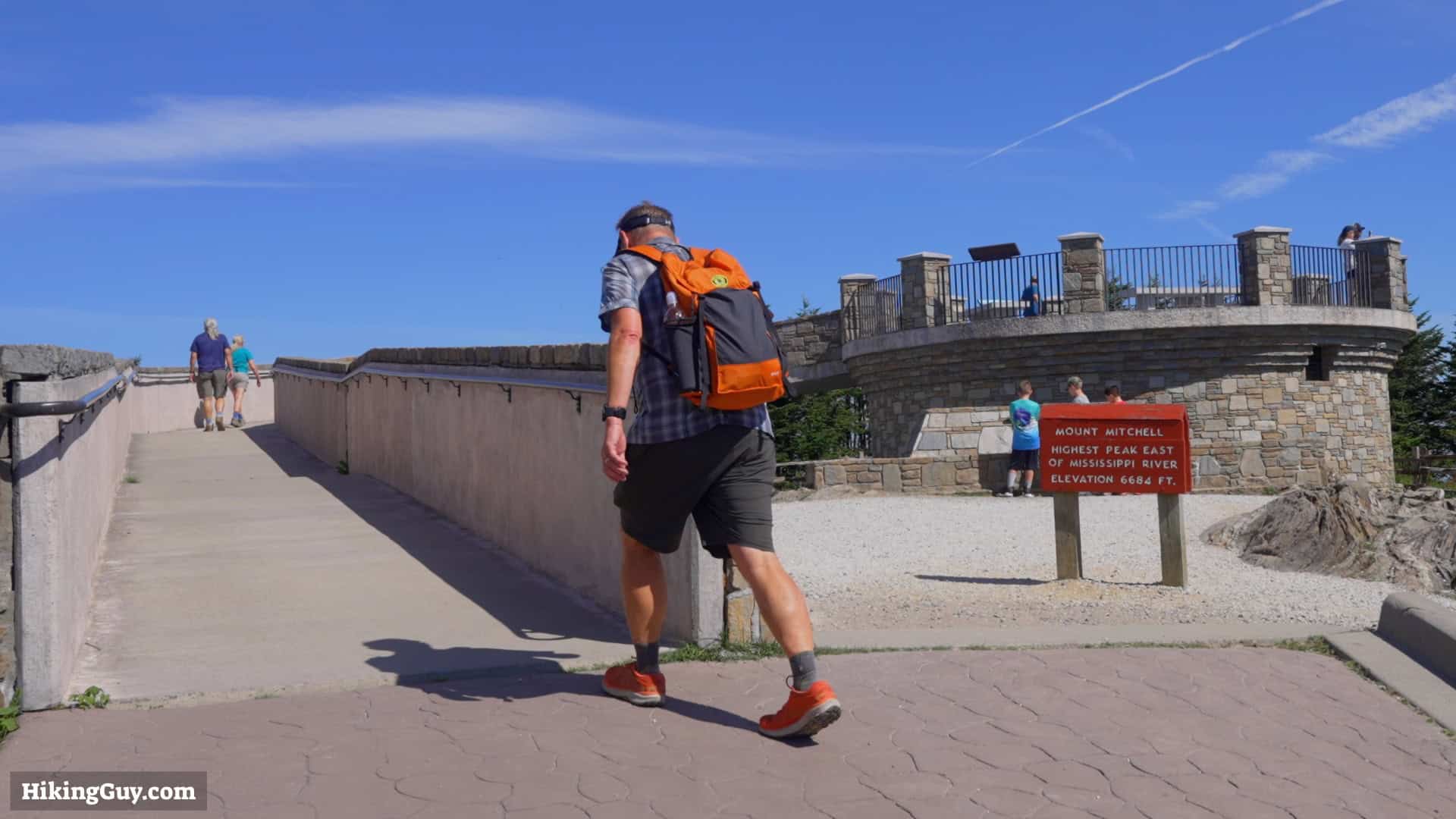
You can drive to Mount Mitchell, which is officially the highest point in the United States east of the Mississippi River. It's just a short walk from the parking lot. But the best way to hike it is from the Black Mountain Campground on the Mount Mitchell Trail. It’s a long, steady ascent through the beautiful North Carolina hills that makes bagging the peak much more rewarding.
The coldest temperature ever recorded in North Carolina, -34 °F, was on top of Mt Mitchell. You'll even find Fraser fir (classic Christmas) trees toward the summit!
Tennessee
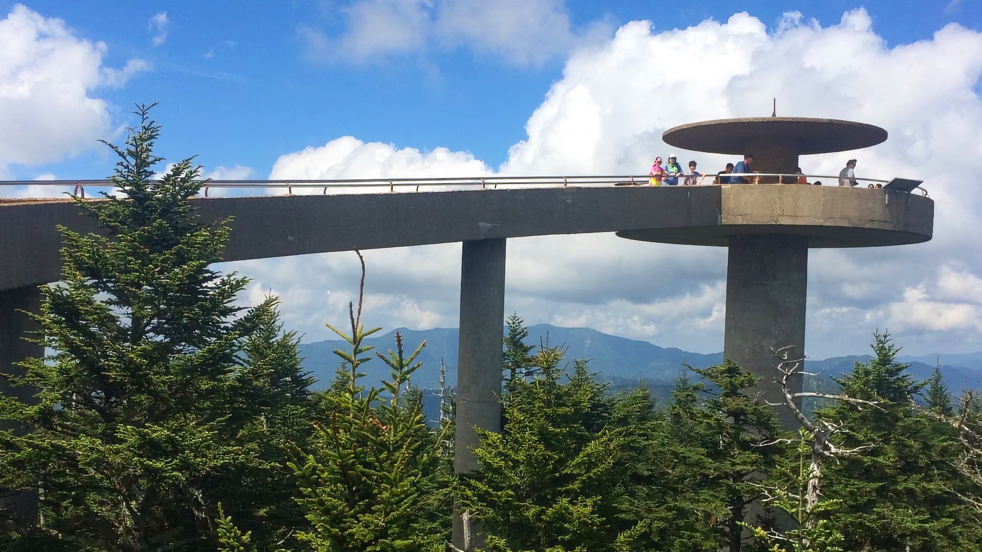
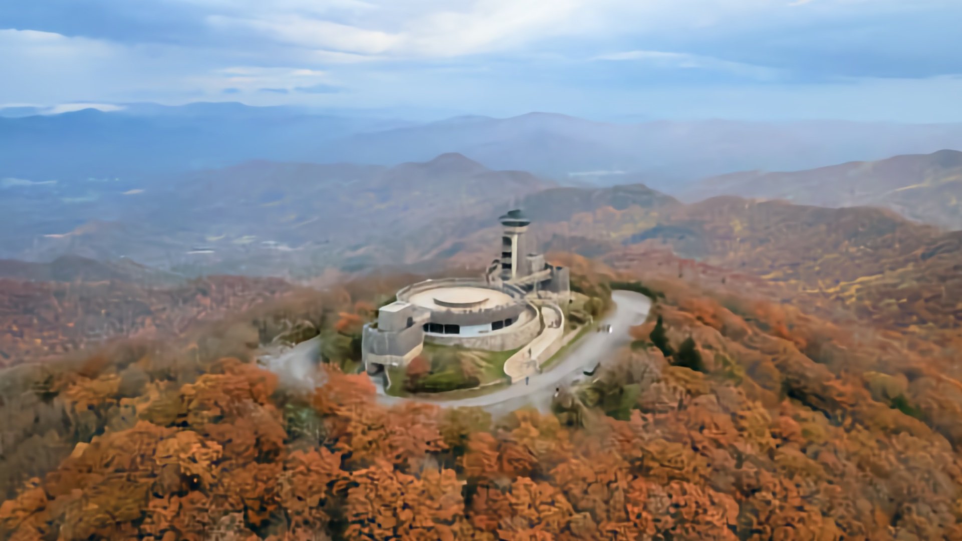
Clingmans Dome, now known as Kuwohi, is the highest point in Tennessee, and you can drive to the summit area and do the short paved walk to the summit and platform. If you want a hike, come in on foot via the Appalachian Trail, which rolls along the high ridgeline of the Smokies with incredible views and no crowds.
The observation tower, built in 1959 to rise above the trees, allows you to see up to 100 miles across seven states on a clear day.
New Hampshire

The Mount Washington Auto Road is a fun way to get to the summit, as is the cog railway. But if you want to do it on your own two feet, the Tuckerman Ravine route up from Pinkham Notch is the most popular route. It's very tough, with some scrambling up rocks, but I've seen all kinds of people do this route and you can too (when there's not snow or ice).
Mount Washington once recorded a 231 mph wind gust, still the highest directly measured wind speed on Earth outside a tornado.
Nebraska
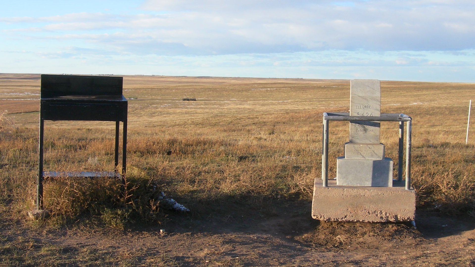
Panorama Point is the highest spot in Nebraska, tucked away on private ranchland in the far western edge of the state. It’s a short, flat walk from the parking area to a small marker on the High Plains, with wide open views and bison grazing nearby. There’s no real summit or climb here, but if you want a hike and a climb in Nebraska, check out Scotts Bluff National Monument.
Panorama Point is part of High Point Bison Ranch, and you can enjoy the bison meat in local restaurants.
Oklahoma
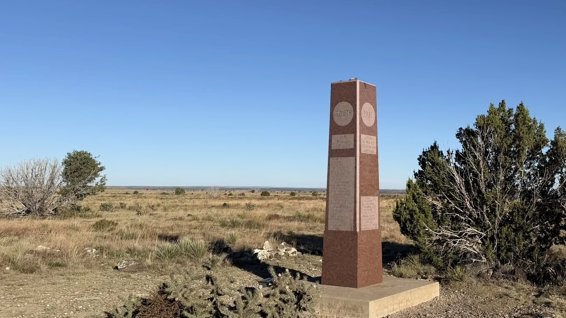
Black Mesa is the highest point in Oklahoma and one of the best true hike-to-high-point experiences on the Plains. The straightforward trail starts in rolling desert grassland and follows an easy path toward the volcanic mesa. You'll get big sky views and a unique hike, very cool!
Dinosaur tracks have been found near Black Mesa, a rare find this far east in the U.S.
West Virginia

Spruce Knob is the highest point in West Virginia, and even though you can drive to the summit area, there’s a nice hiking option that makes it a real outing. The Huckleberry Trail is a mellow climb from the Spruce Knob Lake area through red spruce forest and open high country before hitting the summit area.
Spruce Knob is the highest point in the Allegheny Mountains, a range so rugged it blocked most westward settlement until after the Revolutionary War.
Georgia
Brasstown Bald has a half-mile paved trail to the summit, but there are also options to hike it, including the scenic Arkaquah Trail. The Arkaquah Trail travels through classic southern Appalachian terrain, including spots with open viewpoints. And at the end, you reach the highest point in Georgia!
“Brasstown” likely comes from a mistranslation of a Cherokee word meaning “place of fresh green,” not an actual town.
Kentucky
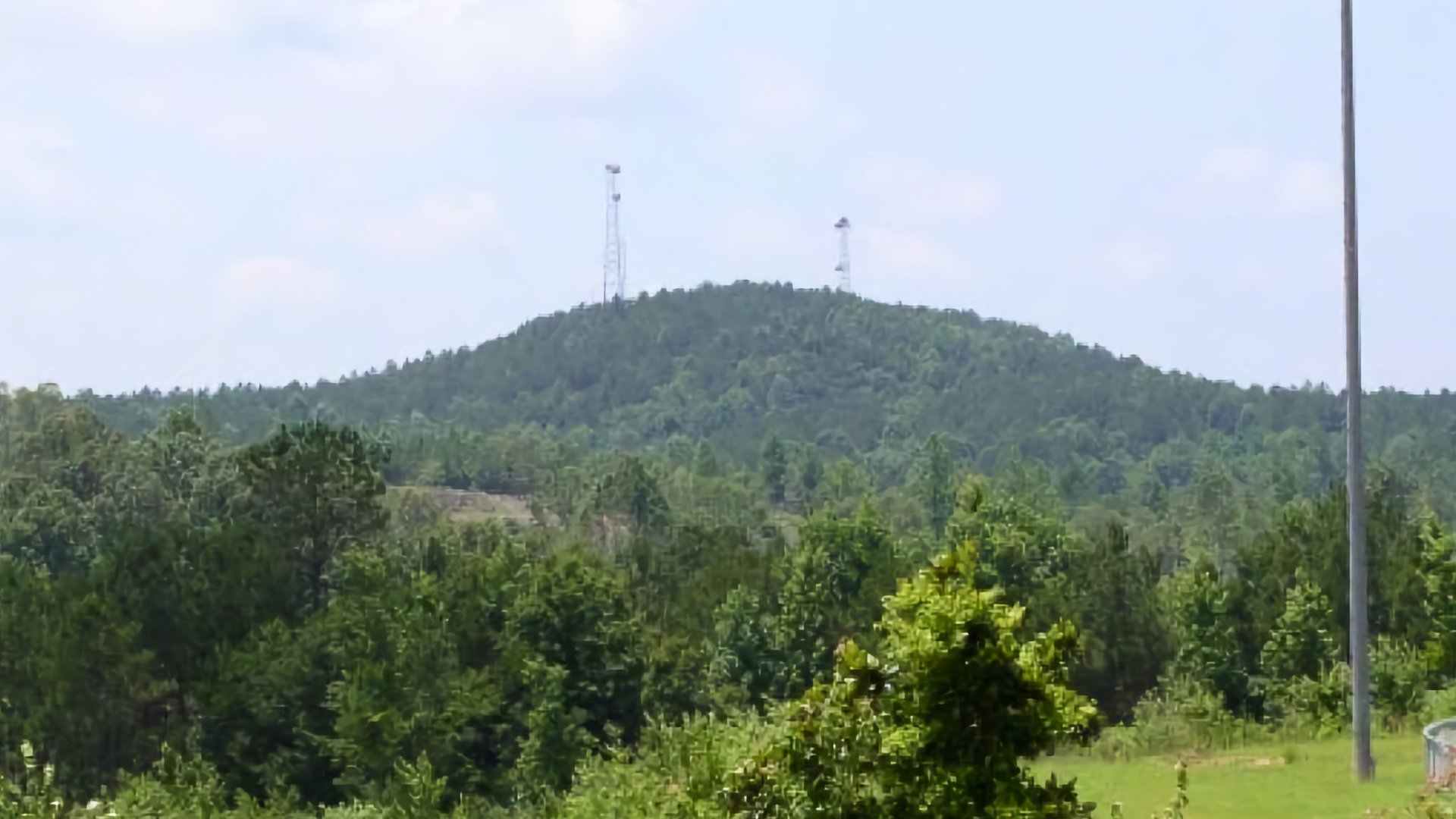
The good news is that you can hike to Black Mountain, Kentucky's high point, close to the Virginia border. The bad news is that it's on a road and the summit area isn't the prettiest, with radio towers at the top. I'm thankful that high-pointers have access and at least you can get a short hike in for this one.
There is an FAA radar "golf ball" by the summit that tracks airplanes from Cincinnati to Atlanta.
Kansas
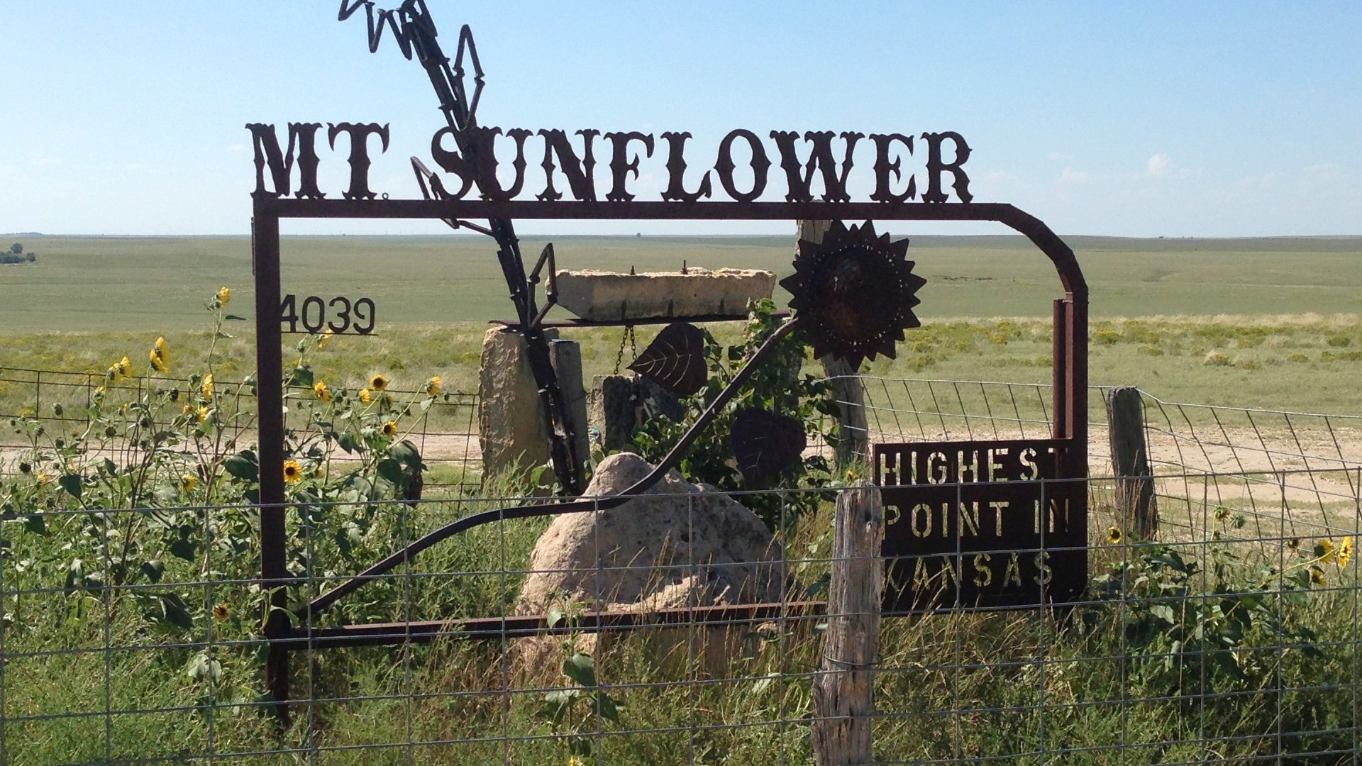
Mount Sunflower sits on private ranch land in far western Kansas, and reaching it is essentially a short walk from the parking area to the high-point marker. There aren’t any trails or public roads you can use to make it a longer outing, so this one is exactly what it looks like: a quick, flat stroll on the High Plains. It’s simple, accessible, and the correct way to tag the highest point in Kansas.
The land owners have a sense of humor, erecting a sign that says "Nothing happened here in 1897."
South Carolina

Sassafras Mountain is the highest point in South Carolina, and while most people drive to the observation deck, you can reach the summit on a real hike. I like the 5 mile route on the Foothills Trail from Chimneytop Gap. It's got some up and down, enough to make it more memorable than driving to a parking lot.
Sassafras Mountain on AllTrails
Sassafras Mountain marks the high point of the Foothills Trail, a 77-mile backpacking route with over 20,000 feet of climbing.
North Dakota

White Butte is a fun and easy short hike on private land. The landowners graciously allow high-pointers to summit here, and the trails are in great condition. The biggest challenge on this highpoint is getting here, it's hours away from any major population center.
North Dakota is known for its prairies, but White Butte is actually a badlands formation. Badlands National Park is about a 4 hour drive away.
Massachusetts
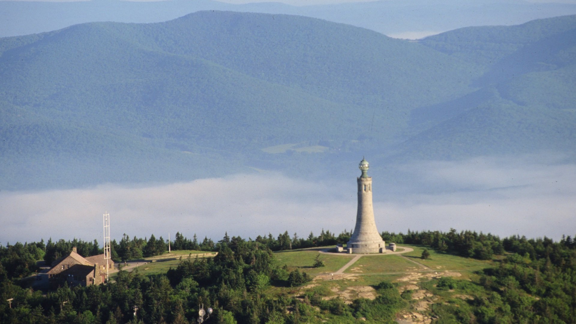
You can drive to the summit of Mount Greylock, but if you want to make it a hike, the Bellows Pipe Trail is the popular route to the summit. It's a beautiful trail through the forest, far away from the crowds taking the road to the top.
Herman Melville dedicated his 1852 novel Pierre to Mount Greylock, calling it “Most Excellent Majesty.”
Maryland

Hoye Crest is on the West Virginia / Maryland border, and you can do a pleasant short hike to reach it. Google Maps shows it as a drive-up, but the roads are rough and private. There's a nice commemorative plaque at the summit and overall this is a pleasant one to bag.
Backbone Mountain on AllTrails
Backbone Mountain is along the Eastern Continental Divide, water from the eastern slope flows to the Atlantic Ocean, on the west, to the Gulf of Mexico.
Pennsylvania
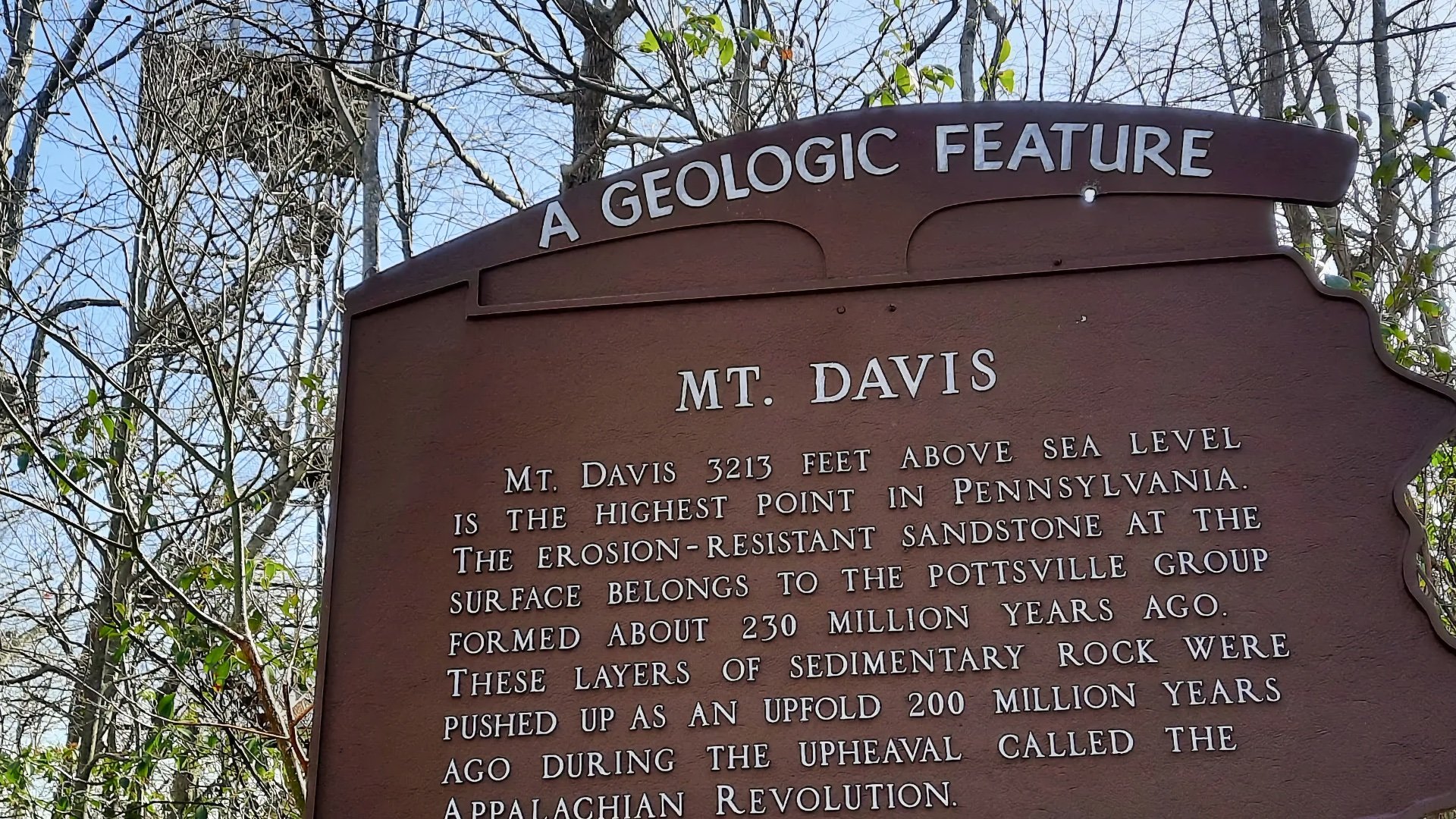
Mount Davis is another one you can drive up to. But there is a nice loop trail through the Laurel Highlands of the Mount Davis Natural Area that takes you to the top and the observation tower. If you've come this far, why not get a hike in too?
Because Mount Davis is so flat, many believed Blue Knob was Pennsylvania’s highest point until modern surveying confirmed Mount Davis in 1921.
Arkansas
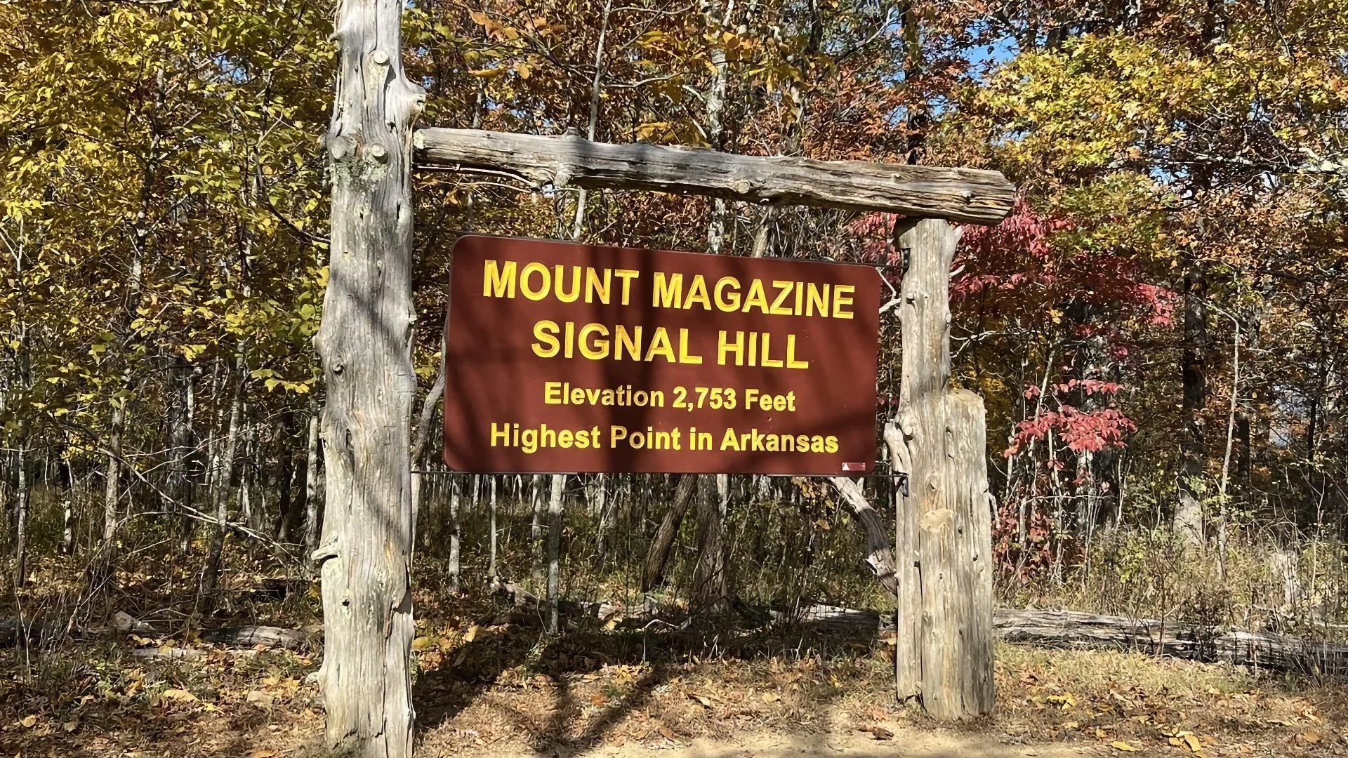
Mount Magazine is an easy one to bag, with a short hike to the high point, Signal Hill. There are lots of other trails here in Mount Magazine State Park, so you can make a day of it by visiting other attractions along the way.
Mount Magazine has one of the rarest butterfly species in North America, the Diana fritillary.
Alabama
Cheaha Mountain sits in the heart of the Talladega National Forest and takes its name from the Muscogee word “Chaha,” meaning “high place.” You can drive to the top, or a nicer option starts at Cheaha Lake and climbs through hardwood forest to the summit.
Cheaha State Park was established in 1933, making it the oldest continuously operating state park in Alabama.
Minnesota

Eagle Mountain is the highest point in Minnesota and one of the better high-point hikes in the Upper Midwest. The well-marked trail runs through the Boundary Waters Canoe Area Wilderness, weaving past lakes and rocky sections before making a steady climb to the summit ridge.
Eagle Mountain sits only 15 miles from Minnesota’s lowest point, Lake Superior.
Michigan
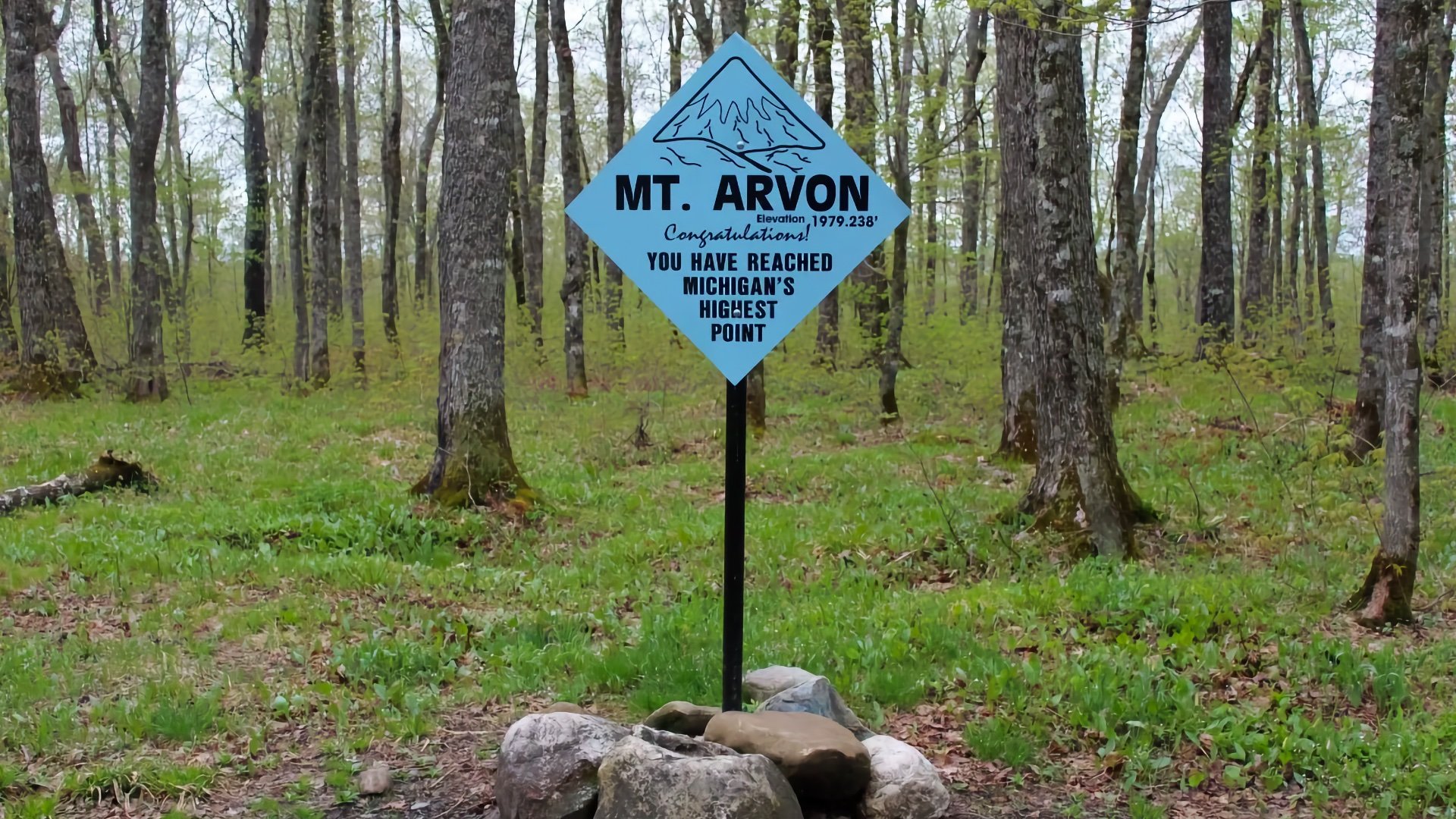
Driving the logging roads to Mount Arvon can be more challenging than hiking there. There are small unofficial trails you can take as well, so there are options. The summit isn't much but does have a nice viewpoint.
There is a higher point in the state: the Tilden Mine waste rock pile. Technically it is rock, but obviously it's not natural.
Wisconsin
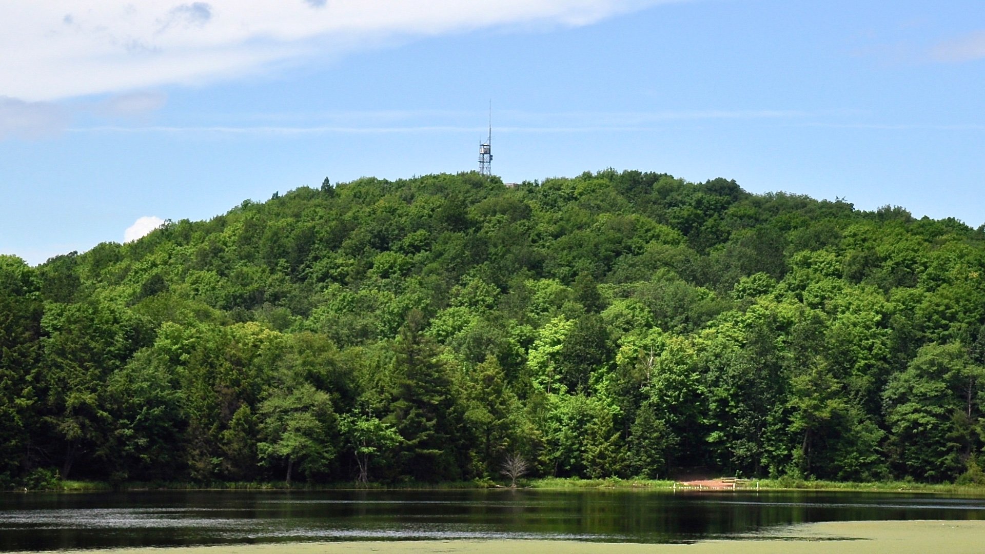
Timms Hill is the highest point in Wisconsin, and there's a nice trail to the summit, where the highest observation tower in the state gives you wide views over the surrounding countryside. If you want a longer outing you can link the summit trail with the other loops in the county park to turn it into a bigger walk.
Until 1962 it with thought that Rib Mountain was the highest point in the state, but modern surveying techniques confirmed it was here at Timms Hill.
New Jersey
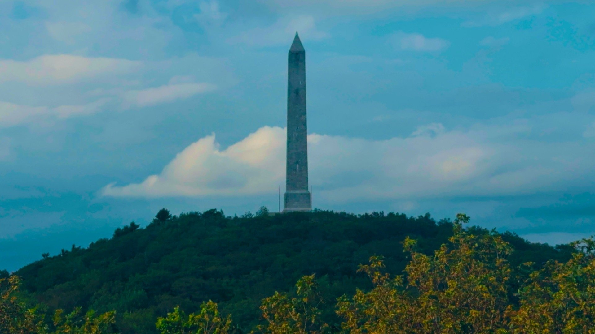
High Point sits in the far northwest corner of New Jersey and is exactly what the name says, the top of the state. Instead of driving right to the monument, the more fun way to reach it is to do the short hike in from the park entrance on the Appalachian Trail . Along the way is a viewing platform giving you postcard views of the summit monument that drivers will probably never see.
You may think the monument on the summit, which honors veterans, is modeled after modeled the Washington Monument, but according to official sources, it was modeled after the Bunker Hill Monument in Massachusetts.
Missouri
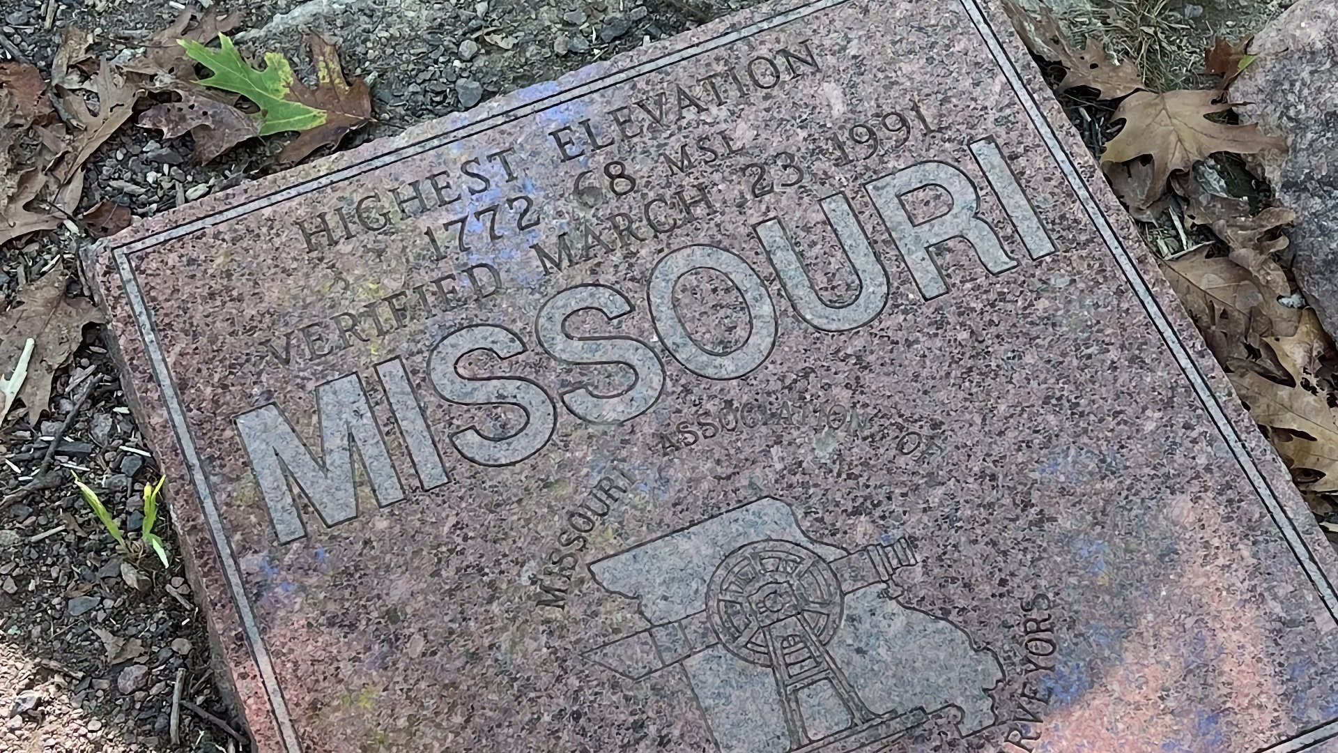
Taum Sauk Mountain sits in the St. Francois Mountains and is the highest point in Missouri, with a short, accessible trail leading from the parking area to the summit marker. If you want more of a real hike, the Mina Sauk Falls Trail loops out from the state high point to the state's highest waterfall.
Taum Sauk Mountain on AllTrails
Jesse James once hid out in these mountains.
Iowa
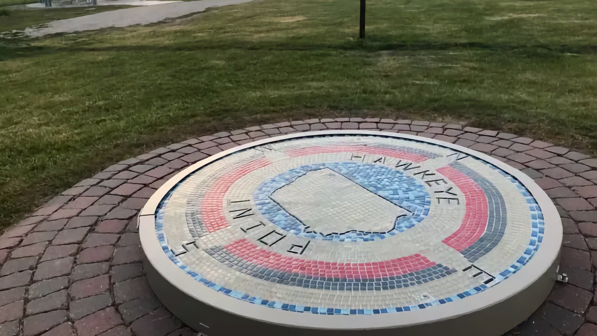
Hawkeye Point has become a small park with displays, signs, and a short walking loop. The high point itself is only about 0.3 miles of walking, but you can probably get a little more mileage in exploring the exhibitions at the site.
Before the Merrill–Sterler donated the land at the highpoint and created the park, the high point used to be at the end of a hog trough.
Ohio
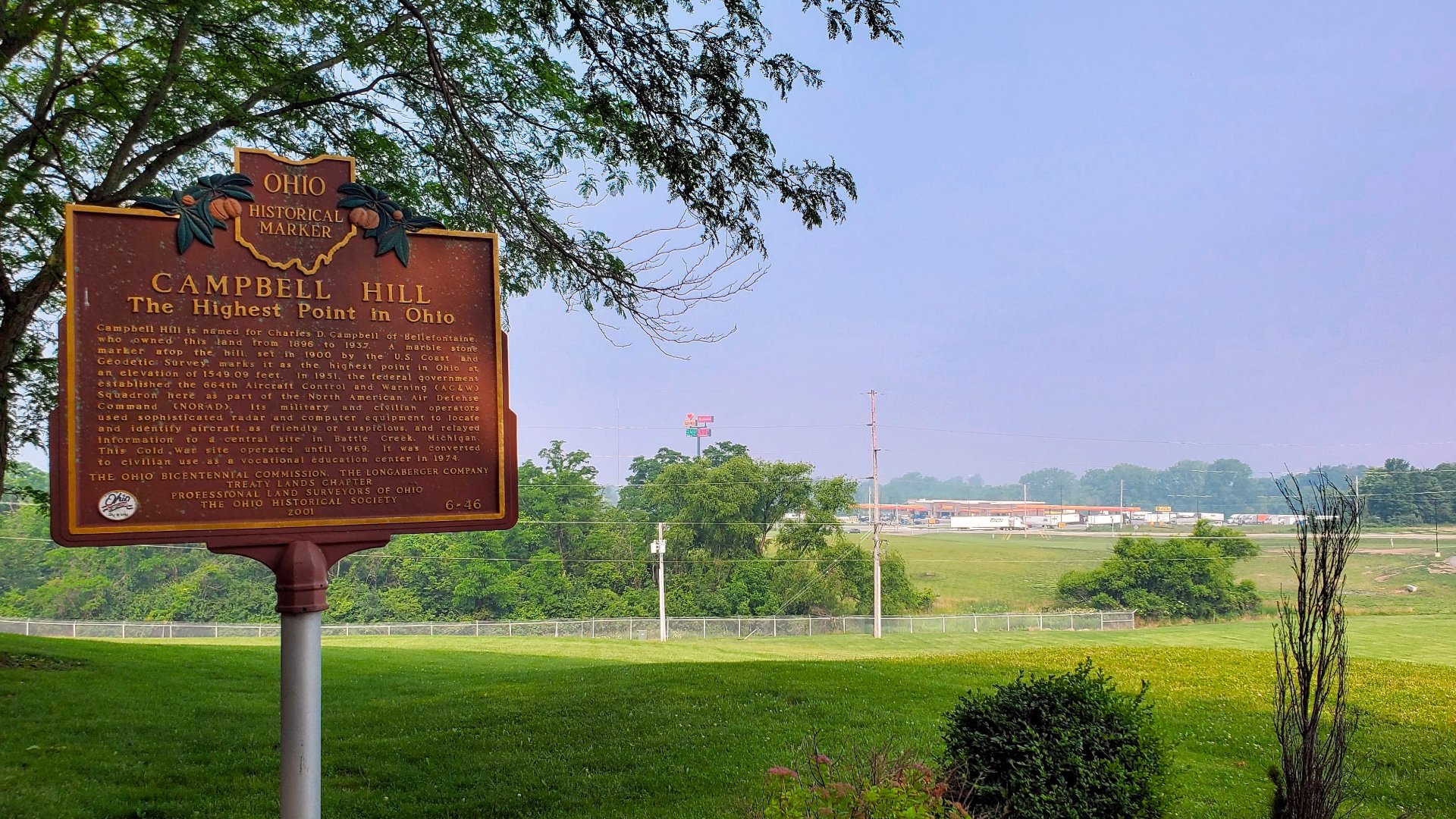
Campbell Hill is the highest point in Ohio, sitting on the grounds of a technical college just outside Bellefontaine. It’s an easy walk from the parking area to the summit marker, with a small landscaped overlook that makes it one of the more pleasant drive-up high points in the Midwest. There’s no real hiking involved, but it’s a quick stop and an easy summit to notch while passing through. There's even a gas station across the street to fill up on the way to another high point!
Campbell Hill served as a Cold War radar site because of its relative height within the state.
Indiana
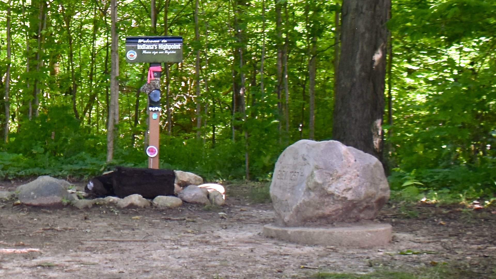
Indiana doesn’t have true mountain summits, but it does have Hoosier Hill, the high point. It can be reached by a short walk from the roadside into a small wooded clearing, is still the most accurate way to tag the top of Indiana. It’s simple and quiet, and while it won’t feel like a mountain, it’s the right choice for this list.
At one point Hoosier Hill was in danger of being overtaken by a landfill in neighboring Randolph County.
Illinois
Charles Mound sits in the rolling farmland of far northwest Illinois and is the highest natural point in the state. The summit is on private property, but the landowners open it to the public on specific weekends throughout the year. When access is open, the walk to the top is a nice stroll along a gravel road and grassy paths through farm country.
The highest point in Illinois is actually the Willis Tower (formerly the Sears Tower).
Rhode Island
Jerimoth Hill is the highest point in Rhode Island and one of the quickest high points in New England. It sits just off Route 101 on a short path through the woods, and is a pleasant area to visit.
Jerimoth Hill was one of the hardest high point to visit until recent years because a hostile landowner wouldn't let visitors cross their land to access the point.
Mississippi
Woodall Mountain is the highest point in Mississippi and sits just outside Iuka in the state’s northeast corner. It's a drive up with no trail system, but if you wanted to, you could walk on the road to the summit.
Woodall Mountain is known as "the bloodiest state high point" because of a Civil War battle here.
Louisiana

Driskill Mountain is the highest point in Louisiana and one of the nicer low-elevation high points in the South. The summit sits on private land but is open to the public, and an easy and well-marked trail leads from the trailhead through pine forest to the top.
Driskill Mountain on AllTrails
Driskill Mountain is actually a hill built from ancient marine sediment deposited as part of the delta, millions of years ago.
Delaware
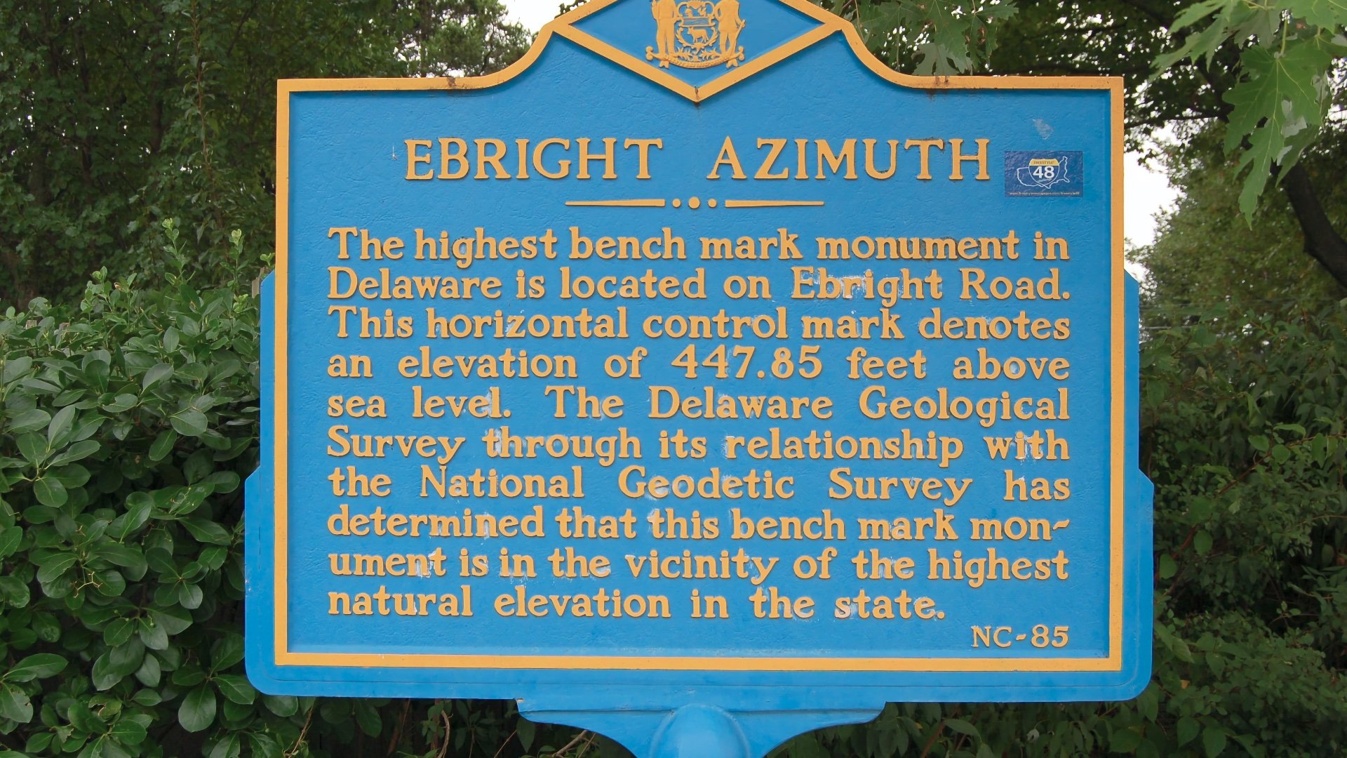
Delaware’s high point, the Ebright Azimuth, sits on a quiet suburban roadside just outside Wilmington. It’s a simple walk-up to a small marker on the shoulder of Ebright Road, with a sign noting the official elevation. There’s no trail or climb here, but it’s quick, easy, and one of the fastest high points you can tag as you move through the Mid-Atlantic. If you want a longer hike while in the area, visit nearby Brandywine Park.
Ebright Azimuth on Google Maps
2007 LiDAR surveys indicated that an area in a nearby mobile home park, just a few hundred yards to the west, might be about two feet higher, but due to its historical marker and established benchmark, Ebright Azimuth remains the officially recognized and visited high point.
Florida
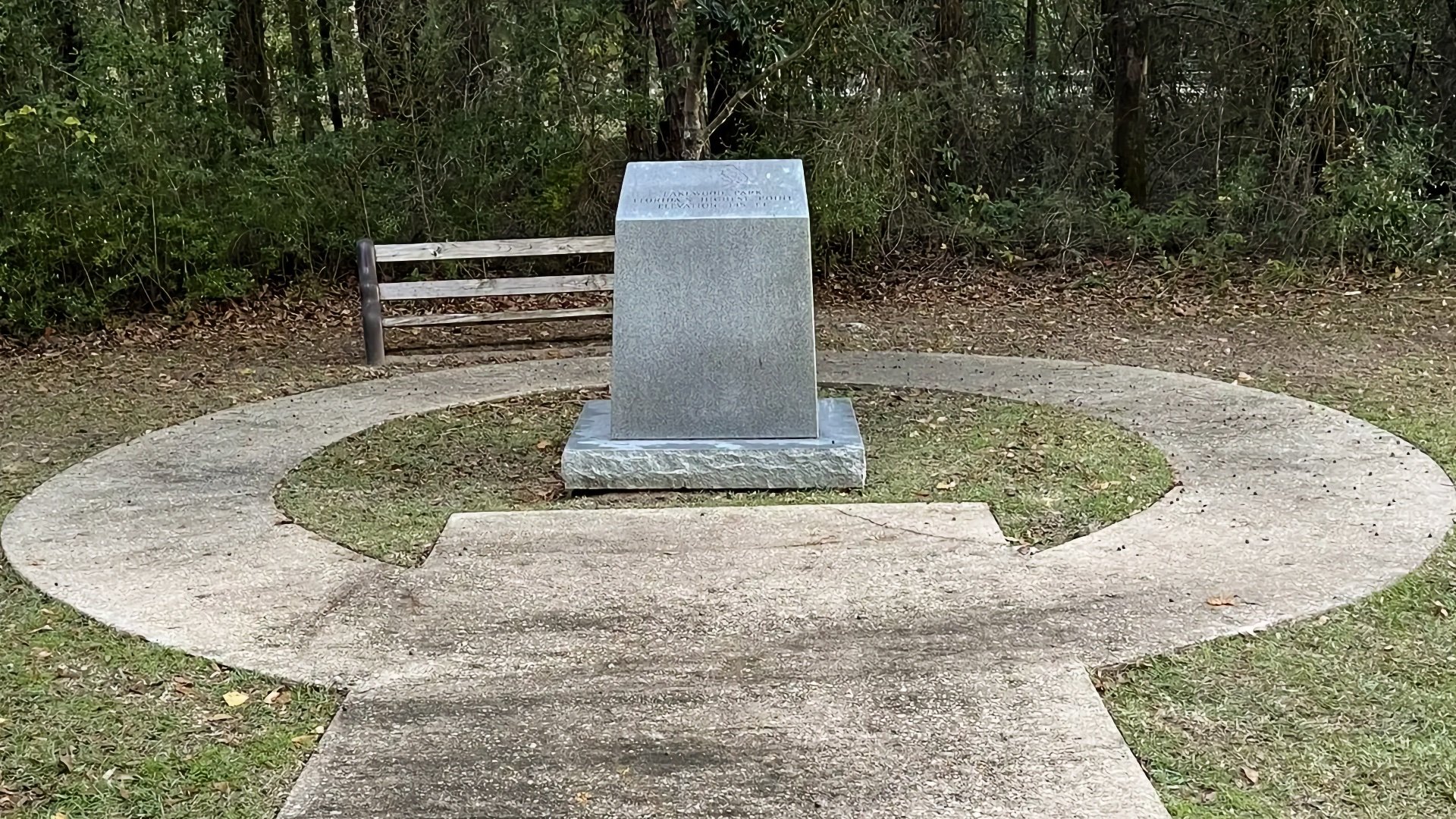
Britton Hill is the lowest state high point in the country, tucked into a small county park with a mix of short forest and meadow loops. There aren’t any long trails that lead to the summit area, but you can link the park’s paths together for a couple of miles and work the high point into the route. It’s an easy stop, but doing a full circuit around the park makes it feel more like a real outing than just walking up to the marker.
Skyscrapers in Miami are much taller than Britton Hill, which is the natural high point of Florida.