Bristlecone and Alpine Loop (Great Basin NP)
PLAY VIDEO

Bristlecone and Alpine Loop (Great Basin NP)

Hike Stats

Total Distance
6.2 miles
Time
2-4 hours
Total Climbing
1320 feet
Difficulty
Moderate
Crowds
Moderate
Dogs
No Dogs

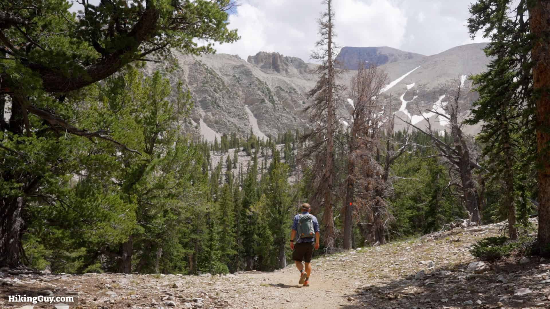
According to the rangers at Great Basin National Park, the Bristlecone and Alpine Lakes Loop hike is the one hike you should do. It features incredible alpine lakes beneath Wheeler Peak, a bristlecone grove with trees over 3,000 years old, and Nevada's only glacier. It's not too hard if you know what you're doing (keep reading!).

Where is the Bristlecone and Alpine Loop?

Great Basin National Park Location
The Bristlecone and Alpine Loop is located within Great Basin National Park, about 3.5 hours from Salt Lake City and 5 hours from Las Vegas.
Bristlecone And Alpine Loop Great Basin Location
The hike starts by the Wheeler Peak Campground, at the end of Wheeler Peak Scenic Drive.

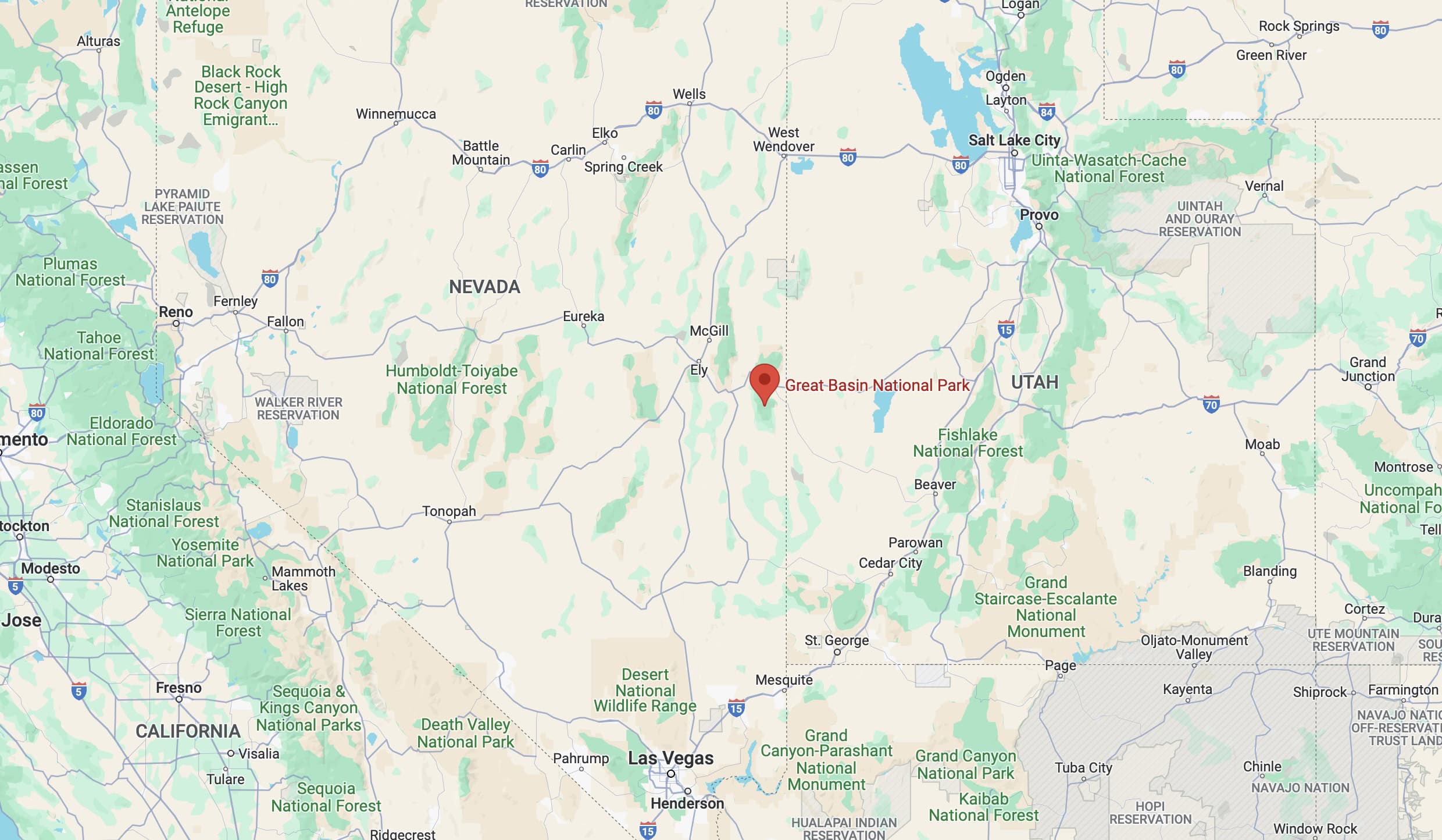
Use this trailhead address:
Bristlecone Trailhead, Wheeler Peak Scenic Drive, Baker, NV 89311

Some notes if you're visiting:

  • There is no entry fee for Great Basin National Park.
  • Get water at the visitor center. The trailhead has no water.
  • The Wheeler Peak Scenic Drive is closed in the winter up to this destination. Check the park website to see if it's open when you visit.
  • The park has no hotels or lodges, it's camping only. Check the park website for more information.
Bristlecone And Alpine Loop Great Basin Parking
There's a medium-sized parking area with primitive toilets. The trail parking is just before you enter the campground.

Gear Recommendations

Hiking Shoes In Great Basin
Having some basic hiking gear like the proper footwear will make this hike more enjoyable.

Plenty of people do this hike in street clothes, especially the first portion to Stella Lake. But this is a backcountry hike and you should be prepared.

  • Bring 1 L of water with you. There is lake water but you'll want to treat it with a filter before drinking it.
  • If you're not used to hiking this far, bring a snack or two.
  • Ideally, you're bringing the backcountry hiking essentials. There is no cellular service for most of this hike, so if you get in trouble, you need to be prepared to handle it.
  • A satellite communicator of cell phone satellite SOS are helpful in case of trouble.
  • The weather can change quickly in the mountains, so bring extra layers.
  • I hike in trail runners, and they work fine here. Early in the season there can be a snow, so if you have microspikes, bring them.

Essentials I’m Using Now

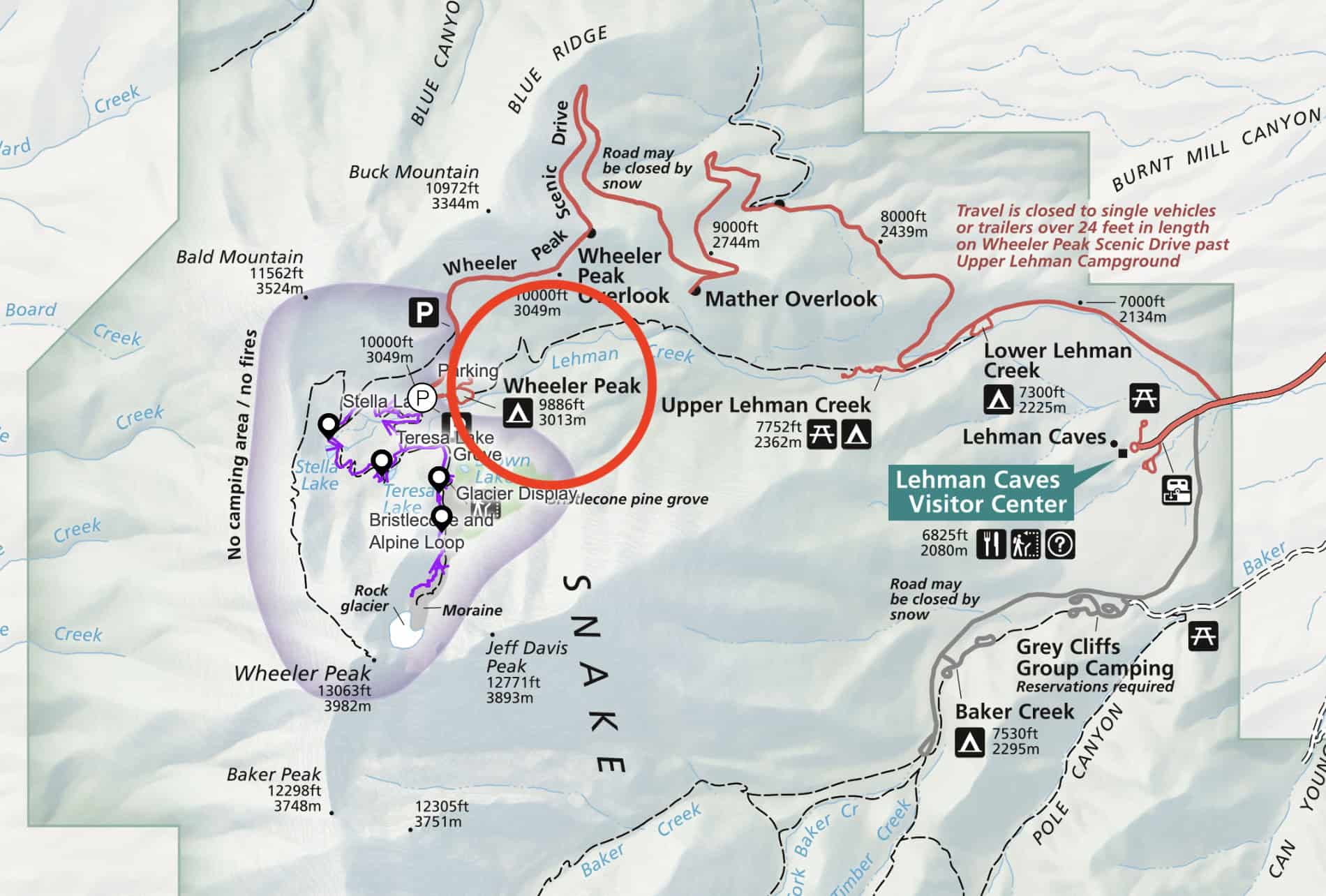
Bristlecone and Alpine Loop Trail Maps
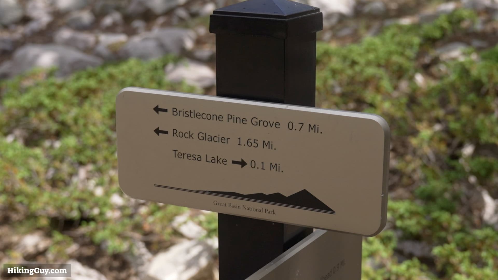
Bristlecone And Alpine Loop Great Basin Signs
Most of the trail, including many of the important junction, are marked with signs. I'd recommend picking up a map at the visitor center too.
Great Basin Alpine Bristlecone Hike 19
Much of the trail has these red markers.
Click to activate map
CalTopo
Print Map, Work With It Yourself
GPX
Bring the Guide to Any GPS

Hike Directions

Great Basin Alpine Bristlecone Hike 2
The hike starts across the street from the parking area by the trailhead sign.
Great Basin Alpine Bristlecone Hike 3
After a minute make the right toward Stella Lake.
Great Basin Alpine Bristlecone Hike 4
And shortly after that, at the big signs, make the right.

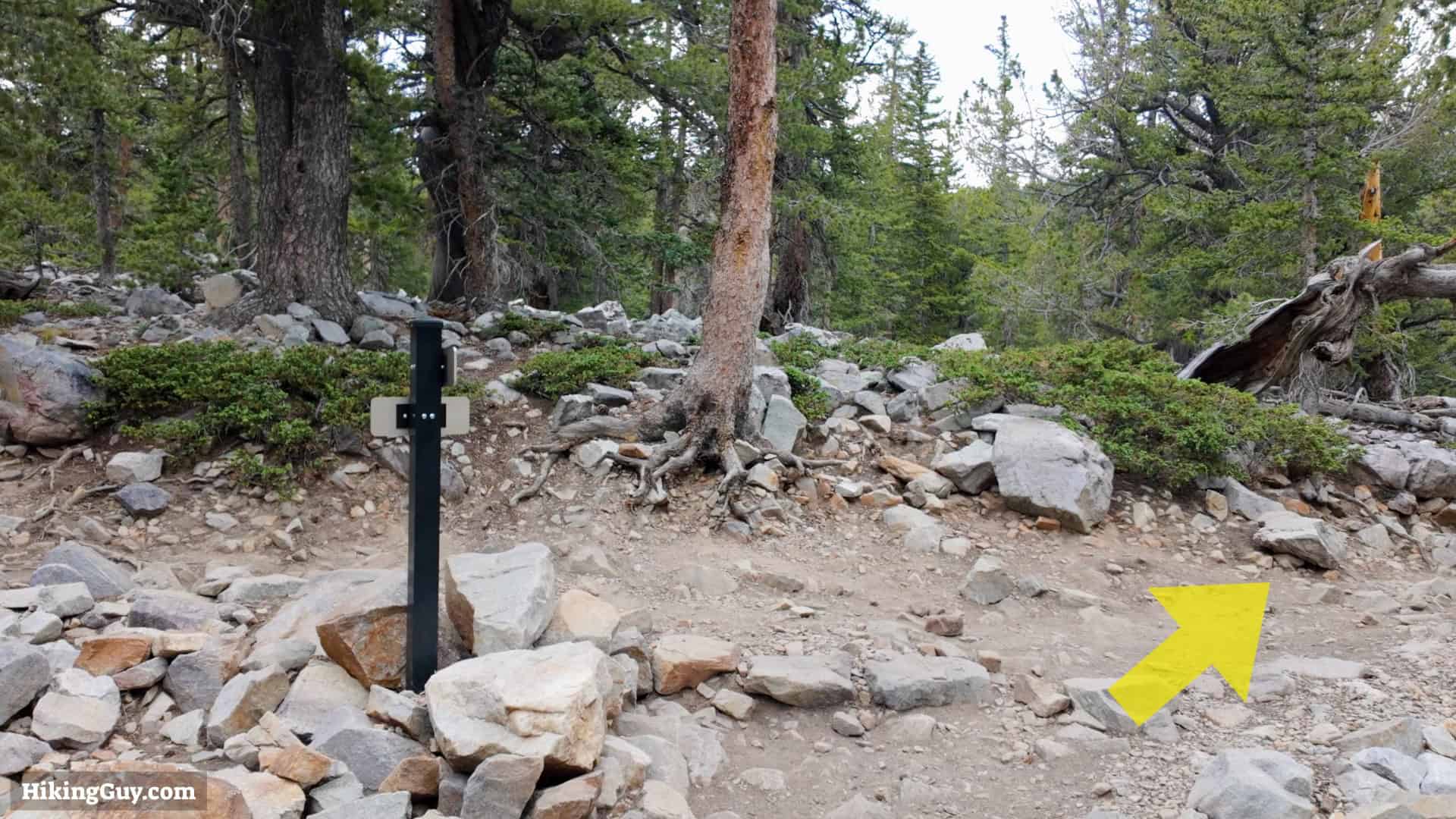
When you come back, you'll pass by these signs from the left.

Great Basin Alpine Bristlecone Hike 5
You have a gentle uphill hike.
Great Basin Alpine Bristlecone Hike 6
At around 0.9 miles the Summit Trail comes in from the right. Stay straight.
Great Basin Alpine Bristlecone Hike 1
And right after that the Summit Trail leaves to the right. Stay straight toward Stella Lake.
Great Basin Alpine Bristlecone Hike 7
At about 1.1 you reach Stella Lake. The trail continues to the left of the lake.
Great Basin Alpine Bristlecone Hike 8
Enjoy the downhill toward Teresa Lake.
Great Basin Alpine Bristlecone Hike 9
At about 1.9 miles you'll reach Teresa Lake. The trail continues to the left of the lake.
Great Basin Alpine Bristlecone Hike 10
After the lake, make the right on the Bristlecone Trail.

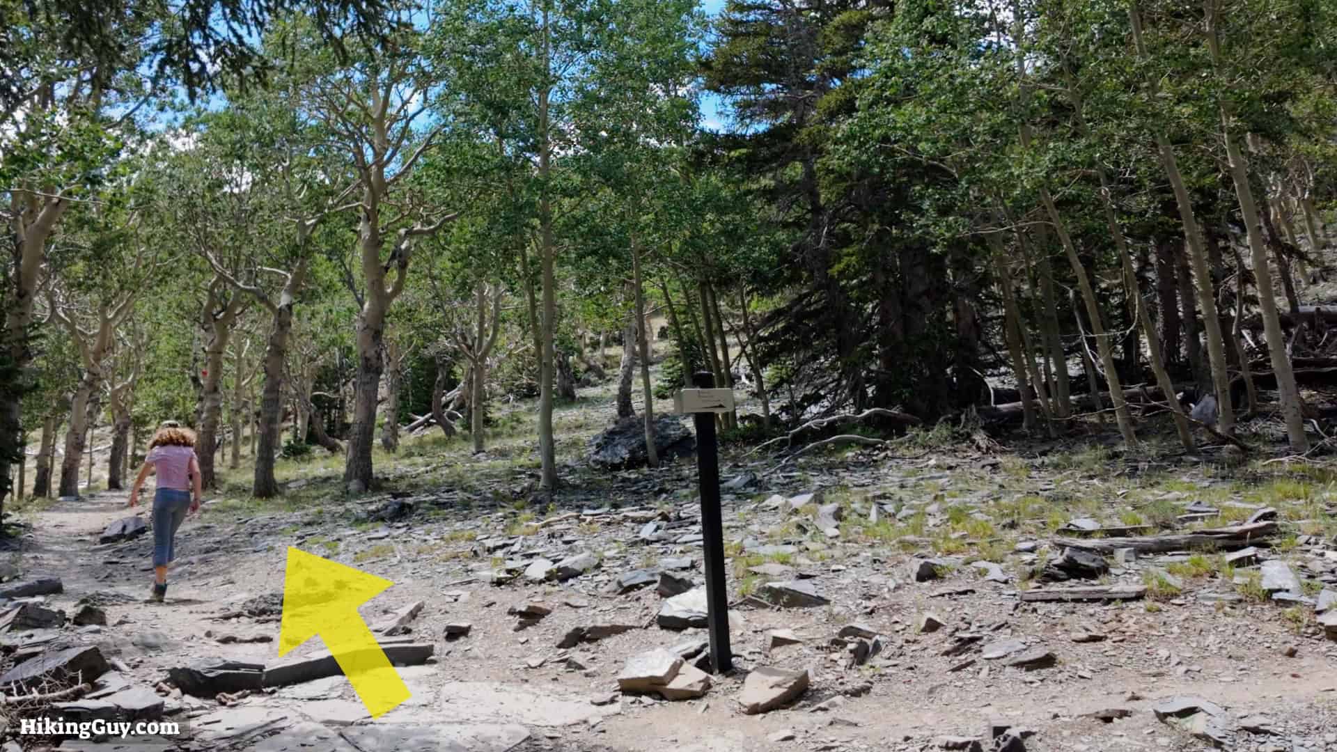
If you want to end the hike, make the left, which takes you back to the start. This loop is about 3 miles.

Great Basin Alpine Bristlecone Hike 11
Hike uphill toward the bristlecone grove.
Great Basin Alpine Bristlecone Hike 12
At about 2.8 miles you reach the Bristlecone Grove. You can bypass it on the right, but I recommend taking the short loop to the left.
Great Basin Alpine Bristlecone Hike 13
The loop to the left has interpretive displays.
Great Basin Alpine Bristlecone Hike 14
Continue uphill past the grove toward the glacier.
Great Basin Alpine Bristlecone Hike 15
At about 3.1 you reach the interpretive display for the glacier.
Great Basin Alpine Bristlecone Hike 16
The trail continues past the sign into the glacier. Eventually the trail fizzles out. You might have to cross some areas of snow and loose rock in this section, be careful.

From here turn around and head back the way you came.

Great Basin Alpine Bristlecone Hike 17
On your way back you'll pass the intersection where we came down from Teresa Lake. Stay straight to return to the start.
Great Basin Alpine Bristlecone Hike 18
And after that, you'll pass the large signs we saw at the beginning. A few minutes after that, you're done!

Originally published July 31, 2024