Enchanted Valley Chalet Backpacking Guide
The Enchanted Valley Chalet in Olympic National Park is one of the most iconic and scenic overnight backpacking trips in the USA. The trail, which most people do as a 2 or 3 day backpacking trip, brings you through a temperate rainforest to the "Valley of 10,000 Waterfalls," deep in one of the most remote parts of the lower-48. In this guide I'll show you everything you need to know to make your hike easy.
Hike Stats
- Total Distance
- 28 miles
- Time
- 2-3 Days
- Total Climbing
- 3400 feet
- Difficulty
- Moderate
- Crowds
- Moderate
- Dogs
- No Dogs
- Gear
- What I Use
- Weather
- Latest Report
When to Hike Enchanted Valley
- Spring usually means blowdowns, mud, and lingering snow.
- Summer has the best trail conditions: clear paths, manageable creek crossings, and long days.
- July and August are generally the driest times.
- Fall can be quiet and beautiful, but you’re rolling the dice with storms and early snow.
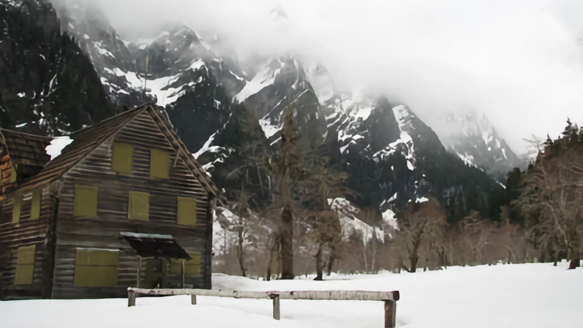
- If you've got winter hiking experience, this isn't too bad with snow because it's in the valley and the trail follows the river, but the road to the trailhead can be closed and the trail will not be well-maintained.
They don't call this a rainforest for nothin'. The Enchanted Valley gets over 11 feet of rain a year, about 4 times as much as Seattle. It can rain anytime. Pack like it’s going to rain, and you’ll be fine if it doesn’t.
Permits
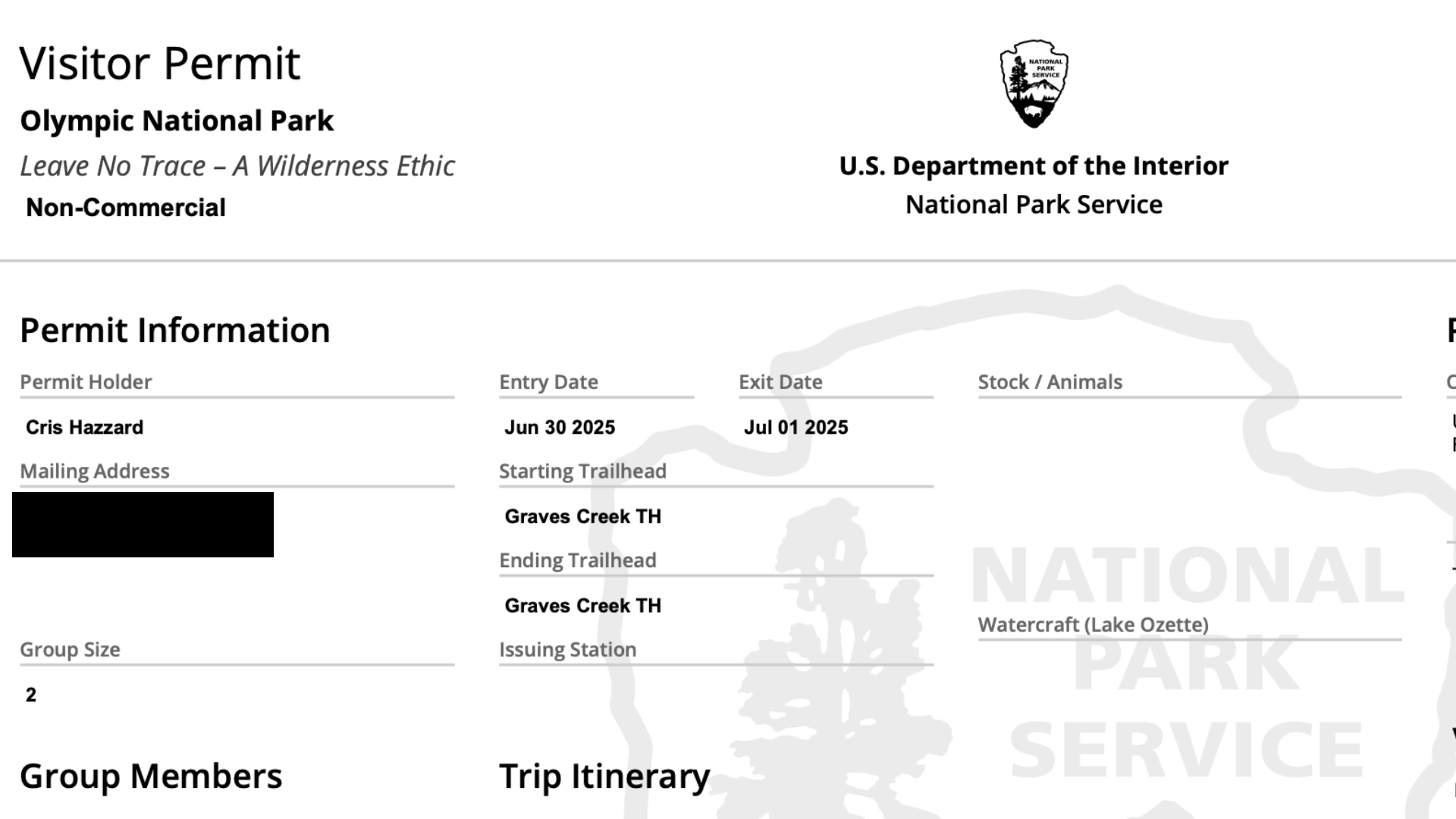


The first thing you need to do is get an overnight permit, which is done on Recreation.gov. I've seen some conflicting information about the quota system, but I can confirm that there is one. There are limited campsites along the way.
- Visit the page for Olympic National Park Wilderness Permit on Recreation.gov
- If you want to book in advance, summer spots open on April 15, winter spots on September 15.
- Pick your dates and group size. The "starting area" is Quinault.
- Once you book your permit, you'll get a receipt. You won't get the actual permit until a couple of days before the start, this is the one you need to print or save to your phone.
- If you can't get a campsite, keep checking back for one to open (if someone cancels). You can also pay for an automated service to do this for you automatically.
- There are no walk-up permits, it's online only.
Suggested Itineraries
There’s no one “right” way to hike to Enchanted Valley. You can stretch it out, go fast and light, or break it up however fits your pace. That said, here are a few common itineraries that work well for most hikers:
2 Days:
Start early at Graves Creek Trailhead, hike all the way to Enchanted Valley, spend the night, then hike out the next day.
3 Days (Late Start):
Hike to Fire Creek on day 1, continue to Enchanted Valley on day 2, and hike out on day 3.
3 Days (No Enchanted Valley Permit):
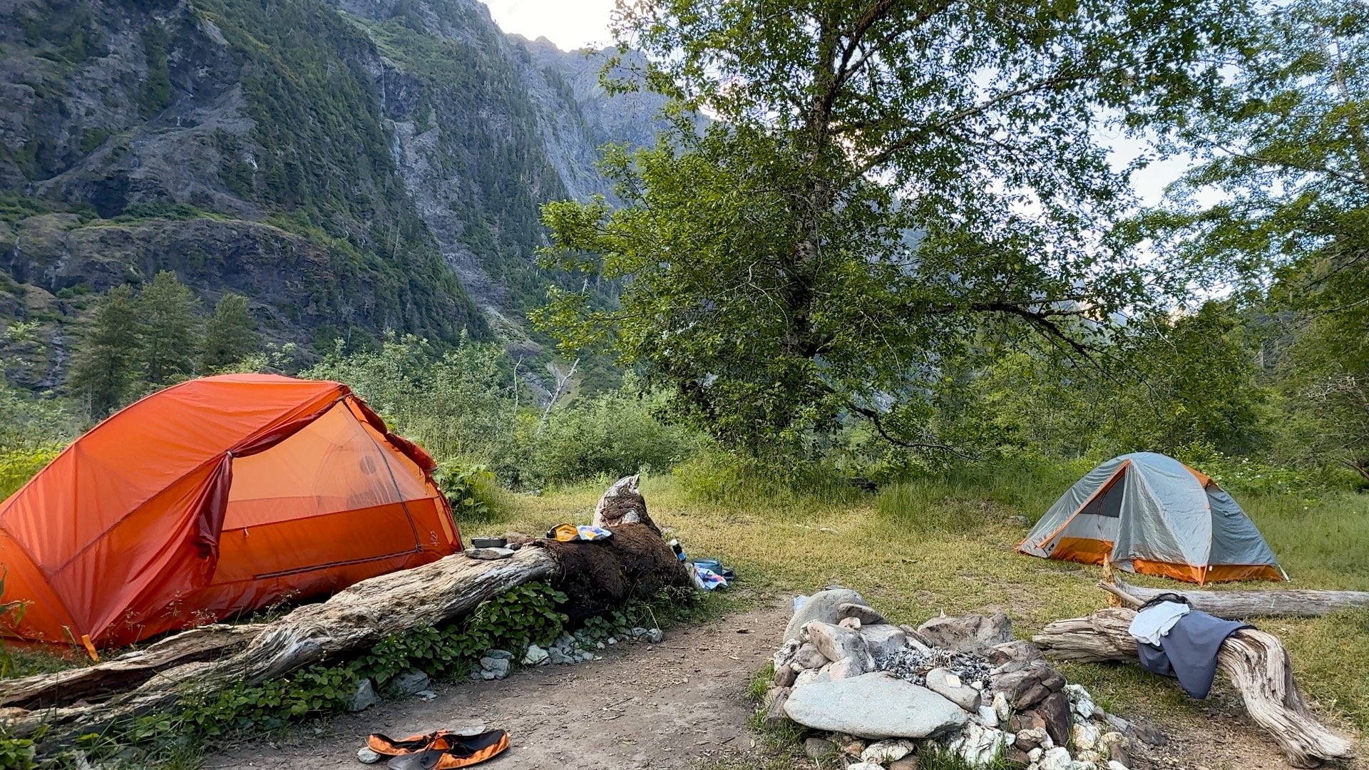
Camp at Pyrites Creek both nights, and do a day hike to Enchanted Valley and back on day 2. This lets you leave your tent up and avoid moving camp.
Day Hike:
If you have the fitness, you can tackle this in a day, no permit needed. For me the great thing about the hike is camping and spending time at the Enchanted Valley, and obviously you don't get that on a day hike. But you can see it. The ups and downs make this feel tougher than the 3400 ft of total ascent.
No Permit Camping / Short Day Hike:
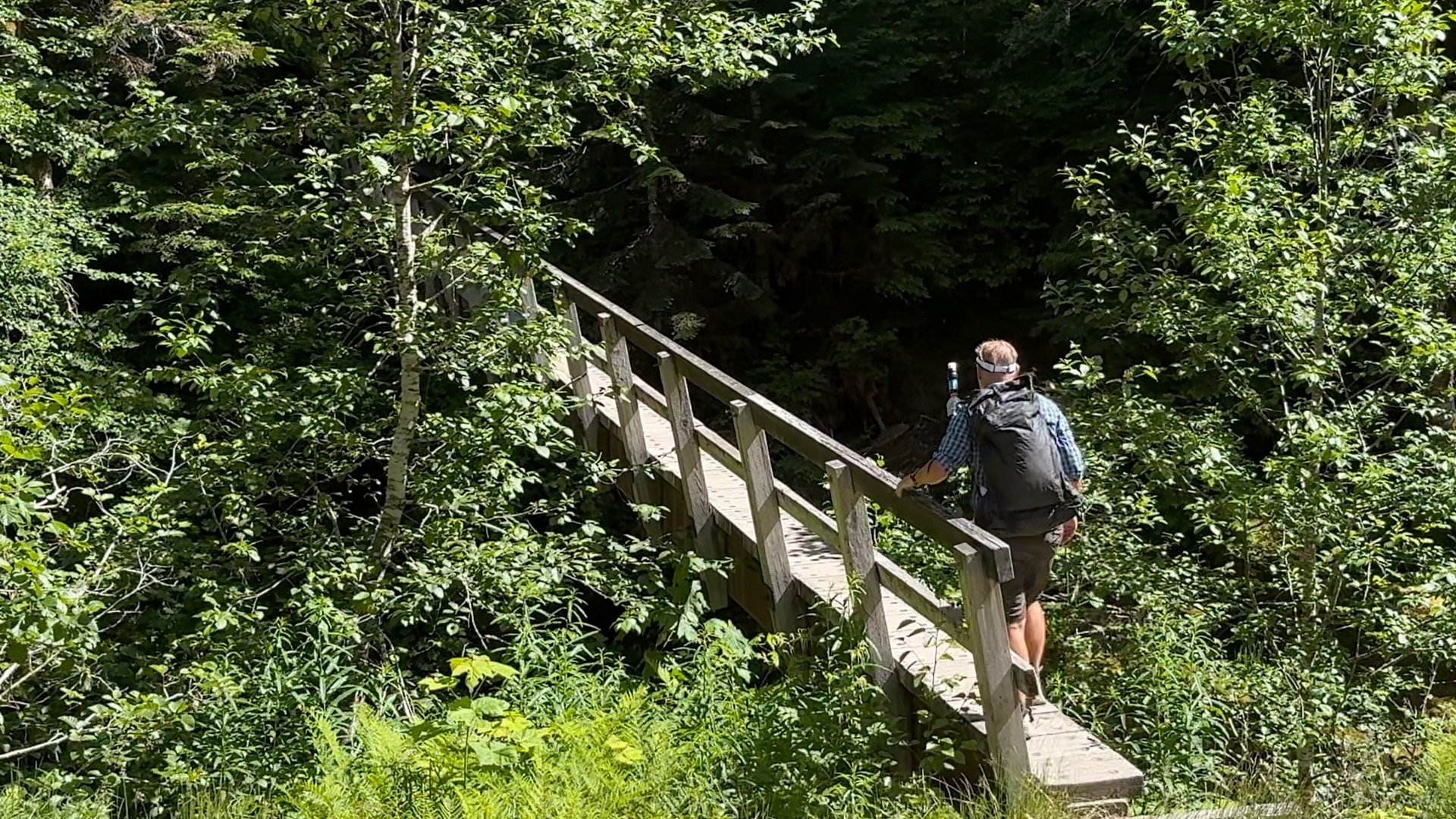
For a short but spectacular day hike, do the 5 mile round trip to Pony Bridge. The gorge is beautiful, the hike is short, and you'll get a "best of" taste for the trail. Combo this with an overnight at the Graves Creek Campground at the trailhead for a taste of the Enchanted Valley experience without any permits.
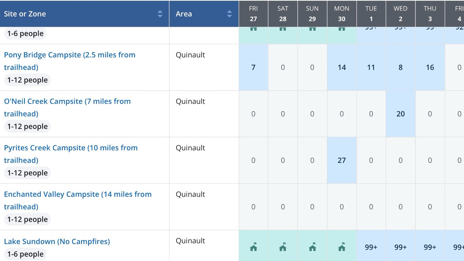
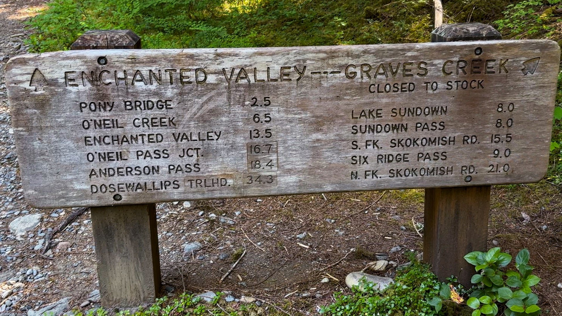
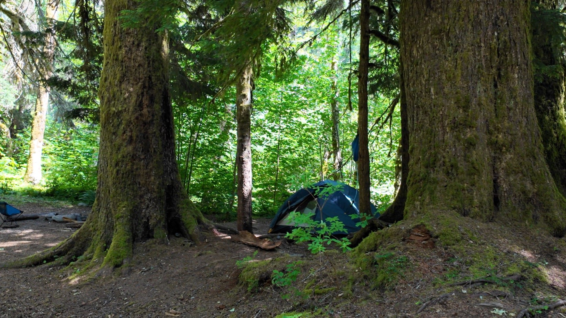
Enchanted Valley Camping

| Campsite | Mile | Sites | Toilet? | Notes |
|---|---|---|---|---|
| Pony Bridge | 2.5 | 3 | yes | three small sites on the north side of the bridge |
| Fire Creek | 4 | 2 | no | quieter than Pony Bridge |
| O'Neil Creek | 7 | 6 | yes | short side-trail descends 100' to campsites |
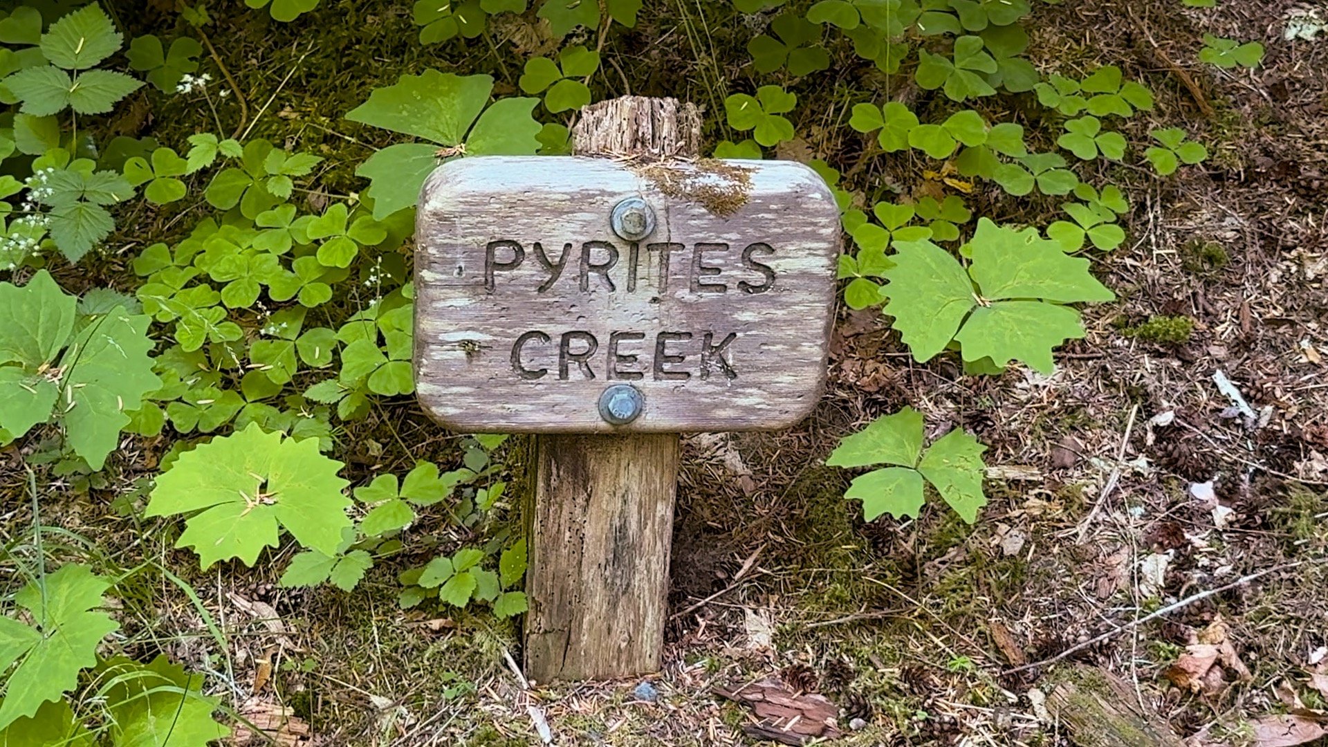
| Pyrites Creek | 10 | 12 | no | 6 campsites on each side of the creek |
| Enchanted Valley | 14 | 20+ | yes | many sites north of the chalet |
Always check the notices that come with your permit and on the alerts page of the Olympic NP website. Sometimes the privies (toilets) are out of order, etc.

- Campsites aren't numbered. Book an area and then individual tent sites are first-come, first-served. Permits reserve areas, not tent sites.
- Every time that I've camped here, a ranger has checked my permit.
- Primitive toilets are available at Pony Bridge, O'Neil Creek and Enchanted Valley. It's easier to use these than to pack out your toilet paper (but you can bury your waste). In areas with no toilet, dig cat holes 6–8 inches deep and 200 feet (about 70 adult paces) from campsites, trails, and water sources.
- Most campsites are close to water sources.
- There are some small tent sites that are not listed in the permit areas (you'll see them on my map below). If you have a permit for a nearby area, you'll probably be safe camping there.
Gear Recommendations

- Don't count on cell service, so download maps offline in a hiking app like AllTrails and bring a paper map. I use the National Geographic Trail map.
- A hard-sided bear canister is required here. Keep all your food and any scented items (including trash) in it.
- The good news is that you can pick up a free loaner (permit and personal info required) at the Quinault Rain Forest Ranger Station, which is open seasonally. I was told that since the permit system went into place, they rarely if ever run out of them. If you have a bear canister anyway, I'd just bring it along and so you can hit the trail sooner.
- Two camp sites along the way have bear wires but according to NPS, canisters are required everywhere now. From NPS: Bear canisters are required in Enchanted Valley. Several bears have recently been seen between Pyrites Creek and Enchanted Valley with habituated behaviors. Proper food storage is essential to prevent dangerous situations.
- There are black bears here but you don't need bear spray. There hasn't been any documented bear attacks in the history of the park. The bears are mellow, just give them space and let them pass. According to the Park Service: Bear spray is not recommended and may present more of a hazard than the bears themselves.
- Since you're hiking up along the East Fork of the Quinault River, water isn't a problem. Just make sure you bring a water filter.
- Trekking poles can be handy if you're crossing streams or navigating a muddy section of trail.
- I use breathable trail runners that I expect to get wet and muddy.
- There can be lots of insects, repellent is helpful.
- As I mentioned earlier, be prepared for rain no matter what. I use a pack liner instead of a pack cover because they seem to work a bit better.
- Bring the essentials and be prepared to wait for emergency resources if you hit SOS on your satellite communicator. From NPS: Local search and rescue resources are limited and may not always be available.
- For a campsite luxury at the Enchanted Valley, bring a folding chair and book, dipping your feet in the river while you read.
Essentials I’m Using Now
- Garmin inReach Mini 2: Reliable SOS Everywhere on Earth
- Sawyer + CNOC Water Filter: Easy & Reliable Safe Water
- Nitecore NU25 Headlamp: Running late? Get home safe
- Altra Olympus 275: Favorite trail shoes right now, no blisters and very comfy.
- AllTrails Plus (30% off): Offline maps on your phone with the Plus level
- Full December 2025 Gear List →
Wildlife on the Trail
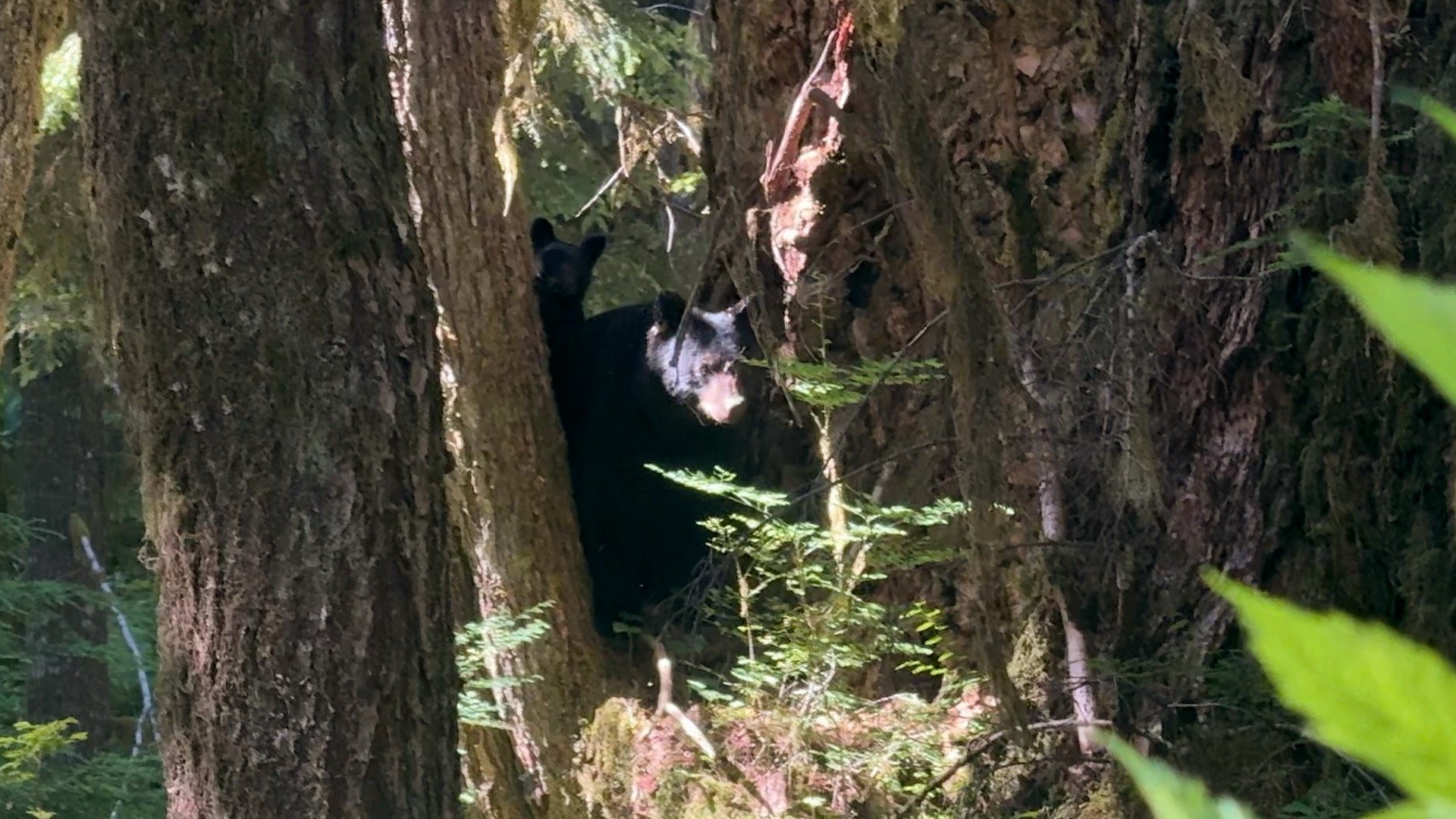
I done this hike many time and the number one question that I always get asked by passing hikers is "did you see a bear?" I've seen people with multiple bear bells hanging off their pack (sounds like Santa), I've seen people with holstered bear spray at the ready. The reality is that the bears here are very mellow, are used to seeing hikers, and generally avoid them. If you see one on the trail, stop, give it space, and let it pass. Make some noise by talking or clapping to let it know you are there without being aggressive. Do your part to keep the bears wild by using bear canisters.
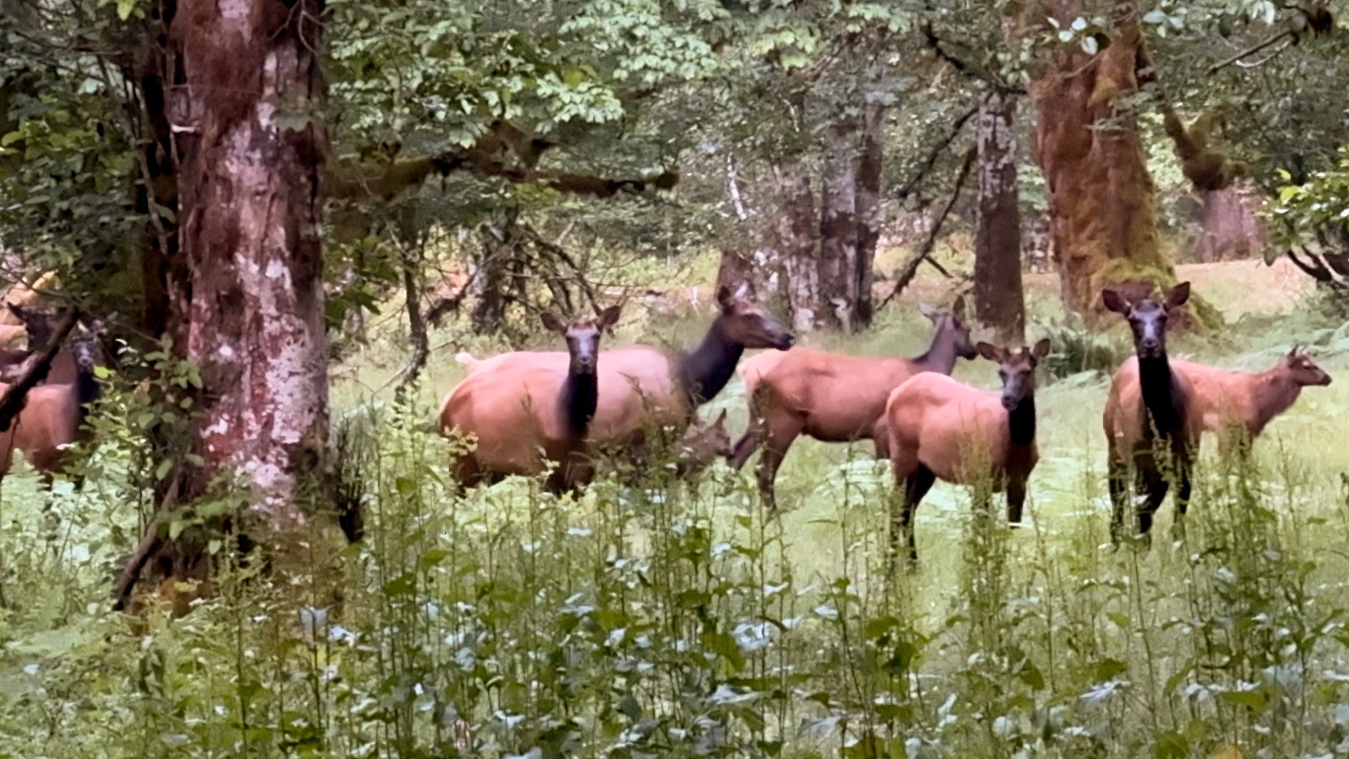
In addition to the bears that I mentioned already, the Enchanted Valley (and Olympic National Park) is home to 3,000-4,000 Roosevelt elk, which can get up to 1,000 lbs and are bigger than Rocky Mountain elk. They can be tough to spot, but you might hear their distinctive call. Like the bears, give them space and don't get too close. The other herd animal that's fairly common is mule deer.
The river is home to beaver and river otter, but they're much tougher to spot.
Where is the Trailhead?
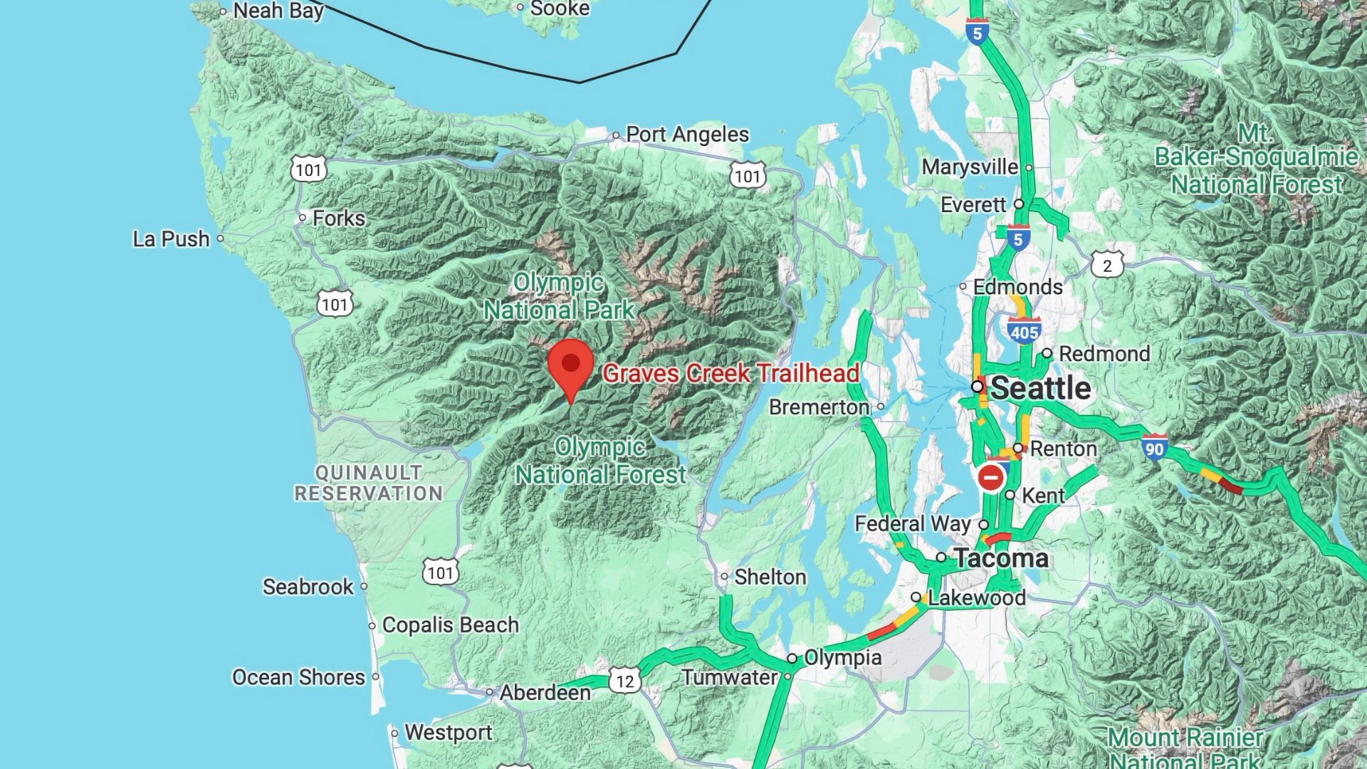
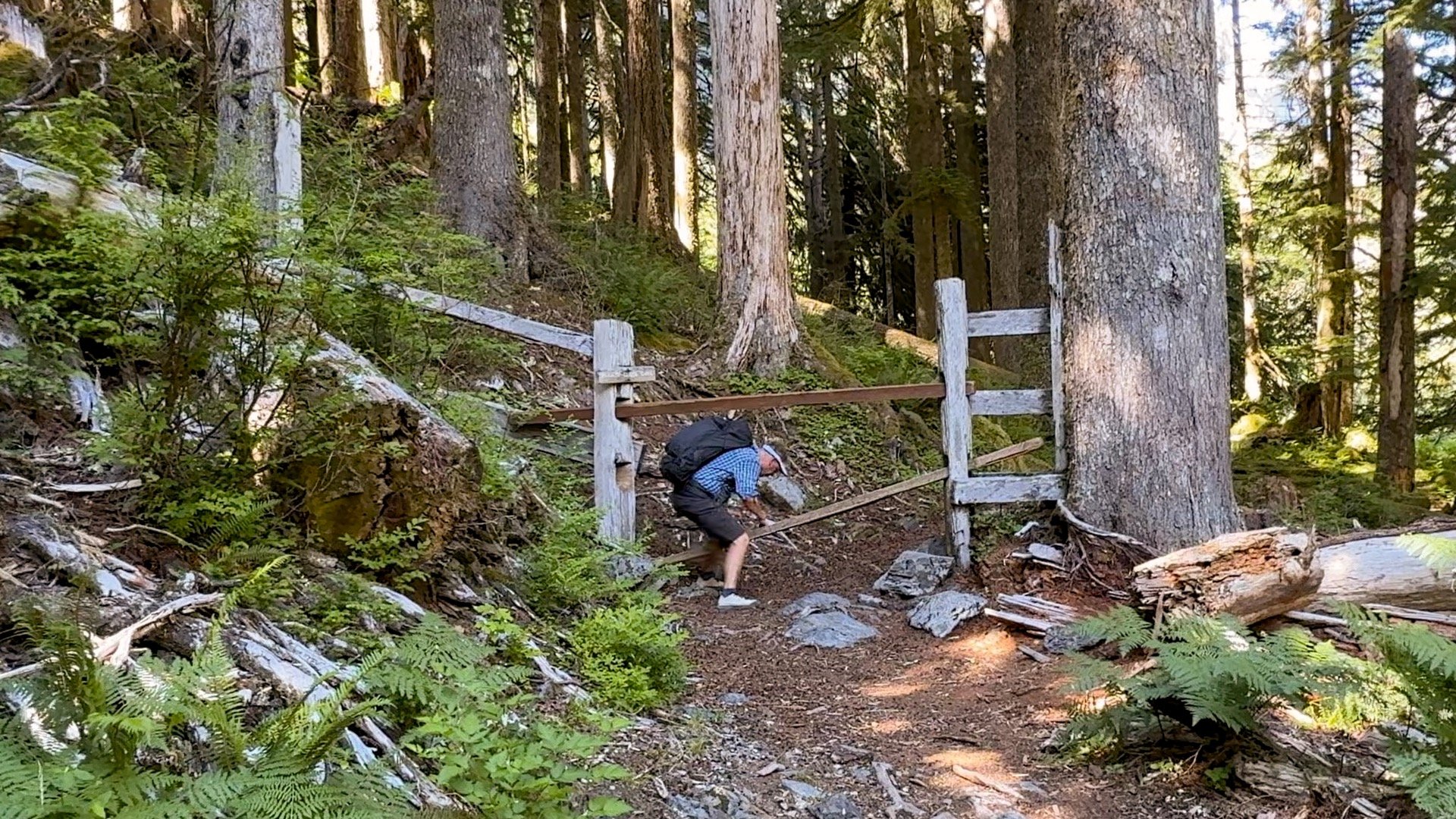
Getting to the Graves Creek Trailhead can be a challenge in itself. Even though it's only 57 miles in a straight line to downtown Seattle, the Olympic Peninsula is known for being undeveloped and remote. I know some locals here and that's how they like it. So it's a long drive.
- First you'll take the 101 to Lake Quinault, then take North Shore or South Shore drive to Graves Creek Road.
- Some sections are gravel and there are holes and ruts. It's doable in a regular car (going slow in some sections) but trailers and RVs are not recommended.
- Sometimes the roads are washed out or closed. Check the park alerts page before you leave. There's no entrance booth to the park here but there is officially an entrance fee.
You may not have cell reception on the drive. Save or print an offline copy of the map and directions

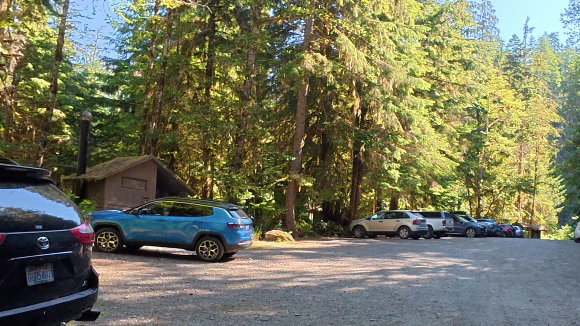
Want to spend the night in the area before hiking? Check out the Lake Quinault Lodge, or camp at the Graves Creek Campground right by the trailhead.
Enchanted Valley Trail Maps
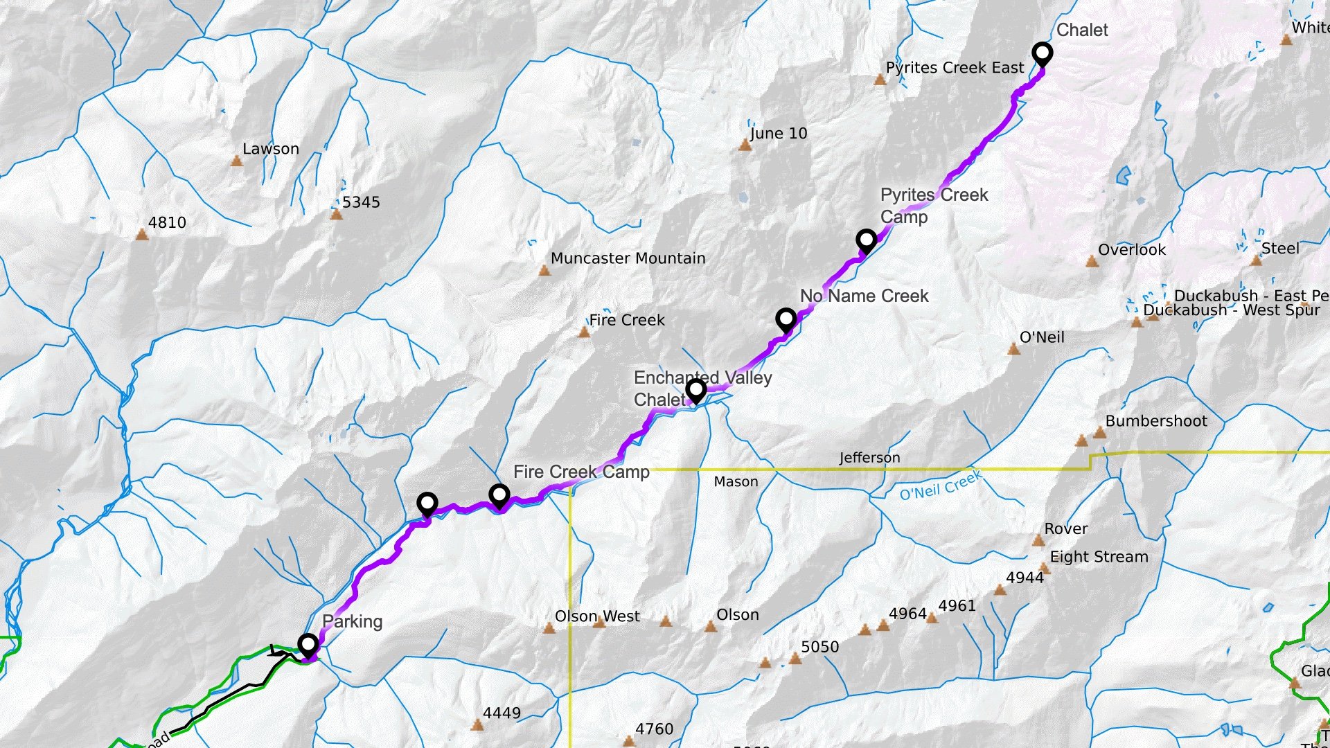 View Interactive Map
Elevation Profile
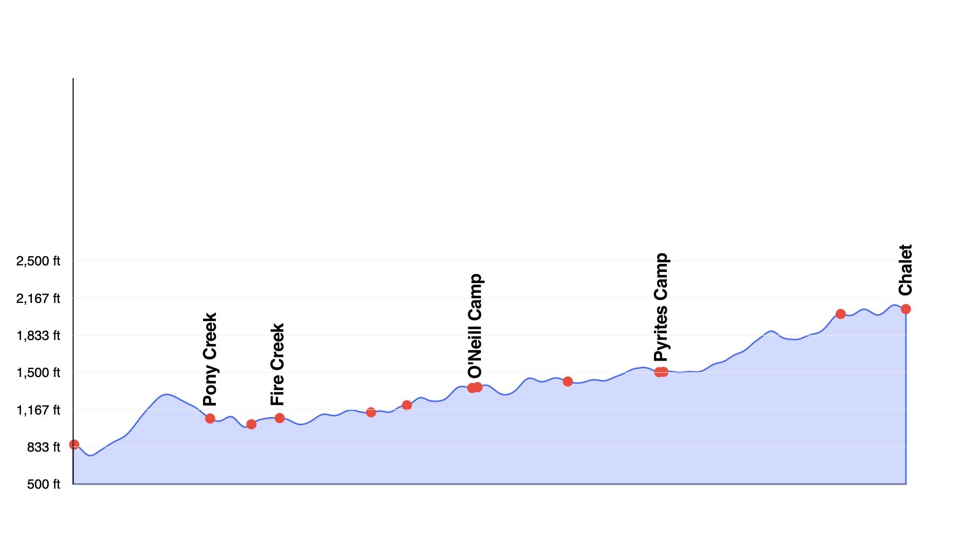
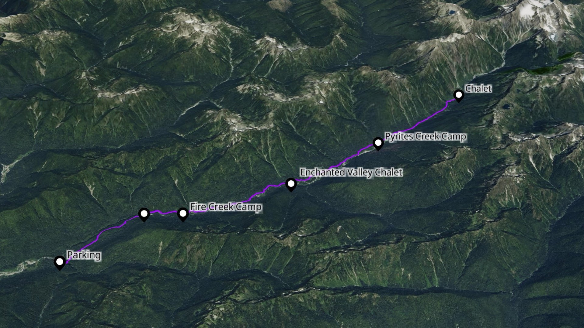
You'll see 1700 feet listed as the elevation change, and 3400 total feet of climbing, but this can be deceiving. It's a long and gradual hike with ups and downs along the way. There are no big climbs or mountains to pass, but all the ups and downs add up over 28 miles.

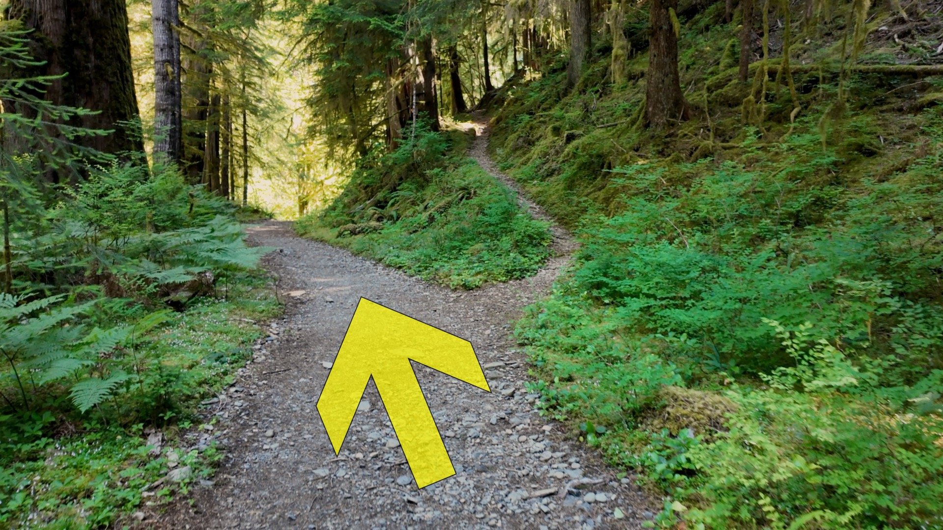
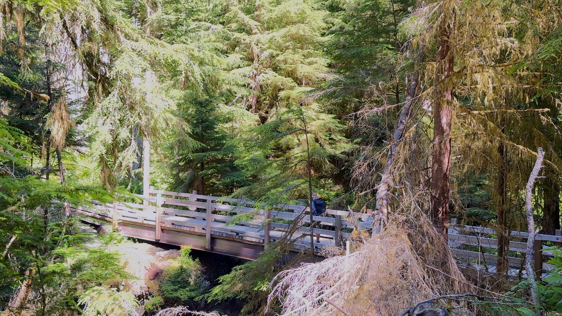
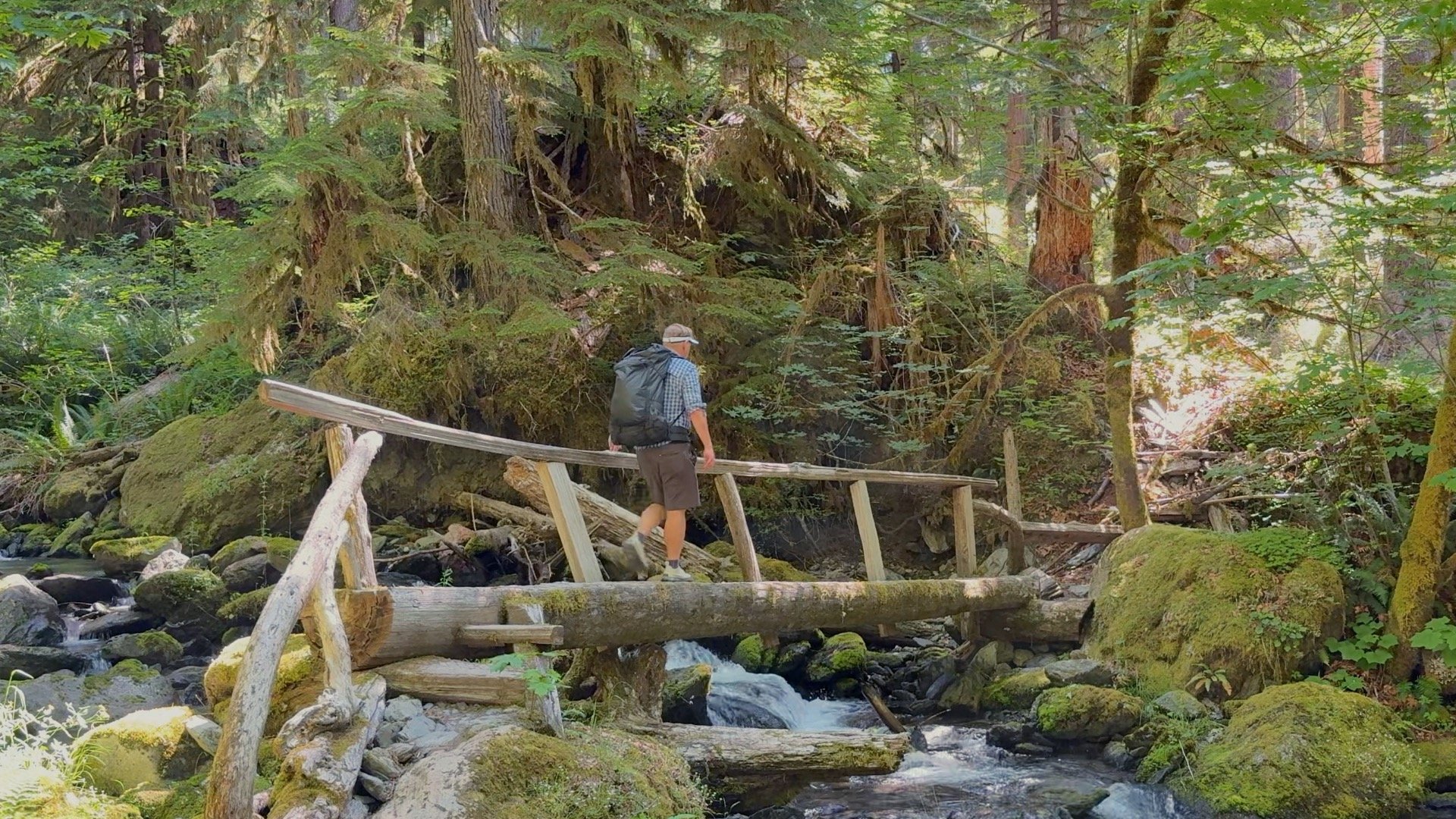
Enchanted Valley Hike Directions
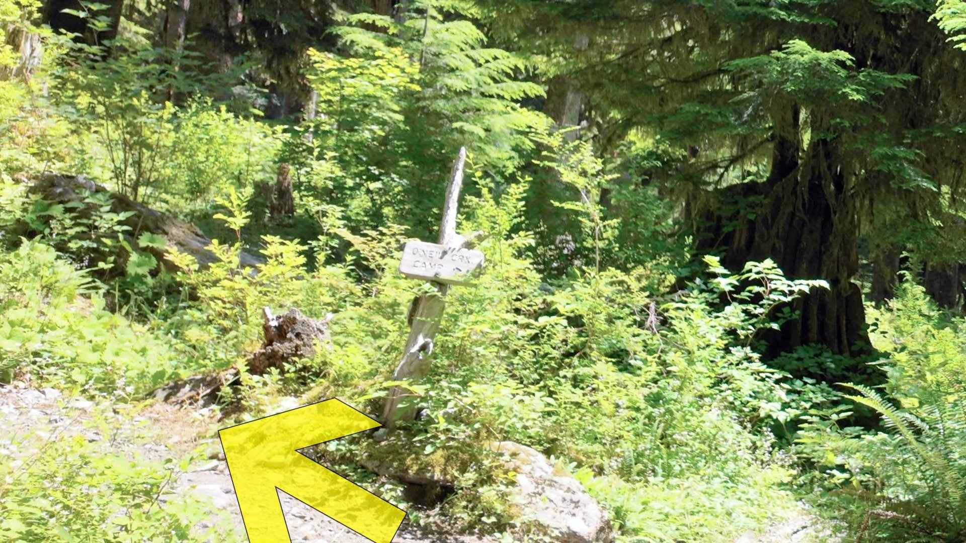
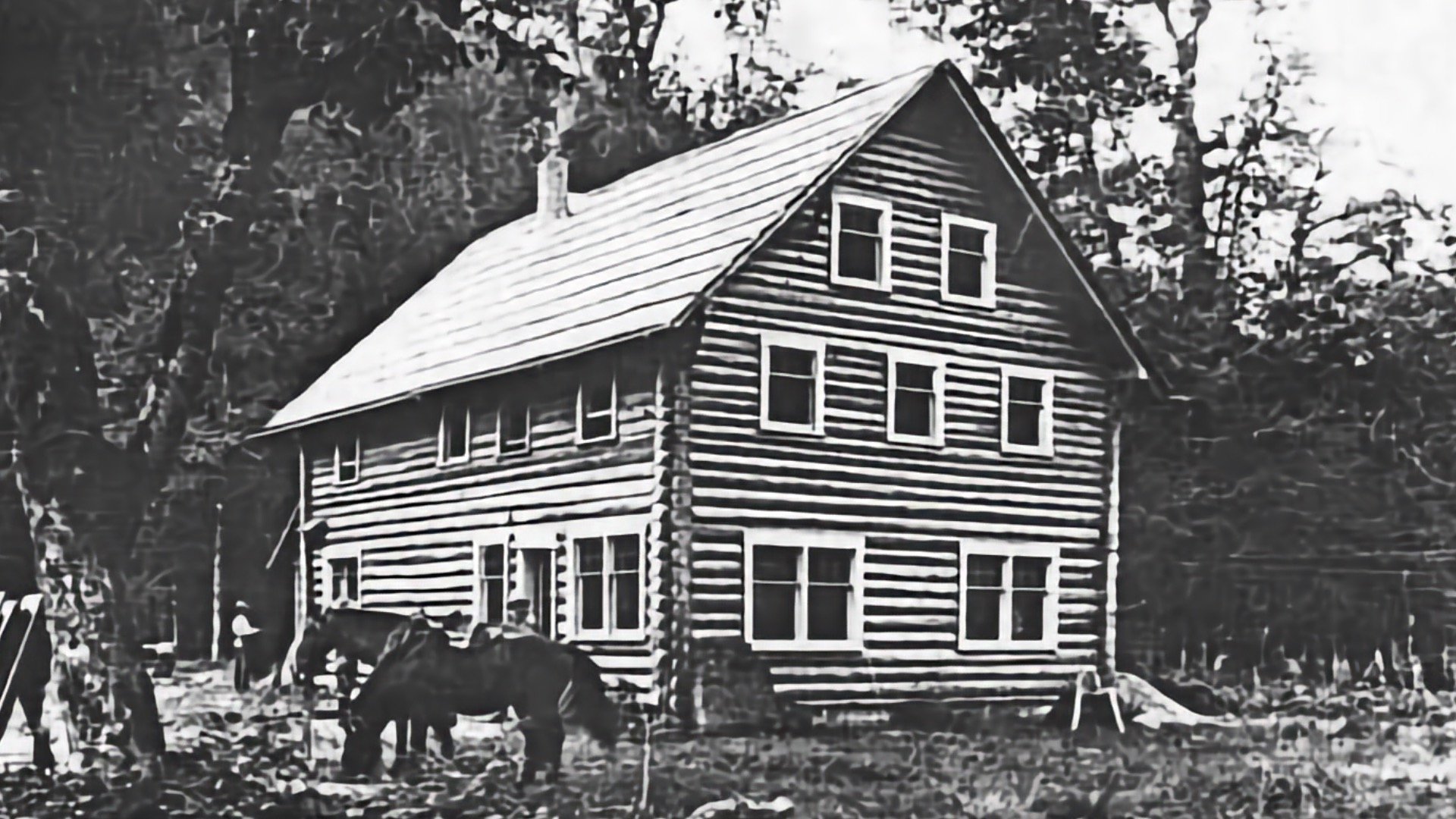
O'Neil camp is named after Joseph P. O'Neil, who was one of the first to really map and survey the interior of the Olympic Peninsula, which believe it or not, didn't happen here until 1890. It gives you an idea of how remote this area is.

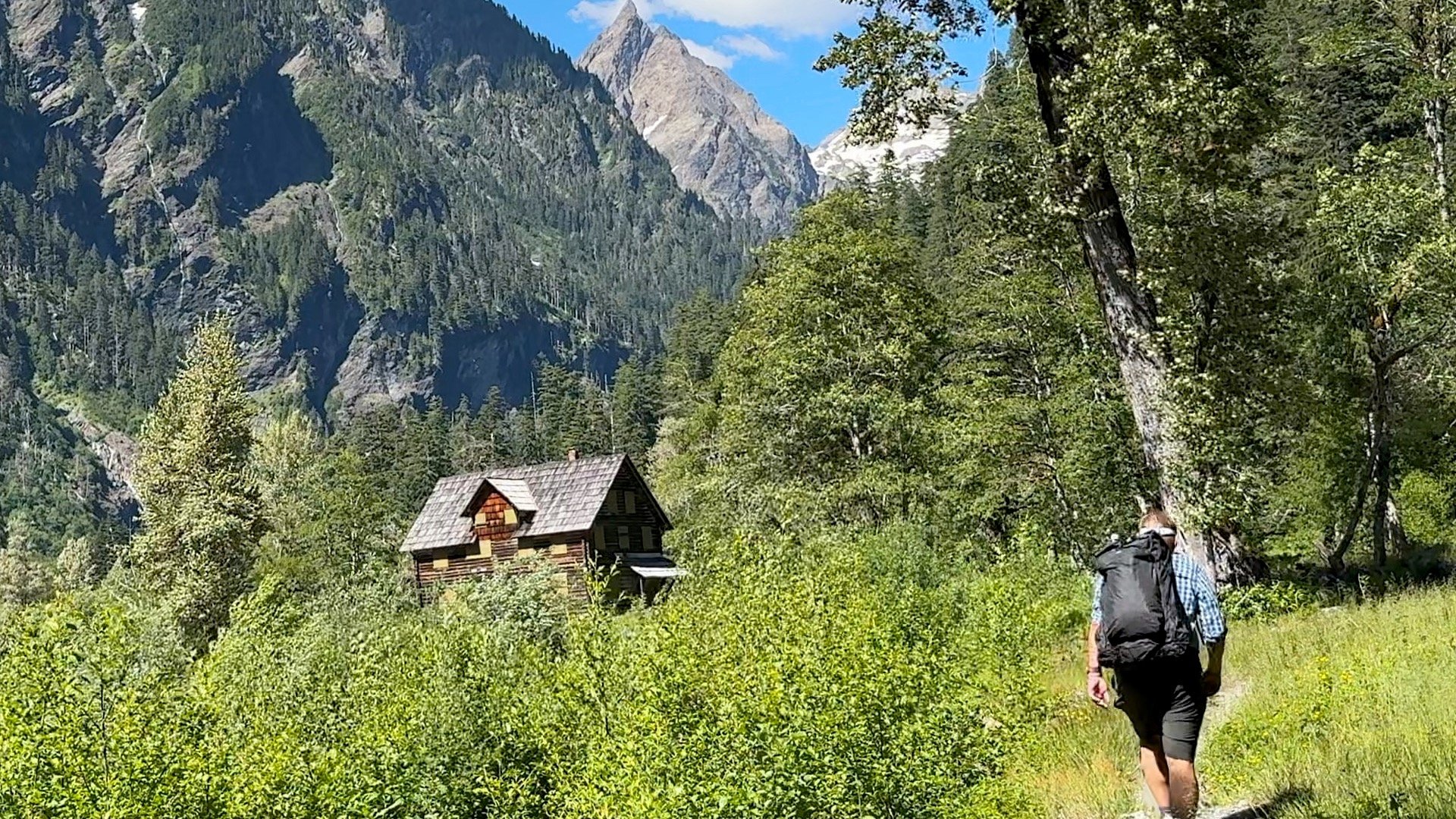
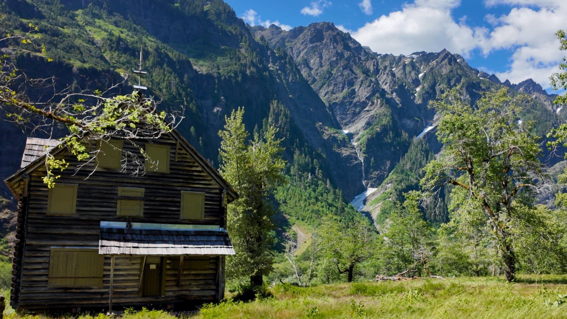
The chalet was built in 1931 as a lodge for hikers and those on mules and horses. During WW2 it was used as an observation post for enemy aircraft. Since then the chalet has been open and closed at various times, and even moved away from the eroding riverside in 2014. Today it is on the National Register of Historic Places, the only structure originally built as a public resort that remains standing in the interior of the Olympic range, and, according to the ranger, infested with mice.