The Mount Tammany Red Dot Trail is New Jersey’s most popular hike for a reason. The steep, rocky climb to the top of Mount Tammany delivers big views of the Delaware Water Gap and the river below. But in this guide I’ll also show you how to get back down without wrecking your knees. Along the way, we’ll check out a waterfall and finish with a short stretch on the famous Appalachian Trail before it’s all said and done.
Where is the Mt Tammany Hike?
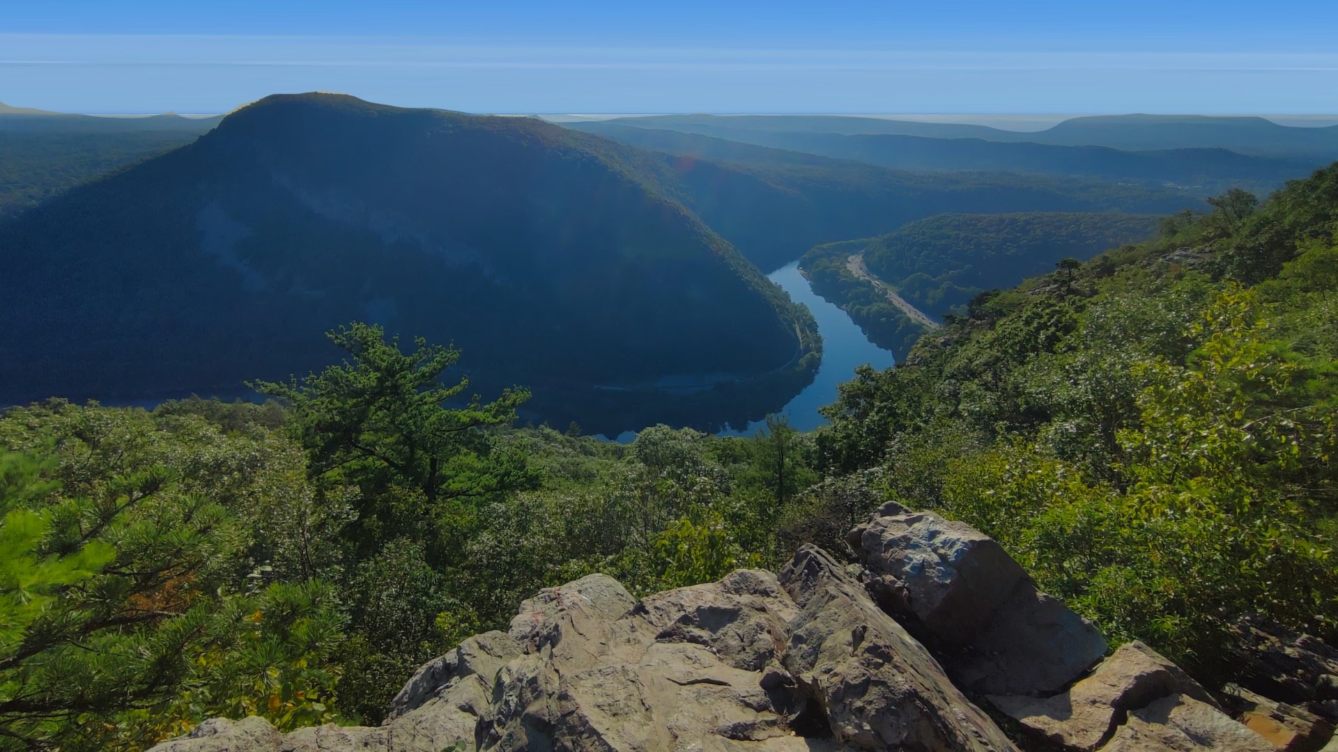
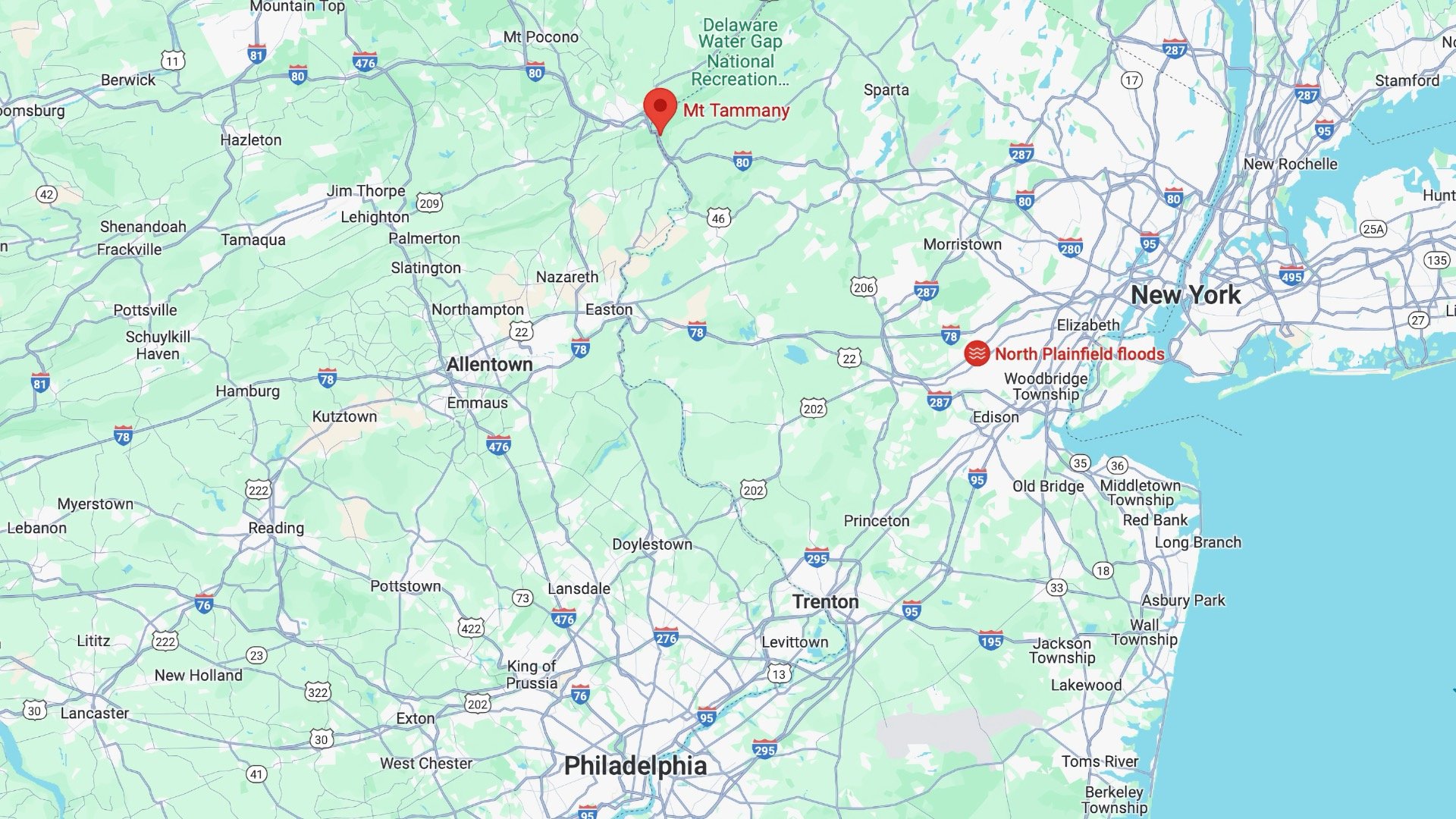
Mount Tammany is the tall mountain on the New Jersey side of the Delaware Water Gap, easily accessible on I-80.
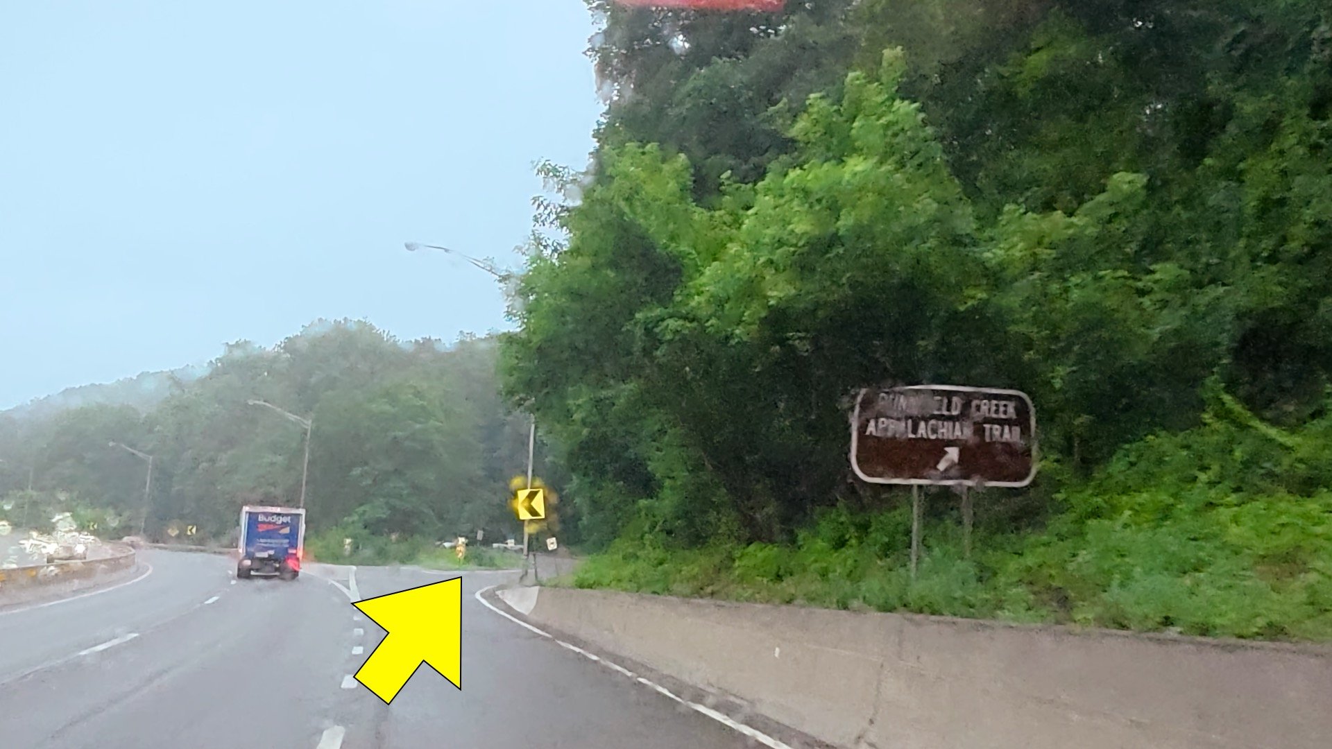
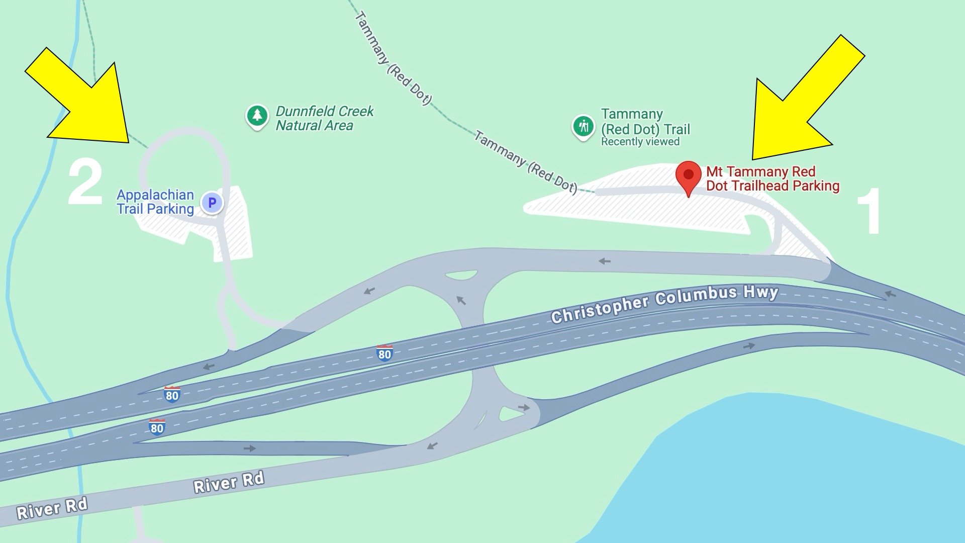
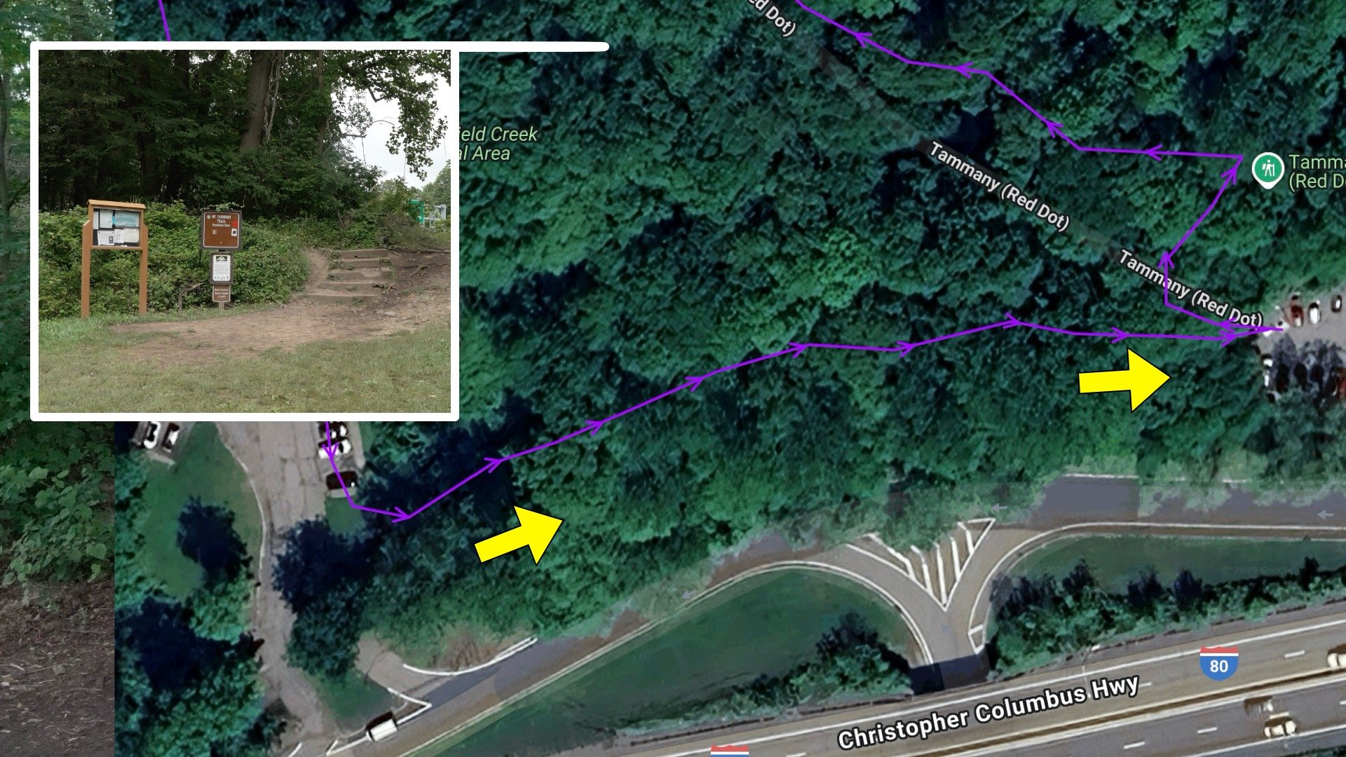
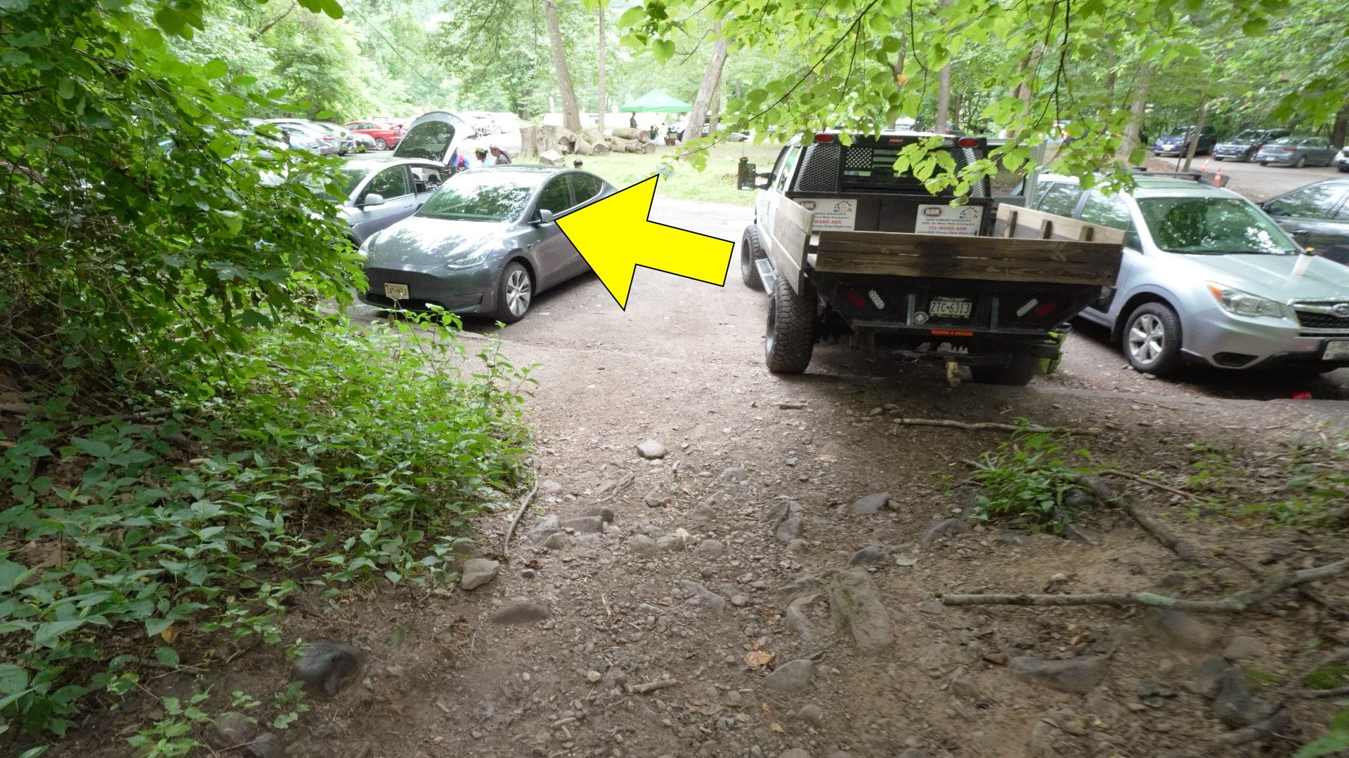
Parking can be tricky, with 2 parking lots right off of I-80. If you're coming from the east (NY direction), you're going to look for this turnoff.There are two parking lots. I recommend turning into the first one, checking for spots, and then trying the next lot. The road is one-way. If you want to go back and check Lot #1, you’ll need to loop around via I-80 again.
These lots fill up fast, especially on weekends.
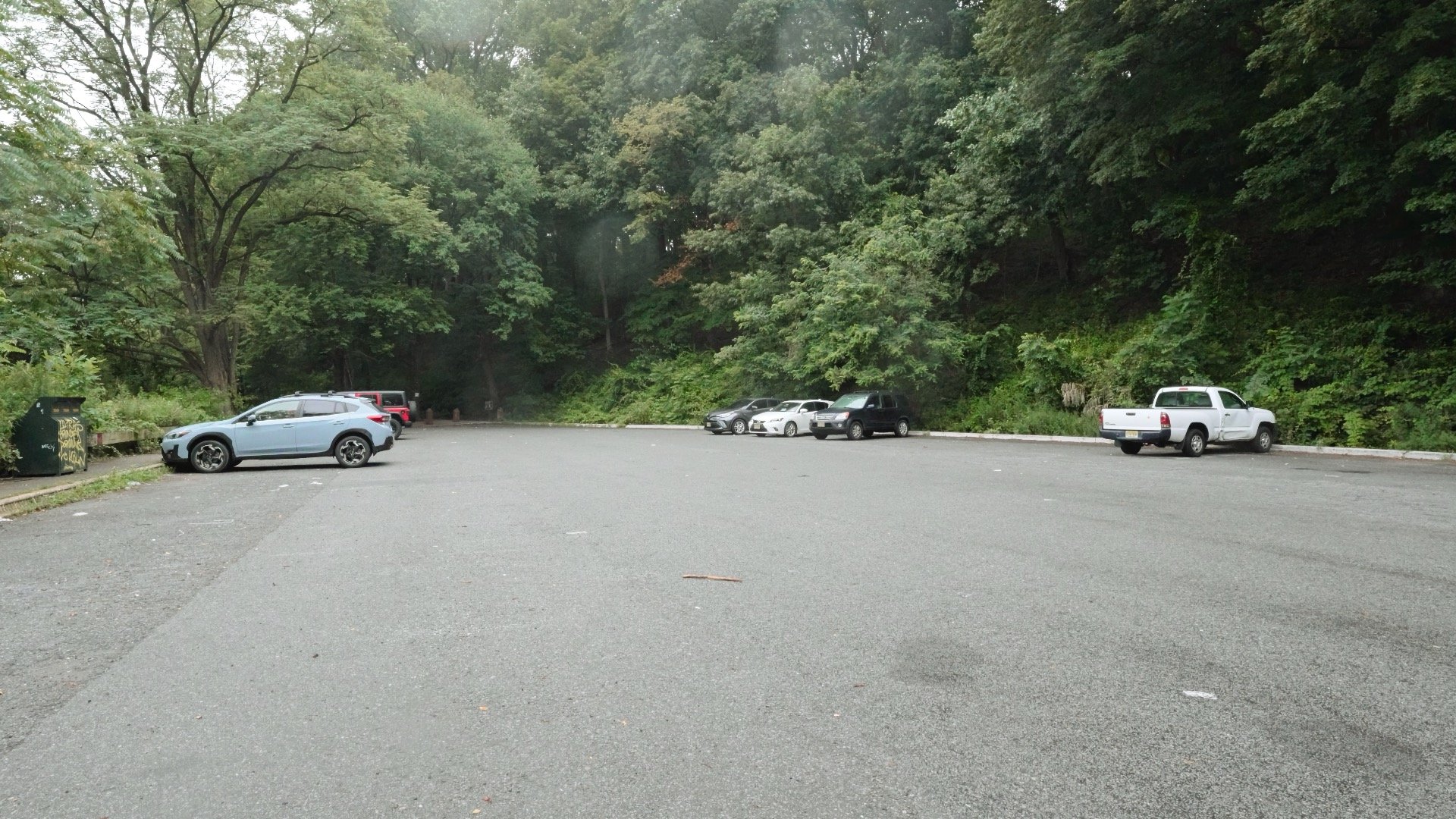
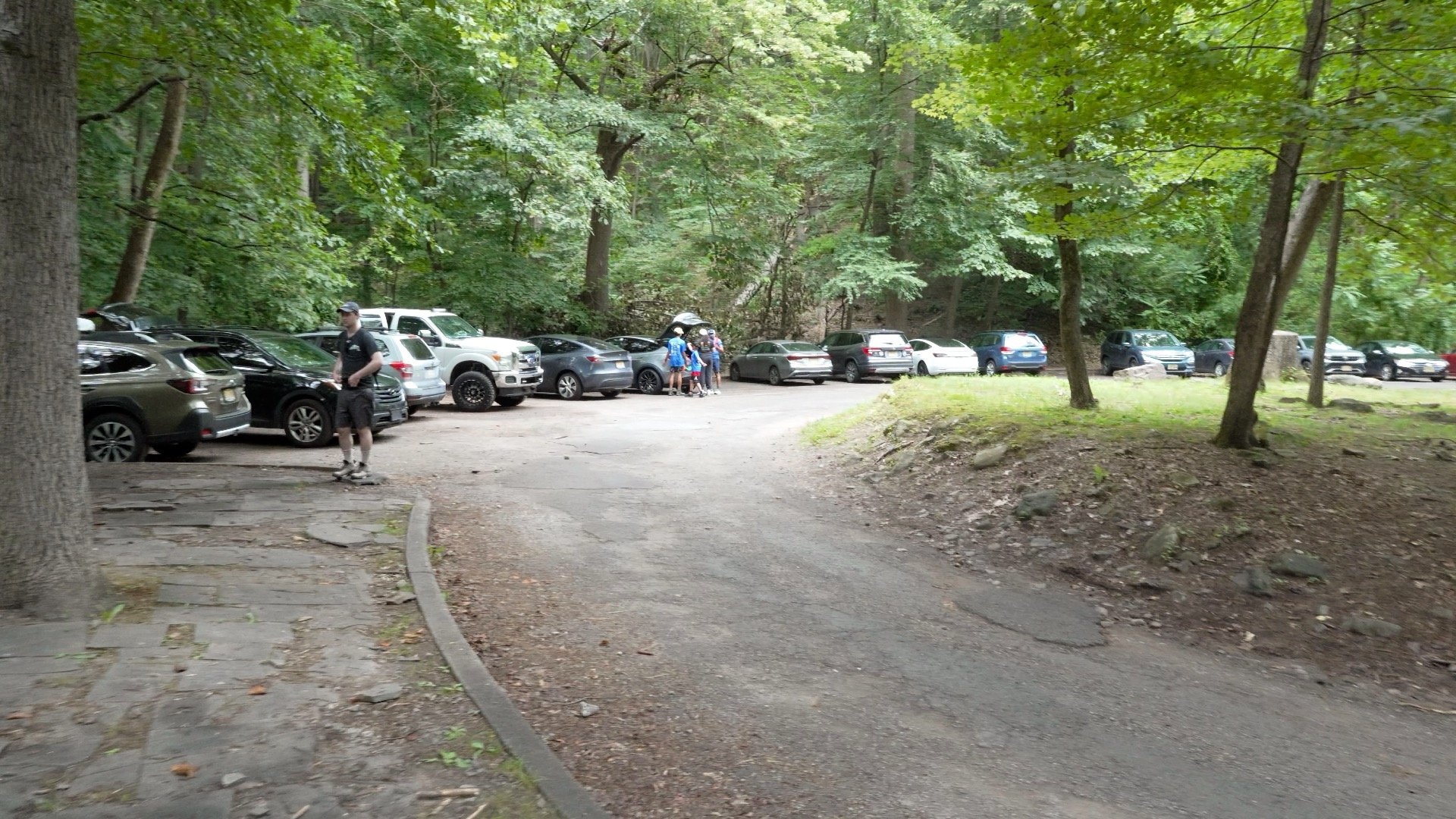
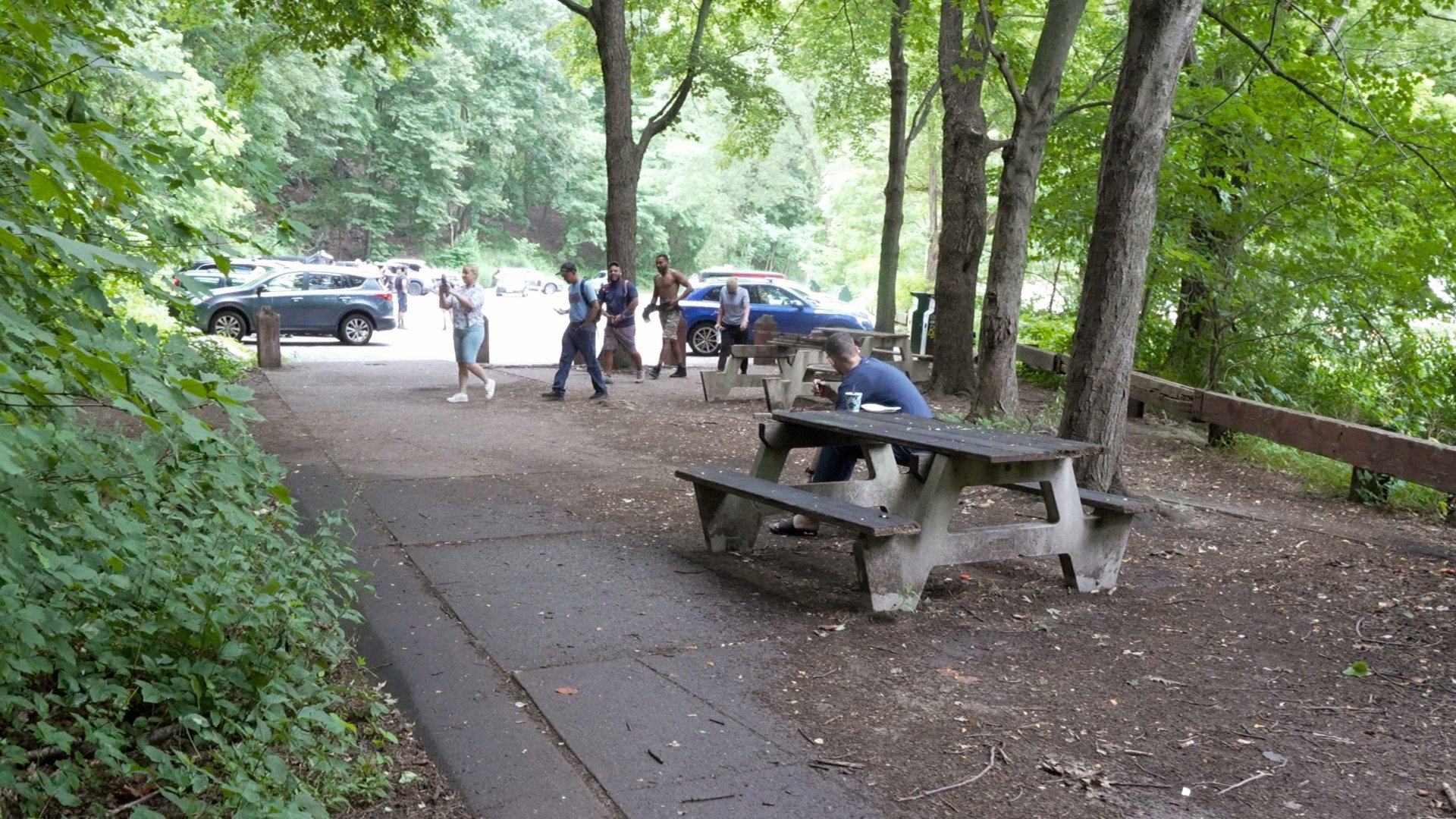
Here's what parking lot 1 looks like. It's fairly empty at about 6am on a Sunday in July. By 8am this lot is full.The second parking lot, the official parking lot for the Appalachian Trail, is circular and fills up quickly as well.
There is a porta-potty at the second parking lot.
Best Time to Do the Hike
Month
Jan
Feb
Mar
Apr
May
Jun
Jul
Aug
Sep
Oct
Nov
Dec
Winter
Best
Winter
Generally, you can hike Mount Tammany year-round, with the most popular times being summer and fall when the leaves change color. In winter, this normally straightforward hike can become much more challenging. If you don’t have winter hiking experience, it’s better to save this one for when you do. In good winter conditions, a few inches of snow can actually fill in the gaps between the rocks and make the hike easier. But when that snow melts into ice and slush, it can turn into a slow, frustrating slog that requires constant attention.
Gear Recommendations
Your best bet for footwear is a good pair of trail runners. If you’re thinking hiking boots are better, take a look at the hikers you’ll see on the Appalachian Trail section of this route, 99.9% of them will be wearing trail runners after hundreds of miles.
If you have hiking clothes, wear them here, otherwise fitness clothes are a good alternative.
Bring at least 1-1.5L of water for the hike. Don't drink water out of the creeks unless you treat or filter it.
Most of the hike has cellular reception in case you get into trouble. There are also lots of other hikers here if you need help.
Some people like trekking poles on the steep slopes, both up and down. If you like using them, bring them, otherwise you don't need to get anything special.
Bring an extra layer, it can be breezy at the summit.
As I mentioned earlier, in the winter this can be a different hike. If you are doing it in the winter, bring micro-spikes to handle any icy rock sections.
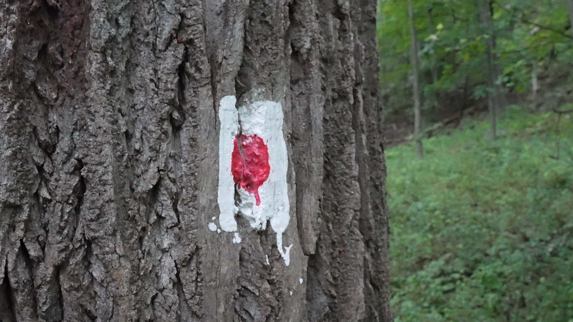
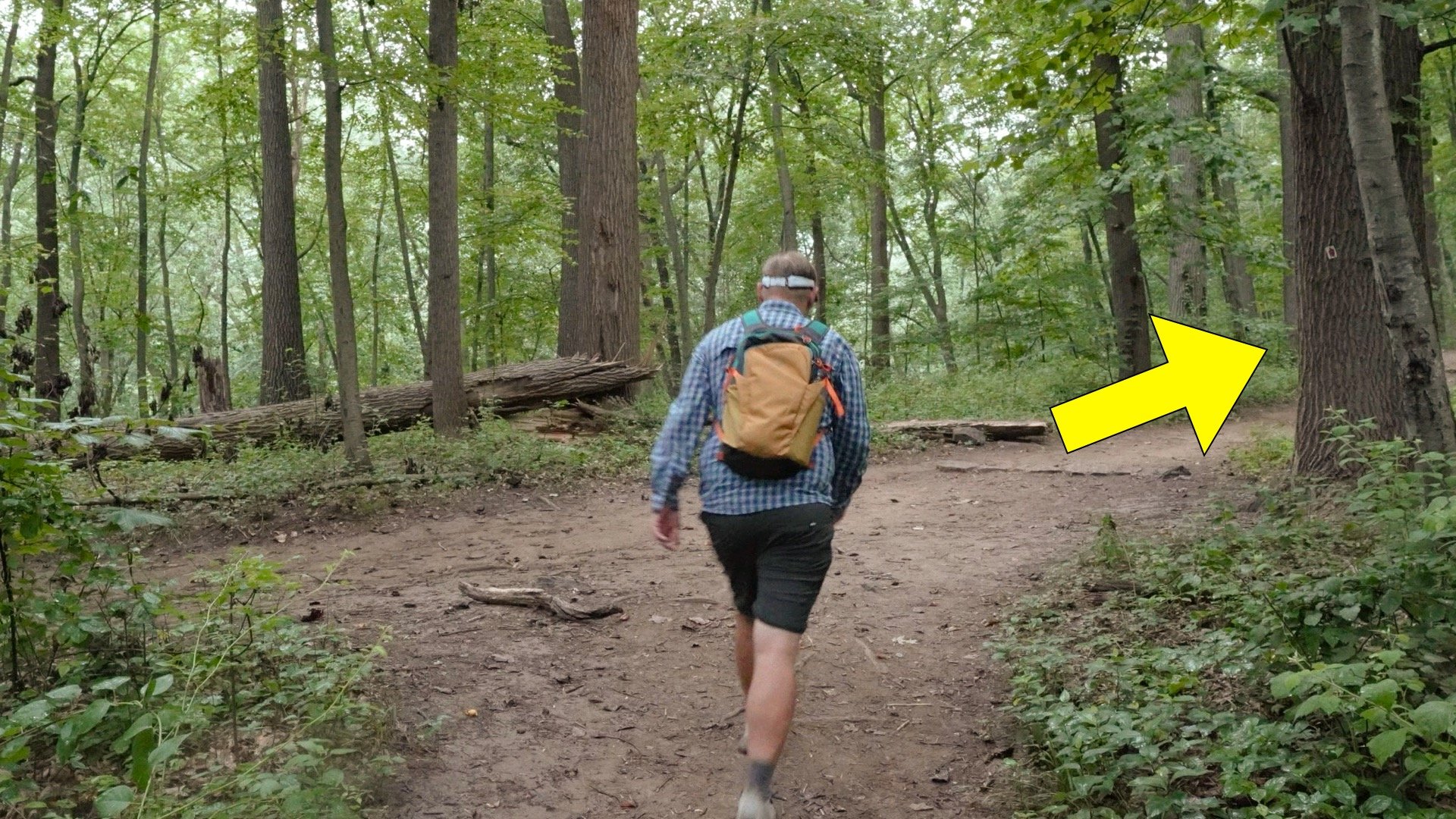
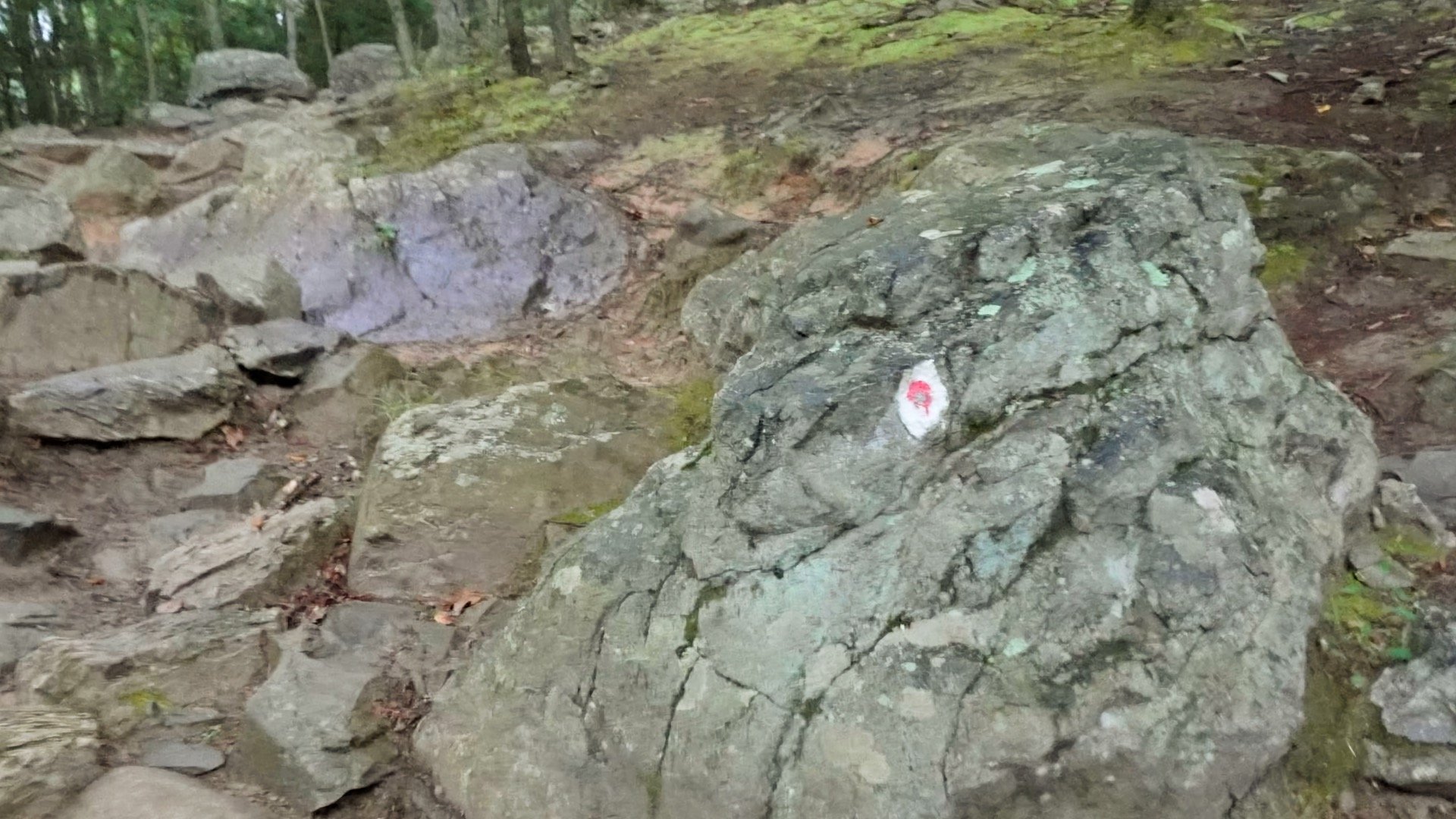
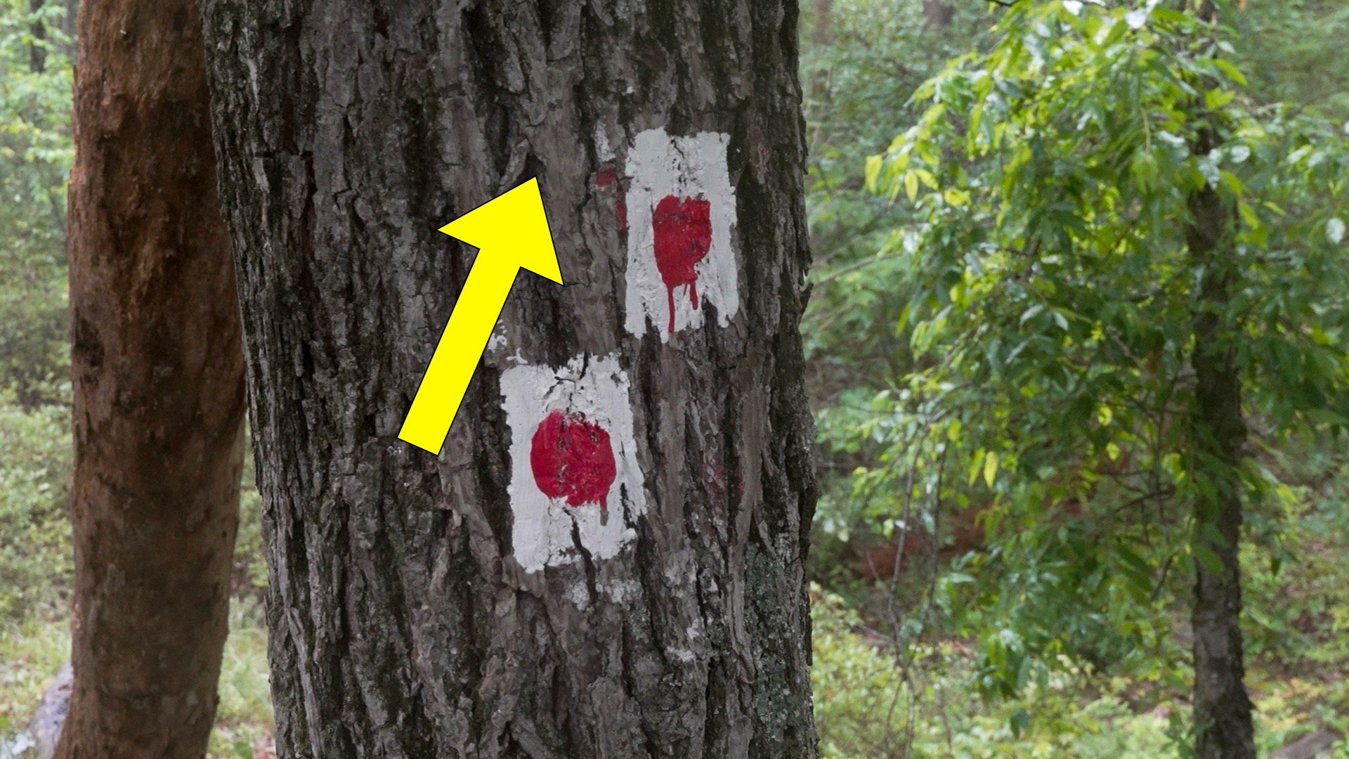
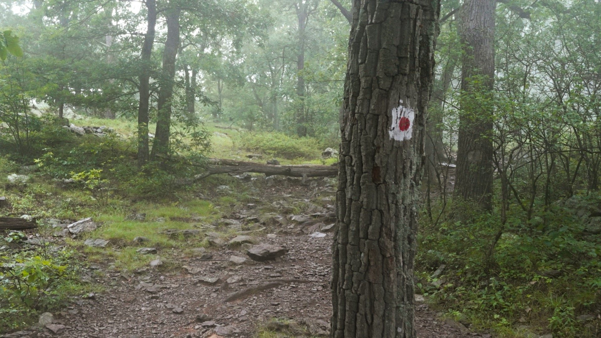
As you might have guessed from the name, the Red Dot Trail is marked by these blazes: a red dot on white background. Look for them on trees and painted on rocks.
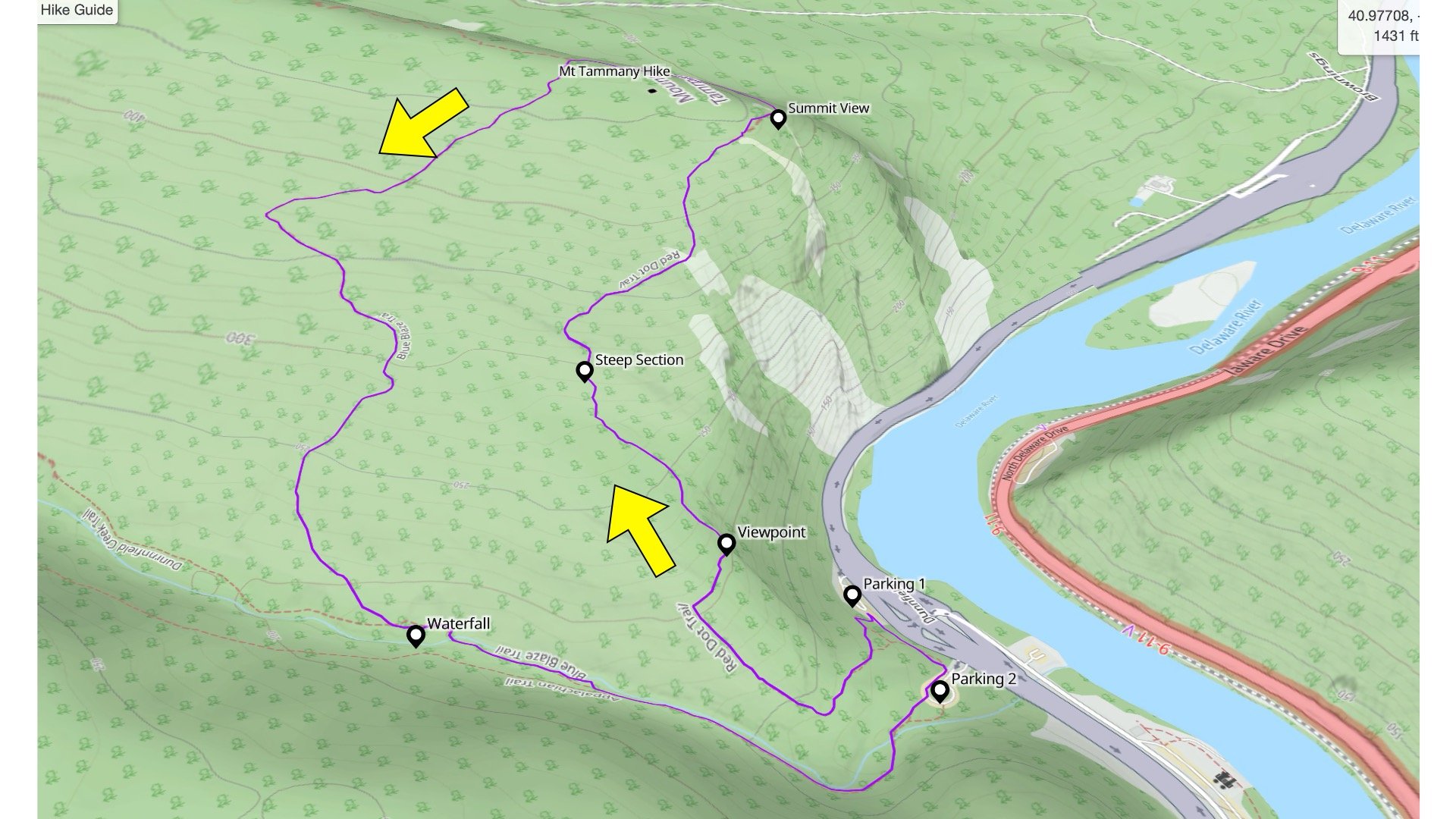
Here's the route I'm going to show you in this guide, and why.
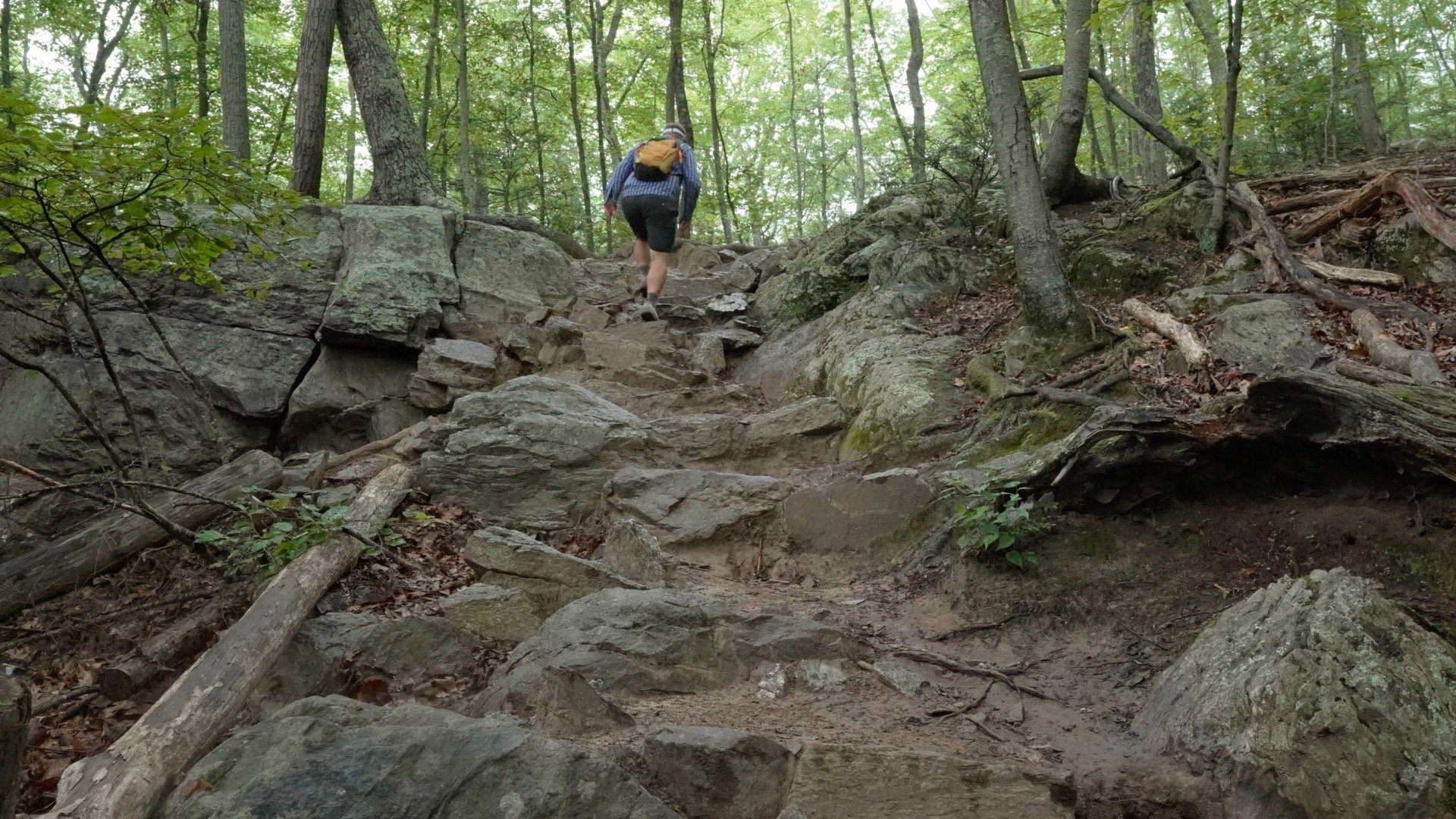
We're going up the Red Dot Trail, which gets us to the top the quickest and has a view or two along the way. It's iconic with some rocky climbs, but no challenging scrambles.
Going down the Red Dot Trail is not very fun, especially for your knees. So we'll take the more gradual Blue Dot Trail downhill, then join the Appalachian Trail for a short stretch.
The hike loop goes counterclockwise, first climbing the area closest to the Delaware River, then back down a bit inland.When you see the word "mount" in the title it usually means there's some climbing involved, and this is no exception. Thankfully the climb has some less steep sections to catch your breath.And if you didn't know, Mt Tammany the mountain on the NJ side of the Delaware Water Gap.
Why is it called Mt Tammany? It's named after the Lenape Chief Tamanend, who negotiated a peace treaty with William Penn for the Lenape and European settlers to live in peace. About 50 years later they were displaced from the area under the Walking Purchase. Today, nearly 350 years later, the Lenape have been displaced to Wisconsin, Oklahoma, and Ontario (Canada).
Mount Tammany Red Dot Hike Directions
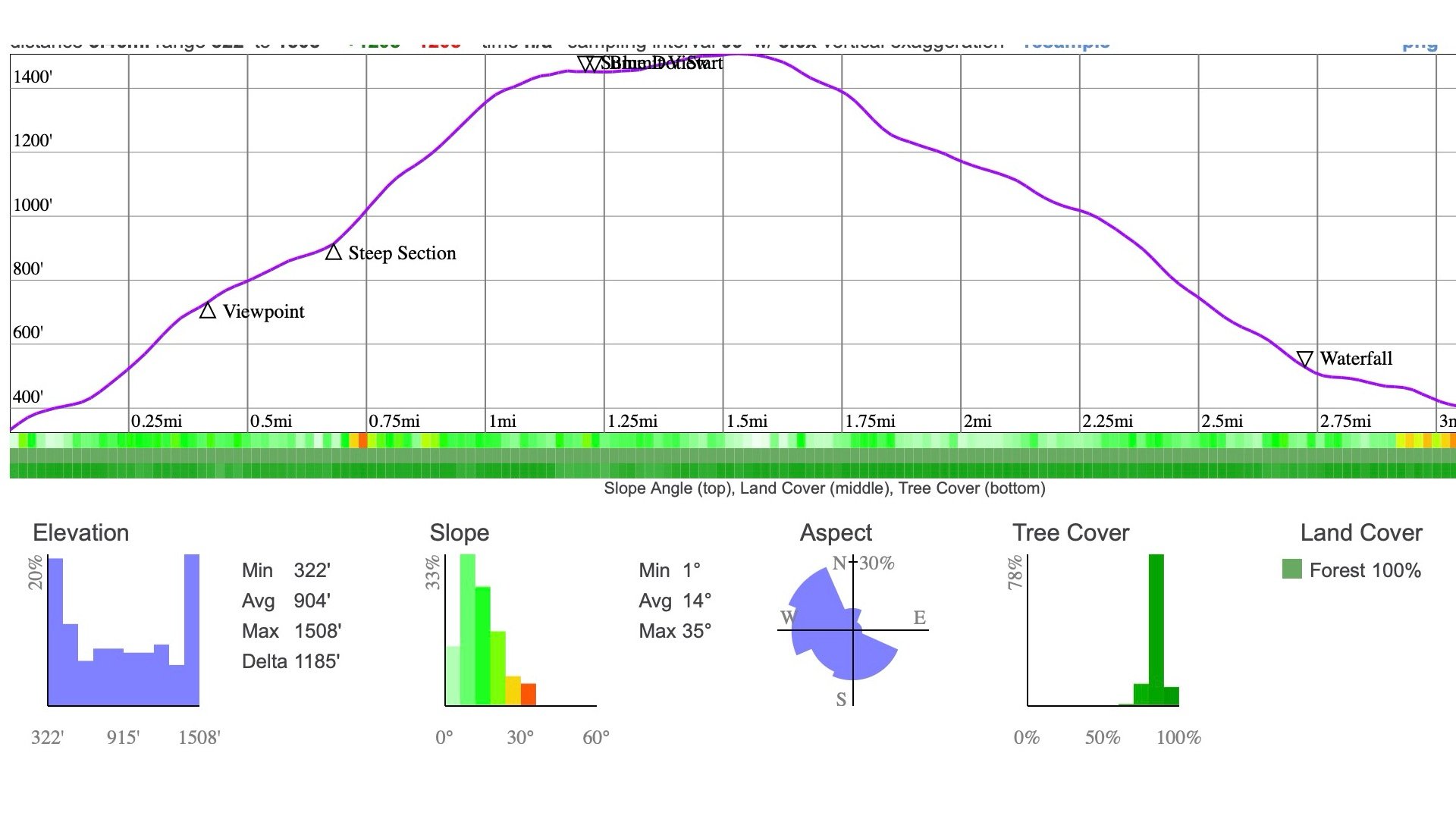
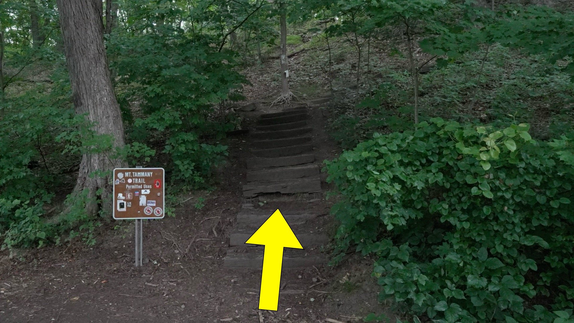
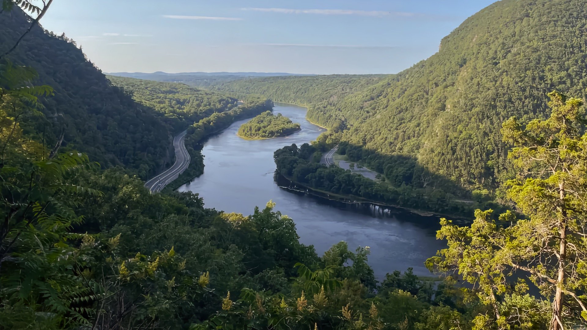
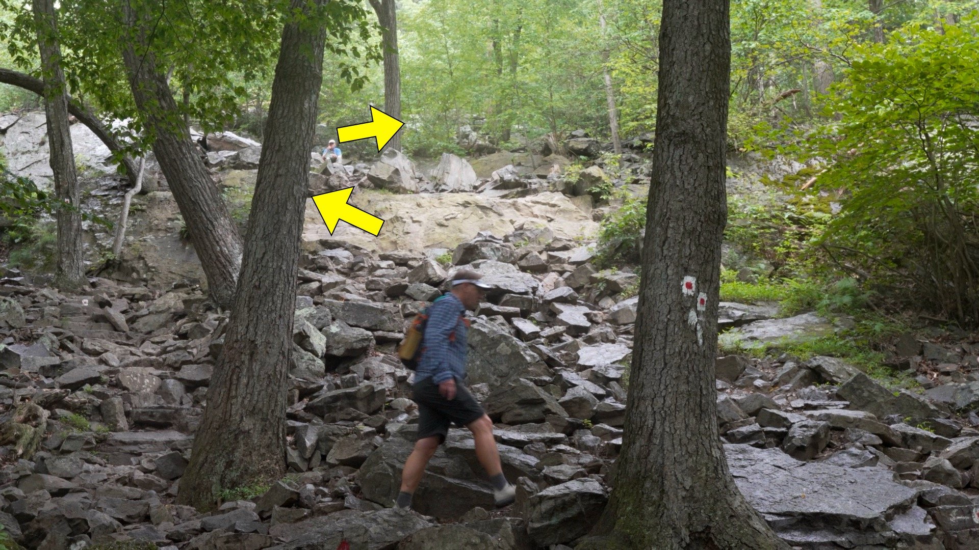
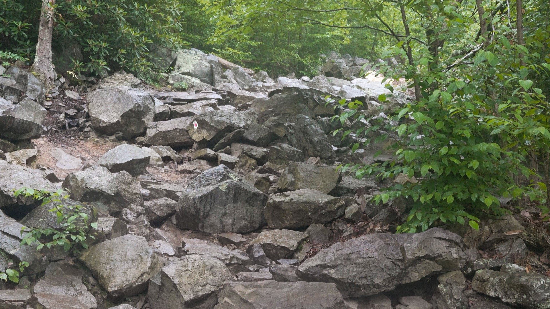
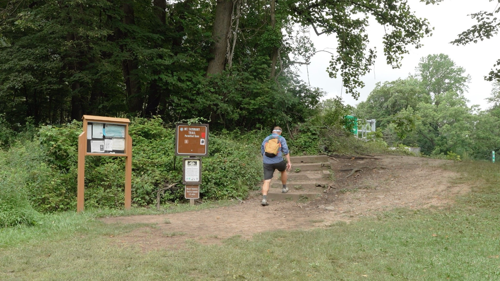
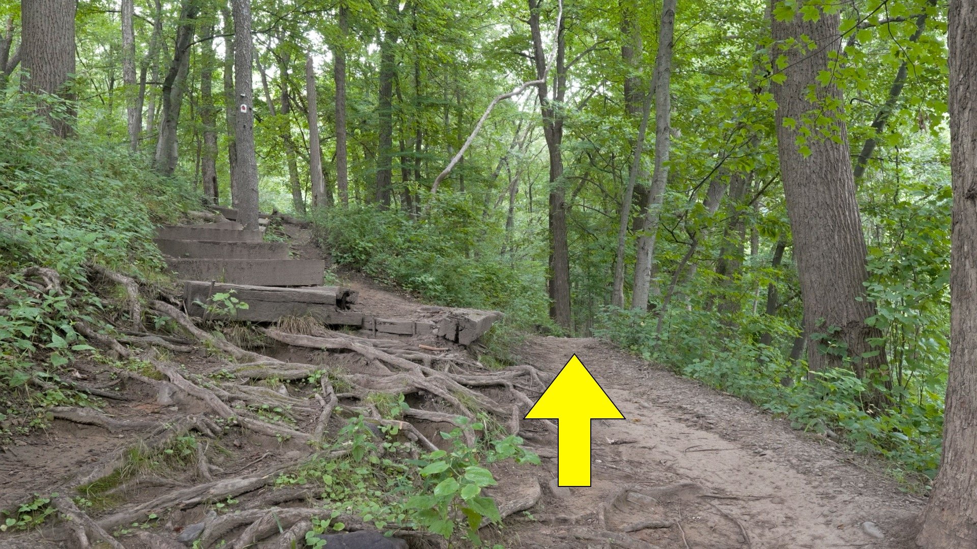
If you parked at lot 2 (the AT trailhead), find the trail by the entrance of the lot and hike over to lot 1.Look for the Red Dot trailhead and start hiking up the stairs.A few minutes in you'll see the trail connecting from lot 2, bear right.Look for the red dots on white. You should be seeing these regularly on the trail. If you don't see them for a while, backtrack until you do.There's a first steep section that gives you a taste of what's to come later.At just before 0.5 miles in, there's a viewpoint to the right. The island in the middle of the river is called Arrow Island.Continue heading on the trail. If you see a double red dot, it means the trail is turning in the direction of the offset arrow.Shortly after the last viewpoint (about 0.75 miles in) you'll start the steep rocky part of the climb. Look for the red dots as you climb.Here's what this section looks like from the bottom. There's a fair amount of hype about this section, but it's not too long, just rocky and steep.After about a mile the tough part is over and you just keep hiking up the marked trail.Then you get to the viewpoint. The mountain across the river is Mount Minsi, the other side of the Delaware Water Gap.
If you're peak bagging and want to reach the actual 1,527 foot summit, that point is about 800 feet behind the viewpoint in the woods.
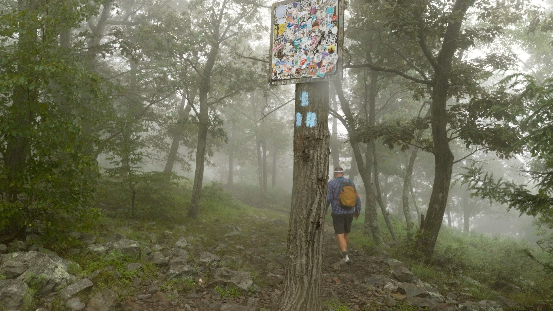
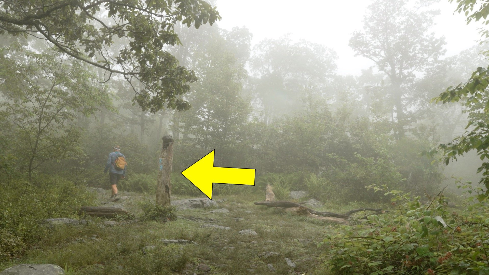
Continue straight after the summit viewpoint. You'll see the three blue blazes. From here we're heading back downhill on the Blue Dot Trail.
The original name of the Blue Dot Trail is the Pahaquarry Trail. Pahaquarry is a Lenape word for “the place between the mountains beside the waters.”
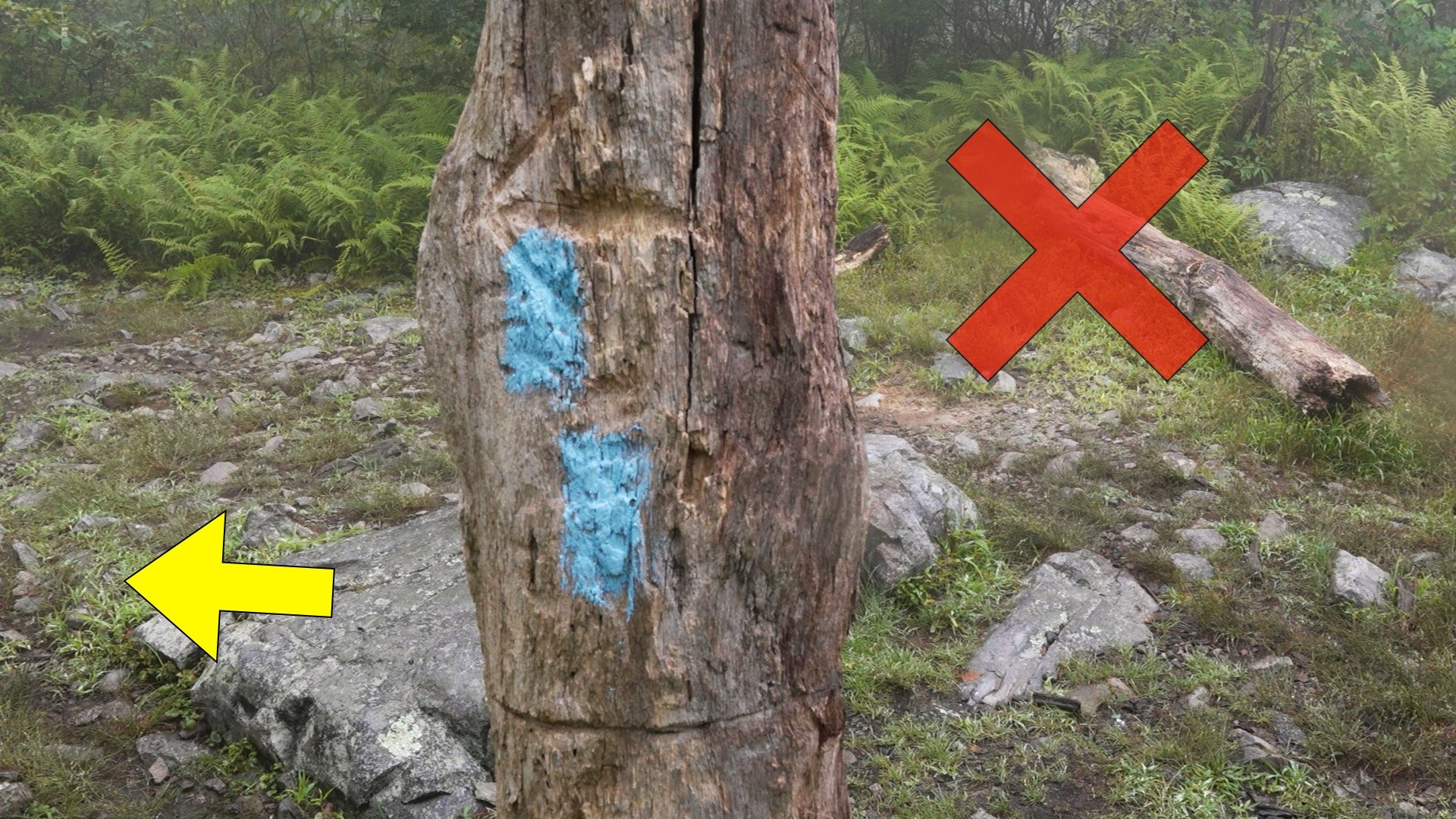
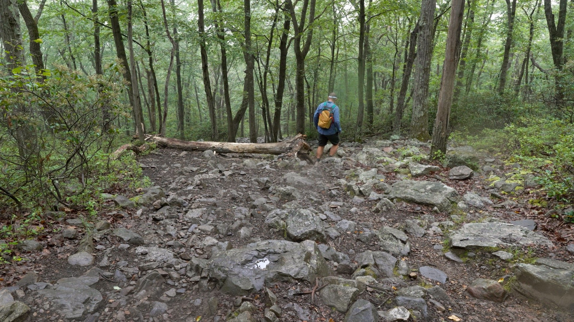
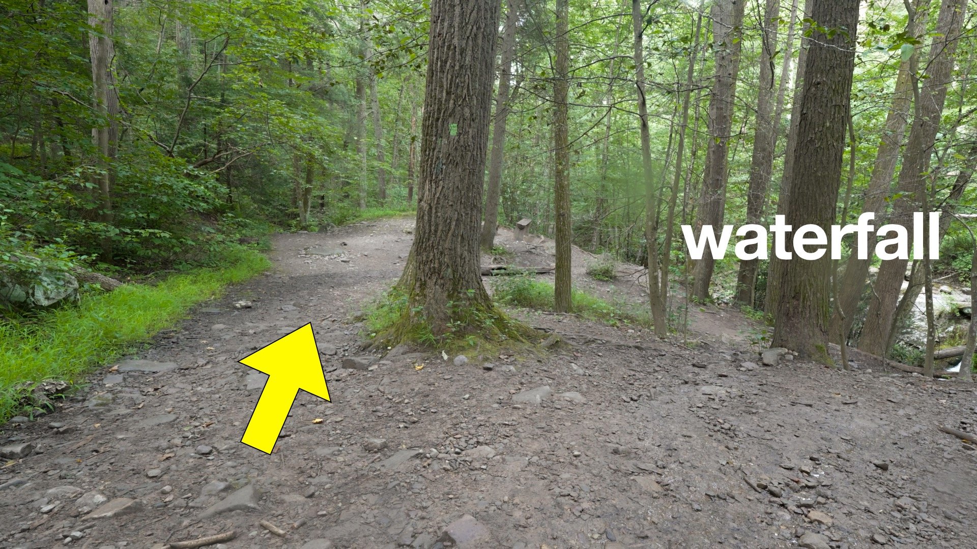
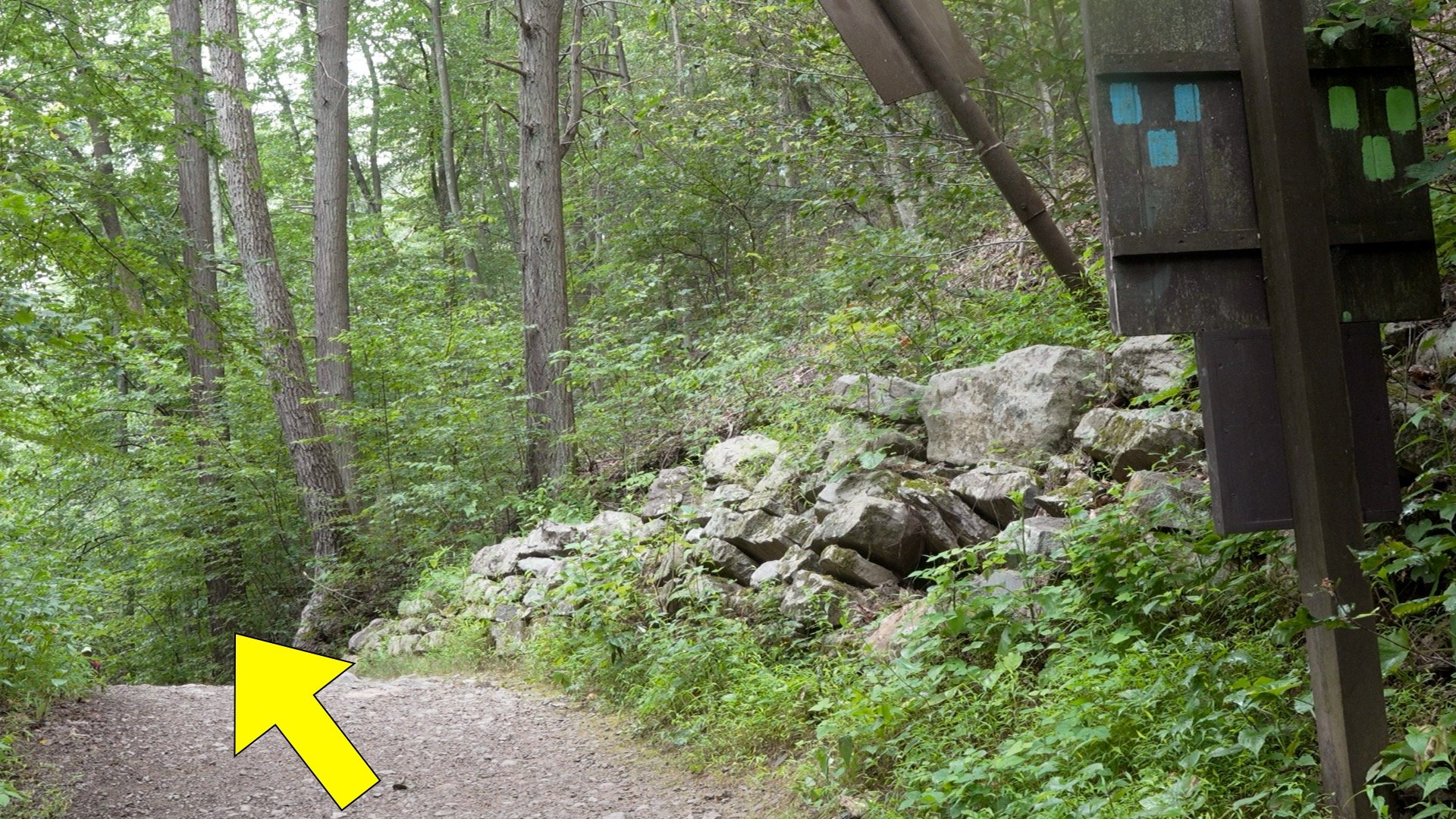
A little after 1.5 miles in, the trail makes a sharp left turn and starts the downhill.Here's a closeup from the last intersection. Look for the double blue dot marking the turn. It's easy to walk straight on Mount Tammany Fire Road, missing this important turn on the Blue Dot Trail.Now you have a long rocky descent back towards the start.At around 2.7 miles stay left as the green-blazed Dunnfield Creek Trail joins from the right.Just after the last intersection there's a small waterfall you can view to the right. Otherwise continue straight.The waterfall is worth checking out. Dunnfield Creek is a designated wild trout stream and is home to native brook trout.
On official topographic maps, the area where you parked is the former town of Dunnfield, which had a post office, train station, and thriving slate business. Today all that's left is the parking lots.
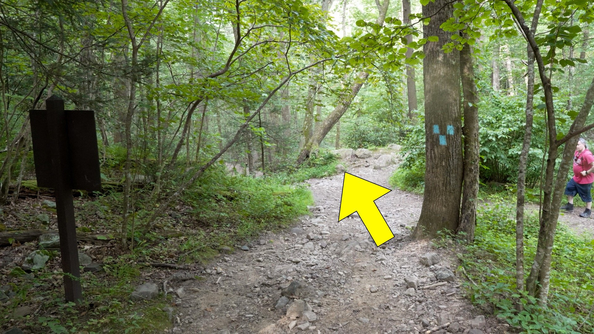
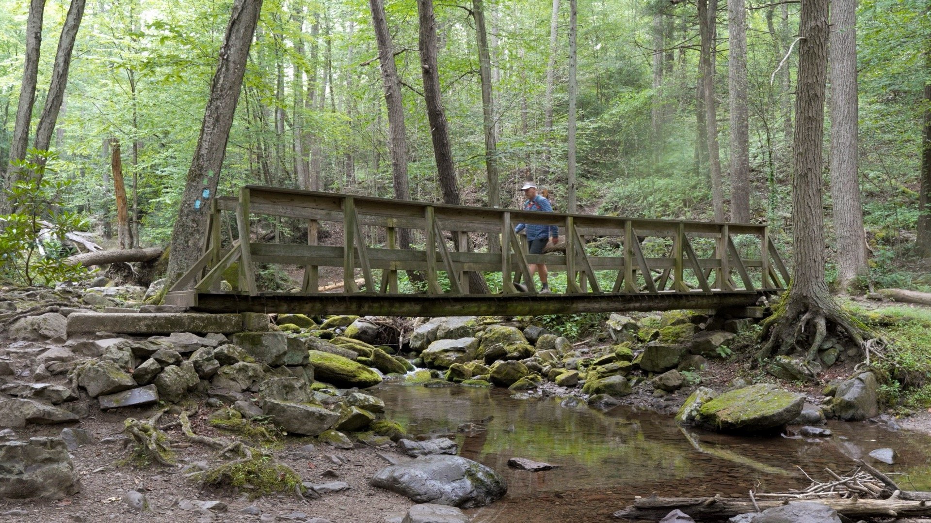
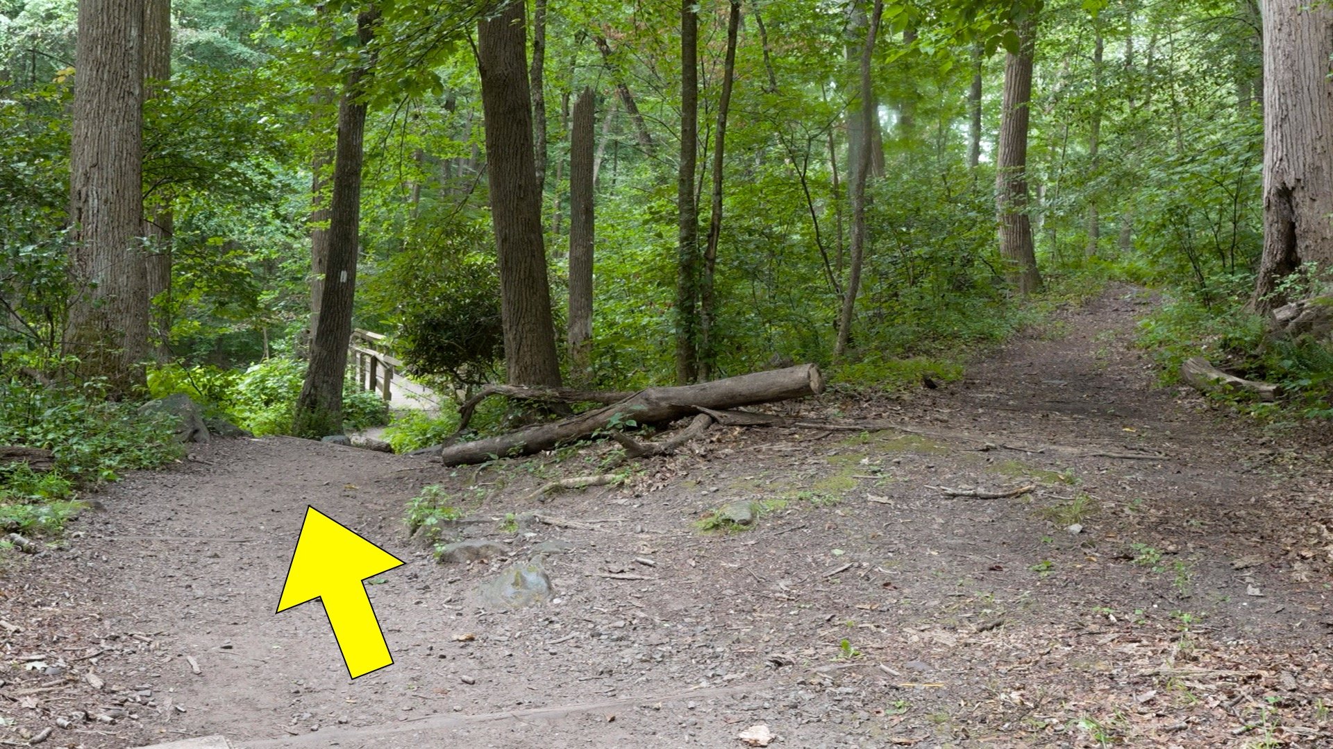
Cross over Dunnfield Creek just past the falls on the bridge.Then merge onto the Appalachian Trail (AT) for a short stretch of downhill.Close to the lot the trail splits, keep left and hike over the bridge.Then make a left into parking area 2.Look for the Red Dot Trailhead by the entrance to the parking lot.Continue straight on that trail.And then you come back out at the parking area. That's the hike!