
Upper Newport Bay Nature Preserve – Easy Hike Guide
Hike Stats
- Total Distance
- 3 miles
- Time
- 2 hours
- Total Climbing
- 120 feet
- Difficulty
- Easy
- Crowds
- Moderate
- Dogs
- Leashed
- Gear
- What I Use
- Weather
- Latest Report
Nestled in Newport Beach, this easy 3-mile loop through Upper Newport Bay Nature Preserve follows trails along the bay’s edge and then climbs to scenic bluff views. It’s one of the last remaining coastal wetlands in Southern California and a top spot for birdwatching, with over 200 species recorded. This guide takes you to a little-visited part of the preserve that’s one of the most beautiful areas in the park.
What Is Upper Newport Bay Nature Preserve?

In the 1960s and 70s, as Southern California boomed with development, Upper Newport Bay wasn’t going to be spared. Developers pushed plans to dredge the bay for water-skiing and line it with homes. At the time, the area already hosted saltworks and shell-works (they ground up shells to mix into chicken feed!). But in 1975, after years of pushback from local citizens, the undeveloped portions were finally protected and expanded as an ecological reserve. Hiking here today, it’s easy to forget this could’ve been just another marina or industrial park.
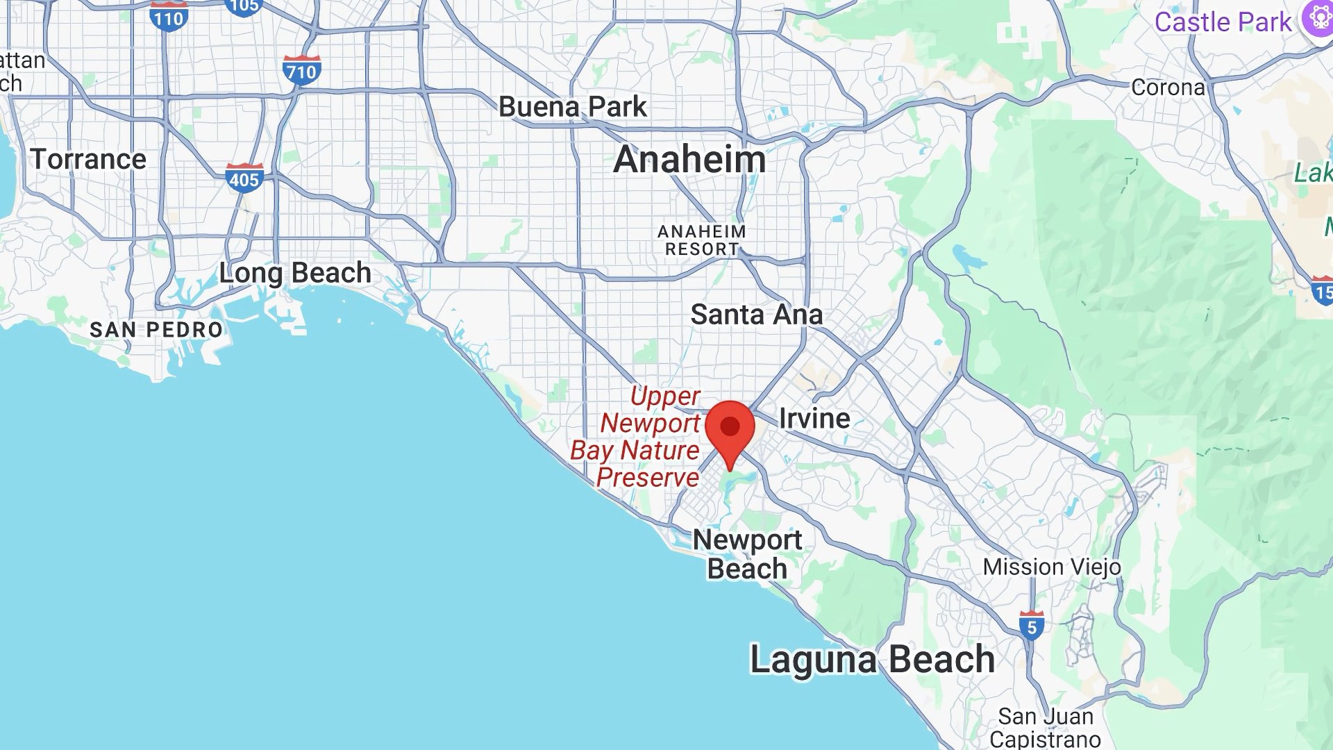
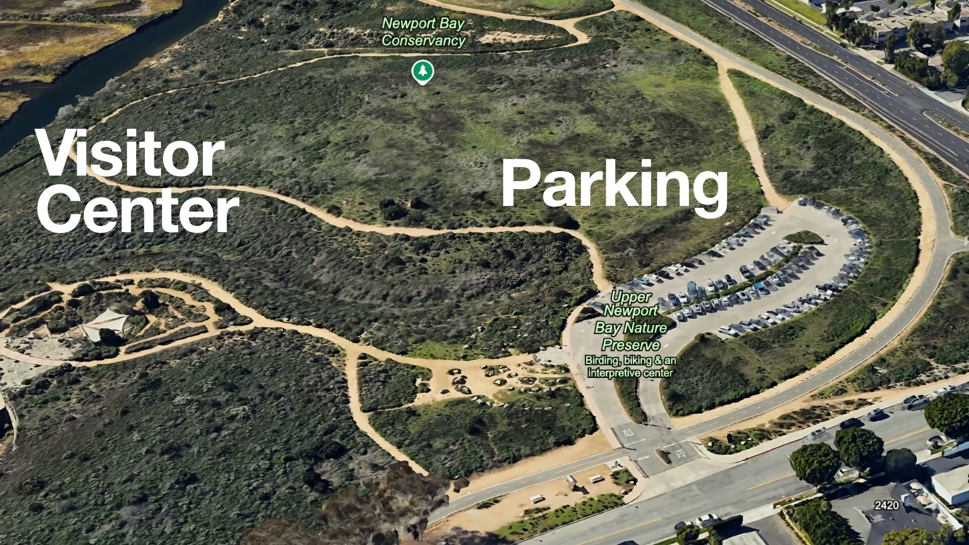
Trailhead and Parking

Best Time to Visit
This is one of the best short coastal hikes in Orange County, and after the first winter rains, Upper Newport Bay transforms into a green oasis. By spring, wildflowers start popping along the trail. As summer hits, the area shifts to golden brown, with some green holding on near the bluffs.
What to Bring for This Hike
- Nothing technical needed, fitness or light hiking gear is ideal
- You’ll see people in jeans and even flip-flops, but shoes with grip like a trail runner are better
- Bring 0.5–1 liter of water if you’re doing the full loop, especially in warmer months when it can get very hot
- Aim for early morning or just before sunset for cooler temps and low/no crowds
- If you're into birds and wildlife, bring binoculars
Essentials I’m Using Now
- Garmin inReach Mini 2: Reliable SOS Everywhere on Earth
- Sawyer + CNOC Water Filter: Easy & Reliable Safe Water
- Nitecore NU25 Headlamp: Running late? Get home safe
- Altra Olympus 275: Favorite trail shoes right now, no blisters and very comfy.
- AllTrails Plus (30% off): Offline maps on your phone with the Plus level
- Full November 2025 Gear List →
Trail Maps
Hike Directions


The Peter and Mary Muth Interpretive Center, named after local conservation advocates who helped preserve the bay, gets about 40,000 visitors a year since it opened in 2000. When you add in educational programs for kids, etc, it's about 50,000 people.


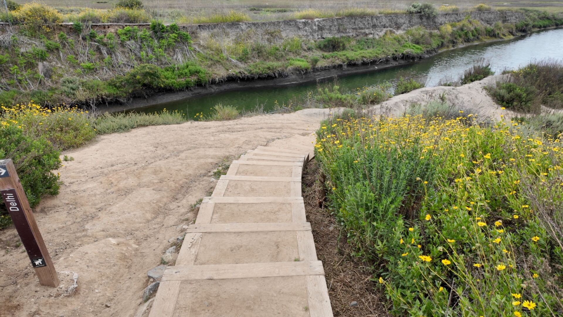

Why is this called the Delhi Trail?
It’s not named after the capital of India, at least not directly. The trail follows the Delhi Channel, which flows into the “Delhi” neighborhood of Santa Ana. That was named after Delhi, New York, which itself was named after Delhi, India. So in a metaphorical way you can follow this waterway back to India.

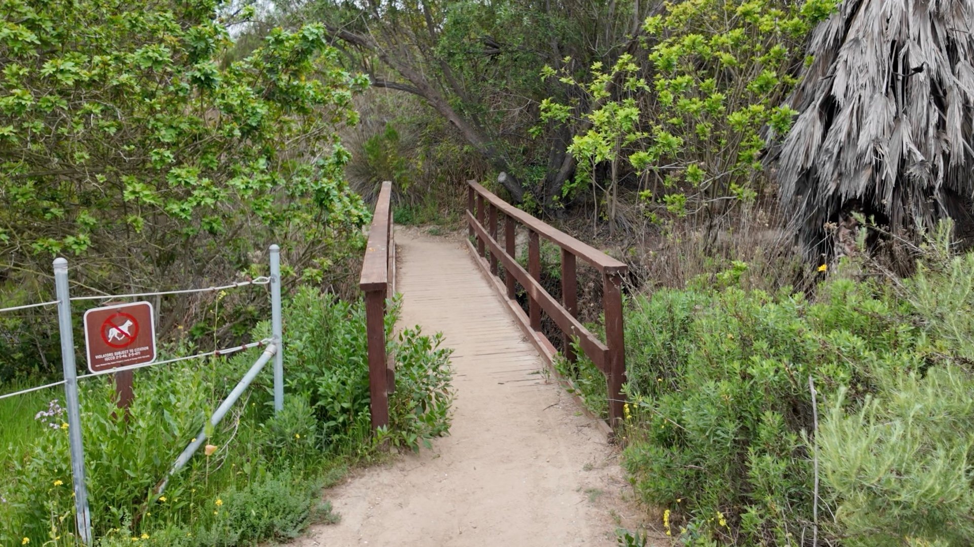
If you want to cut the hike short, simply bear right at one of these points, and then make a right on the bike path to return to the parking lot.


The interpretive displays give you lots of great information about what you're seeing and are worth a few minutes of your time. Here's a fun fact that I'll add. Back in the Ice Age, it was cold enough for walrus to live here. When they were building the nearby Fletcher Jones car dealership, crews uncovered the fossilized remains of one.


Enjoy the views and then head back the way you came. When you get to the bike path you can simply stay on it to go directly back to the parking lot.