Hike the Etiwanda Falls Trail
Hike Stats
- Total Distance
- 3.5 miles
- Time
- 2 Hours
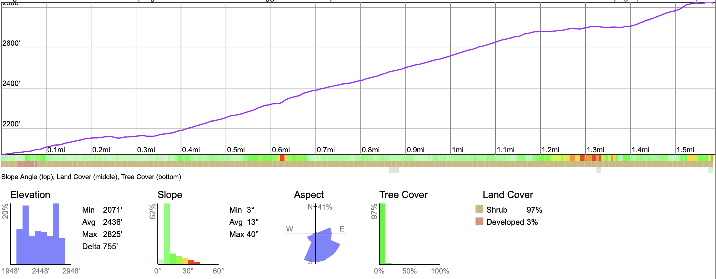
- Total Climbing
- 790 feet
- Difficulty
- Moderate
- Crowds
- Moderate
- Dogs
- No Dogs
- Gear
- What I Use
- Weather
- Latest Report
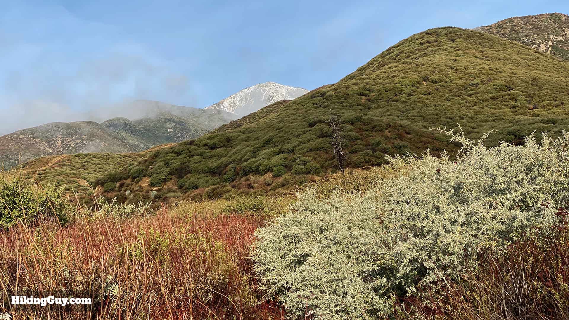
The Etiwanda Falls Trail hike feels like you're a world away from the nearby LA suburbs. Starting in North Etiwanda Preserve, you gently hike up through the foothills of the San Bernardino Mountains, with glimpses of the prominent mountain peaks along the way. After a short 1.6 miles, you'll reach Etiwanda Falls, tucked into a shady canyon. The trail is easy to follow, the workout is good, and the scenery is beautiful.
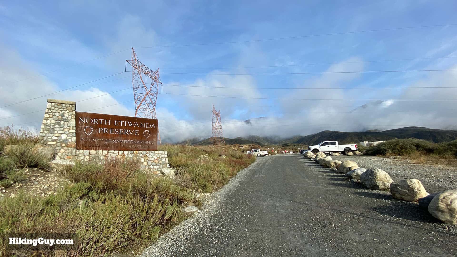
Where is the Etiwanda Falls Trail?
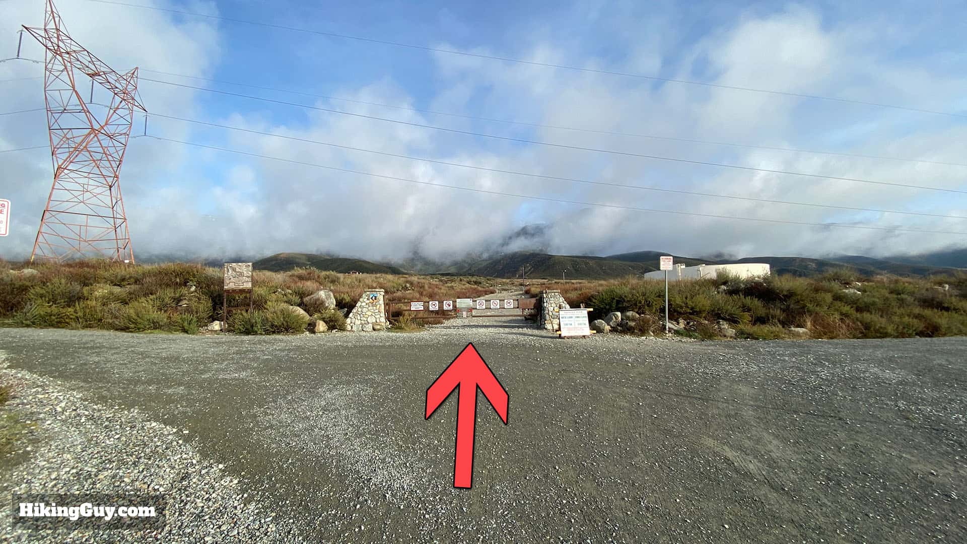
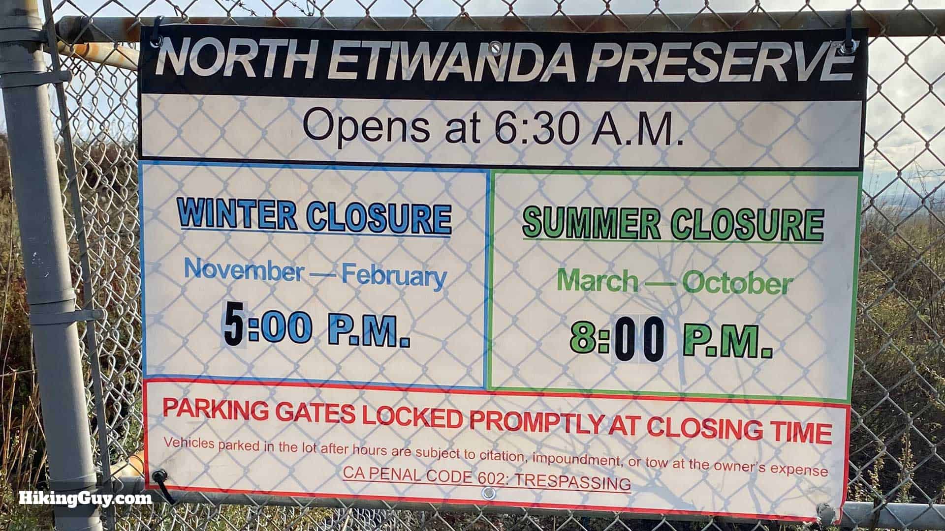
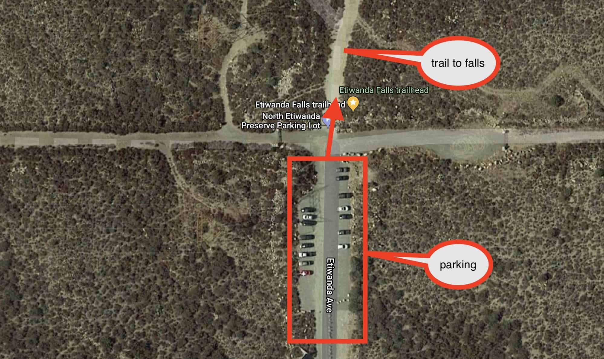
Although there is plenty of parking at North Etiwanda Preserve, the trails are very popular, and spaces fill up quickly. I recommend doing this hike at 630am when the park opens. There are no bathrooms at the trailhead.
Use this trailhead address:
North Etiwanda Preserve, 4890 Etiwanda Ave, Rancho Cucamonga, CA 91739
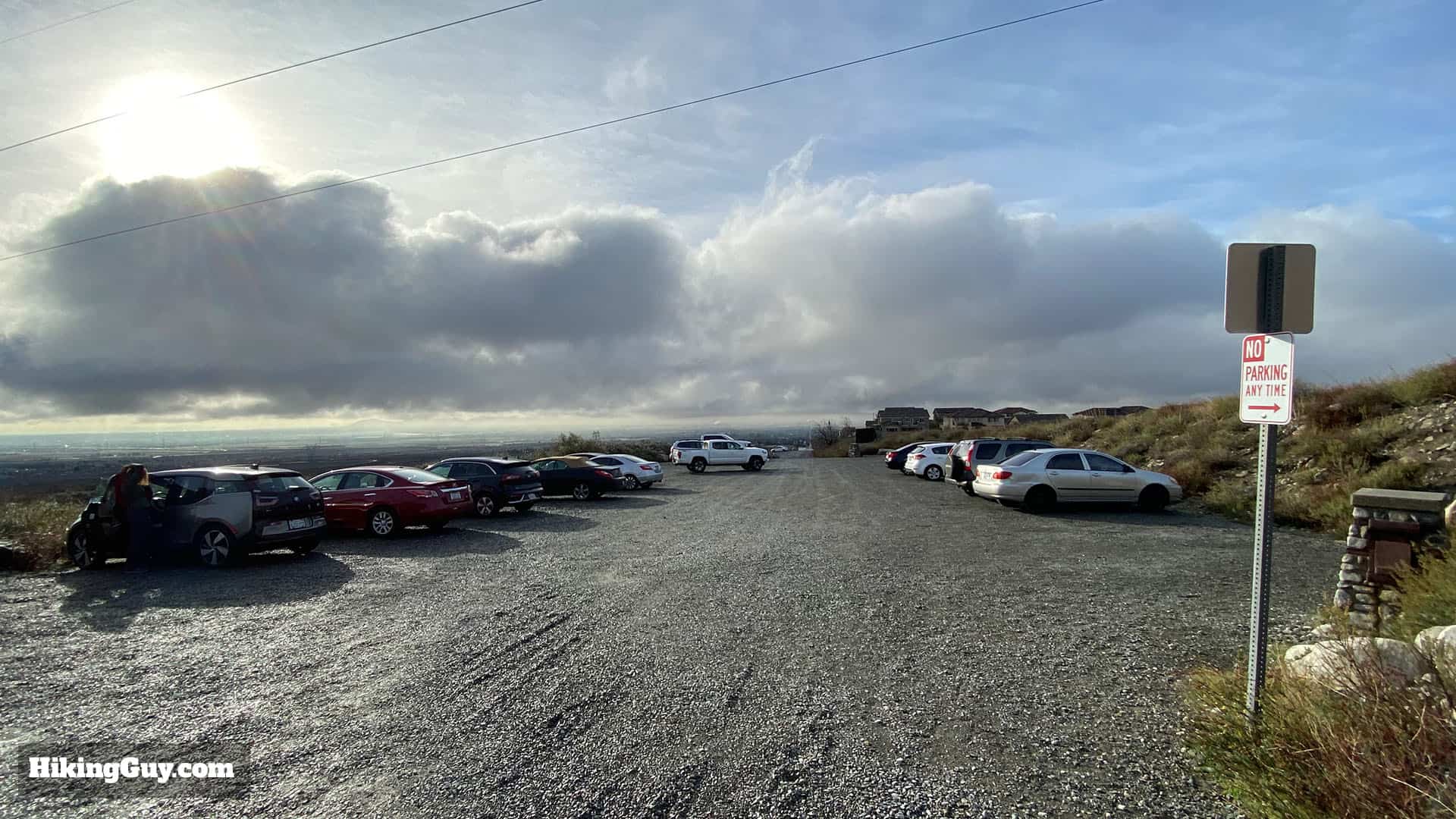
It looks like you have to pay for parking now, which is done through an app that is promoted at the parking lot. The fee is $3.25 for 4 hours. Thanks to reader Weston B. for the update!
Gear for the Hike
I recommend wearing light hiking gear for this hike. In a pinch you can get away with fitness clothing. The trail is wide and easy to follow, but rocky, so trail runners or hiking boots will work best. If you have sandals it will be tough. The route is also exposed and in the summer can get very hot; bring 1L of water and sunscreen.
Essentials I’m Using Now
- Garmin inReach Mini 2: Reliable SOS Everywhere on Earth
- Sawyer + CNOC Water Filter: Easy & Reliable Safe Water
- Nitecore NU25 Headlamp: Running late? Get home safe
- Altra Olympus 275: Favorite trail shoes right now, no blisters and very comfy.
- AllTrails Plus (30% off): Offline maps on your phone with the Plus level
- Full December 2025 Gear List →
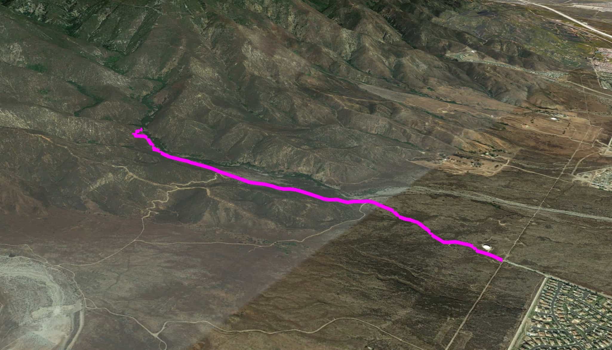
Etiwanda Falls Trail Maps
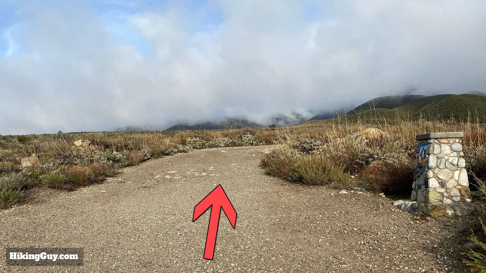
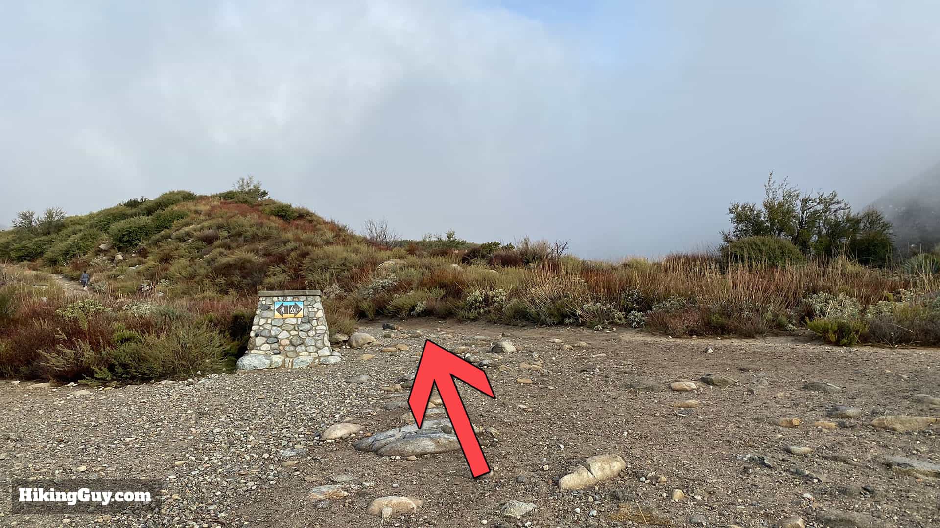
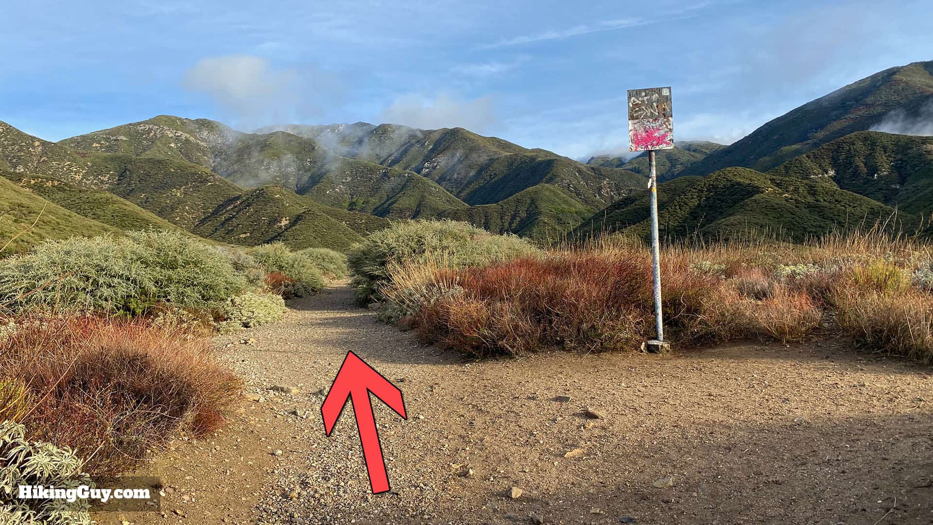
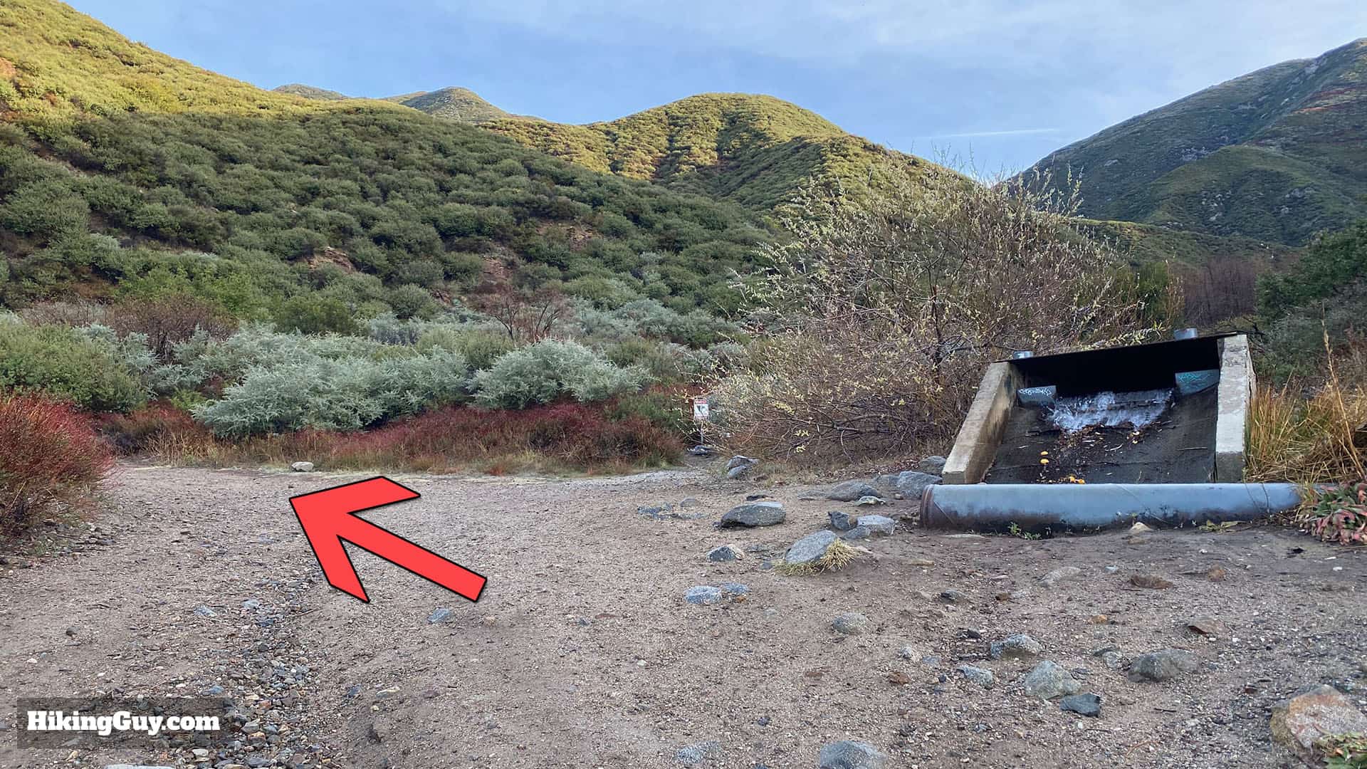
Although the trail is easy to follow, there are other trails at the park and random signs with arrows and hikers at multiple points. Sometimes it can get confusing. Follow the directions below to get to Etiwanda Falls. There's a trail map on the park website (at the top of this guide) if you want to explore the other trails.
Elevation Profile
3D Map
Hike Brief

- Why are the falls called Etiwanda? In 1882 settlers named the area Etiwanda after a native tribe in the Lake Michigan area.
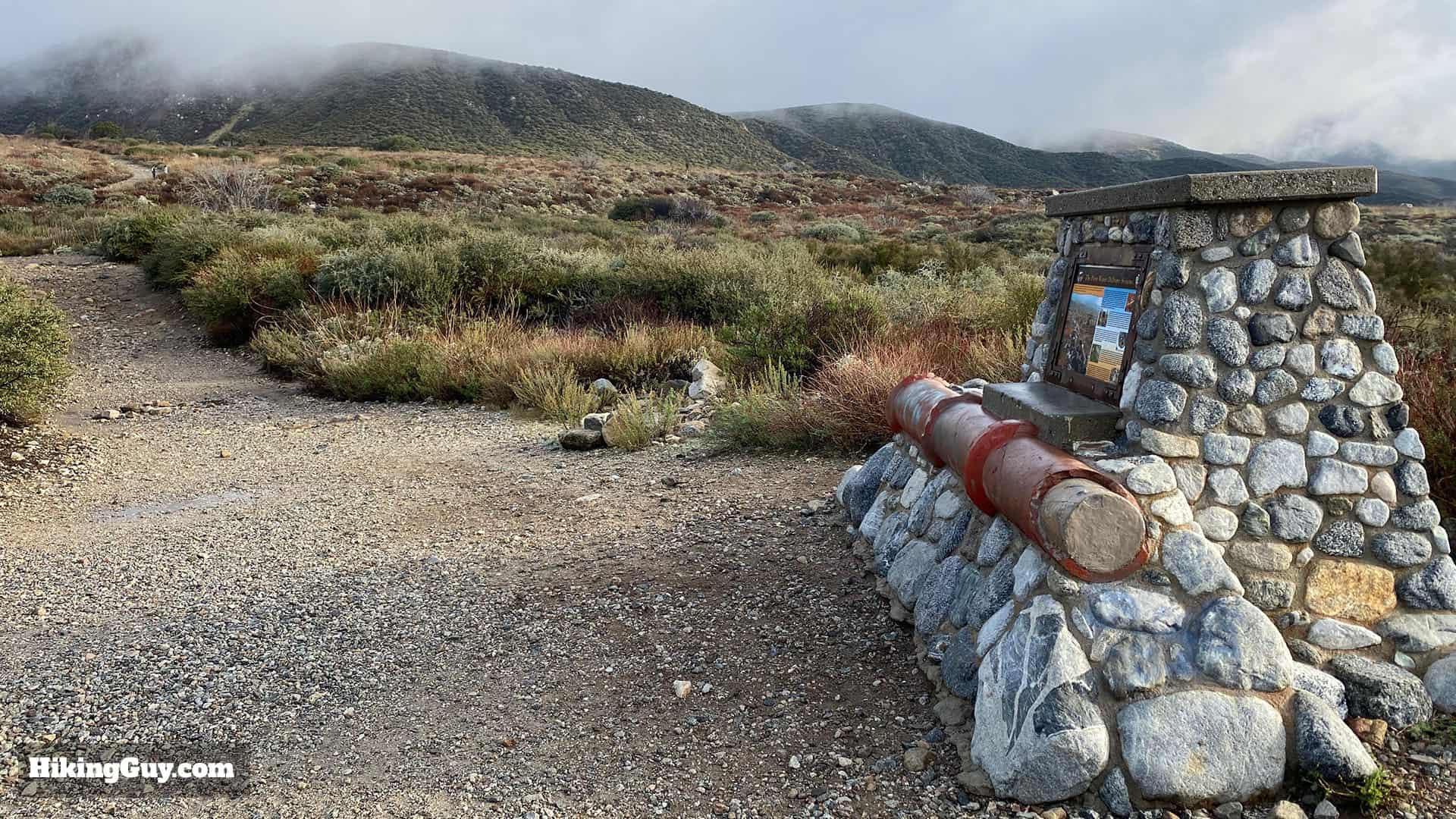
- In 1893 one of the earliest irrigation systems was started here using Etiwanda Creek. There is an interpretive display along the trail. Etiwanda Creek continues to provide a portion of the water supply to Rancho Cucamonga.
- Much of the area you are hiking in was burned in the 2003 Old Fire, part of one of the worst fire seasons in SoCal history.
Etiwanda Falls Trail Hike Directions