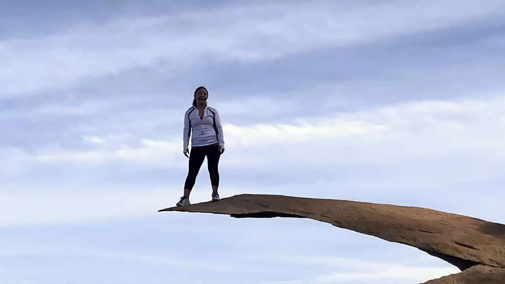
I'm sure you've seen pictures of the Potato Chip Rock hike, even if you're not familiar with it. Potato Chip Rock is the iconic rock formation in San Diego County where everyone grabs a photo of themselves perched out on the rock, over the oblivion. The hike to the rock and summit of Mt Woodson is a fun one, with a few options to get to the top. It's a hard hike because of the uphill, but otherwise well-marked and easy to do. It gets crowded so plan your trip accordingly (keep reading!).
Where Is Potato Chip Rock?
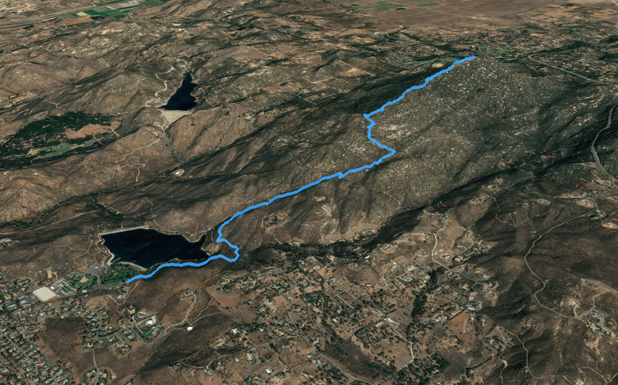
The Potato Chip Rock hike starts in Poway, located about 30 minutes north of San Diego. There a few ways to hike to Potato Chip Rock, and this route is the most scenic and offers bathrooms and facilities. I'll give you a few other options later in the guide.
Note that if you put "Mt Woodson Trailhead" or "Potato Chip Rock Trailhead" into your GPS, it might take you to one of the other ways to do the hike.
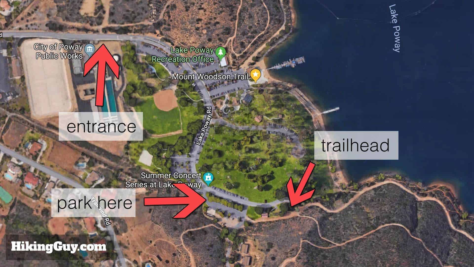
This hike, which is probably the most popular route to Potato Chip Rock, starts at the Lake Poway park in Poway, CA. The park has bathrooms, picnic tables, and plenty of parking. There's a non-resident fee on weekends and holidays; on weekdays it's usually free. It's free for Poway residents with ID.
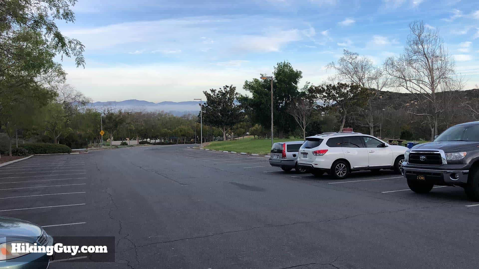
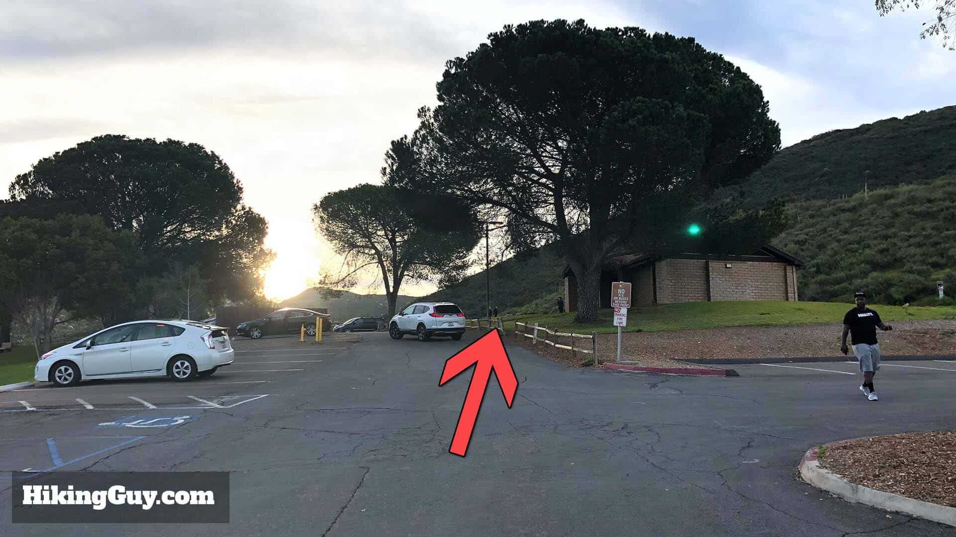
When you enter Lake Poway, go to the far lot to park. There's plenty of parking, bathrooms, and a place to fill water bottles.There's lots of parking but it fills up later in the day.
I highly recommend leaving as early as possible. The gates usually open at 6am (check the website above). When you do this hike first thing in the morning, it's glorious. When you leave around 8-9am, you'll have crowds of people on the trail. It's worth getting up early for.
What About the Potato Chip Short Trail?
There are a few ways to hike to Potato Chip Rock and Mt Woodson. The route from Lake Poway is the most popular route for a good reason. It has great scenery, plenty of parking, facilities and bathrooms, and is the least steep (although still a tough climb). It does have an entry fee on the weekends.
If you want to try the other routes, here they are. Otherwise, keep reading for all the trail directions from Lake Poway.
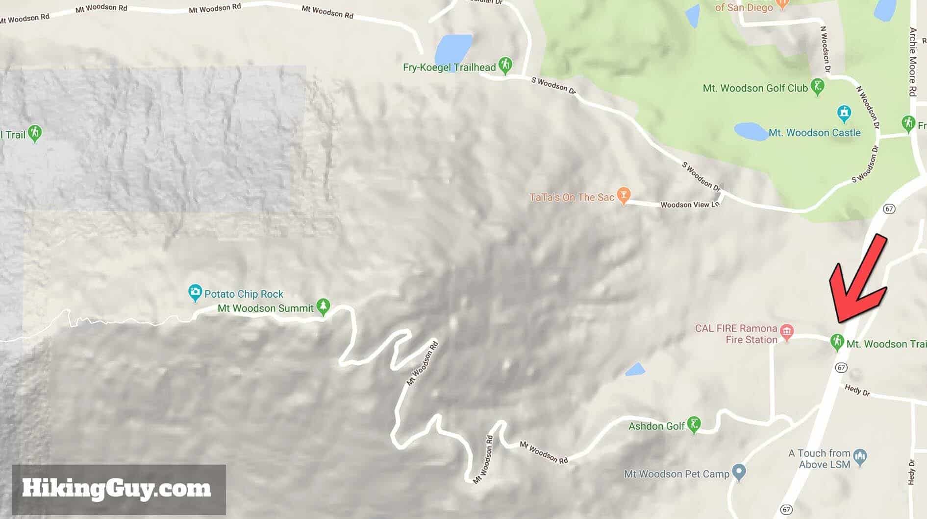
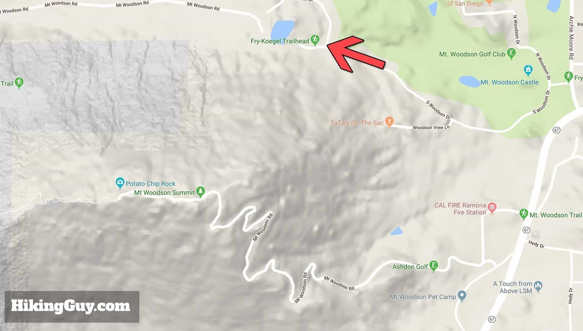
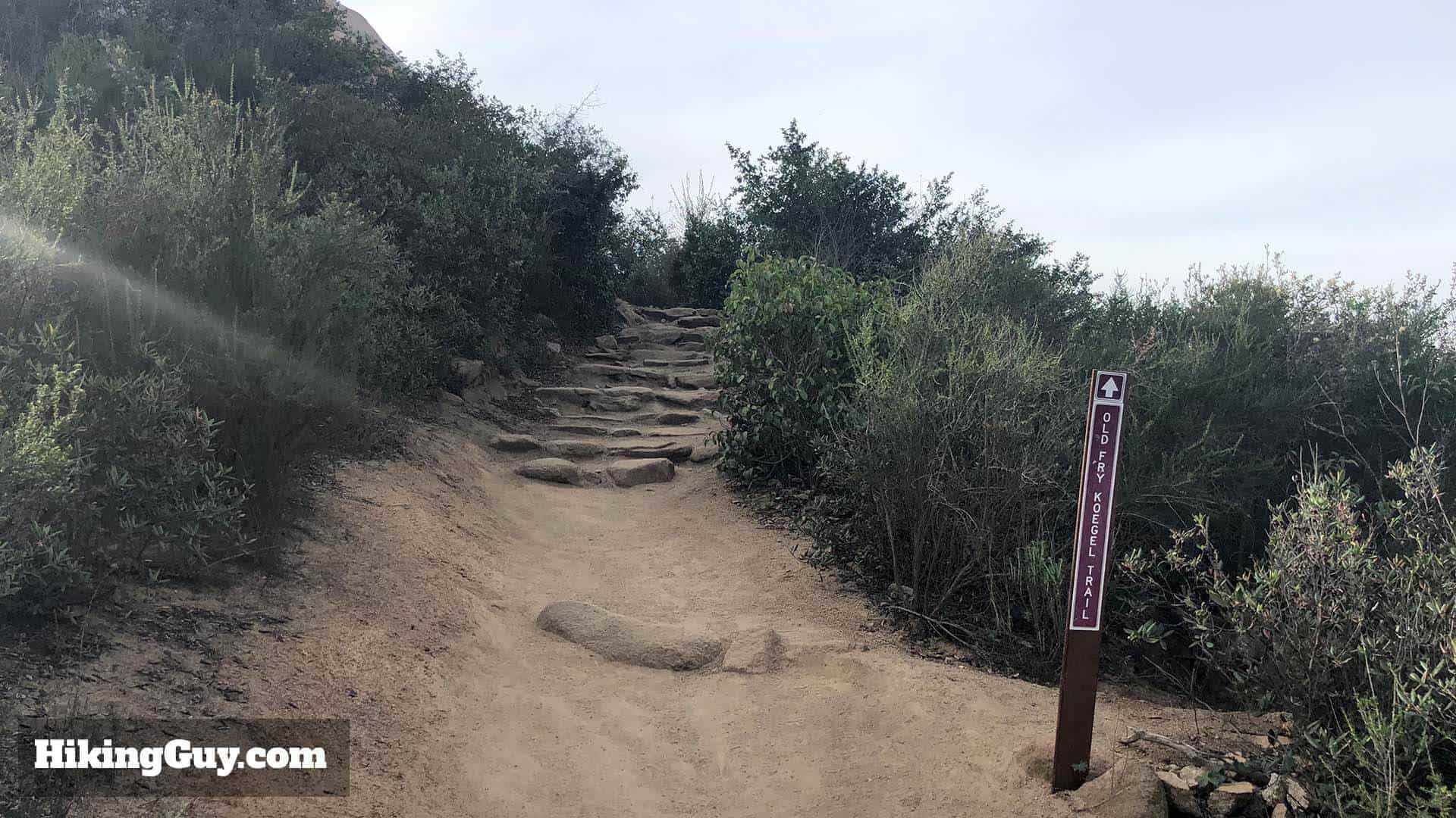
The most popular free route starts on the side of Rt. 67, where you can park for free along the road. The 4 mile round-trip route takes Mt Woodson Road to the summit. It's a paved and steep route, and lacks the scenery of the Lake Poway route.My second favorite route to the top leaves close to the Rt 67 route, it's the Fry-Koegel Trail. The trail is not paved and offers great scenery, but not as good as the Lake Poway route (in my opinion). There are also no bathrooms.
Is Potato Chip Rock Safe?
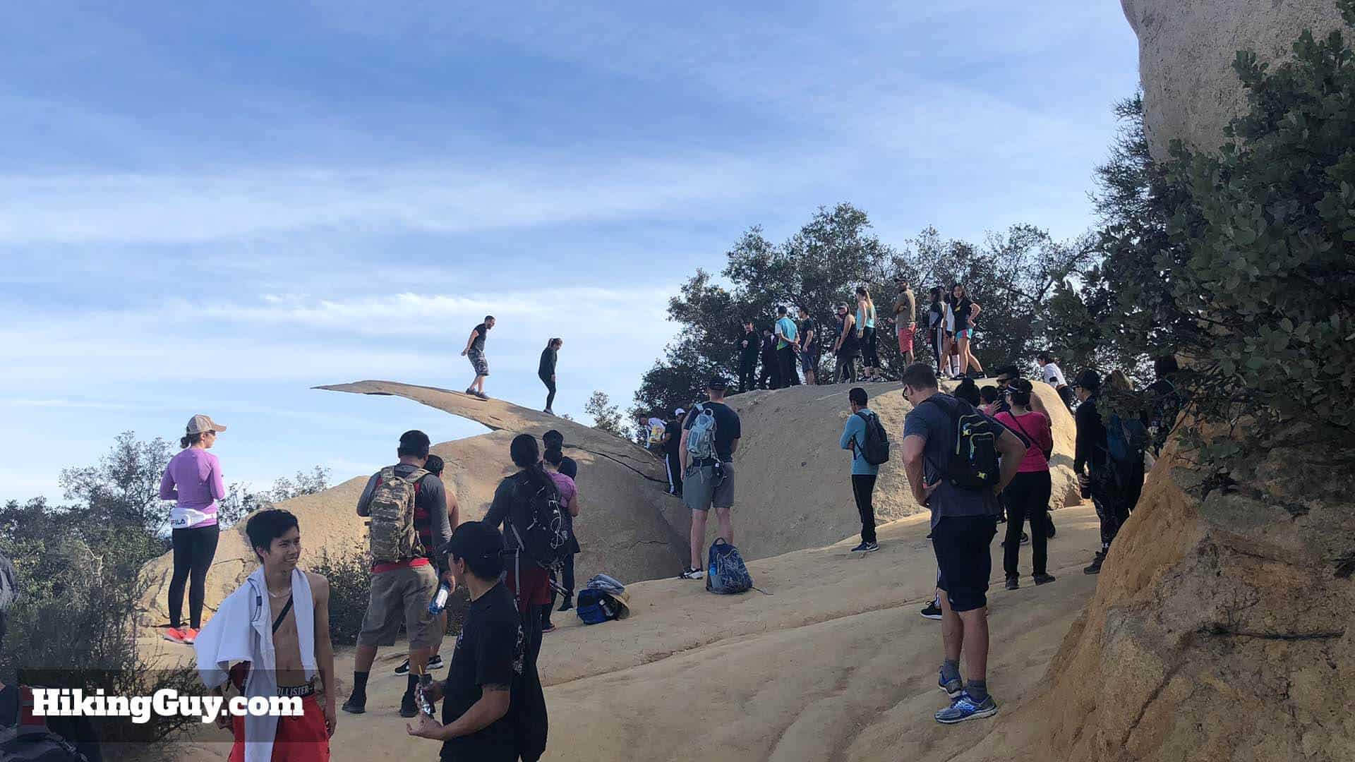
Yes, as long as you're not a dummy. People get hurt here when they do stupid things like hanging off the rock or trying risky poses. If you fall off the rock, it's about a 40 foot fall. I've been there when a kid was hanging off, fell, and had to get rescued.
There's a small hop onto Potato Chip Rock, and when people land on the rock, it can vibrate a bit which can be scary. When you're standing on the rock, it's not too bad, and you won't fall hundreds of feet if it breaks. You might break a few bones, but you'll survive.
What You Need For the Hike
There is no shade on the trail and it can get brutally hot here (which is another reason to leave early). I see people doing this with a single bottle of water and it's just not enough. Bring at least 1L of water, I bring 3L.
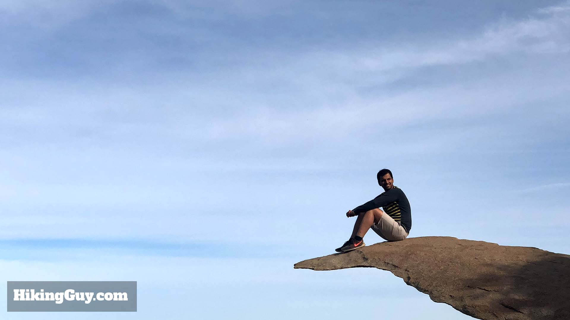
And if you want the pictures of yourself standing on Potato Chip Rock, it's best to do this hike with another person so you can take pictures of each other. Selfies don't work, you have to have someone else take the picture. You could try it with a tripod and Bluetooth remote, but I'm not sure if the Bluetooth range is long enough.
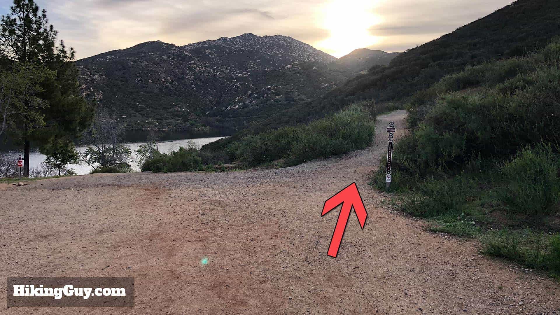
After winding around Lake Poway, you head up the slopes until you reach Mt Woodson.
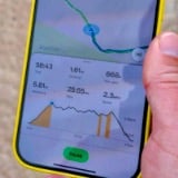
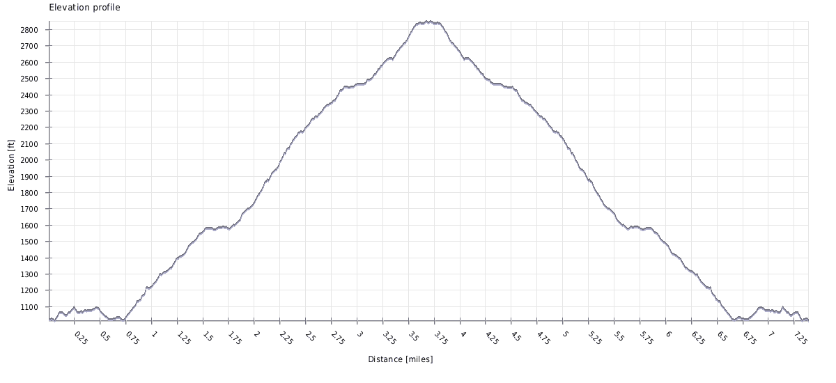
Elevation Profile
This hike is mainly uphill, but you can see there are a few sections where the gradient eases up and you can catch your breath.
Potato Chip Rock Hike Directions
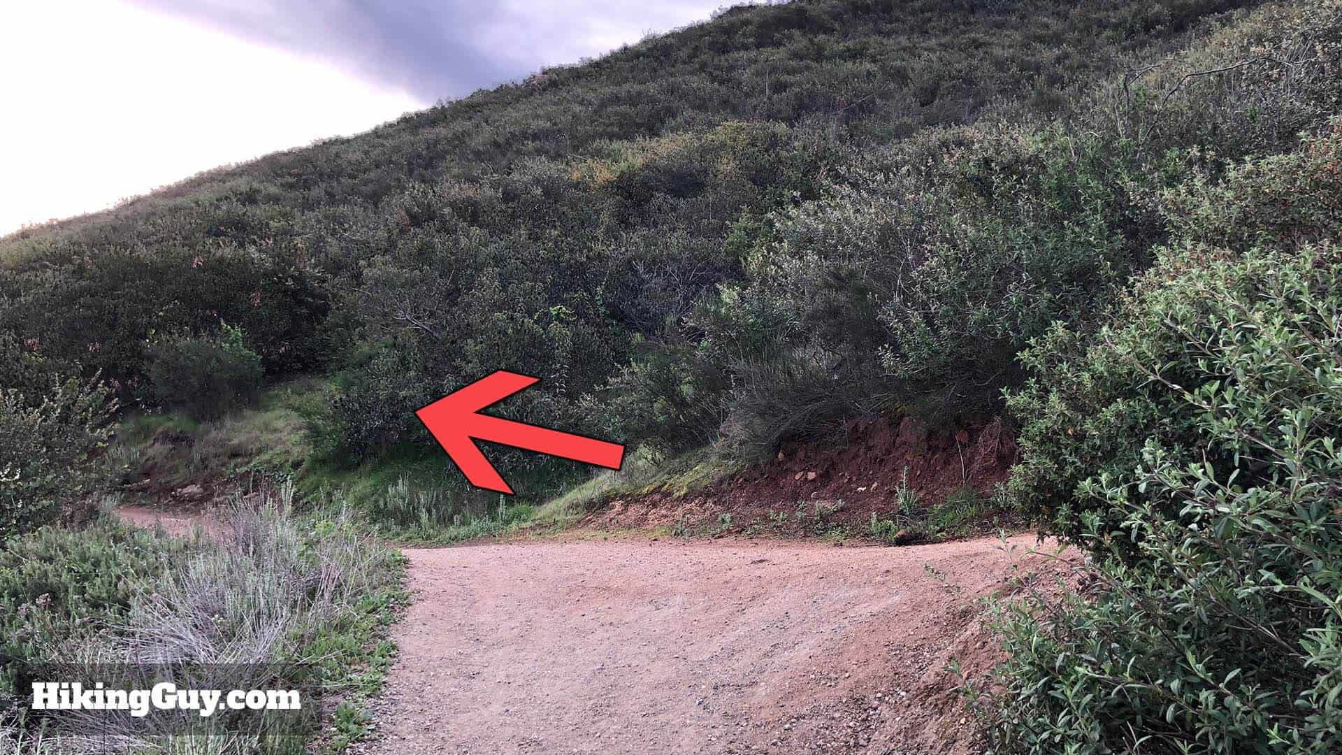
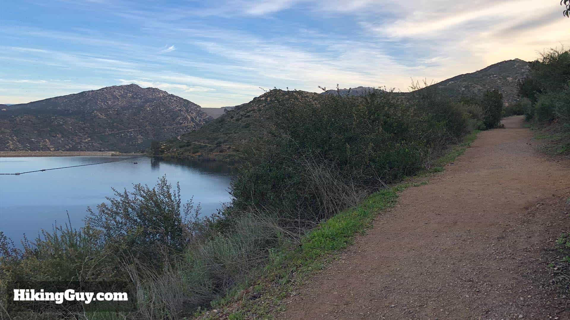
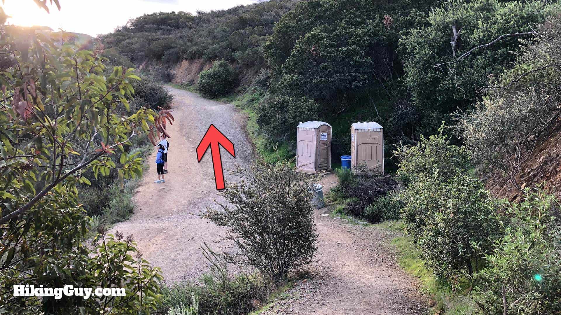
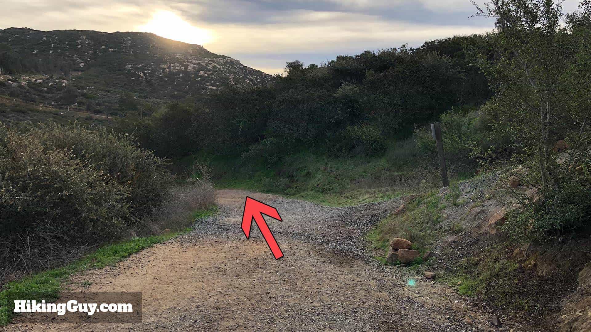
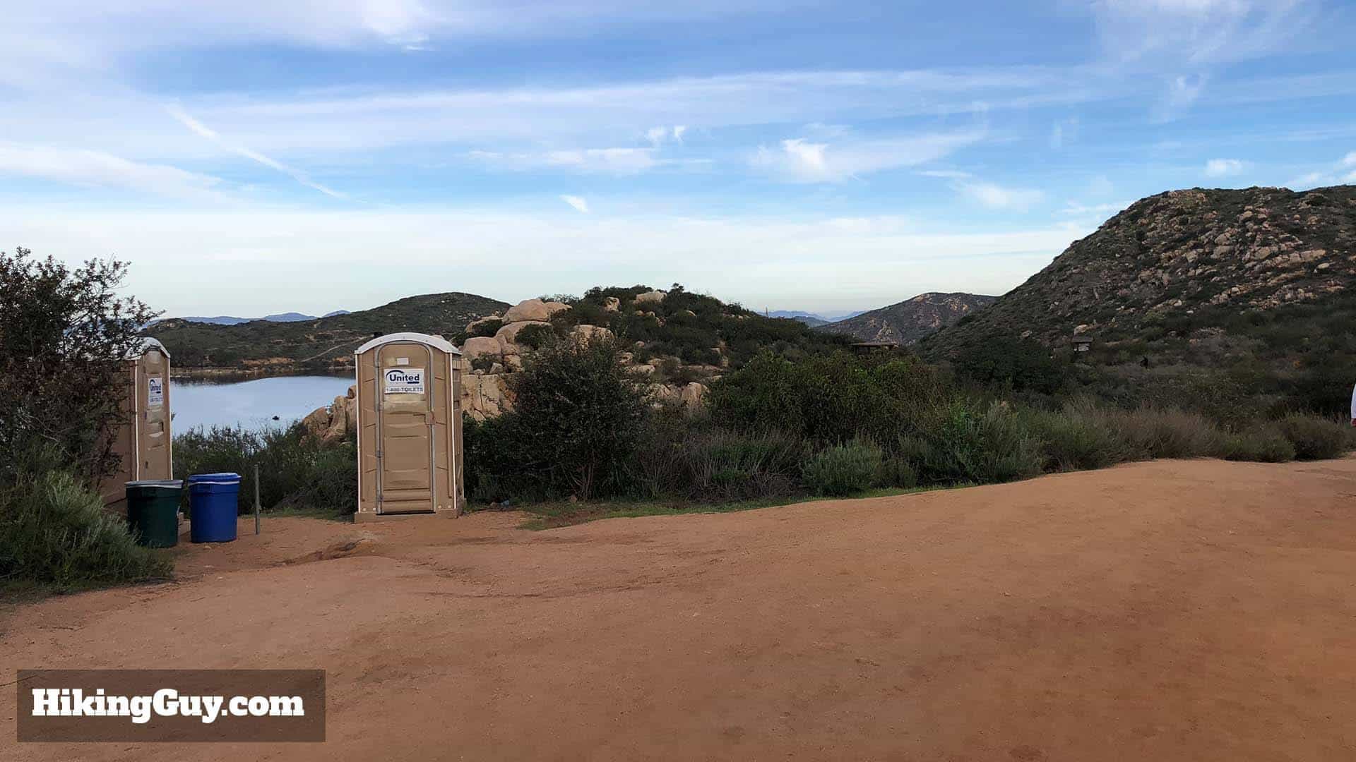
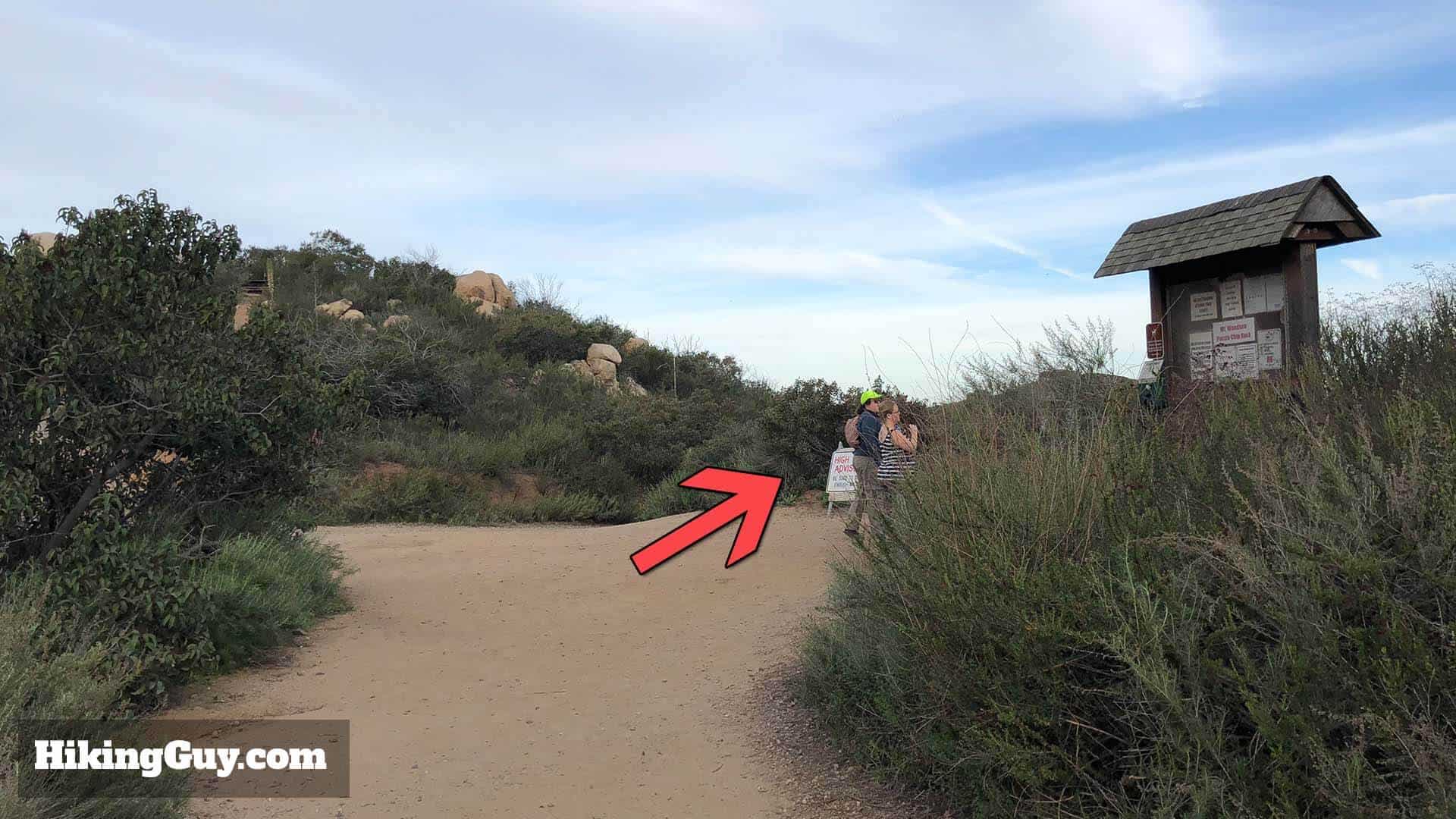
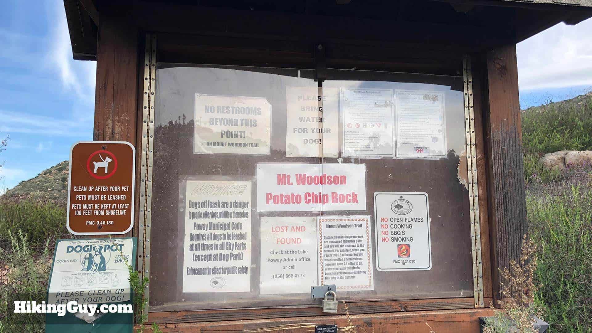
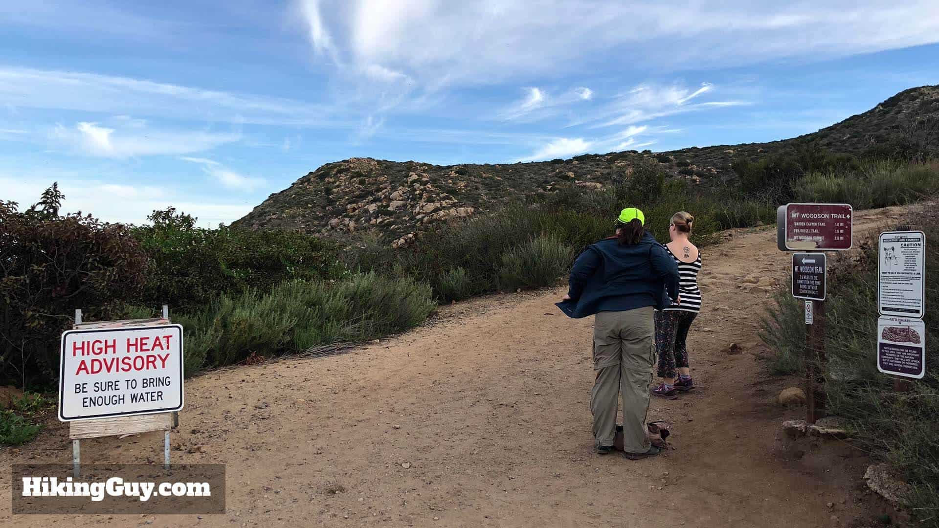
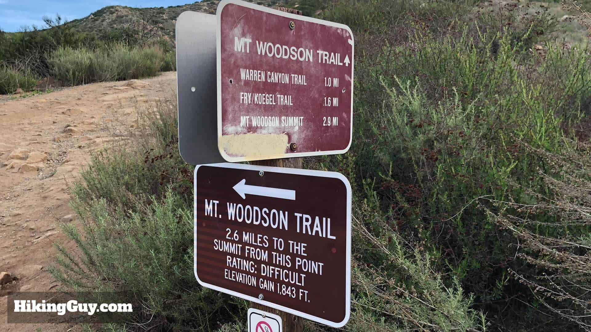
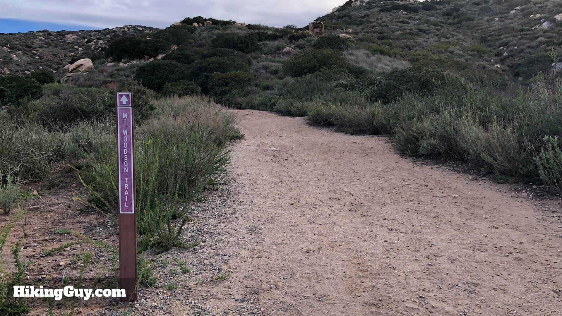
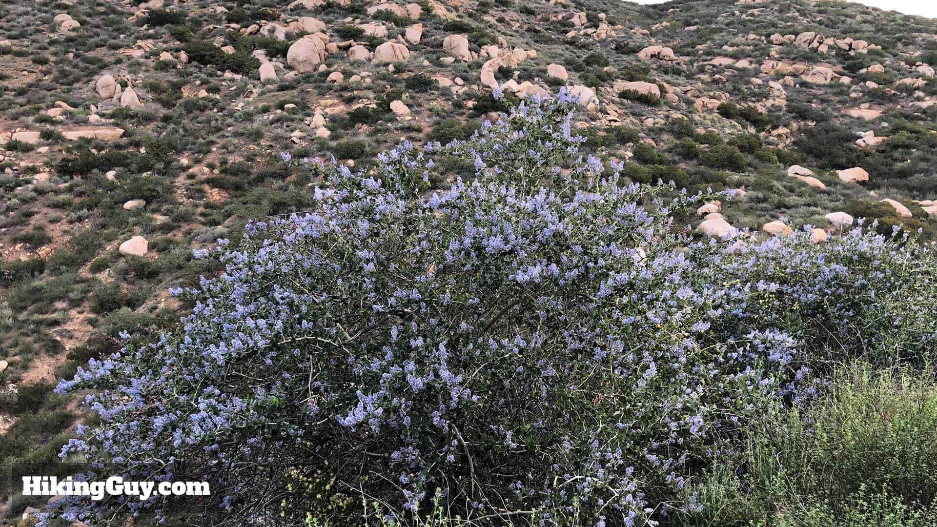
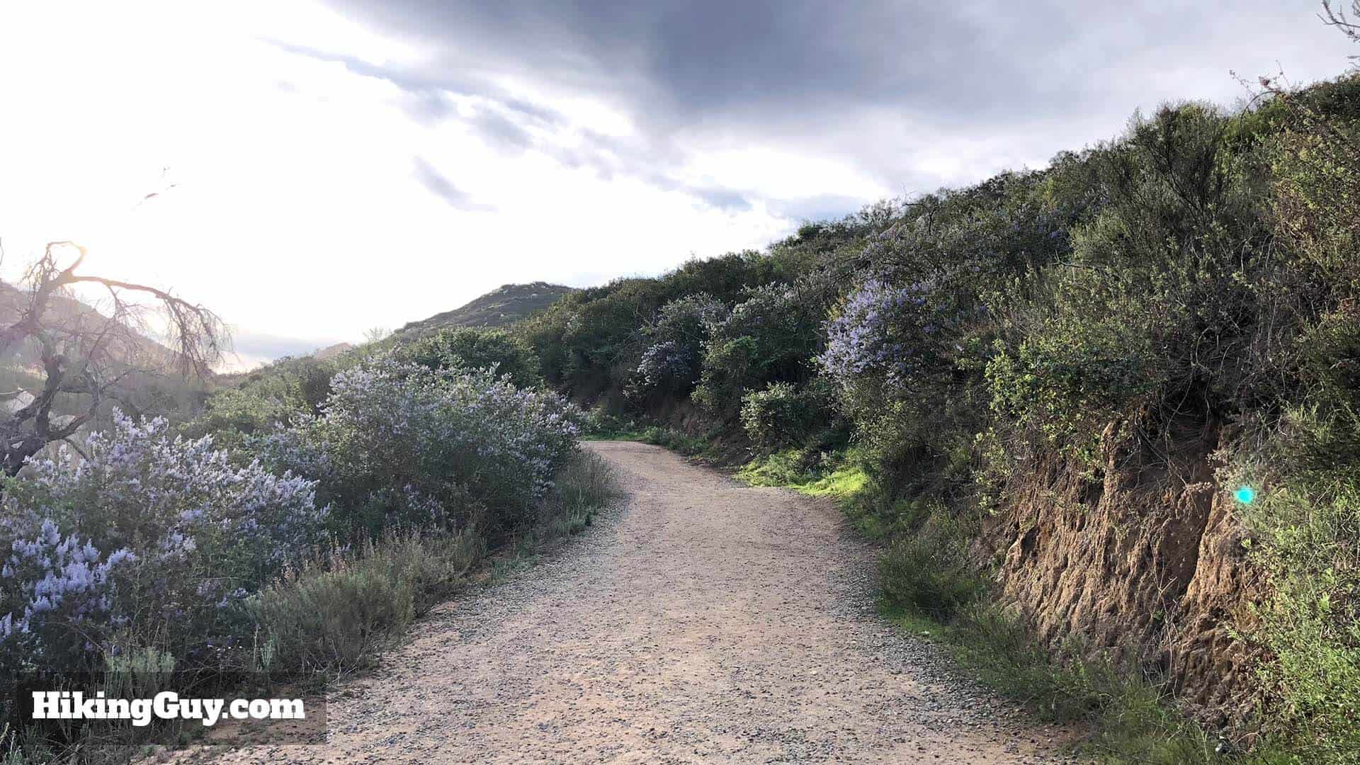
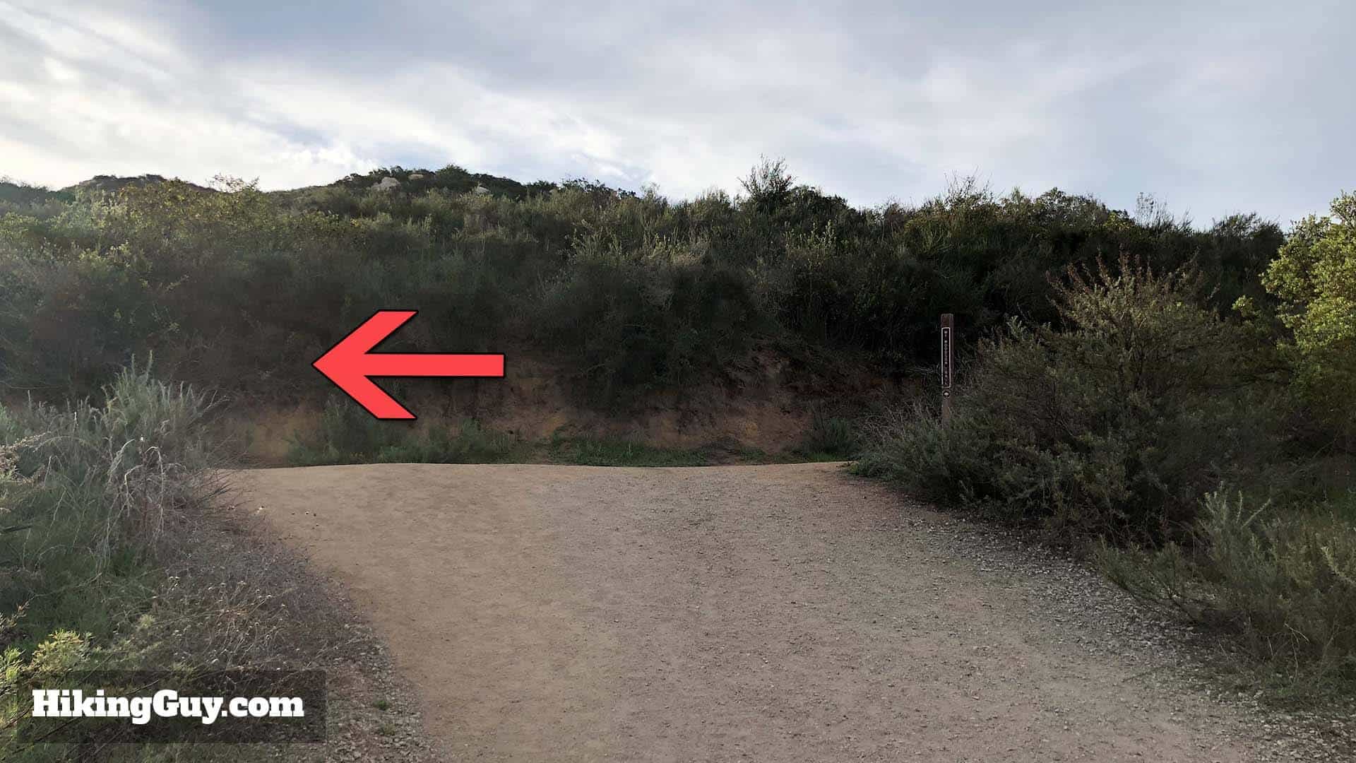
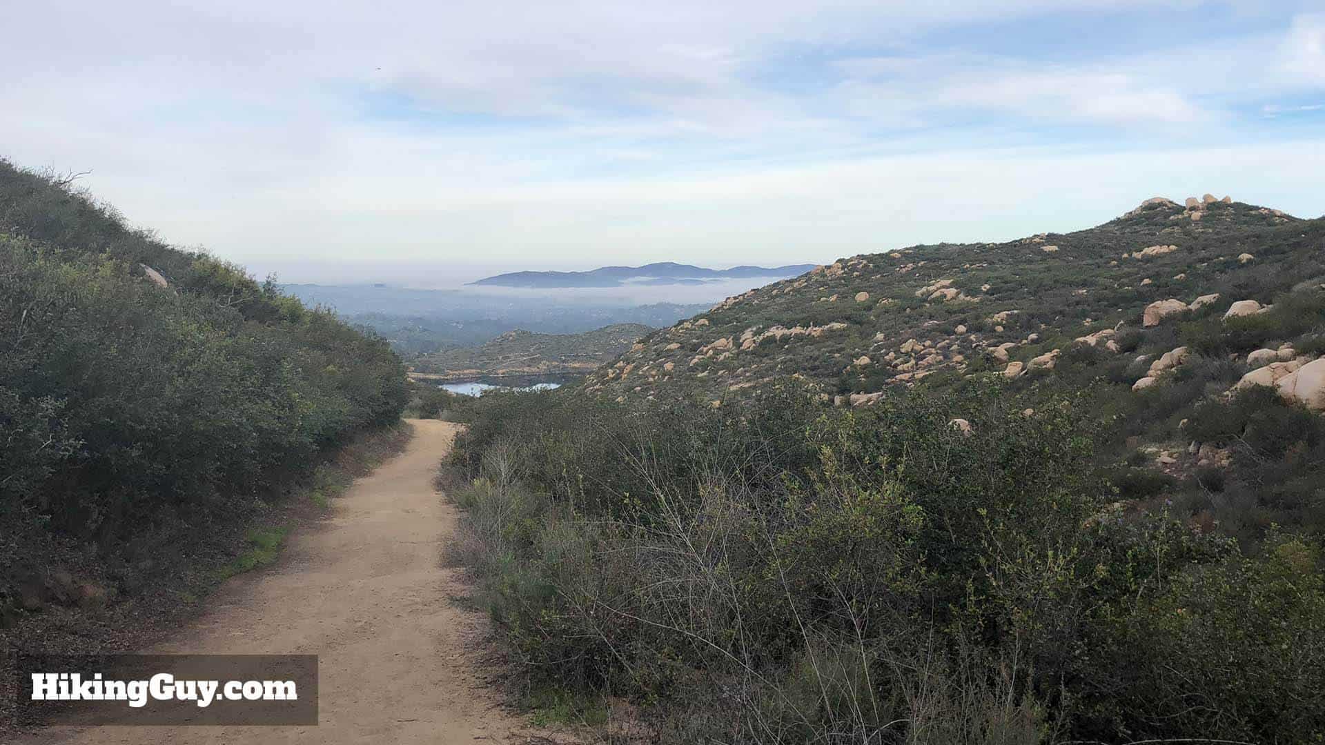
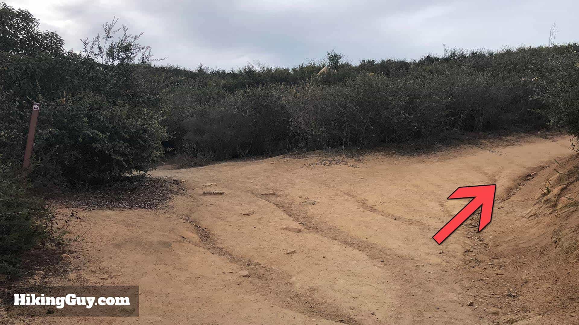
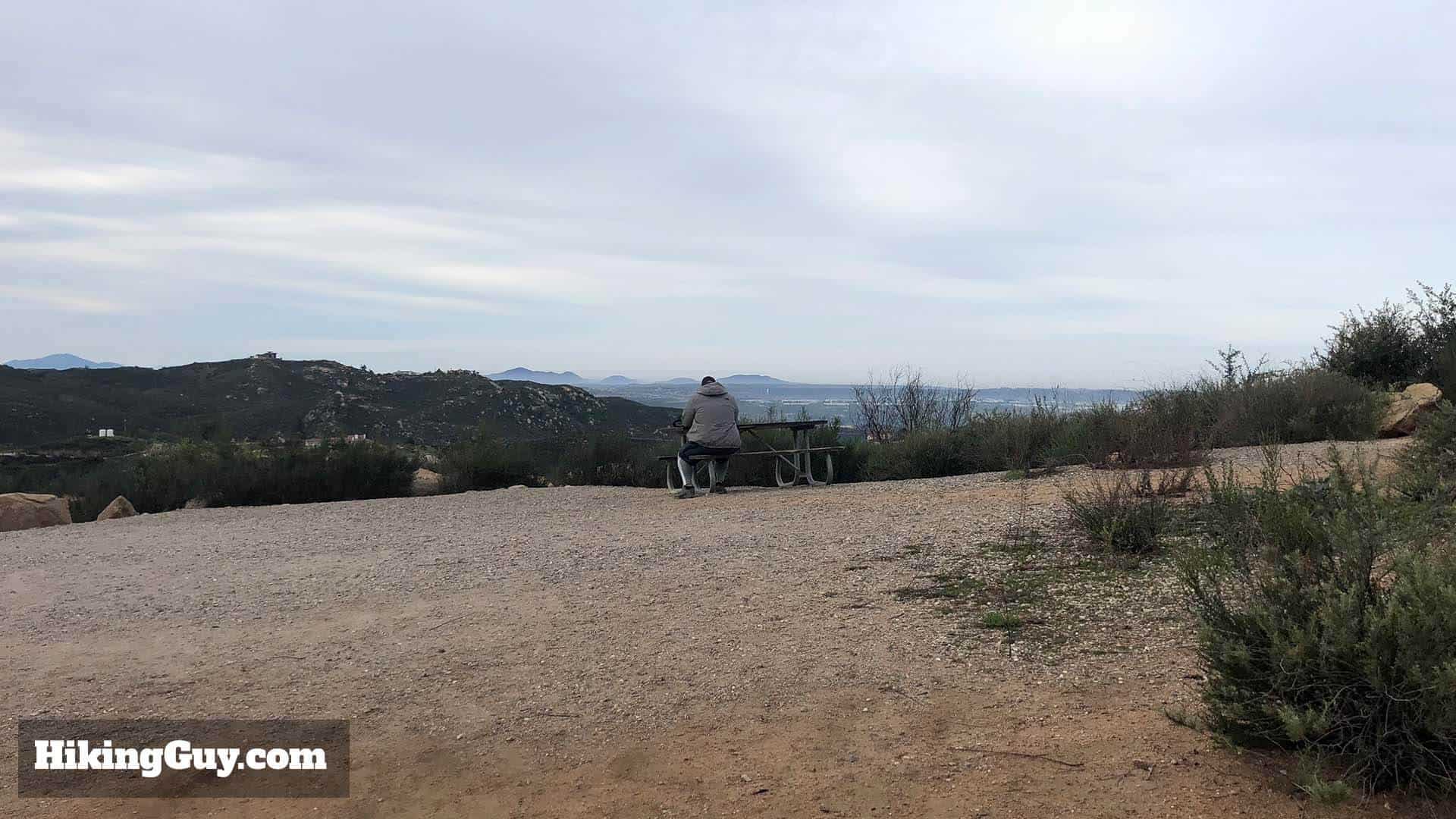
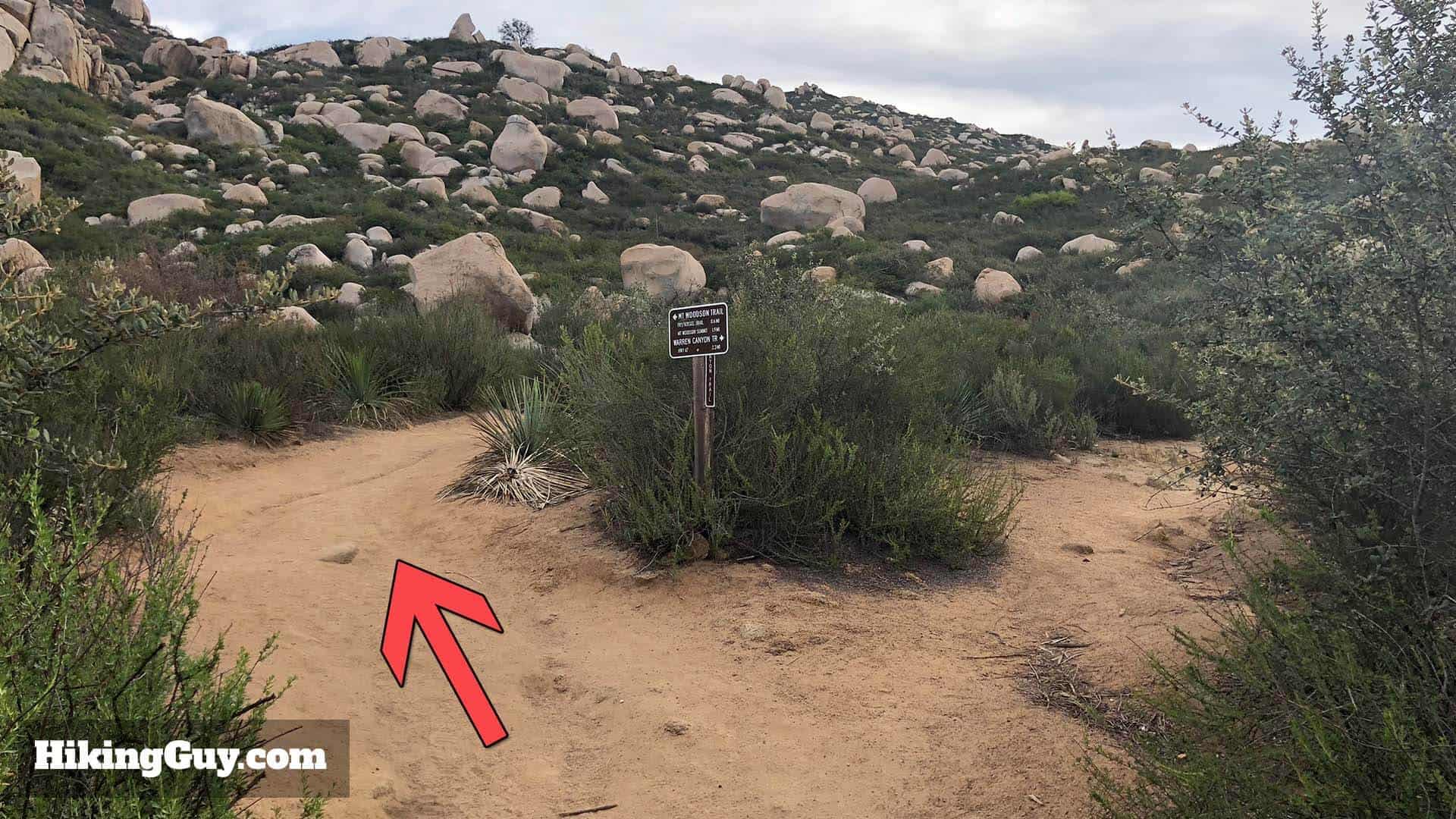
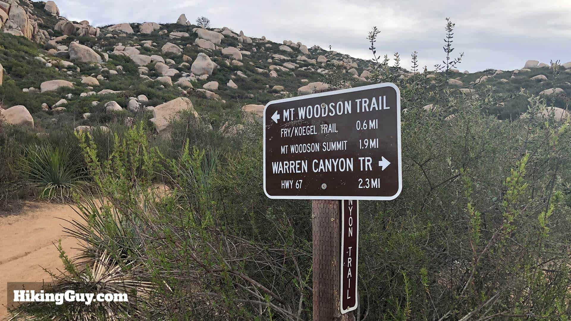
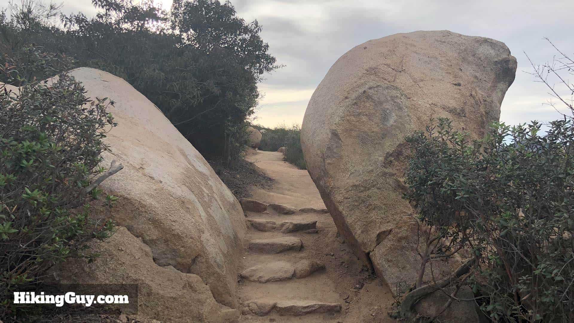
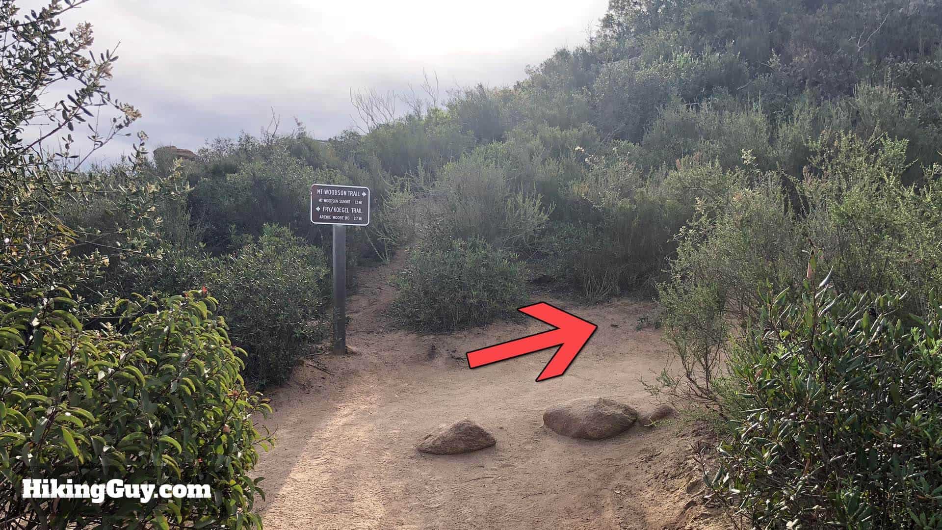
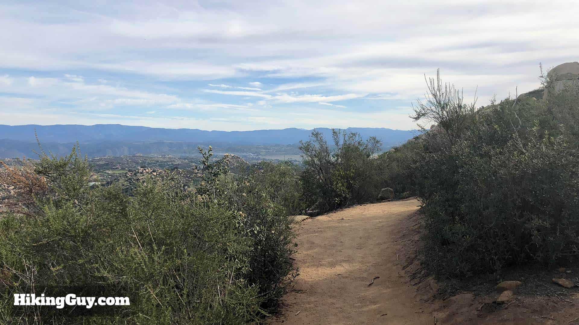
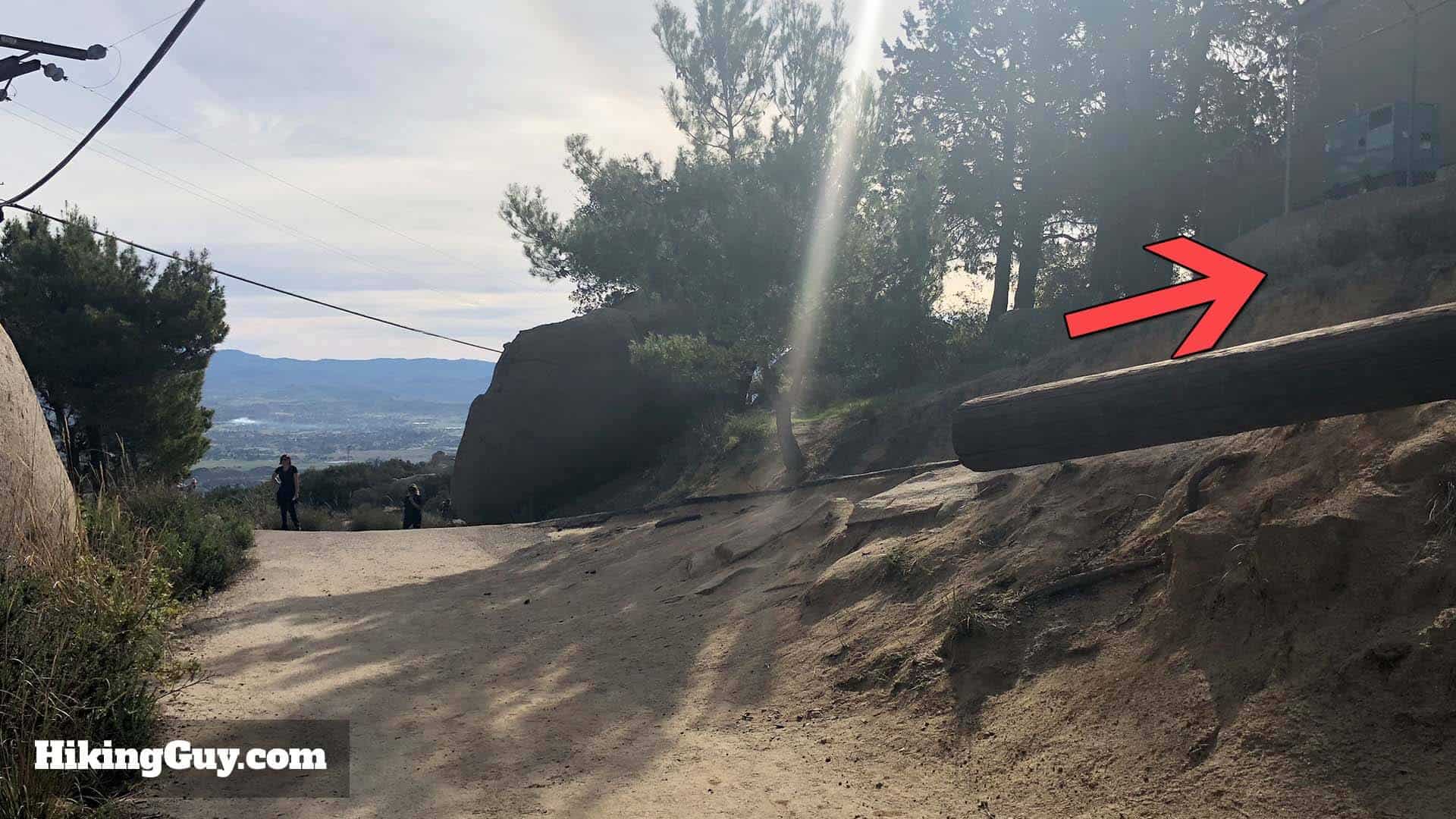
Head to the far end of the parking lot from the earlier directions. The building on the right is a bathroom with water fountains. Take care of any business and head around the building to the right. You'll cross over some grass to the trail. The official trailhead is on the right side of the bathrooms, but the entrance to the bathrooms is on the left side, so I usually go this way.Once you start on the trail past the bathrooms, bear to the right on the Sumac Trail (not marked as such though).Shortly after that, continue left above the lake, avoiding the trail that joins from the right.You'll be hiking above Lake Poway to your left. This part of the hike is really beautiful. The lake is stocked with fish and you might see some folks trying to catch them.At this junction, continue straight to head towards Potato Chip Rock and Mt Woodson. The left takes you to the lake.Avoid the trail that joins from the right and continue hiking left, around Lake Poway.Here's the most important junction, the trail to Mt Woodson. You'll see some porta-potties here, which is your last bathroom opportunity.To the right of the bathrooms is the Mt Woodson Trail. Make a right at the board.Make sure to check out the hiking board for any recent trail info and standard warnings to not doing anything stupid.The start of the Mt Woodson trail also has signage about the heat and water. There are a ton of folks who do this hike unprepared. If you're reading this article, hopefully, you're not one of them.Here's the sign at the start of the Mt Woodson Trail.From here the trail goes up. It gets steep but it's not crazy.Keep your eyes open for lavender in bloom.You're basically staying straight on the Mt Woodson Trail until you reach Potato Chip Rock. Continue climbing.Afger that stay left on the main trail, avoiding the side trail to the right.If the hike gets too steep, stop, turn around, and enjoy the sweet views of Lake Poway and the surrounding mountains. It's a nice way to catch your breath.Keep staying on the main trail and avoid the unofficial cutoff to the left. You'll be rewarded with some nice views in a minute.Now you reach a nice wide area with a bench. The views from here are great, and if you're having a tough time, it's a great place for a break.After continuing for a few minutes, you'll reach the junction of the Warren Canyon Trail. Hike to the left towards Mt Woodson.Here's the detail of the Warren Canyon Trail sign.This next part of the hike is one of my favorites. The Mt Woodson Trail makes its way up through a very funky boulder field.The boulders were formed by spheroidal weathering, where joints in the rocks eroded leaving just the boulders exposed, and weathered and smoothed over thousands of years.
e wilThis section has a few switchbacks, so make sure you stay on the official trail and avoid any cutoffs. The views of the surrounding mountains and boulders is great. Local Native Americans called Mt Woodson "Mountain of Moonlit Rocks." It didn't become Mt Woodson until 1895 when it was named after a settler who moved to the area.
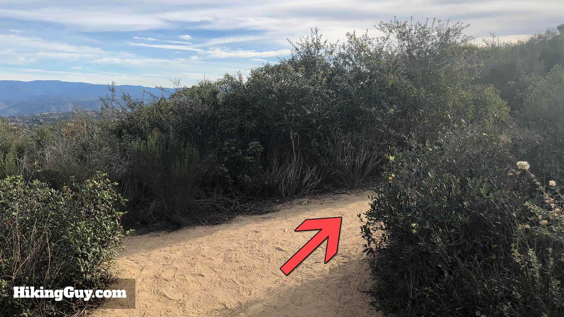
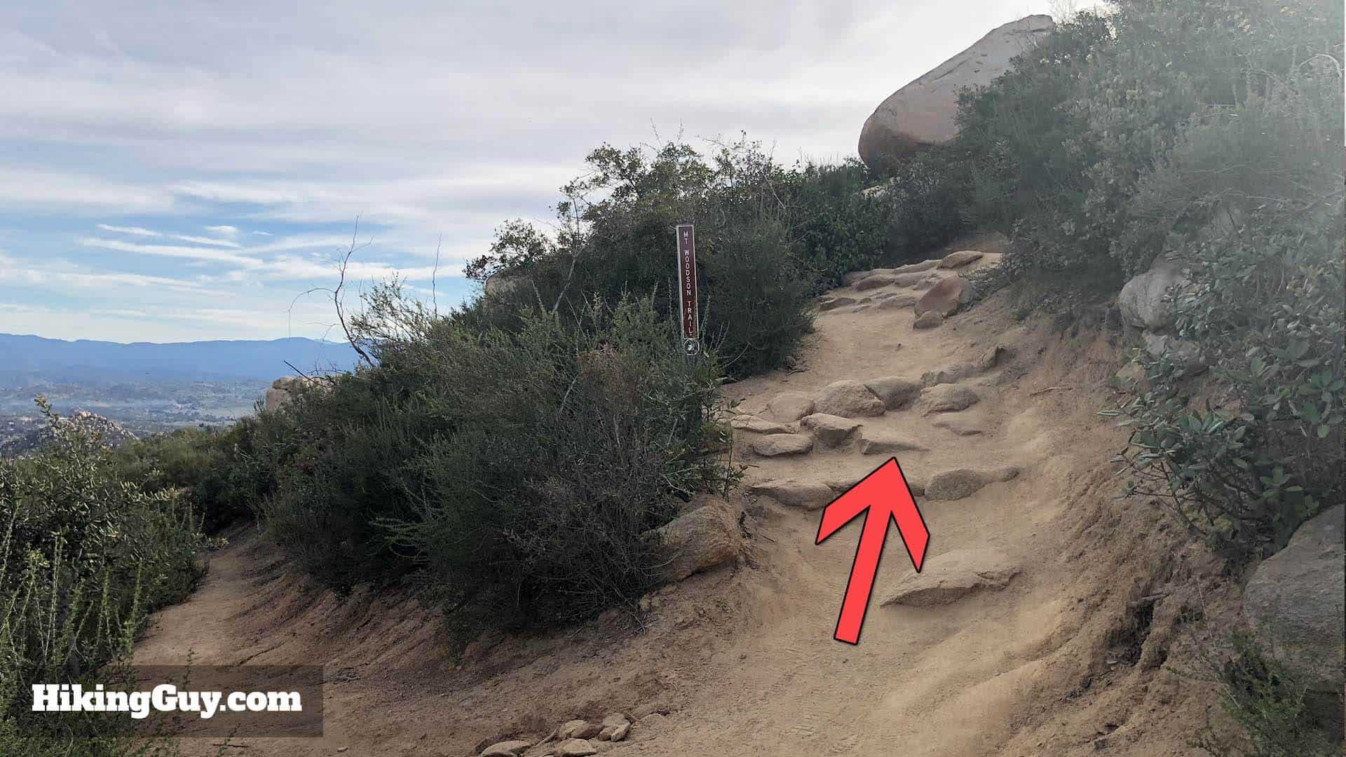
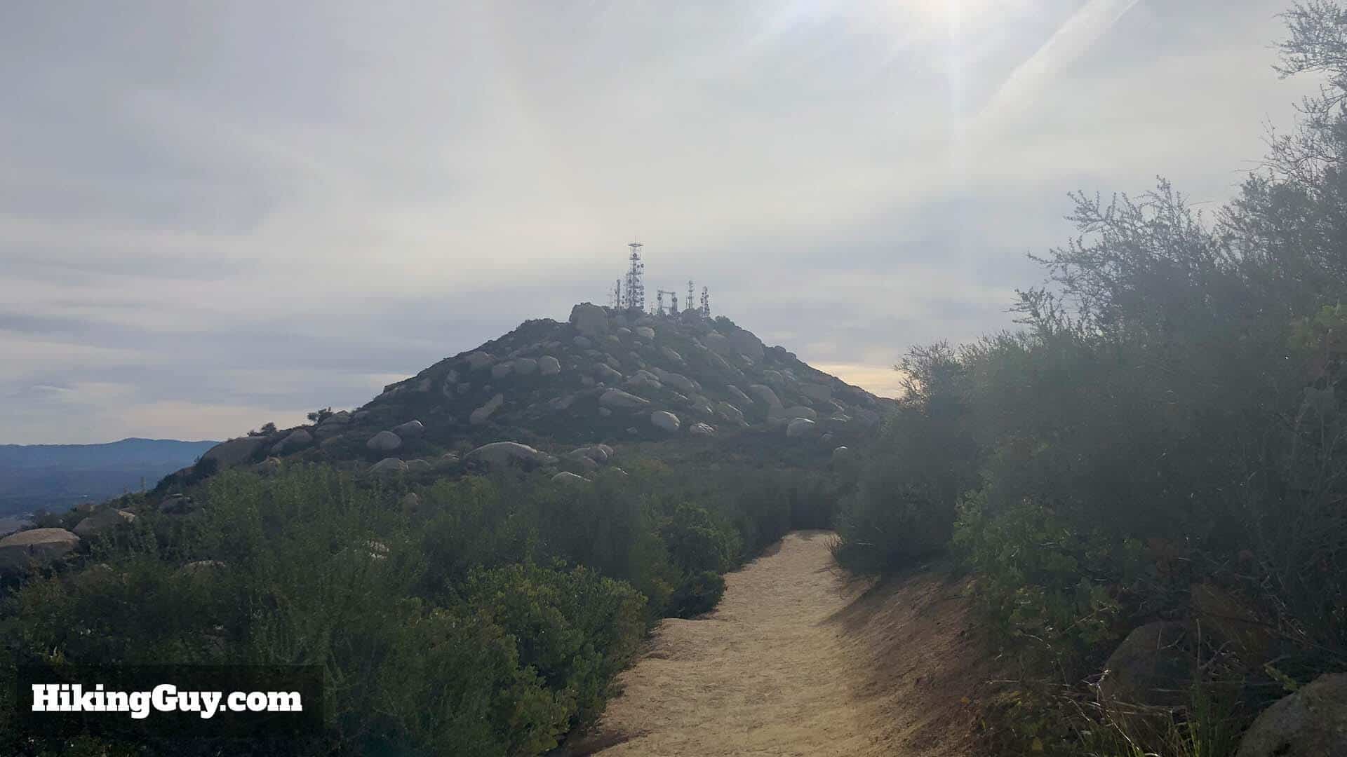
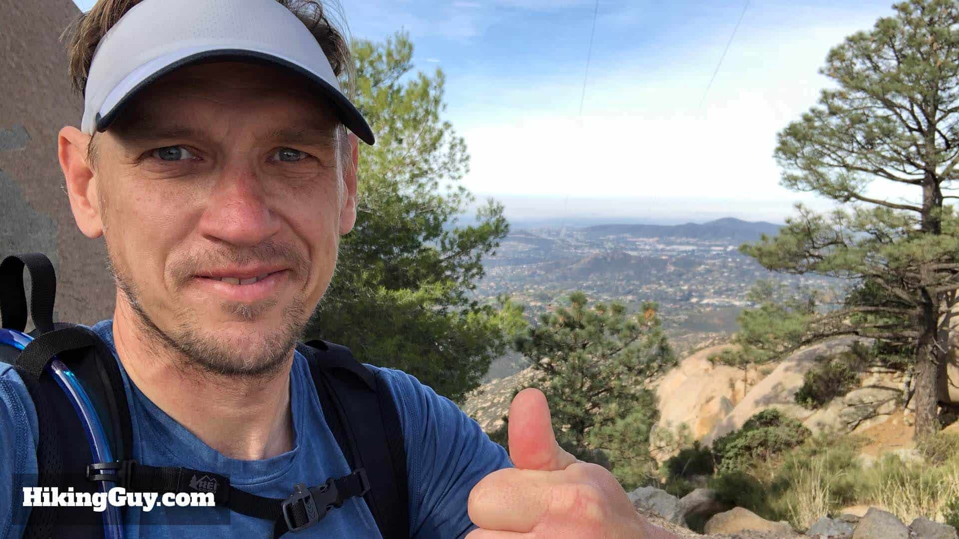
After the boulder field, you'll reach a ridge. Keep right.Right around that turn, you'll have another split, stay right again.Right after that last turn, you'll see a pole marker confirming that you're on the Mt Woodson Trail.This section is relatively level and offers some great views to the east and west as the trail follows the ridgeline.Stay right on the Mt Woodson Trail.You'll start to see the radio towers on top of Mt Woodson in the distance. Almost there.You'll know you're at Potato Chip Rock when you see the crowd. If you time it wrong, there can be 100+ people here. Wait in line to get your photo (or just skip it).If you want a picture, make sure you have someone else to take the shot for you. Selfies don't work here.You've come this far, so now you might as well visit the summit of Mt Woodson. Keep hiking for a minute up the trail past Potato Chip Rock.Take the hard right toward the radio towers.Boom! You're on the summit of Mt Woodson. From here, just go back down the way you came to finish the hike.