
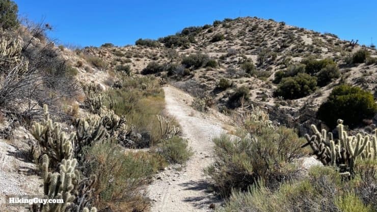
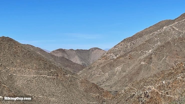
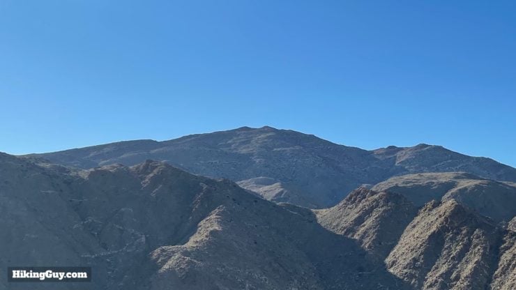
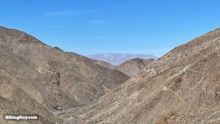
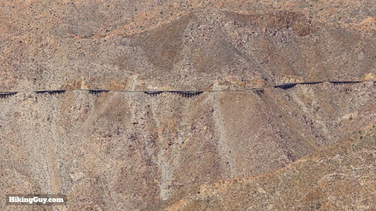
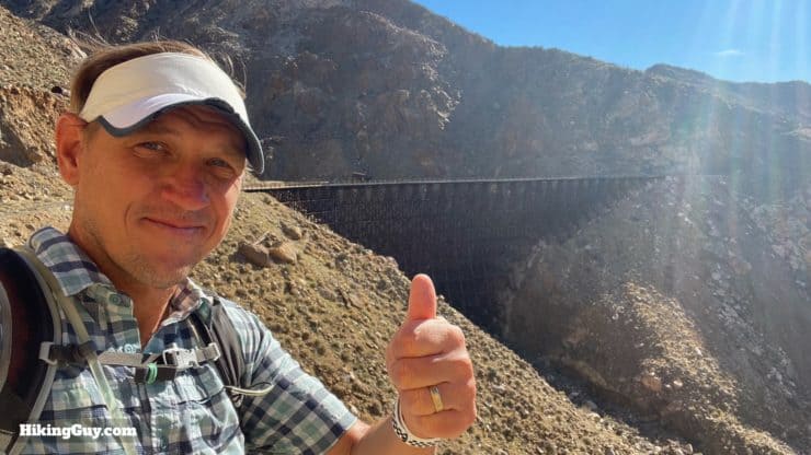
The Goat Canyon Trestle hike is iconic: a meandering trail along what is dubbed "the impossible railroad," through the spectacular Carrizo Canyon, and finally to the world's largest wooden trestle bridge, hidden miles away from civilization. Although not offering any big mountain climb, it is a strenuous hike through a harsh desert environment, with over 16 miles of distance to cover.
- Video and Turn-by-Turn Directions to Goat Canyon Trestle
- Where to Park for the Goat Canyon Trestle Hike
- Navigating the Tunnels & Bridges
- Insider Tips and Recommendations for the Hike
The hike described in this guide is on private property, which you may not be authorized to use. Please hike safely and obey all laws and guidelines set out by the property owners and law enforcement. If you are not allowed to be on this private property, the information presented here is for entertainment purposes only.
How to Get to the Goat Canyon Trestle
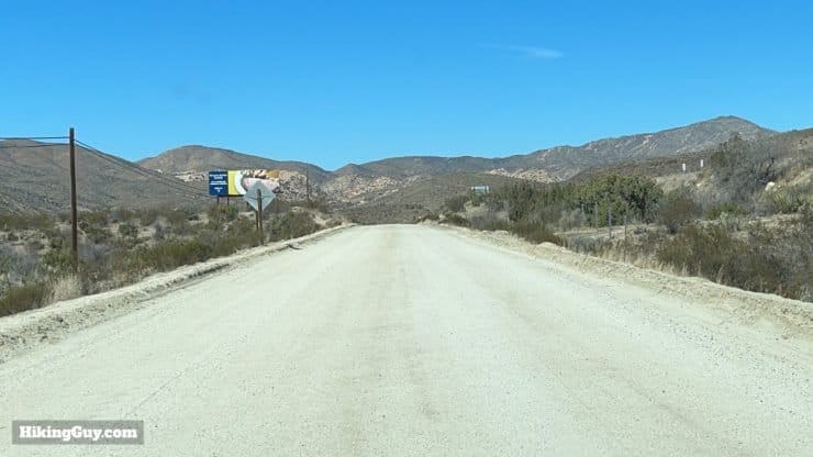
There are several routes to reach the Goat Canyon Trestle, all of which involve walking or biking, and all accessing private property at some point. This route to Goat Canyon Trestle starts in Jacumba Hot Springs, and is generally considered the most popular way to access the trestle, whether by hikers or by mountain bikes. You'll be parking just over 2 miles north of the Mexico-US border.
Use this trailhead address:
1800 Carrizo Gorge Rd, Jacumba Hot Springs, CA 91934
There are no bathrooms or water fills at the trailhead.
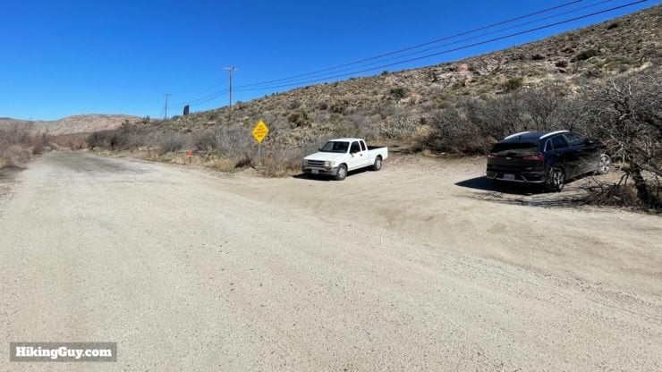
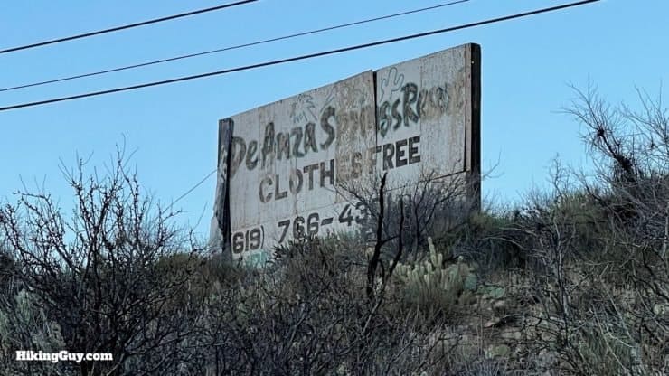
There have been some reports of free parking spots being blocked off. I've also heard that folks are able to call De Anza Springs Resort and pre-pay for parking if you'd like to arrive early. It's probably smart to give them a call and do it that way.
Gear For the Hike
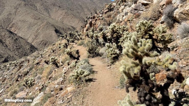
As you'd imagine, at 16 miles, this is a "hike hike", even if there's not a lot of elevation change. The conditions are harsh, and aside from the tunnels, there is no protection from the elements.
- When it's hot out, don't do this hike. The winter offers mild and even cool temperatures in the region and is a great time to visit.
- Bring lots of sun protection and at least 3L water.
- A satellite communicator is great if you have it. Although the hike is popular, I've been here plenty of times without seeing anyone, so you can't count on passing hikers for help.
- Bring layers in case it's cooler or in case you have to overnight because of an emergency.
- You'll benefit from a headlamp or flashlight in the tunnels.
Gear That I Love Right Now
Nothing is sponsored or promoted, just the actual gear that I use.


Check out the complete list here. ( Updated July 2024)
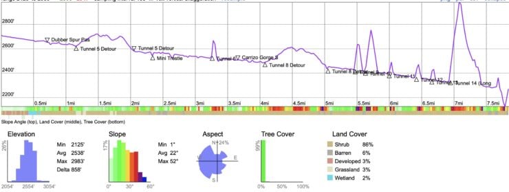
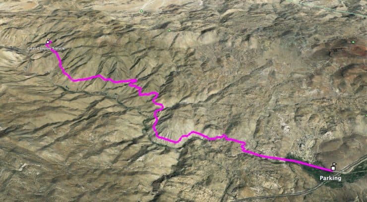
Goat Canyon Trestle Trail Map
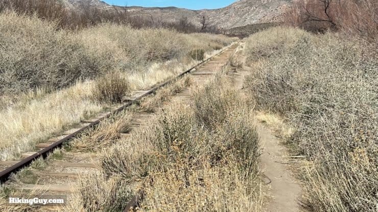
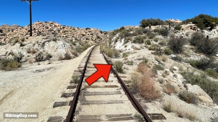
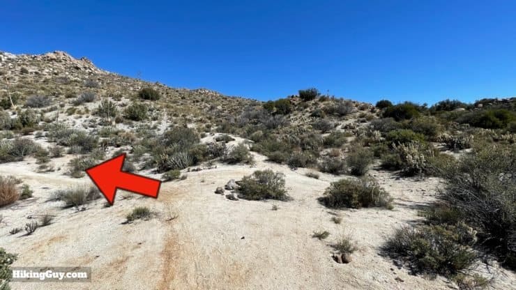
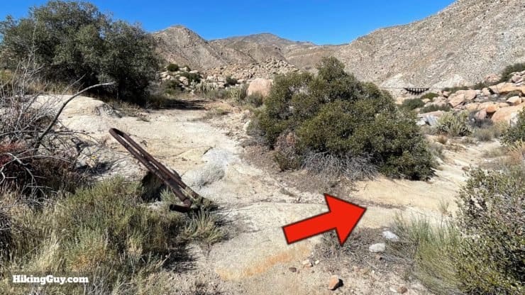
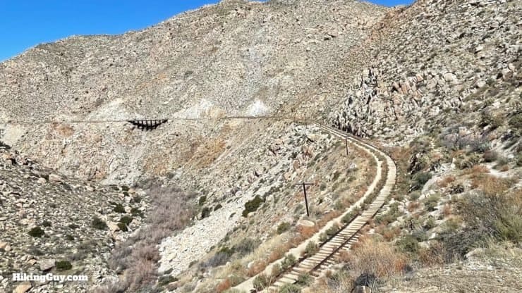
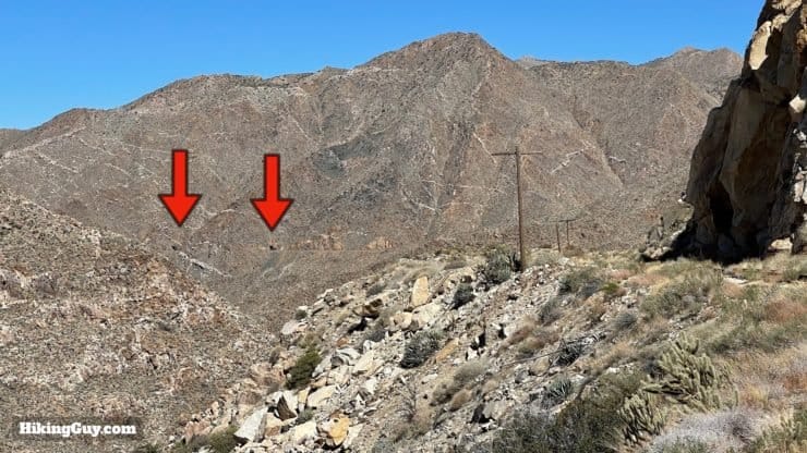
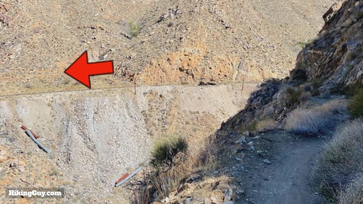
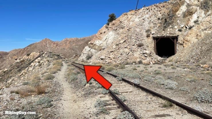
Aside from a few stretches of trail, you'll be hiking along the railroad tracks for most of the way, so it's very straightforward. I've included lots of waypoints in the map and GPX file below so that you know what to expect. And remember that your GPS won't work in the tunnels.
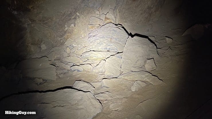
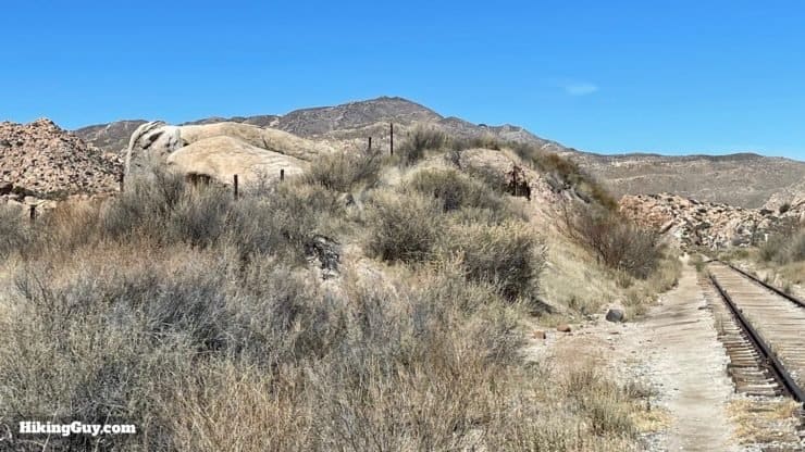
Some of the tracks, bridges, and tunnels on the hike are over 100 years old. The area is prone to rockfalls and seismic activity. Extreme care needs to be taken when navigating this hike.
How Will You Navigate?
 Using the Apple Watch for Hiking
 Garmin Fenix 7 & Epix Review For Hikers
 How To Read a Topographic Map
 Garmin GPSMAP 67i Review
Elevation Profile
3D Map
This Hike Is On Private Property
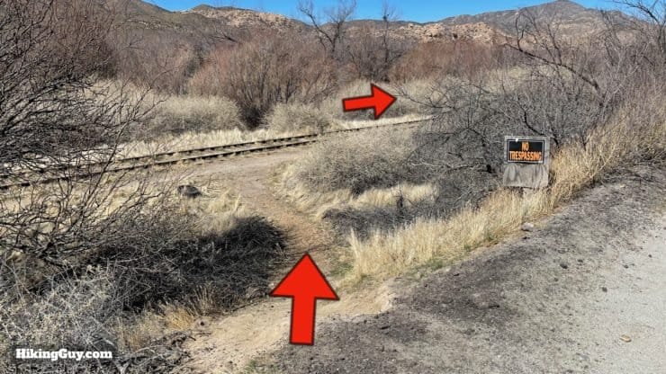
Let me reiterate, this hike is on private property and there are numerous "no trespassing" signs, so you should only be on the land here if you have permission. Depending on what is happening at the time with the railroad (more below in the hike brief), there may be railroad personnel along the route. If you are caught and the owners decide to press charges, you could be ticketed, fined, etc. However, there are many times that hikers pass along the route without seeing any officials and without any problem.
Hiking there has always been illegal, but it’s always been overlooked.Reena Deutsch, a UC San Diego professor who gives talks on the history of the railway
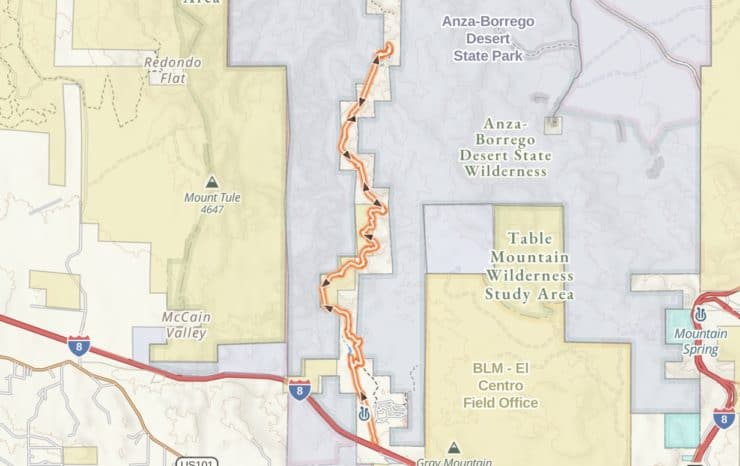
There are several other routes to Goat Canyon Trestle, all of which have their challenges. If you want to try the hike with minimizing your time hiking on private property, the route to the trestle via Mortero Palms is your best bet. Most of the hike goes through Anza-Borrego Desert State Park, with 0nly the last part of the route being on private property. Know that if you do choose that route, it's a very challenging desert overland hike with boulder scrambles and minimal navigation aids. You can read about that route in Afoot and Afield: San Diego County. I've done that route and didn't feel comfortable recommending it to most hikers.
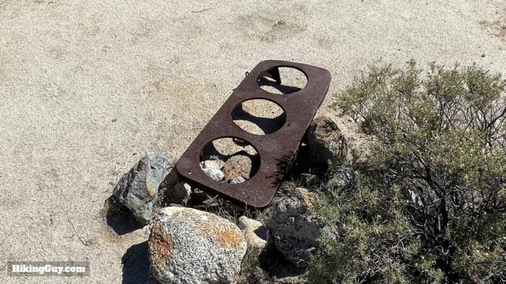
As you hike, you'll notice lots of railroad gear and equipment. This is all private property. Taking it with you is considered theft.
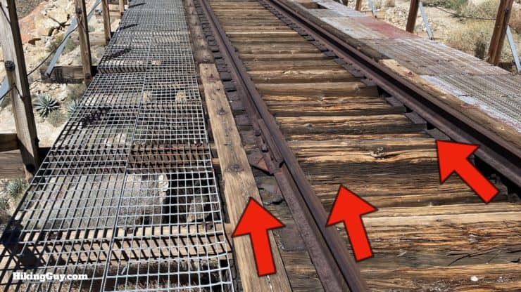
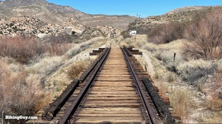
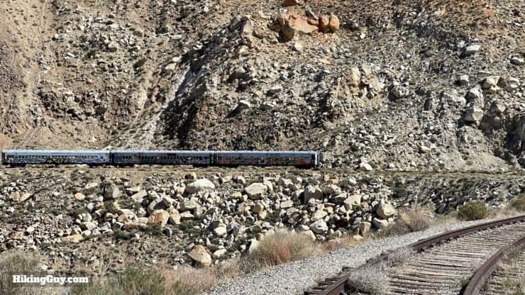
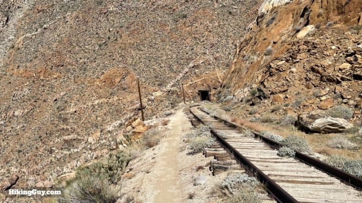
Walking the Tracks
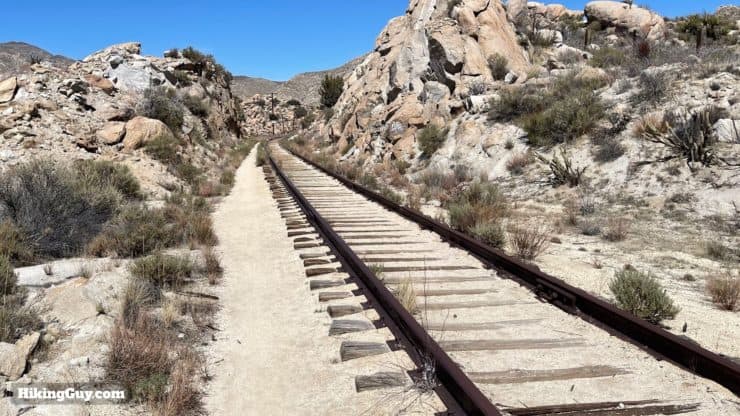
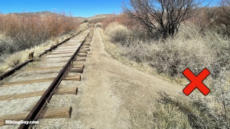
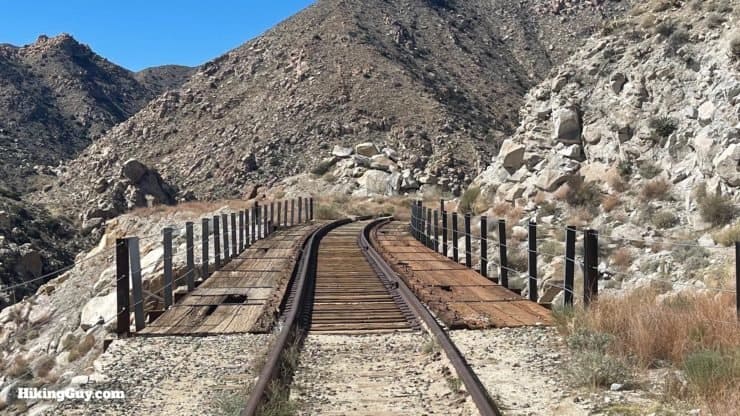
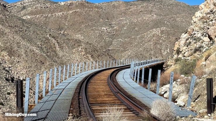
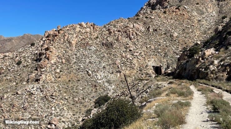
The good news is that you don't have to walk down the middle of the railroad tracks for 16 miles, which would probably drive most people insane. The tracks have a smooth walkway alongside where you can walk as normal. Some sections are smaller and rockier, but in general, it's always there.
As of the time that this guide was published, no trains running along this route. If you find that changes, please let me know. Theoretically there could be the odd maintenance train out there, but I believe the last one was in 2012.
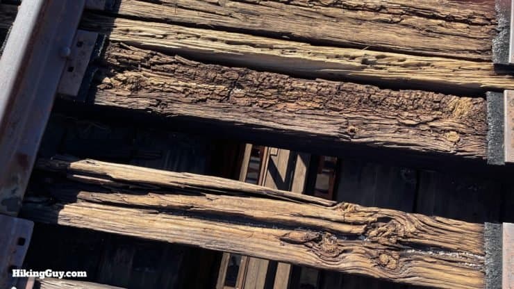
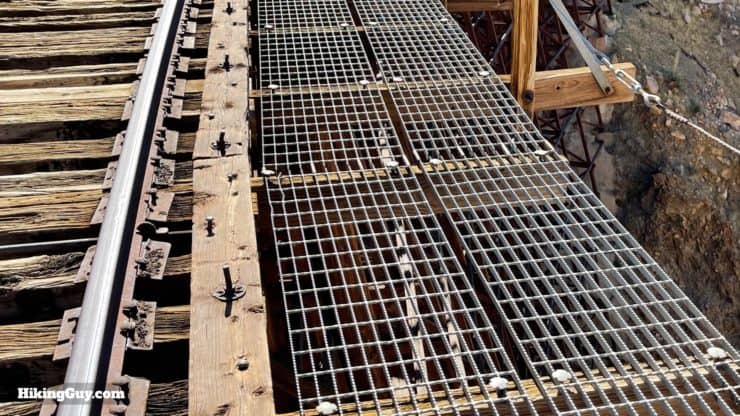
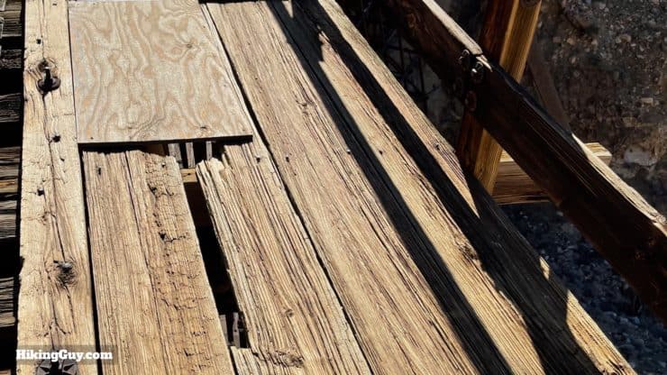
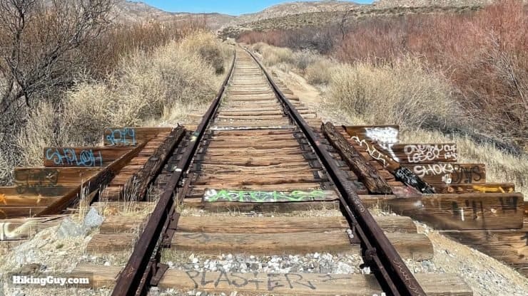
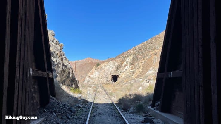
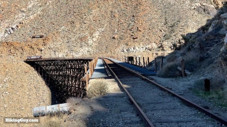
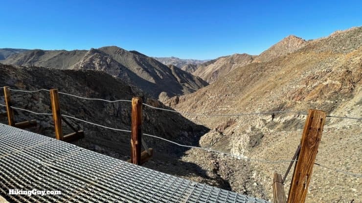
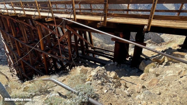
Crossing Bridges
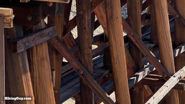
There are several bridges of varying lengths before you get to Goat Canyon Trestle. Because of the extreme conditions on this hike, the bridges are susceptible to decay from dry rot and other natural forces. Don't assume that stepping down will be safe. Always think wisely about where you are stepping and don't shift your weight onto a step until you know that it's safe.
If you are going to sit on the bridge or crawl around it, I've read reports of wood ticks (also known as dog ticks), so heads up. I've never had a tick on my leg from walking over the bridges.
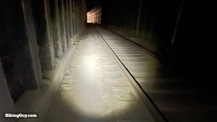
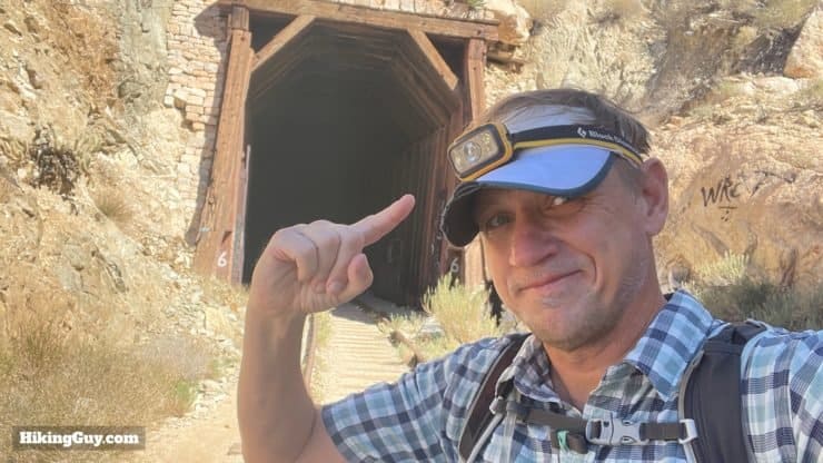
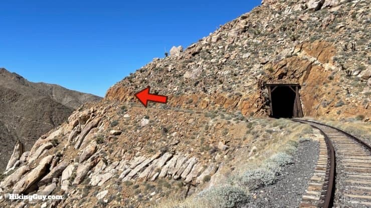
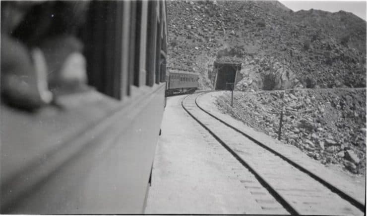
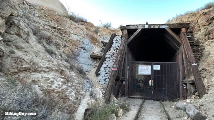
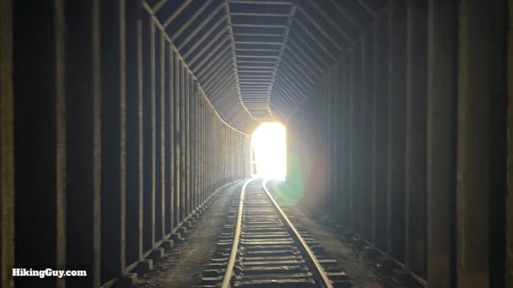
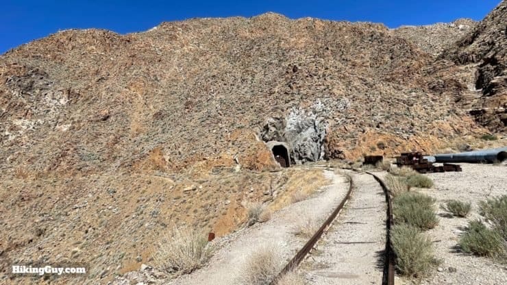
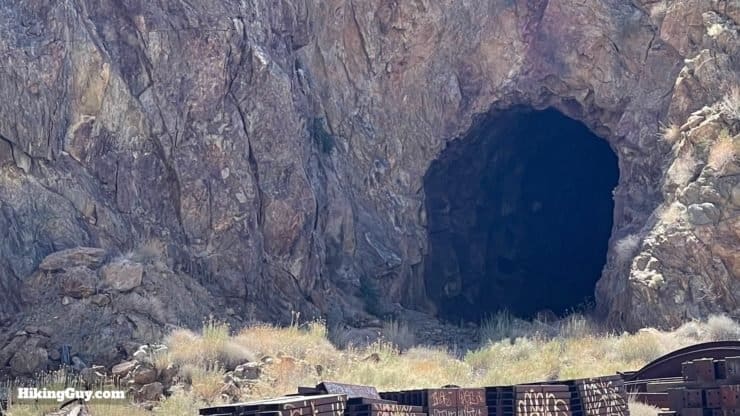
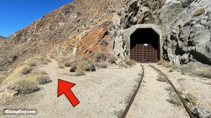
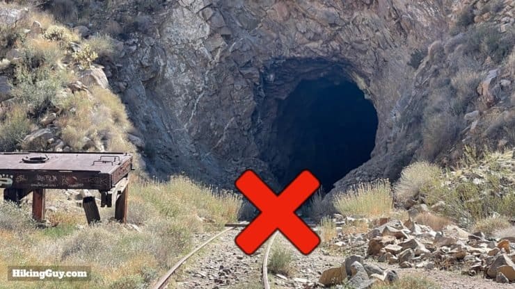
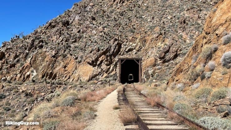
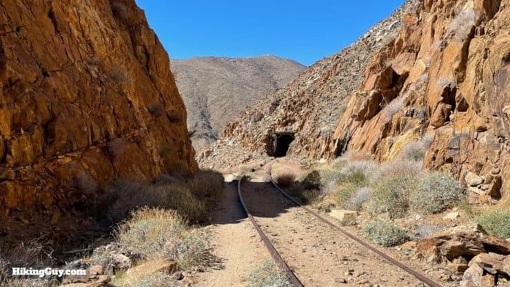
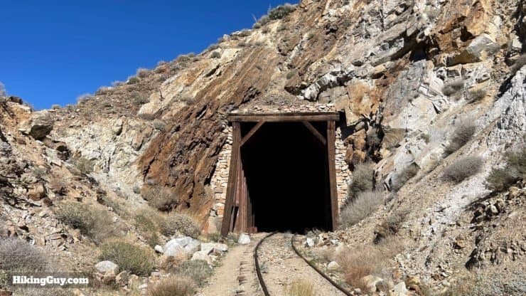
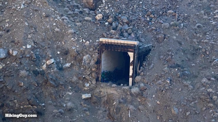
Navigating the Tunnels
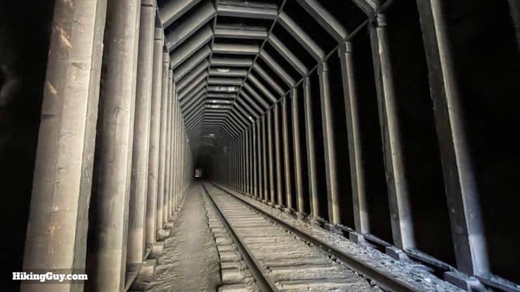
There are several tunnels along the hike that you'll have to pass through, ranging from 100 feet to 0.5 miles long. While at first, the tunnels may seem unnerving, after one or two, it's fine. Some tunnels are blocked off, in which case I'll show you the detour in the directions below.
Again, no trains are running, so you don't have to worry about getting stuck in a tunnel with one. And because I know people will ask, there are no bats or animals that I've ever seen in these tunnels. They cool, dark, and a nice respite on a hot day.
Goat Canyon Trestle on a Mountain Bike
You can do the route described in this guide to Goat Canyon Trestle on a mountain bike without having to carry the bike up over any scrambles or steep sections. That said, there are some extremely narrow sections and stretches that have cacti alongside, with little margin for error. Mainly this is on the detour around Tunnel 8. My advice is to just get off and walk through any really narrow sections and the bridges.
Hike History
There's a lot of history on the Goat Canyon Trestle hike. Let me point out the salient points for this adventure.
- You'll be hiking up the Carrizo Gorge, along a stretch of the "Desert Route" of the San Diego & Arizona Railway, also known as the "Impossible Railroad" because no one thought a rail line could be built there. The Carrizo Gorge section of the line was considered an engineering marvel when it opened in 1919, and is featured on the companies advertising (and you can even get your own poster here!) This section of rail alone cost $4m in 1919, about $60m in today's money.
- The original railroad connected Tijuana and San Diego with Yuma, Arizona. Before that, travelers would have to take a train to LA to travel east. The line was considered so important that it was the only railroad allowed to continue construction during World War 1. Today it runs east to Plaster City (yup, that's a place).
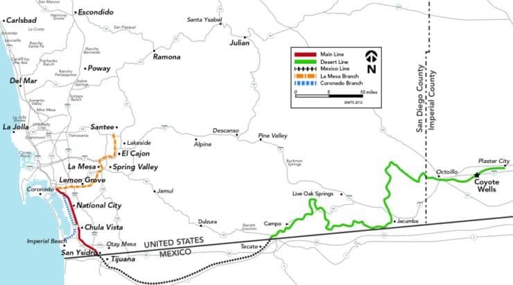
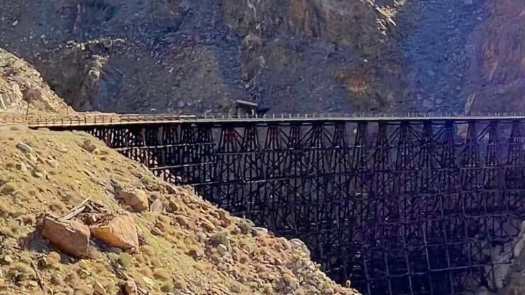
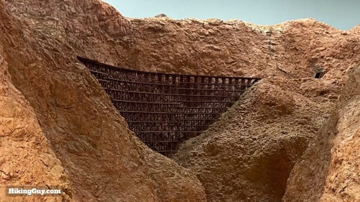
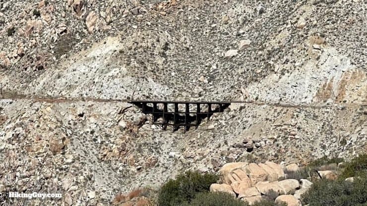
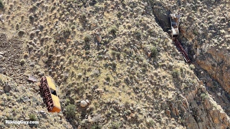
This hike is on the North-South section of the green "Desert Line" from Jacumba shown here on the map. The rail line is unique in that it spans the Mexico-US border. - Although the railroad started operation in 1919, the Goat Canyon Trestle wasn't built until 1933 after the old tunnel was washed away in a rock slide. At 633 feet long and 185 high, it's been labeled as "the world's largest curved, all-wood trestle" and I think that's accurate.
- Steel cannot withstand the desert's temperature extremes without excessive fatigue, so the trestle was instead built with redwood timber and no nails. Since a wood bridge in the dry desert can easily catch fire from an ember falling out of a steam locomotive, they had to keep water nearby. Today you can see a tank car on the cliff above the bridge, which is filled with water in case of a fire.
- The line effectively stopped running in the 1970s with the advent of interstates and the high costs to maintain it through this rugged environment. Repairs were made and intermittent service occurred since then, including tourist trains run by the Pacific Southwest Railway Museum. The last official train hit the rails here in 2008, with only sporadic maintenance runs since then. Over the years various plans have been made to reopen this stretch of track, but so far nothing has come to fruition and the line remains unused. It's estimated that the Desert Line needs at least $100m of repairs to get it up and running again
Want to see the trestle without doing the hike? Head over to the San Diego Model Railroad Museum in Balboa Park to see a beautiful replica.
Goat Canyon Trestle Hike Directions
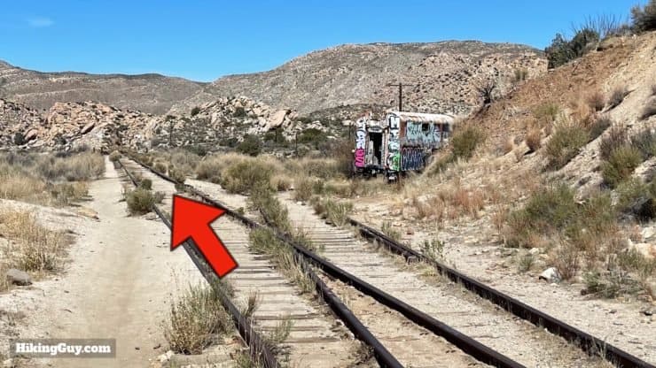
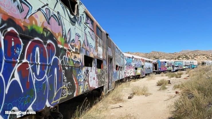
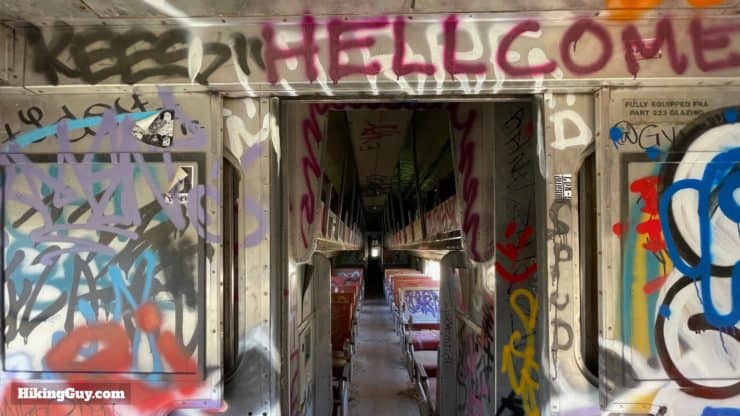
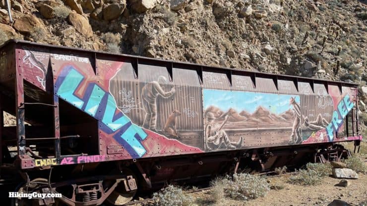
These are unique double-decker "gallery" cars where the middle section of the interior is open. They are still used by METRA, a small commuter service from Chicago, and the only passenger trains run by Warren Buffet's BSNF railroad. Eleven of these cars were sold to the railroad here in 2007 to run the Tren Turístico Tijuana Tecate on the Mexican side of the line. A commuter train between Tecate and Tijuana was also floated but never implemented.
Carrizo is a reed used for weaving mats, baskets, and arrows, found at bottom of the canyon. It's also seen spelled as "carisso."
These passenger cars are from Montreal's commuter service, STCUM (Société de transport de la Communauté Urbaine de Montréal).
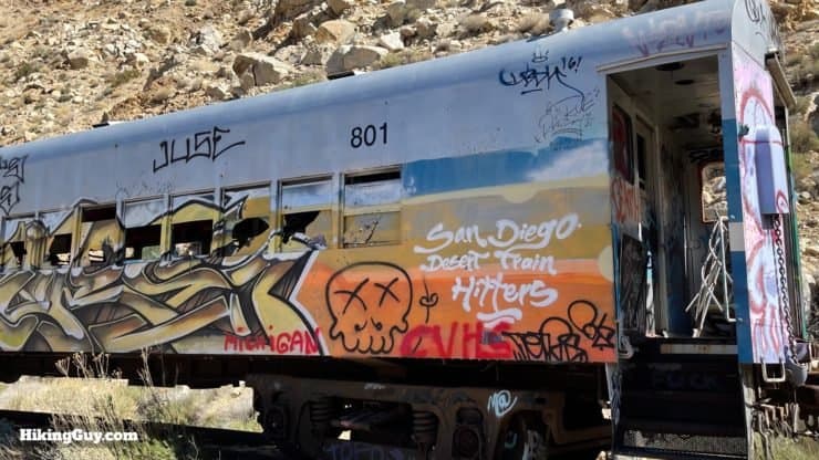
These cars have been burned recently, but will probably be covered again in graffiti shortly.
Need More Info?
- Have a question about the guide? Join my Patreon and ask me a question.
- When planning, always check the park website and social media to make sure the trails are open. Similarly, check the weather and road conditions.
- Do you have an update to this guide? View the Youtube comments for this video. Leave a comment and I will do my best to update the guide.
Related Guides
 Bridge to Nowhere Hike
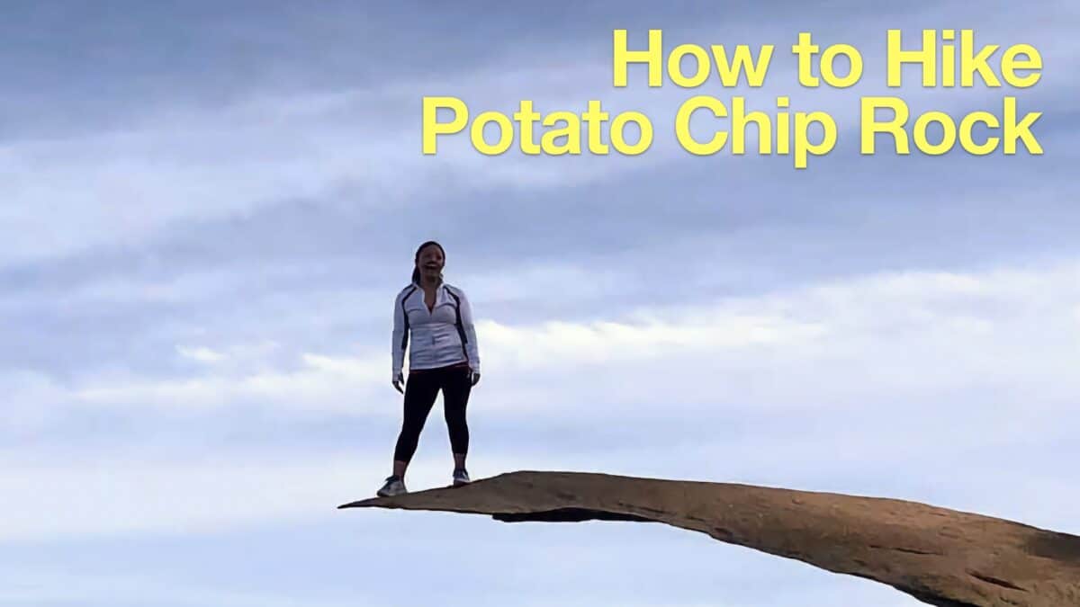 Potato Chip Rock Hike (San Diego)
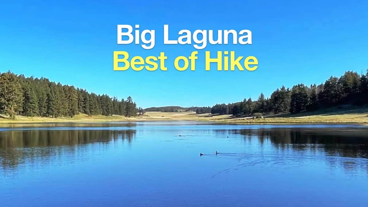 Big Laguna Trail - Best of Loop
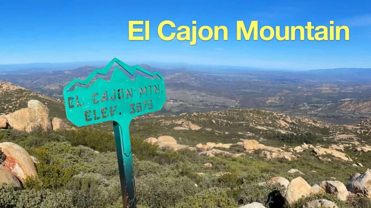 El Cajon Mountain Trail Guide
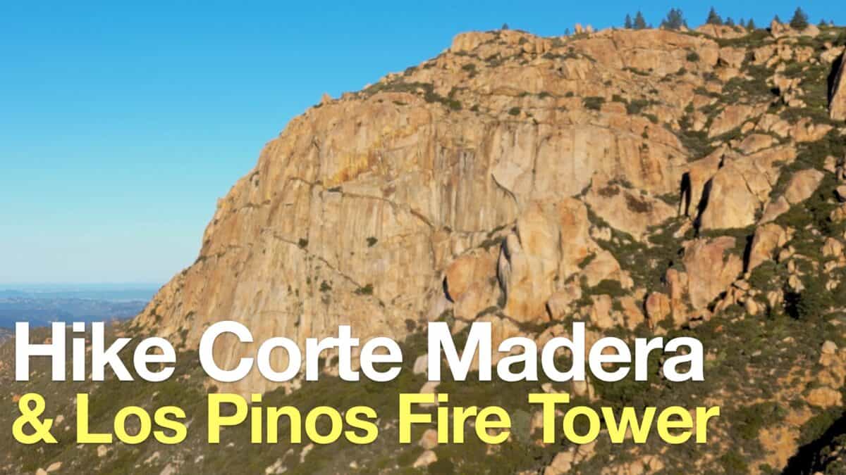 Corte Madera Mountain Hike
 Hiking San Diego
Popular Guides
 Best Hiking Gear 2024
 Hiking Boots or Shoes: Do I Really Need Hiking Boots?
 When to Hit SOS on inReach
This Guide Was Written by Cris Hazzard

Hi, I'm Cris Hazzard, aka Hiking Guy, a professional outdoors guide, hiking expert, and author based in Southern California. I created this website to share all the great hikes I do with everyone else out there. This site is different because it gives detailed directions that even the beginning hiker can follow. I also share what hiking gear works and doesn't so you don't waste money. I don't do sponsored or promoted content; I share only the gear recommendations, hikes, and tips that I would with my family and friends. If you like the website and YouTube channel, please support these free guides (I couldn't do it without folks like you!). You can stay up to date with my new guides by following me on YouTube, Instagram, or by subscribing to my monthly newsletter.