How to Hike To Eaton Canyon Falls
PLAY VIDEO

How to Hike To Eaton Canyon Falls

Distance: 4 miles
Time: 2 Hours
Total Climbing: 500 feet
Difficulty: Easy
Crowds: Crowded
Dogs: Leashed

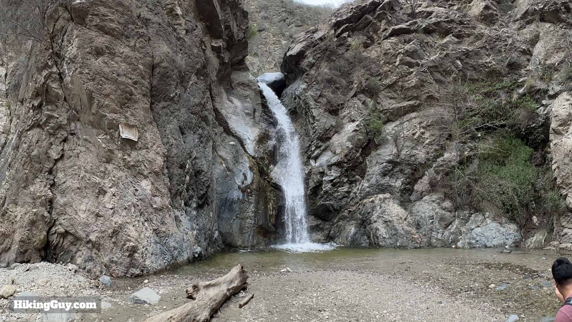
The hike to Eaton Canyon Falls is one of those LA classics you have to do at least once. Eaton Canyon and the falls are spectacular, one of the true gems of the San Gabriels. Even John Muir wrote about Eaton Canyon Falls's beauty. But its easily accessible location means that you'll find crowds here, and many people on the trail are not familiar with hiking etiquette. The best time to hike Eaton Canyon Falls is early on a weekday when the canyon is still peaceful, and the masses haven't yet arrived.

Where is Eaton Canyon Falls Trail?

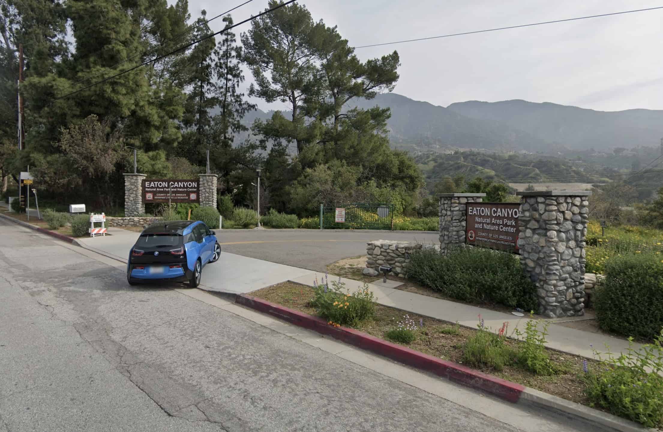
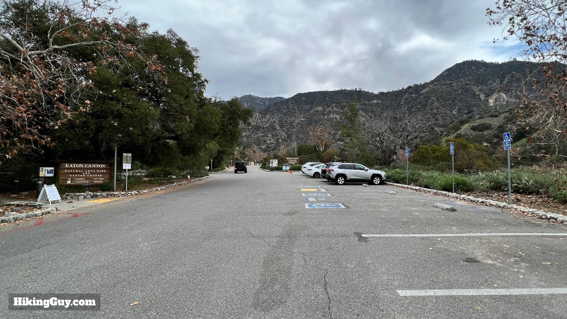
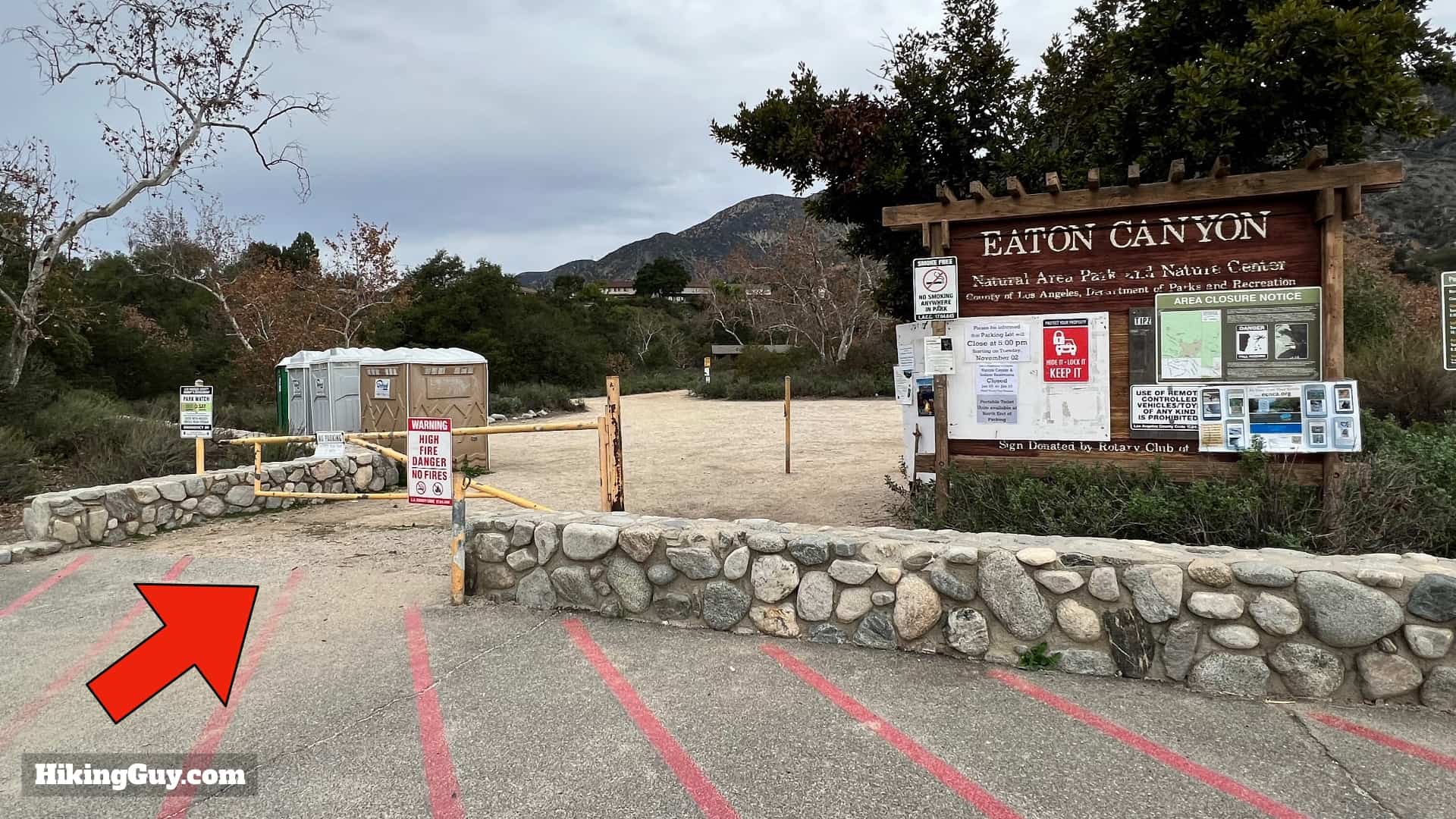
There are a few ways to get to Eaton Canyon Falls, but the main route starts from the Eaton Canyon Nature Center in Pasadena. Use this address:
Eaton Canyon Nature Center, 1750 N Altadena Dr, Pasadena, CA 91107

Eaton Cayon Entrance
You'll go down a long driveway to the Nature Center parking areas.
Eaton Canyon Parking
Park as close as possible to the trailhead. It does get very crowded and you may have to park in the overflow parking.
Eaton Canyon Falls Directions 5
Here's the parking leading up to the trailhead. The hike starts at the far end of the parking lot.
Eaton Canyon Falls Directions 7
Check the park website before your trip, the hours do occasionally change.
Eaton Canyon Falls Directions 10
There are (fairly nasty) toilets at the trailhead.

Gear For the Hike

Eaton Canyon Falls Directions 2
There are many stream crossings. It's much easier to wear footwear (like trail runners, sandals, or sneakers) that you are okay with getting wet.

Your best bet on this hike is to wear fitness clothes or light hiking gear. You may have to scramble up and down some small rises, so be prepared to get your hands dirty. If you have trekking poles, they can be helpful on the stream crossings. Or, as I said earlier, get comfortable with getting your feet wet and plow through the stream crossings.

Gear I Love Right Now

Eaton Canyon Falls Trail Maps

Click to activate map
CalTopo
Print Map, Work With It Yourself
GPX
Bring the Guide to Any GPS

Elevation Profile

Eaton Cayon Elevation
This profile is a little deceiving; it's a gentle climb up to the falls. The first half is largely exposed, and the last mile is shaded.

3D Map

Eaton Cayon 3d Map
The first half is a mellow trail along the (wide) Eaton Wash banks. Then, towards the end, you enter the steeper walls of Eaton Canyon to what's known as the "lower falls." When you enter the canyon, you also officially enter Angeles National Forest. Also, note that the different colors are from different satellite photos on Google Earth. It's not like that in real life.

Hike Brief

Eaton Cayon Historic
Eaton Canyon Falls looks pretty much the same today as it does in this photo from 1898. This photo was taken by Theo Lukens, and the highest point in Los Angeles (city) is named after him. If you want to hike Mt Lukens, I have a guide here.
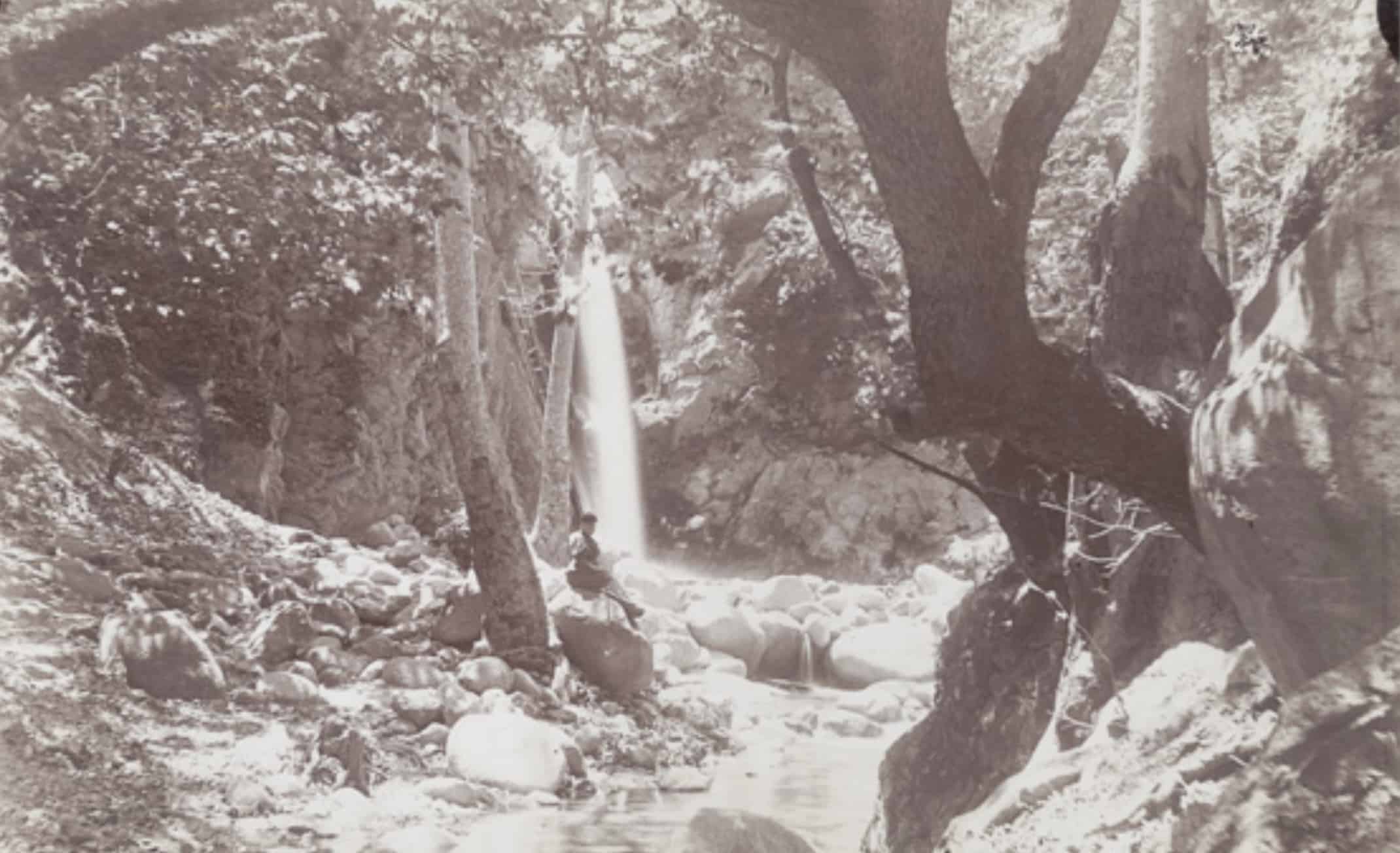
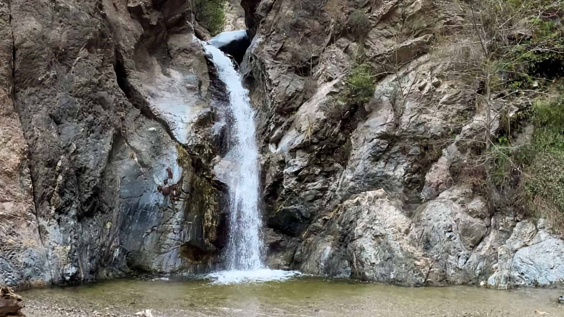
  • Eaton Canyon Falls has long been a popular attraction. In 1877 John Muir wrote about it. "It is a charming little thing, with a low, sweet voice, singing like a bird, as it pours from a notch in a short ledge, some 35 or 40 feet into a round mirror-pool."
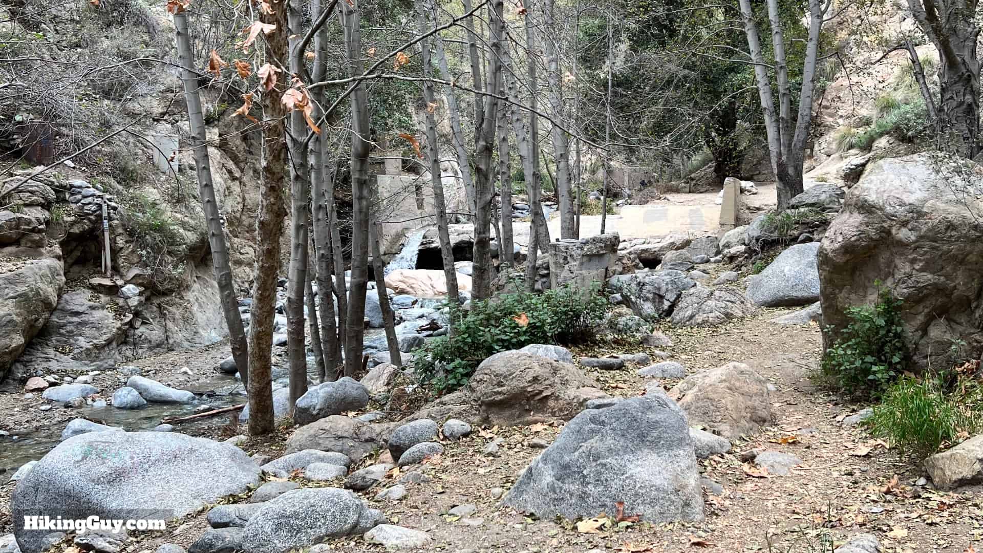
  • You'll see some structures along the trail once you get into the canyon proper. Most were built to support what's known as "water mining" or gathering fresh water and supplying it to farms and ranches farther down toward Pasadena. The Precipice Canyon Water Company, named after the canyon's original name, El Precipio, was started here in 1887, and there were over 50 "water mines" in Eaton Canyon.

    Eaton Canyon Falls Directions 3
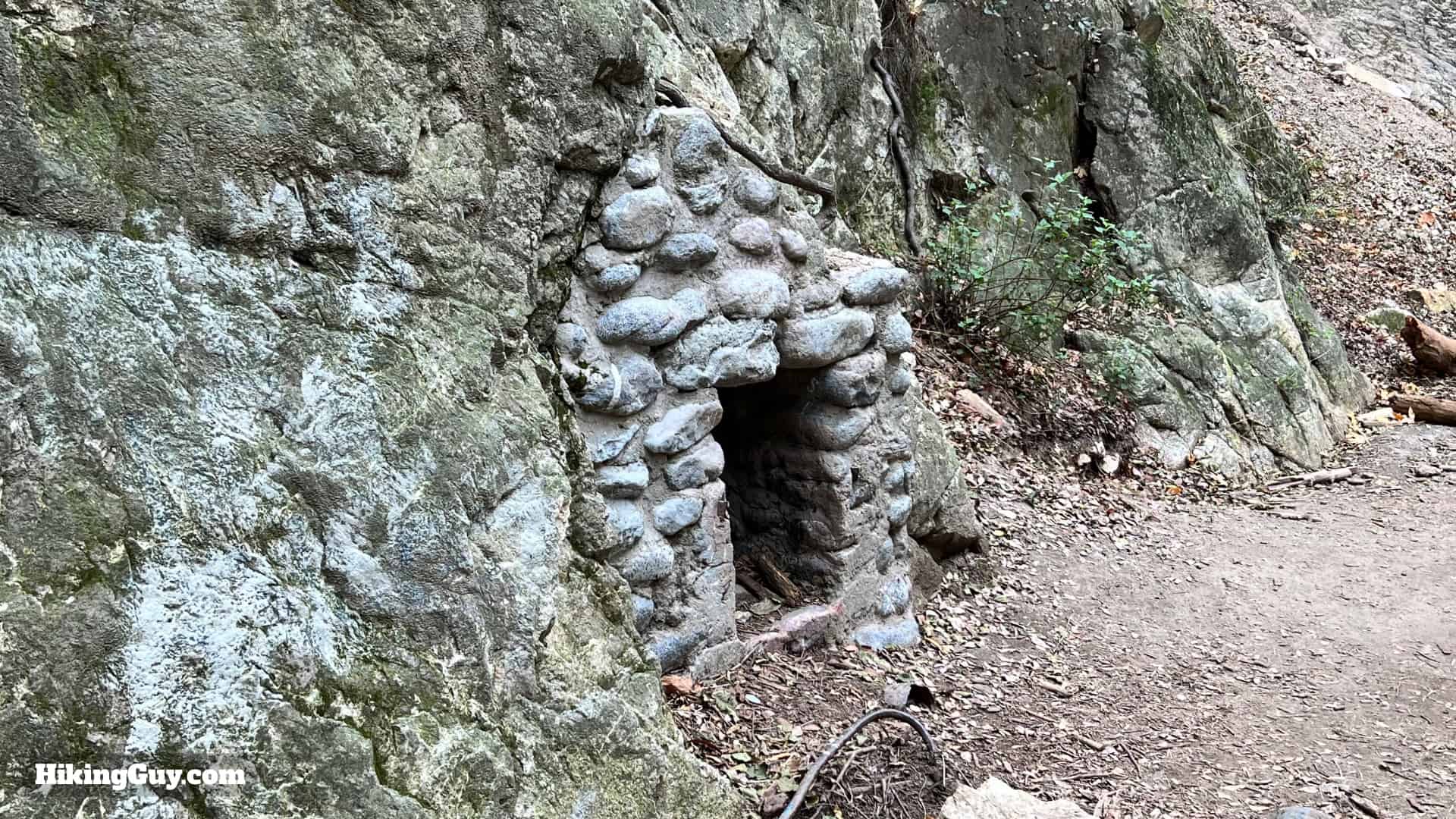
    Here's one of the original "water mines" along the hike, although this mine tunnel has now been filled in.
  • If you've been here before and it looks noticeably cleaner, you can thank Edgar McGregor. He's spent hundreds of days cleaning up the trash around Eaton Canyon and other SoCal trails. Pitch in and pick up any trash you may see on the hike!

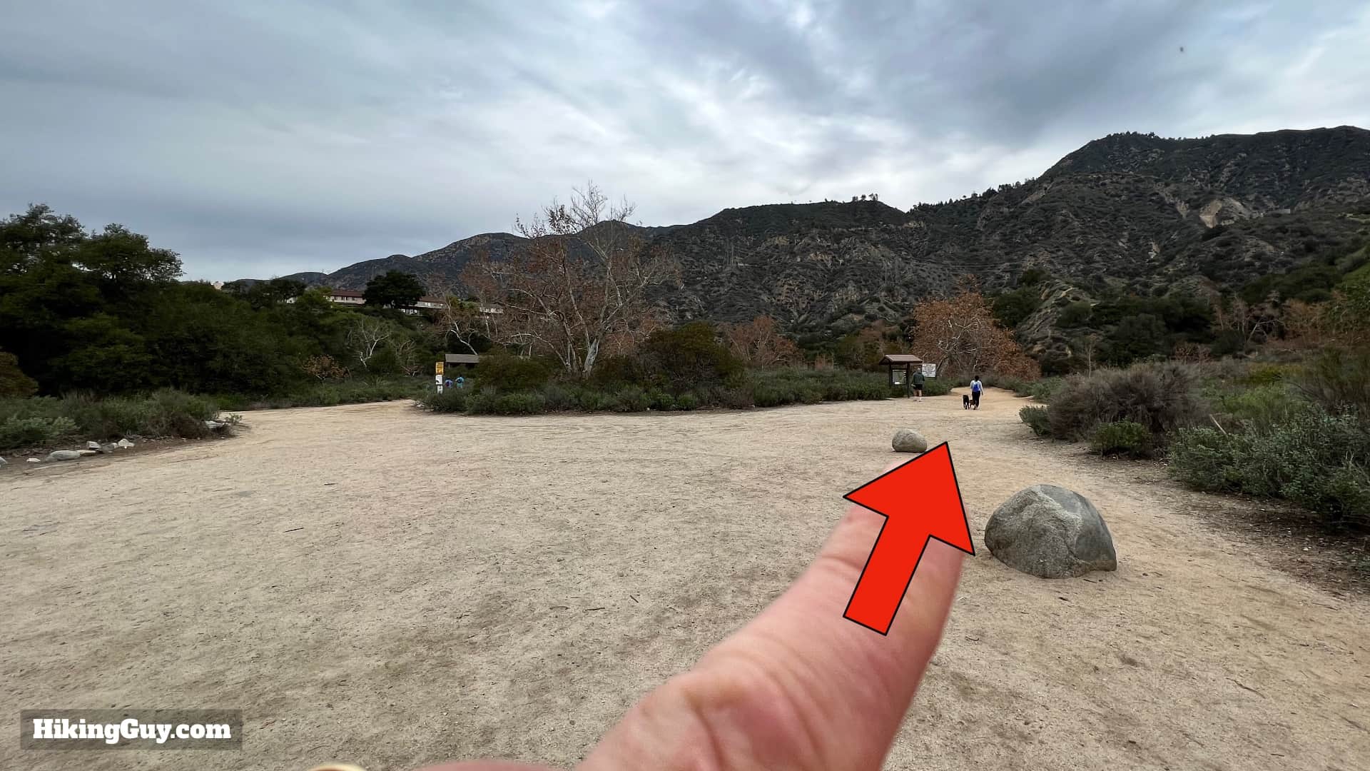
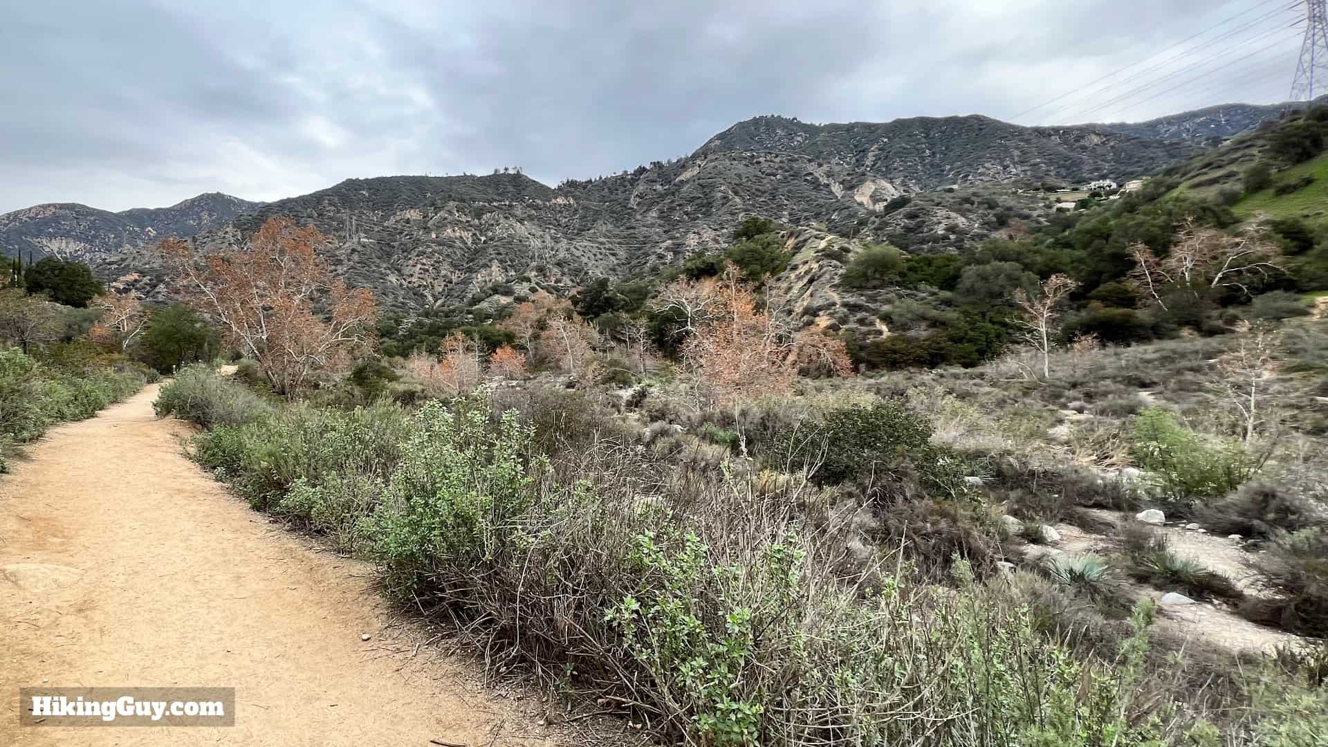
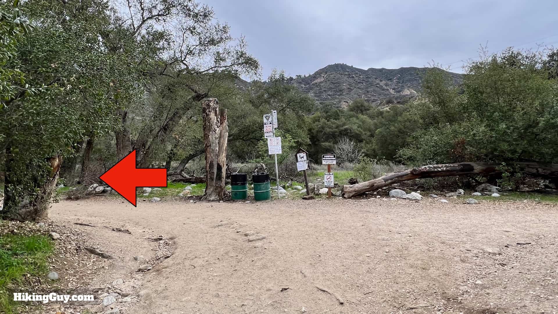
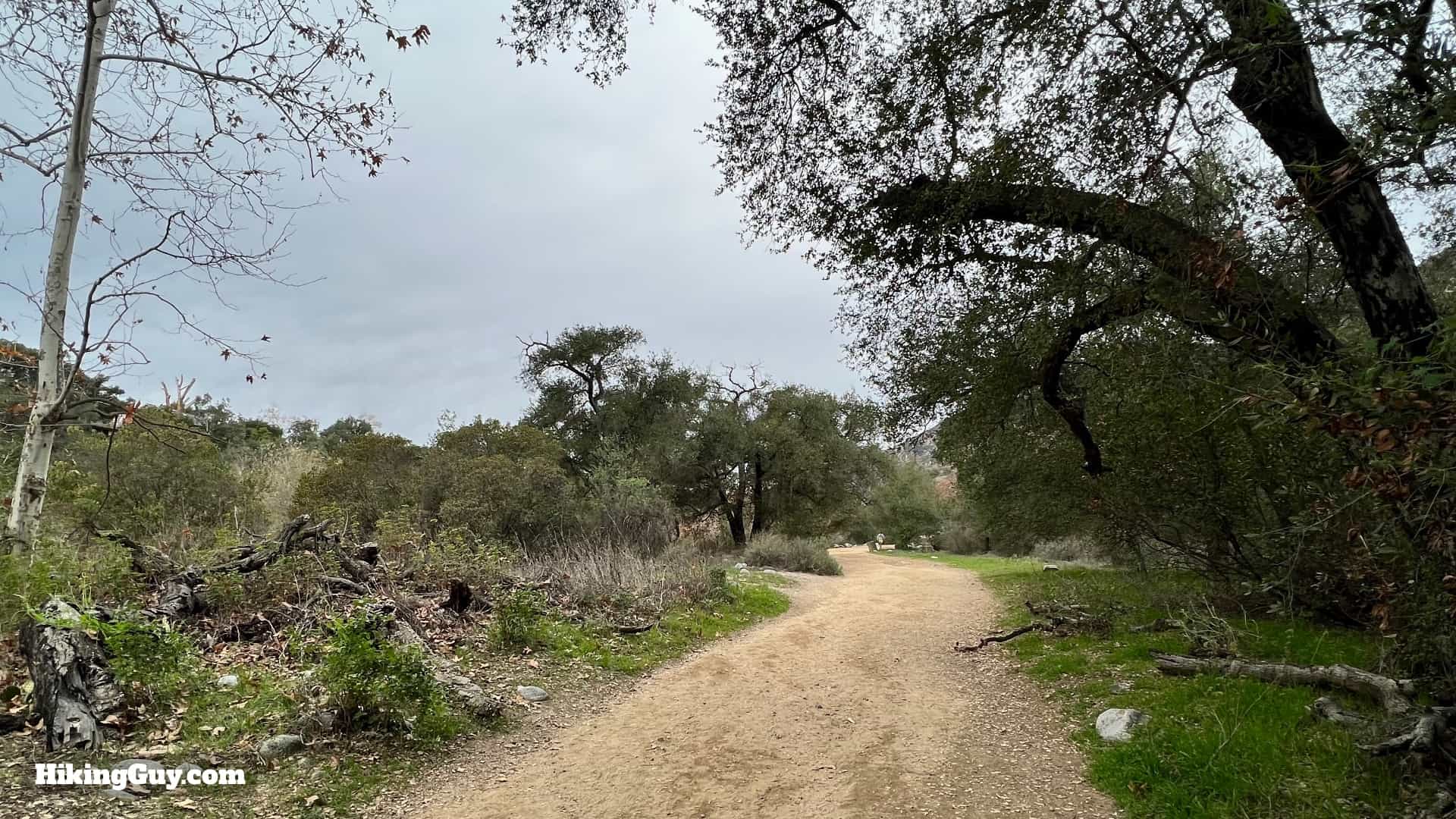
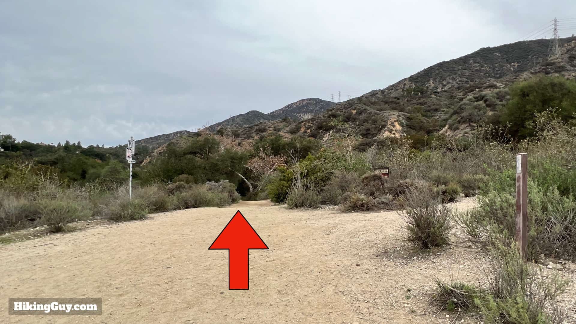
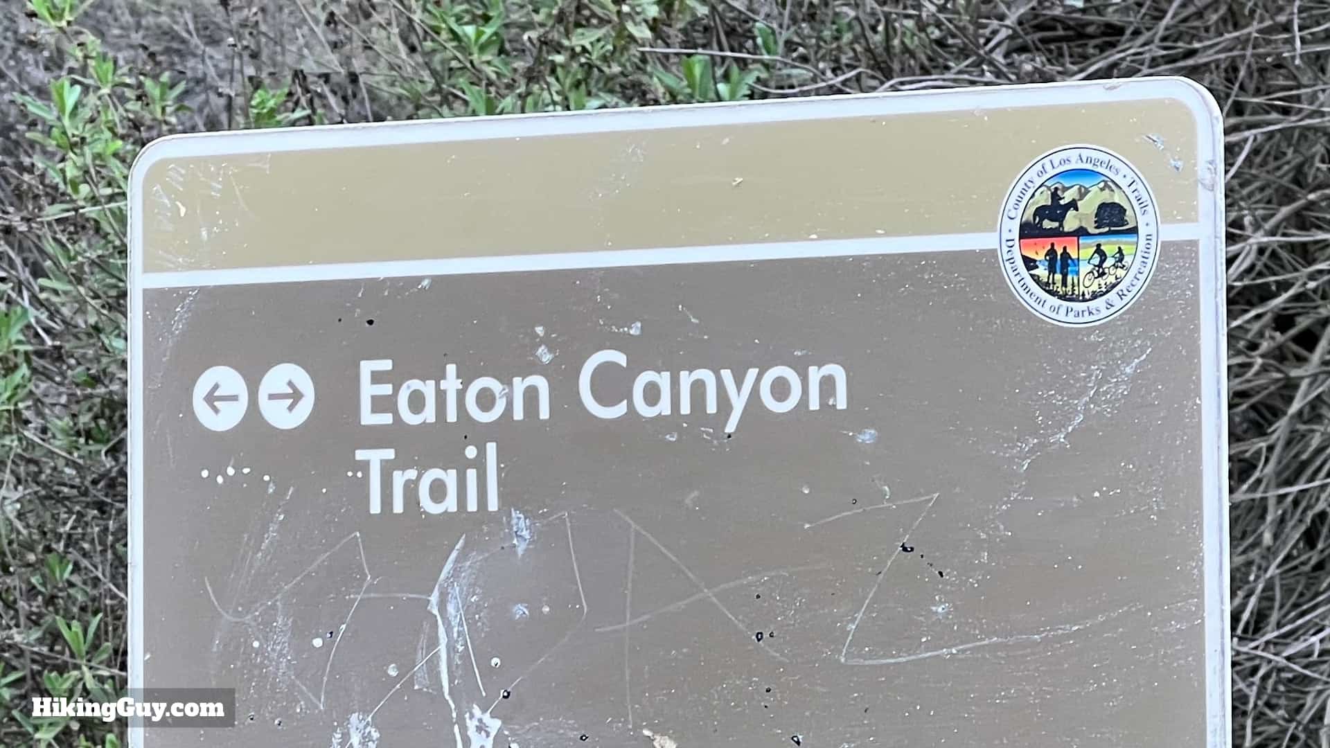
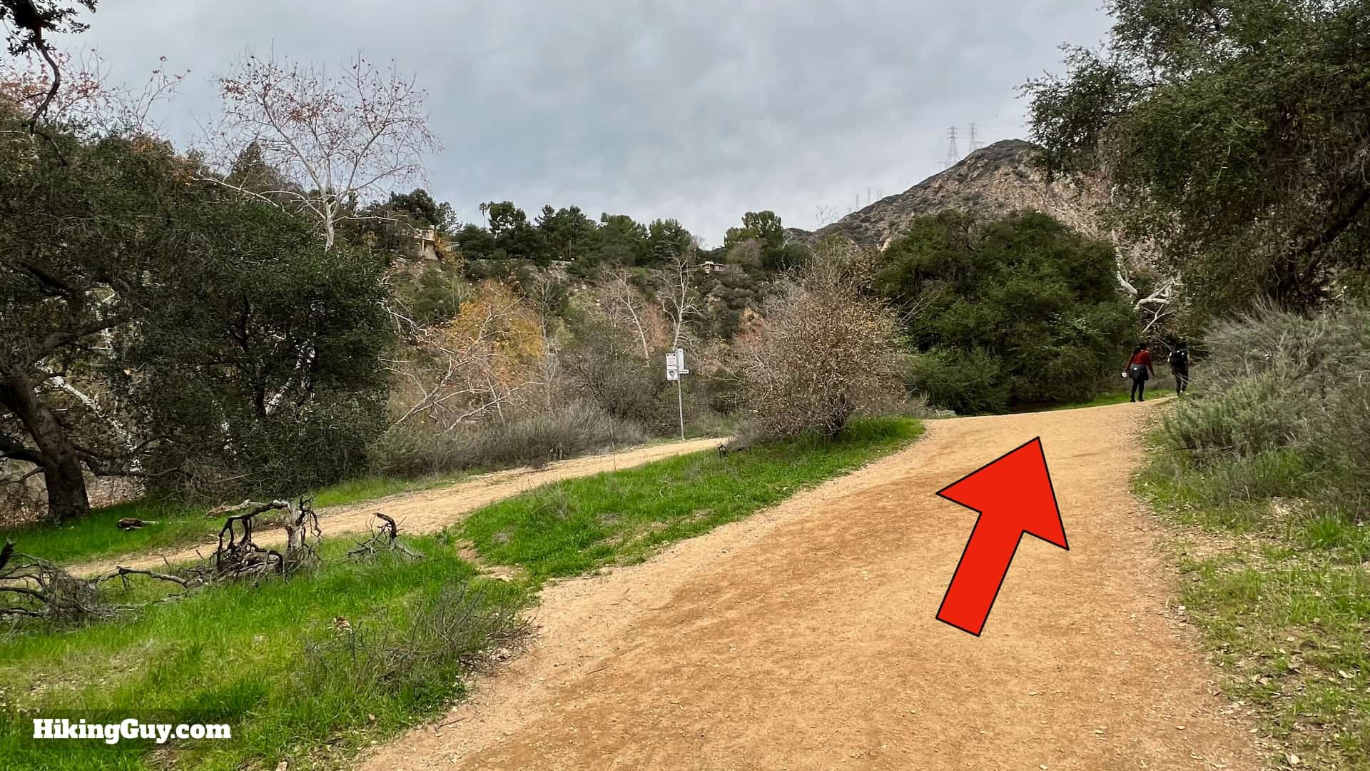
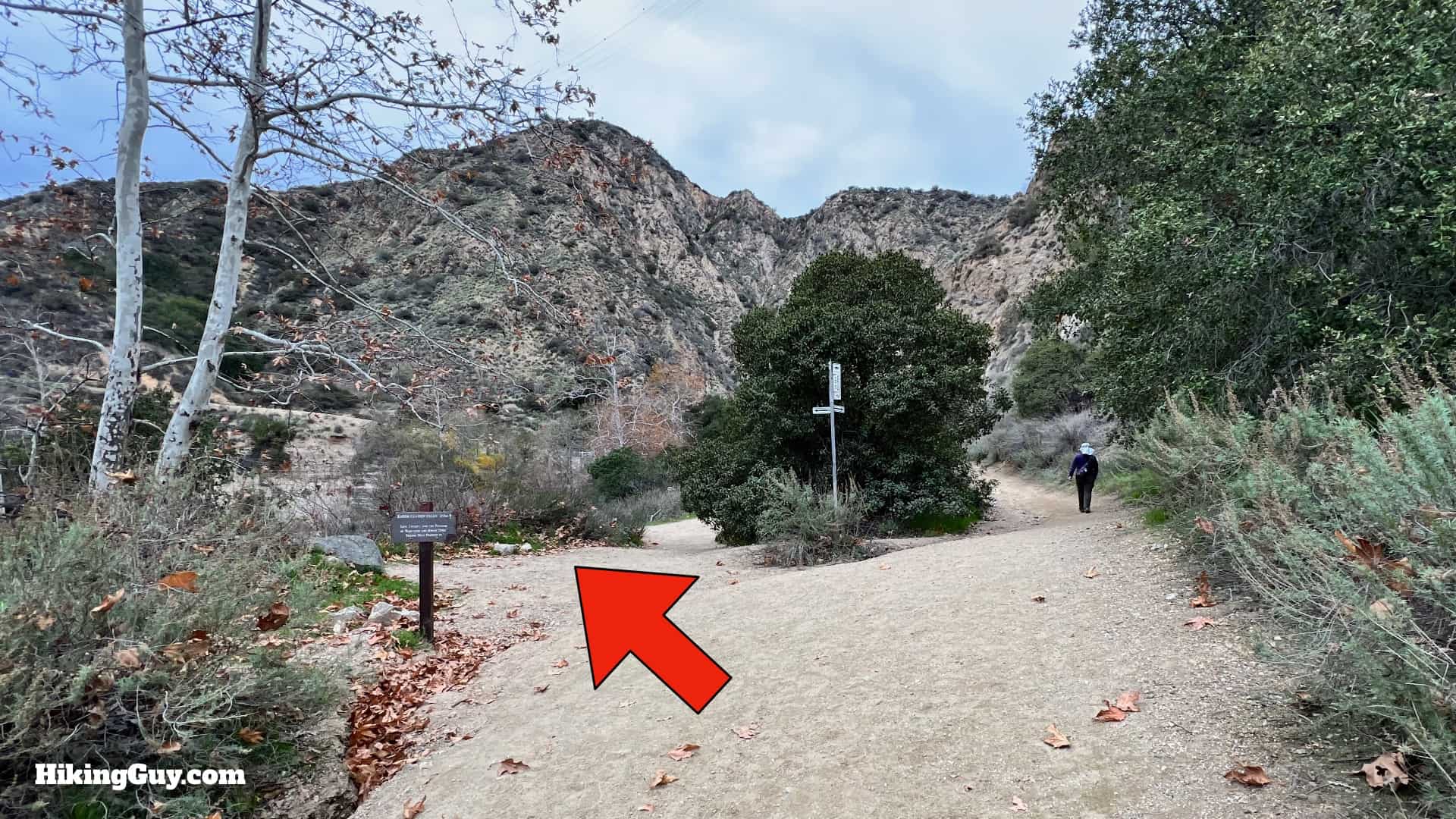
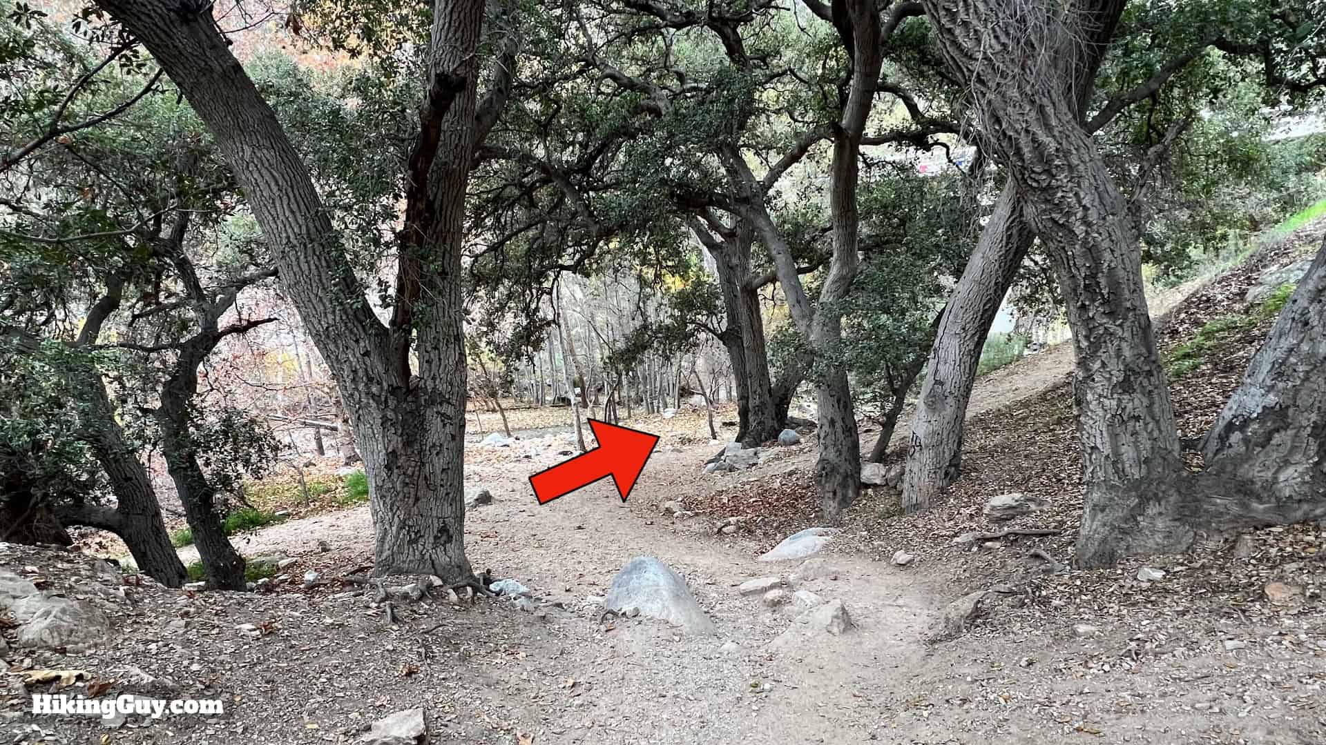
Eaton Canyon Falls Hike Directions

Eaton Canyon Falls Directions 9
The trailhead is at the end of the parking area.
Eaton Canyon Falls Directions 11
When you pass the gate there are two paths. You can take either. I like the right path, which goes along Eaton Wash.
Eaton Canyon Falls Directions 12
There's a trail map here. Take a picture with your phone in case you need to refer back to it.
Eaton Canyon Falls Directions 13
Follow the trail, with the wash on your right.
Eaton Canyon Falls Directions 14
The trail rejoins the other path from the left.
Eaton Canyon Falls Directions 15
And then you cross Eaton Wash. The first of many crossings, but the next crossing isn't for over a mile.

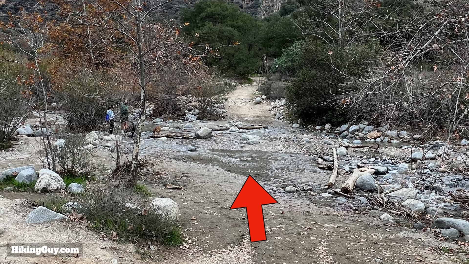
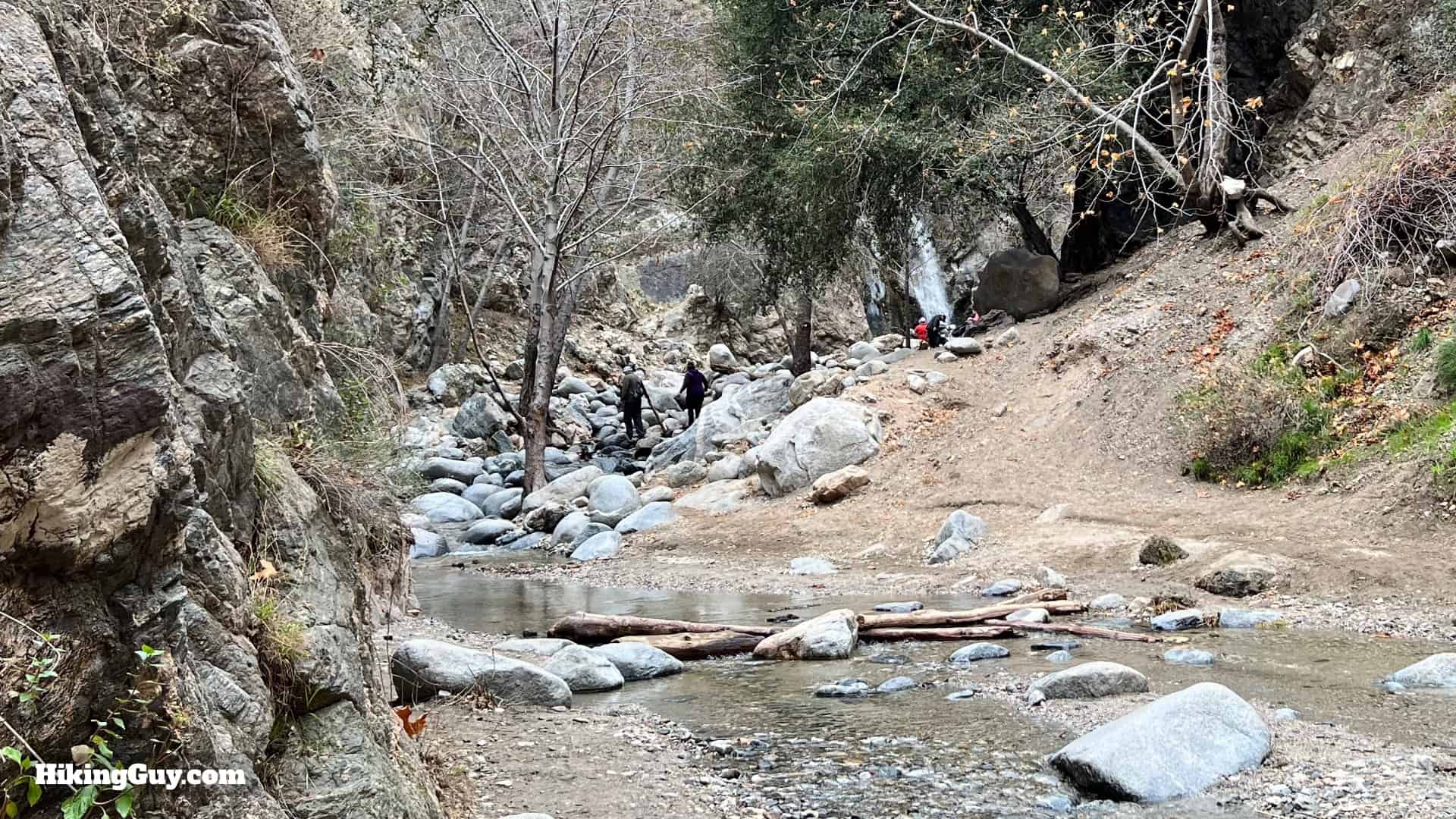
If there's a decent water flow at this crossing, chances are good that the falls will be flowing. In these times of extreme weather, the falls can dry up occasionally, especially in the summer and early fall.

Eaton Canyon Falls Directions 16
Once you cross over, make the left and continue upstream.
Eaton Canyon Falls Directions 17
The first part of the hike is a wide dirt path. Not the prettiest trail in the world, but not the worst either.
Eaton Canyon Falls Directions 18
At the intersection of the Coyote Canyon Trail, keep going straight.
Eaton Canyon Falls Directions 19
And then after that is the intersection of the Walnut Canyon Trail. Keep going straight.
Eaton Canyon Falls Directions 20
There's a sign at this intersection pointing you in the right direction. There used to be more trail markers, but I've noticed that they disappear more than they should.
Eaton Canyon Falls Directions 21
You'll continue up along the wash, which is closer now.
Eaton Canyon Falls Directions 22
Keep going straight when a trail joins in from the right.
Eaton Canyon Falls Directions 23
And after that is a split. Make the left to head down to the wash. To the right is the Mt Wilson Toll road.
Eaton Canyon Falls Directions 24
There's this old school sign at the junction. You can see more of these around Chantry Flat.
Eaton Canyon Falls Directions 25
When you get down to the wash, make the hard right.
Eaton Canyon Falls Directions 26
And now you're in the narrow part of Eaton Canyon. The trail goes under the bridge.

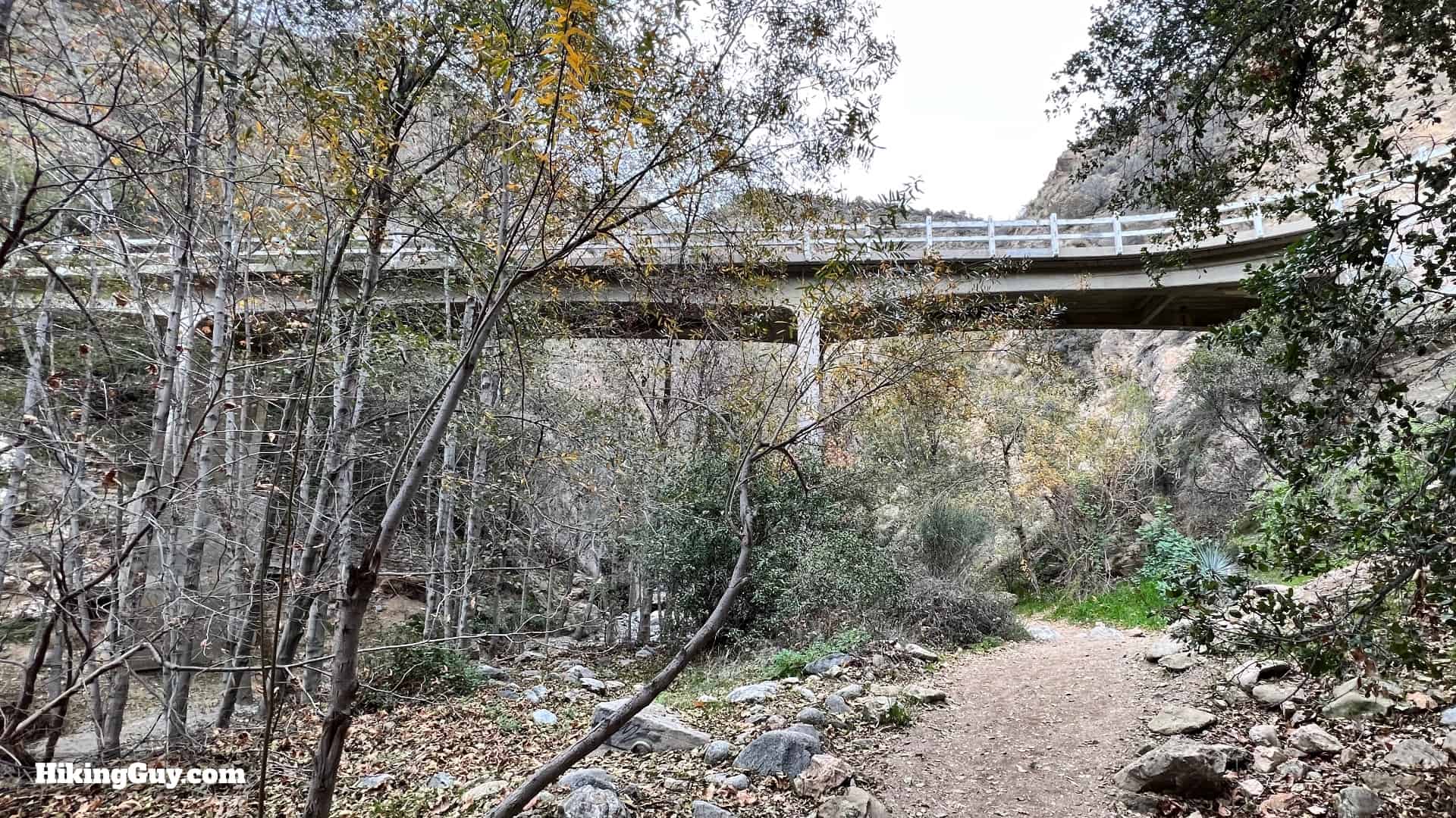
The original bridge here was wooden, and built for the Mount Wilson Toll Road Company. That bridge and a few others were washed away during flooding in Eaton Canyon. The bridge you see today was built after the flood in 1969. Today the bridge is known as the "Chuck Ballard Memorial Bridge," after the man who was a banker by day, and a badass member of the Altadena Mountain Rescue Team in his off time. Chuck Ballard served for more than 50 years with the rescue team and passed away in 2020.

Eaton Canyon Falls Directions 27
The hike from here on out is very different than the earlier stretch. From here you'll be in the steep canyon, following the creek upstream.
Eaton Canyon Falls Directions 29
You'll also have your first stream crossing, the first of several on your way to Eaton Canyon Falls.
Eaton Canyon Falls Directions 28
You'll also see some structures along the way that were part of the original water mining operations.
Eaton Canyon Falls Directions 1
Some crossings have multiple spots to hop over. There are also a few splits in the trail. Overall you're following the creek. If for some reason you're leaving the canyon, you're not doing the right thing.
Eaton Canyon Falls Directions 31
There are some points that leave the waterside but rejoin after a minute or two. At no point are you climbing up and out of the canyon.
Eaton Canyon Falls Directions 32
And after about 0.6 miles in the canyon, you'll arrive at the falls. You made it! When the water is really flowing, you can splash around in the pool below the falls.

From here, just turn around and return the same way that you came up!

Eaton Canyon Falls used to be known as LaBelle Cascade, named after Judge Benjamin Smith Eaton's daughter, who the canyon is named after.

Originally published January 17, 2022