The Dawn Mine Trail hike takes you on a loop through history and beauty. You'll see the old abandoned Dawn Mine and then retrace your way back along the Mt Lowe railway. But more than that, it's a beautiful hike. You hug ridges with expansive views, you hike along a lush canyon stream, and then you descend along the ridge and soak in a vista that includes LA and the Verdugo Mountains. And there's just enough climbing to make it a decent workout.
In this Guide:
Video and Turn by Turn Hike Directions to Dawn Mine
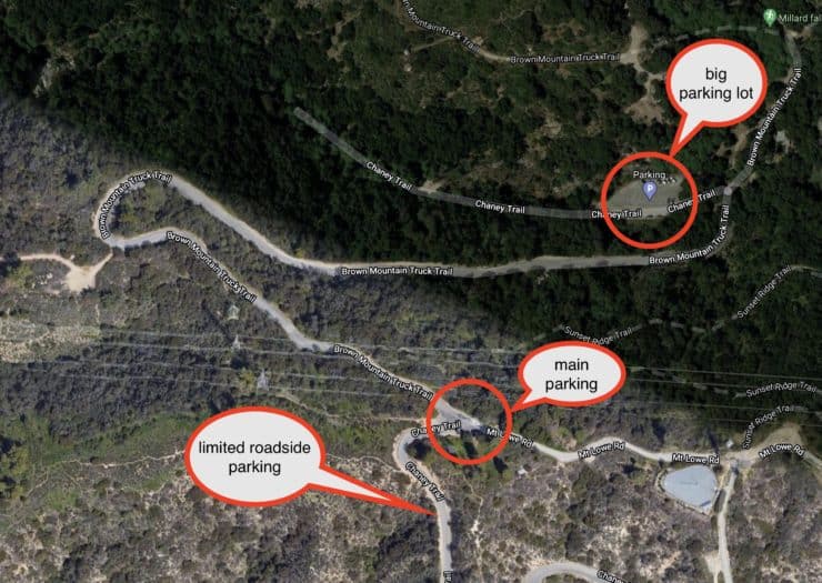
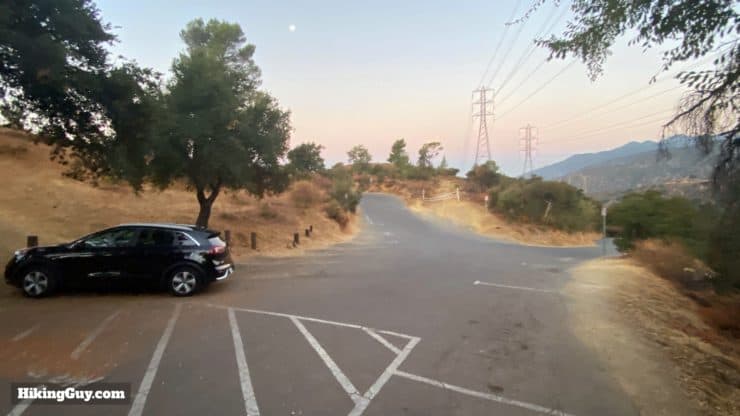
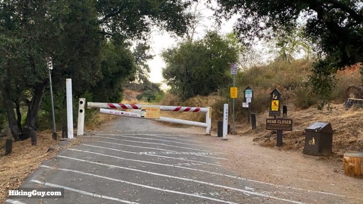
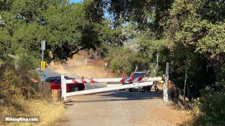
To start, you're going to park at the end of Cheney Trail (a paved road). There's a small parking lot that fills quickly, so the hike is best done at sunrise (when the lot is often empty).
The trailhead doesn't have an address on Google Maps; use the following address and then drive up the road until you reach a junction. The parking area is on your right at the top (before you go down the hill). There are no bathrooms or water fills at the trailhead, but there are some if you drive down the hill to the Millard camground parking area.
When you get to the top of the hill at the split, the parking lot is on the right. If you can't find a spot, try the alternative parking options, but be very careful of the "no parking" signs which are peppered around the area.There aren't a lot of parking spots in the trailhead (closest) lot, but if you get here early, it's often empty. Otherwise try one of the alternatives mentioned before and walk to the trailhead.
You need a Parks Pass or Adventure Pass to park here.
Gear for the Hike
This is a backcountry hike and I recommend hiking gear. There are stream crossings (aided by rocks and logs), having good footwear is recommended. Trekking poles will help push the poison oak aside. And usually the stretch along Millard Creek has bugs. The first half of the hike is shaded; after the mine it's all exposed (but downhill).
Osprey Hikelite 26Lightweight, carries all your gear, and your back doesn't get sweaty. Oh yea, it's also one of the most inexpensive packs you can get.
The trail to Dawn Mine used to be in pretty rough condition, but these days it's great. The Restoration Legacy Crew has done some incredible trail building. The hike is much easier than it used to be.
While there are a few ups and downs in the beginning, in general you'll climb to the mine, then finish with a steep climb up to the ridge, and then enjoy a nice long downhill cruise back to the start.
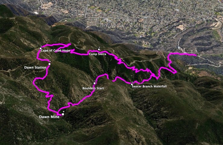
3D Map
From the beginning you make your way up Millard Canyon to Dawn Mine. Then it's a steep climb up to the old Dawn Mine Station on the Mt Lowe Railway, and back down along Sunset Ridge.
Hike Brief
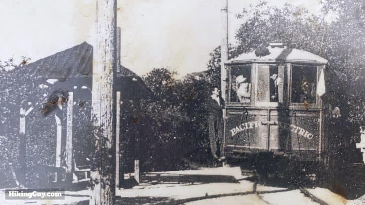
You'll follow the path of the Mt Lowe Railway for part of the hike. Dawn Mine used to use the railway to haul ore down the mountain. This is the old "Dawn Station" which is no longer there.
Most mines in the San Gabriel Mountains weren't so successful; Dawn Mine was an exception. It operated on and off from 1895 to 1954.
Dawn Mine's hundreds of feet of tunnels were a favorite for local explorers until the Forest Service closed most entrances in 2017.
After visiting the mine, you'll pass the junction at "Dawn Station," which was a stop on the Mt Lowe Railway. When tourists learned of the mine, they wanted to visit. But the journey down and back was too tough, so a fake mine shaft was dug about 100 feet away from the stop for tourists to peer into.
Dawn Mine Trail Directions
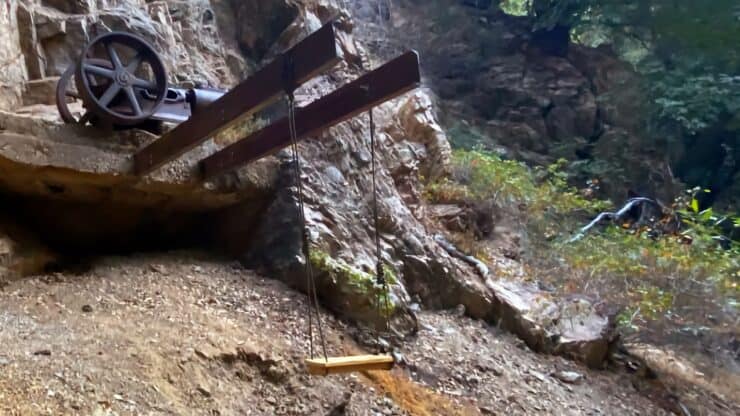
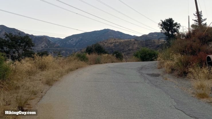
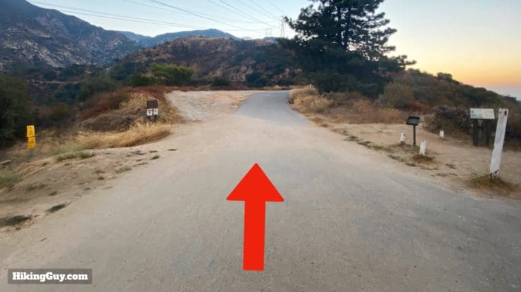
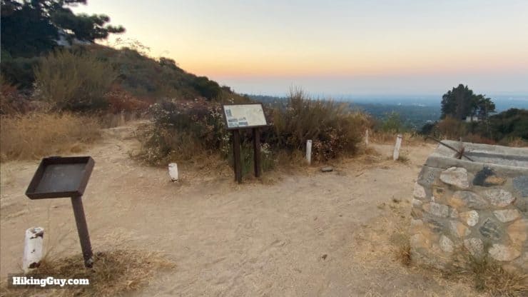
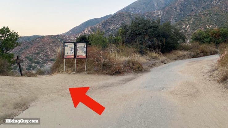
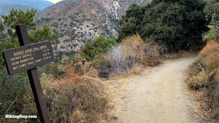
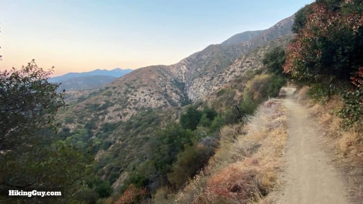
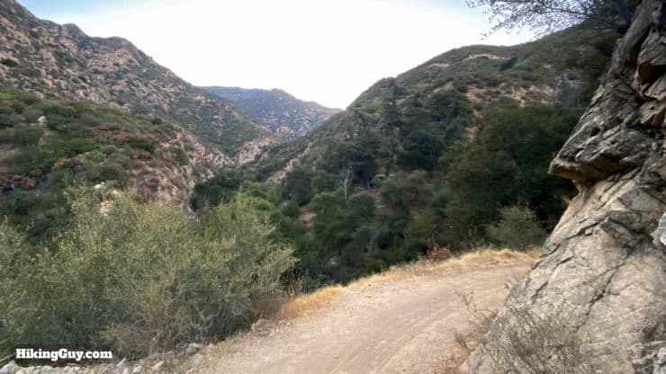
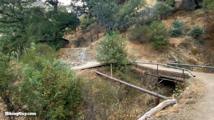
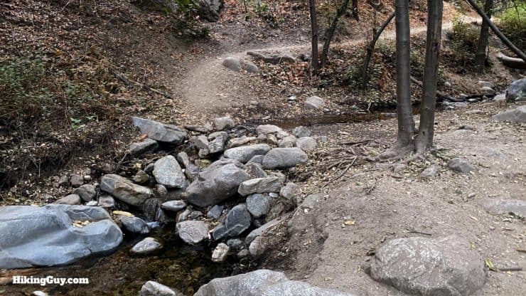
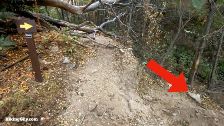
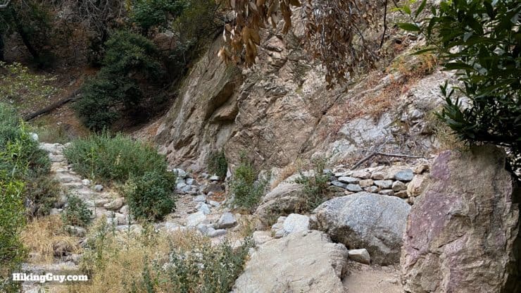
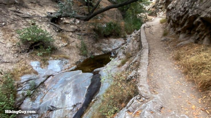
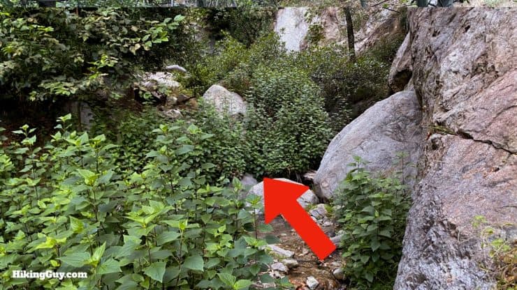
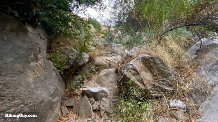
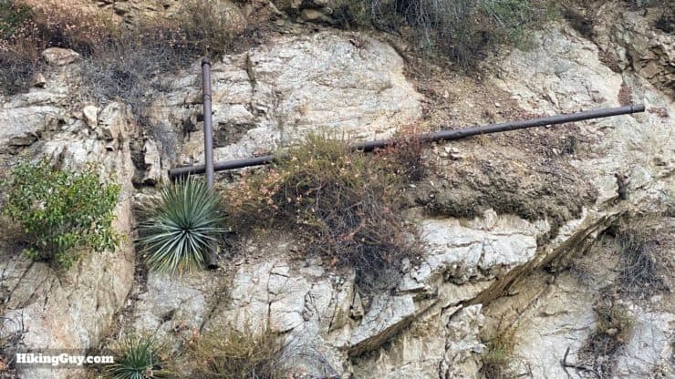
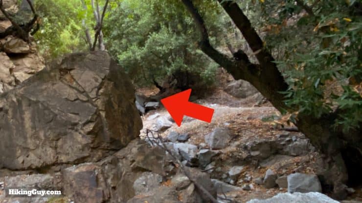
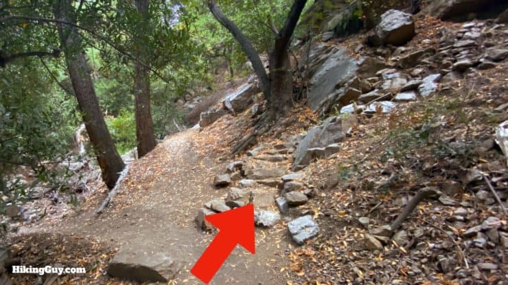
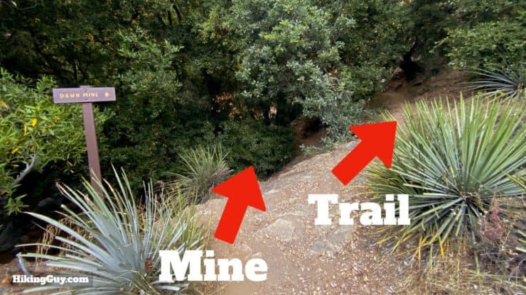
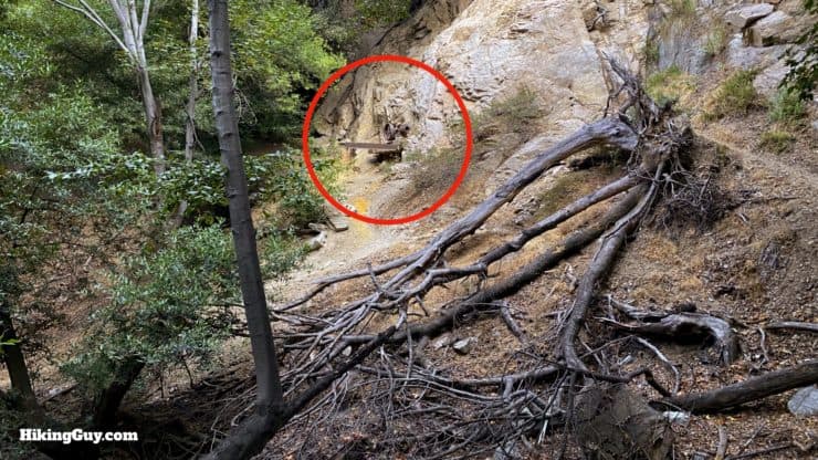
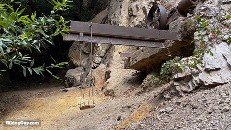
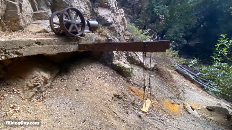
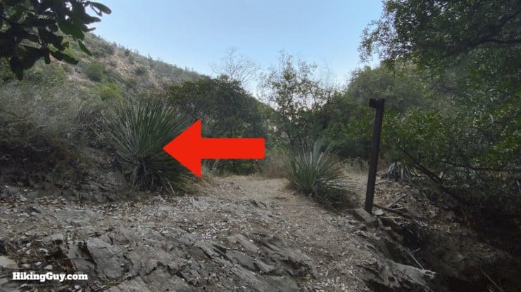
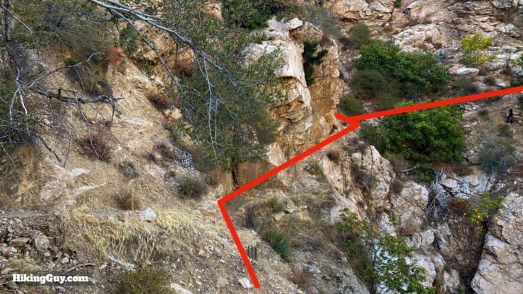
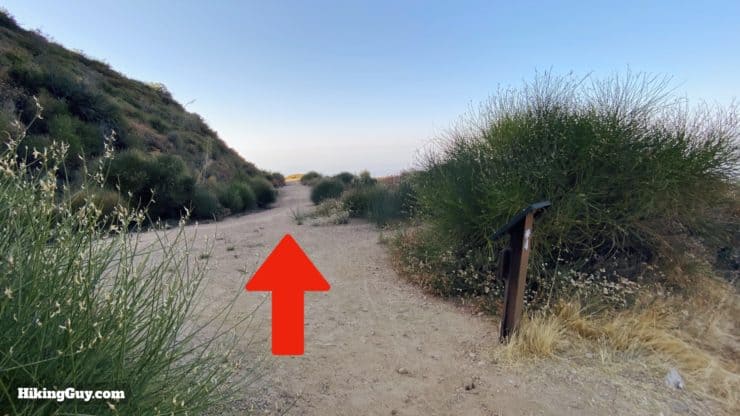
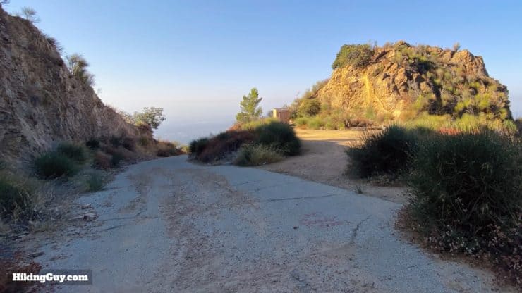
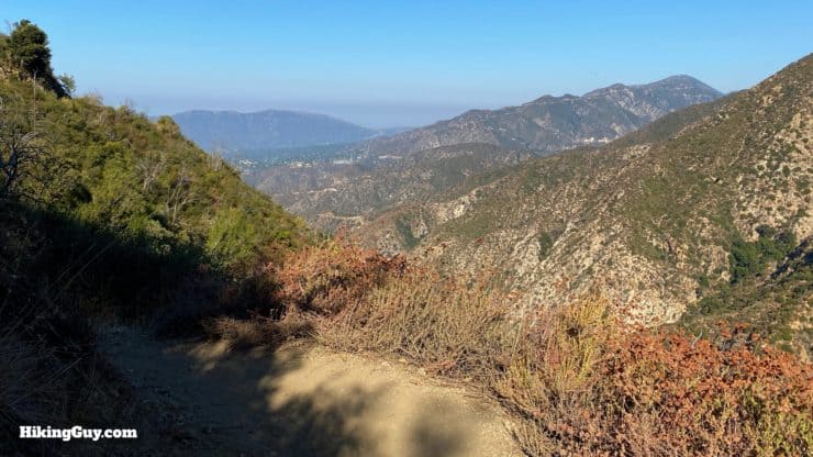
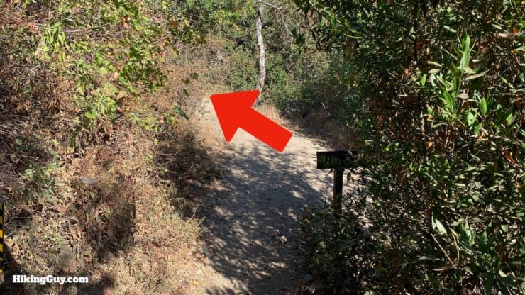
Start the hike by heading through the gate on the paved Mt Lowe Road.You'll start heading uphill.And shortly after the start you'll see a trail off to the left and an interpretive display on the right. Go straight.The interpretive display is for the Mt Lowe Railway trail. There will be more of these on the return loop and are worth a look.After the road twists, you'll see this turnoff for the Sunset Ridge Trail, which you want to take.Here's the start of the Sunset Ridge Trail. From here on out you'll be on "trail trails" to Dawn Mine.I love this part of the Sunset Ridge Trail. As you hug the ridge you'll get big views into to the west.And then the trail swings around and you get sweet views into Millard Canyon, which you'll be traveling up to reach Dawn Mine.When you come to this split, go left to head to Dawn Mine. On the loop back, you'll come back out on the right.Soon after the junction you'll pass a private cabin; stay on the trail.Then you're going to cross over Millard Creek several times. Usually the creek is pretty low but can get a bit more challenging in the Spring. The trail is well defined as you can see in this shot.Keep an eye out for trail signs to mark twists and turns on this section. The trail crew has repaired the route, and it sometimes deviates from the old trails.And take time to admire the recent trail work, including the beautiful retaining walls and steps. The trail is generally in great condition thanks to volunteers.Keep following the trail up along Millard Creek.There can be some pretty aggressive poison oak when you cross the creek. And of course it is overgrown right here, at the narrowest section of the hike.The canyon starts to angle upwards and you'll climb through a steep, rocky area referred to as "the bounders."When you finish "the boulders" and the trail levels out, look to the right across the stream bed to see some washed away mining relics. From here until the mine there are rusty debris scattered around.When you go around a rocky bend, it looks like a trail goes right. But you want to head left.Here's another view just past that last spot, looking left. Loop around and keep left.When you get to the rock stairs, head up them. You can also take another route to the left through the creek bed. But the official trail is up to the right.Climb the beautiful switchbacks.You'll see a small trail leading through the trees. Take that trail for the short spur to Dawn Mine. When you're done at the mine, you'll come back here and continue to the right to do the loop hike.Just through the trees you'll see the mine ahead on the hillside.Here you are, Dawn Mine! A lot of the graffiti has been cleaned up too. Thank you volunteers!
The swing that was once here seems to be gone now.
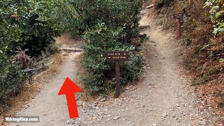
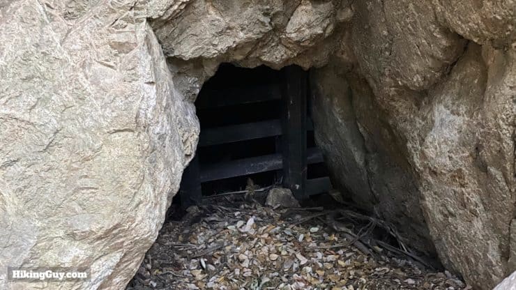
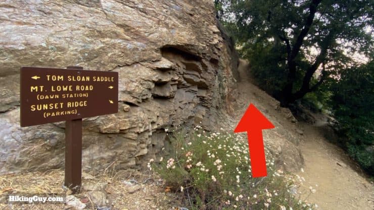
The mine shaft is just past the equipment, behind a boulder.When you're done at Dawn Mine, head back the way you came to the last junction.At the junction, make the left.Right after that, you'll reach the beautifully restored junction for the trail to Tom Sloane Saddle. Make the hard right to hike toward Mt Lowe Road (Dawn Station).
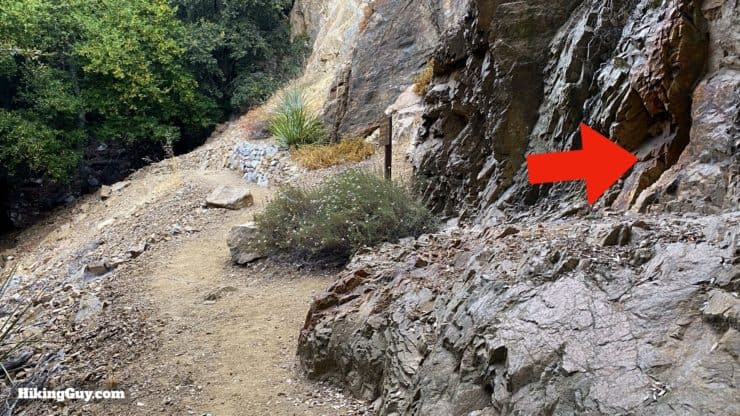
If you want to see another mine shaft, do a five minute detour up the trail toward Tom Sloan Saddle. Look for a tunnel entrance on the wall of the opposite bank of the creek. I've marked the waypoint for the mine shaft on my map.
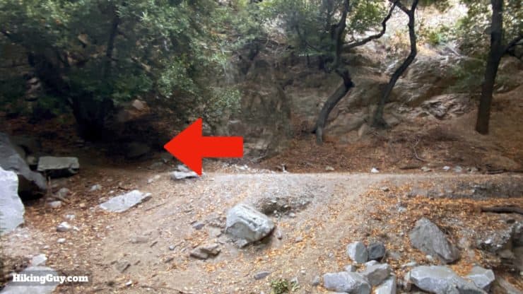
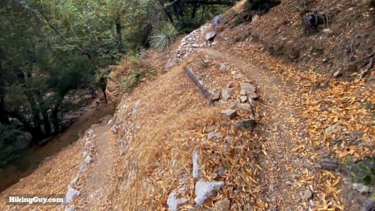
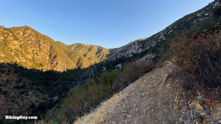
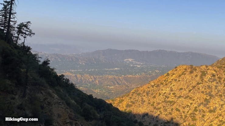
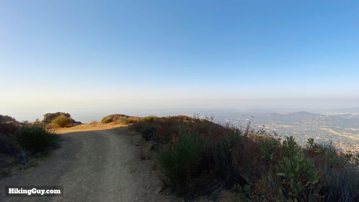
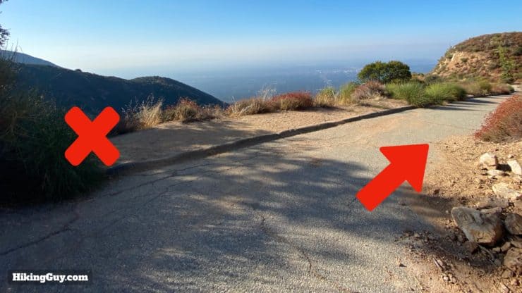
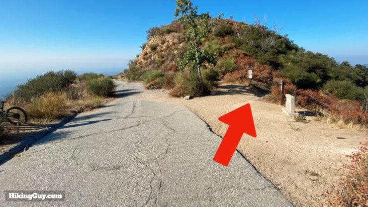
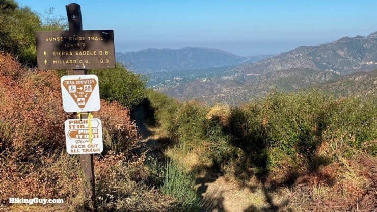
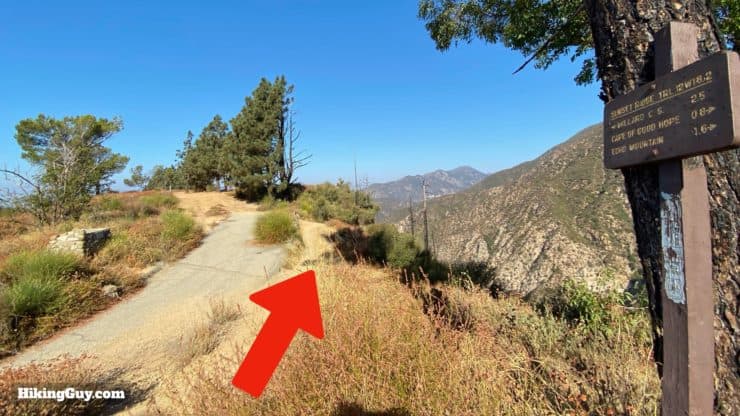
Start heading uphill from the junction. This section is steep and tough. It's incredible to imagine mine workers hauling ore up there to be transported on the Mt Lowe Railway.Make your way up the steep switchbacks. The good news is that once this climb is over, it's all downhill.As you start to climb out of Millard Canyon you'll get some sweet views of the Verdugo Mountains.Some sections of the trail hug the cliff wall. Look ahead to see the path of the trail.After about 0.6 miles of climbing you'll reach Dawn Station, the old stop on the Mt Lowe Railway. From here make a right onto Mt Lowe Road and start your descent.The views as you descend Mt Lowe Road are great. You should be able to see downtown LA and beyond on a clear day.You'll go past this rock formation that the railroad called the "cape of good hope" because the trains used to do a sharp turn to round this corner, just like ships would round the actual cape at the southern tip of Africa. The rock also resembles Table Mountain at the real Cape of Good Hope.Shortly after that you'll pass the trail to Echo Mountain back to your left, go straight. You might even hear people yelling into the echo phone there (I often do).And then hike right onto the Sunset Ridge trail to the right.Here's the start of the Sunset Ridge Trail at the last junction. Stay aware of mountain bikers who generally go downhill on this stretch.The nice winding descent offers more great views of the Verdugo Mountains and Mt Lukens (with all the antennas on top) and the highest point in the City of LA.When you get to Sierra Saddle, also know as Camp Sierra (you can picnic and camp on the flat area here), the trail bears off to the right.Once you leave Sierra Saddle, keep your eyes open across Millard Canyon for Saucer Falls.
If you want to visit Saucer Falls, the Dawn Mine Trail we took earlier goes close, but it's a tough go from that trail to the falls. I put the waypoint in the map for you.
Soon you'll pop out at the junction by the cabin that you were on earlier. Make the left and retrace your steps back.And soon you'll be back at the start. That's all she wrote!


 Using the Apple Watch for Hiking
 Garmin Fenix 7 & Epix Review For Hikers
 How To Read a Topographic Map
 Garmin GPSMAP 67i Review
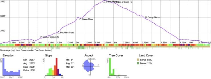

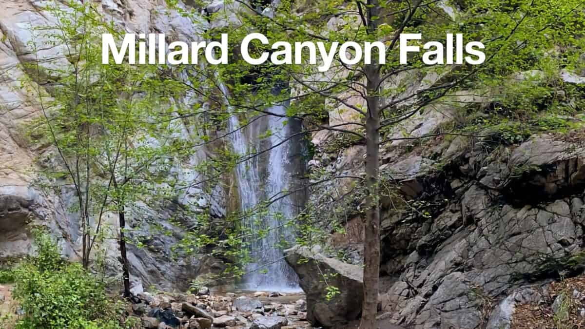 Millard Canyon Falls Hike
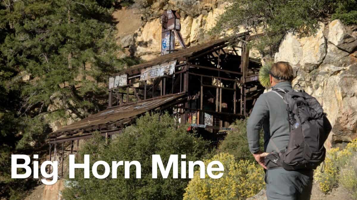 Big Horn Mine Trail & Vincent's Cabin
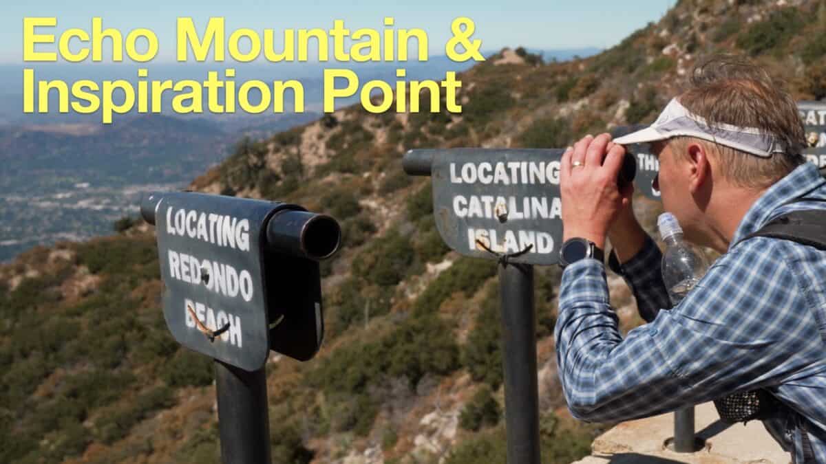 Echo Mountain & Inspiration Point Hike
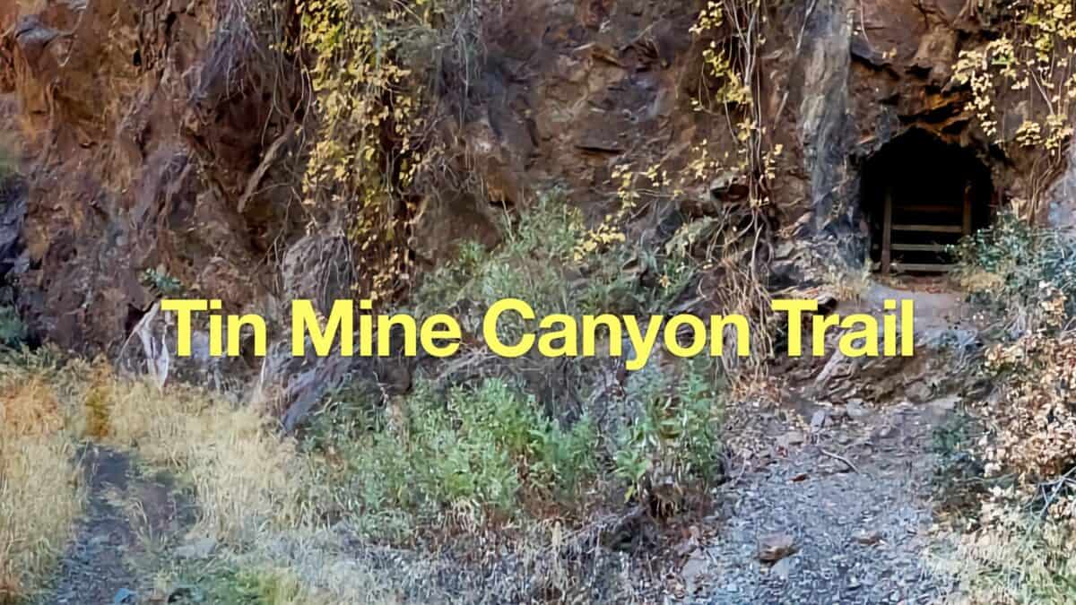 Tin Mine Canyon Trail Guide
 How to Hike To Eaton Canyon Falls
 Los Angeles Hikes
 Angeles National Forest Hikes
 Best Hiking Gear 2024
 Hiking Boots or Shoes: Do I Really Need Hiking Boots?
 When to Hit SOS on inReach