Momyer Creek Trail to Dobbs Cabin
PLAY VIDEO

Momyer Creek Trail to Dobbs Cabin

Distance: 12 miles
Time: 5-7 Hours
Total Climbing: 3150 feet
Difficulty: Hard
Crowds: Quiet
Dogs: Leashed

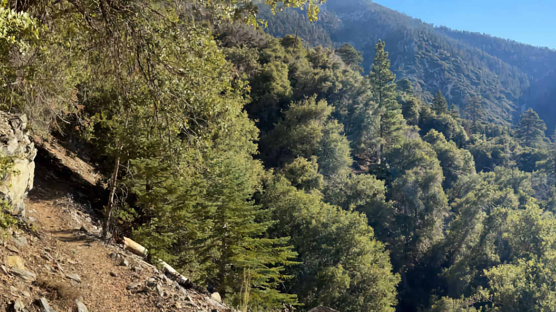
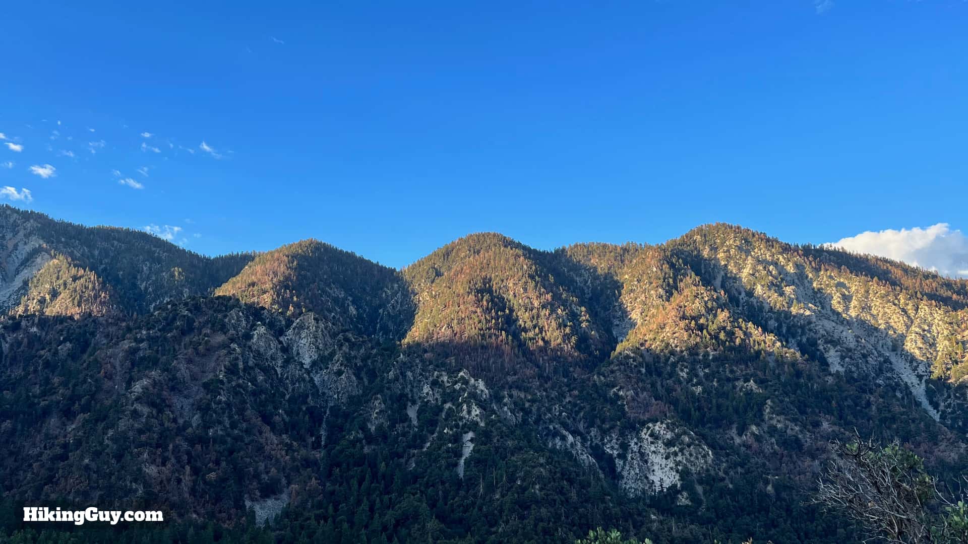
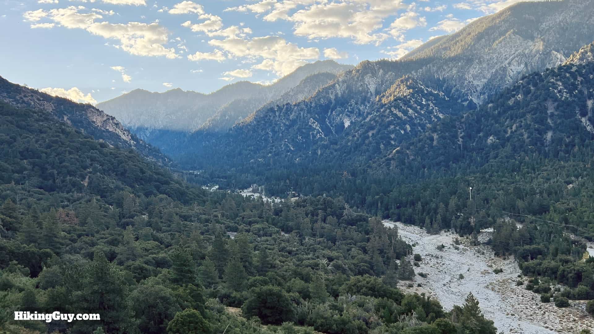
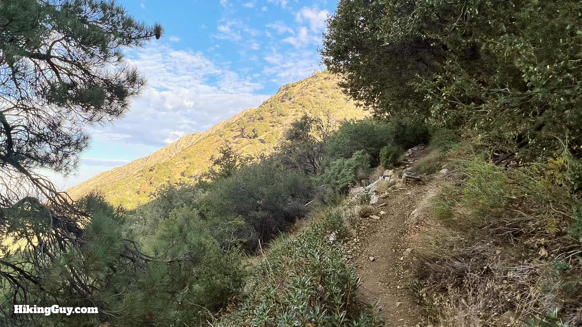
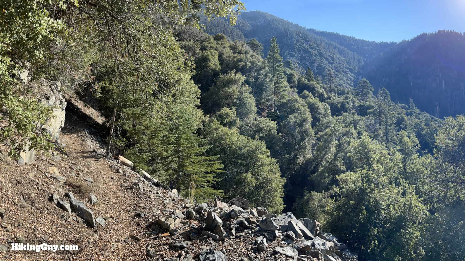
Located in some of the most pristine wilderness of Southern California, the hike up Momyer Creek Trail to Dobbs Cabin is a real treat. The hike offers several camping options, solitude, and a backcountry feel, even though it is not that far from civilization. And Momyer and Dobbs are influential figures in local history: this peaceful hike route was at the center of the battle between development and wilderness protection.

Where is the Momyer Creek Trail?

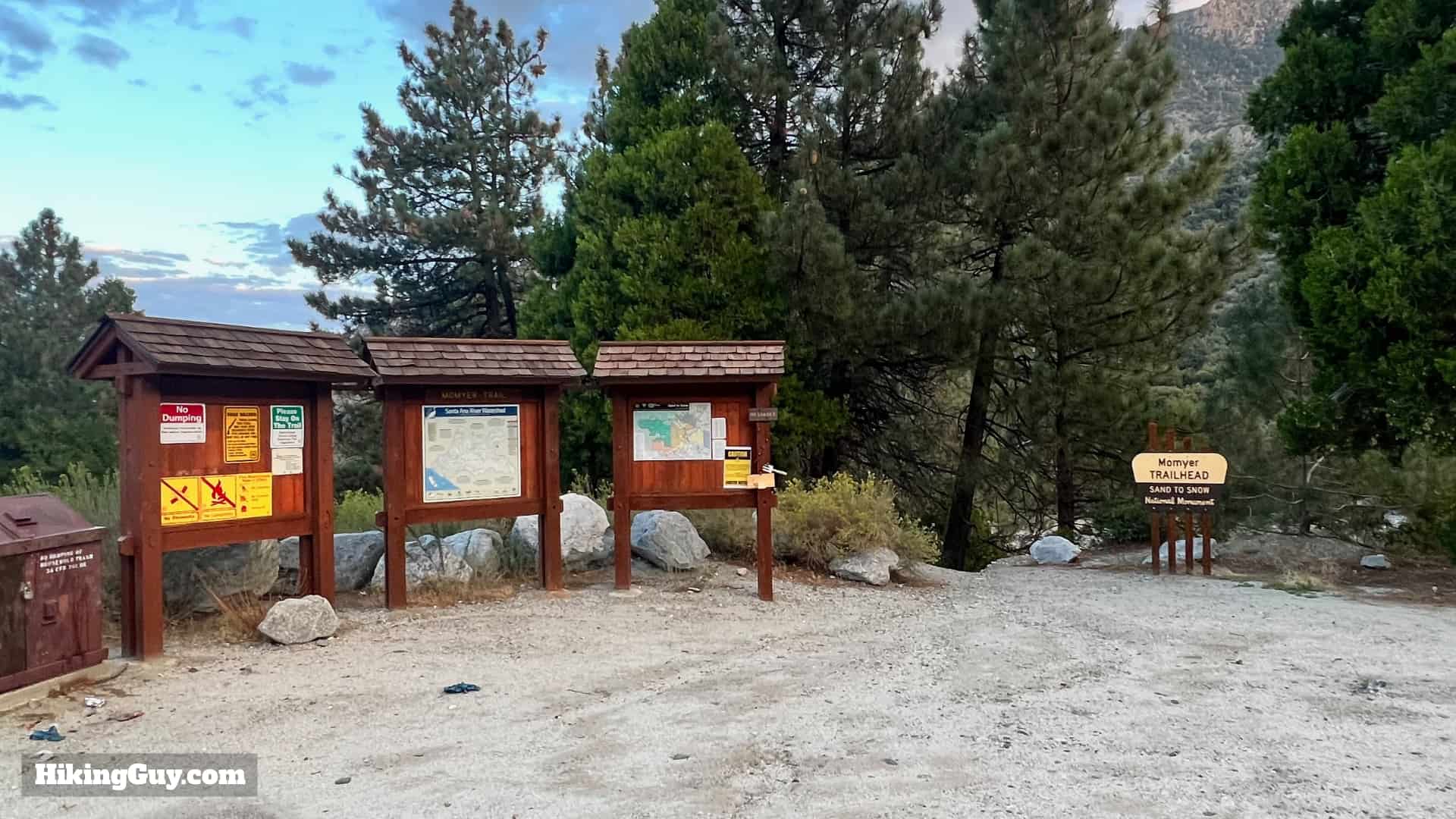
The hike starts at an established trailhead in Forest Falls, CA. Use this trailhead address:
40560 Valley of the Falls Dr, Forest Falls, CA 92339

Momyer Creek Trail To Dobbs Cabin 3
The parking lot is massive and never close to full.
Momyer Creek Trail To Dobbs Cabin 2
There's a board at the trailhead. Check it out before you hit the trail.

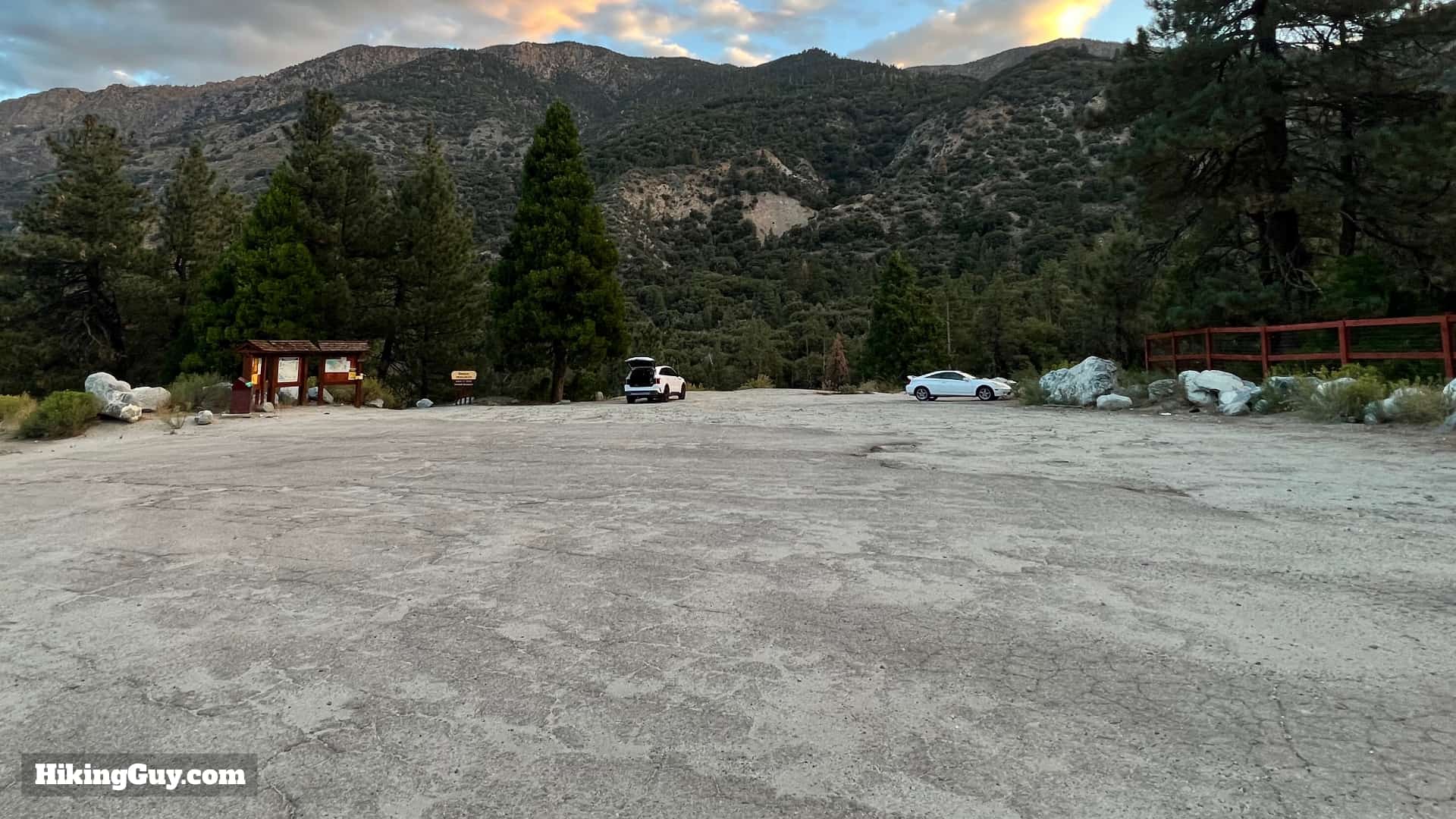
There are no bathrooms here. If you have to go, drive up to the nearby Falls Picnic Area.

You do not need a parking pass at the Momyer Creek Trailhead.
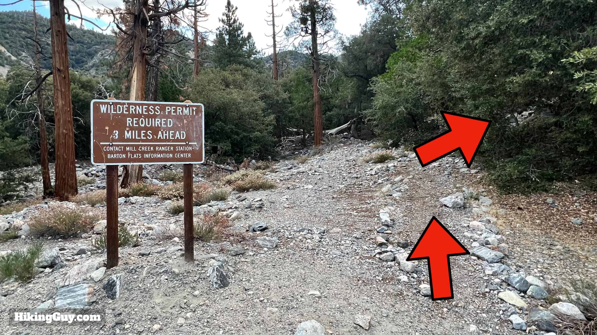
Permits

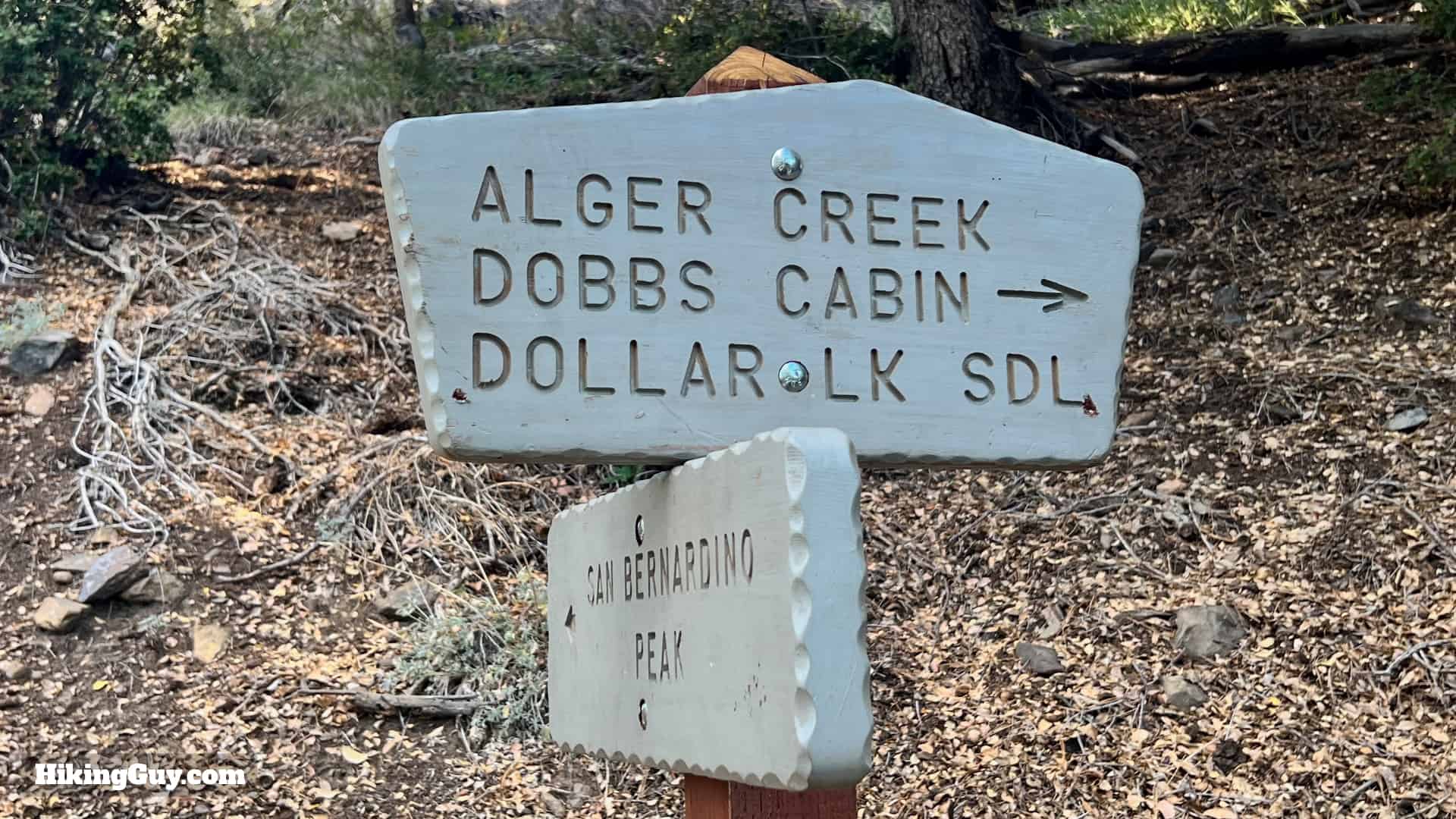
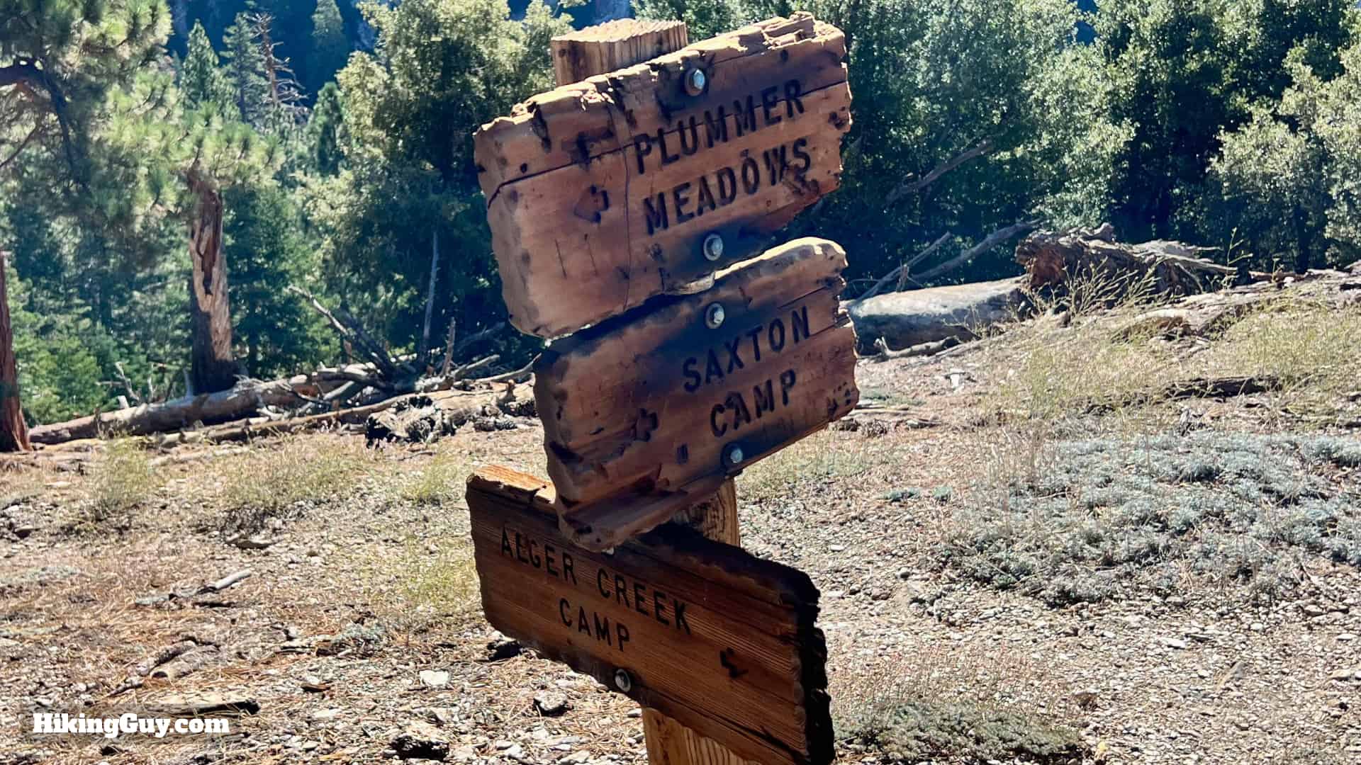
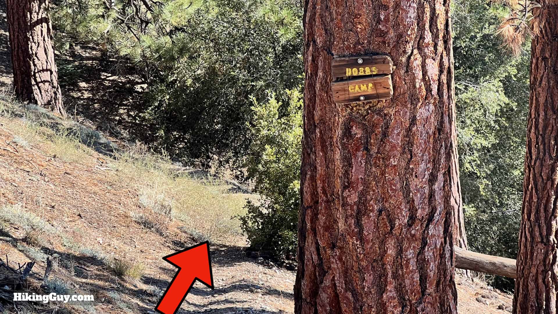
You can get a free permit for a day hike or overnight camping trip at the San Gorgonio Wilderness Association's permit website. Save the permit on your phone or print it out. This isn't a popular trail and you should be okay to score a permit at the last minute. The two campsites are Dobbs Camp and Alger Creek. Space is limited at the trail camps (no facilities), but again, this is not a popular area.

Gear For the Hike

This is a backcountry hike and you should plan accordingly.

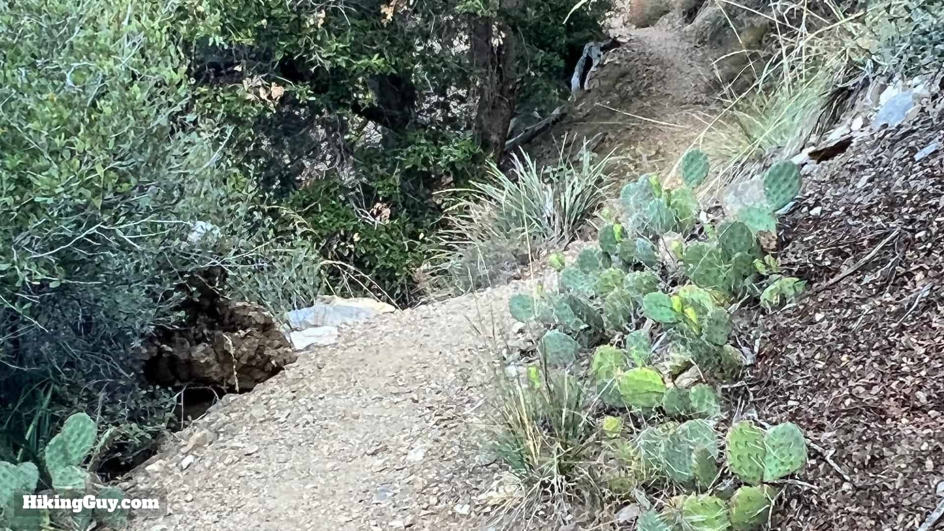
  • Trekking poles help on the slopes and stream crossings.
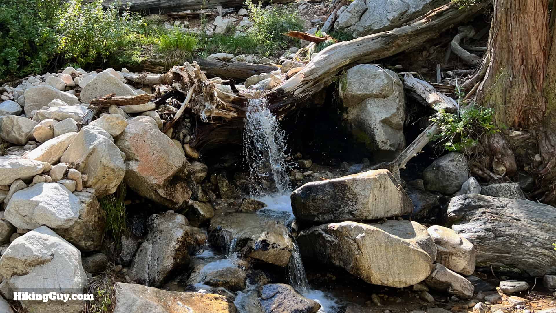
  • Your feet could get wet at the stream crossings.
  • There are perennial water sources along the route; you can get away with 1L and refilling with a filter.
  • In the winter, snow and ice can be on these lower slopes.
  • The route is well-shaded and cooler in the summer.
  • Bugs can be intense when it's warm out.

Gear I Love Right Now

Momyer Creek Trail to Dobbs Cabin Trail Maps

Click to activate map
CalTopo
Print Map, Work With It Yourself
GPX
Bring the Guide to Any GPS

Elevation Profile

Momyer Creek Trail To Dobbs Cabin Elevation
Here's the one-way elevation profile. The trail eases into a climb that ends once entering the San Gorgonio Wilderness boundary. From there it's rolling terrain that falls on the side of uphill as you head toward Dobbs Cabin.

3D Map

Momyer Creek Trail To Dobbs Cabin 3d Map
After crossing Mill Creek wash, we'll climb up a few miles before heading along the ridge, crossing the Alger Creek drainage, and coming around to Falls Creek and Dobbs Cabin

Hike Brief

Momyer Creek Trail To Dobbs Cabin Historic
Here's Dobbs Cabin around 1900. The picturesque cabin, visited by tourists guided by John Dobbs, was featured in postcards at the time. Photo Pioneers of Mill Creek Canyon
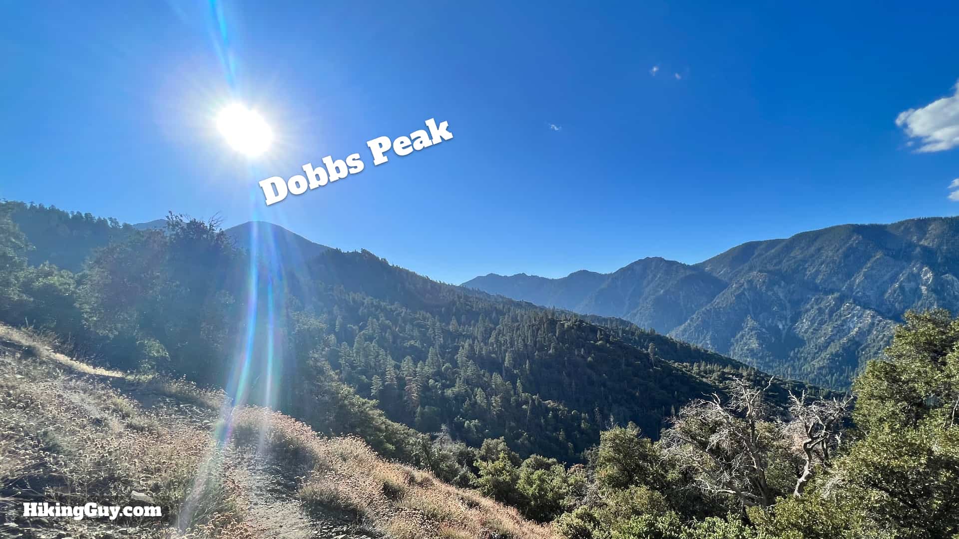
  • Dobbs arrived in the area in 1896, originally from Arkansas and then Texas. He quickly became a fixture in the area, working as a mountain guide. Dobbs Cabin and Dobbs Peak were named after him.
  • Dobbs was also opportunistic, staking mining claims here and pursuing his most significant project, a hydroelectric power generation system. He teamed up with hydroelectric pioneer Cyrus G. Baldwin to channel the water on the north side of Mill Creek into a flume, providing power to developed communities like Lakeview and Perris. The project never panned out, and Dobbs focused on tourism, but you can still scattered lumber from the flume project in the area.
  • Dobb's original Falls Creek Trail and flume route was east of the Momyer Creek Trail. However, local homeowners shut down the lower slopes of that trail in the 1960s because they didn't want hikers traversing their land. After that, Boy Scouts created the connector trail from Momyer to the old Falls Creek Trail, which you'll hike on for this route.

    Momyer Creek Trail To Dobbs Cabin Old Trail
    You can still see the old trail on some maps. I haven't explored it and I'd imagine it's pretty overgrown.
  • Dobbs was hit by lightning when hiking by San Gorgonio. After getting hit, he retired and wasn't seen often.
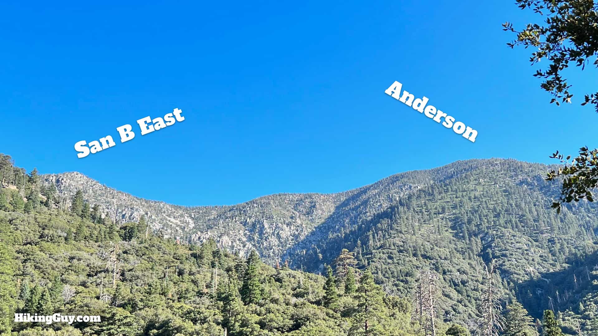
  • This area of the San Bernardino mountains was at the forefront of the battle against development. From the early 1900s, Forest Falls was home to several resorts. Baldwin (Dobbs's partner) wanted to use his hydroelectric power to build a gondola from Forest Falls to the summit of San Gorgonio. The high slopes were also popular with skiers, and in the 1960s, Walt Disney tried to build a ski resort here.
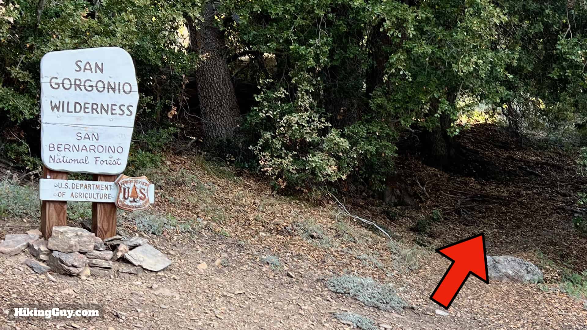
  • But in 1962, Joe Momyer and a few others created the Defenders of the San Gorgonio Wilderness, which fought against Disney and others. Eventually, they helped pass the Wilderness Act, and today the entire wilderness is protected against development. The Momyer Creek Trail honors one of the folks who saved the area.

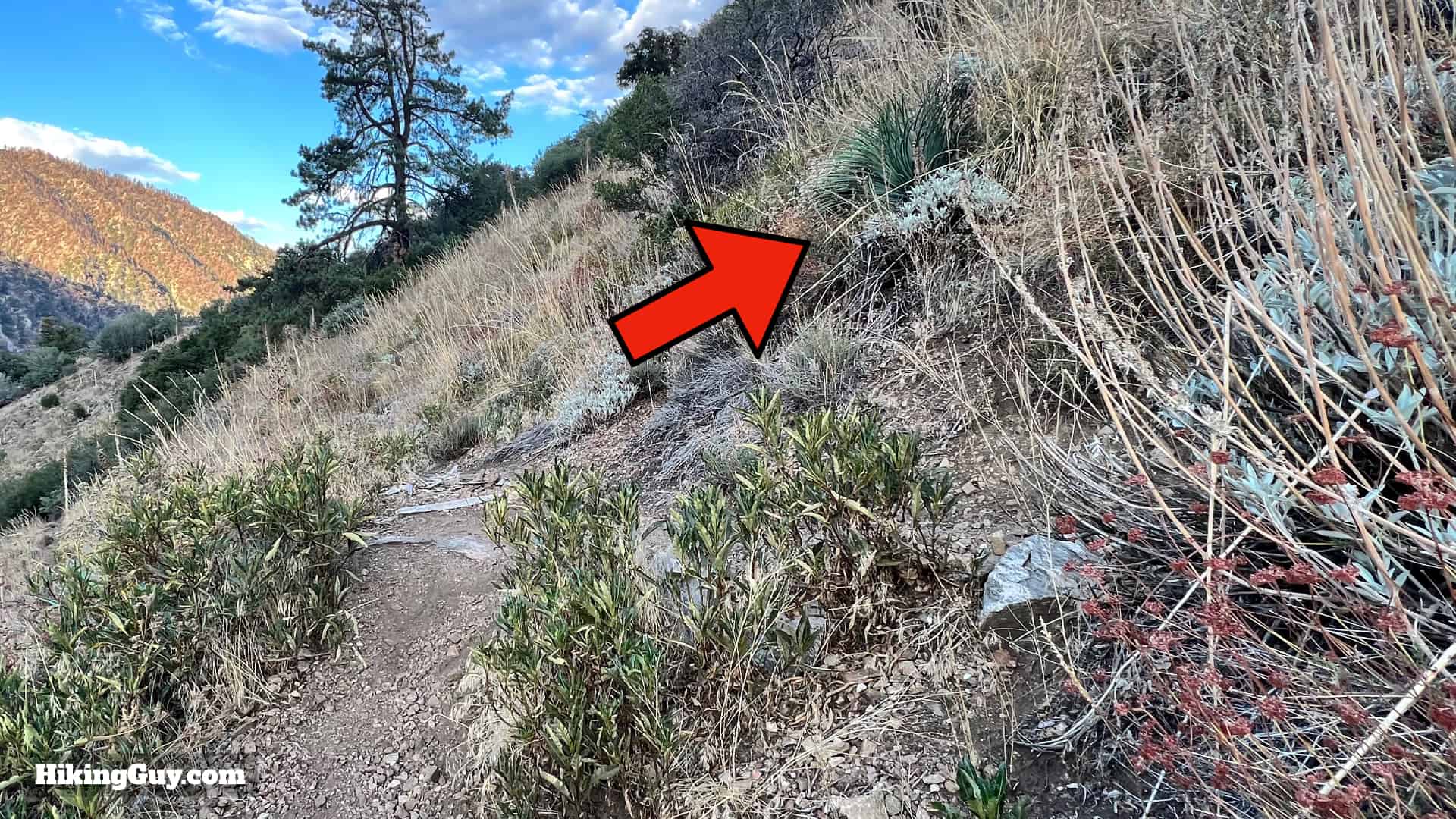
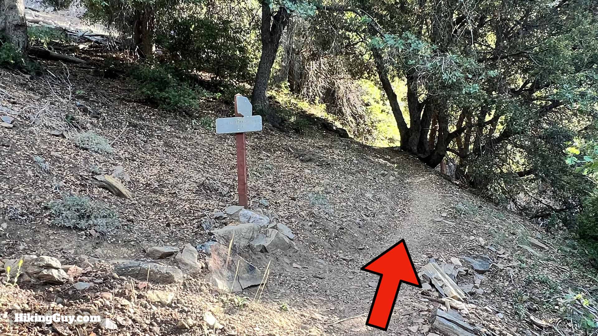
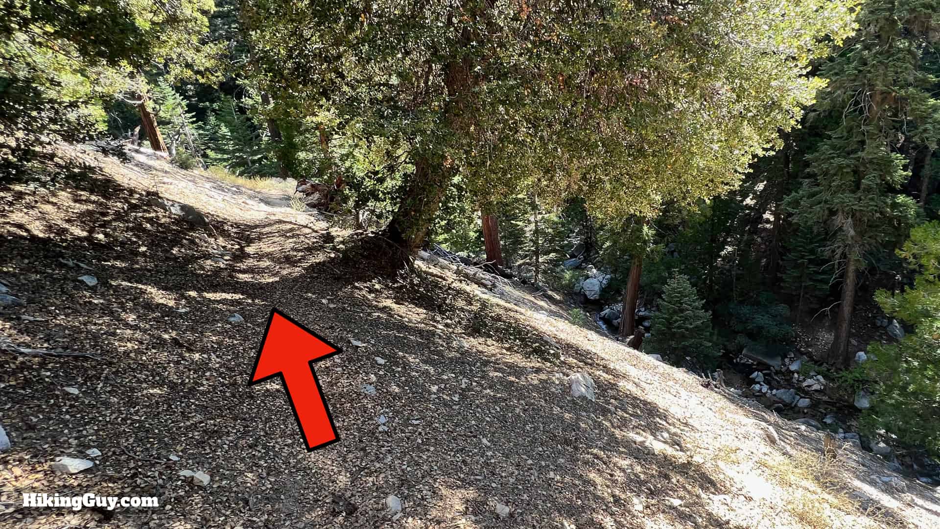
Dobbs Cabin Hike Directions

Momyer Creek Trail To Dobbs Cabin 4
Go past the trail sign and bear left, taking the wider switchback down to the lower area. It's easier than the steep cutoff straight ahead.
Momyer Creek Trail To Dobbs Cabin 5
Hike past the bench toward the Mill Creek wash.
Momyer Creek Trail To Dobbs Cabin 6
The trail winds down toward the main area of the wash.
Momyer Creek Trail To Dobbs Cabin 7
Crossing Mill Creek is always a new experience. The trail changes based on water flow and changing conditions. And the stream can be high or low. The key is to look for the big brown sign on the other side and make your way toward it.

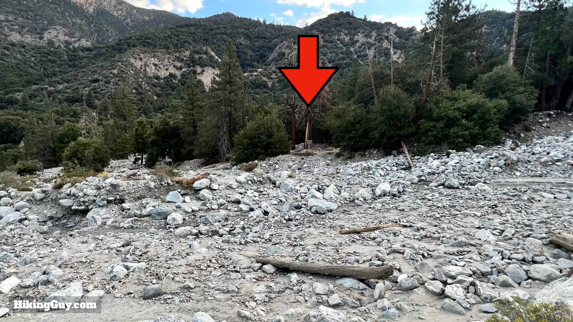
Sometimes there can be intense flash floods at Mill Creek. If that's the case, it's not the time to do this hike.

Momyer Creek Trail To Dobbs Cabin 8
Once across Mill Creek, start the Momyer Creek Trail on the right of the sign. The beginning can be hard to spot.
Momyer Creek Trail To Dobbs Cabin 9
The trail continues above Mill Creek.
Momyer Creek Trail To Dobbs Cabin 10
And then turns back west and is mostly level.
Momyer Creek Trail To Dobbs Cabin 11
When you break out of the oak canopy, you'll get expansive views down Mill Creek and the trail gently slopes uphill.
Momyer Creek Trail To Dobbs Cabin 12
Across Mill Creek Canyon are some small peaks, including Oak Glen Peak (center here). On the other side of the peak is Oak Glen, where all the apple orchards are.
Momyer Creek Trail To Dobbs Cabin 13
When you hit the first switchback, the climb starts in earnest.
Momyer Creek Trail To Dobbs Cabin 14
The views up Mill Creek Canyon are epic.
Momyer Creek Trail To Dobbs Cabin 15
Soon you'll enter a canopy of oak. Aside from short exposed sections after this, the trail is mainly wooded.
Momyer Creek Trail To Dobbs Cabin 16
You can even see prickly pear cactus as you pass 6000 feet.
Momyer Creek Trail To Dobbs Cabin 17
Keep winding up the switchbacks and enjoying the views as they present themselves.
Momyer Creek Trail To Dobbs Cabin 18
At about 2.7 miles in you enter the San Gorgonio Wilderness.
Momyer Creek Trail To Dobbs Cabin 19
And shortly after that you reach a trail junction. The Momyer Creek Trail continues toward San Bernardino Peak to the left. We're going straight on the Momyer-Alger Creek Trail.
Momyer Creek Trail To Dobbs Cabin 20
Here's a closeup of the trail sign. We're heading to Alger Creek next.
Momyer Creek Trail To Dobbs Cabin 21
After the last junction the main climbing is done, and the trail is rolling. This is the connecter trail that the Boy Scouts built. Thank you Boy Scouts!
Momyer Creek Trail To Dobbs Cabin 22
In front of you as you head east is Dobbs Peak, named for the same Dobbs as Dobbs Cabin.
Momyer Creek Trail To Dobbs Cabin 23
This section of trail is spectacular with cliff walls on one side and the lush Alger Creek basin below.
Momyer Creek Trail To Dobbs Cabin 24
As you enter the Alger Creek watershed it feels more like the Sierras than the cactus-lined scrub it was a mile or so before. You'll start a descent toward Alger Creek.
Momyer Creek Trail To Dobbs Cabin 26
When your reach Alger Creek Camp spur (to the right), make a hard left on the Falls Creek Trail.
Momyer Creek Trail To Dobbs Cabin 28
Alger Creek Camp has some primitive tent sites along the trail.
Momyer Creek Trail To Dobbs Cabin 29
Cross over Alger Creek just upstream from the last junction.
Momyer Creek Trail To Dobbs Cabin 30
And then climb out of Alger Creek's gully.
Momyer Creek Trail To Dobbs Cabin 31
As you climb there's one viewpoint where you get nice views of Anderson Peak and San Bernardino Peak East.
Momyer Creek Trail To Dobbs Cabin 32
The trail levels out and rolls as it passes through some small meadow areas.
Momyer Creek Trail To Dobbs Cabin 33
At around 5.1 miles in the Falls Creek Trail continues up to the left. We're taking the spur trail to Dobbs Cabin, which is straight.
Momyer Creek Trail To Dobbs Cabin 34
Here's the sign from the last junction.
Momyer Creek Trail To Dobbs Cabin 35
Once past the junction you'll see a sign for Dobbs Camp. You have about 0.5 miles of descent to the creek.
Momyer Creek Trail To Dobbs Cabin 36
Continue down the steep slopes.
Momyer Creek Trail To Dobbs Cabin 37
When you get to the creek, make the sharp turn downstream and stay on this side of the creek.
Momyer Creek Trail To Dobbs Cabin 38
Hike under the fallen tree.
Momyer Creek Trail To Dobbs Cabin 39
And when you come out at the waterfall, you can cross the stream to the right and below it to find the tent sites.
Momyer Creek Trail To Dobbs Cabin 40
You can also stay on this side and head downstream more for other places to cross. At this point it's all unofficial use trails.
Momyer Creek Trail To Dobbs Cabin 41
There's several tent sites and then this lower and largest one, about 100 yards downstream from where you joined it.

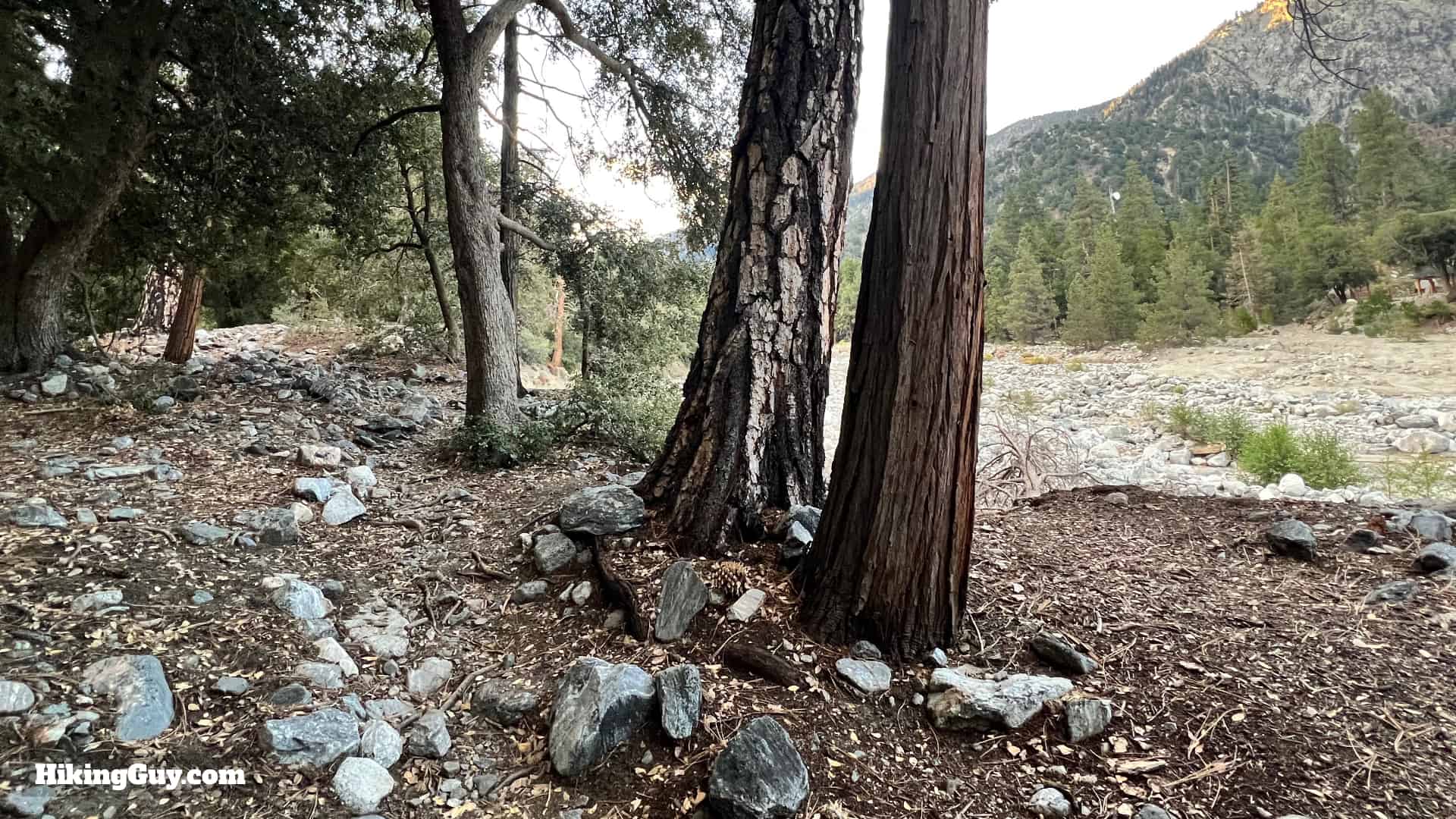
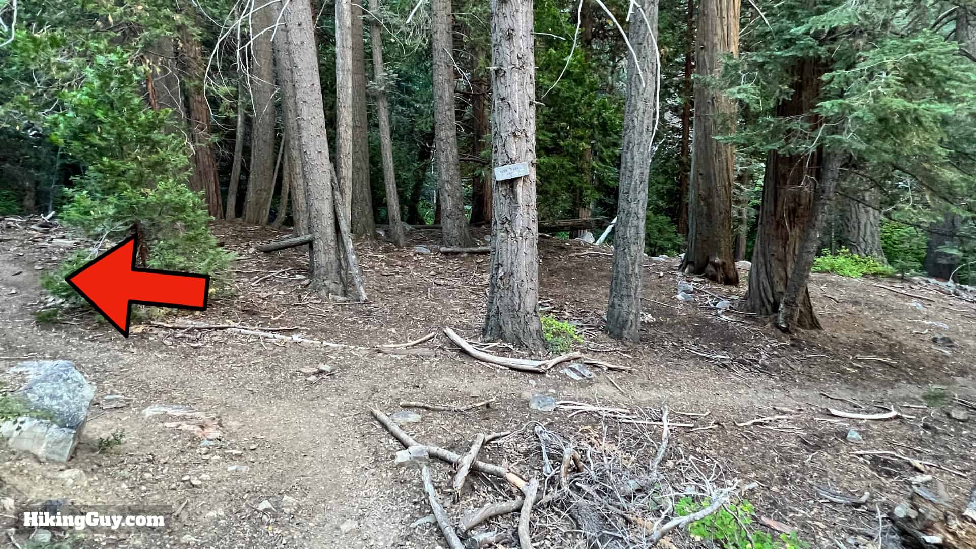
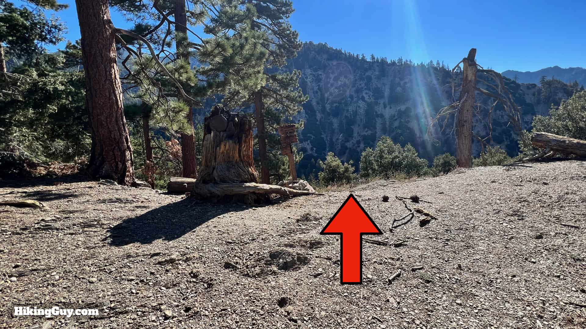
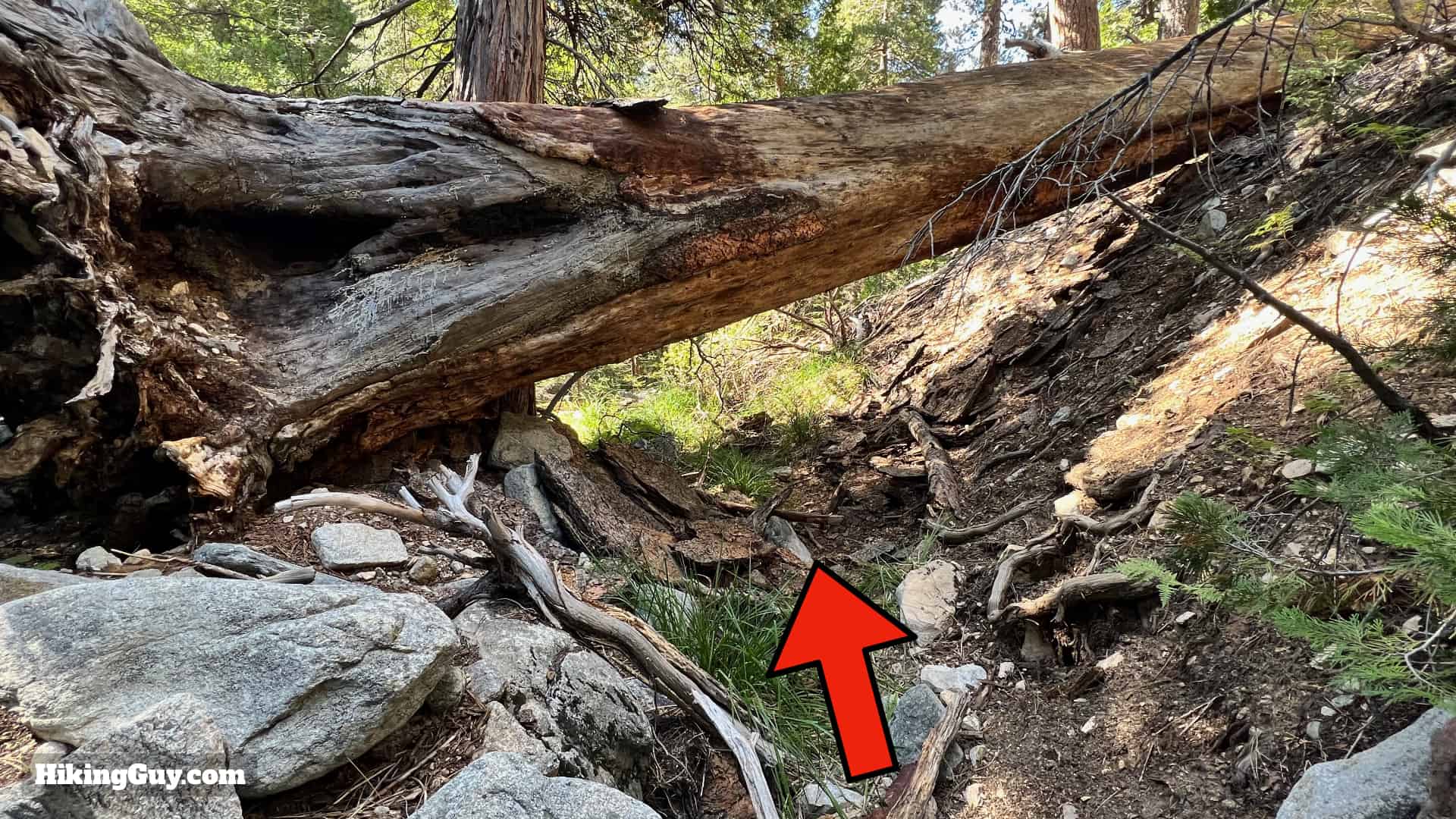
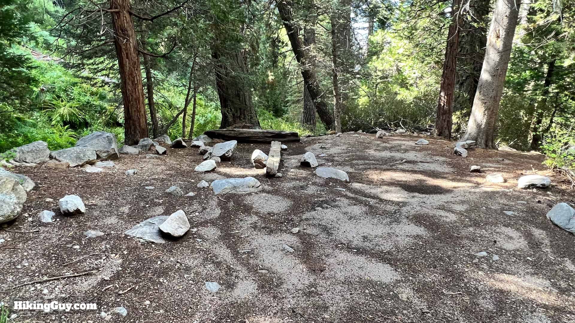
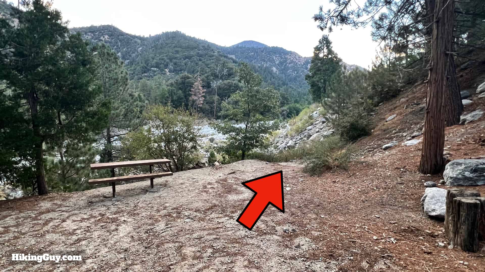
Is this the actual site of the cabin? I was told that but I'm not sure. I've heard of metal debris off-trail to the north. I'm also not positive after looking at the old image earlier in the guide. Wherever it was, it was around here somewhere. The area in the last photo was definitely cleared and leveled by humans.

Momyer Creek Trail To Dobbs Cabin 42
That's the hike! When you're done, just return the way you came.

Last updated May 2025