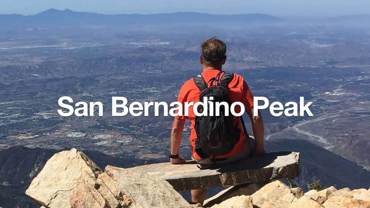
Hike San Bernardino East Peak From Forsee Creek Trail
18 miles - Hard Effort
8-9 Hours (Total)
4,600 Total Feet of Climbing
Max Elevation of 10,691 feet
Leashed Dogs Allowed
Get away from the crowds on this San Bernardino East Peak hike that climbs up the Forsee Creek Trail, meanders along the breathtaking Bernardino Peak Divide Trail, then heads back to the start on the primitive and secluded John's Meadow Trail. It's a tough hike with a fair amount of climbing, but the scenery and ruggedness of the San Gorgonio Wilderness make it well worth it. I usually do this as a loop hike in a day, but there are several camping options if you want to make it an overnighter.
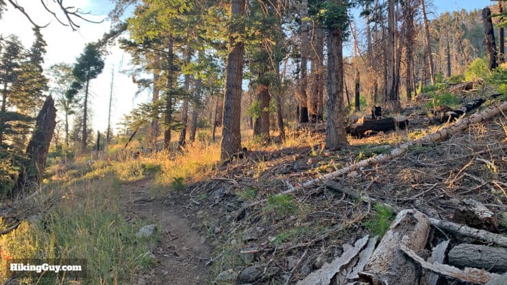
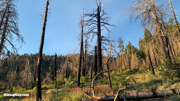
This whole area was badly damaged by forest fires in recent years. Although the area is reopened, John's Meadow Trail is in bad shape and non-existent and dangerous in spots. Your best move is to bag the San Bernadino summits and then return the same way. Thanks to Troy C for the update.
Getting to the Trailhead
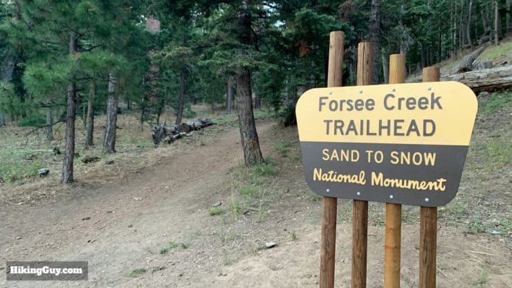
The Forsee Creek Trailhead is in Angelus Oaks, about 15 minutes up CA-38 from the popular San Bernardino Peak Trailhead. The last section of the drive is on a dirt road that has some rough spots, but it's doable in a low-clearance car if you go slow. I did it in a Kia Niro and was okay. I would have liked to blow through it in my old Jeep, but not in the cards for me these days.
You need a National Parks Pass or Adventure Pass to park in the lot. There are no toilets or facilities here.
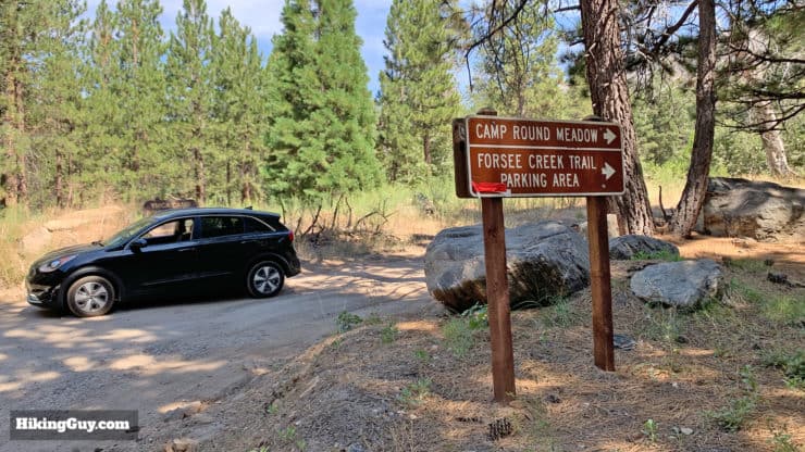
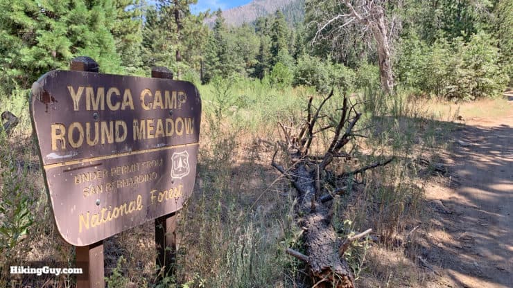
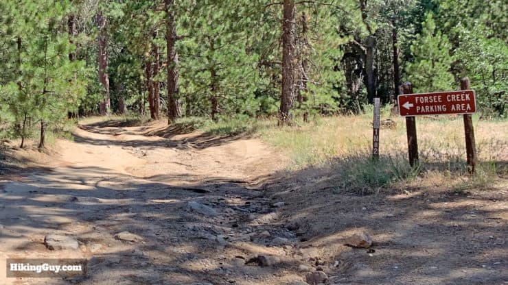
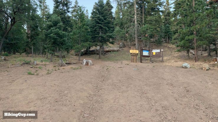
There are forest service signs pointing you to the Forsee Creek Trailhead. You can also see the vehicle that I used on the dirt road. I just went slow on the rough spots, picking my way through the ruts and bumps, and the drive was fine.There's also this YMCA sign where you turn off the paved road, which is easier to spot.Once you turn onto the dirt road, go straight and avoid the turnoffs which lead to private property.The parking area is pretty big and the trailhead is well-marked at the far end of the parking area.Here's a view looking back onto the parking area. Given the remoteness of this trail, you should be okay for parking when you get here early for a day hike. The times I've seen it the most crowded were on weekend afternoons when folks use this trailhead to hit campgrounds like Jackstraw or John's Meadow.
Permits for the Hike
For a day hike you now DO need a quota-based permit. And if you want to camp at one of the primitive campgrounds along the route, you'll need a permit for that, which you can book in advance. Rangers do turn around hikers who plan on camping but don't have an approved permit. Each campground has a daily quota. You can get all the permits and instructions on the San Gorgonio Wilderness Associate website here.
Permit Availablity
Can't get a permit for your date? Try OutdoorStatus.com and get a text message as soon as a cancelled permit opens up!.
Gear For the Hike
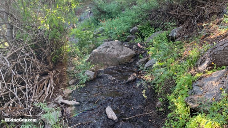
This is a long hike and you should prepare accordingly. I generally go through 1L of water (or beer) every 4 miles, and on this one I'll go through about 4-5L There are some water sources along the hike where you can fill up, but they're not always reliable. As always, better in the spring, worse in the fall. The slopes can be steep and trekking poles are useful on this hike, especially on some of the more primitive sections of John's Meadow Trail.
In the winter, you're pretty high up, so this hike can become a mountaineering experience. Even in the summer, temperatures on the San Bernadino Peak Divide Trail can be windy and chilly. Check the conditions before you go.
If you want to check if there's snow on your hike, read this guide.
Osprey Hikelite 26Lightweight, carries all your gear, and your back doesn't get sweaty. Oh yea, it's also one of the most inexpensive packs you can get.
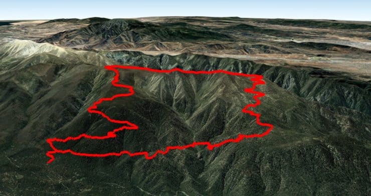
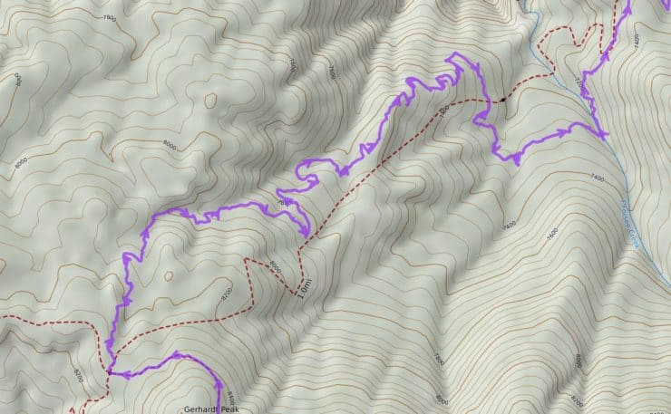
There are a few routes you can take to San Bernadino East Peak and I chose this particular routing because it's beautiful and relatively easy to follow. The climb goes up Forsee Creek Trail, then across the San Bernadino Peak Divide Trail with great views, then back down on the San Bernadino Peak Trail, then back to the start on the John's Meadow Trail. This hike hits San Bernadino East Peak, but you can also easily bag Andersen Peak and San Bernadino Peak on the way too.
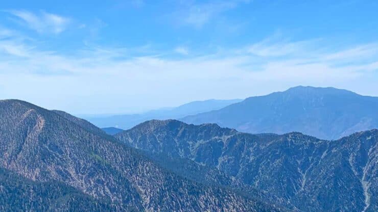
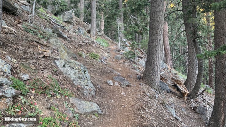
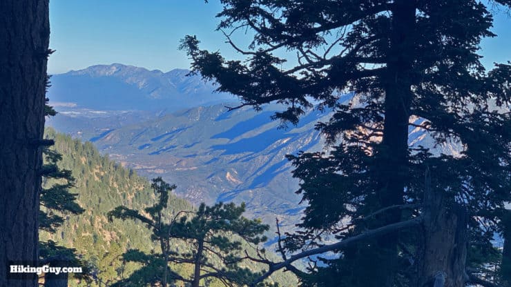
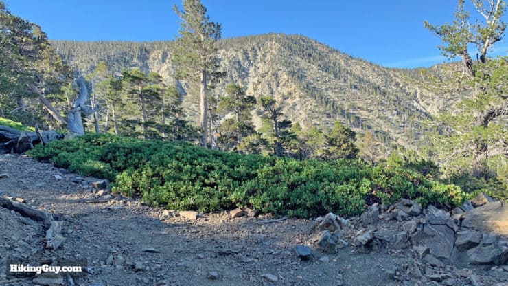
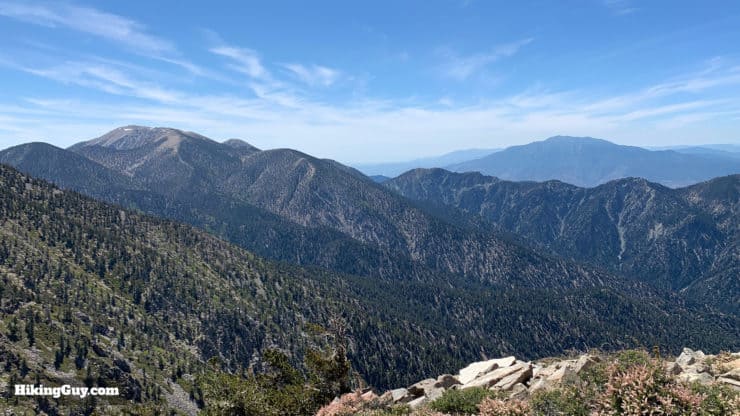
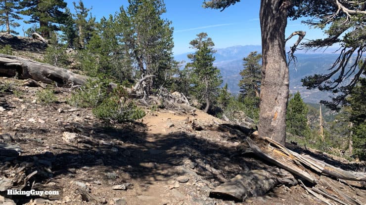
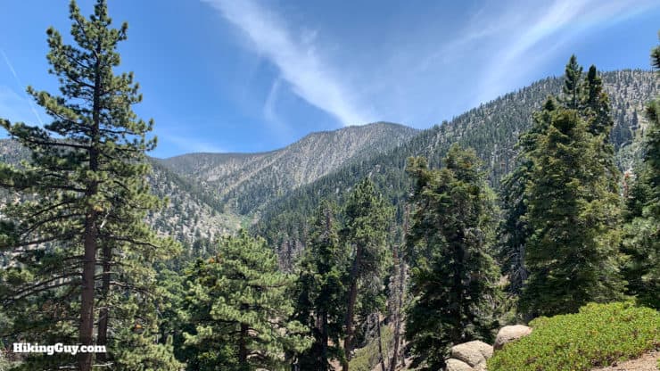
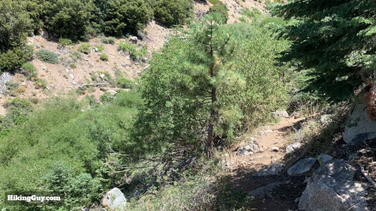
The climb at the beginning of the hike is long but doable. The slope is relatively consistent for most of the way with a few sections to take a breather. The last section on John's Meadow Trail can be tough with some ups and downs that always hurt me more after the big climb on the first part of the hike.I enjoy doing this hike clockwise but you could also do it the other way. You can see from this view that once you get to the ridge you'll have great views of San Gorgonio and San Jacinto.One thing to note, if you're looking at OSM maps, the John's Meadow Trail is way off (the dotted line here). There was a different trail in the past (I've heard) that was destroyed but I have no idea if it's the line on the map. I submitted a correction with the new trail to OpenStreetMaps but older maps may still have this incorrect trail. Follow my GPS track and you'll be good.
San Bernardino East Peak Hike Directions
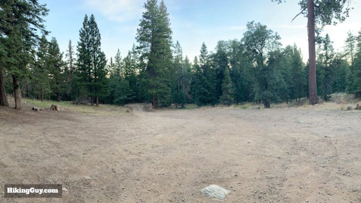
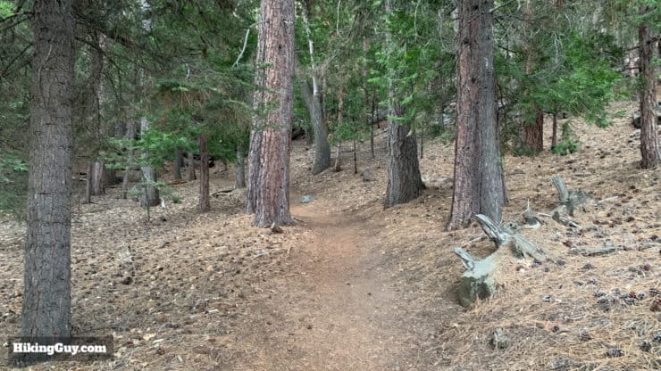
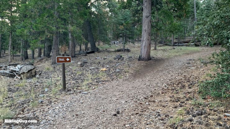
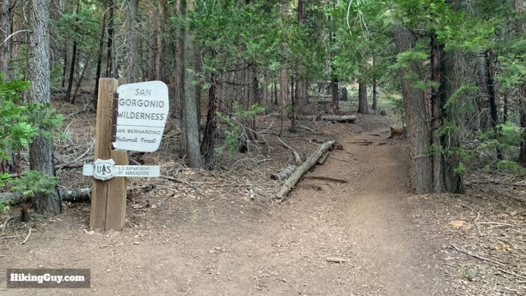
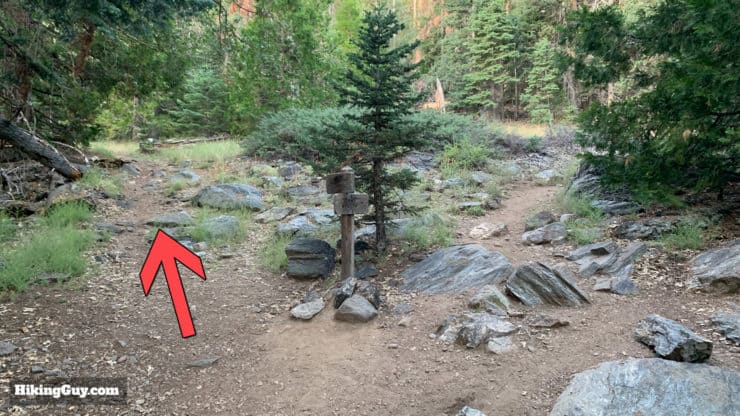
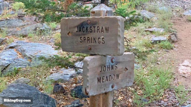
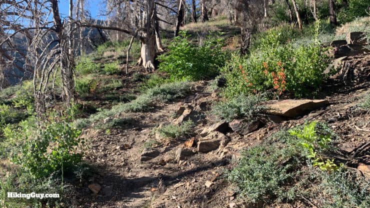
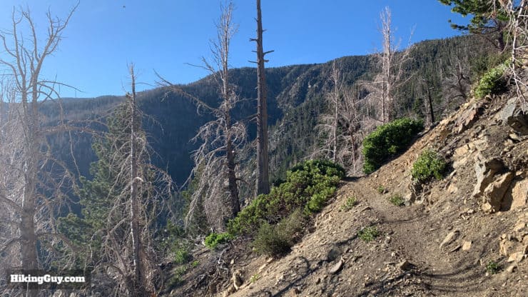
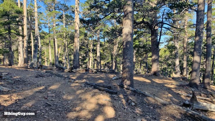
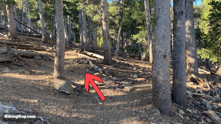
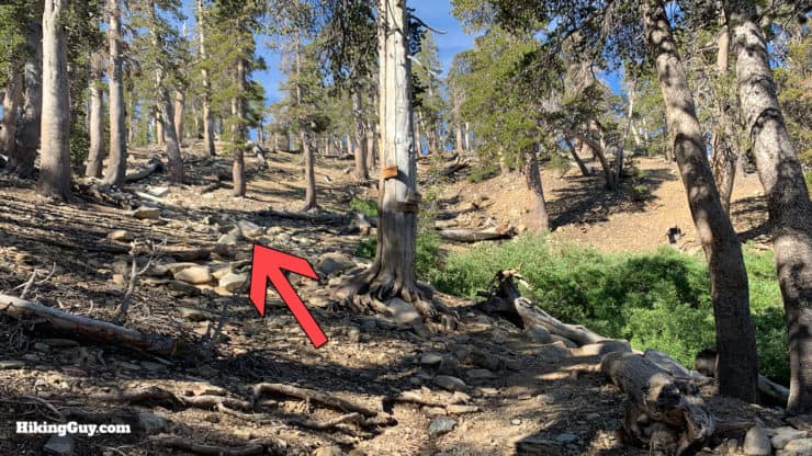
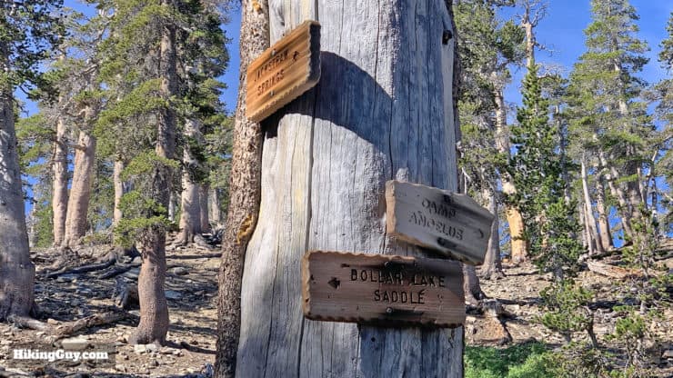
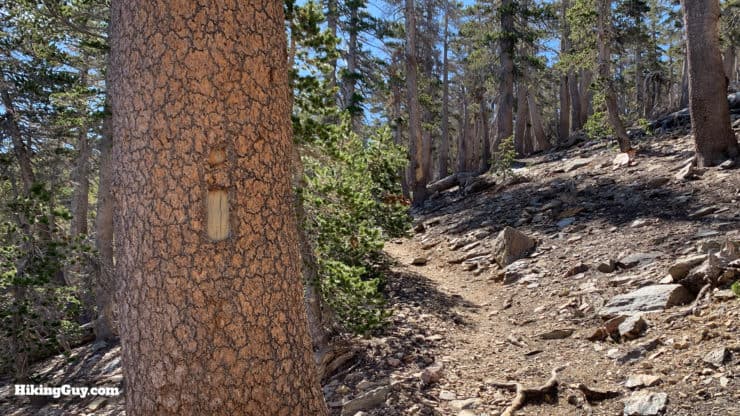
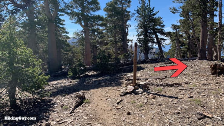
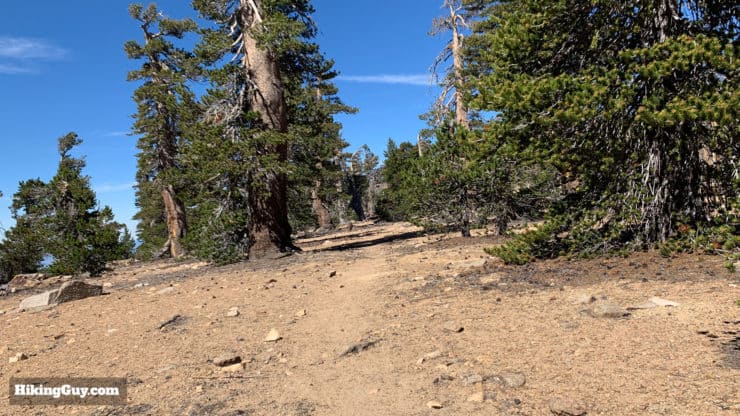
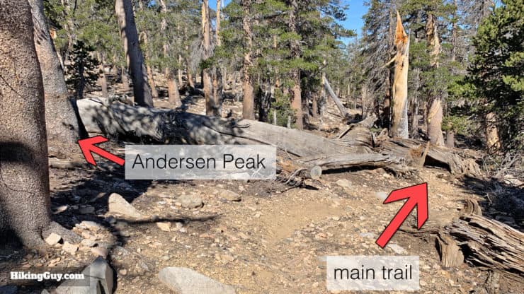
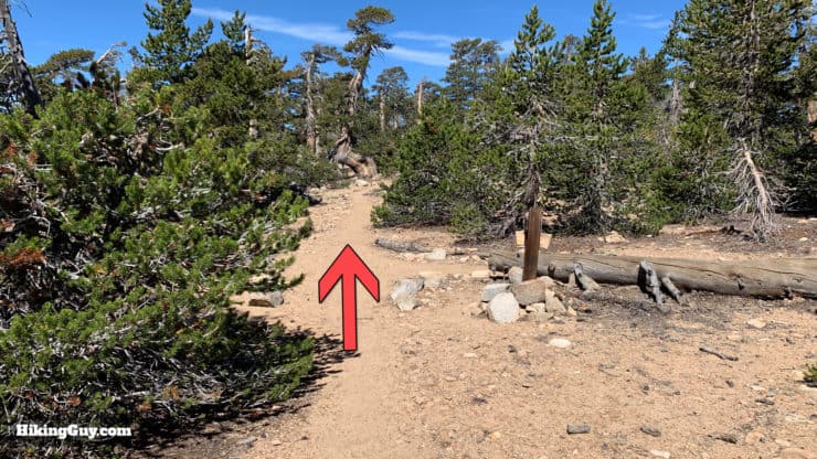
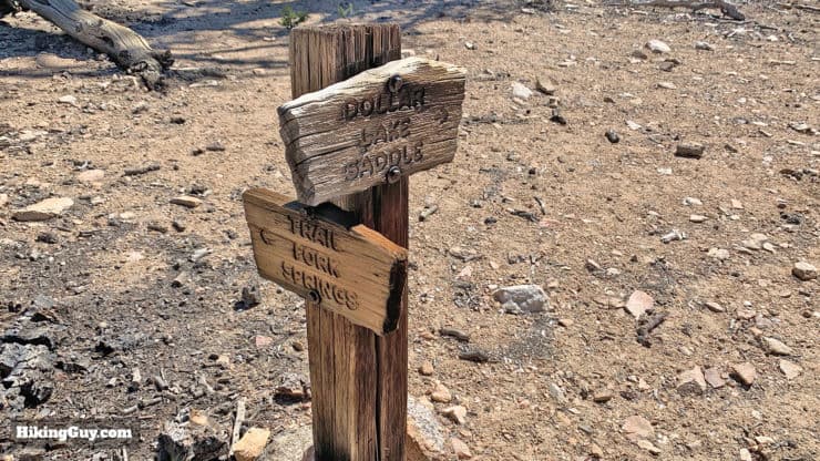
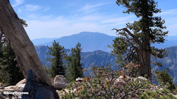
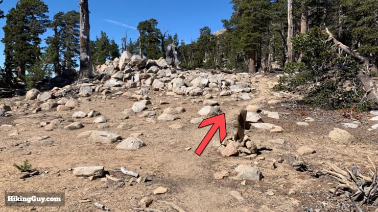
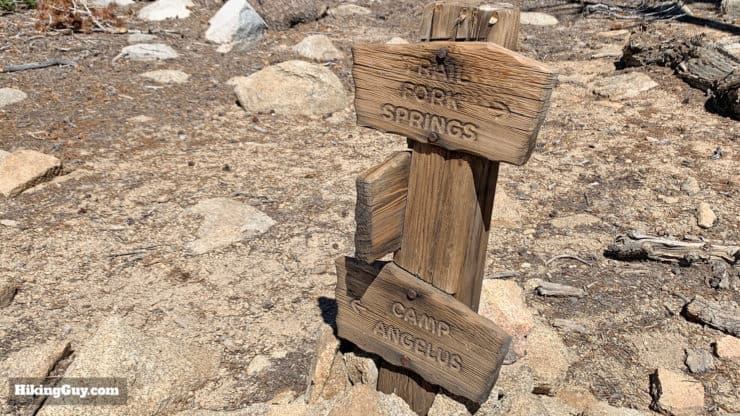
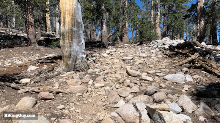
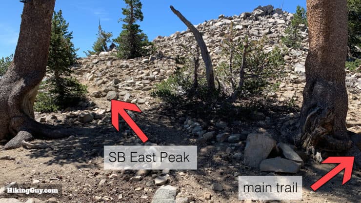
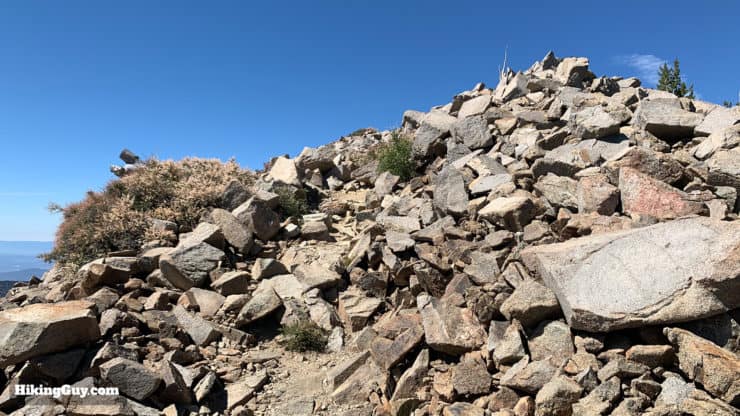
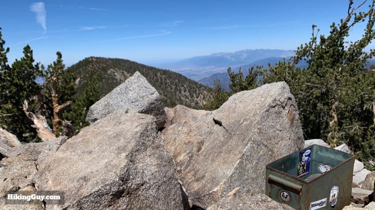
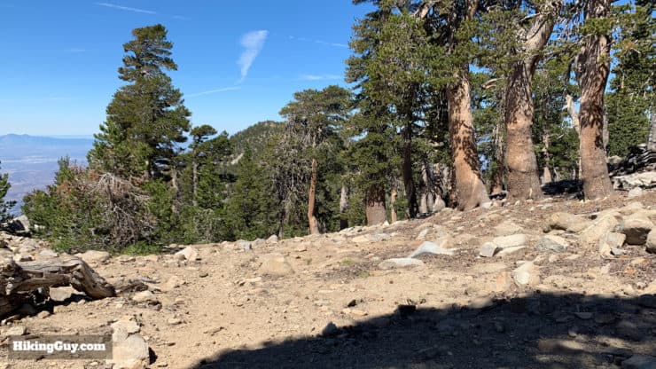
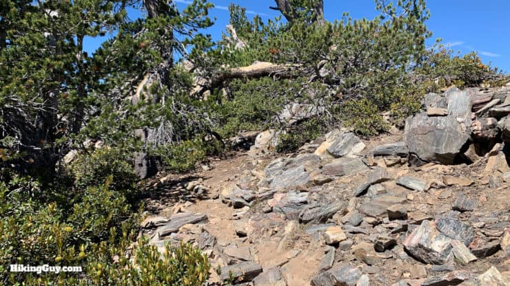
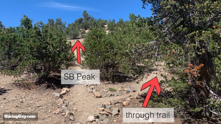
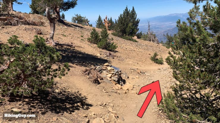
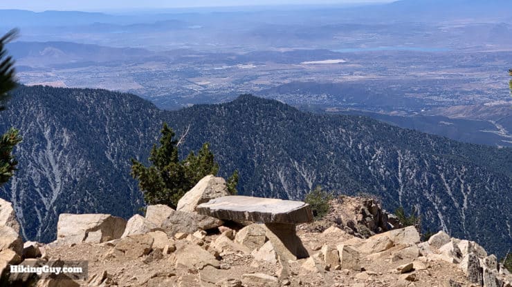
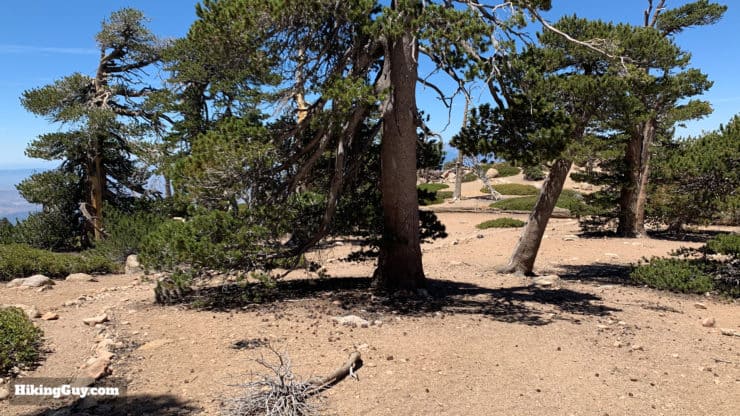
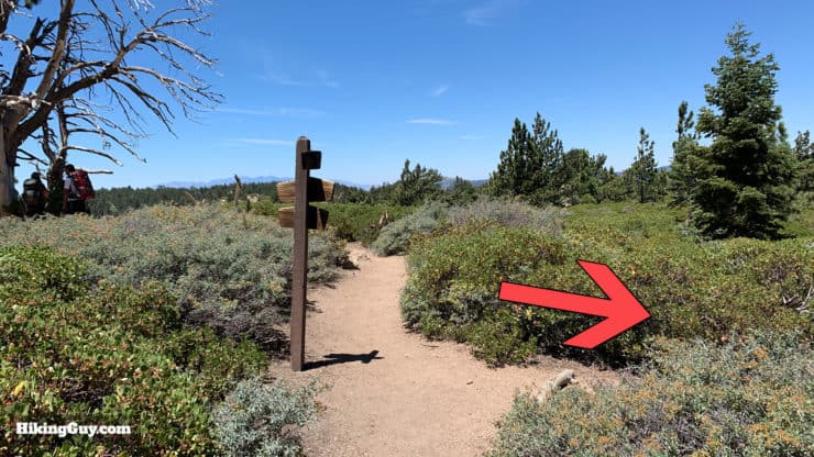
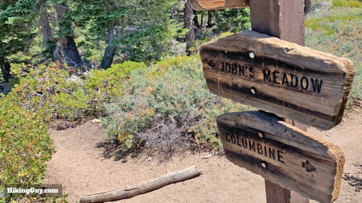
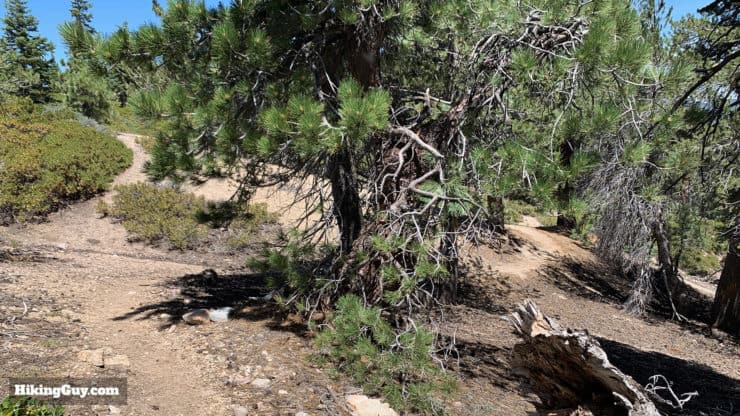
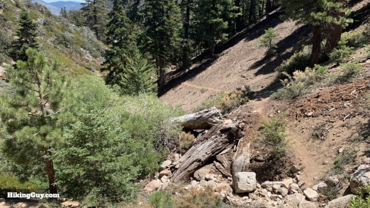
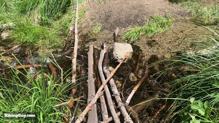
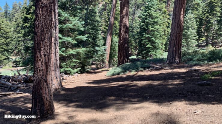
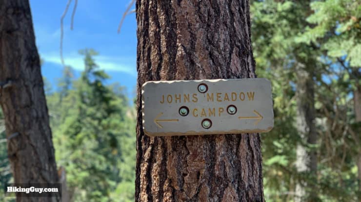
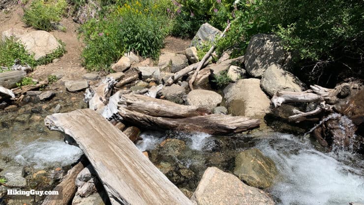
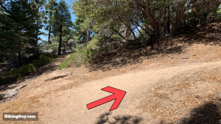
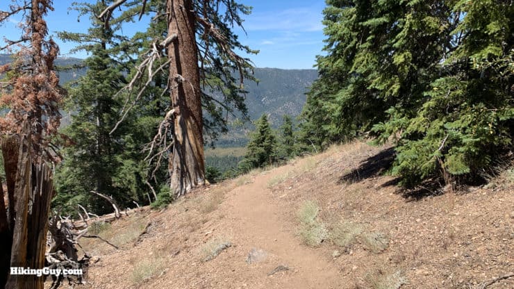
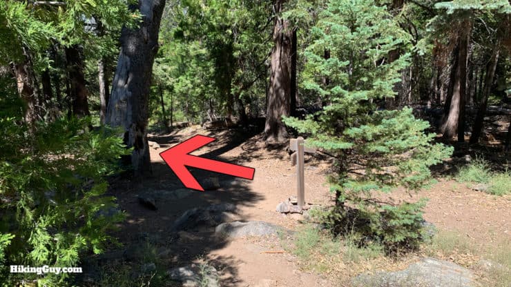
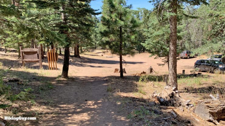
Start the hike at the well-marked Forsee Creek Trailhead, located at the far end of the parking lot.The beginning of the trail is gentle and easy to follow.A helpful "trail" sign makes sure you don't make a wrong turn.Another sign! Welcome to the San Gorgonio Wilderness.Your first trail junction comes around a half-mile into the hike. Stay left on the Forsee Creek Trail. We'll be ending the hike from the trail on the right.Here's a closeup of the sign at the last junction. Our next landmark is Jackstraw Camp.From here on out you've got some climbing to do. The trail is easy to follow.The Forsee Creek Trail touches the west end of the 2015 Lake Fire, which burned 49 square miles in the San Bernardino National Forest. The fire was started by humans at the nearby Barton Flats Campground. Investigators couldn't determine if the fire was started accidentally or as arson.The climb ascends ridges and has some sections of switchbacks.As you climb you'll be able to see the mountains of Big Bear and beyond, including Mt Baldy and Angeles NF.There are a few small creek crossings on the way up. In the spring there's usually water, later in the season it can be dry.As you approach the edge of the Lake Fire on the upper slopes there are some steep sections.Soon you'll come around the bend and see the ridge on the San Bernardino Peak Divide. We'll be climbing up there soon.The trail levels out and you will see some tent sites at Jackstraw Camp. The full campsite and water source are down to the right, but there are spots here too. You're at around 9,200 feet now.To continue on the hike, bear left. If you want water or want to visit the full Jackstraw Camp, head right about 0.2 miles.The slopes at this point are pretty gentle, and you'll get nice views of San Bernadino East Peak, your destination.At the next junction, Trail Fork Springs, make the left. You could shave 0.5 miles off the hike by taking the shortcut, but the route to the left is nicer and less overgrown. The spring is not very reliable.Here's a closeup of the signs at the Trail Fork Springs junction.The trail starts to get blazed by notches in the trees, so you can look for the notches from here until about San Bernardino East Peak. The notches are an older style of blaze, usually done by a hatchet, that you don't see much anymore. But there a lot of them on the San Bernadino Peak Divide Trail that show you the way.Here you are at Andersen Flat (10,500ft) on the Divide Trail. You'll probably hear the wind before you reach the spot. The big climbing is behind you. You can camp here but there is no water. Make the hard right on the San Bernadino Peak Divide Trail. Also notice that when I shot this, all the trail signs were stolen.The San Bernadino Peak Divide Trail is one of my favorites. If there was a zombie apocalypse in LA, I would come up here to live. The trail goes slightly uphill towards Andersen Peak. Blazes on the trees mark the way.If you want to bag Andersen Peak, there's no real trail to the summit but a number of smaller runs where folks have just hoofed it up. You can really take any way you want to the peak, but I generally make the right turn here at the point where the Divide Trail hops around this tree. There's a trace of a trail to the summit from here. Otherwise continue down around the slope on the Divide Trail.The next intersection is for the cutoff trail from Trail Fork Springs that you passed before Andersen Flat. Keep going straight.Here's a closeup of the sign at the last junction.You'll start to get some nice views of San Jacinto opening up to the south. You can also see San Gorgonio through the trees behind you occasionally.At the next junction with Moymer Creek Trail, bear right.Here's a closeup of the sign at the Moymer Creek Trail junction.Now the trail starts to climb a bit as we head up toward San Bernardino East Peak.When you see the big pile of rocks, you're at San Bernadino East Peak. The path to the summit is at the very beginning of the rocks on the left.After the summit, continue on the main trail.The small section to the peak is pretty easy to follow.Here you are at the peak, complete with trail register.The views from the peak are some of the best. You can see Saddleback Mountain, Mt Baldy and Angeles NF, and the great combined view of San Gorgonio with San Jacinto shot shown here.After you're done on the peak, head back down to the main trail and continue. You'll be able to see San Bernardino Peak in the distance.The trail has some up and downs, twists and turns, but is easy to follow.When you get to this junction, you can go left to bag San Bernadino Peak, or to just continue on the main trail.After that last junction, keep going straight as the peak trail joins back up with the side trail. If you went to the peak, come down here and rejoin the hike. You'll start your long descent on the San Bernadino Peak Trail now.Keep right past the Washington Monument.Don't forget to visit the bench on the first big switchback. There are also some places to put a tent up around here.Continue through Limber Pine Bench Camp (9,200ft). There's a small spring here if you need water.When you get to the junction with Colombine Spring, make the right onto the trail to John's Meadow. You can also fill up with water at Colombine Spring if you need to. It can be dry in the summer.Here's the detail of the sign at the last junction.Here starts the 5 mile adventure called John's Meadow Trail. Between here and the John's Meadow campground the trail is not maintained, but is generally easy to follow although some sections are narrow or slightly overgrown. It's not bushwhacking, but it's also not as nice as the San Bernardino Peak Trail.The trail meanders its way down and around the north side of the ridges. Some uphill sections might hurt at this point, but no long uphill grinds.After a mile or two you'll be able to see San Bernadino East Peak high above you.There are a few stream crossings, and they tend to be overgrown but easy to get through. Each stream crossing has rocks and logs to cross.After about 2 miles from the last junction, you'll reach John's Meadow campsite. It's not so much of a meadow but a nice enough campsite.There's a sign on a tree to make it official.Hike through the camp and you'll soon arrive at another stream crossing. Again, all the stream crossings are generally overgrown but easy enough to walk through.The last big steam crossing has some logs. It could be difficult with a child.After you climb up from the last stream, bear right on the switchbacks. There's still a bit of up and down as you tackle the end of John's Meadow trail. The trail is here is in better condition than it was earlier.Enjoy the views as you do the 2.5 miles from the campsite to the junction back at the Forsee Creek Trail. When you start to hear the cars and motorcycles on Rt 38, you'll know you're almost there.When you get to the junction at the Forsee Creek Trail that you hiked past about 18 miles ago, make the left to return to the parking lot.The parking lot! That's the hike!


 Using the Apple Watch for Hiking
 Garmin Fenix 7 & Epix Review For Hikers
 How To Read a Topographic Map
 Garmin GPSMAP 67i Review
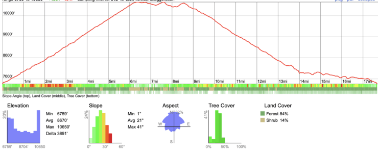
 San Bernardino Peak Hike
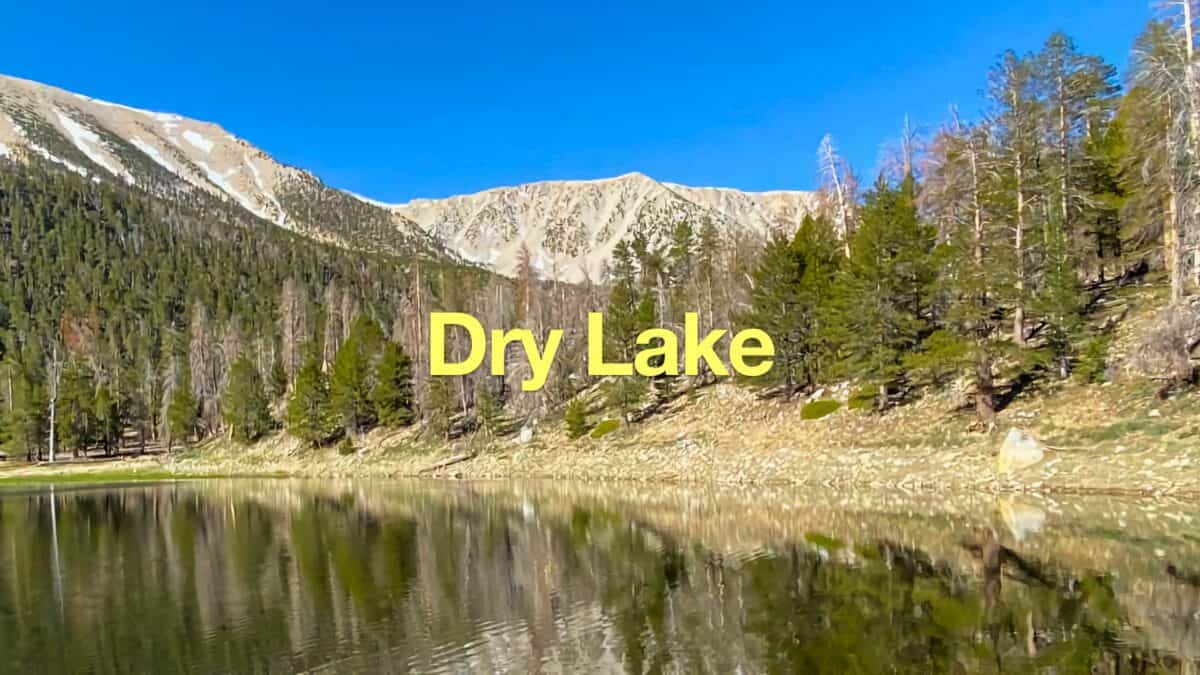 Dry Lake (San Gorgonio) From The South Fork Trail
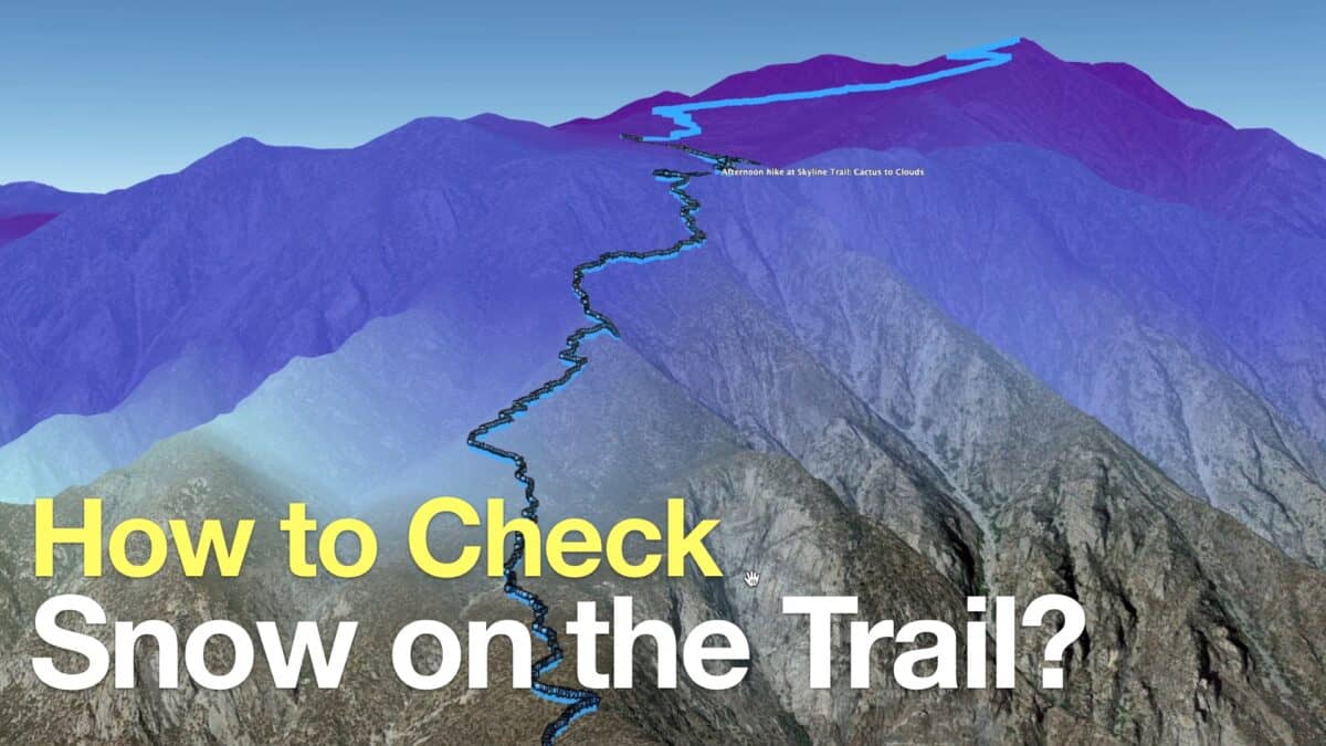 How to Check If There Is Snow On the Trail
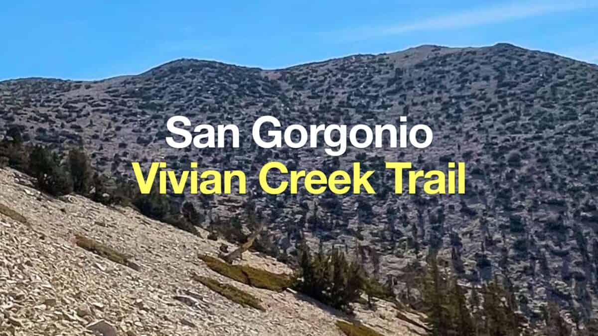 San Gorgonio Hike on the Vivian Creek Trail
 Los Angeles Hikes
 Backpacking Trips
 LA Mountain Hikes
 San Bernardino National Forest Hiking Trails
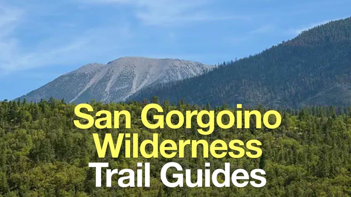 San Gorgonio Wilderness Hikes
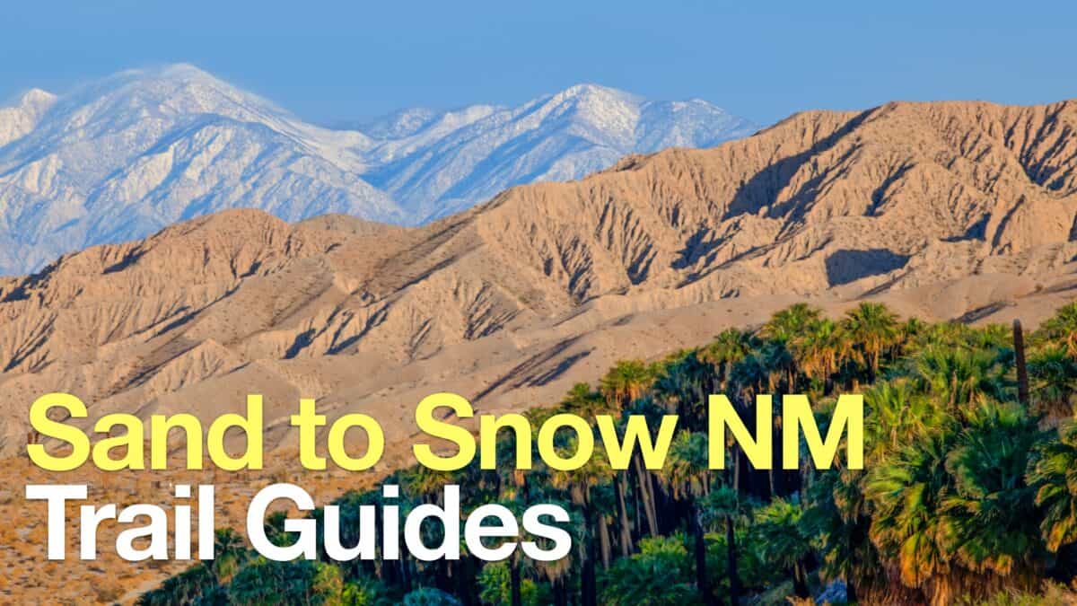 Sand to Snow National Monument Hikes
 Sierra Club 100 Peaks
 Best Hiking Gear 2024
 Hiking Boots or Shoes: Do I Really Need Hiking Boots?
 When to Hit SOS on inReach