
ACR ResQLink View PLB Review
If you need to call for a rescue in the backcountry, the ACR ResQLink View offers a solid, professional-level method to trigger a distress signal using the government-run satellite network. The ACR ResQLink View doesn't offer two-way communications like an InReach, but it also doesn't require a subscription. There are pros and cons to both which I'll cover in this review.
- What is the ACR ResQLink View and How Does It Work?
- ACR ResQLink or Garmin InReach?
- Setup, Registration, and Use
You can support this website and these independent reviews by using the links above to purchase this or anything. I receive a small commission that helps offset website costs; you pay nothing extra.
What is the ACR ResQLink View?
The ACR ResQLink View is the latest generation of personal location beacon (PLB) by ACR. It's essentially an emergency beacon that uses satellites and GPS to signal a backcountry rescue. You're in the middle of nowhere, you get in trouble, you hit a button, and people come to rescue you. PLBs are great to have in the wilderness when hiking where cell phones don't work. And they work worldwide so you can take it wherever you go. No matter how much you prepare, accidents can happen. So I carry a PLB (and InReach) with me just in case.
To understand why the ACR ResQLink View is a great backcountry tool, it helps to understand the process behind it from a high level. (Note: I'll go into details of the actual ACR ResQLink View unit farther down in the guide.)
Who is ACR?
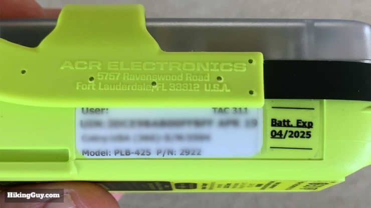
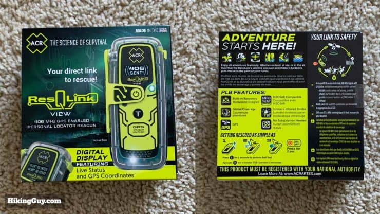
ACR isn't really a household name in the hiking community, but in the professional search and rescue industry they're well known. They've been building this type of gear since 1956 for the military, NASA, Coast Guard, etc. They even had gear on the Apollo 13 mission. I came to know of them through the sailing world, where they make emergency beacons for yachts sailing thousands of miles off-shore (aka EPRIBs). They started making miniature emergency beacons for outdoors people in 2003 with their first PLB. Their gear is professional-grade and built to survive in harsh conditions. The ACR ResQLink View is their latest PLB built for hikers and outdoors people, released in mid-2019.
I am a retired US Coast Guard rescue pilot with over 30 years of aviation experience (Alaska – Pacific Northwest) and currently flying HEMS in the Rocky Mountains. Knowing the vital importance of a 406mhz beacon in a rescue situation ACR ResQLink provides optimum alert and rescue resource dispatch in an emergency. Its small size and unmatched capability gives the indidvidual the best chance of rescue regardless of climate, place or physical capacity. Well done! – ACR ResQLink Reviewer
Who Handles a ACR ResQLink View Rescue?
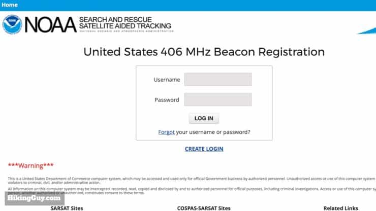
The whole rescue process for the ACR ResQLink View distress is managed by the Cospas-Sarsat (Search and Rescue Satellite Aided Tracking) program, a multi-national agency dedicated to worldwide search and rescue. In the USA the program is managed by the NOAA, the Coast Guard, the Air Force, and NASA. ACR simply makes the PLB device, but the signal and distress handling is all handled by Cospas-Sarsat. It's the same organization and system that is invoked if a plane crashes, a boat is sinking, etc. The service is free to use, and there is no subscription needed to invoke a rescue. All you need to is register your ACR ResQLink View with the NOAA, and that's free.
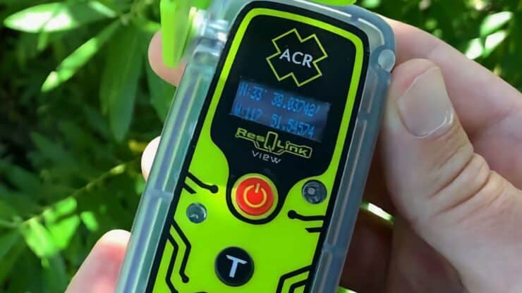
What Does a ACR ResQLink View Look Like?
Unlike the InReach devices that use the Iridium satellite network to offer 2-way communications, the ResQLink is a one-way distress beacon that broadcasts your location and distress call using different bands and methods. This is how it works once you hit the distress button.
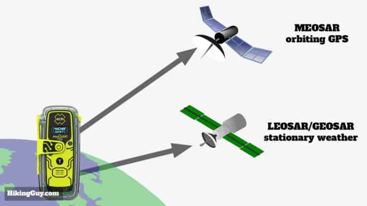
The first of satellites that your signal goes to are the LEOSAR/GEOSAR set of satellites. These are weather and other satellites that do extra duty as emergency listeners. High-altitude GEOSAR satellites appear stationary relative to a given location on the Earth, while LEOSAR appear to be moving quickly as they are orbiting at lower altitude, about 500 miles above Earth. The average time for these satellites to locate you is about an hour.
The second set is MEOSAR, which are the orbiting positioning satelites of GPS (USA), GLONASS (Russia), and GALILEO (Europe), which also do double-duty as emergency listeners. MEOSAR is a newer addition (2016) to the search & rescue satellite system and is available for rescues with the ACR ResQLink View. Unlike the other stationary satellites, MEOSAR are constantly orbiting the earth. MEOSAR satellites can locate you almost immediately and confirm your position in a matter of minutes.
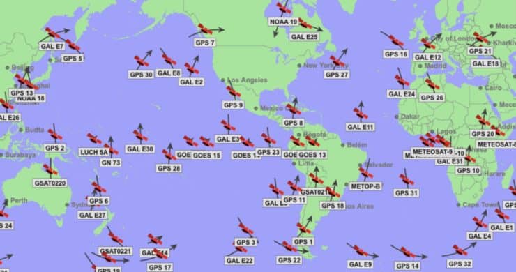
So in practical terms, when you hit the distress button, your ACR PLB distress signal has many opportunities to reach at least one of the many satellites in the sky. Not all satellites are always working, but in general there is great coverage. You can check the status of all the satellites here. ACR states that with the ResQLink View you can be located within 100 meters or less, 95% of the time, within 5 minutes of hitting the distress button.
Your distress signal also includes your GPS position. Even without a GPS signal, once your signal is picked up by one satellite, the others can be used to triangulate and locate your signal. The signal also includes a unique beacon identifier that you register with your information (more later).
Worldwide ground stations monitor f0r distress signals and then send your position to a national Mission Control Center (MCC). In the USA it's in Suitland, MD. At the MCC the distress signal is linked to your registration, looked at by a human, and routed to a local Rescue Coordination Center (RCC) based on your position. If you are inland in the USA, the Air Force will coordinate your rescue, on the coast or at sea, it will be the Coast Guard.
If you're in another country, similar agencies will be dispatched. For countries that are not part of Cospas-Sarsat, MCC will contact local rescue authorities or coordinate a rescue from an adjacent participating country. You can also notify the local authorities if you are hiking or traveling abroad and let them know your itinerary and beacon ID. Almost every country has a contact in the Cospas-Sarsat contact list.
The Rescue Coordination Center (RCC) will dispatch a rescue to your GPS position. As a hiker in the USA, this will probably be an aircraft from local authorities like a sheriff's department or park service, but could also be Air Force or Coast Guard. Not all evacuations are possible by air, but that is usually the first choice if conditions allow for it.
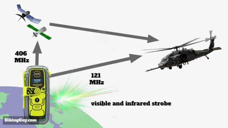
During this rescue process, the ACR ResQLink View stays on and continues to broadcast both a 406 MHz signal to the satellites, and also a 121 MHz homing signal. This 121 MHz homing signal lets rescuers pinpoint you as the move within a few miles of you. A full charge on the device keeps the unit broadcasting for 28 hours after you trigger the distress signal. And when the rescuers approach, the ACR ResQLink View includes a visible and infrared strobe that you can use to signal rescuers. And that's it, hopefully you're found.
Here's what happens when a rescue gets dispatched. Obviously this is different every time, but it gives you a good idea of rescue workflow.
Even though Mr. Mould was hiking alone in a very remote area, he had a personal locator beacon that may have saved his life. These items are not very expensive and send a distress signal to satellites which prompt search and rescue crews to respond. In this case, a cell phone would have no signal to call or text, a PLB is the proper equipment for this type of adventure. - CHP From YouTube Video Description
There's also a neat website where you can see hiker rescues on the Cospas-Sarsat network.
How does the ACR ResQLink PLB Compare with Garmin inReach?
Okay, so how does the ACR ResQLink compare to the Garmin InReach devices? There are a few key differences but in a lot of ways they compliment each other.
Communications Flow
- InReach: Offers two-way texting to emergency services and family. Also offers weather reports on demand.
- ResQLink: Only one-way distress signals to government search and rescue officials.
Transmitting Power
- InReach: The InReach has a 1.6 watt transmitter that is effective.
- ResQLink: This PLB has a much bigger 5 watt transmitter and is generally considered "industrial" level.
Other Features
- InReach: InReach devices generally offer more functions such as navigation. How these functions are offered and what they do varies by device.
- ResQLink: Only used for a distress call.
Cost
You can get both types of units for somewhere between $200-400 depending on the sales, etc. They differ mainly in the monthly costs.
- InReach: Requires activation fee and monthly subscription.
- ResQLink: No fees after purchasing the beacon.
Distress Call Handling
As one of my friends said when discussing this topic "Who do you trust more (or less)? The government or private industry?" It's a bit cynical, and both parties are serious and professional, but those are really the two flavors here.
- InReach: SOS is received by a private firm, GEOS, who then contacts the appropriate local authorities (worldwide). GEOS service is included in your subscription (read about the process in my InReach Mini review here). I think the two-way communication is very powerful here. Let's say you smell or see a lot of smoke, suspect a forest fire, and need to know where it is and how you should evacuate. You can chat with GEOS and they can advise on the best way to evacuate (which might just be you hiking in a certain direction). You can also communicate (via text) with non-rescue personal to coordinate an evacuation. For example, if you are doing a thru-hike, get sick, and want a family member to pick you up before the finish, you can just text them with the InReach.
- ResQLink: SOS is received by a national government SAR agency who then contacts the appropriate local authorities (worldwide).
In both cases, the parties ingesting the distress signal will generally contact the same local authority to perform the rescue. I'll go out on a limb, face your email wrath, and hypothesize that since the ResQLink 406 is coordinated by the US Air Force (for inland rescues), you might have a better chance at getting an Air Force evacuation if local authorities can't handle it (like if they are busy with other SAR cases, etc.). GEOS probably has to jump through some more hoops to make that happen if they can at all.
Rescue Insurance
Sometimes you may have to pay for a rescue, or want to evacuate from another country back to your home country.
- InReach: Offers low-cost add-on to your monthly subscription at different coverage levels (see the InReach Mini review for more info).
- ResQLink: Not offered as part of the beacon purchase, but you can buy private evacuation and travel insurance. There are more insurance options if you get it on its own, but generally the pricing is higher than the InReach add-ons.
Signal Technology
The ACR ResQLink View and InReach devices use different signal frequencies to communicate with satellites. Note: I'm not an engineer, but I am semi-technology literate. If you are an engineer and have some insights here, I'd love to hear them.
- InReach: Garmin doesn't publicize the transmit power but it's believed to be 1.6w, which is less than the ACR ResQLink View, but also uses different satellite technology, so maybe it doesn't matter as much. The Iridium satellites that it communicates with are in low earth orbit at around 500 miles above the surface, so the signal doesn't have to go as far. If the unit can't get a GPS signal to broadcast, your position can't be determined.
- ResQLink: Broadcasts a distress signal at 5w, stronger than the InReach. The signal is at the 406 MHz wavelength, which is a lower wavelength than the Iridium frequency (1616-1626.5 MHz), and can travel a greater distance. The distress signal can connect with many different types of satellites at a variety of altitudes (good redundancy). GPS position can be confirmed by satellite doppler processing and reverse triangulation if not available in PLB signal.
Again, this is pure speculation since I haven't triggered an SOS side-by-side with these devices, but overall the ResQLink looks like a better technology for triggering a rescue. Since it's inception in 1982, there have been over 43,000 rescues worldwide. So the system works. That said, I text all the time with my InReach and it works great. There have been over 3,000 rescues with the InReach system.
Short Range Distress Tools
Sometimes you may not be visible to rescuers, even if they have a GPS fix, the accuracy is about 16ft under ideal conditions. Having other means of being found can come in handy, especially if you're experiencing some severe trauma or lack of consciousness.
- InReach: There are no two-way communications outside of the texting, but you can describe your position and situation to rescuers.
- ResQLink: There's no way to describe your situation outside of a distress signal, but there are two short-range location indicators when rescuers get close. First, the ACR ResQLink View includes a 121.5 MHz homing beacon which rescuers can home in on as they get closer to pinpoint your location. It also includes a visible and infrared strobe light to get their attention.
Battery Life
How long will your distress call broadcast after you activate it? If the weather is bad or you are in a very remote location, a rescue could be days. Generally rescues are at minimum several hours. It's important that you have enough juice in your device to be found.
- InReach: There are a few models of InReach devices and they all have different battery lives. If your InReach is used for navigation as well as communications, you'll run the battery down quicker. You can generally keep it charged with a cheapo USB battery pack though.
- ResQLink: The ACR ResQLink View will broadcast a distress signal for about 28 hours. When it's not being used, the battery lasts for 5 years without any charging, so you can throw it in the bottom of your pack and forget about it. You need to replace the battery at an authorized service center after 5 years (more later).
Size and Weight
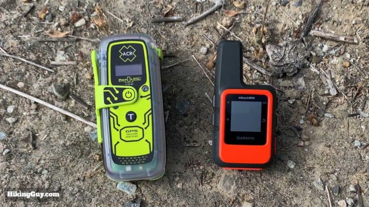
Overall these both are small units that can fit in the palm of your hand. They're small enough to throw in your pack, not have it be a major hassle, and use it when you need it.
- InReach: There are a few types of InReach devices and the InReach Mini is the lightest and smallest option.
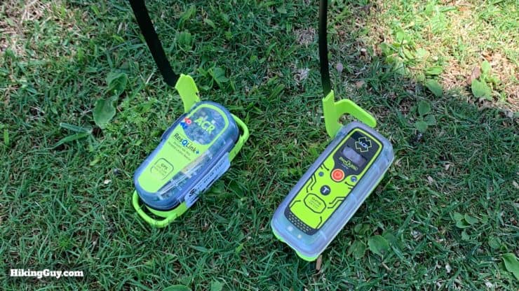
- ResQLink: Only slightly larger and heavier than the InReach Mini.
InReach or ACR ResQLink View?
Overall, I think the InReach devices give you more options with their two-way communications, so if I had to get just one and didn't mind the subscription fee, I would get an InReach. You can read my detailed reviews of those devices here.
If you're not too interested in two-way texting in the backcountry and don't want to pay any additional fees, get the ACR ResQLink View. You can throw it in your emergency kit at the bottom of your pack and forget about it until you need to replace the battery in 5 years.
Can you afford both? Do you mind carrying a few extra ounces for redundancy? That's what I do. I have the ACR ResQLink View in the bottom of my pack in case I need it, and I have my Garmin InReach handy to send "I'm okay" messages to my family at regular intervals, or to initiate an SOS if I need to.
I've decided that if I'm in trouble, but am not in imminent danger of death or losing a limb, I'll use the InReach two-way texting to help me get out of the situation. If I've fallen, hit my head, or are bleeding profusely, or are in danger of losing consciousness or a limb, I'll trigger distress on the ACR ResQLink View and then contact GEOS on the InReach and tell them I activated my PLB. I even have a quick-text message on my InReach with my beacon number so that I don't have to find all that info when injured. For a few extra bucks the redundancy is worth it for me.
Lowest Prices on ResQLink View
Interesting to note that ACR also offers a combination 406/Iridium unit, the ACR SARLINK. It's the same idea as the ACR PLB/Garmin InReach combo, but the features aren't a one to one match. Unfortunately it's not available for commercial sales, but knowing that you can replicate functionality that professionals are probably using by having both is somewhat comforting.
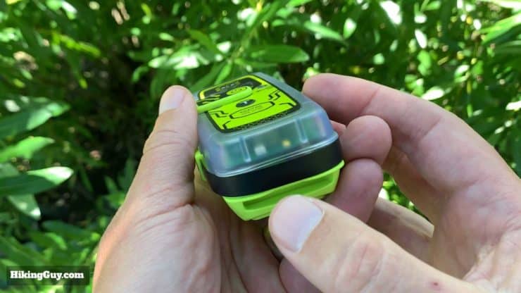
Tour Of the ACR ResQLink View
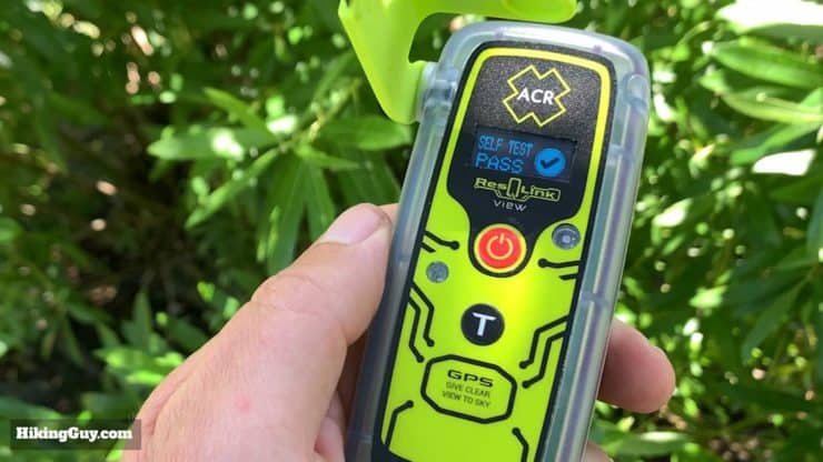
Overall the unit is simple and easy to use, which is want you want, especially in an emergency.
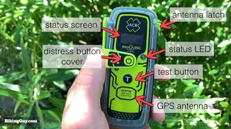
- Status Screen: where you feedback messages appear
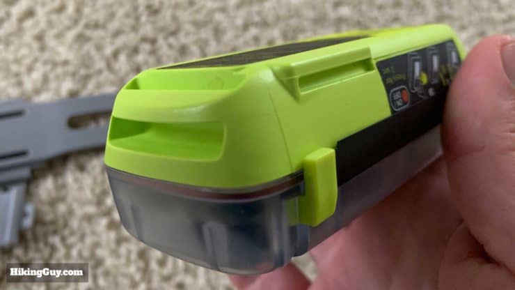
- Distress Button Cover: lifts up when you deploy the 406 satellite antenna
- Antenna Latch: releases the 406 antenna which wraps around the unit
- Status LED: green or red flashes depending on the situation
- Test Button: hold down for a self or GPS test (more later)
- GPS Antenna: keep clear and give line of site for antenna to get signal
Easy to use. Hope I never need to. We use ACR in all of our aircraft and I can attest that they work in backcountry incidents. They make great products and have good customer service. Not a toy and if you need to count on it for life and death don't gamble on 3rd party service. Get the best that does one thing. And does it well. I have set off ACRs more than once by accident in an aircraft and my contact phone is ringing within minutes every time. - Amazon Reviewer
Registering the ResQLink View
Before you take the ACR ResQLink View out in the field, you need to register it with the government. I'll cover the USA registration here, but if you need to do it in another country, ACR has a good set of links to the appropriate authorities here.
In the USA you register your beacon with the NOAA. The information you enter is only used for rescues and is not shared outside of the emergency database. Within 48 hours of entering your data online it will be in the national database and ready for rescues. The information that you provide is used by the dispatch and SARs team to decide on the best course of action when rescuing you.
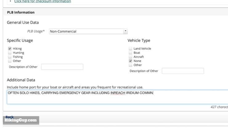
Recommended pieces of information to include in your "additional data" section are:
- Name
- Date of birth
- Medical conditions
- Fitness level / outdoors experience
- Survival gear overview
Don't forget to describe all the people in your party if you're hiking with others.
You can also update this section at any time. So if the people in your party change, or you are doing a different type of trip, etc., simply log on and update this so that rescuers can accurately apprise your situation.
You need to renew your registration every 2 years. It's as simple as hitting the "renew" button on the website. Again, no cost involved (aside from your tax dollars).
ACR ResQLink View Test Modes
After you've registered the ACR ResQLink View, it's recommended that you test it. There are two types of tests you can perform, a basic self-test and a GPS self-test. I set a recurring calendar reminder to test mine every year, and I test it when I first get it set up. I'll also do a self-test before any major backcountry extended trip. ACR recommends doing a basic self-test every month but I'd rather save the battery.
It's also important to note that these tests only involve the beacon itself. There is no confirmation from the satellite or from the rescue center that the signal has been received. You can test that with the 406link service if you really need to (more later).
Basic Self-Test
The basic self-test sends a 406 MHz signal coded as a self-test to the SARSAT satellites and will also momentarily activate the 121.5 MHz homing signal. The beacon has the battery life to perform 60 self-tests during the 5 year life of the battery.
To test you:
- Deploy the antenna
- Press the T button for 2 to 5 seconds (until you see a green LED flash)
If your unit fails the test, you will get a "fail" message. At that point you have to bring it to a service center. It will fail a test if the battery is low, and will give you a "fail" and a low battery message.
GPS Self-Test
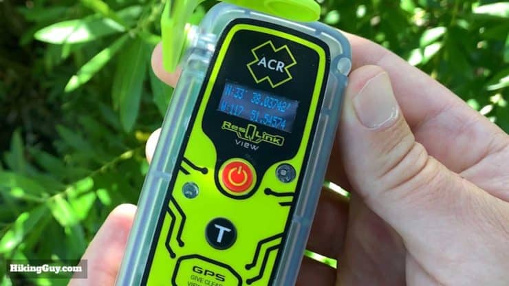
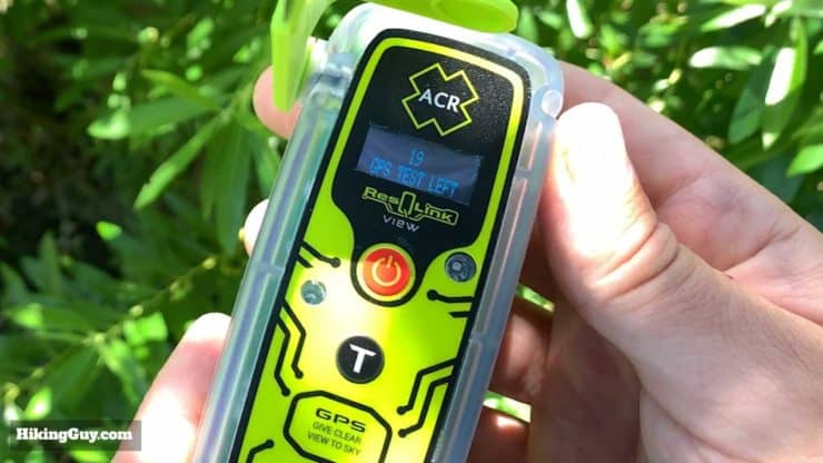
This is the same thing as the basic test with the addition of getting your GPS fix. Again, I do this once a year and otherwise forget about it. The test displays your latitude and longitude, so in a pinch if you needed to locate yourself on a map, you could do the test. You can only do 20 GPS tests until the battery is replaced. After performing the GPS test the display will let you know how many GPS self-tests are left.
To test you:
- Deploy the antenna
- Make sure the GPS antenna is clear and pointed to the sky
- Press the T button for 5 to 10 seconds (until you see a green LED flash)
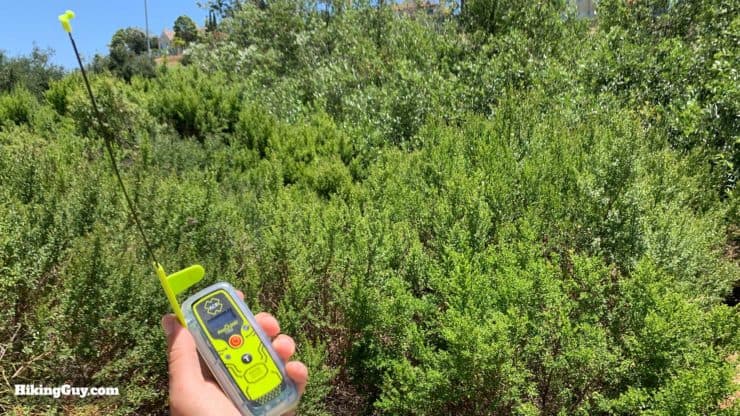
Activating a Distress Call
Activating a distress call is dead simple, which is a great thing, especially if you're not in great physical, mental, or emotional shape.
- (If possible) find an area where you can safely wait and is open for a helicopter to land and/or spot you.
- Deploy the antenna with a clear line of sight. Try to find an open space if possible, but it's not always an option. Do your best with the conditions that you have.
- Don't hold the (long) satellite antenna or block the GPS antenna.
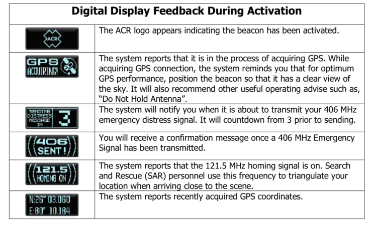
- Hold the distress button down for 2 seconds.
- The screen will give you messages and the LED will flash red until you have a GPS fix, and then it will flash green, indicating that your position has been determined and is being broadcast on the 406 MHz frequency to SARSAT.
- Wait where you are unless you are in danger from the environment (flooding, etc.).
- Don't block the strobes on the bottom.
The ResQLink will get (and broadcast) a new GPS fix every 30 minutes for the first 6 hours. After that it will try to get a fix every hour. So if you do have to move, the beacon should be updating the SARS team appropriately.
When do you know that it's okay to hit SOS? Read this.
The digital display will also give you feedback on the activity which is helpful, including your position.
After a Rescue
First off, thank the team that saved you. Common sense. Then contact ACR. They have a "survivor stories" section of their website where they encourage people to share their stories. They're worth a read. Lots of broken legs in the backcountry. It's sobering because it could happen to anyone, so again, having a PLB is a great investment.
If you were rescued with an ACR beacon and you share your story, ACR will give you a free replacement beacon.
Servicing the Battery
There are no user serviceable parts on the ACR ResQLink View, and you need to bring it to an authorized service center when the battery expires. ACR has authorized locations where you can replace your batteries. I did it once with my old ACR ResQLink+ and it cost $100, which included a battery and testing. It was serviced at a local marine shop that had experience servicing ACR EPIRBs (that's a PLB for a boat). I dropped it off on a Monday and picked it up on a Thursday.
You can also find places online that you can ship your unit to for replacement if there isn't a location close to you or if you want to get the best price. A simple Google search will reveal a bunch of options. Some are almost as expensive as a new beacon but you can bargain some shops down. Worse case is that you buy a new beacon after 5 years.
It's not officially recommended but you can also save some money and replace the battery yourself. Again, there's plenty out there that a Google search will yield. I'm usually a DIY kind of guy but I just ended up going to the service center since I didn't want to mess around with gear that my life depended on. Also important to note that doing it yourself voids the warranty.
406Link
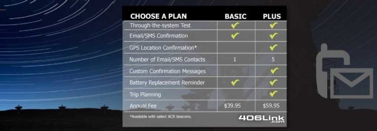
ACR offers a program called 406Link that extends the functionality of your ResQLink beacon. With this plan you can send people your position when you hit the "test" function on the ResQLink. You specify who gets notified in an online portal. It requires a subscription but is totally optional. As noted before, there are only a limited number of times you can use the test function before draining the battery.
I'm not a big fan of this because
- Every time you hit the test button you drain the battery
- You can't recharge or replace the battery yourself
- When you really need to use the PLB, you'll want every ounce of battery
You can check out the service more on the 406Link website.
Improvements Over The ResQLink
For years I've carried the ACR ResQLink+ in my pack, and it's been great. So what's new on the ACR ResQLink View compared to the ResQLink+? Well, first a note that ACR got hands-on feedback from people who actually had to deploy their PLB (you can read their stories on the ACR Survivor Club website). So there's a combination of new technology (the ResQLink came out in 2012) and user feedback.
- Readout with GPS position / signal status / battery life / test status
- New chipset / tech guts
- 2oz lighter
- 28 hour batter life (4 hours more)
- The View uses the Galileo (GNSS) global positioning system in addition to good old USA GPS
- Activation button is located away from the test button and is more protected
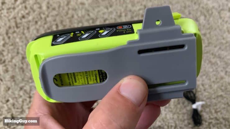
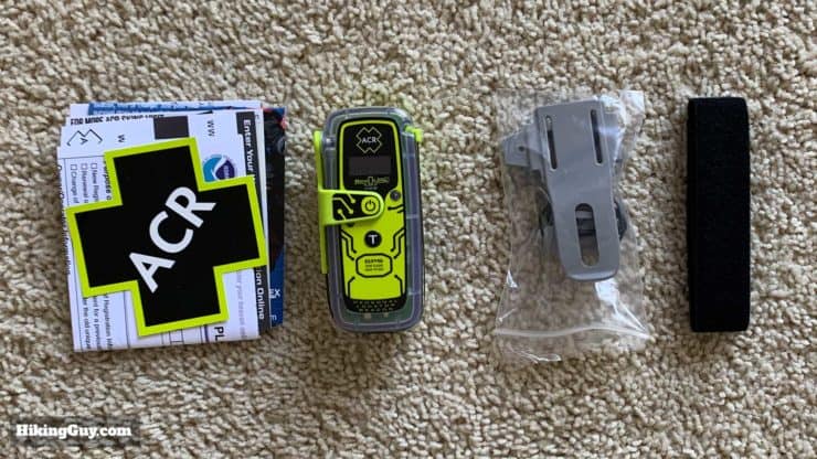
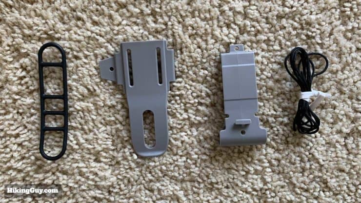
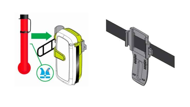
- Multiple mounting options including a belt clip
- Easier to release antenna (the old one would come undone easily if jostled around)
Recommendations
If you do any hiking in the backcountry where there is no cell-service, you should be carrying at least one form of satellite communicator or distress beacon.
- If you just want something for emergencies and don't want to pay any ongoing subscription fees, get the ACR ResQLink View.
- If you want to be able to do two-way communications, get a Garmin InReach device.
- If you want some redundancy and can afford it, get both.
My son had a ResQLink on one of his backcountry excursions recently in the PNW near Canada. He found a group of hikers with one who had hurt her leg, miles from cell phone reception. He used the PLB to send a help signal and within about one hour help arrived. The lady and her group were thanking my son non-stop for his help. They said that they were going to purchase a ResQLink before they ever went on another hike. Everyone who boats or hikes should have this device. - Amazon Reviewer
Personal Locator Beacons come programmed to specific countries, so make sure you buy one that is programmed for the country you live in so that you do not need to get it reprogrammed. Generally if it's sold in a country it will be setup for that country.
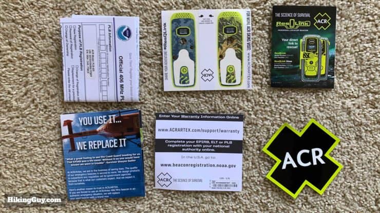
Unboxing
ACR ResQLink View Quick Links
- ResQLink View Manual (PDF) (at end under downloads)
- ACR Warranty Registration
- NOAA Beacon Registration (USA)
- International Beacon Registration
- ACR Survivor Stories
- USA SARSAT/PLB Interactive Rescue Map
Using a PLB Responsibly
I'm a big fan of PLBs because they save lives, but a PLB is not something to be used frivolously. The use of PLBs should only be viewed as a way to send out a call for help when you are in imminent danger of loss of life or limb, or when you absolutely cannot self-evacuate. It should be your last option.
There are stories of people using PLBs when they're too tired to hike out, have stomach aches, sprained ankles, and other non-life threatening emergencies. For example, if you take a look at the rescues page, you can see that someone triggered a distress call in June 2019 when in the Grand Canyon because of exhaustion. You don't know what you don't know but you need to be better prepared than that. You don't put people's lives at risk when you get tired.
Many states have passed laws that put the charges of a rescue on you if your call is deemed frivolous. Having a PLB is also not a reason to take excessive or unnecessary risks. When you summon a rescue you put every rescuer's life in jeopardy and take them away from other potential emergencies. If you can self-evacuate, do that first.
What if I accidentally hit the distress button?
First off, just don't. Second, hold the distress button down for 2 seconds to turn it off. You then need to contact emergency services right away and let them know about the false alarm. The best way to do this is to have your beacon ID handy (keep it in a note on your phone) and contact your national beacon authority. You can look up your local one but I have some major ones handy here:
- USA (inland): United States Air force Rescue Coordination Center (AFRCC), 1-800-851-3051
- USA (Alaska): Alaska Rescue Coordination Center (AKRCC), 1-800-420-7230
- USA (Coastal) U.S. Coast Guard Rescue Coordination Centers (RCCs)
- Canada: Canadian Mission Control Center, 1-800-211-8107
- UK: National Maritime Operations Centre
- Australia: Australian Maritime Safety Authority, Joint Rescue Coordination Centre
- New Zealand: Rescue Coordination Centre New Zealand (RCCNZ)
Need More Info?
- Have a question about the guide? Join my Patreon and ask me a question.
Related Guides
 ACR Ocean Signal rescueMe PLB1 Review
 Garmin inReach Mini 2 Review for Hikers
 Hiking Gear & Outdoor Technology
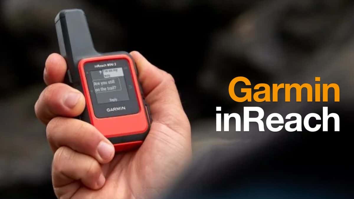 Garmin inReach
Popular Guides
 Best Hiking Gear 2024
 Hiking Boots or Shoes: Do I Really Need Hiking Boots?
 When to Hit SOS on inReach
This Guide Was Written by Cris Hazzard

Hi, I'm Cris Hazzard, aka Hiking Guy, a professional outdoors guide, hiking expert, and author based in Southern California. I created this website to share all the great hikes I do with everyone else out there. This site is different because it gives detailed directions that even the beginning hiker can follow. I also share what hiking gear works and doesn't so you don't waste money. I don't do sponsored or promoted content; I share only the gear recommendations, hikes, and tips that I would with my family and friends. If you like the website and YouTube channel, please support these free guides (I couldn't do it without folks like you!). You can stay up to date with my new guides by following me on YouTube, Instagram, or by subscribing to my monthly newsletter.