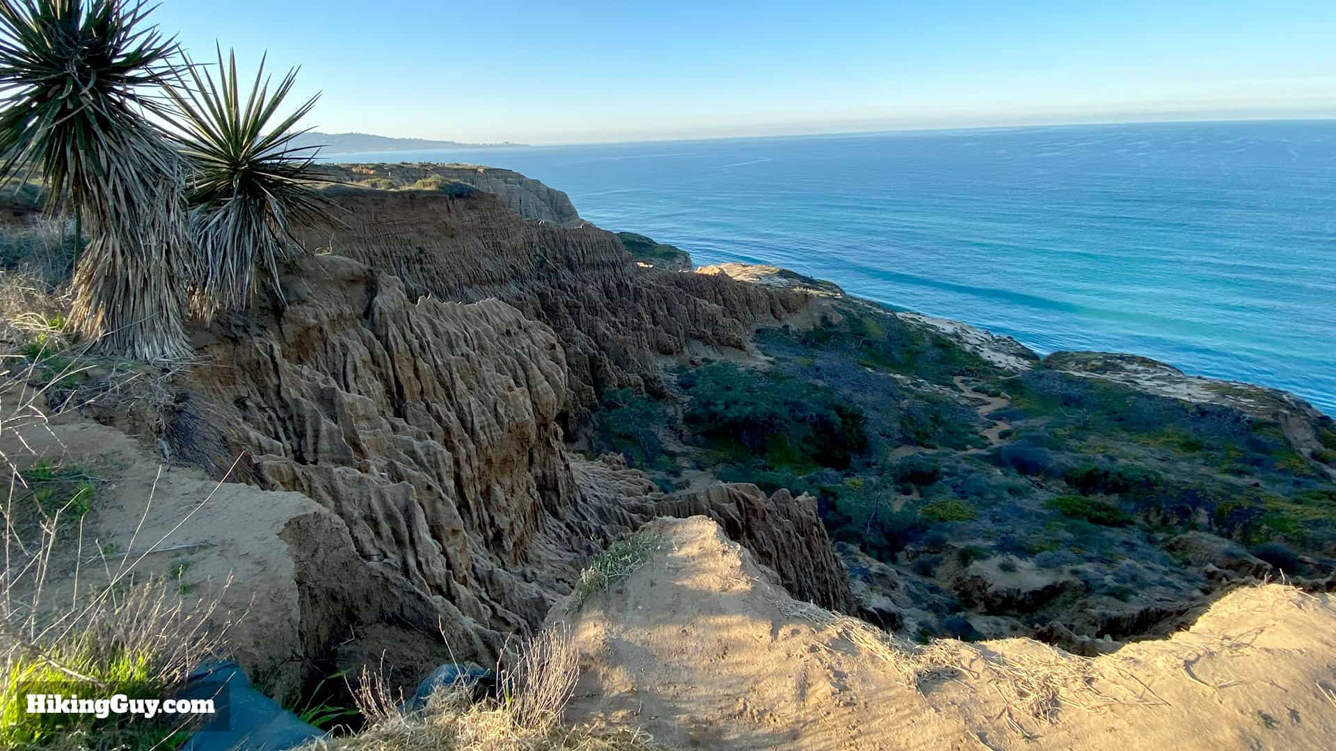
This Torrey Pines hike takes you to the best of the park - you experience get great ocean views, hike through unique geological formations, get a glimpse of the world-famous golf course, hike on an antique version of the Pacific Coast Highway, and of course, get see the Torrey Pine. The Torrey Pine is the rarest pine tree in the United States and is an endangered species. You can only see them here and on the Channel Islands. As you're hiking Torrey Pines, remember that the environment is fragile, so please stay on the trail. Torrey Pines State Natural Reserve is one of those once in a lifetime destinations, I highly recommend this hike!
How to Get To the Torrey Pines Hike
Torrey Pines State Natural Reserve is very popular, get here early to beat the crowds. If it's after 8am, you might have a hard time finding a parking space. There is a parking fee for this state park.
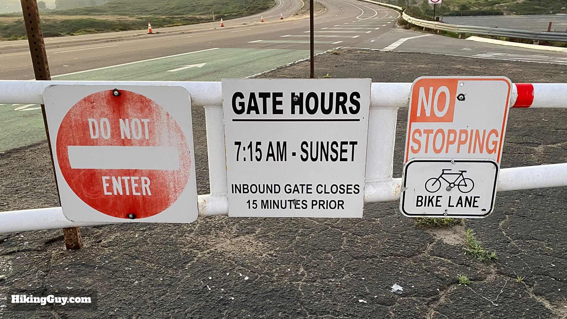
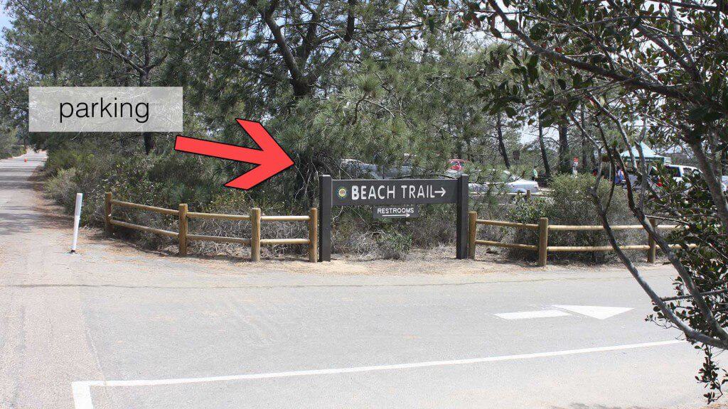
To park, drive up past the entrance gate, go up the hill, and enter the first parking area on your right, just past the visitors center on the left.There are gates at the entrance. The opening time is listed as 715am but I've seen the gates open earlier. If they're closed, just park in the free parking lot right before the gate and wait for them to open.After entering the park gate, drive up the narrow road to the visitors center. The parking area for the hike is up the hill on the right.
There are bathrooms at the parking area and Visitor's Center.
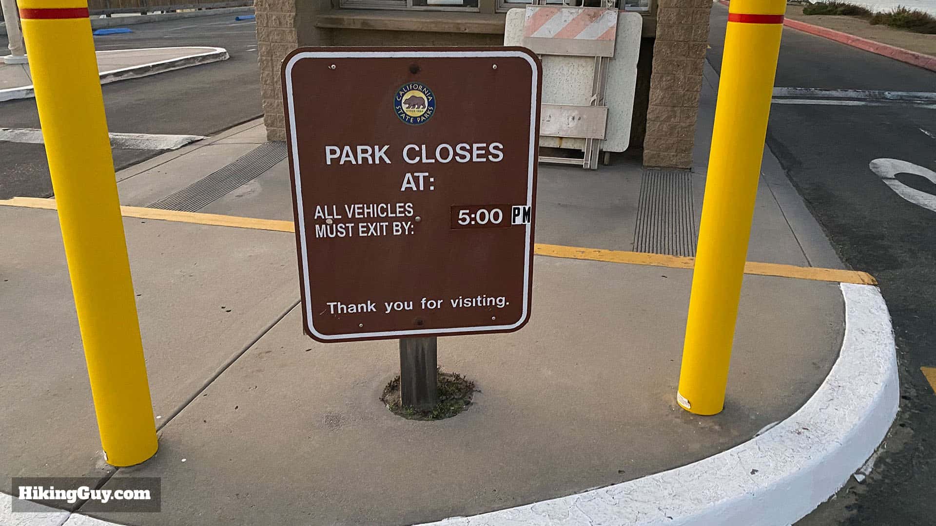
Check the closing time if you do the hike later in the day. The closing time changes over the year.
Gear for the Hike
You don't need any special hiking gear for Torrey Pines, you can get away with workout clothes.
If you're thinking of swimming, the hike does go down to the beach at one point. If you're not from the area, you might not know that the Pacific Ocean is usually pretty cold. You can take a dip if you hike in a bathing suit, but it'll be chilly.
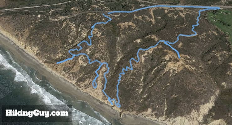
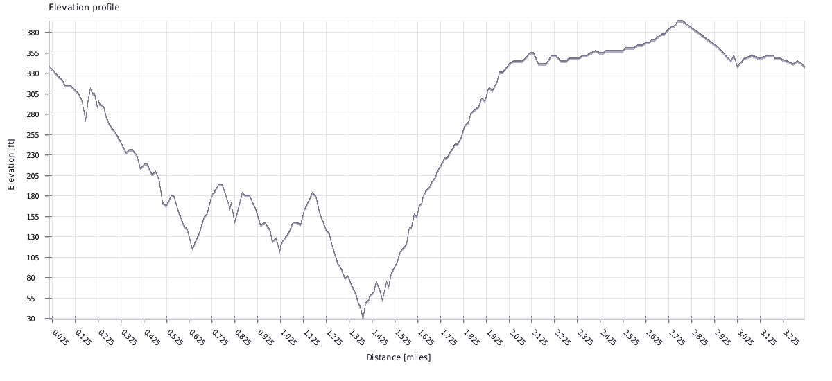
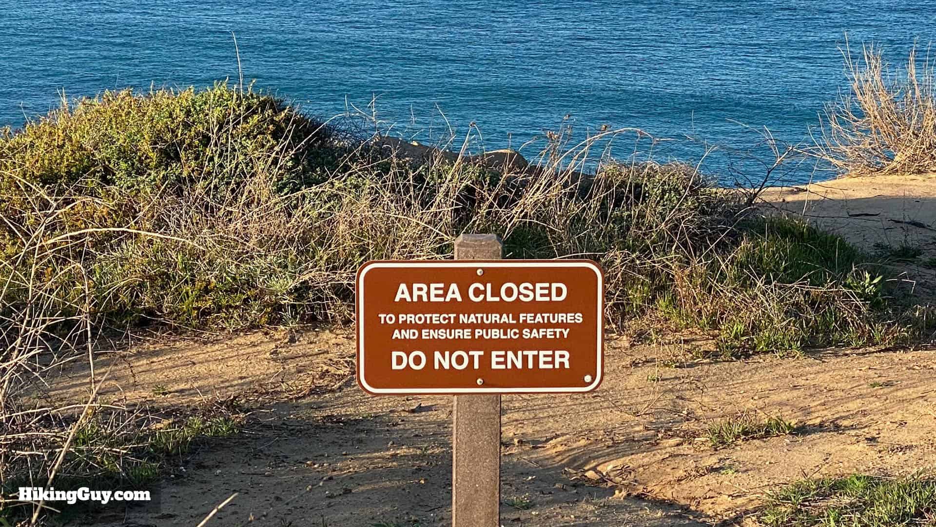
The hike hits all of the overlooks in Torrey Pines Park, then heads down to the beach. From the beach, it climbs back up and to the trailhead.The hike meanders down to the ocean, then climbs back up to Torrey Pines Park Rd.Stay on the official trails. The area is extremely fragile and if a ranger or volunteer see you off the trail, there is a steep fine.
Torrey Pines Hike Directions
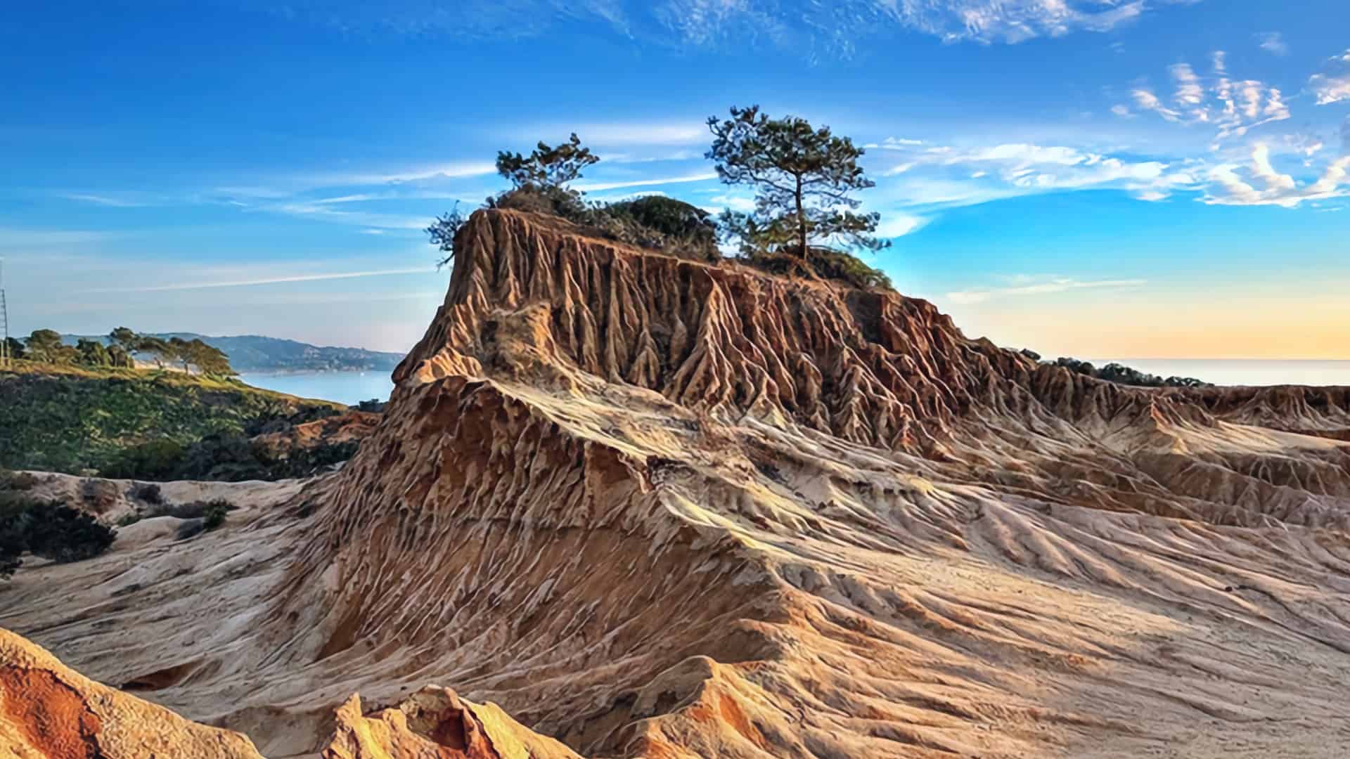
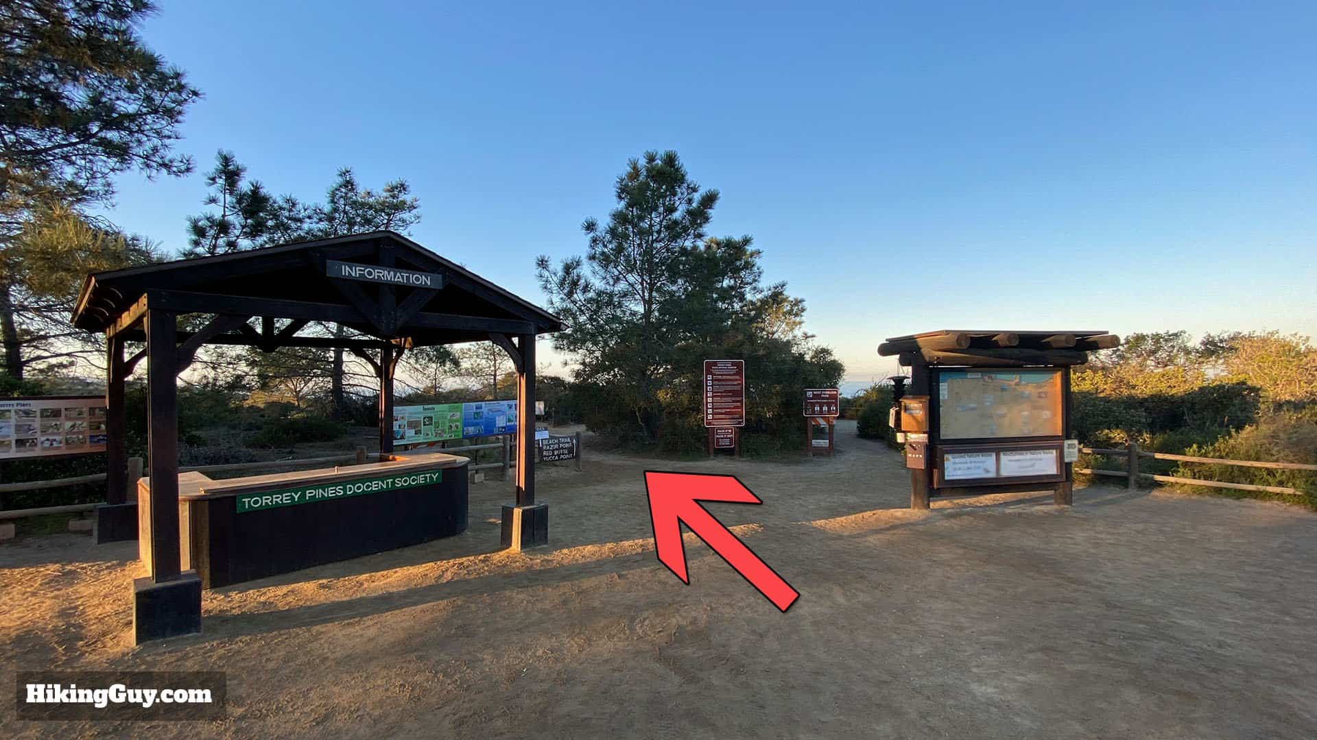
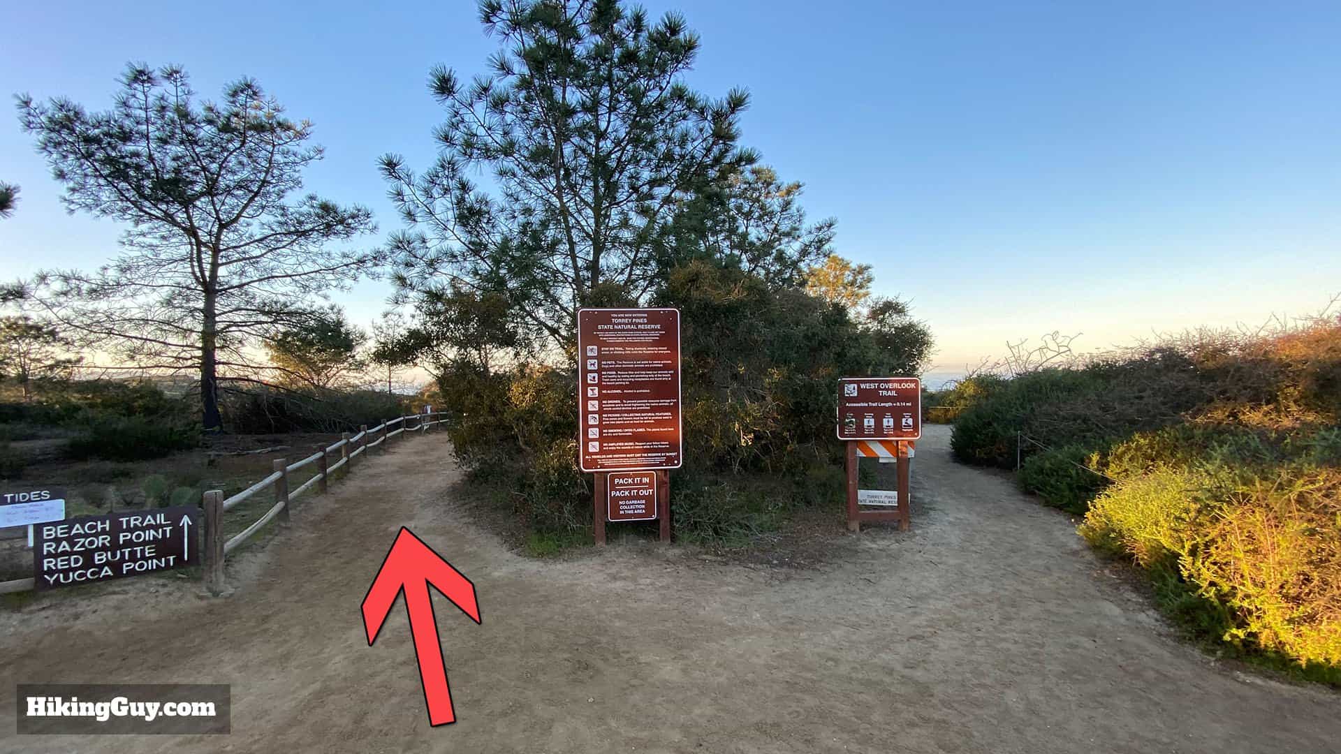
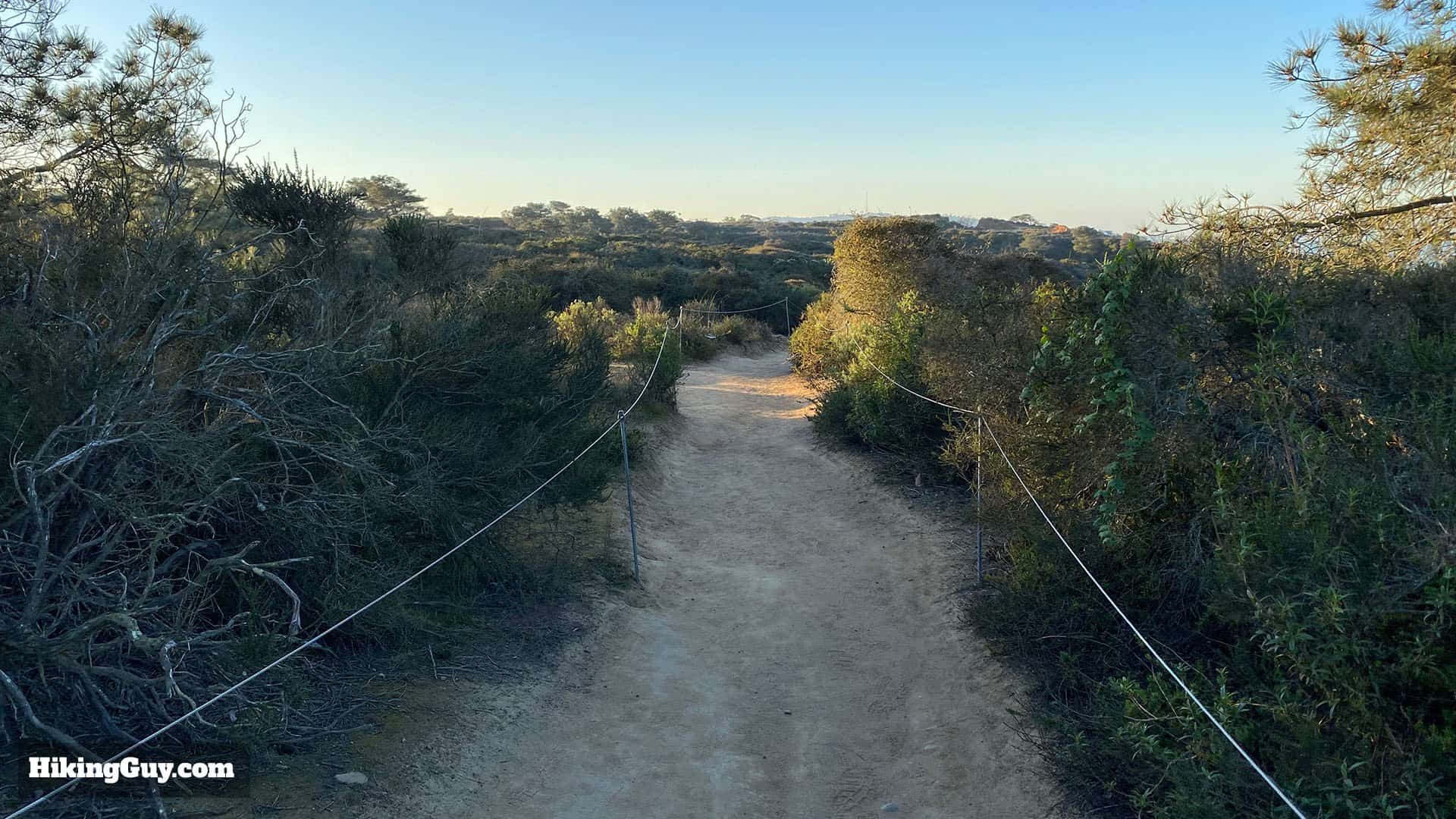
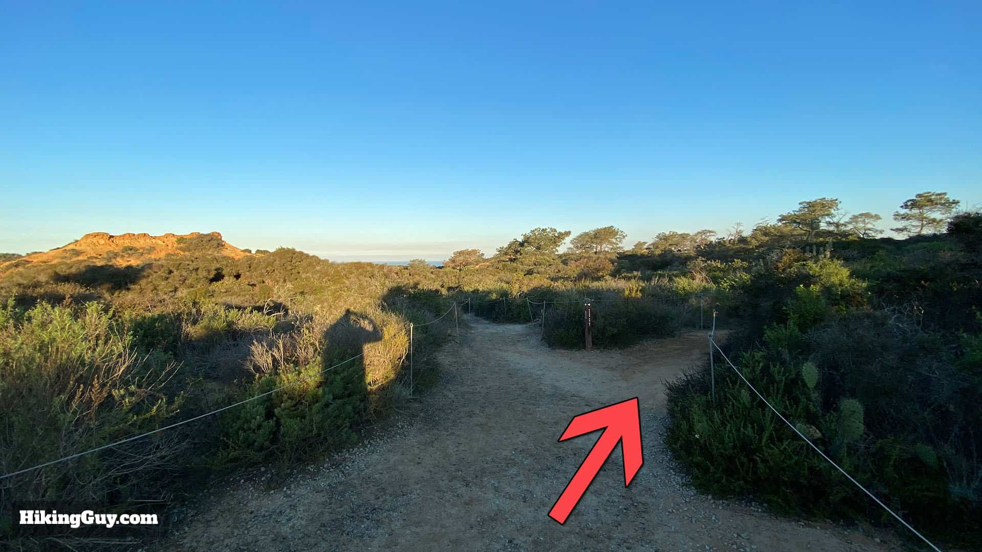
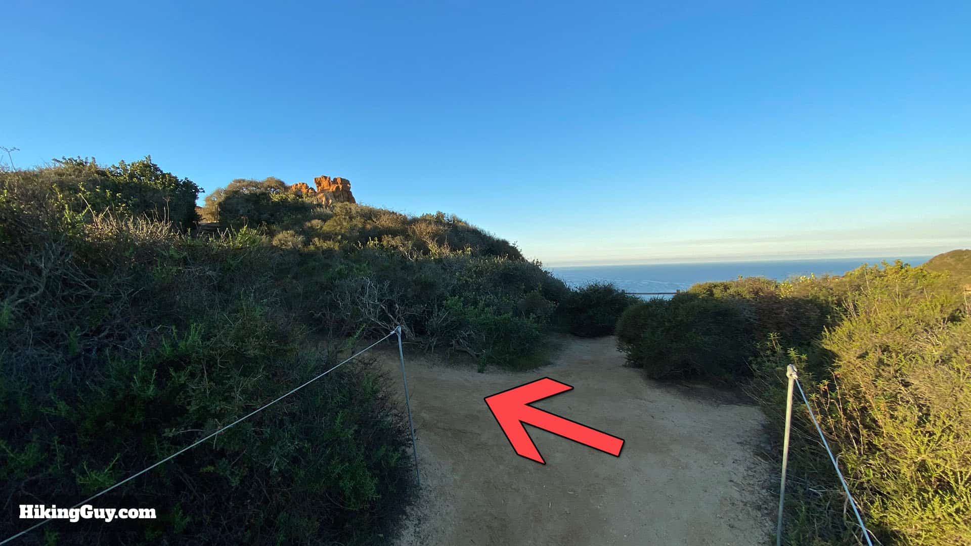
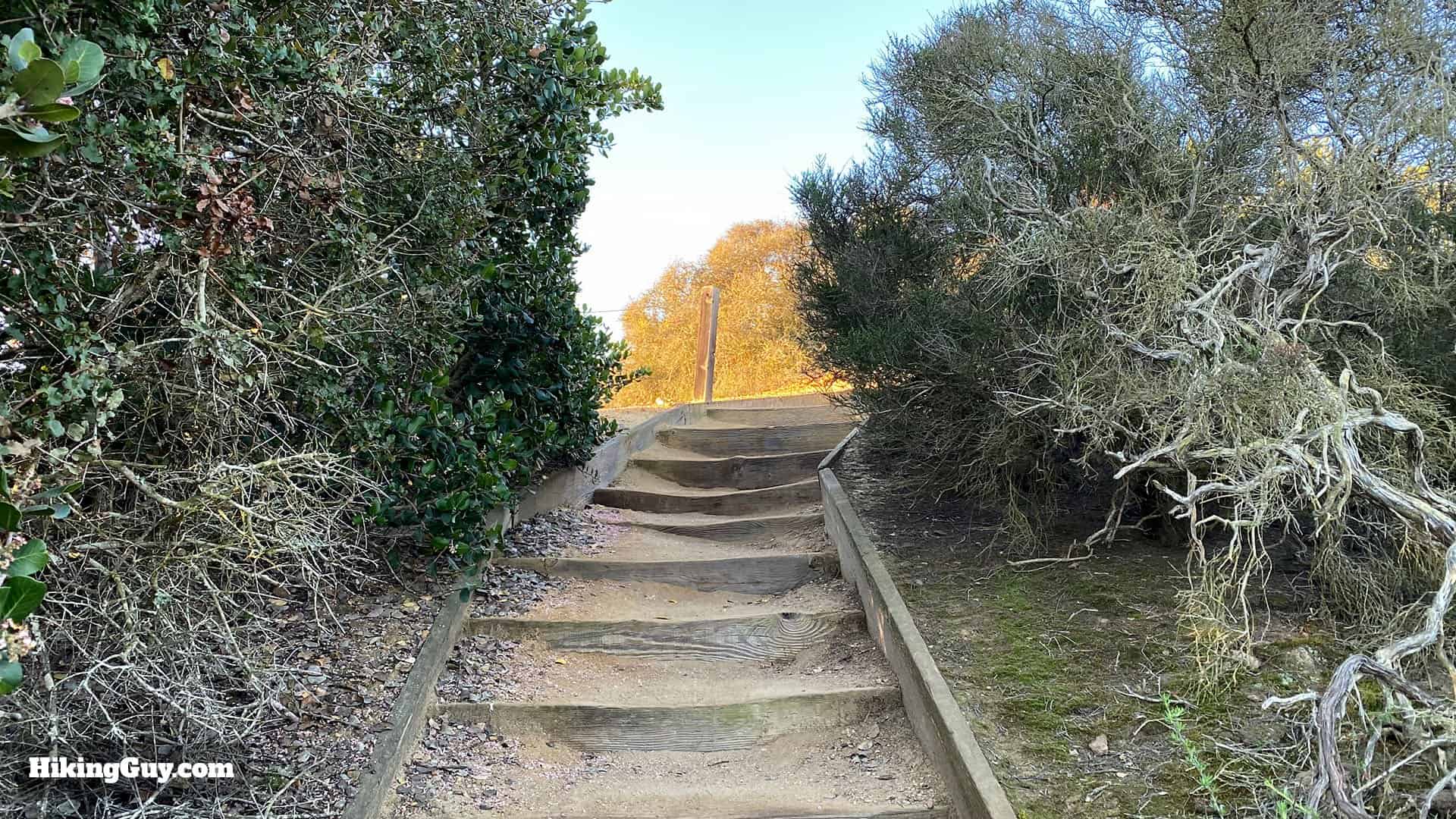
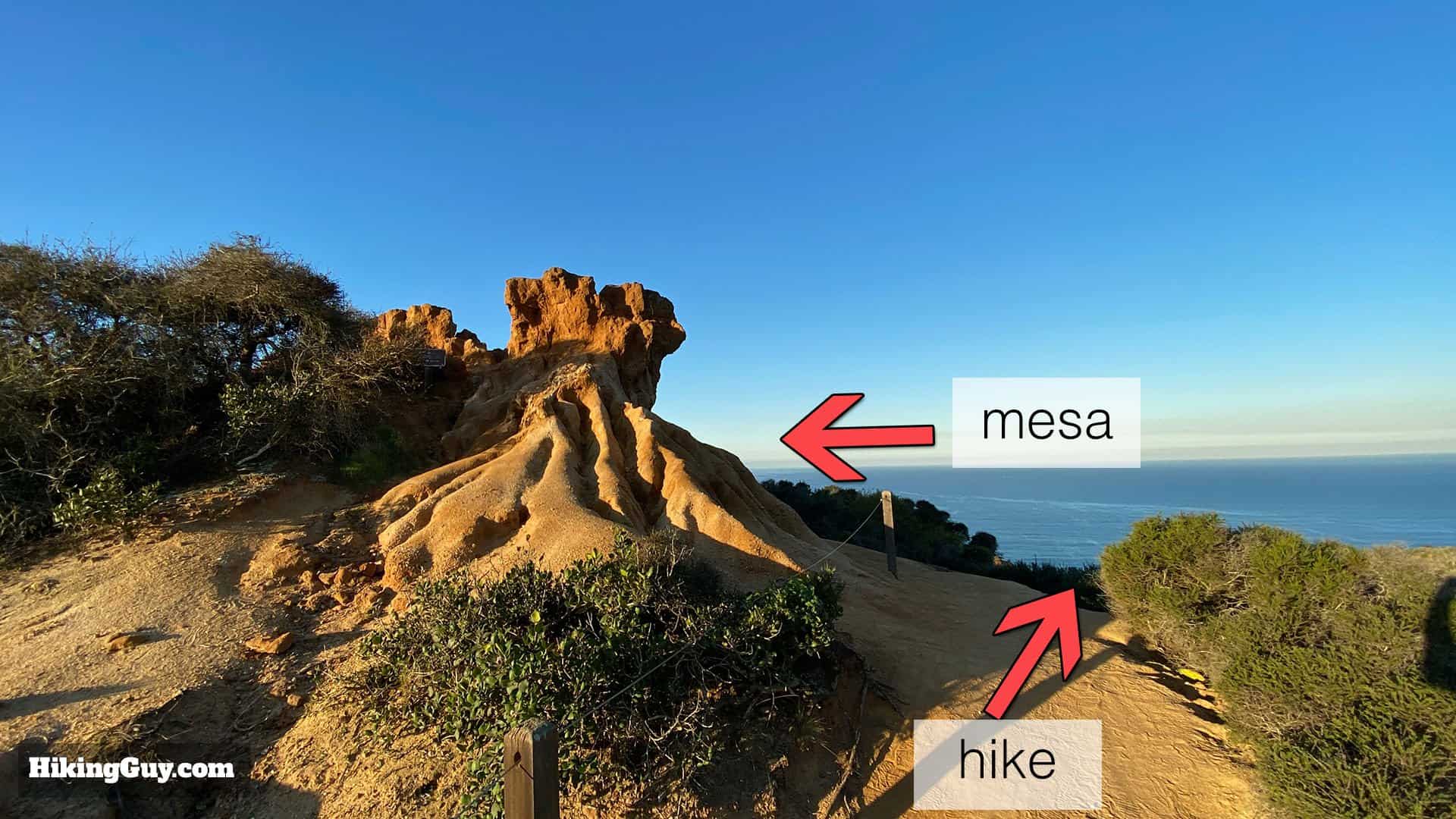
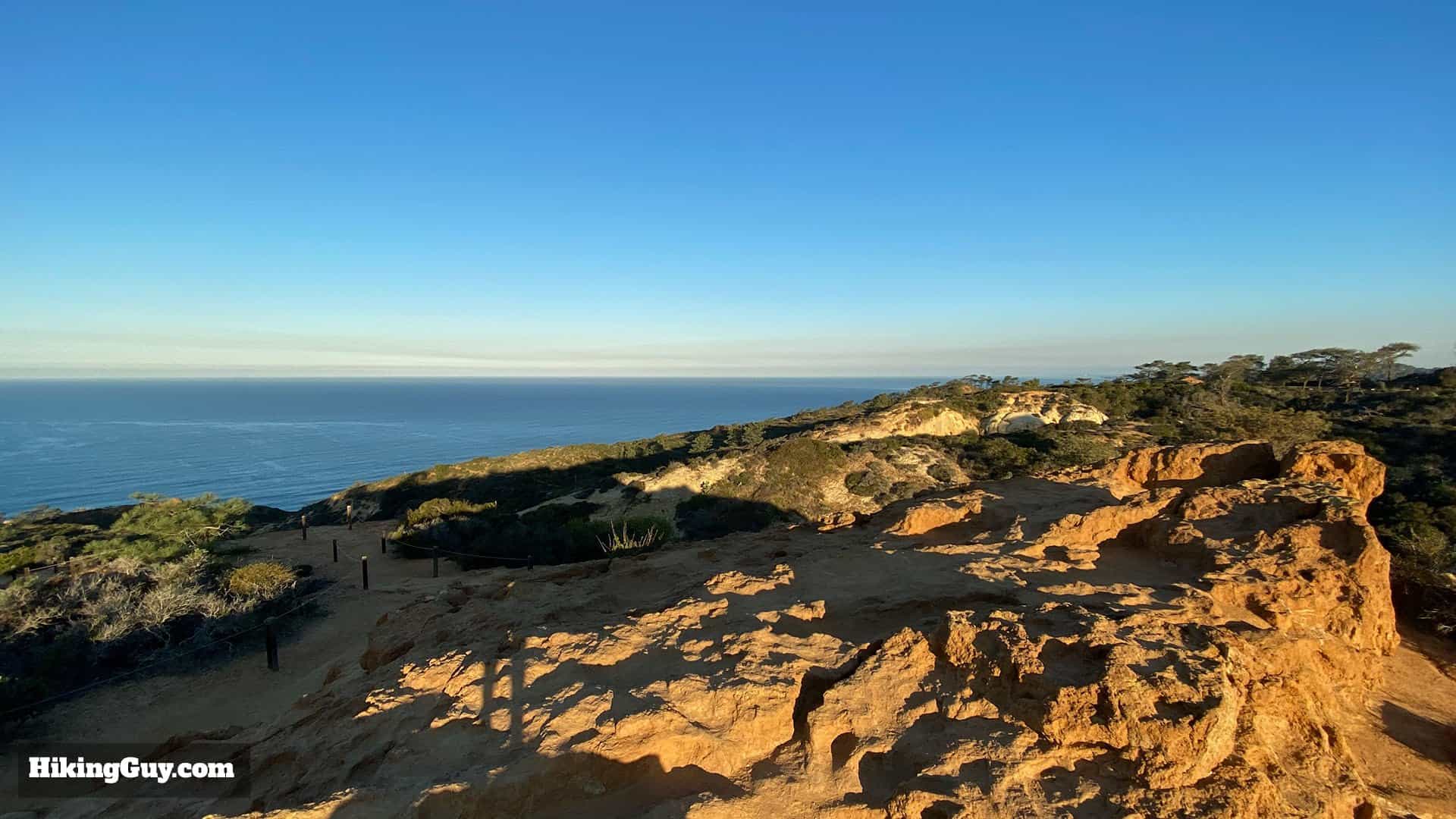
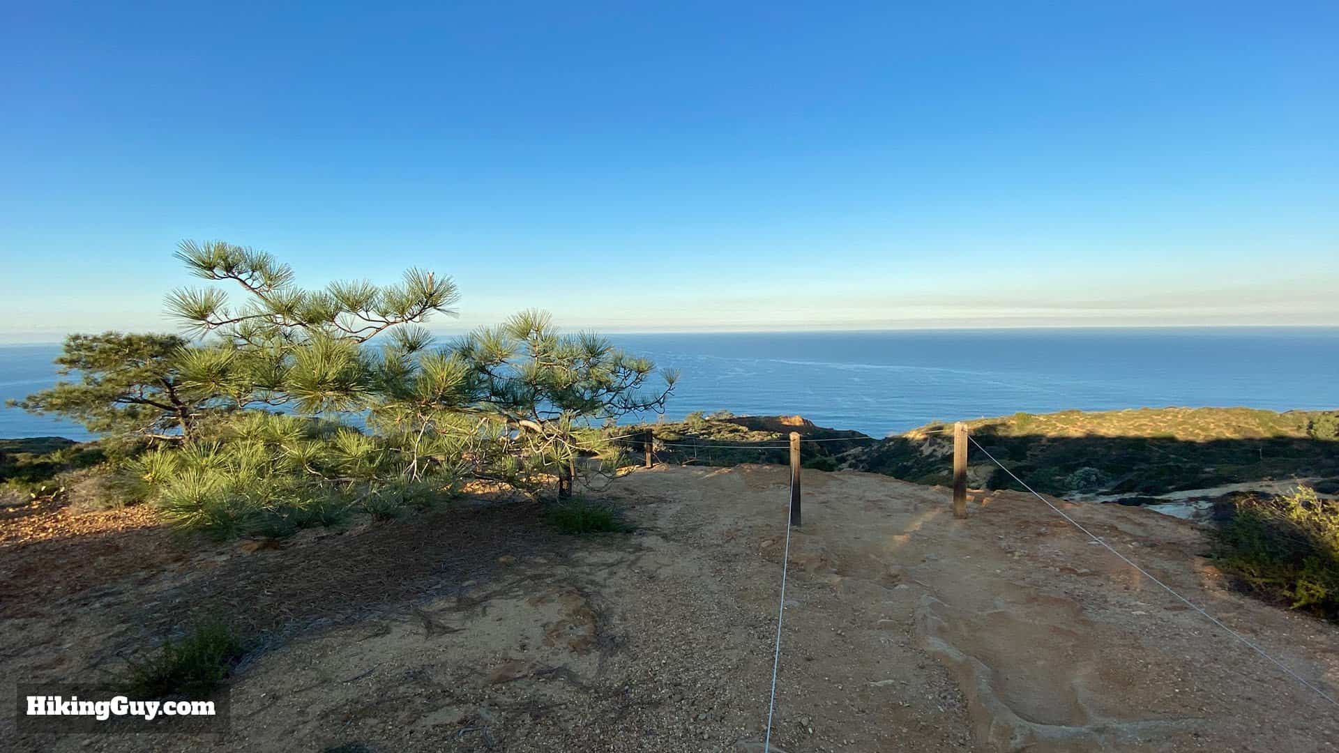
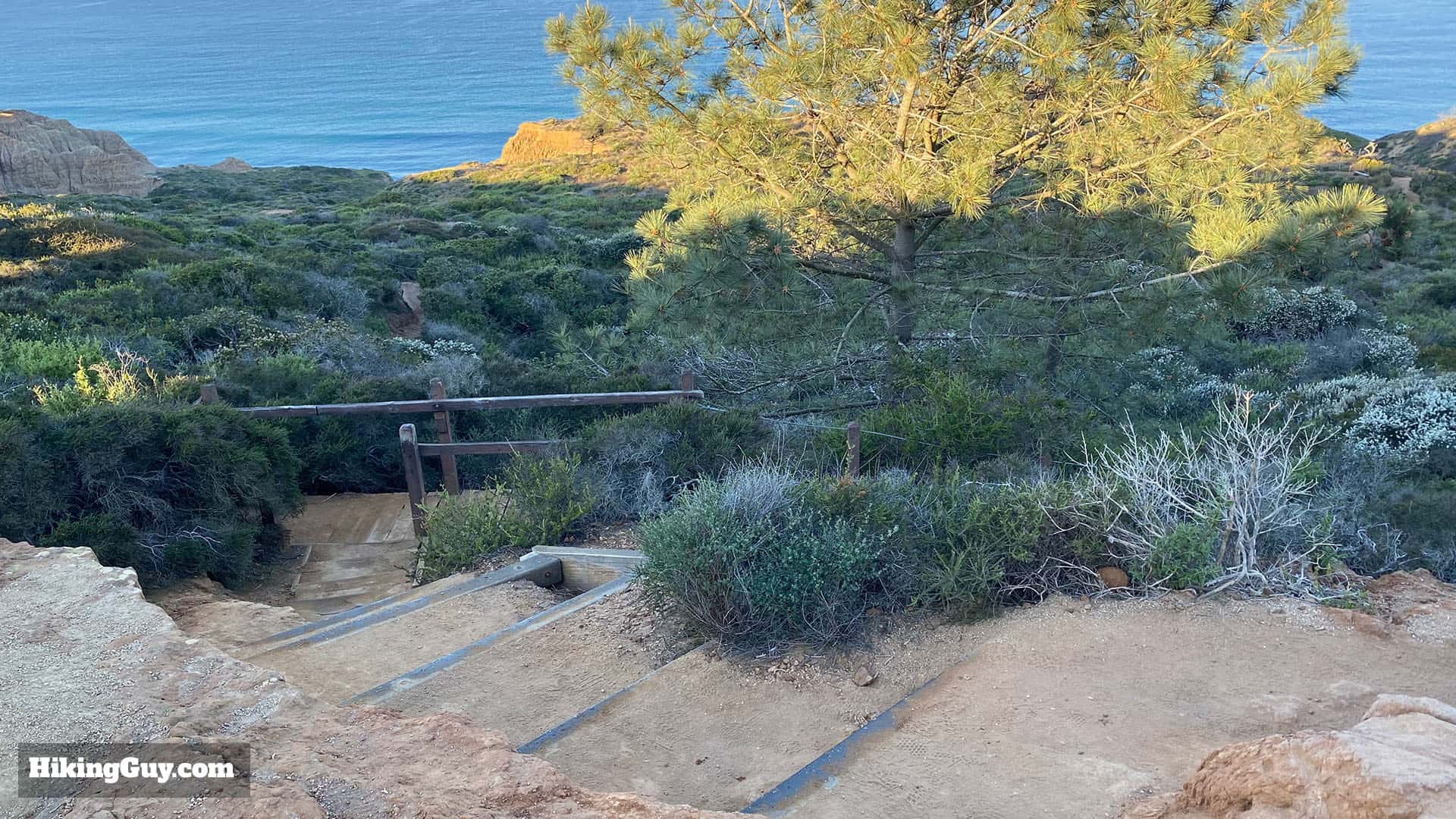
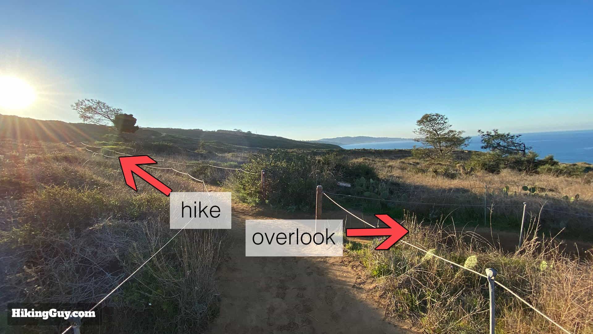
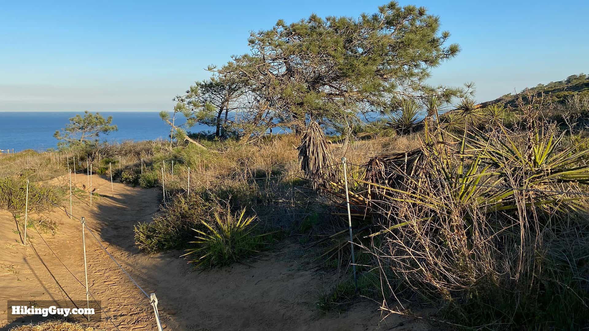
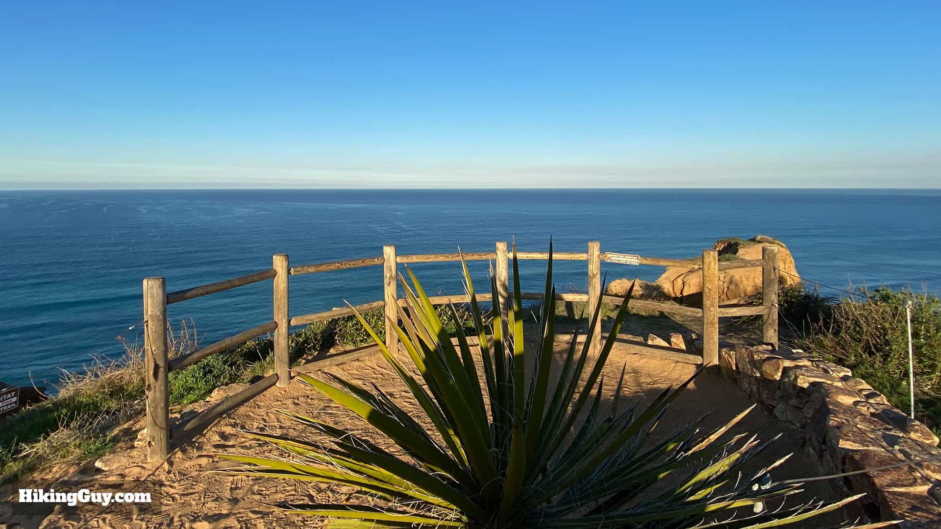
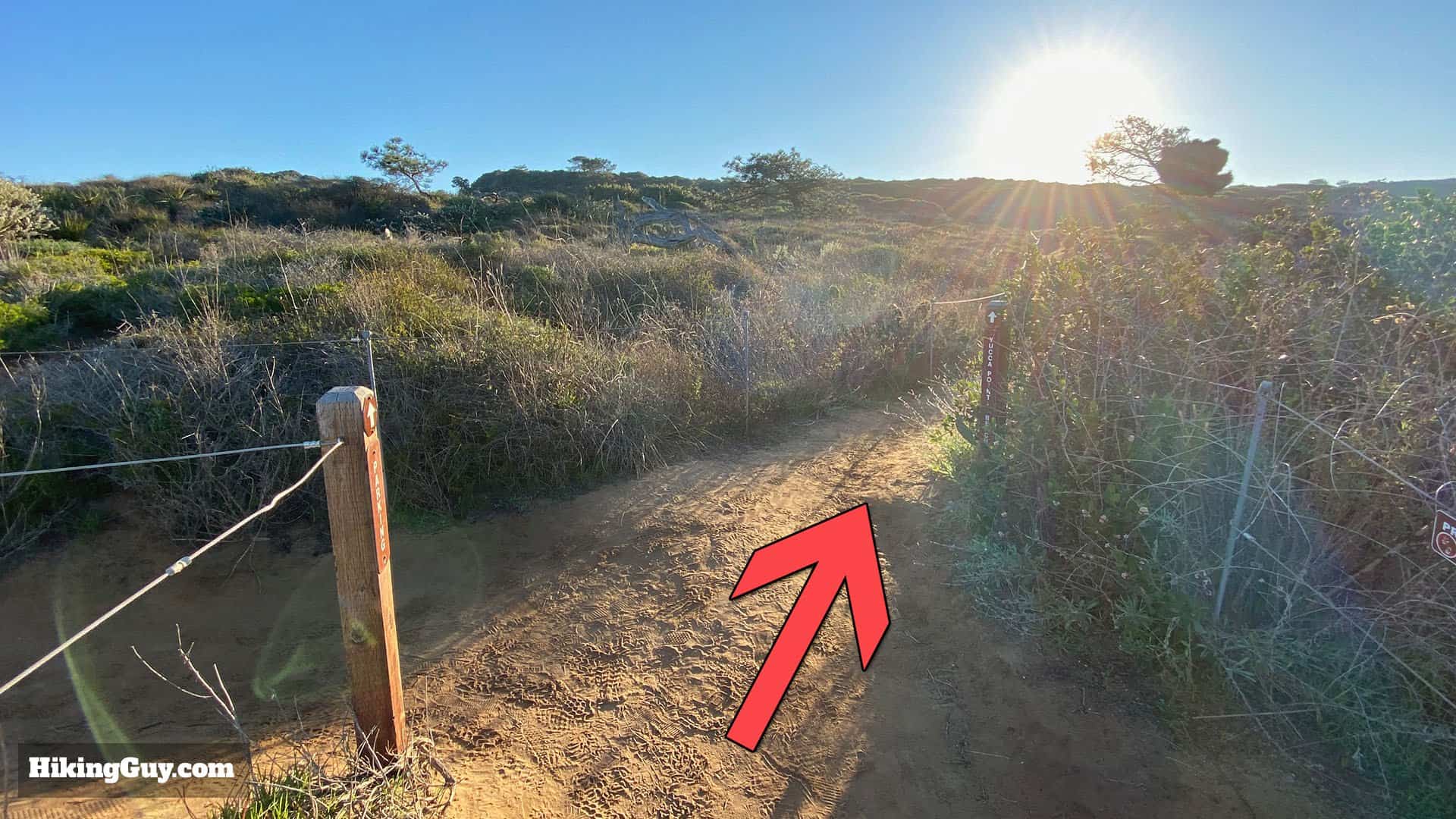
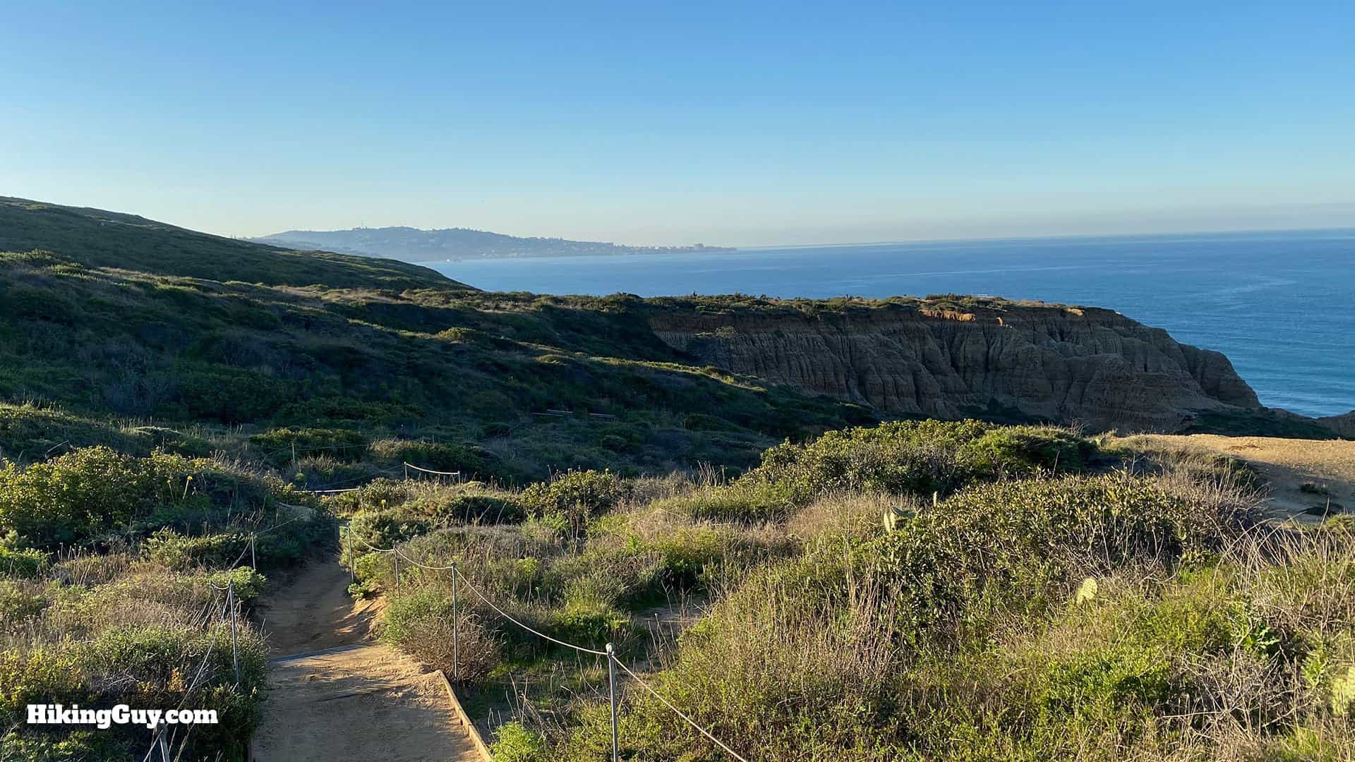
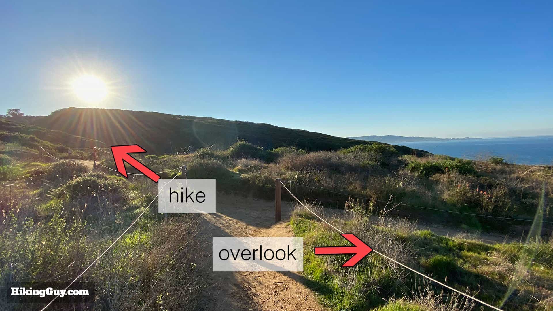
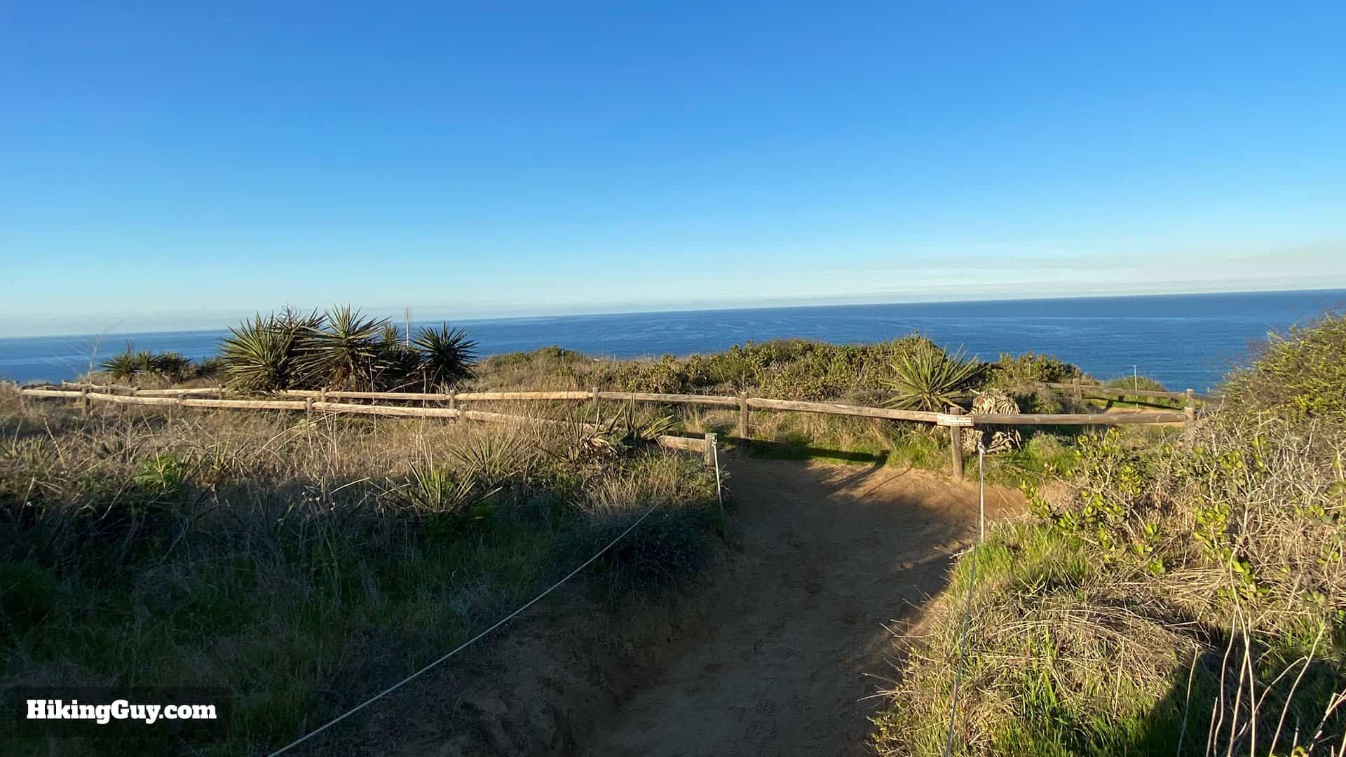
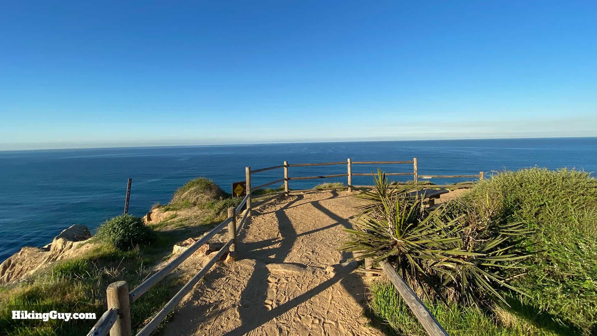
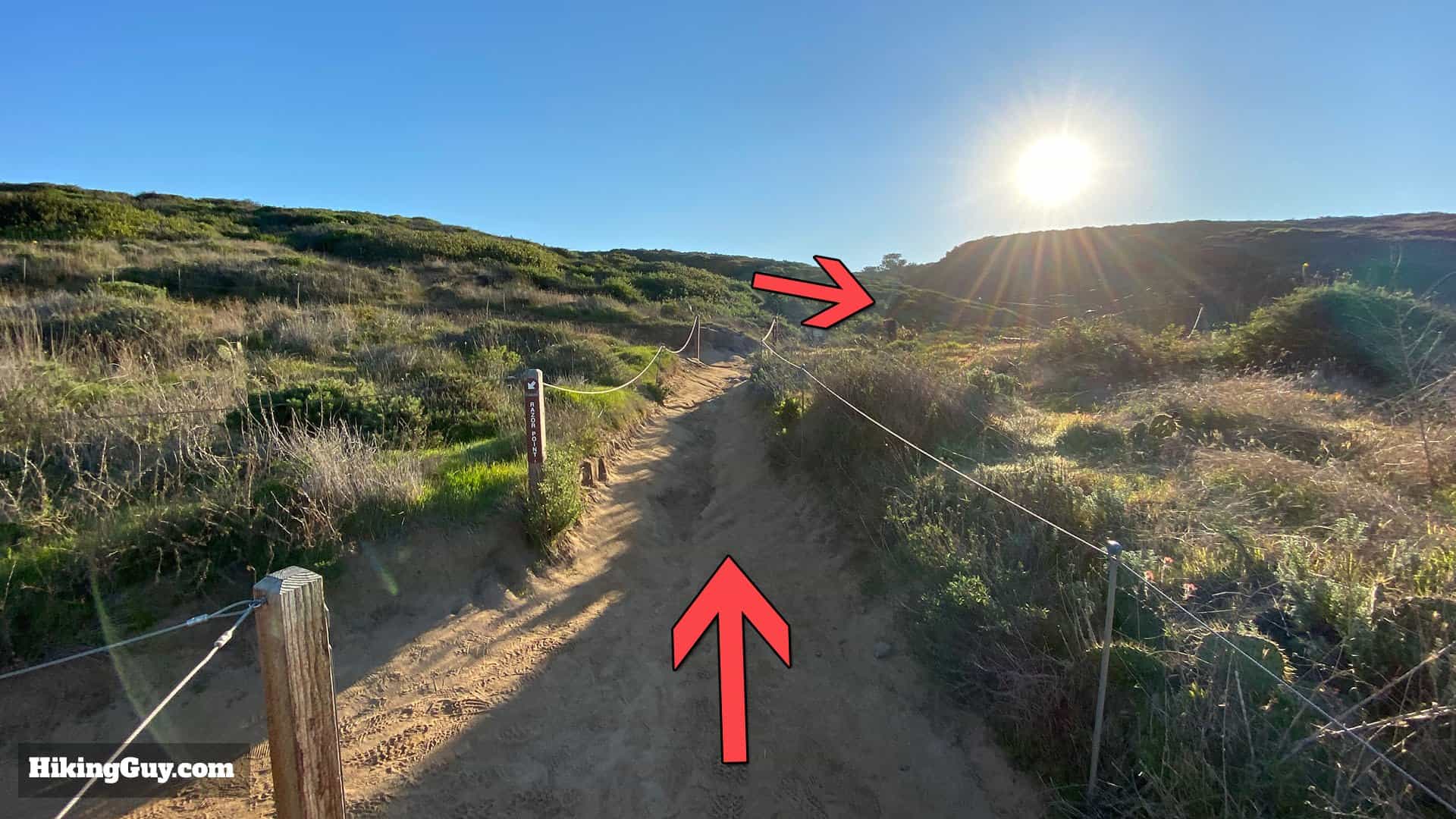
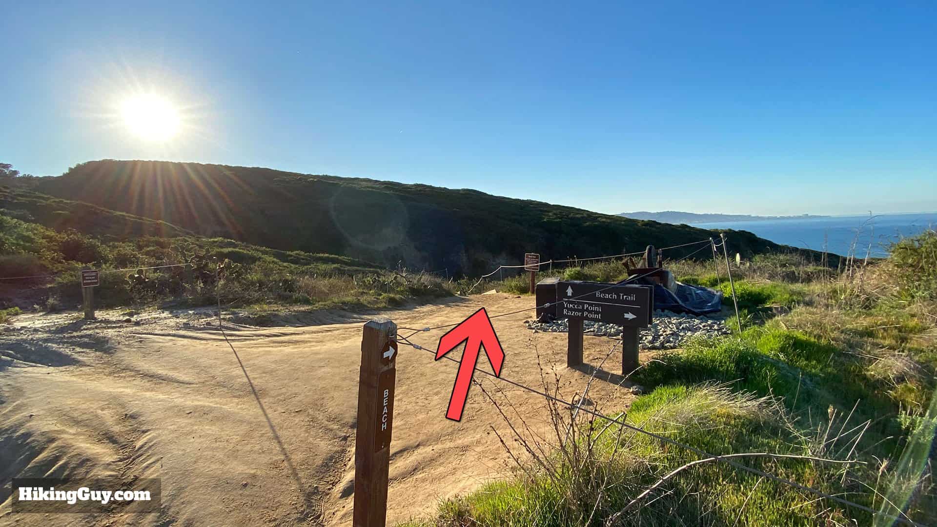
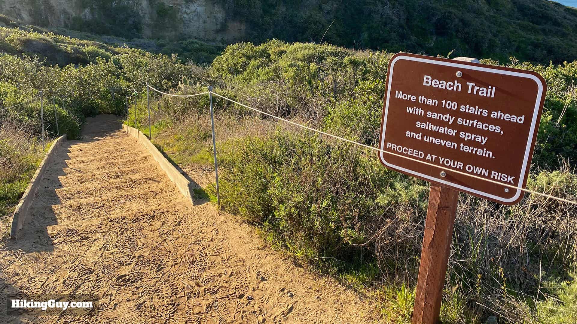
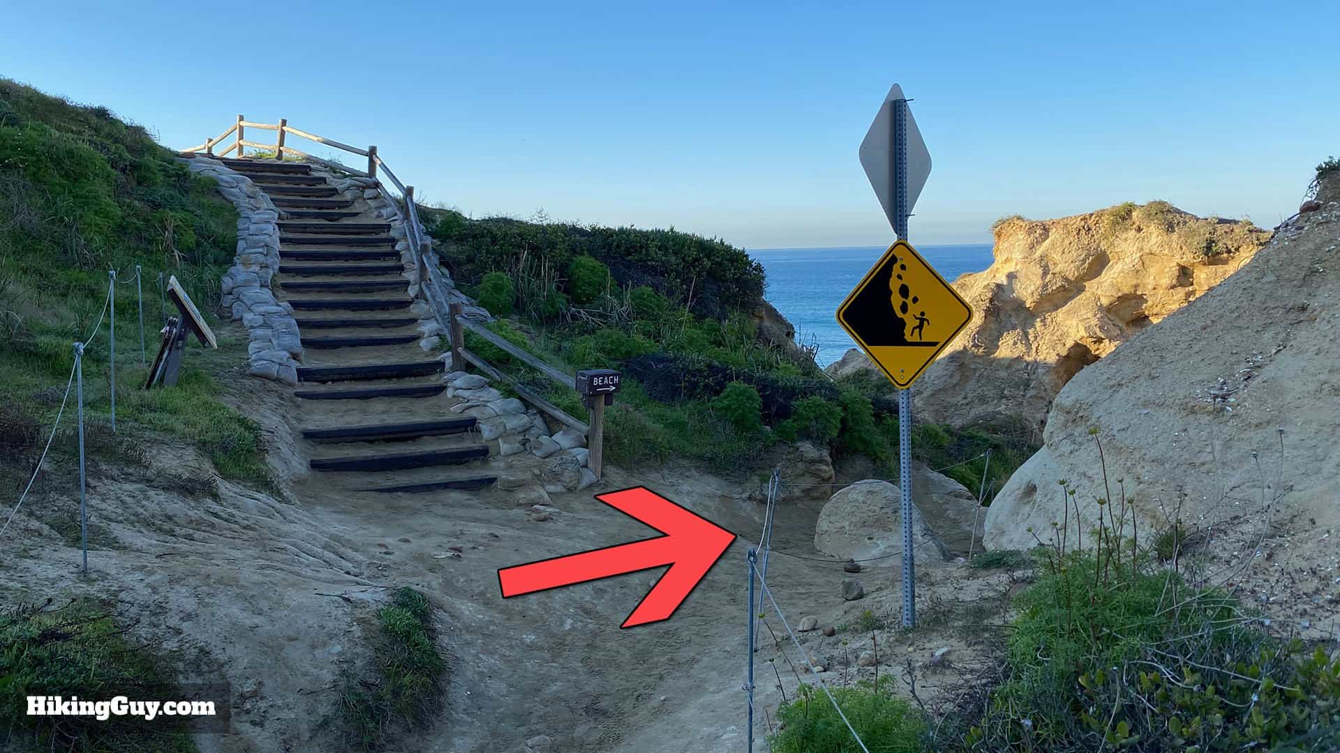
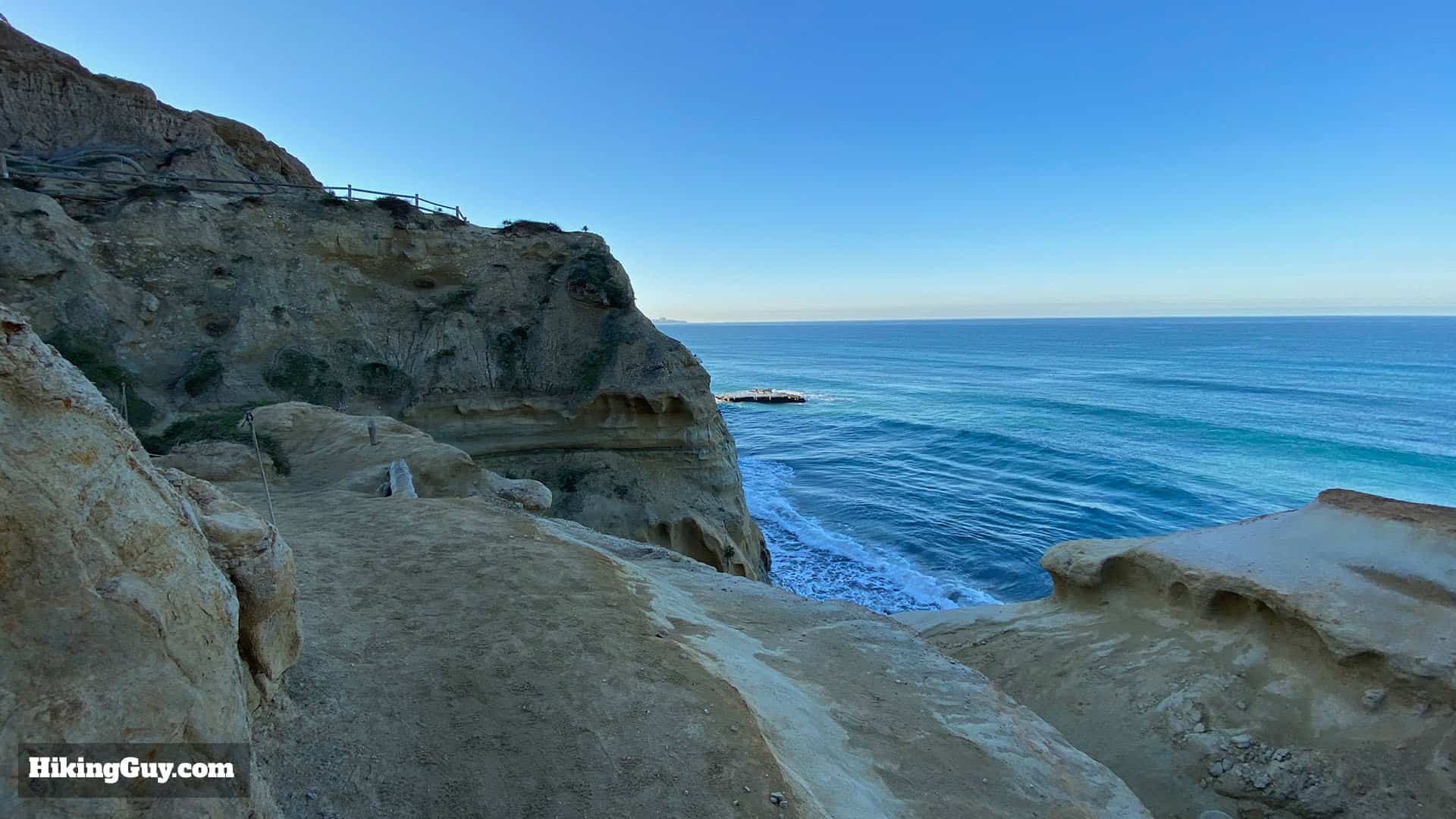
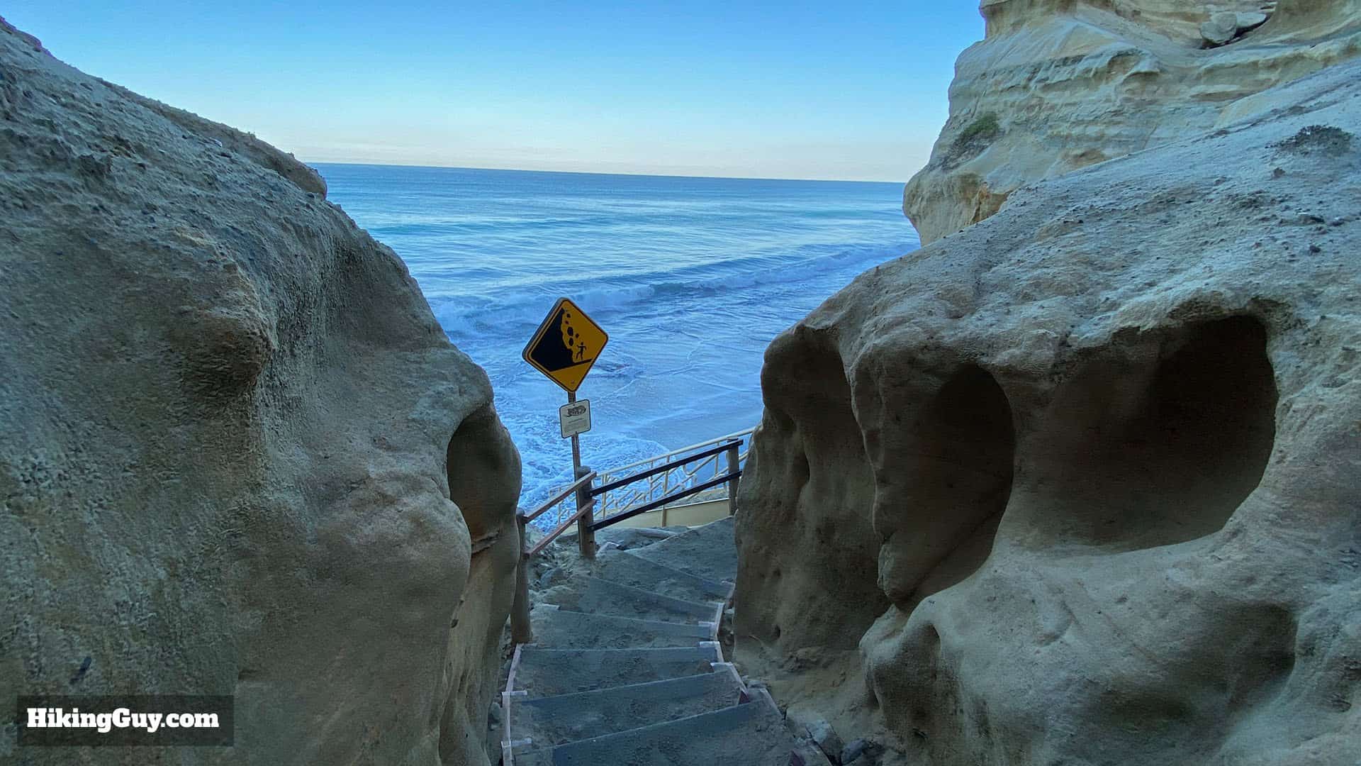
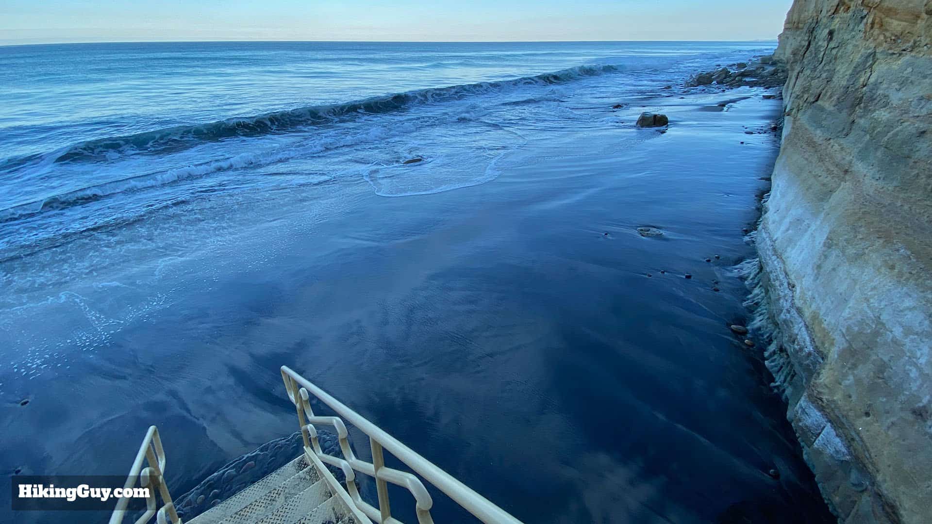
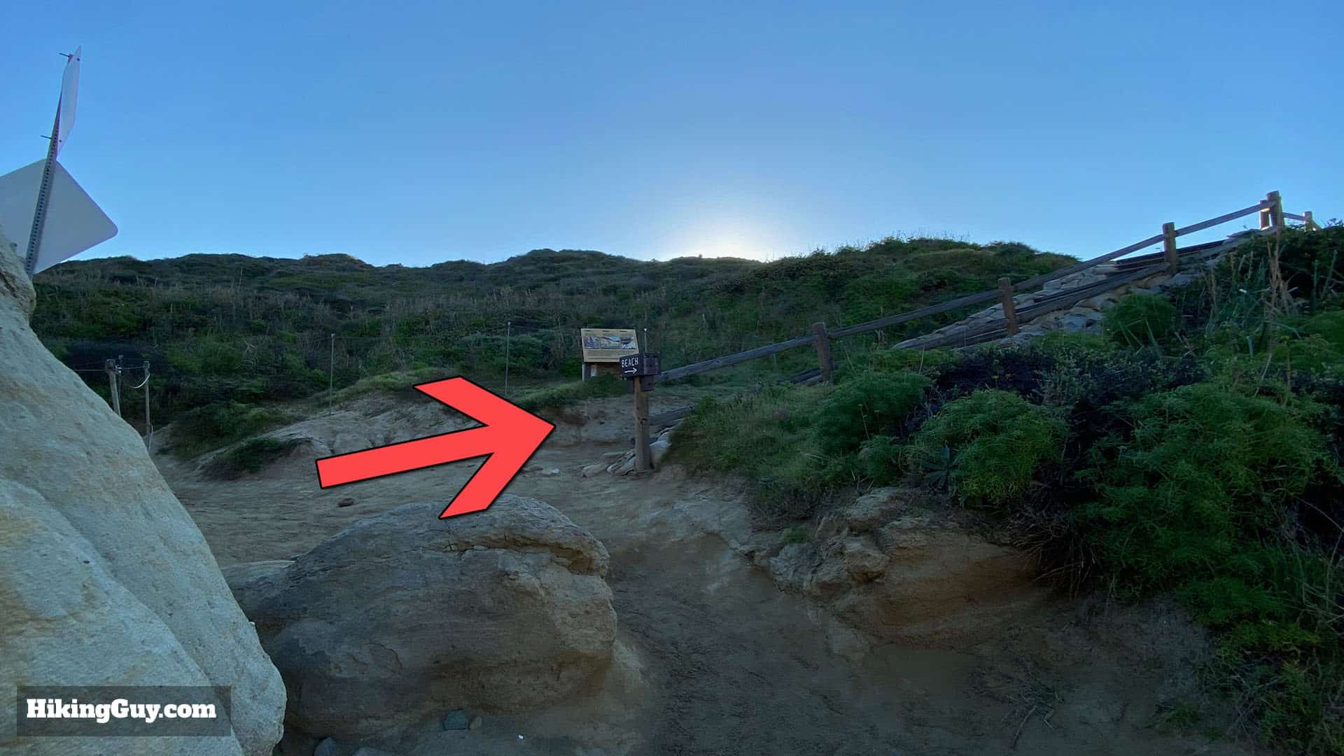
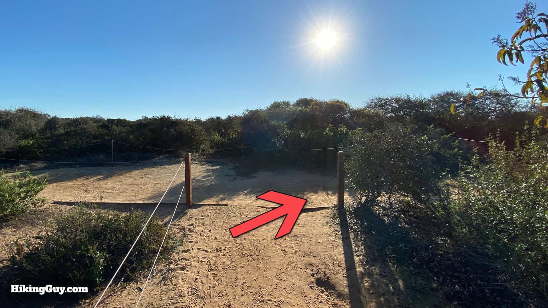
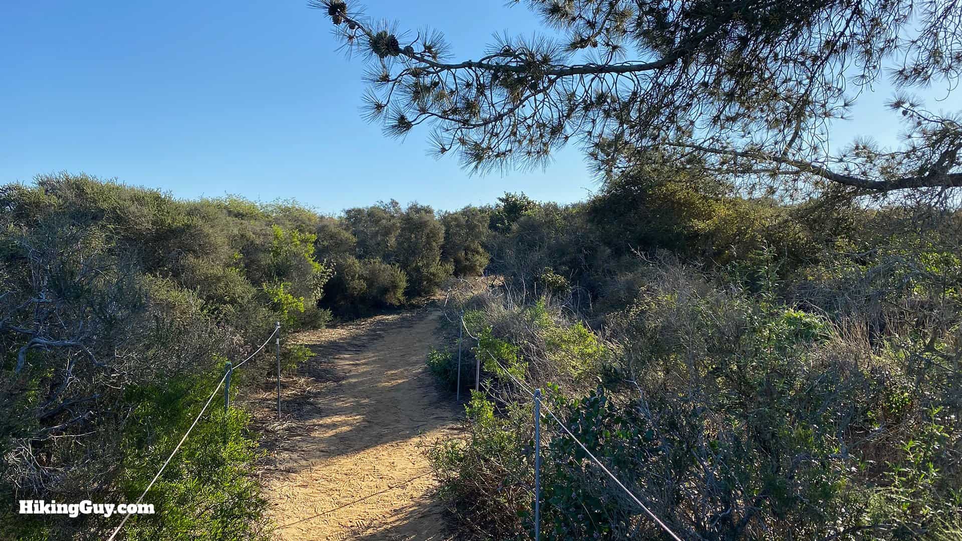
From the parking lot head through the trail signs to start the hike. During the day there are volunteers here to answer questions.At the start take the trail to the left.Continue straight avoiding the side trail to the right.You'll get expansive views as you follow the trail from the start. The trail has rails on the side to keep you in the right place. Leaving the trail could land you a $400 fine.At the intersection make the right toward Razor Point. Notice the trail signs on the posts. The junctions are well-marked.When you get to the junction, make the hard left.And then climb up the stairs to Red Butte.Here you are at the unique rock formation called Red Butte. The hike continues down to the right, but you should make the side trip to the top of the butte.Here's the view from the top of Red Butte.After you've looked around Red Butte, head back down the trail to the right.Soon after Red Butte you'll pass some nice Torrey Pine trees.The trail winds down toward Razor Point.When you see the turnoff, make the right to head out to Razor Point.The trail winds its way to the promontory point.And soon you arrive at Razor Point. Soak in the views. This is also a great place to spot whales. When you're done here head back to the last junction.There's some really cool eroded sections visible on this section of the hike.At the junction, make the right to continue to Yucca Point.The trail winds down toward Yucca Point, which you can see off to the right.At the junction, make the right to visit Yucca Point.When you reach the T-junction, you can go either way.Enjoy Yucca Point and then head back to the last intersection.Continue through the last intersection and then make the hard right to head down the Beach Trail.Head down the Beach Trail.There's a sign warning you about all the stairs you have to climb to get back out. Head on down the stairs toward the beach.When you get to the stairs, make the hard right down to the beach.This part of the trail is spectacular as it winds through eroded sandstone.The stairs go down through a split in the rocks.And soon you'll reach the beach. Check the tides at the trailhead. Here the tide is in. If the tide is out you can explore the beach.
Stay away from the cliff walls. They do break off and fall. There have been fatalities in the area from cliffs falling.
Head back up to the last junction with the stairs and make the right up the stairs.
If you're tired and want to end the hike here, go straight for about 0.75 up the Beach Trail to reach the parking lot.
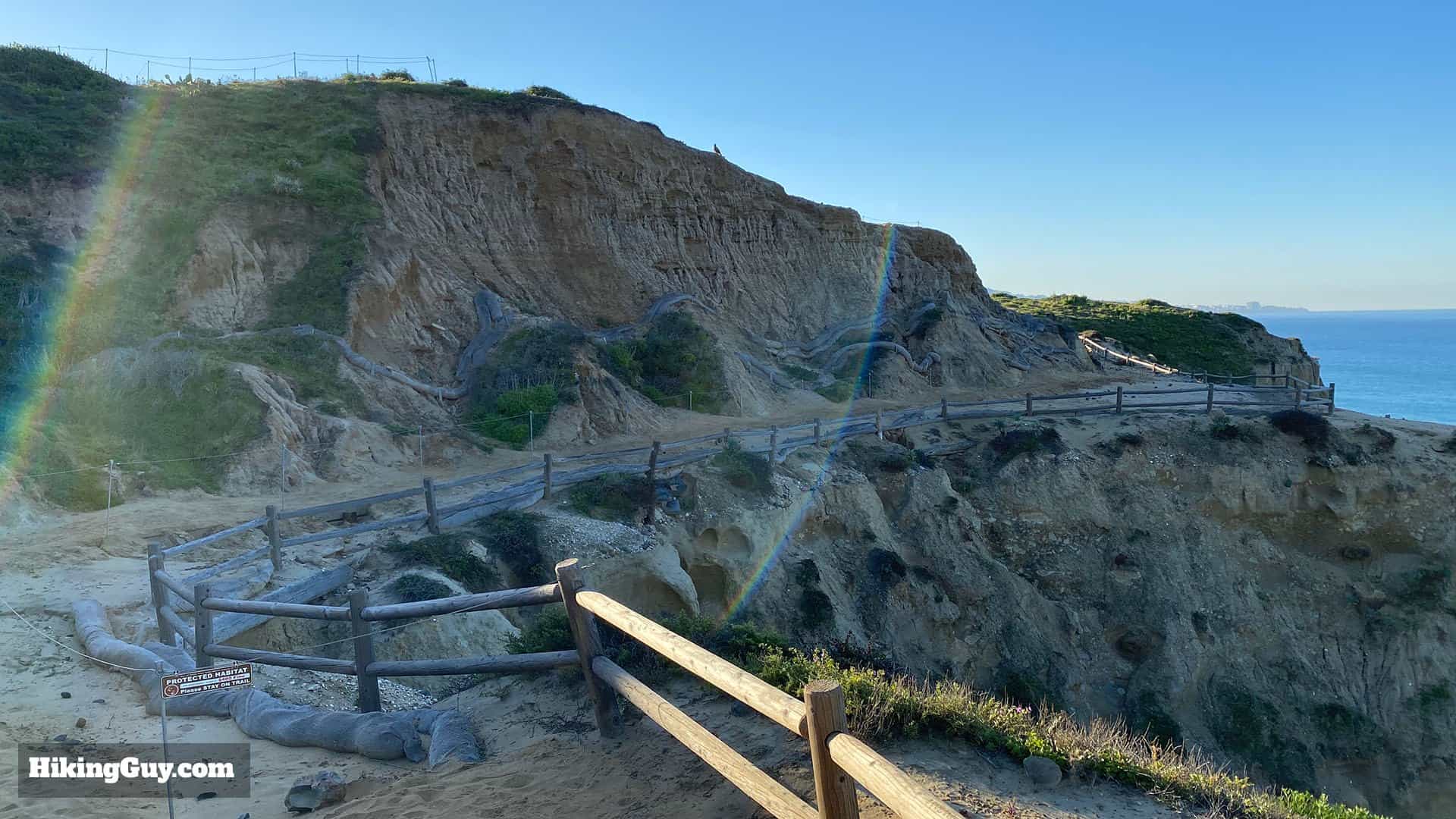
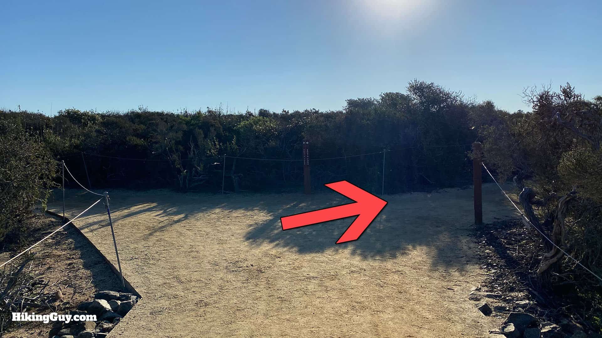
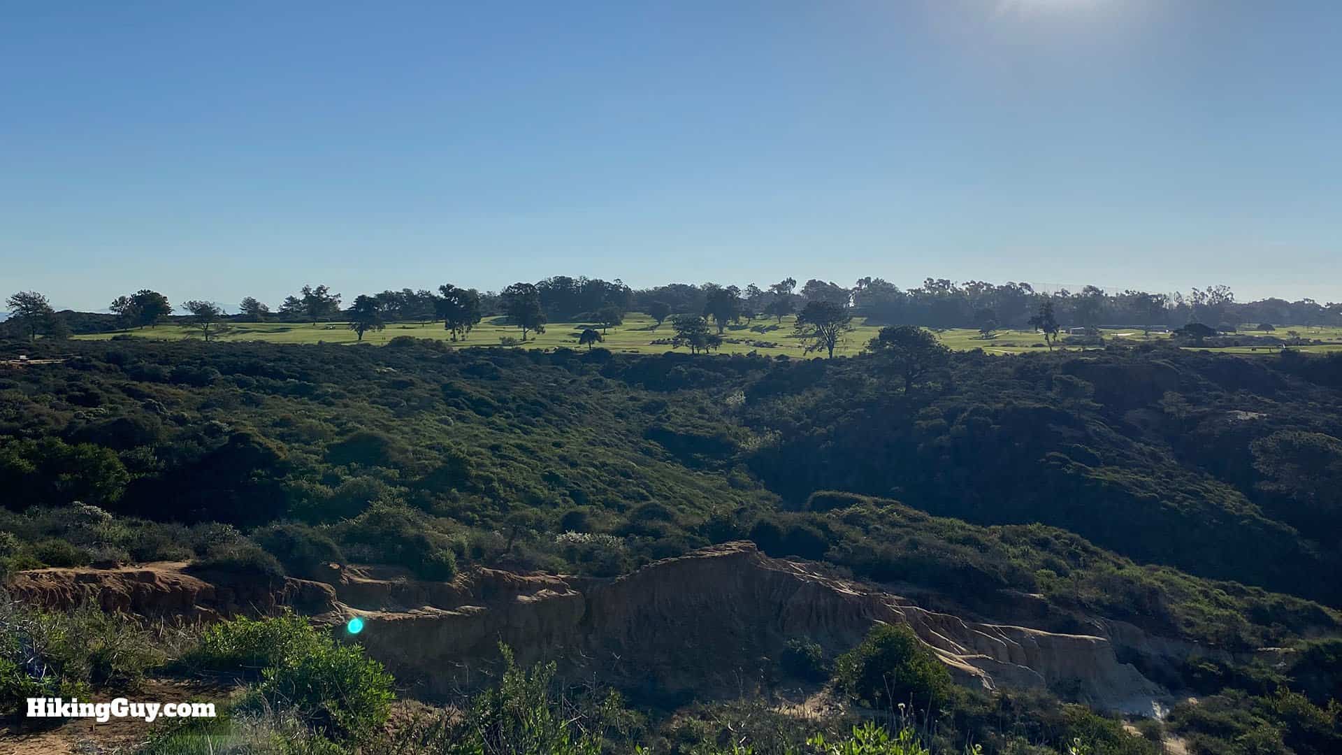
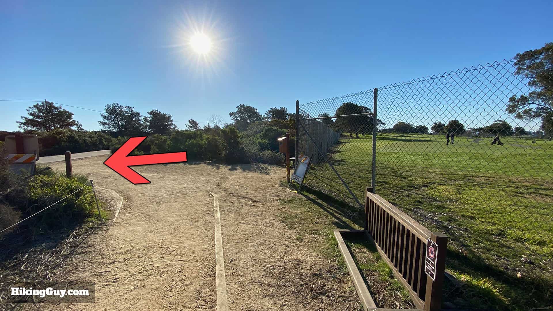
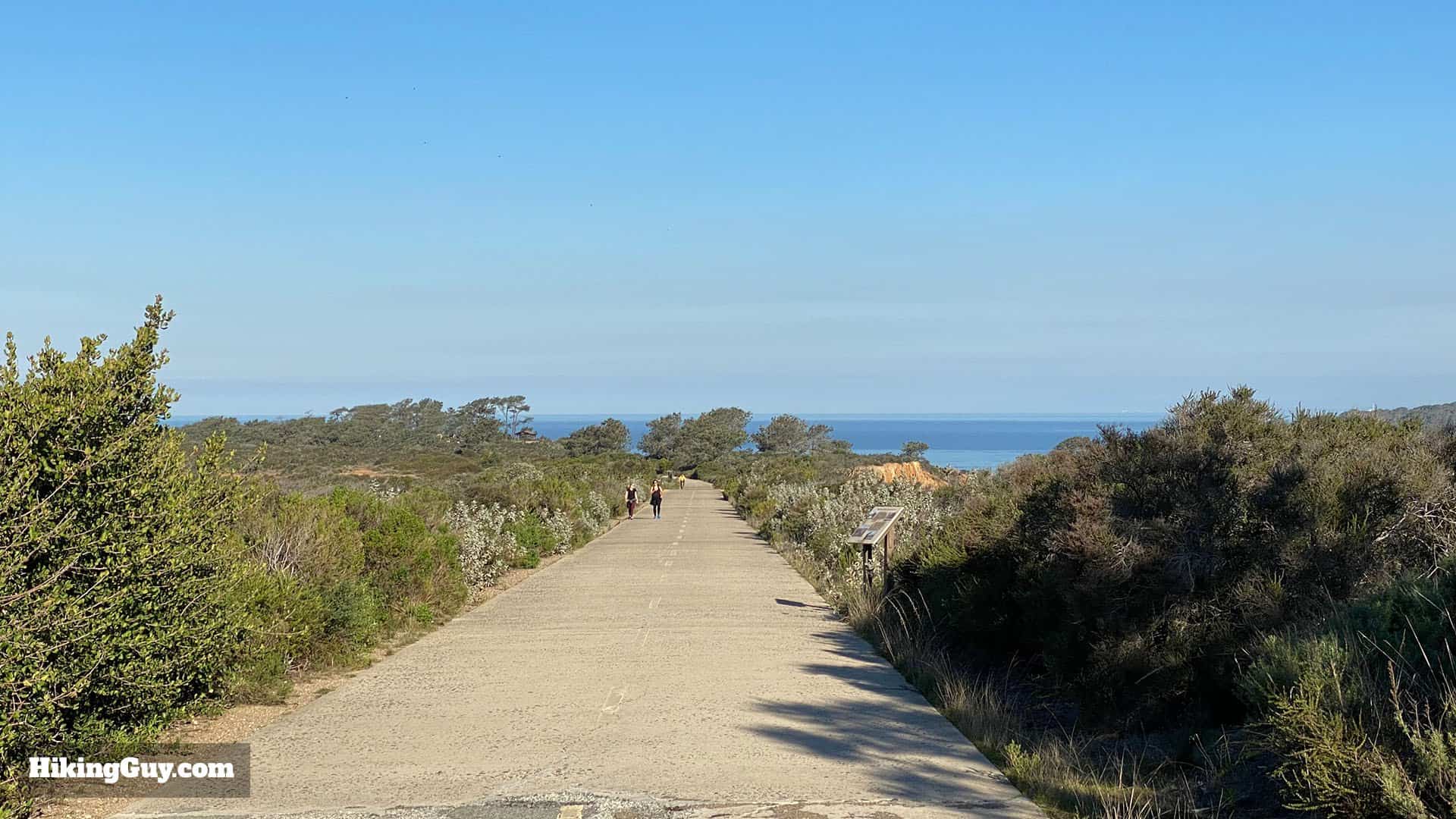
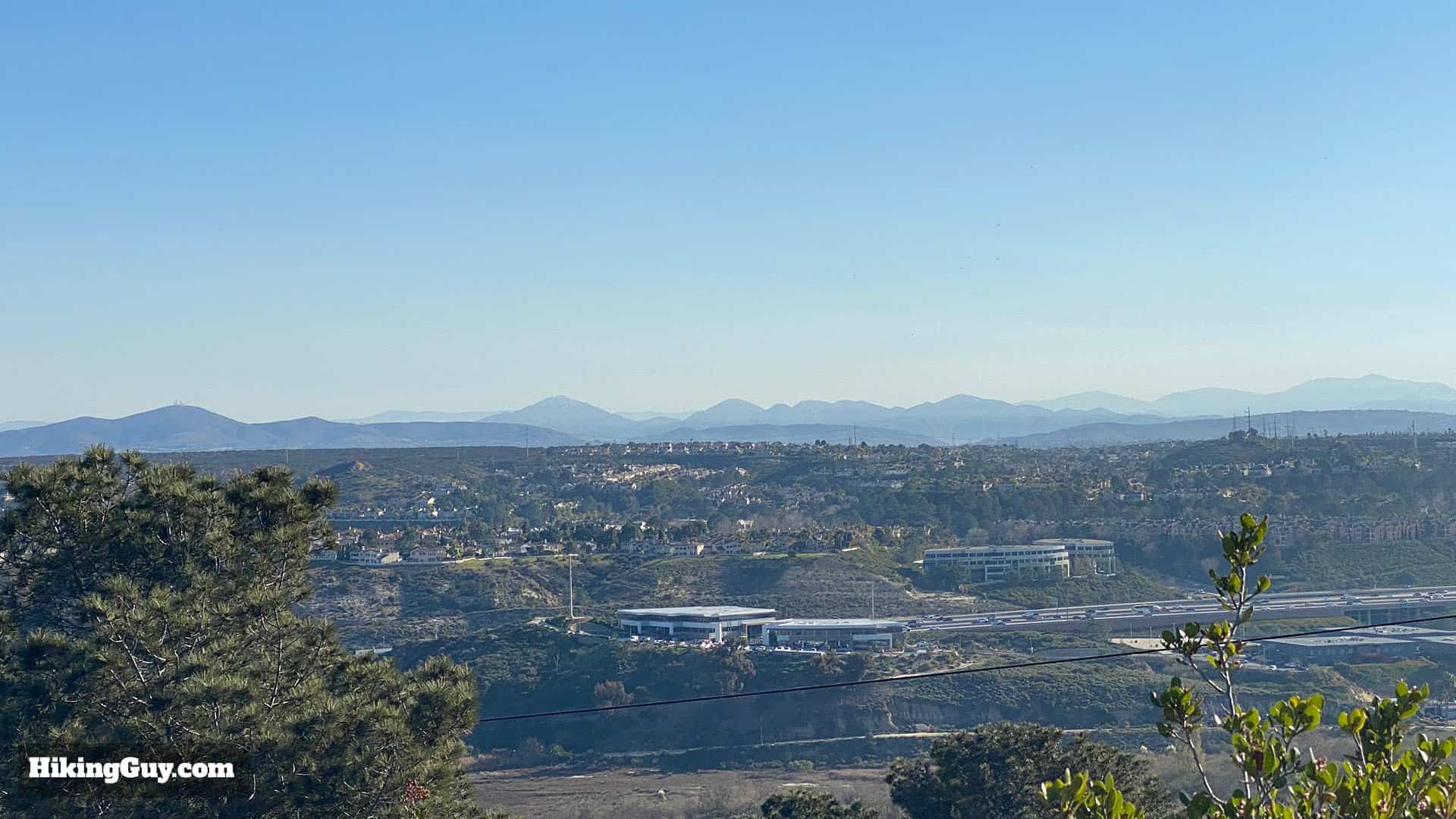
The trail winds its way up the hillside along the water.You have to climb a bit, but you'll get nice views and stairs to help on the steep parts.When you get to the junction for the North or South Fork of the Broken Hill Trail, make the right onto the South Fork Trail.Soon after the junction you'll reach the junction for the Broken Hill Overlook. Make the right to head to the overlook.Unlike the other overlooks, the Broken Hill Overlook doesn't have any fences. Remember to stay on the trail and treat the fragile environment with care.Turn around and head back. You'll see the Torrey Pines Golf Club in the distance.At the last junction, make the right to continue on the South Fork Trail.This part of the park is pretty mellow and is much less busy that the earlier parts of the hike.At the end of the South Fork Trail, make the left onto the old Pacific Coast Highway.The last stretch follows the old highway, which was too narrow and steep and was moved. Today it's used by hikers, runners, and bikers.Enjoy the views to the east (right) including Potato Chip Rock (Mt Woodson).And soon you'll be back at the parking lot where you started. That's the hike!