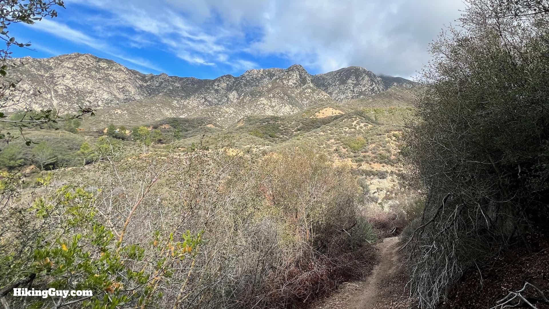
The hike to Hoyt Mountain, often overshadowed by its more popular neighbors, is a great adventure packed into 4 miles. To start, you'll scramble up a challenging use trail to the summit, which offers panoramic views into Angeles National Forest and along the San Gabriel Fault. The hike continues by looping down and circling the mountain along an old trail blasted out of the cliffside about 100 years ago. Along the way, you'll even pass LA's outdoor school for kids, which has been operating continuously since 1925.
Where is Hoyt Mountain?
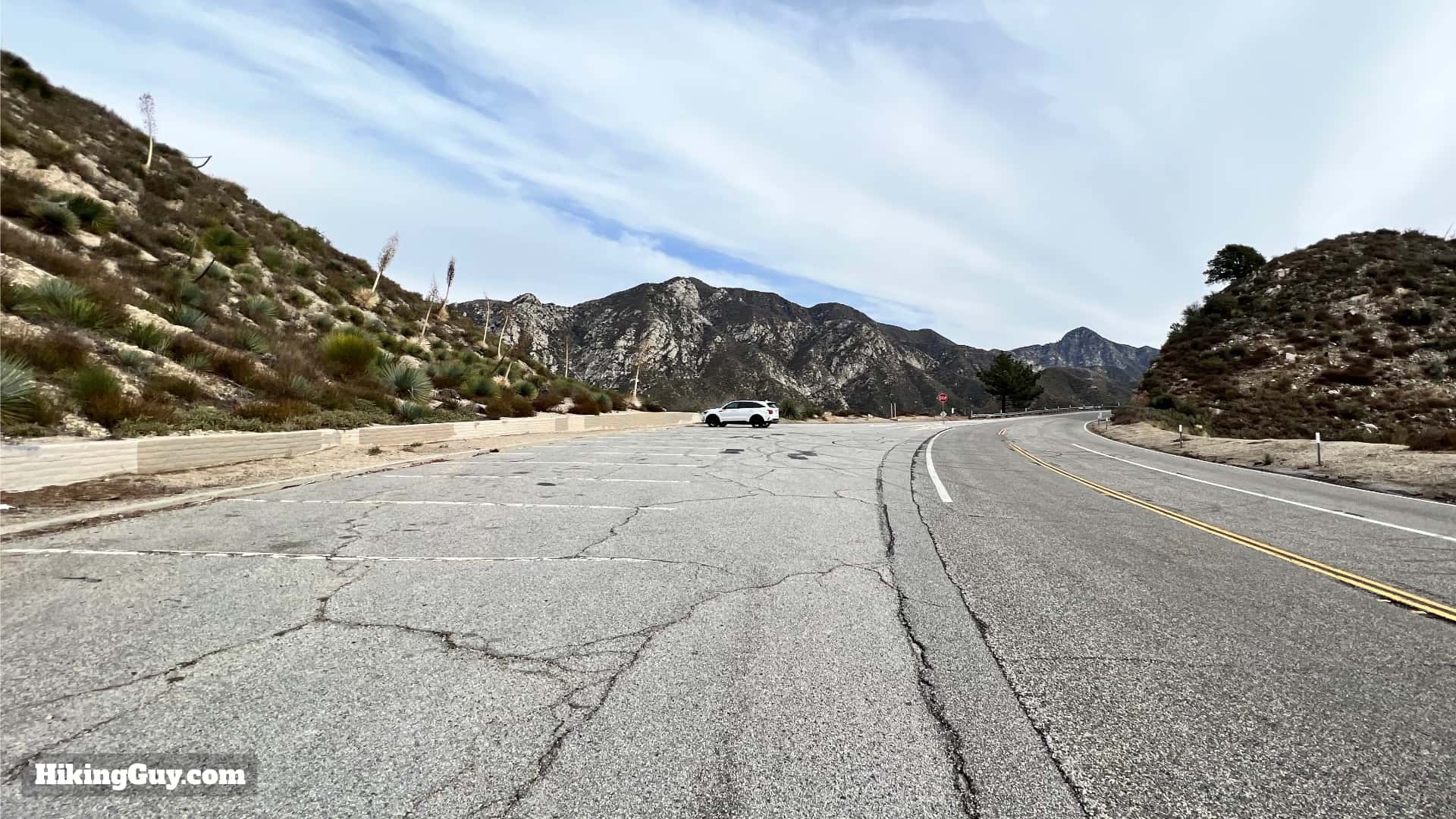
You can find the trailhead a short way up CA-2, the Angeles Crest Highway, at Georges Gap. Use this trailhead address: Georges Gap, Tujunga, CA 91042
There are a dozen or so spots at the Georges Gap trailhead.
You don't need a pass to park at Georges Gap.
The trailhead is at the end of the parking lot, through the little wall.
Gear For the Hike
The first part of the hike requires a steep climb up a loose dirt trail, and then there's a steep descent; having trekking poles and good footwear is a must here. Long pants are also helpful if some sections are overgrown. 1L of water is enough for the short distance, even in the summer when it can be very hot at this lower elevation.
An unofficial and steep trail up and over Hoyt Mountain (marked as "firebreak" on USGS maps).
The Hoyt Mountain Trail (11W04) back around the mountain. This trail is also marked as the Telephone Trail on some maps, and is shown as an extension of Grizzly Flat Road on others.
The World of Chaparral Trail (11W03) back to Georges Gap.
The bad news is that the toughest climbing happens at the start. The good news is that once it's done, it's mostly downhill until the last graded uphill stretch back to the beginning.
3D Map
We're going to do the hike in a clockwise loop, climbing up Hoyt Mountain, high above Angeles Crest Highway, and then back around the north side of the mountain to the start.
Hike Brief
On the way back you might hear children's voices coming from Clear Creek Outdoor Education Center, which helps children create an emotional connection to learning and the outdoors. The center has been in continuous operation since 1925, and according to the data from the slide above, it's doing a great job.
Hoyt Mountain is named after Silas Hoyt, who had built a ranch close to the mountain in 1888. He was referred to in newspapers as "the hermit of Big Tujunga Canyon." The ranch was destroyed in a landslide in the 1930s.
There was a famous court case surrounding Hoyt Ranch in 1917. Allegedly two hunters found Hoyt in 1902, at the time 80 years old, emaciated and living in squalor. They offered to improve the ranch, farm the area, and take care of him if Hoyt would lease them the land. Well, they improved the land, started ranching, and even explored some mining prospects, but then Hoyt wanted to back out of the deal. The case went to court after Hoyt died in 1916 when his estranged daughters fought for the inheritance. In 1919 the CA state supreme court eventually ruled in favor of the two hunters, who "gifted" three-quarters of the land back to the state. It's hard to say whether the hunters were genuine do-gooders who deserved the land, or hustlers who took advantage of an old man.
Although known as Hoyt Mountain for many years, the summit wasn't an official USGS name until the Forest Service submitted the name in 1986. It appears as the peak name on USGS topographic maps from 1995 and later.
If you look east from Hoyt Mountain, up the valley where Angeles Crest Highway is, you're looking at the San Gabriel Fault, which moves about 3mm a year and used to be part of the San Andreas Fault.
Hoyt Mountain Hike Directions
There's some reports of washed out sections from the winter storms of 2022/23. Users have reported that it's sketchy but doable on hands and knees. Maybe better to chose another hike.
At the trailhead you'll see a memorial for Angeles Crest Highway, which truly is a an engineering marvel. Looming above are Josephine Peak and the jagged Strawberry Peak.We'll be coming back on the trail straight ahead (the World of Chaparral Trail), but to start, make the hard left and start hiking up the use trail.The trail is steep, and it's sometimes hard to follow, but it's there.You'll be climbing up above the road. Look for the main path.There are sections where people have cut the trail off and taken other routes. The "main" trail is generally always rocky and generally stays to the left in these beginning slopes.Eventually you'll gain the false summit.The views to the north - Fox Mountain and Condor Peak, open up. The vista is spectacular.After a short while on the false summit you'll see Hoyt Mountain in front of you. There's a level section along the ridge before we start the final climb.This last stretch is steep, but not as bad as the first part of the hike. The trail is small again, but a little easier to follow.There are some steep sections. The trail winds to the right as it approaches the summit.And here you are, at the big flat "summit" area of Hoyt Mountain. There are several groups of boulders but no benchmark.The first group of boulders sometimes has a small summit register, but on the day I shot this, it was MIA.To the east, the radio tower-covered peak of Mt Lukens dominates the skyline.Hike to the other side of the flat summit area.And you'll soon see the ridge heading down. Follow the trail, which you can easily see from the top, down. We're not climbing the bigger peak in front, Peak 4253.There are some great views of downtown LA on the descent.I also saw a fire hose. This section of trail is marked on maps as a firebreak, even though it's not very wide. It was also burned in the 2009 Station Fire, and you can still see some evidence of it along the hike today.There's a small bump to climb as you head down the ridge.As you descend you'll eventually see the power lines at the saddle. That's where we're going.More great views north as we descend, with Condor Peak (5443 ft) in the distance.At the saddle, make the hard right.And go past the power line tower.And now you're on a proper single-track trail, the Hoyt Mountain Trail.Soon the trail gets rocky. This route was blasted out of the cliff in 1925 by Socal Edison to create a path for the original power lines (not the large ones here today).The trail winds along the cliffside.You'll notice these old posts along the trail. The trail is also known as the Telephone Trail. Perhaps these poles carried a telephone line along the old road. If you know the history here, please contact me.The views continue to be epic along the north side of Hoyt Mountain.And then the trail twists around and you'll start to get views back toward Josephine Peak.Off to your left is the Clear Creek Outdoor Education Center. Sometimes when I hike here I can hear kids cheering and laughing, and it's great.You'll have a nice gradual downhill, with Clear Creek down to the left.Towards the bottom of the trail, look for a turnoff to the right and start the climb back to Georges Gap.To start the trail is steep.And then levels out and offers nice views of Clear Creek below.Soon you'll see the Nature's Canteen Trail joining in from the left. Continue right.And you'll see a series of trail signs, one for Hoyt Mountain Trail, the other for World of Chaparral, which we're taking by going straight.We'll climb a series of switchbacks on the World of Chaparral Trail, where which carves a path through the chaparral.
The definition of chaparral is "a thicket of dwarf evergreen oaks; broadly : a dense impenetrable thicket of shrubs or dwarf trees."
Towards the top of the switchbacks you'll start to hear the traffic noise again.And then here you are, back where you started!