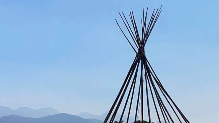

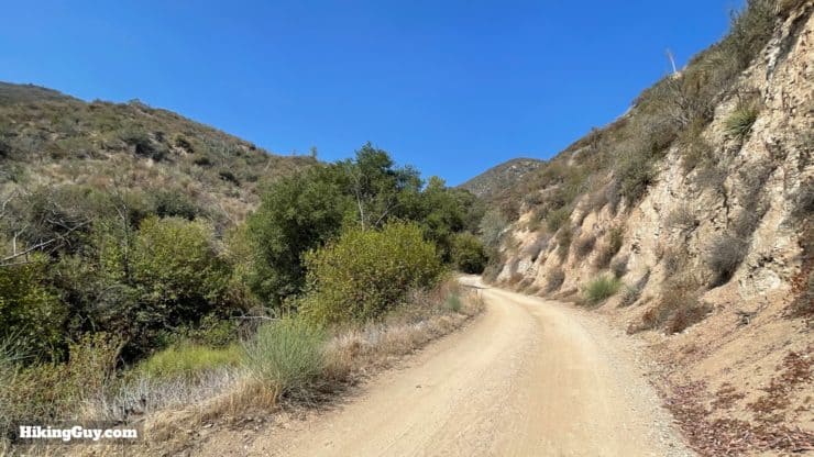
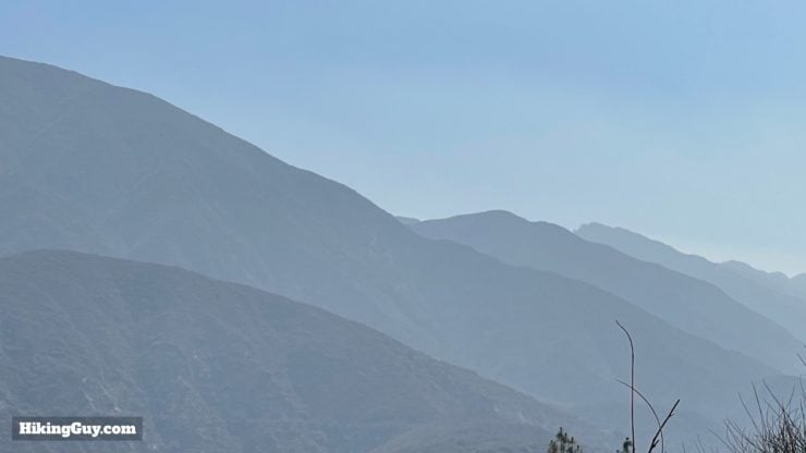
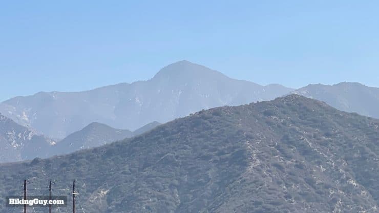
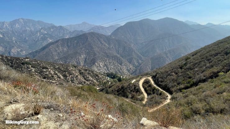
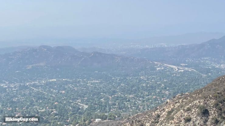
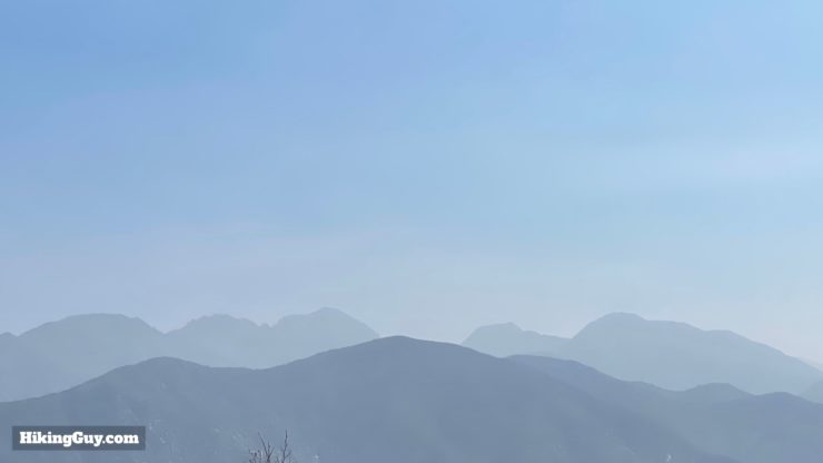
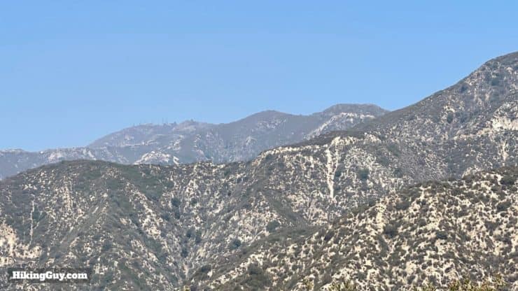
The Teepee Trail is a great hike, but probably not for the reason that you think. Yea, the teepee is cool to visit and great to take photos with, but the climb up to the teepee offers some of the best views into the western peaks of Angeles National Forest that you'll ever see. The hike takes the Mt Lukens Truck Trail up to the teepee, which is uphill, but expertly folded onto the land with switchbacks to make the gradient doable. Overall it's a fun little hike in the foothills of Angeles National Forest.
- Video and Turn-by-Turn Teepee Trail Directions
- Getting to the Teepee Trail Parking Area
- Insider Tips and Recommendations for the Hike
Where is the Teepee Trail?
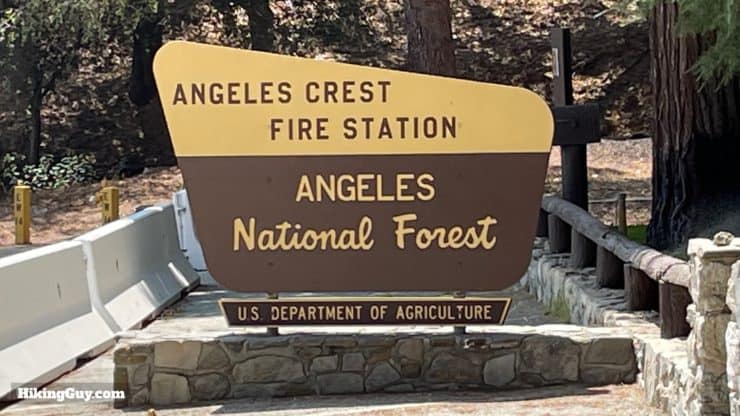
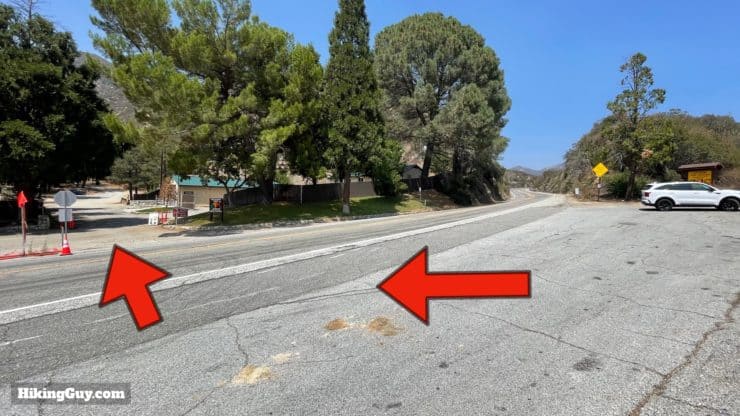
There are a couple of routes to the Teepee, and in this guide I'll show you the most popular (and easiest) route from Angeles Crest Highway (SR-2), which starts across the road from the Angeles Crest Fire Station. Use this address: USFS Angeles Station 11 - Angeles Crest, 5898 CA-2, La Cañada Flintridge, CA 91011
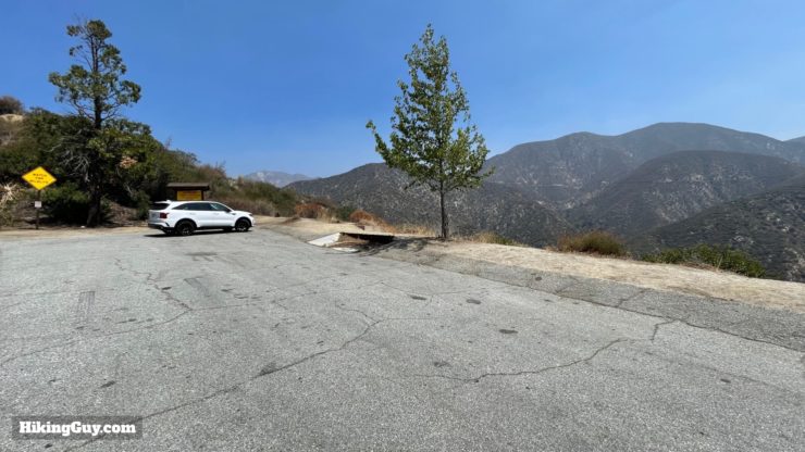
You do not need a parking pass here. There are no facilities or toilets.
Gear For the Hike
This is not a technical hike, but it is uphill and all exposed.
- Fitness clothes or light hiking gear works well here.
- You'll want sun protection and at least 1L of water.
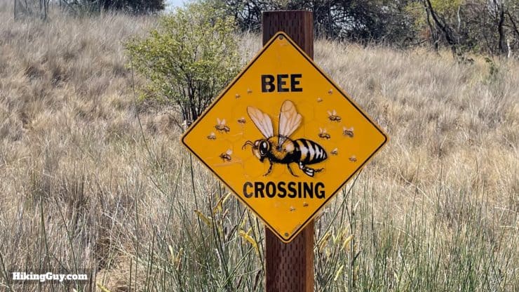
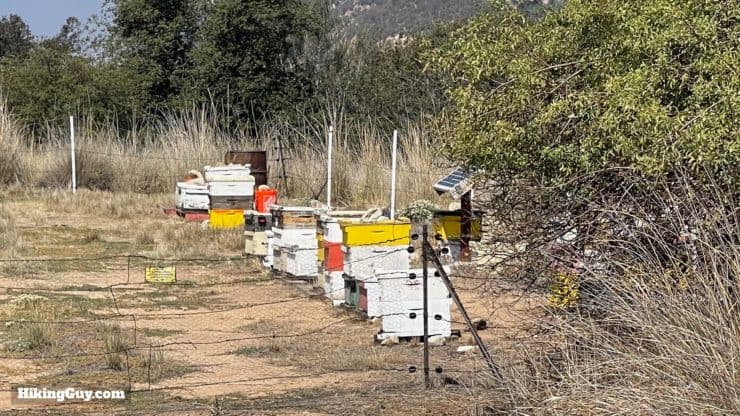
- There are bee hives to pass, so if you are allergic, bring whatever you need to deal with a sting. That said, I've never seen any big swarms of bees, just a few here and there, as you would in any suburban park.
Gear That I Love Right Now
Nothing is sponsored or promoted, just the actual gear that I use.


Check out the complete list here. ( Updated July 2024)
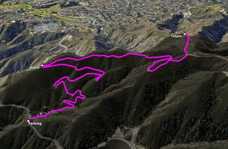
Teepee Trail Maps
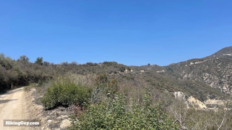
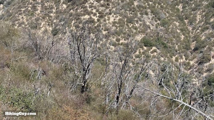
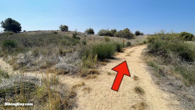
So there isn't actually a "Teepee Trail," you hike up the (dirt and closed to the public) Mt Lukens Truck Trail. While the road might not be a pristine single-track trail, it does offer incredible views of the mountains around every turn, so focus on that.
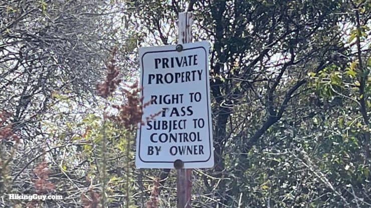
The hike starts in Angeles National Forest, but then enters land owned by Pasadena, and then private property (more later).
How Will You Navigate?
 Using the Apple Watch for Hiking
 Garmin Fenix 7 & Epix Review For Hikers
 How To Read a Topographic Map
 Garmin GPSMAP 67i Review
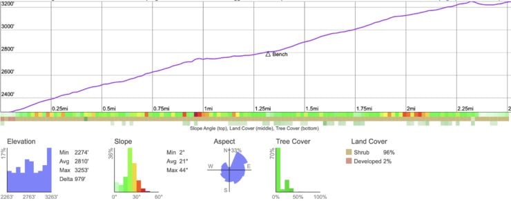
Elevation Profile
3D Map
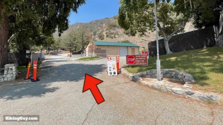
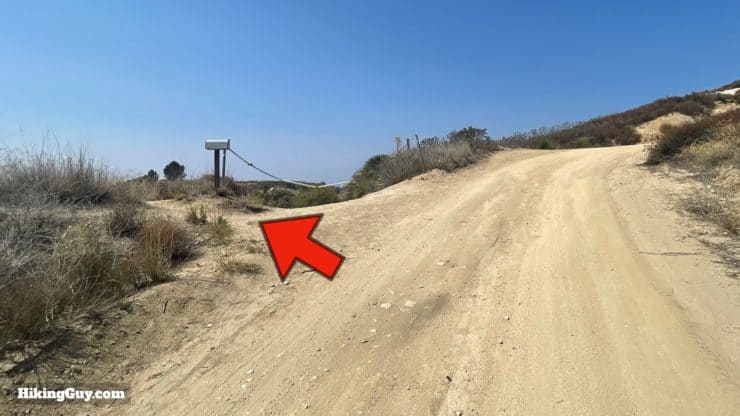
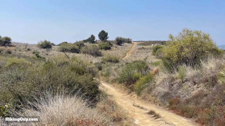
Teepee Trail Hike Directions
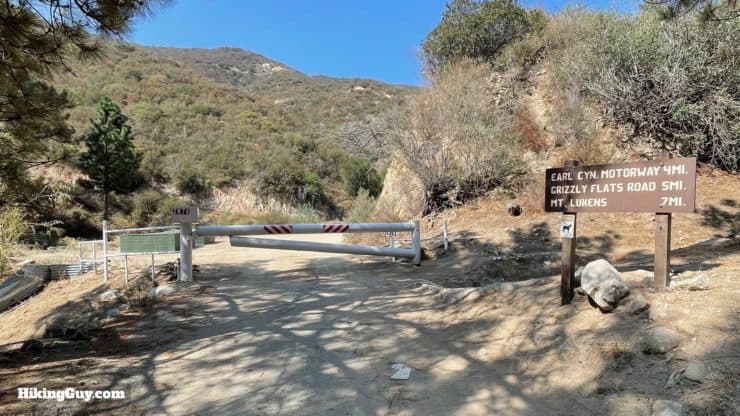
There can occasionally be trucks on this road, driving up to service one of the many antennae on the summit of Mt Lukens.

After the gate, you are entering private property. The owners of this land built the teepee and allow hikers to RESPECTFULLY visit. Please keep this in mind as you hike here.
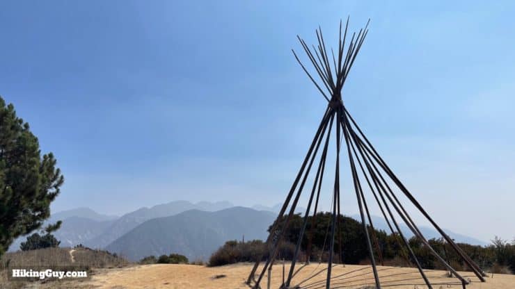
Where's the canvas on the teepee? When there is fire danger, the owners take the canvas off.
The teepee is private property, build by the landowners. Please be respectful here. Don't hang on it, mark it, or do anything to it.
Once you're done at the teepee, just hike back the way you came.
Need More Info?
- Have a question about the guide? Join my Patreon and ask me a question.
- When planning, always check the park website and social media to make sure the trails are open. Similarly, check the weather and road conditions.
- Do you have an update to this guide? View the Youtube comments for this video. Leave a comment and I will do my best to update the guide.
Related Guides
 Hike Jones Peak on the Bailey Canyon Trail
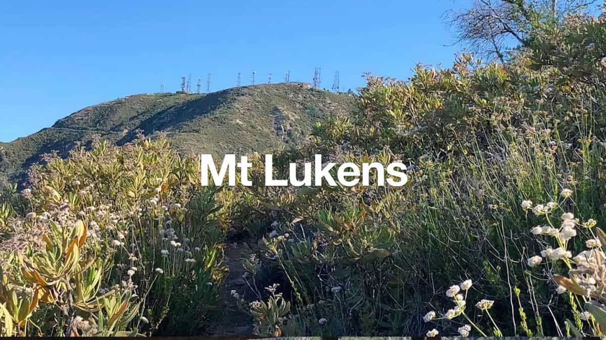 Hike Mt Lukens From Deukmejian Wilderness Park
 Stoddard Peak Hike
 Los Angeles Hikes
 Angeles National Forest Hikes
 LA Mountain Hikes
Popular Guides
 Best Hiking Gear 2024
 Hiking Boots or Shoes: Do I Really Need Hiking Boots?
 When to Hit SOS on inReach
This Guide Was Written by Cris Hazzard

Hi, I'm Cris Hazzard, aka Hiking Guy, a professional outdoors guide, hiking expert, and author based in Southern California. I created this website to share all the great hikes I do with everyone else out there. This site is different because it gives detailed directions that even the beginning hiker can follow. I also share what hiking gear works and doesn't so you don't waste money. I don't do sponsored or promoted content; I share only the gear recommendations, hikes, and tips that I would with my family and friends. If you like the website and YouTube channel, please support these free guides (I couldn't do it without folks like you!). You can stay up to date with my new guides by following me on YouTube, Instagram, or by subscribing to my monthly newsletter.