
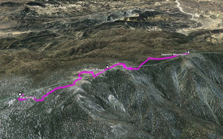
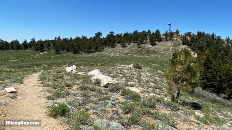
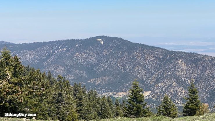
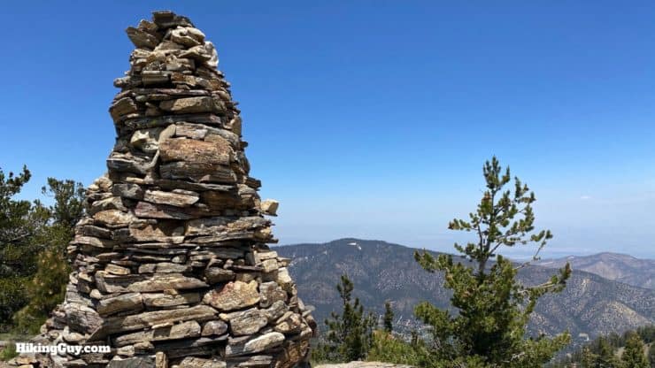
This two-peak hike is incredibly beautiful. First, you bag Mount Pinos, the highest point in Ventura County at 8847 ft. The Mount Pinos Trail is wide, shady, and pleasant. The real fun starts as you continue to Sawmill Mountain, the highest point in Kern County, at 8822ft. You'll pass a condor observation point, enter the rugged Chumash Wilderness, and then enjoy sweeping views and a huge cairn on Sawmill Mountain. The hike is challenging, but it's not a big mountain expedition; most folks can do this hike without much fuss.
- Video and Turn by Turn Hike Directions
- How To Get To the Mount Pinos Trailhead
- Gear Recommendations and Tips for the Hike
If you just want to hike to Mount Pinos, it's a relatively easy 4 mile roundtrip hike.
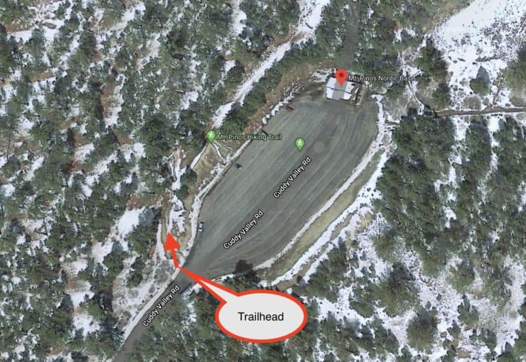
Where Is the Mount Pinos Trailhead?
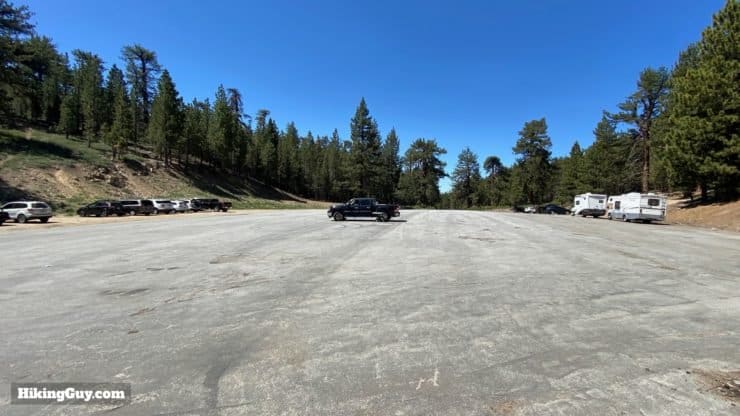
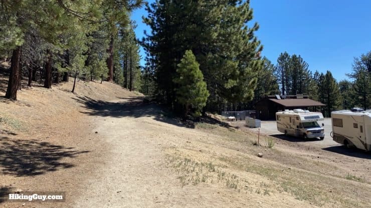
The hike to Mount Pinos starts at the very exciting sounding "Nordic Base," an operations base and first-aid center for the Nordic Ski Patrol. The Nordic Base trailhead is located within Los Padres National Forest, to the north of Los Angeles. Driving up to the trailhead is a beautiful experience as your vehicle climbs several thousand feet to the start of the hike.
Use this trailhead address:
Mt Pinos Nordic Base, Cuddy Valley Rd, Frazier Park, CA 93225
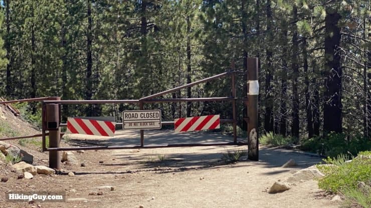
Some maps can be confusing, with a road going all the way to Mount Pinos. The dirt road that you hike on used to be open to motor vehicles, open from Nordic Base to the Condor Observation Point.
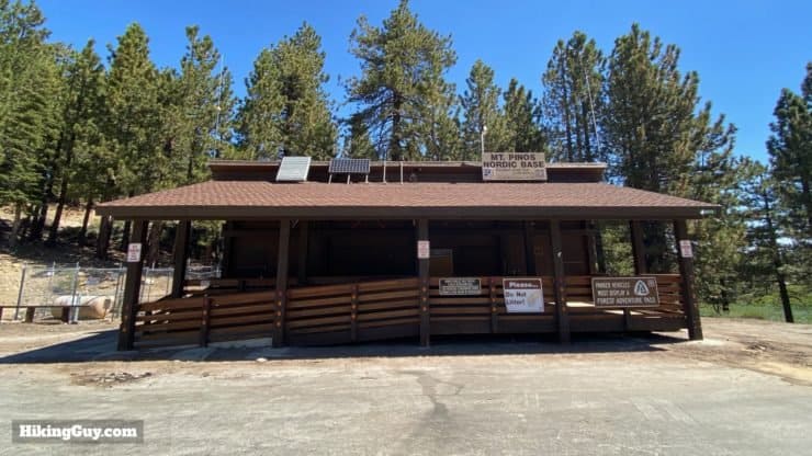
Sometimes there are porta-potties here. Otherwise, go to the right of Nordic Base to find Chula Vista Campground, which has vault toilets. If you want to stay the night, Chula Vista is considered one of the best stargazing spots in SoCal.
Visiting in the Winter
Compared to the rest of Southern California, Los Padres NF experiences pretty harsh winters, and most of the precipitation comes down as snow. You'll want to check for any road closures if you are trying Mt Pinos in the winter. When the snow is bad, the road to Nordic Base will close. And of course, expect snow on the trail and prepare accordingly.
Gear for the Hike
While this hike isn't a long mountain expedition, it is a backcountry hike and you should have proper hiking gear. I'd bring at least 2L of water. The hike back includes some uphill and can be tough, so having a snack at the halfway point is a good option. If you are doing the shorter 4 mile hike to Mt Pinos, you can get away with fitness clothing. There are a lot of vista points on the hike and binoculars are nice to have.
Gear That I Love Right Now
Nothing is sponsored or promoted, just the actual gear that I use.


Check out the complete list here. ( Updated July 2024)
Mount Pinos & Sawmill Mountain Trail Maps
How Will You Navigate?
 Using the Apple Watch for Hiking
 Garmin Fenix 7 & Epix Review For Hikers
 How To Read a Topographic Map
 Garmin GPSMAP 67i Review
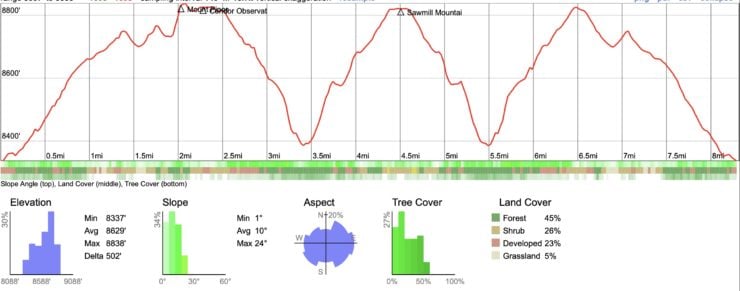
Elevation Profile
3D Map
Hike Brief
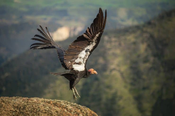
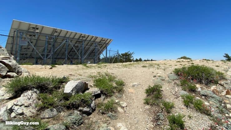
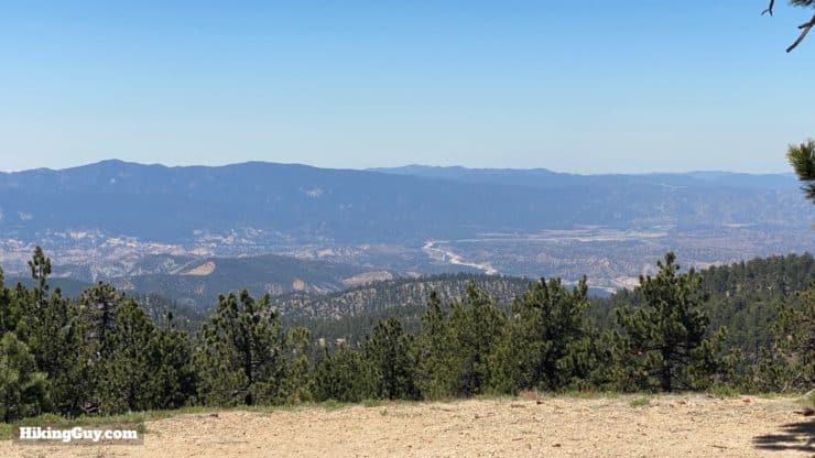
- Along the hike you'll come to the Condor Observation Point, which gives you a panoramic overview of the Sespe Condor Sanctuary. Condors only eat dead animals, and lead poisoning and micro-trash (plastic, bottle caps, etc.) have taken their toll; in 1987 only 22 California Condors existed. They were bred in captivity and reintroduced to this area in 1992. Today, there are over 200 California Condor living in the wild here.
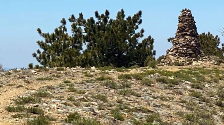
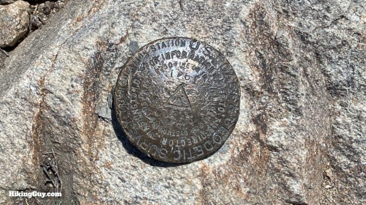
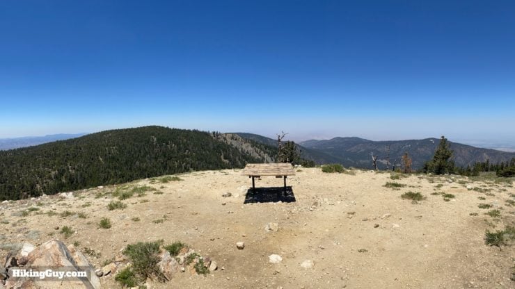
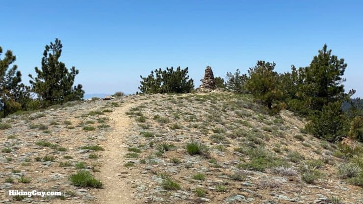
- There's some controversy regarding the actual highest point in Kern County. Is it Sawmill Mountain or Mount Pinos? The border between Kern and Ventura counties goes through Mount Pinos, and some folks think the pile of rocks on Mount Pinos is higher than Sawmill Mountain. Does it matter? If you bag both peaks on this hike, you'll have the high points covered regardless.
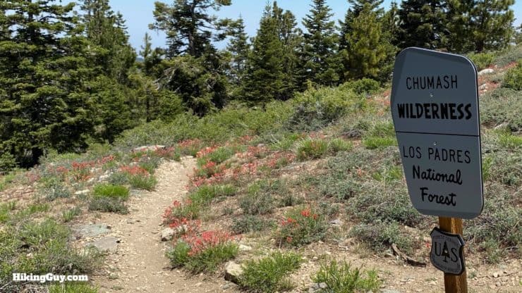
- You'll enter the Chumash Wilderness Area, named after the Chumash native peoples and created in 1992. Some Chumash place names you might already know are Malibu and Ojai. The Chumash consider Mount Pinos to be the center of the world. And here's what a Wilderness Area actually is.
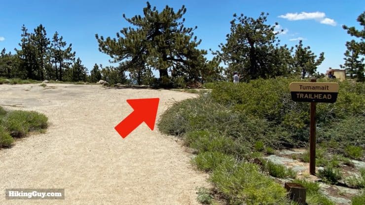
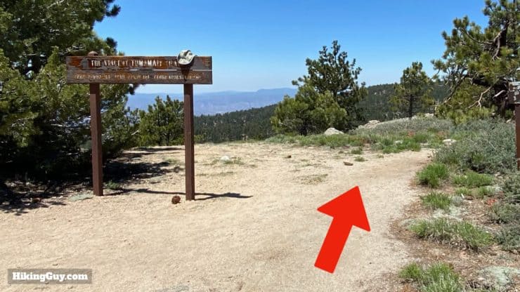
- We'll also hike on the Tumamait Trail, named after Vincent Tumamait, the Chumash spiritual leader who helped keep their culture alive. His daughter Julie is active in Native American culture and has some good YouTube videos that share Chumash culture.
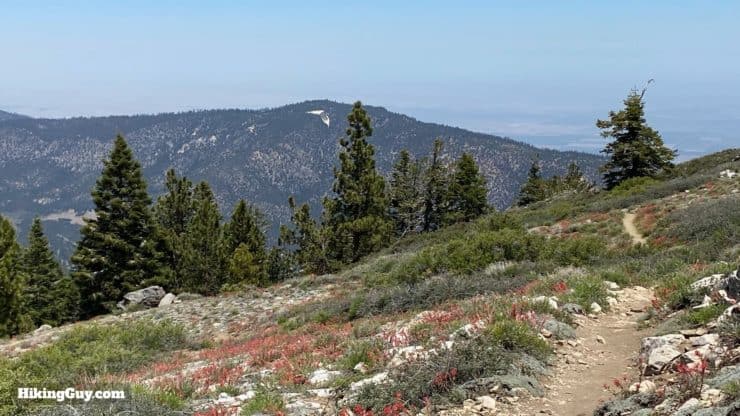
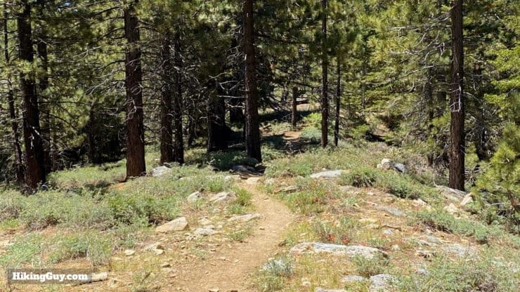
- Pinos is the Spanish word for pines. As you might have figured out, this high altitude hike is home to many Jeffery and Limber pine trees.
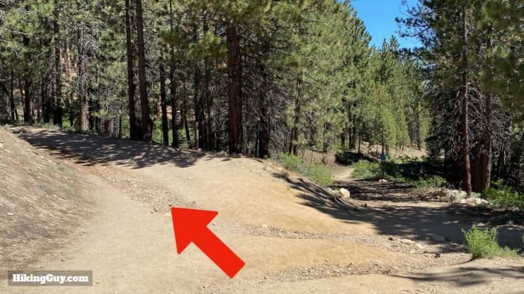
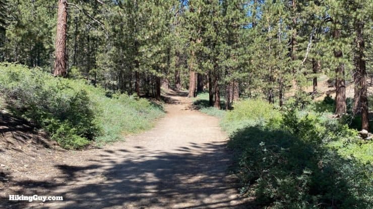
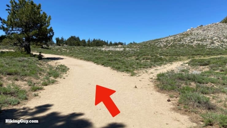
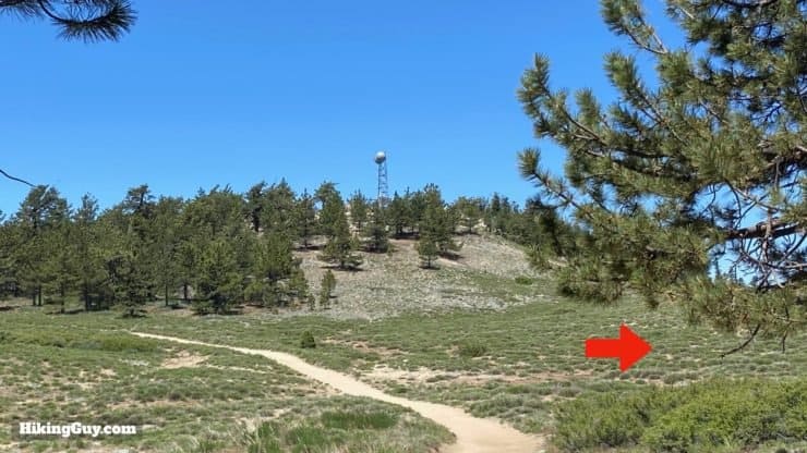
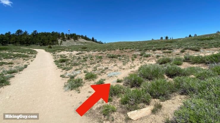
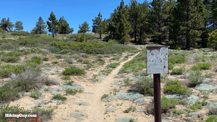
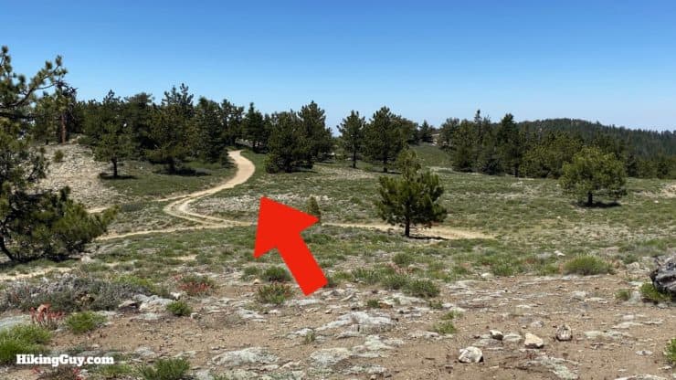
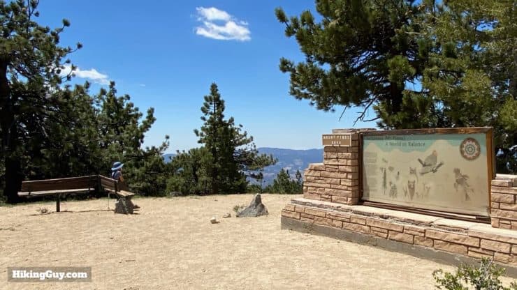
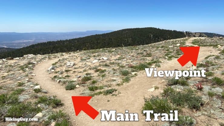
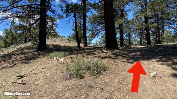
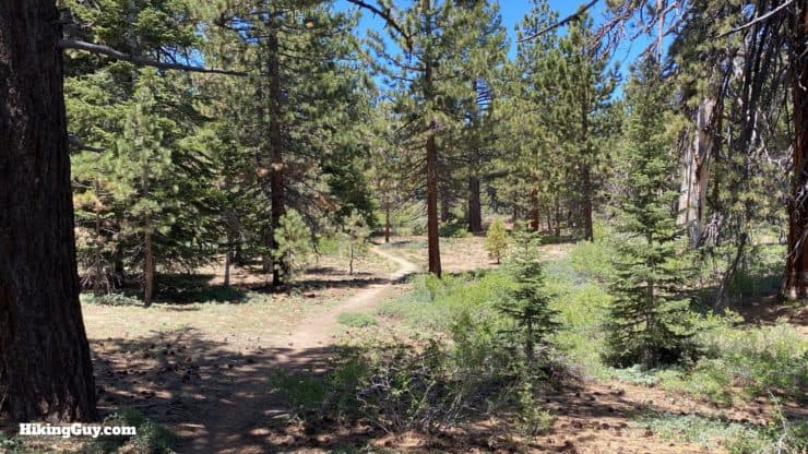
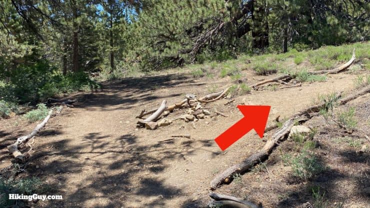
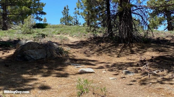
Mount Pinos Hike Directions
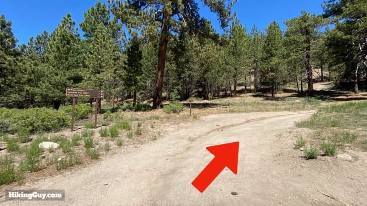
Want to get into snowshoeing? The trail from Nordic Base to Mt Pinos on the Forest Service road is a great place to do it, especially for beginners.
When you return, just come back on the dirt road and skip the side trail if you'd like.
If you are just doing the 4 mile hike to Mt Pinos, make the left in the last picture and just continue back down the dirt road to the start of the hike.
From here you just turn around and go back the way you came. And remember, you can skip the summit of Mount Pinos and just go straight back on the dirt road if you like.
And if you want to get a few more miles in (about 3), you can continue back to the junction and head to Grouse Mountain, the next peak over. There's actually something called the 321 Challenge for bagging all three peaks, and you can get a patch if you complete it. The summit of Grouse is not as spectacular as Sawmill, but the trail and wilderness are beautiful. I included the trail on the downloadable PDF.
Need More Info?
- Have a question about the guide? Join my Patreon and ask me a question.
- When planning, always check the park website and social media to make sure the trails are open. Similarly, check the weather and road conditions.
- Do you have an update to this guide? View the Youtube comments for this video. Leave a comment and I will do my best to update the guide.
Popular Guides
 Best Hiking Gear 2024
 Hiking Boots or Shoes: Do I Really Need Hiking Boots?
 When to Hit SOS on inReach
This Guide Was Written by Cris Hazzard

Hi, I'm Cris Hazzard, aka Hiking Guy, a professional outdoors guide, hiking expert, and author based in Southern California. I created this website to share all the great hikes I do with everyone else out there. This site is different because it gives detailed directions that even the beginning hiker can follow. I also share what hiking gear works and doesn't so you don't waste money. I don't do sponsored or promoted content; I share only the gear recommendations, hikes, and tips that I would with my family and friends. If you like the website and YouTube channel, please support these free guides (I couldn't do it without folks like you!). You can stay up to date with my new guides by following me on YouTube, Instagram, or by subscribing to my monthly newsletter.