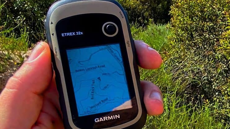

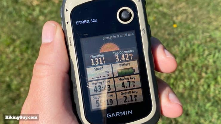
In-Depth Garmin eTrex 32x Review & How-To Guide
The Garmin eTrex 32x (and 22x) is a mixed bag. Most importantly, it's a solid, rugged and reliable handheld GPS that simply works well. There's not a ton of bells and whistles, and there are some downsides to consider, but if you're looking for a purpose-built GPS that can keep you on the trail or help you navigate, the eTrex 32x might be for you.
- eTrex 32x/22x Highs and Lows
- Is the eTrex 32x Right for Me?
- Guide to Navigating With and Using the eTrex 32x
- GPS, Battery, and Map Performance
You can support this website and these independent reviews by using the links above to purchase this or anything. I receive a small commission that helps offset website costs; you pay nothing extra.
I was not paid by Garmin to do this review. All reviews on this site and independent and unsponsored.
Highs and Lows of the eTrex 32x and eTrex 22x
No device is perfect and the eTrex 32x/22x is no exception. After using this eTrex for hundreds of miles out on the trails, here's what I've come to learn. I'll go into detail on the performance and usage in the sections following this one.
Highlights
- It's simple and allows you to just focus on navigation without a lot of clutter.
- It's rugged and you don't have to treat it with much care (unlike a smartphone).
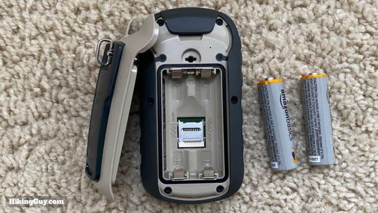
- It runs on AA batteries which are simple to replace and work with.
- The screen is easily readable in the sunlight.
- The included Garmin topo maps have much better trail coverage then they did a few years ago.
- The software is stable and it just works.
Needs Improvement
- The interface feels like it's from a 1998 flip-phone.
- It's expensive considering most smartphones can do everything it does but better.
- The joystick can take a little finesse, especially with gloves on.
- The unit wakes easily when the joystick is touched.
- The internal 8gb memory is loaded with the Garmin topo maps and doesn't have much space left for additional maps. You will need a microSD card if you plan on loading any more maps or big data onto it.
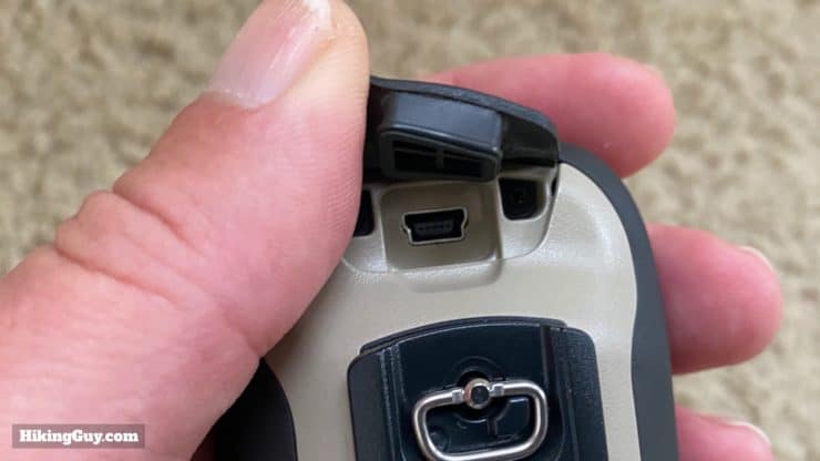
- The USB connector is the old-style mini-USB, but they do include a cable with the unit.
FYI - the eTrex does not have InReach functionality.
How is the eTrex 32x Different Than the Other eTrex Units?
There are a bunch of different models of eTrex and it can get confusing. Here's the lowdown.
- eTrex 32x - onboard topo maps, GPS + GLONASS (Russian GPS), 3-axis compass, barometric altimeter, ANT+ connection
- eTrex 22x - onboard topo maps, GPS + GLONASS (Russian GPS), GPS-based compass and altimeter
- eTrex 30x - no maps, GPS + GLONASS (Russian GPS), 3-axis compass, barometric altimeter, released 2015
- eTrex 30/20 - earlier generation of eTrex released in 2011 with GPS only
As I mentioned earlier, if you want to save money, just get a eTrex 20/30 or eTrex 30x. The units are almost identical. The cases are exactly the same except for the color, but the guts are different.
Here's what the 22x/32x series offers over the regular 20/30 series.
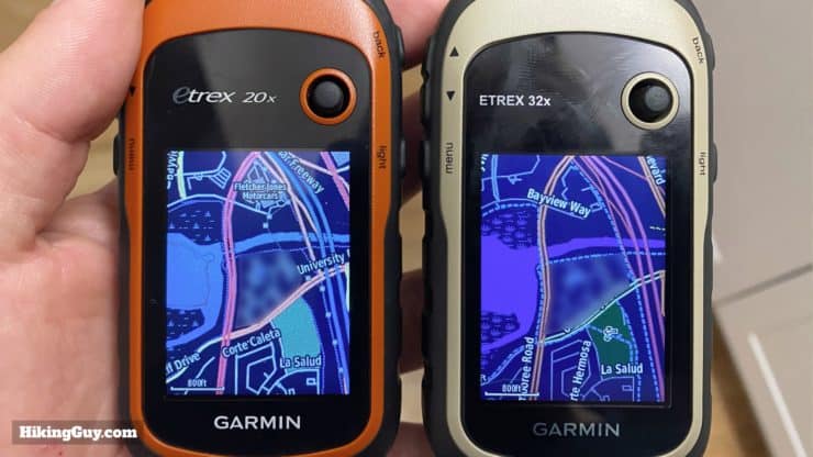
- 240 x 320 pixel screen instead of a 176 x 220 pixel screen. The actual screen size is the same, it's just a better fidelity image.
- 8gb internal memory instead of 1.7gb. But because the 32x uses that memory for its maps, you have much less usable memory (more on that later).
- GPS and GLONASS for better (theoretical) positioning. You can see how the actual tracks compare in the GPS test below.
- ANT+ sensor connectivity. If you have an ANT+ sensor that you'd like to connect to the eTrex, you can do it with the 32x. For hikers you are probably not worried about sensors, although you may want a temperature sensor. If you use the eTrex for biking and want to connect a power meeter or speed sensor, I guess ANT+ could come in handy. You can also control VIRB cameras with the ANT+ sensor.
Here's the difference between the 22x/32x and the 30x.
- 22x/32x have maps and 30x does not.
- 30x has 3.7gb of internal mem and the 22x/32x has 8gb (with only about 90mb usable, see the maps section later).
- The 22x/32x has a newer chipset and is a bit quicker than the 30x.
If you can afford the 22x/32x and just want a reliable GPS for the longer term, it's worth getting it. The product will be supported longer and you get a better screen, which is nice. If you want to save money and are okay with the GPS becoming obsolete (e.g. not supported) quicker, than the 20/30 and 30xseries with free maps are fine.
What About the eTrex Touch?
There's a series of GPS called the eTrex Touch, which has similar guts to this eTrex, but with a touchscreen. I've used Garmin touchscreens in the past and have had trouble when it's very wet or when I have gloves on, so that makes the eTrex Touch non-starter for me. If you've had a different experience, please let me know.
Should I Get the eTrex 32x / 22x?
I'd say that even though the eTrex 32x/22x is a solid GPS unit, it's probably not for everyone. Here's where I see the eTrex being a good buy, when it's not, and when you should go with something else.
- Get the eTrex 32x if you're looking for a dedicated GPS that is built for the outdoors, has trail maps, functions well, and is easy to use.
- If you are just doing light to medium hikes without any real backcountry travel, just use your smartphone with some protection and an app like Gaia GPS.
- Get the eTrex 32x if you want a lightweight and reliable backup to your smartphone that has topo maps onboard.
- Get the 32x over the eTrex 22x if the 3-axis compass and barometric altimeter are important to you.
- The 3-axis compass will tell your direction like a normal compass. Otherwise you get a digital compass reading but you need to move.
- The barometric altimeter will plot your attitude based on barometric pressure (after you calibrate it). Otherwise altitude is calculated based on a (3d) GPS signal and isn't always that accurate (usually +/- 50-250 ft).
- If you want to save some money, get the older eTrex 20 or 30 model or eTrex 30x and load free maps on it.
- If you want InReach integrated into your GPS, get the GFSMAP 66i.
- If you want the best consumer / prosumer handheld you get, get the GPSMAP 66i.
Device Overview
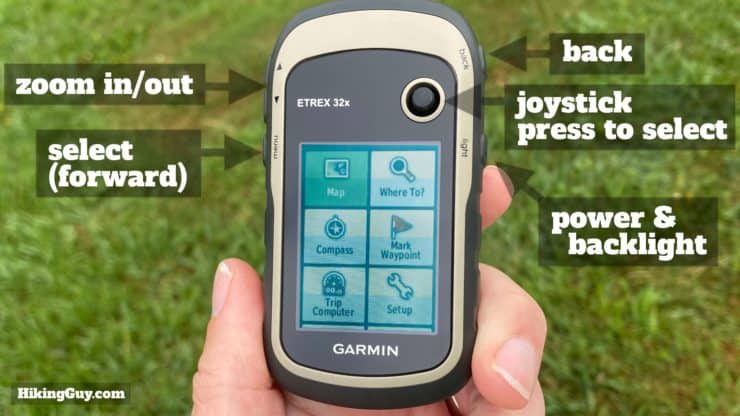
Using the eTrex 32x is straightforward and once you spend a few minutes getting used to it, it become second nature.
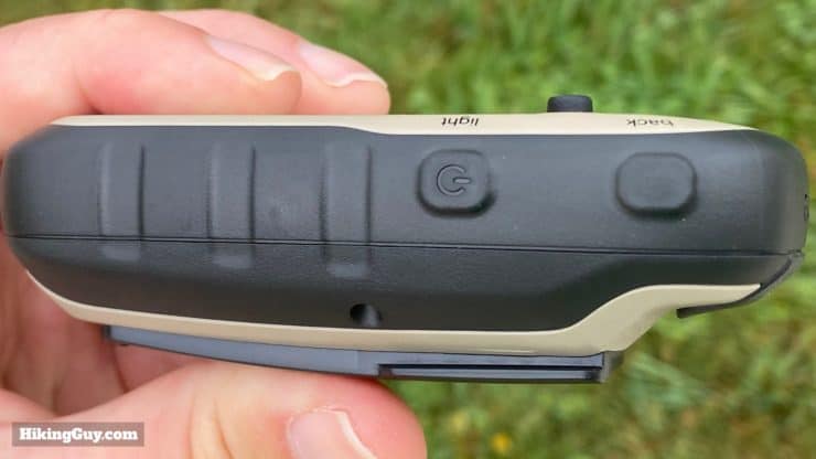
- You hold the power button in for a second or two to power on or off.
- You move around the menu tiles using the joystick.
- To select a menu item you can press the joystick in, which has a tactile click, or you can press the select button on the side.
- The select button also brings up any sub-menus on a page, such as the function to customize data fields.
- You can think of the select button as how you choose an item and move forward.
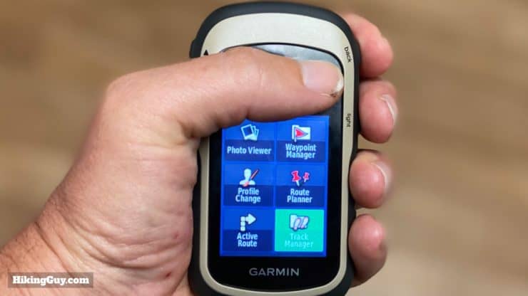
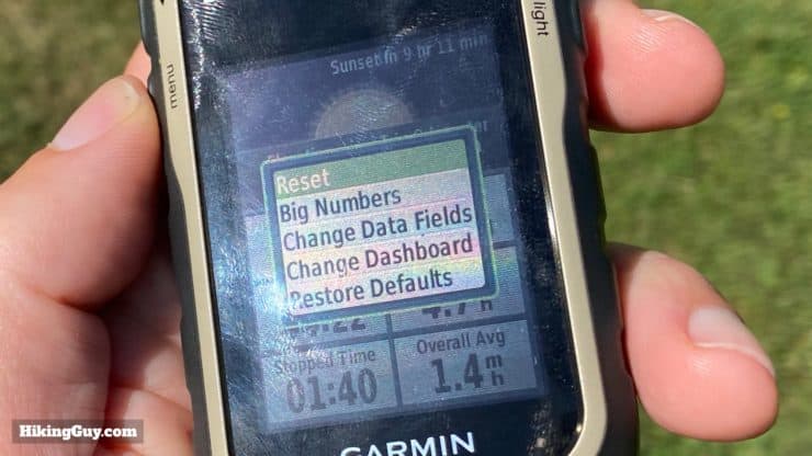
- If you want to back out of a menu or screen, you simply hit the back button. Hitting the back button until it can't go anymore brings you to the main menu screen shown on the image above.
If the eTrex 32x looks similar to the old eTrex 30 that came out in 2011, it's because the case is the same (as far as I can tell). What's different is the guts inside.
To avoid accidental joystick touches, try this tip from Dan: Use a Bic pen body cut down to cover the stick when not in use. Fits tight and easily replaceable.
eTrex Software
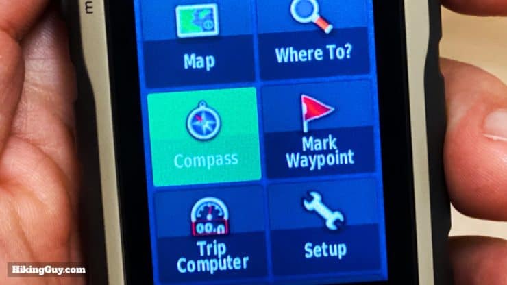
The software functions on the eTrex 32x will be very familiar if you've used an older eTrex, and that's because they are basically the same. Here's what you get.
- Map - You can also load OSM and custom maps and toggle them on/off.
- Where To? - Navigate to the preloaded POI (point of interest) database which includes things like hospitals, fuel, towns, waypoints, etc.
- Compass - What you'd expect plus some trip information that you can customize.
- Mark Waypoint - Drop a waypoint (I'll show you how in this article).
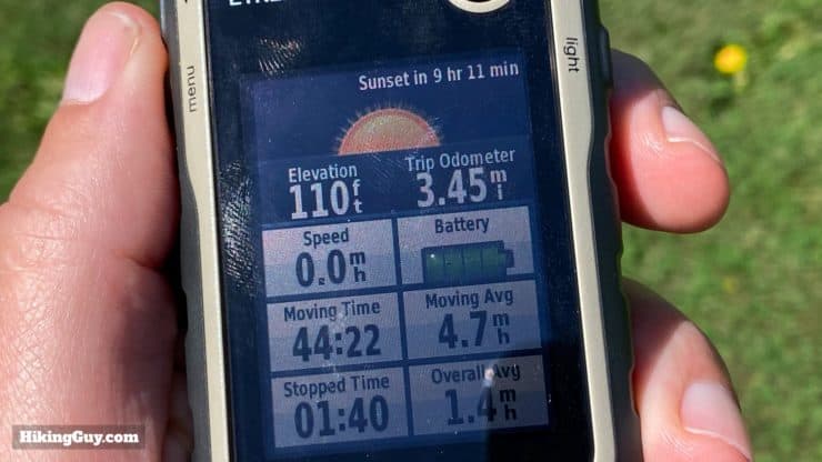
- Trip Computer - Your trip odometer and current track information, which you can customize.
- Setup - Tweak all the settings on the device.
- Geocaches - Mange your geocaching from Geocaching.com
- Elevation Plot - See the elevation of your trip graphically.
- Photo Viewer - Pretty worthless.
- Waypoint Manager - Browse and edit your waypoints.
- Profile Change - There are several profiles such as fitness, recreation, automotive where you can customize the interface for each and easily switch between them.
- Route Planner - Navigates you to a destination (I'll show you how in the article).
- Active Route - Information on your active route and ETA.
- Calendar - Browse a calendar to see dates that you marked waypoints, etc.
- Area Calculation - Walk a permitter and calculate the area of a piece of land. Handy for surveying.
- Sun & Moon - Sun and moon rise and set. Would have been nice to have dusk and dawn too, but you don't get that.
- Calculator - Simple calculator that shows saved navigation items from a date.
- Hunt & Fish - Recommended "good" times to hunt and fish.
- Alarm - What you think it is.
- Stopwatch - What you think it is.
- Sight & Go - Point at an object in the distance and follow the compass reading to it.
- Man Overboard - Drop a waypoint if someone falls off your watercraft.
- Waypoint Averaging - Take a series of GPS fixes and average them to get a very accurate waypoint reading.
- Proximity Alarms - Set an alarm when you near a waypoint or POI.
- Satellite - Get detailed information on the GPS fixes that the device has.
- Adventures - Follow Garmin Adventures that you've created in Basecamp.
- VIRB Remote - Use the eTrex as a remote control for a VIRB camera.
GPS Accuracy
GPS is always a touchy subject and people have strong opinions here, and there are many variables. I have used the eTrex 32x for many hours over a few months, and the results of the test I did align with my actual experiences using it. In a nutshell:
- The eTrex 32x offers GPS and GLONASS, and I had my best performance when both were turned on.
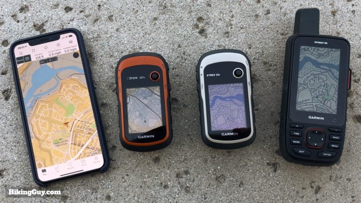
- The GPS fix on the eTrex 32x was pretty close to the GPSMAP 66i (best GPS in my opinion) and Fenix 6x Pro Solar GPS watch (pricey but good).
- The eTrex 32x performance was slightly better than my iPhone 11 Pro Max.
- The eTrex 32x almost always got a better fix than the eTrex 20.
The eTrex uses a small patch antenna, while bigger units like the GPSMAP use a quadhelix antenna, which generally gets better results.
The eTrex 32x offers both GPS and the Russian version, GLONASS, but does not offer Galileo (European GPS). You can turn GLONASS off or on. The basic theory is that the more satellites that you can potentially get a fix on, the better your (triangulated) GPS fix will be. So theoretically having GLONASS on will give you better results. In practice the results with GLONASS were slightly more precise.
You can set the GPX track recording interval in 5 preset settings from "most often" to "least often,"
eTrex 32x GPS Test
I took the GPS units on the Red Rock hike at Whiting Ranch Wilderness Park hike to do the test, and you can browse the tracks and details on my shared Caltopo map here.
eTrex 32x - green / eTrex 20 - dark blue / iPhone 11 Pro Max - yellow / Fenix 6 Pro Solar - light blue / GPSMAP 66i - purple
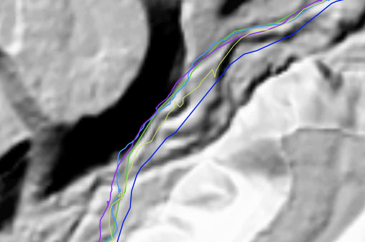
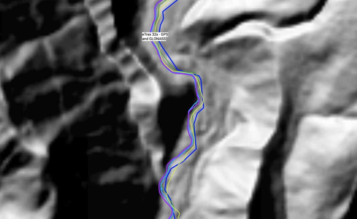
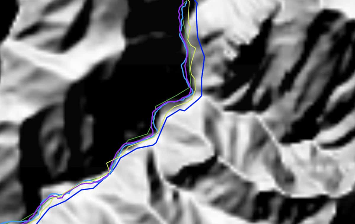
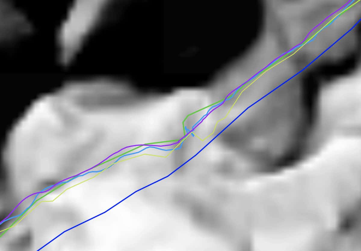
See the whole GPS test map on Caltopo.
Battery Life
The nice thing about the eTrex is that it takes AA that you can get anywhere. It's simple to carry spares, and you can get them almost anywhere, including gas stations at 4am when you're driving to your hike and suddenly remember that your batteries are dead.
Garmin advertises 25 hours of life out of a set of batteries, which in general I found accurate. And like my eTrex 20, using lithium batteries allowed me to use the eTrex for about 40 hours.
Here's what I do to maximize my battery life.
- Turn on battery saver mode which turns the screen off when the backlight times out. To turn the screen back on, just tap the power button.
- Set the backlight as low as possible given my light conditions. You can easily adjust the backlight by tapping the power button.
- Turn off GLONASS.
- Don't mess around with the map and routing too much.
And if you don't care about recording your track and just want to get a GPS fix once and a while, just turn the unit off until you need it. It's relatively quick to power on. You can usually power up, get a position fix, and power down in less than 2 minutes.
When the joystick gets nudged, the unit wakes. If it's in your pocket and rubbing around, it will wake often. With the eTrex 20 you could put the compass or trip computer on and it would not wake with the joystick, but that trick doesn't work on the 32x. Your best bet is to clip it onto something so that the joystick doesn't get nudged or just power it down when not using it. Hopefully Garmin will address with a firmware update.
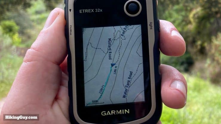
eTrex 32x Maps
One of the attractive features of the eTrex 32x is that it comes bundled with Garmin topographic maps. That means you can buy it, put two AA batteries in it, power up, and get going. The onboard maps are Garmin TopoActive, which are based on Open Street Maps (OSM). The amount of coverage depends on the region and what the Garmin map team decided to take or leave from the OSM maps. In general you get about 24k in popular areas (like national parks, urban centers, etc.) and in more remote spots somewhere between 50k and 250k.
I used the eTrex 32x to navigate in Yosemite NP, Angeles NF, Cleveland NF, and sections of the AT, and all the official trails were on the device (and routable). However it doesn't have most (unofficial) use trails, which is not necessarily a bad thing.
Don't forget to update the device with Garmin Express to get the latest map updates.
Loading Free OSM Maps
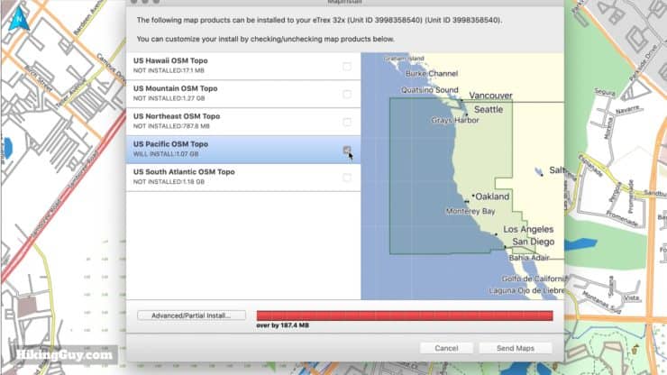
If you'd like to load your custom maps or more detailed free OSM maps (that include use trails), there's a bit of a hiccup. The unit is advertised as having 8gb of memory, which it does. But the preloaded Garmin TopoActive maps take up the majority of that space, leaving you with about 100mb for your own maps, tracks, and info.
If you want to load your own custom maps I highly recommend buying an inexpensive microSD card which you can get off Amazon for less than $10. The eTrex 32x takes up to a 32gb Class 4 through 10 card.
Navigation
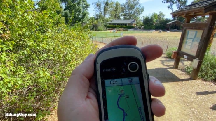
The eTrex 32x is a powerful backcountry navigation device. You can get navigation instructions on the fly, routed by the device, or you can preplan your trip, load it on the eTrex, and make sure you're following the path your planned. I'll show you some of the more important screens for navigation and then walk you through some real-world examples of using the device.
I highly recommend watching the video earlier in the article to see these navigation concepts in action.
Trip Computer
You record your trip and track on the "trip computer" screen. When you want to start a new trip, you reset it, and then go. The trip computer will continue to record your track while the GPS is awake or in "battery saver" (screen off) mode.
Compass
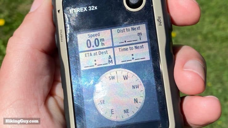
If you are navigating a route, the compass screen will include an indicator to point you in the right direction. The 32x has the 3-axis internal compass, and will work when you are standing still. If you have the 22x without the internal compass, the unit will calculate your direction based on your last few GPS fixes.
Elevation Plot
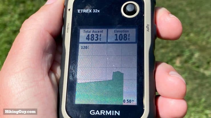
The elevation data on the eTrex 32x was marginally helpful. First off, you should calibrate it to a known elevation often, which is not always possible, especially when starting a hike. If you calibrate to a know elevation, you can get an accuracy of +/- 50 feet. If you calibrate it based on your GPS fix, it's +/- 400 feet. That's not so great.
Garmin's outdoor devices are designed as recreational GPS devices, as an aid to navigation. They should not be used for any activity requiring precise measurements. - Garmin Support
The altimeter will measure your progress up and down regardless if it's calibrated or not, so it's helpful to measure your total ascent.
You can also look at the elevation plot of a saved track which I found helpful too.
Waypoints
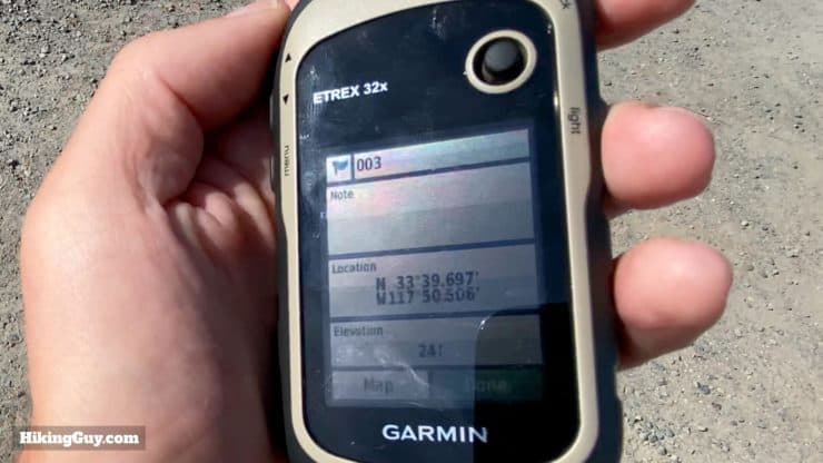
If you mark a waypoint you can customize things like the name and even tweak its position. You can also scroll around the map page with the cursor, press in the joystick, and create a waypoint from there.
With waypoints you can:
- View them on a map.
- Navigate to them on trails or in a straight line.
- Set a proximity alarm for it.
- Get a more precise fix using waypoint averaging.
The eTrex map also comes with thousands of waypoints that are called "points of interest" or POIs. POIs include things like public buildings, restaurants, geographic features, and towns. You can navigate to any of these just as you could a waypoint. It's important to update your device (more later) so that the maps and POIs are up to date.
There is a maximum of 2000 waypoints on the eTrex units.
Routes
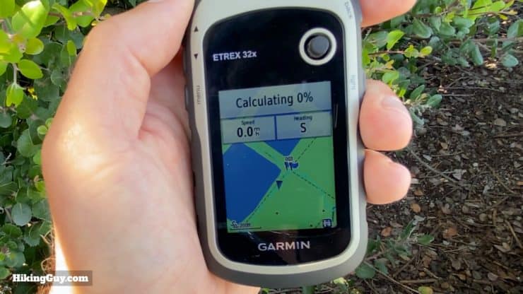
You can think of routes as a direction from point A to B, just like when you use something like Google Maps. The eTrex can take a waypoint or POI, or a series of them, and dynamically calculate a route between them all. The route can be straight lines, but it can also be on trails and roads (you choose on the device).
Once you are following a route, the eTrex will give you a bearing, ETA, and distance to the next point on the route. If you come to a junction or waypoint on the route, the eTrex will wake and give you a little alarm.
While routing is cool to have in a pinch, the reality is that I pre-plan most of my hikes and don't need to create a trip on the fly using a device. So for me, routes are a "nice to have" in case my plans change and I quickly need to get to civilization or a hospital.
The eTrex supports saving 200 routes with 250 points per route.
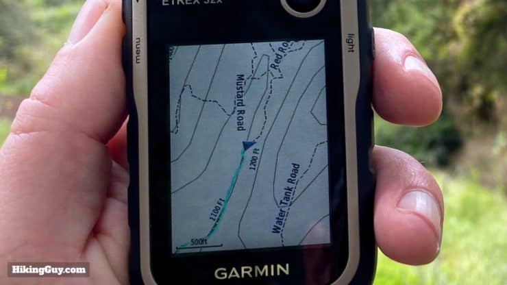
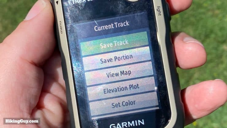
Tracks
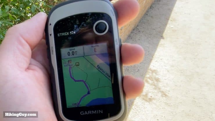
You can think of tracks like a series of breadcrumbs that you follow. On the eTrex, when you are moving, the Trip Computer is creating a track of your movement which you can save for later. You can also load other tracks onto the device and follow them. The eTrex has a screen called "track manager" that lists them all out. Just select one, navigate it, and you'll get a nice purple line overlaid on the map. The idea is simple; just stay on the purple line. If you are in doubt at an intersection, just consult the purple line and map. For me this type of navigation "second opinion" is more enjoyable than a turn-by-turn notification.
The maximum number of points per track on the eTrex is 10,000. If you have bigger tracks (like for a thru-hike) you'll have to break it up into sections.
Loading External GPX Files
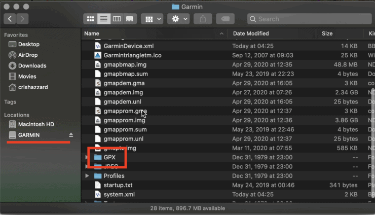
If you download a GPX file from a website (like mine) you can easily load it onto the eTrex 32x without any fuss. Just take the actual GPX file and copy it into the folder (of the plugged-in eTrex) GARMIN > GPX.
Note that you CANNOT transfer data wirelessly to the eTrex from a phone. You need to connect it to a computer or transfer on the microSD card. If you want to transfer wirelessly from the phone, take a look at the GPSMAP 66i.
Basecamp
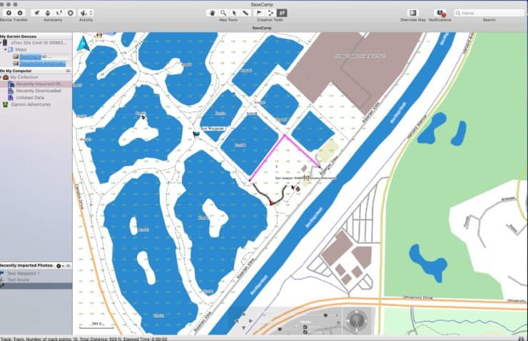
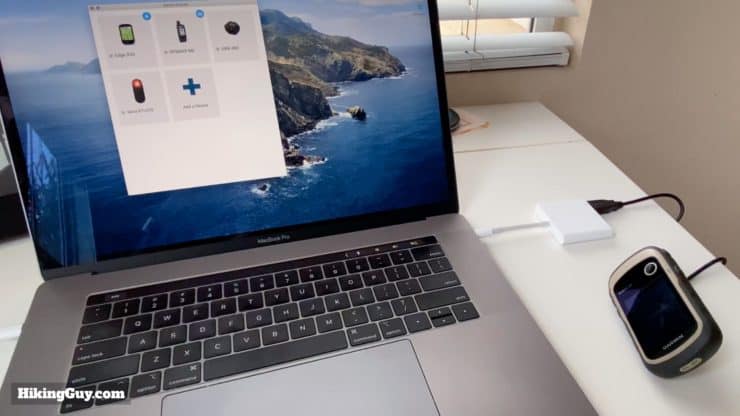
You can connect your eTrex to a computer with the free Garmin Basecamp program to plan navigation and transfer data between the unit and computer.
- Plug the eTrex in and power it up.
- The onboard maps from the eTrex will (very slowly) load and you can view them in Basecamp.
- You can also load free OSM maps to the computer and Basecamp which will be much quicker.
- Use the tools to create waypoints, routes, and tracks in Basecamp.
- Send them to your device and then use them in the field.
- You can also copy that data from the eTrex into Basecamp.
Tips for Using the eTrex 32x
Setup
Here's what I recommend doing when you first get your eTrex 32x or 22x.
- Install Lithium batteries and set the battery type in the settings - Setup > System > Battery Type.
- Install Garmin Express on your computer
- Plug in the 32x and update the firmware and maps
- Install a cheap microSD card
- Load free OSM maps onto the device if you'd like to have another set of maps that you can reference.
- Turn on battery saver mode - Setup > Display > Battery Save > On.
- Turn on GLONASS for the best position fix - Setup > System > Satellite System
- Spend a few minutes in the settings screens customizing anything else you'd like to. Going through these screens is also a great way to gain some familiarity with the device.
- Customize the data on the map and trip computer screen.
- Take it outside and have fun!
Basic GPS Concepts in Use
Copying Device Maps to Computer
Need More Info?
- Have a question about the guide or want to see what other people are saying/asking? View the Youtube comments for this video. Leave a comment and I will do my best to respond.
Related Guides
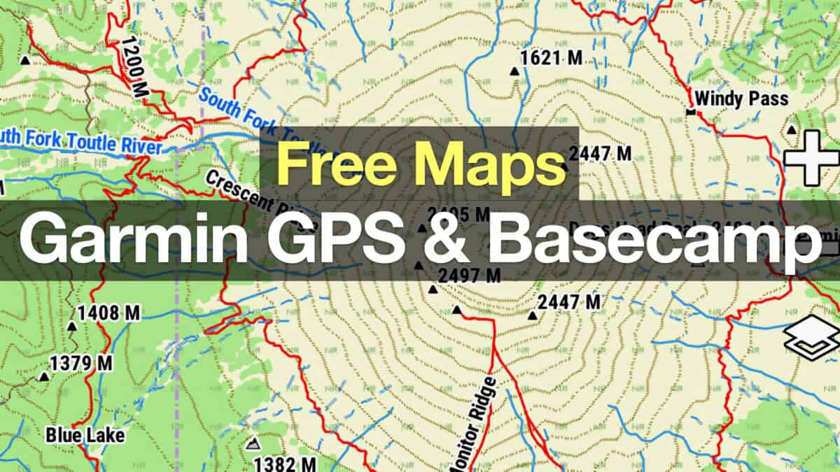 How To Get Free Garmin GPS Maps For Hiking
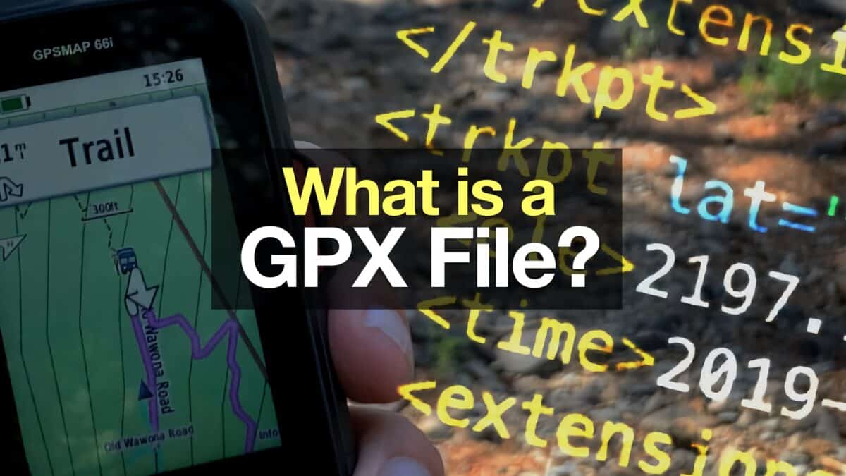 What is a GPX File?
 How to Create and Download Garmin Custom Maps
 How Does GPS Work? GPS for Dummies
 Hiking Gear & Outdoor Technology
Popular Guides
 Best Hiking Gear 2024
 Hiking Boots or Shoes: Do I Really Need Hiking Boots?
 When to Hit SOS on inReach
This Guide Was Written by Cris Hazzard

Hi, I'm Cris Hazzard, aka Hiking Guy, a professional outdoors guide, hiking expert, and author based in Southern California. I created this website to share all the great hikes I do with everyone else out there. This site is different because it gives detailed directions that even the beginning hiker can follow. I also share what hiking gear works and doesn't so you don't waste money. I don't do sponsored or promoted content; I share only the gear recommendations, hikes, and tips that I would with my family and friends. If you like the website and YouTube channel, please support these free guides (I couldn't do it without folks like you!). You can stay up to date with my new guides by following me on YouTube, Instagram, or by subscribing to my monthly newsletter.