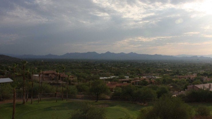
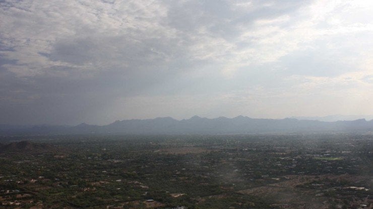
The Camelback Mountain hike is one of the most popular hikes in Phoenix. Camelback Mountain is just 20 minutes from downtown and can be seen all over the area, rising to 2,707 feet. It's a popular spot for hikers, rock climbers, and tourists, so make sure you do the hike as early as possible, with sunrise being the sweet spot. There are a few ways to hike Camelback Mountain, and this guide takes the easier, less trafficked, and more scenic Cholla Trail. It's still a tough hike, but the Cholla Trail is a nicer way to hike Camelback Mountain, which is a must-do Phoenix hike.
About 450,000 people a year hike Camelback Mountain, and it can feel like all of them are with you on the trail if you leave at the wrong time. It's not only important to leave early to beat the crowds, but also to beat the heat. You're in the middle of the desert, and if the temperatures are high, the heat can be serious.
There are about 200 search and rescue efforts in Phoenix, with the majority of those happening at Camelback Mountain. That's about one rescue every other day, which is pretty crazy. The two main reasons why hikers get in trouble is the heat, and from going off trail (intentionally or unintentionally). While this is a popular hike, it's also a tough hike that requires you to be prepared and smart. Read this guide, follow the advice, and you should have a great time hiking Camelback Mountain.
The Cholla trail has been undergoing some maintenance and may not be open. Click the "alerts & closures" link above to confirm. If the trail has reopened, please drop me a line and let me know.
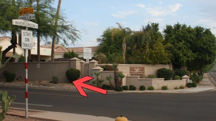
Parking is free in a residential neighborhood. Don't park on Cholla Lane or you'll be towed.
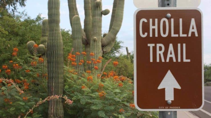
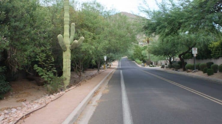
Park on Invergordon Road. It’s street parking and it’s free.Signs on the street lead you to Cholla Trail.Walk to the corner of East Cholla Lane and Invergorden Road, this is where my hike mileage starts.
Another note, if you decide to take the other route up, Echo Canyon, the rangers are strict and aggressive about ticketing after official sunset in the trailhead lot. Do yourself a favor and just take the Cholla Trail (and park correctly).
Gear for the Hike
You can get away with workout clothes on this hike, and most people do. What's imperative is bringing enough water and sun protection. Bring at least 1L of water. I brought 2L.
Osprey Hikelite 26Lightweight, carries all your gear, and your back doesn't get sweaty. Oh yea, it's also one of the most inexpensive packs you can get.
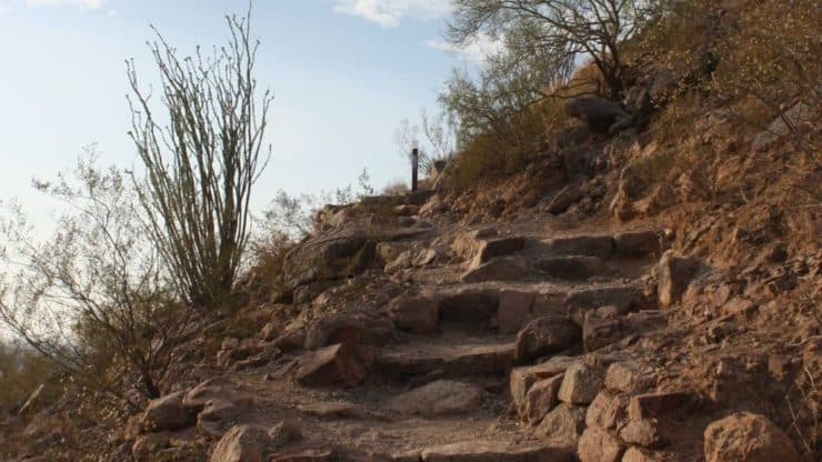
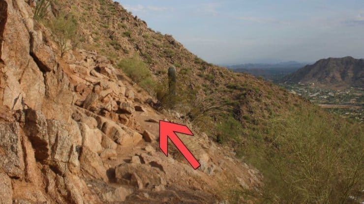
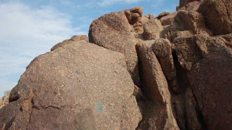
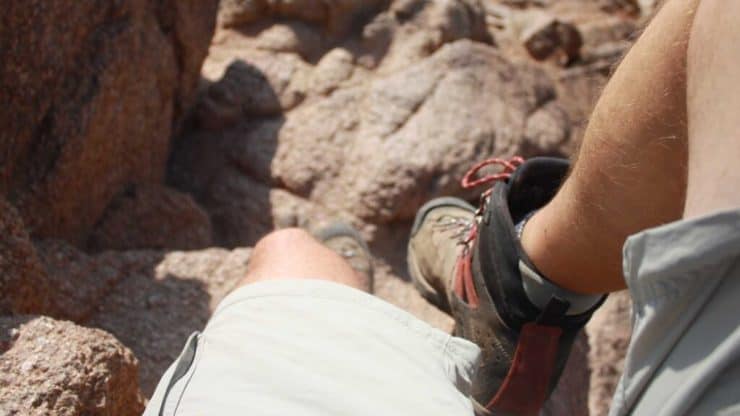
Just a note on the trail. The last half a mile of the Camelback Mountain hike involves a rock scramble. I've seen kids, senior citizens, and dogs all do the rock scramble, but if you're not comfortable with it, it may not be for you.
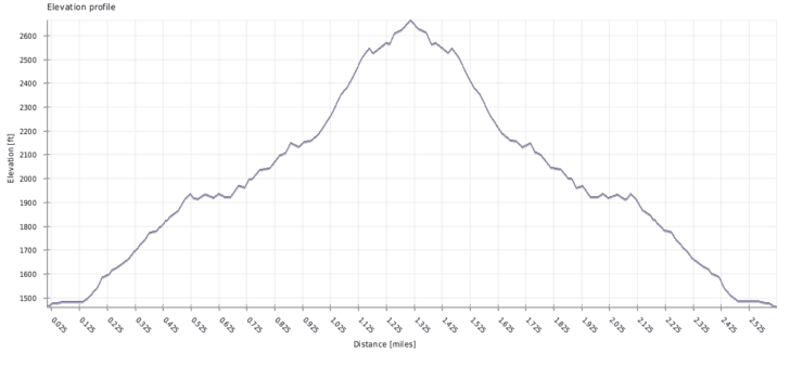
The Cholla Trail is a little longer but takes the gradual ridge line up to the Camelback Mountain summit.The hike to Camelback Mountain on the Cholla Trail is all uphill, but has a gentler slope than other options. Pace yourself and bring more water than you think you need.
Camelback Mountain Hike Directions
Note: Hike milage references start from the intersection of Invergordon Road & Cholla Lane.
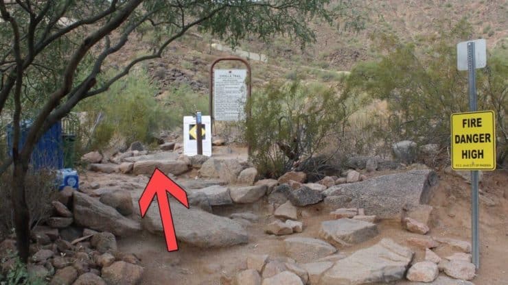
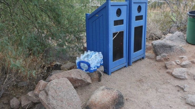
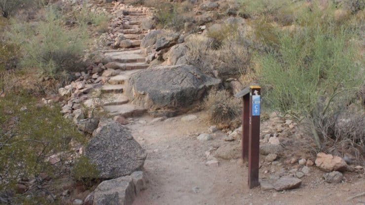
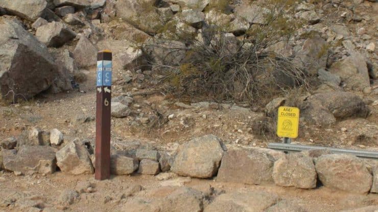
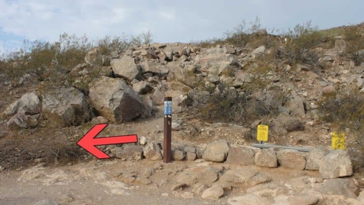
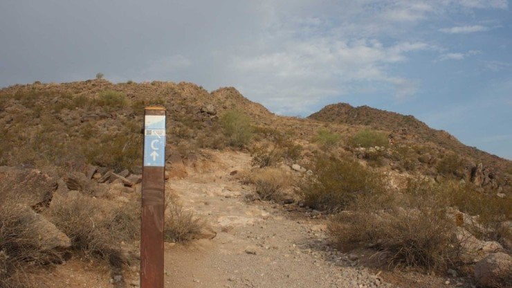
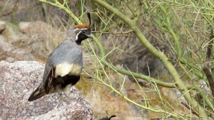
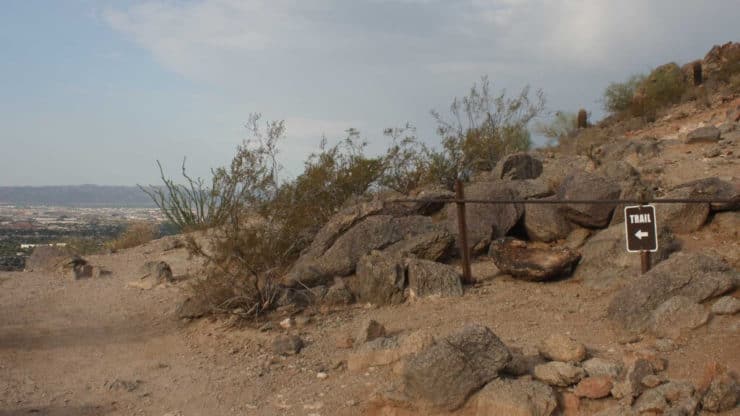
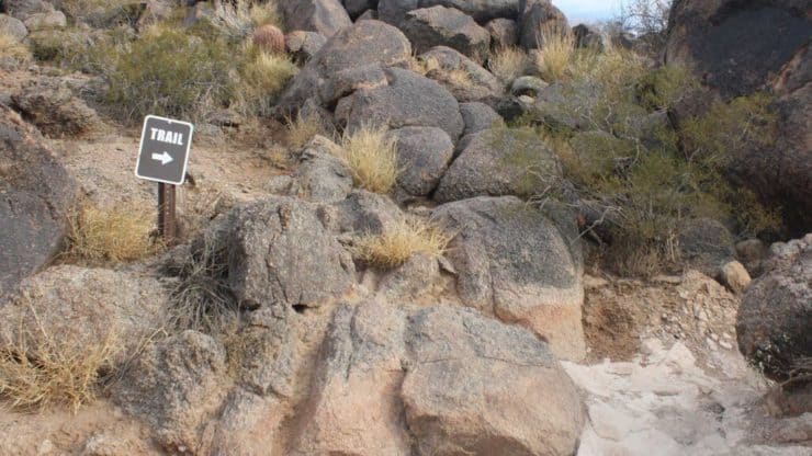
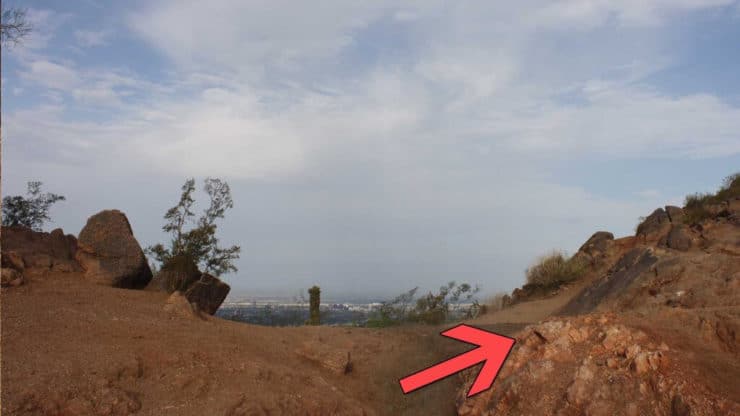
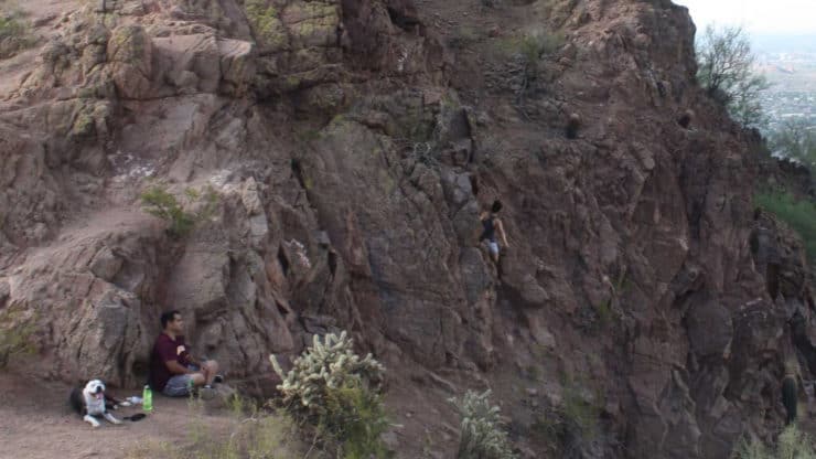
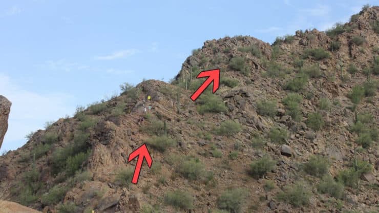
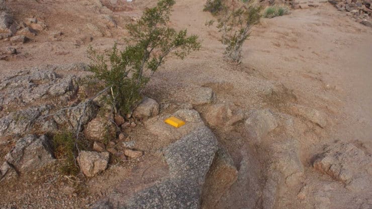
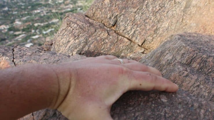
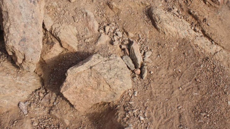
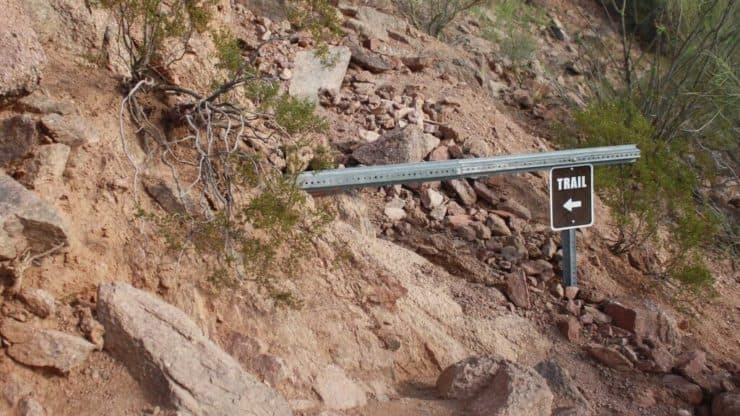
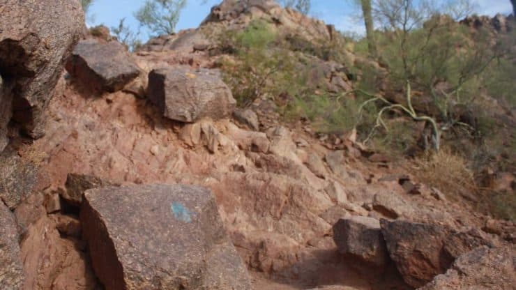
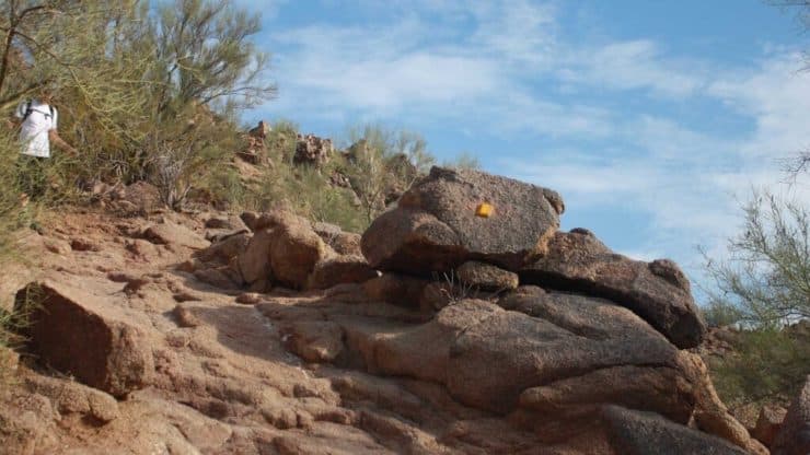
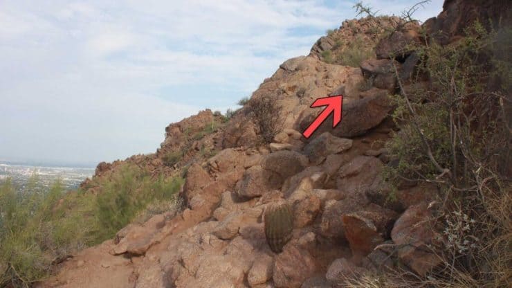
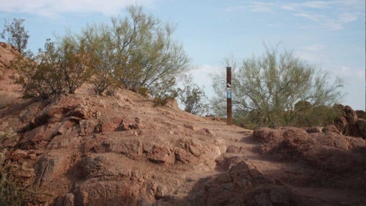
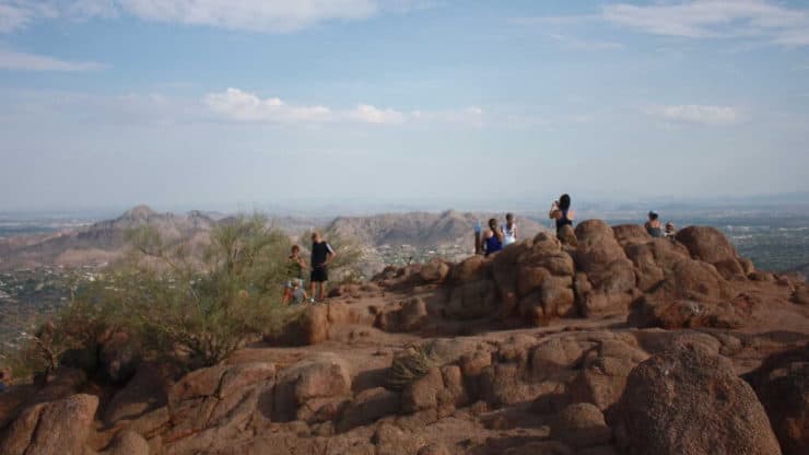
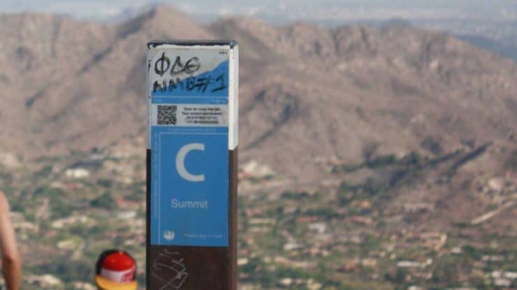
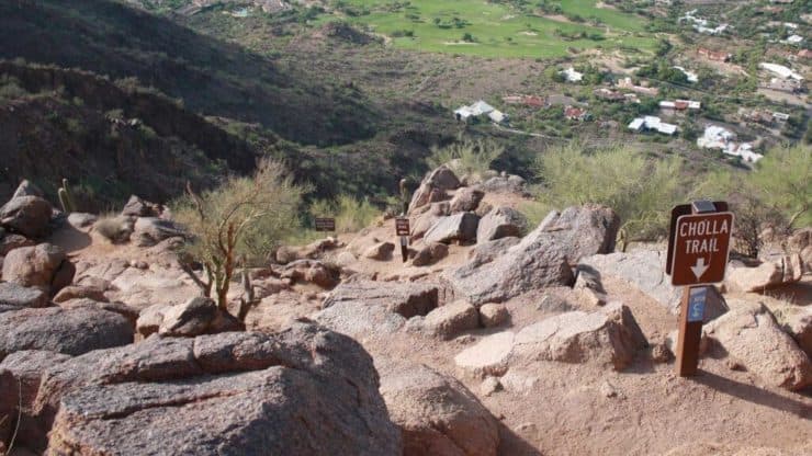
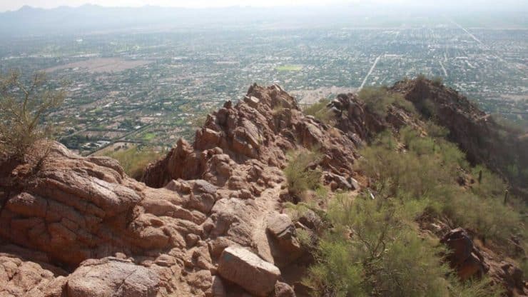
Hike up beautiful East Cholla Lane. Some of the homes here are valued in the millions.At about 0.3 miles on the left, you’ll see the Cholla Trail trailhead. Notice all the warning signs. Be prepared and take it seriously.Sometimes rangers leave cases of bottled water here for the folks who are unprepared.Look for the blue Cholla Trail makers and hike your way up the well worn trail.As you hike up, you’ll immediately have nice views.The trail is well marked and climbs up rock stairs for a whileBlue blaze signs mark the Cholla Trail and yellow signs warn of fragile and dangerous areas.At about 0.5 miles, hike to the left along the trail.Keep following the blue blaze Cholla Trail signs.Keep your eyes open for lizard, hawks, falcons and quail.The trail signs change to brown occasionally.Occasionally the trail goes over rocks. Usually there's a sign marking where the trail crosses them.The climb is tough, so take breaks and soak in the views.At around 1 mile, the hike turns toward the saddle of Camelback Mountain and gently climbs up.At about 1.2 miles, the gradual climb ends at the saddle of the mountain. This is the middle of “the hump” of Camelback Mountain. Make the right to hike up to the summit.The saddle has great views. On this day, someone was climbing along the cliff at the saddle. DON’T DO THIS. This is why people get hurt and die on Camelback Mountain.This section of the hike goes up the ridge of the mountain. The trail is rocky and not a dirt path. If you want to know which way to head, look for other hikers going up and down.This is where the rock scramble begins. The small blue signs are now mixed in with yellow blazes and reflectors on the rocks. Follow them up. There is no rhyme or reason to which marker is used when. You’ll also see the brown and yellow signs occasionally.You will have to use your hands to pull yourself up some sections of the hike. You can do it, just take your time and stay away from the edges of the ridge.There are points where there are no clear trail markings. Look for footprints and wear on the rocks to make you best guess at which way to hike. You can also turn around and look for markers going down, they will offer clues as to where the Cholla Trail is. If at any point you feel lost or scared, stop, make sure you’re safe, and go back the way you came until you know you are safe.When you see trail signs, you know you’re hiking in the right place.You’ll also see a mix of trail markers, including blue and yellow paint blazes.If you loose the trail, you can wait to look for hikers coming down for a clue as to which way to go.In general, you want to hike towards the middle of the ridge. There are side trails that dead end. Just turn around and hike back.Be prepared to pull yourself up some sections.A post with the blue Cholla Trail marker tells you that you’re almost at the Camelback Mountain summit.You made it! Welcome to the summit. There will be hikers here who took the tougher Echo Canyon trail too. At least you'll have someone to take your picture.From the Camelback Mountain summit you have 360 degree views of Phoenix and Scottsdale.Don't forget to get a shot with the Cholla Trail summit marker.You're going to hike down the way you came up, on the Cholla Trail. There's a sign for the Cholla Trail if you forgot where you entered the summit.The scramble down the Cholla Trail is easier because you can see the way.You might have to go down on your butt for sections of the scramble. Again, take your time, have fun, and most importantly, play it safe.


 Using the Apple Watch for Hiking
 Garmin Fenix 7 & Epix Review For Hikers
 How To Read a Topographic Map
 Garmin GPSMAP 67i Review
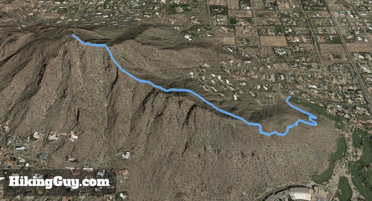

 McDowell Sonoran Preserve Hike
 Phoenix Hiking
 Best Hiking Gear 2024
 Hiking Boots or Shoes: Do I Really Need Hiking Boots?
 When to Hit SOS on inReach