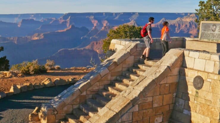
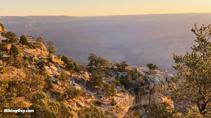
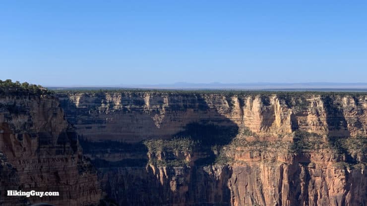
The Rim Trail from Bright Angel to Hermit's Rest hike is one of the best-kept secrets on the Grand Canyon's South Rim. The well-maintained and easy to follow Rim Trail winds along the western section of the South Rim, stopping at every marked vista point and making it's way past dozens of others that aren't on the map. The hike is flat, away from the crowds, and away from the cars (the road next to it is only open to shuttle buses). And if you get tired at any point, you can just hop on the shuttle bus. If you want to do a Grand Canyon hike that doesn't include hardcore hiking down into the canyon, but do want a peaceful and spectacular experience on the trail, this hike is for you.
In this Guide:
Turn-by-Turn Hike Directions & Video
What to Expect on the Rim Hike to Hermit's Rest
Tips on Weather, Parking, and Planning for the Hike
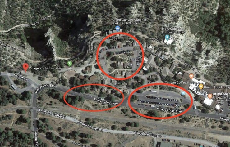
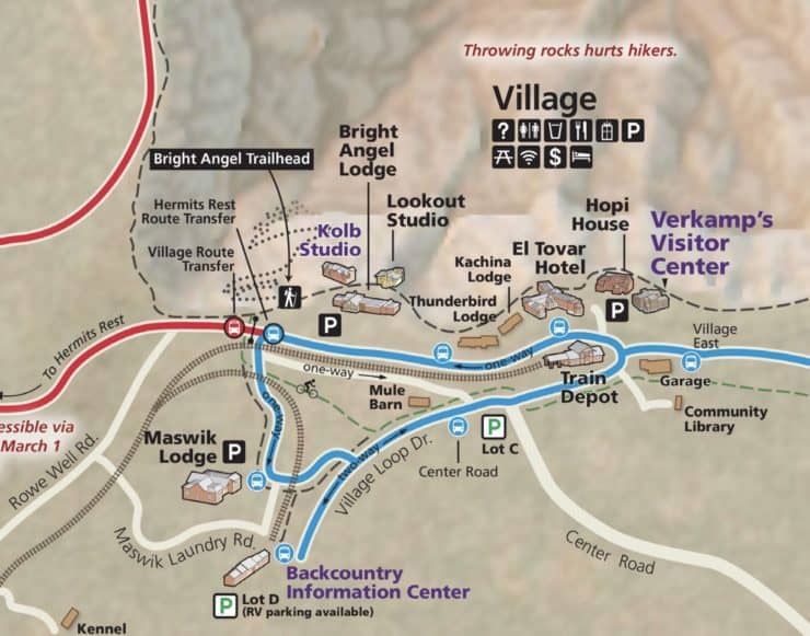
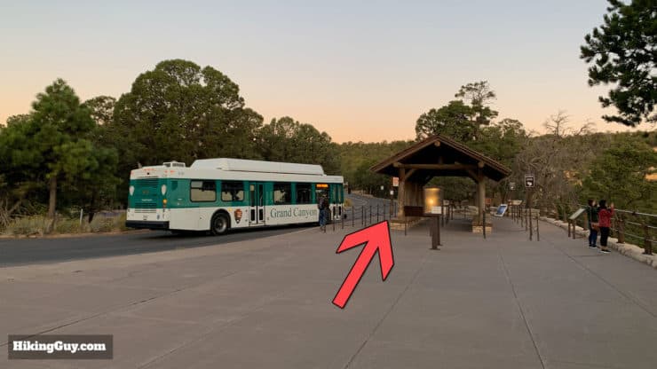
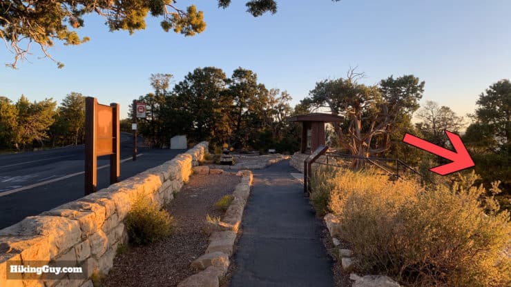
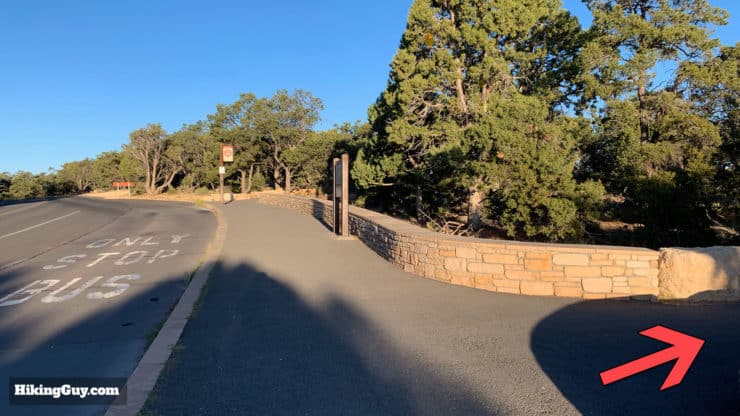
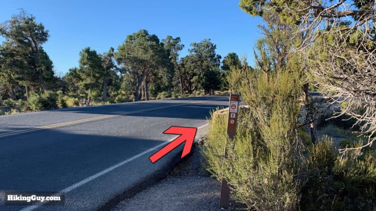
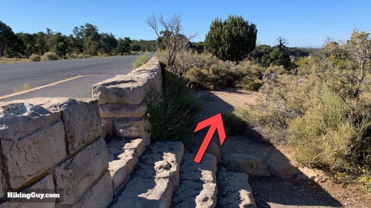
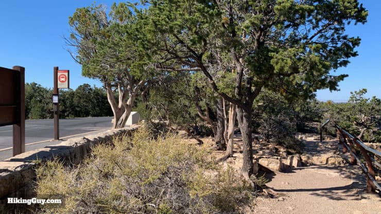
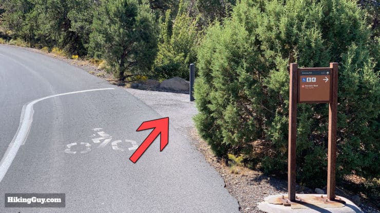
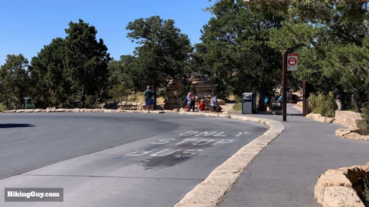
The hike starts from the Village Route Transfer station, where the blue Village Route intersects the red Hermit Road route. There's not a parking lot right at the bus station, but there are nearby lots just to the east. If you're driving to the start of the hike, navigate to the Bright Angel area and then find a spot just past (to the west) of the lodges. There's parking on the street and in the lot by the Bright Angel Trailhead.
Once you past the Bright Angel Lodge (on the right), you can park in any of these lots or street-side parking spots.
You can park anywhere that you don't see a no-parking sign or staff parking sign. The parking lots are shared with visitors staying in accommodations such as Bright Angel Lodge.
If you do need to park farther out, here are your options, all within a short walk to the trailhead.
The blue Village Shuttle Bus is a good option to get to the trailhead if you're parked or staying somewhere else in the park. The bus runs year-round.
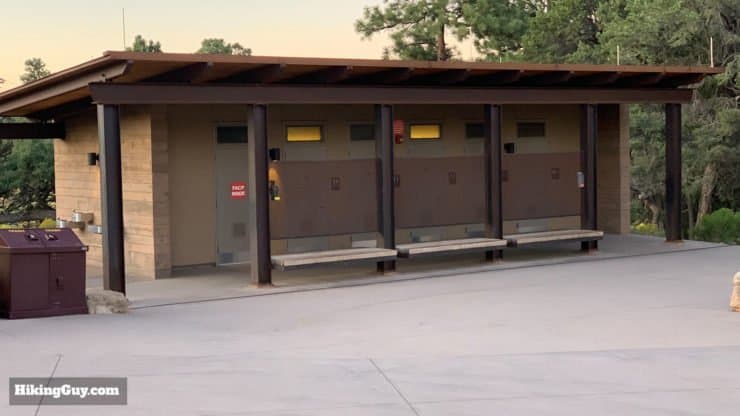
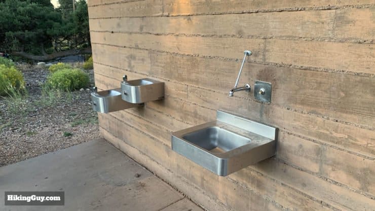
If you need bathrooms or water before your hike, your best bet is to walk up to the Bright Angel Trailhead.
There are lots of bathrooms at the Bright Angel Trailhead.There's a water fill station at the trailhead on the side of the bathrooms.
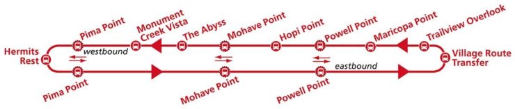
Hermit Road Shuttle Bus
This hike follows the route of the Hermit Road Shuttle Bus (from east to west). If at any point you want to end the hike, you can just hop on the bus and keep going or head home. At the end of the hike at Hermit's Rest, you simply take the bus back.
The bus doesn't run in winter. If it's winter you have to make this hike an out-and-back adventure. Pick a distance that is comfortable for you, and turn around somewhere during the hike. The road is open to cars when the bus isn't running.
You can take Leashed Dogs Allowed pets on the hike but pets are not allowed on the shuttle bus.
Gear For the Hike
This is a long hike but the conditions are pretty tame. You can get away with casual clothing, but you'll have a better time wearing fitness or hiking gear. You'll need to bring water with you; there's no water along the route until you get to Hermit's Rest. In the warmer months you should bring 3L; when it's not so hot you can probably get away with 2L.
The Grand Canyon is a place of weather extremes. It can be cold and icy from Fall to Spring, and from Spring to Fall it can be very hot. Prepare accordingly for your hike. If you leave early bring a layer or two extra. If there are thunderstorms in the forecast, it's better to do this hike another time.
Gear That I Love Right Now
Nothing is sponsored or promoted, just the actual gear that I use.
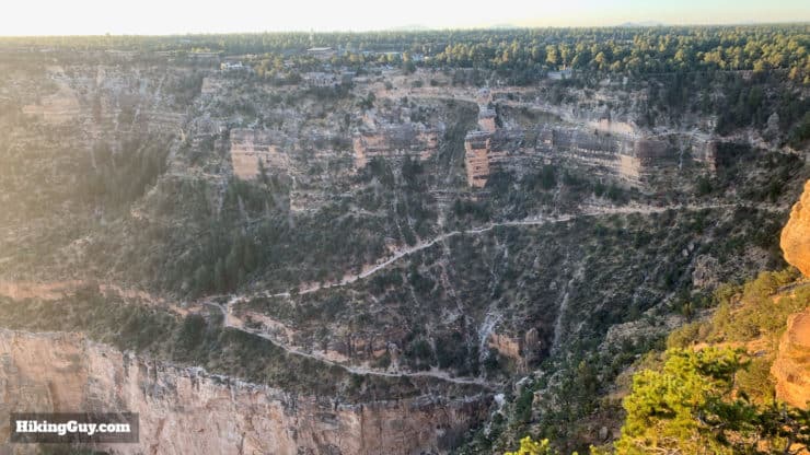
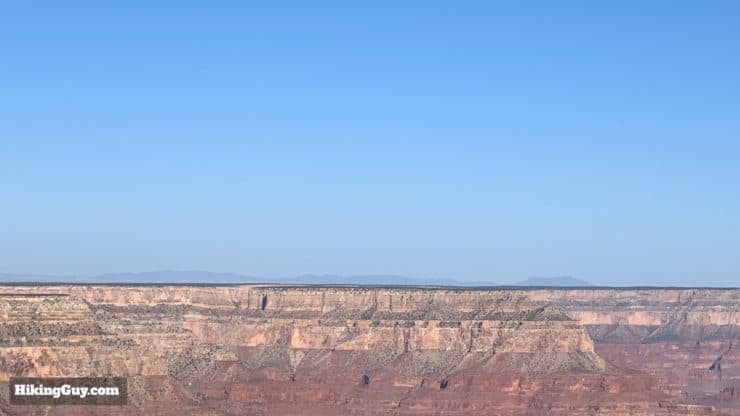
The hike takes you to promontory after promontory, all packed into a nice 8 mile stretch.
South Rim Trail to Hermit's Rest Hike Directions
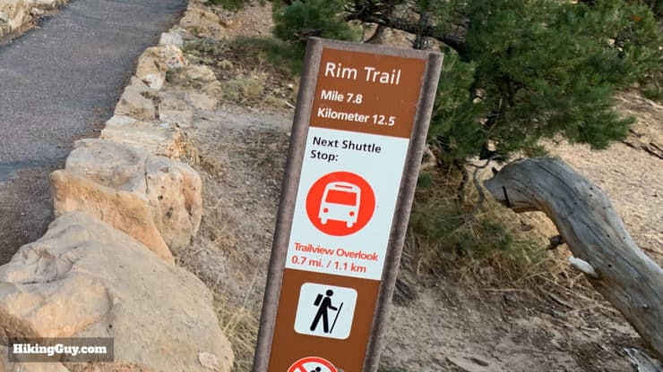
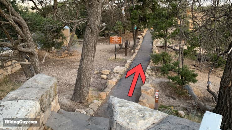
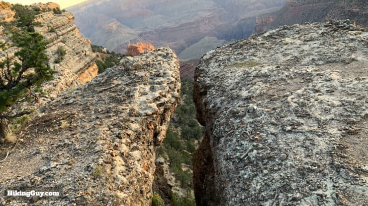
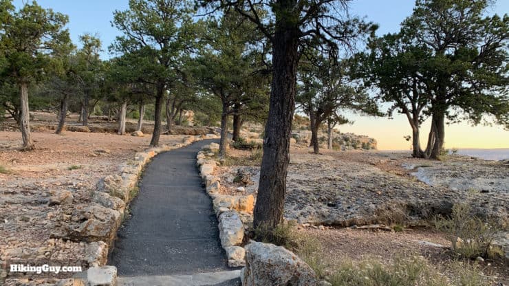
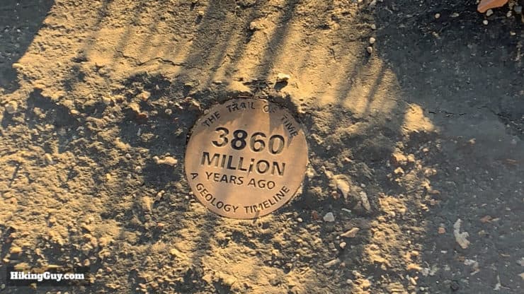
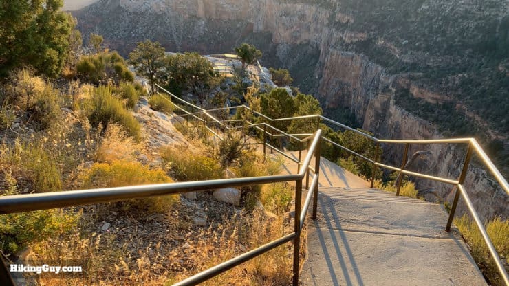
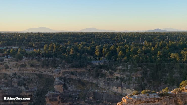
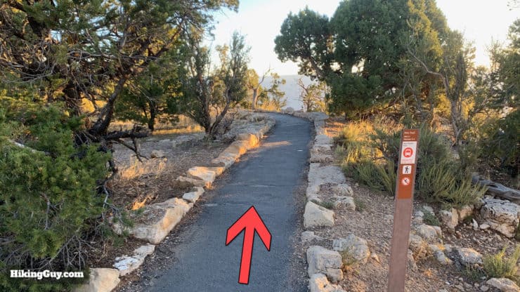
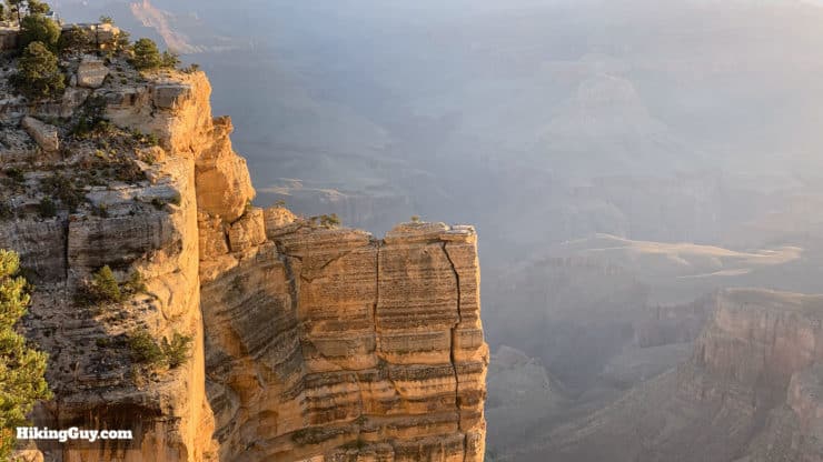
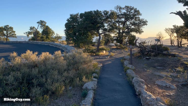
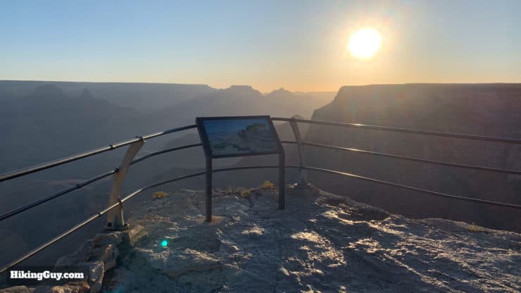
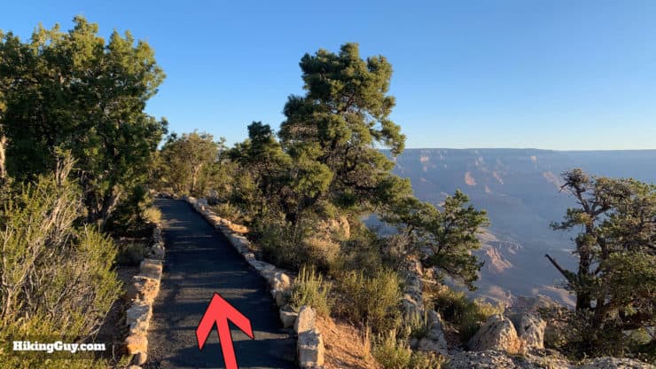
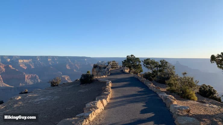
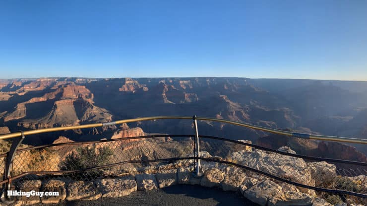
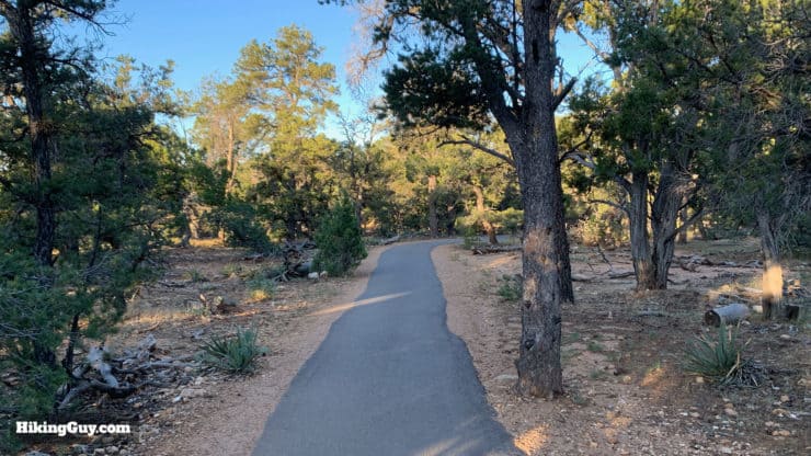
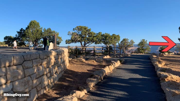
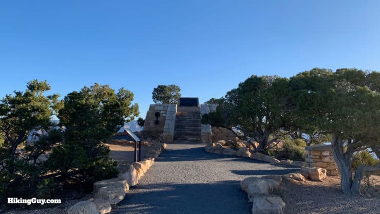
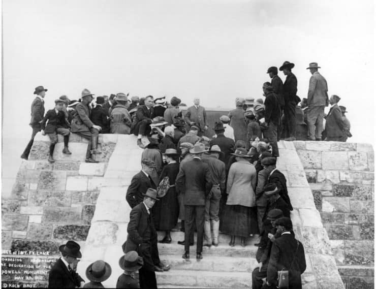
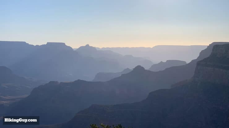
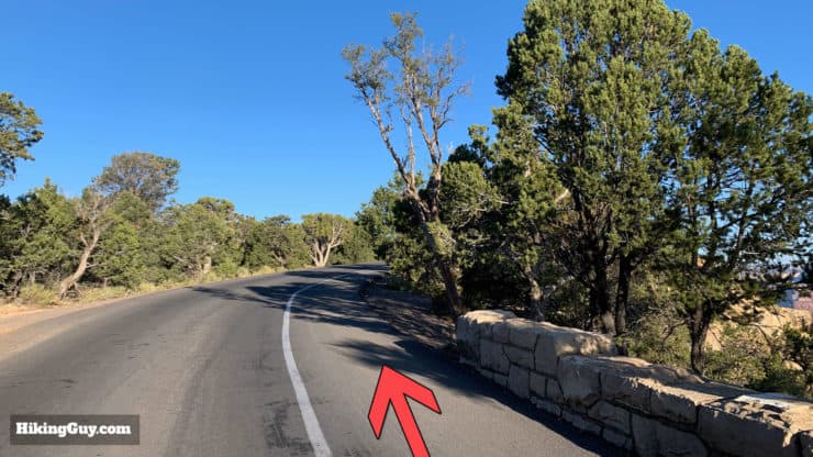
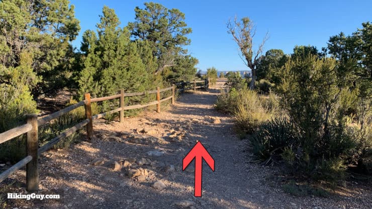
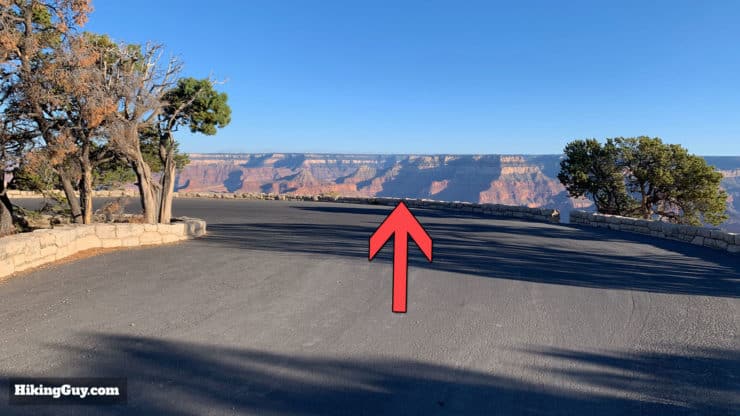
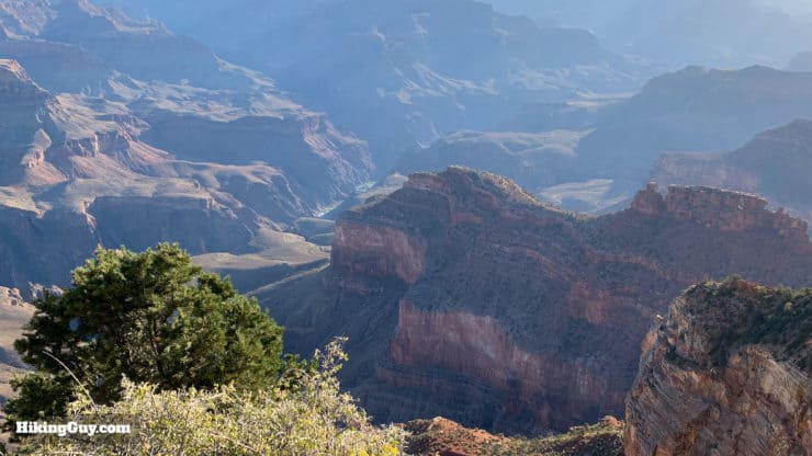
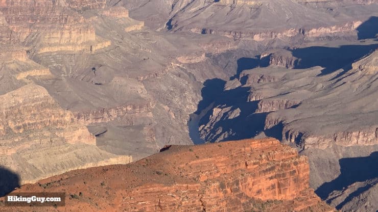
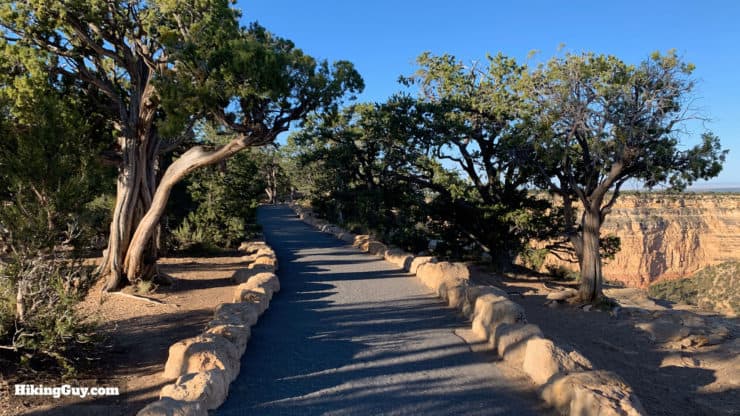
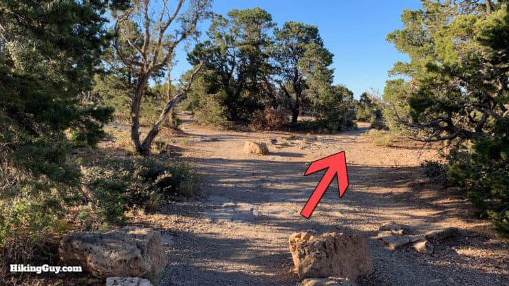
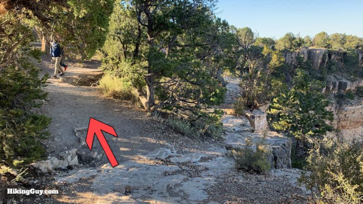
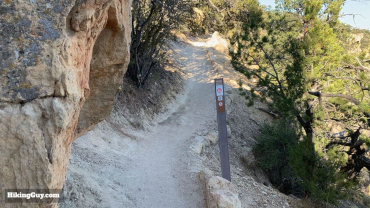
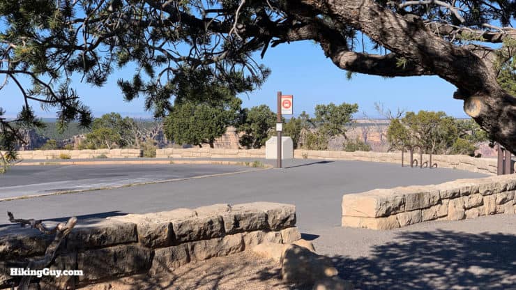
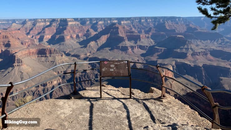
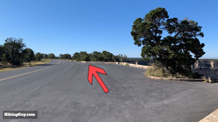
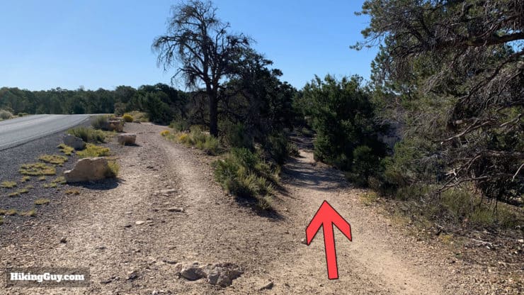
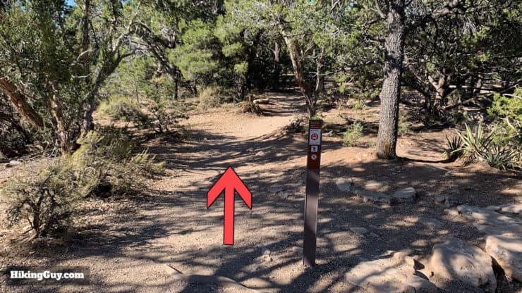
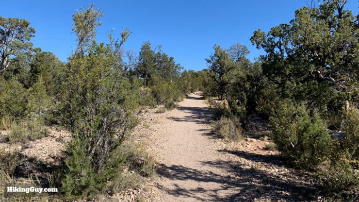
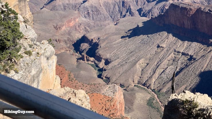
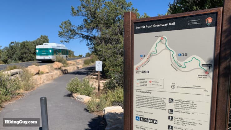
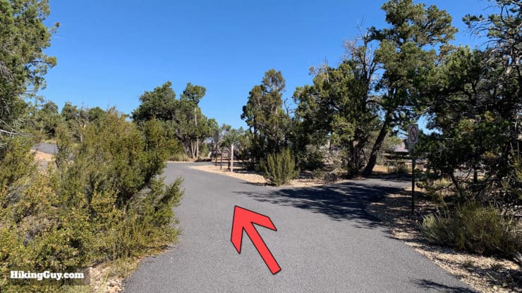
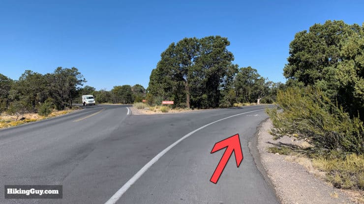
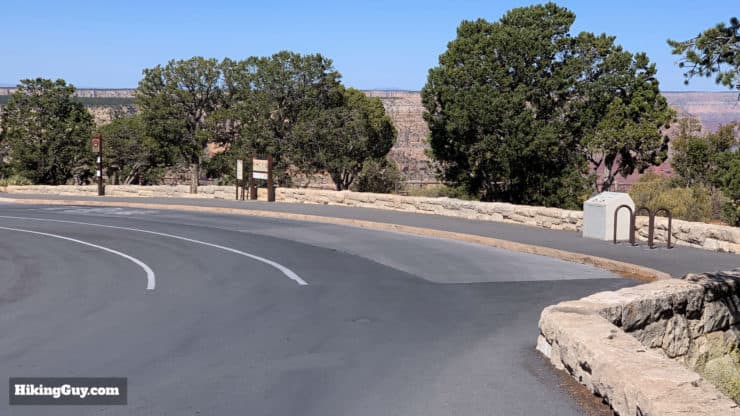
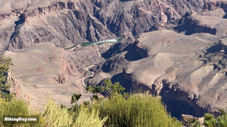
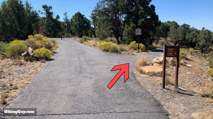
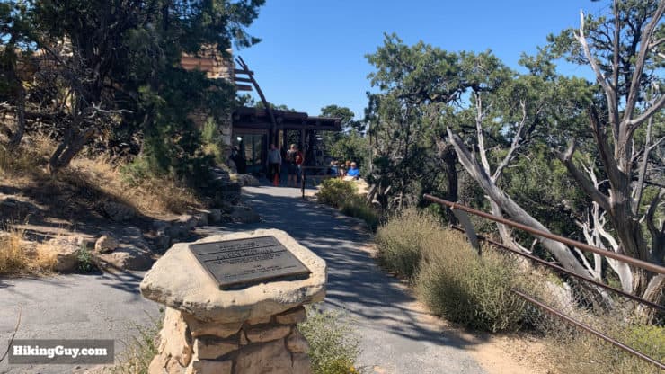
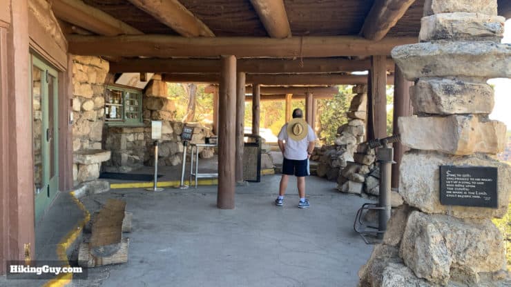
Start the hike at the bus shelter. The Rim Trail starts right on the other side of the station.Right away the trail is easy to follow and mellow. Leave the tourists at Bright Angel behind and start your adventure.Look down to the right to see these chasms along the cliff wall.At the beginning there are some ups and downs, but, in general, the trail is mellow and easy to follow.Soon you'll see Trailview Overlook in the distance.You might notice these bronze timeline medallions along the trail. They're part of the "Trail of Time" exhibit that you can learn more about on the hike between Bright Angel and the Visitor's Center.When you reach the turn-off for Trailhead Overlook, head down to the right to visit the overlook. When you're done, you return here to the trail and continue straight. You can also see the bus stop here.Head down to the overlook.You get some great views into the Bright Angel area here, and you can easily see the Bright Angel Trail as it winds its way down to the Colorado River.On a clear day you'll be able to see the San Francisco Mountains, about 50 miles away, just north of Flagstaff.When you're done at the overlook, head back on the trail. Notice the Rim Trail marker on the right that has the distance to the next bus stop.Oh yea, and there are more incredible views. There are so many views on this hike; it's non-stop.Soon you'll reach an unmarked overlook.Here's a closeup of the overlook. There are dozens of these unmarked rest stops and displays along this hike.Head back on the trail and continue hiking toward Maricopa Point.Soon you'll reach the shuttle bus stop for Maricopa Point. Head to the right to walk out to the vista point.It's worth walking out to the promontory which stretches 100 feet off the rim.The lookout at Maricopa Point offers unobstructed views to the Colorado River. You might even be able to see the Tonto Trail far below.The path heads away from the rim for a stretch between Maricopa and Powell Points. The path is diverted inland away from the rim because close to here on the rim once stood one of the most productive uranium mines in the country. The mine closed in 1969 and was here until 2009, when the contaminated remains and soil had to be removed (costing $15m in taxpayer money). The streams below the old mine site are still contaminated; hikers are warned not to drink from them. In 2012 the Arizona legislature voted (along party lines) to ban uranium mines at the Grand Canyon.Next you'll arrive at Powell Point, which is off to the right from the shuttle stop.Powell Point offers not only views, but also a large granite memorial to John Wesley Powell, a one-armed Civil War veteran who led the first party of gringos through the whitewater of the Colorado River in 1869.Here's the dedication of the memorial in 1918, two years later the Grand Canyon National Park dedication happened here too. Photo Kolb BrothersIronically you can't see the river from Powell Point, named after the man who went down the river. But there are some great views east and west.After Powell Point the trail continues along the side of the road.Head up along the fence toward Hopi Point.Head over the road to reach Hopi Point.Here you are at Hopi Point, the most popular spot on Hermit Road to see the sunset. You get a much wider view at Hopi Point because the Colorado River bends northward here.Down to the left you'll see this butte called The Battleship. It's a popular place for nesting California Condors.You'll also get great views of the Colorado River from Hopi Point.And on a clear day you'll see Mt Trumbull, about 60 miles away and 8,028 feet high.From Hopi Point hop back on the paved Rim Trail.The trail turns to dirt and there are some splits (that come back together).Take care to make sure that you're on the trail and not on a path to an unofficial overlook.There are a few sections of the trail that go alongside the road. When the road is closed you only have to watch out for buses, and they are used to hikers.The trail turns to dirt again and has some spectacular sections. The Rim Trail is wide and well maintained. This is probably as narrow and close to the edge as you get.Soon you'll see the bus stop for Mohave Point.Welcome to Mohave Point where the views are similar to Hopi Point, and you can even see rapids on the river below.In the distance look for the volcanic peak, Mount Floyd (left) at 7,444 feet. Mount Floyd is part of the Bright Angel Fault, which stretches up into the Grand Canyon and forms the geologic basis of the Bright Angel Trail.Continue on the trail as it winds its way on and off the road.There are quite a few of these pull-over points on the road. Just walk straight through them to continue the hike where they end.Follow the trail into the dirt area.Here's the Abyss Overlook, which gives you views down a 2,600 vertical drop to Monument Creek.Keep hiking along the Rim Trail, following the markers which go all the way to the end.The trail heads away from the edge for a while and takes you through the Grand Canyon's pygmy pinyon-juniper woodlands.The next stop is the Monument Creek Vista. The drop from the rail is a sheer one and the views are incredible.Monument Creek Vista marks the start of the Hermit Road Greenway Trail, a section of the Rim Trail that's paved and optimized for bikers (and walkers).Follow the wide and easy Greenway Trail. There are several benches and overlooks along the way like the one on the right.Keep right as the trail approaches Pima Point.Welcome to Pima Point, the last big overlook on this hike.Pima Point offers some of the best views of the river and rapids.Past Pima Point follow the signs for the Rim Trail.This stretch of the trail used to be the old road to Hermit's Rest. In 2008 the Parks Service made this a greenway path and rebuilt the main road to what it is now, widening it for buses. They also performed one of the largest revegetation projects in the park, planting over 20,000 shrubs and laying over 200 pounds of grass seed.Bicycles must continue straight to the road; hikers make the right.And here you are, Hermit's Rest!
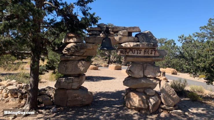
Hermit's Rest is named after "the hermit" of the Grand Canyon, a Quebecois, Louis Boucher. Boucher staked his claim here, carved out trails in the canyon, and eventually evolved his homestead to be a tourist destination.
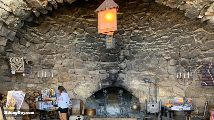
Get your photo with the old entrance gate. The stone of the gate was taken from a Spanish Mission.Continue down the right side of the area to visit the Hermit's Rest building from 1914 that is built in the “National Park Rustic” style.Head inside to admire the huge alcove fireplace. When the building was opened in 1914 they rubbed soot on the stones and used antique lamps to make the building look like had been there for a while.There's a small snack bar where you can grab a bite. You can also refill your water by the bathrooms, close to the shuttle bus stop.
From here just hop on the bus back to the start. As the bus passes all of the same places that you did, you'll be amazed at how far you've walked! Congrats!
Need More Info?
Have a question about the guide or want to see what other people are saying/asking? View the Youtube comments for this video. Leave a comment and I will do my best to respond.
When planning, always check the park website and social media to make sure the trails are open. Similarly, check the weather and road conditions.


 Using the Apple Watch for Hiking
 Garmin Fenix 7 & Epix Review For Hikers
 How To Read a Topographic Map
 Garmin GPSMAP 67i Review
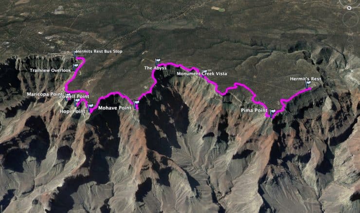


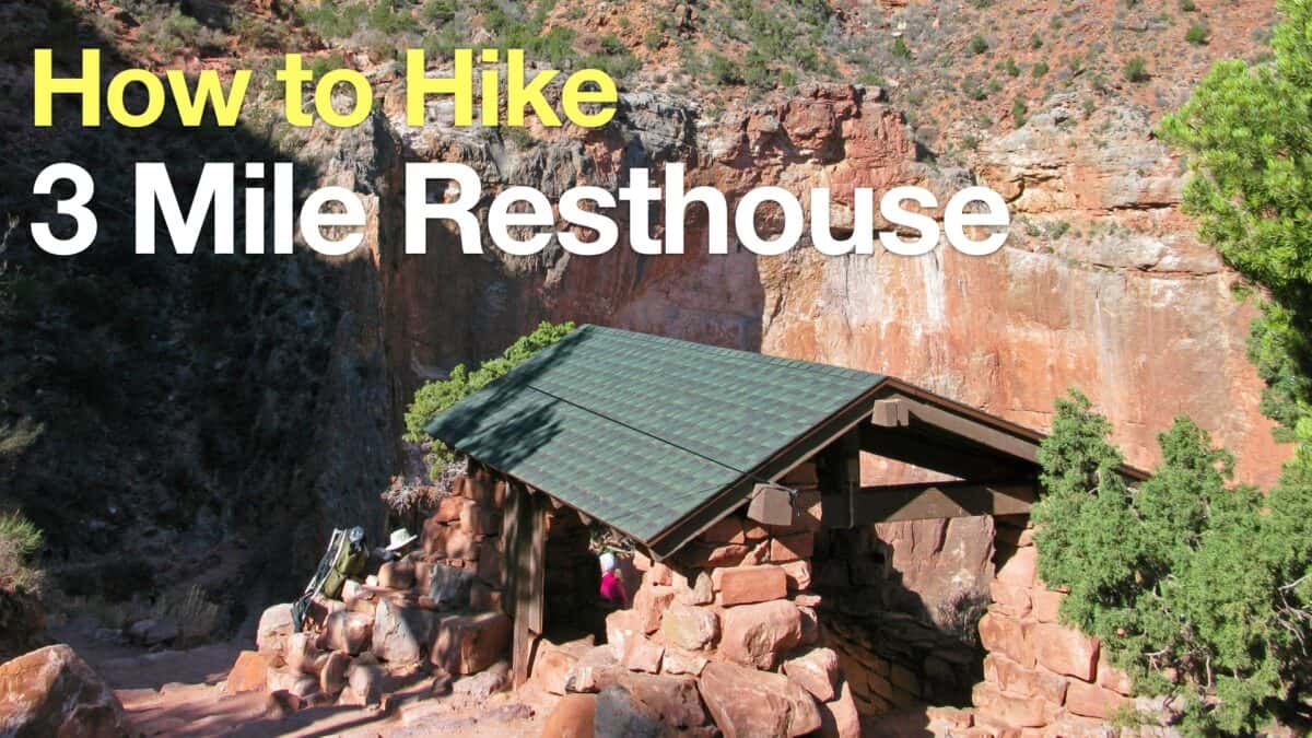 Hike 3 Mile Resthouse on the Bright Angel Trail
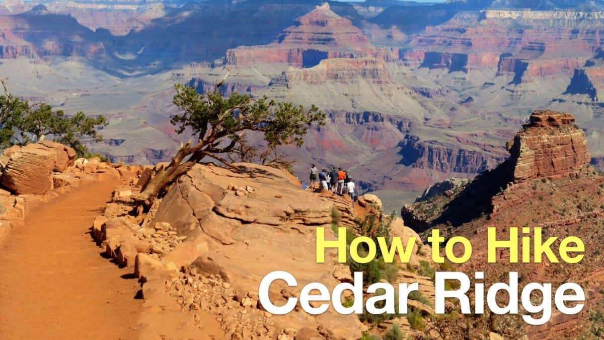 Cedar Ridge Trail
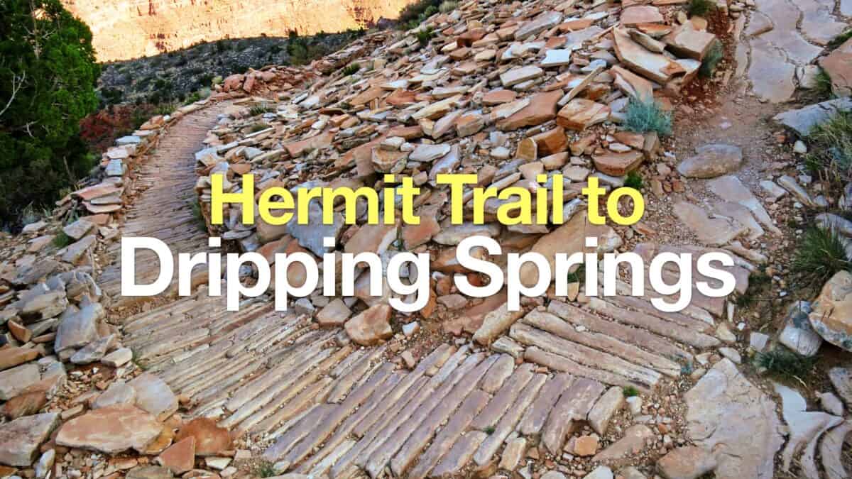 Hike Hermit Trail to Dripping Springs
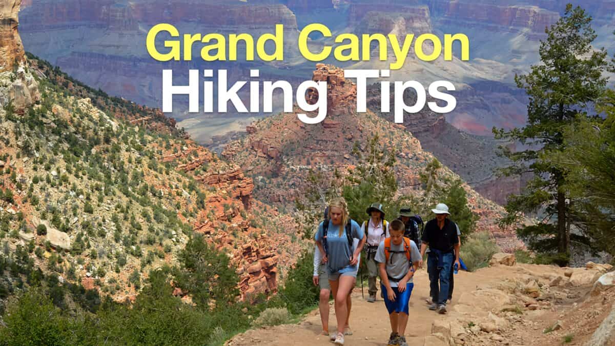 Grand Canyon Hiking Tips
 Grand Canyon Hikes
 Best Hiking Gear 2024
 Hiking Boots or Shoes: Do I Really Need Hiking Boots?
 When to Hit SOS on inReach