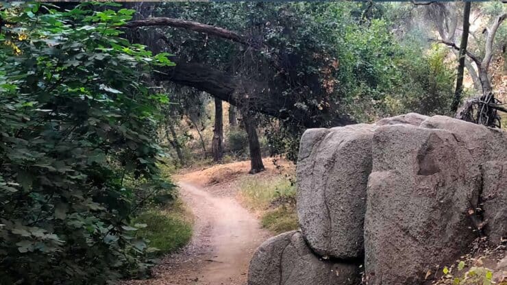
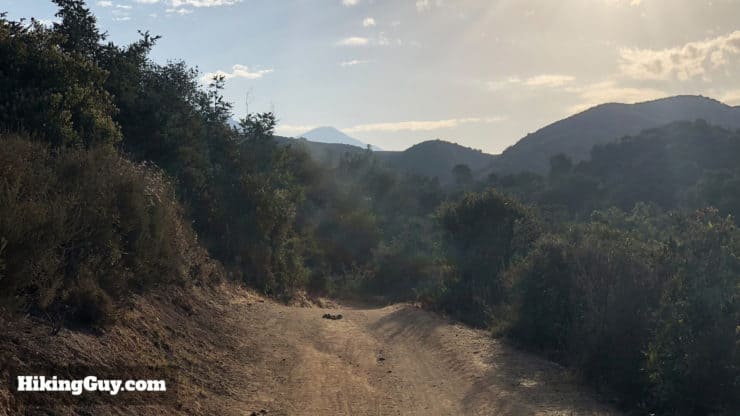
Tucked into the suburban sprawl of Los Angeles, the Marshall Canyon Trail hike offers a shaded oasis along Marshall Creek. The hike climbs into the foothills Marshall Canyon Regional Park, does a lollipop-loop with great views, and then descends back along Marshall Creek. This hike offers a little bit of everything: moderate distance, reasonable climbing, and lots of scenery. Keep your eyes open for deer and wildlife that are using the creek to hydrate. This route takes you about 10.5 miles, but there are opportunities to cut the distance and climbing down with a simple out-back turnaround. It's a great trail for beginners looking to get some distance in without super-tough conditions, and also a great options for experienced hikers who want a change of scenery.
Technically speaking, Marshall Canyon Trail is a 7.8 mile trail that starts in La Verne, CA, and makes it way up to Marshall Canyon Regional Park. This hike covers the most popular route, which starts at the Oak Mesa Park, follows the trail north, and then comes back.
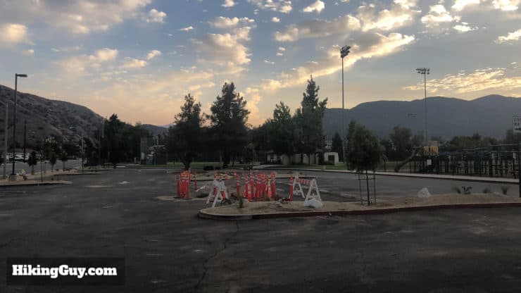
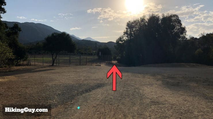
There are bathrooms and water fountains at the ball field next to the parking area. Oak Mesa Park is a short walk to the actual trail, but most folks park here because of the lot and bathrooms.
You'll share the trail with runners and bikers. Get there early to beat the crowds.
Gear for the Hike
Although you could get away with doing this hike with fitness gear as many trail runners do, I strongly recommend using proper hiking gear. Don't let the fact that this isn't a big mountain hike fool you, it's long and has tough sections. There's a decent amount of shade on the hike but there are also exposed sections that can get very hot. There can also be flies and mosquitos, so bring insect repellant.
Osprey Hikelite 26Lightweight, carries all your gear, and your back doesn't get sweaty. Oh yea, it's also one of the most inexpensive packs you can get.
This popular hike route actually covers a few parks. It starts the Marshall Canyon Trail, which then enters Marshall Canyon Regional Park, which then enters Claremont Hills Wilderness Park and becomes the Cobalt Canyon Trail, then heads back on the Marshall Canyon Trail. So all that happens. There are a lot of trails in these parks, and if you want to go off the guide to explore, there are many opportunities. But again, this route is the most popular one and a good starting point for your first hike in the area.
The route is an out-and-back with a lollipop at the end. If you want to hike less distance, just turn around anywhere before the lollipop loop. Turning around at the start of the loop makes this a 7.2 mile hike.
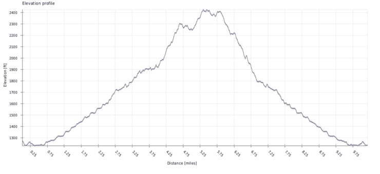
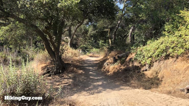
The hike makes it's way up through a developed area and then does a loop in larger parks.The Marshall Canyon Trail follows Marshall Creek until it gets to Marshall Canyon Region Park, where there are more ups and downs and you can see by the topo lines.The elevation chart is deceiving. The hike climbs gradually to the foothills, and then there are some ups and downs. This is not a tough mountain climb.
Marshal Canyon Trail Hike Directions
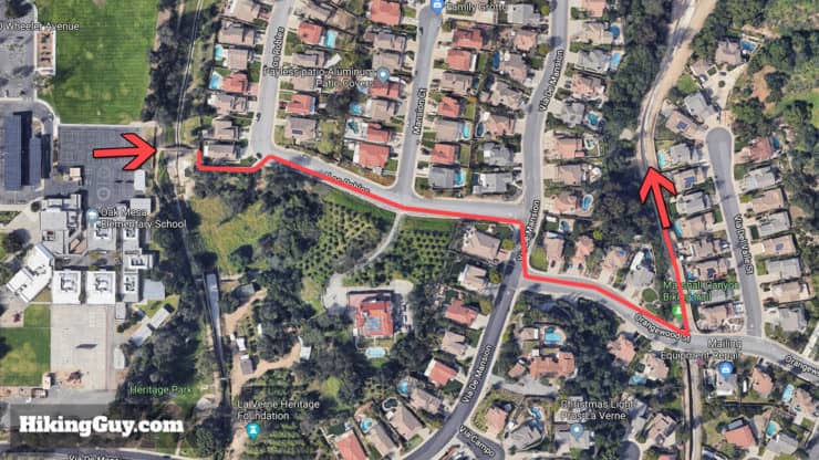
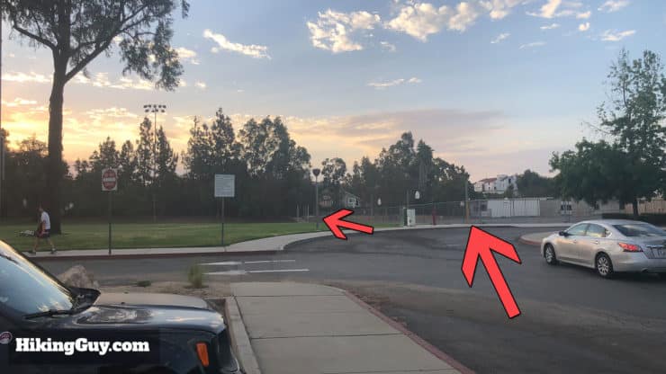
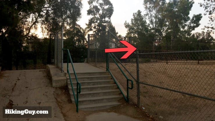
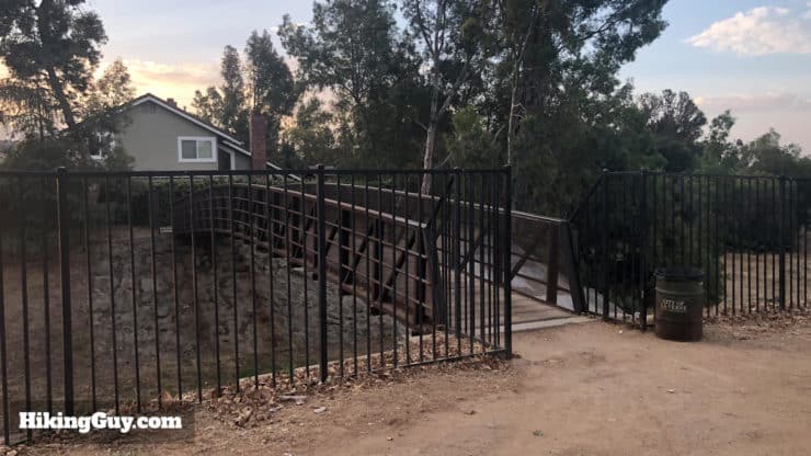
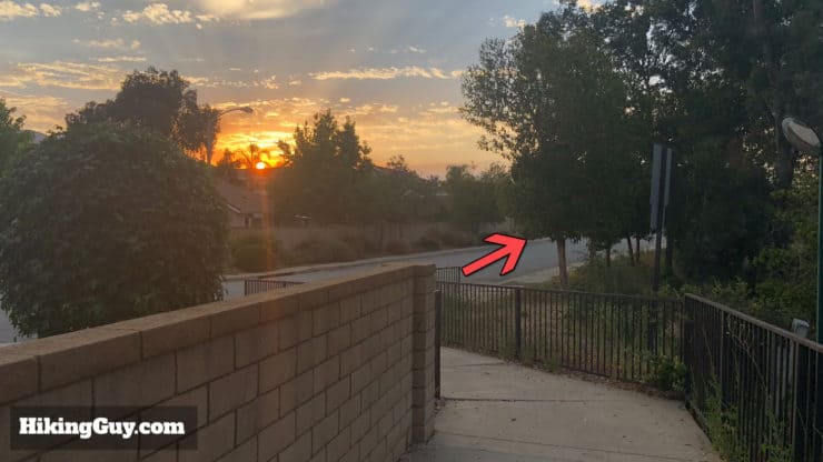
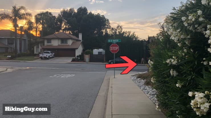
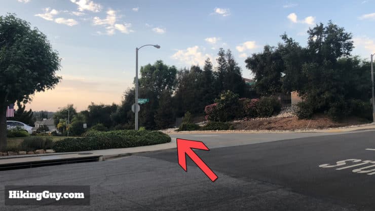
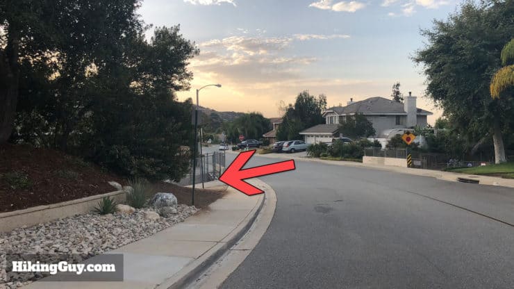
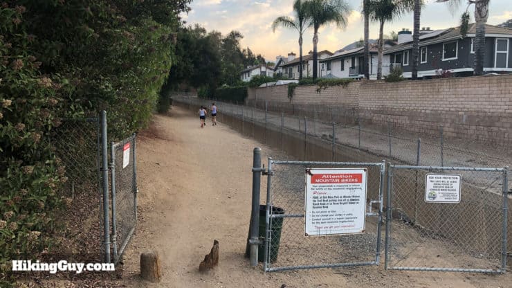
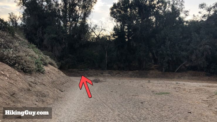
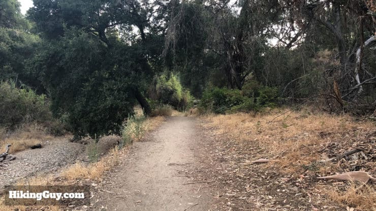
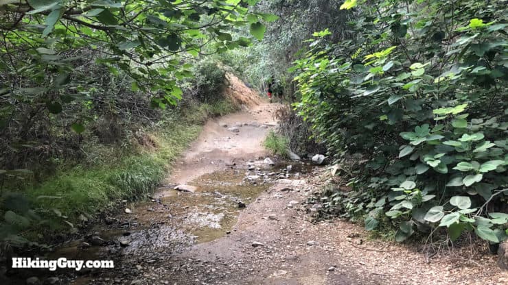
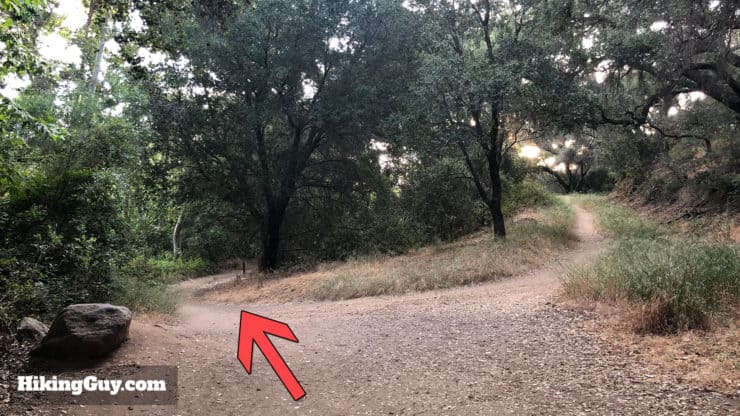
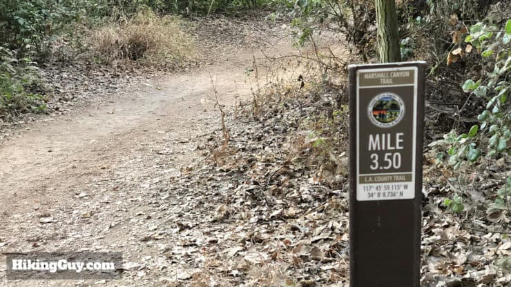
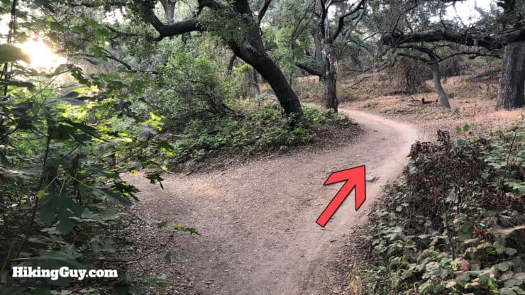
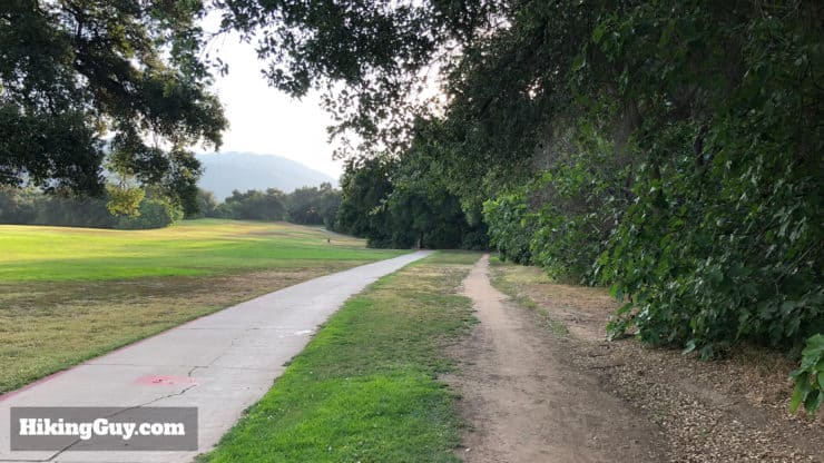
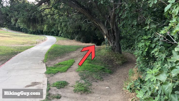
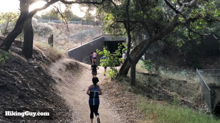
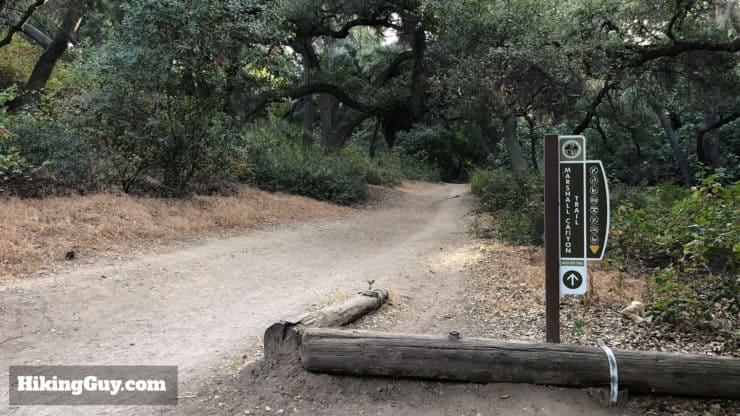
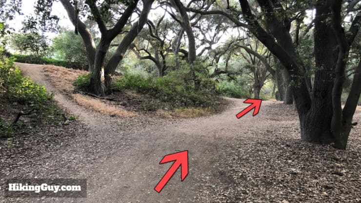
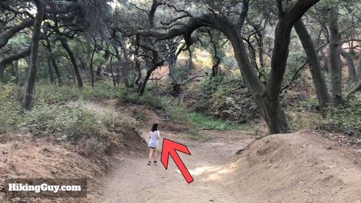
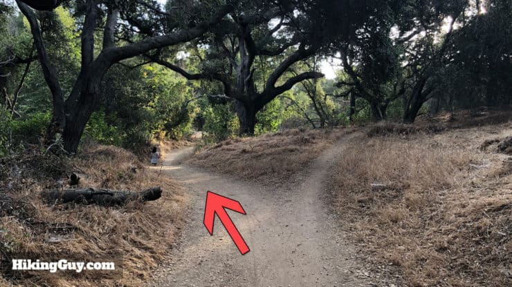
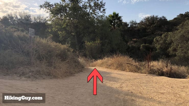
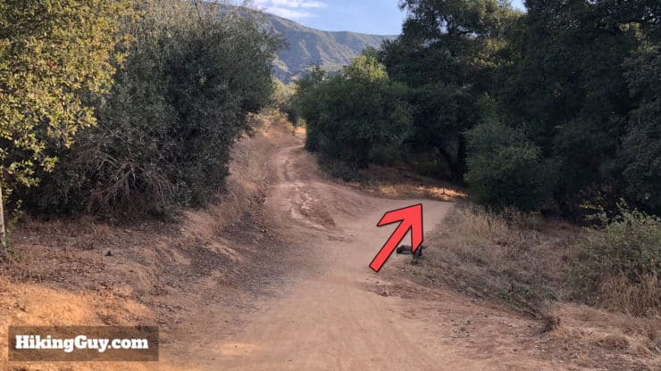
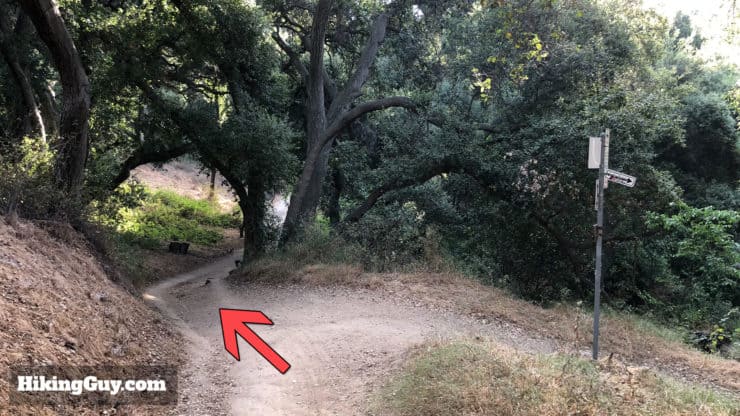
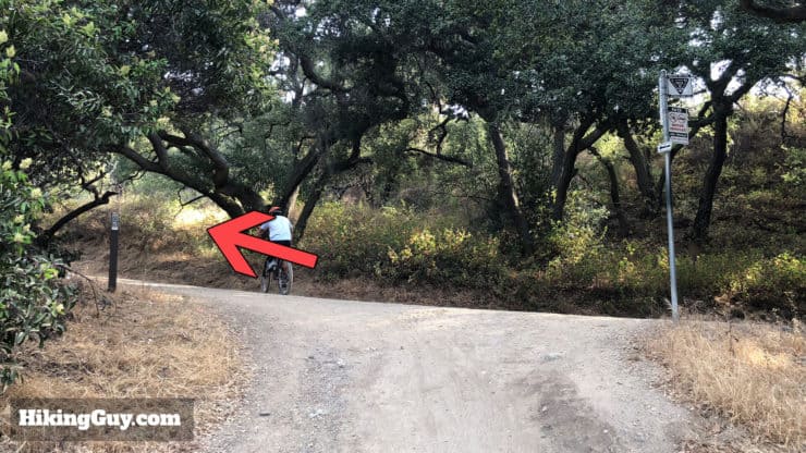
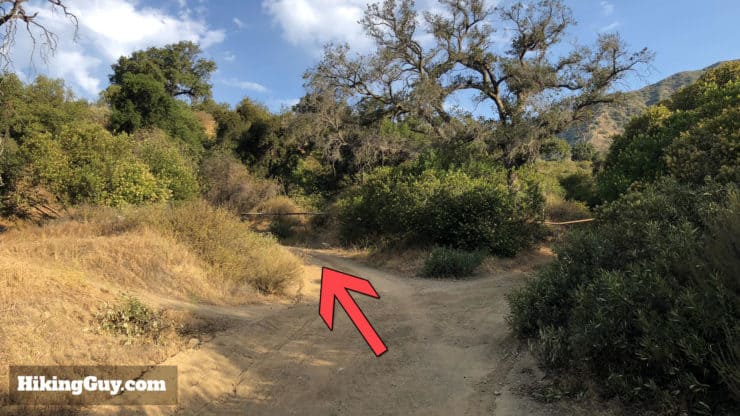
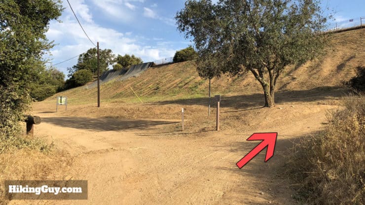
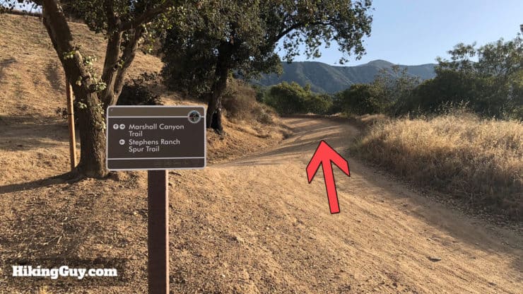
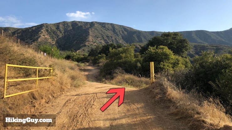
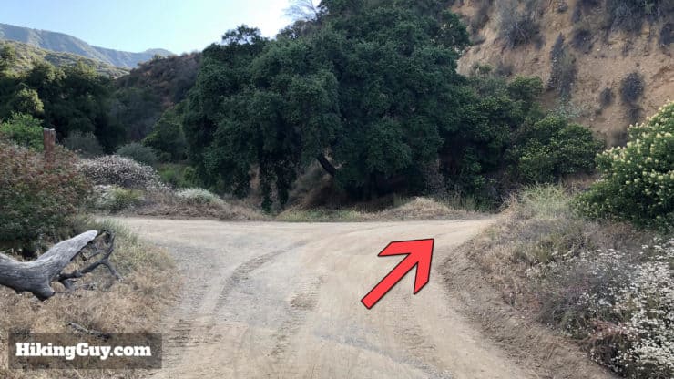
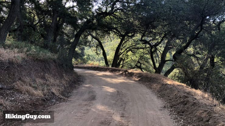
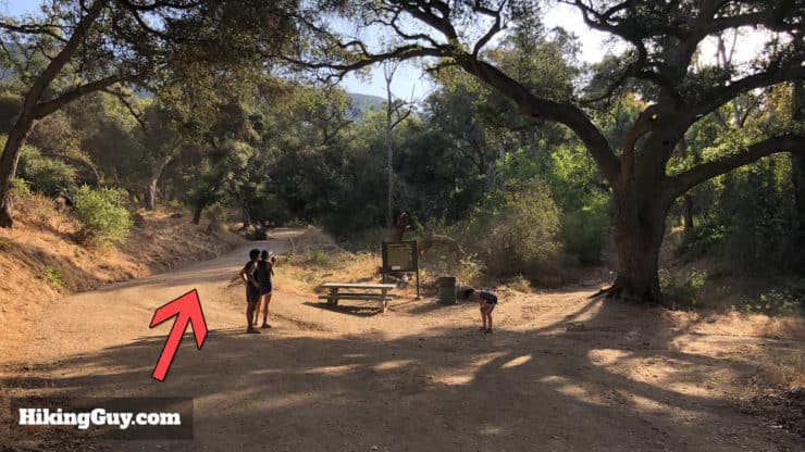
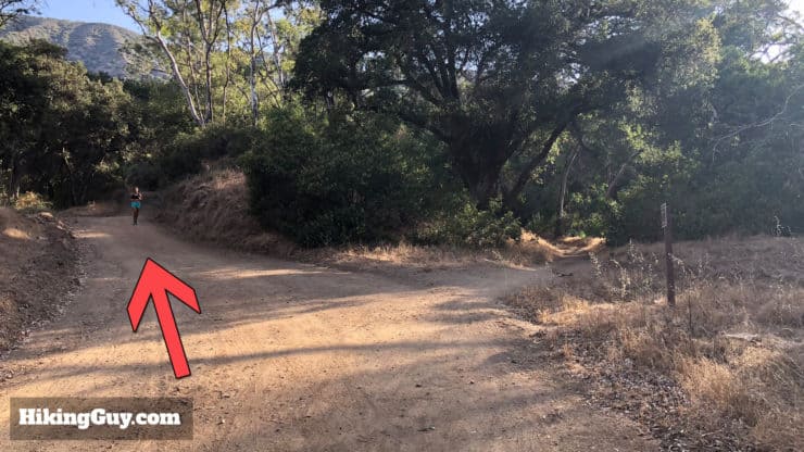
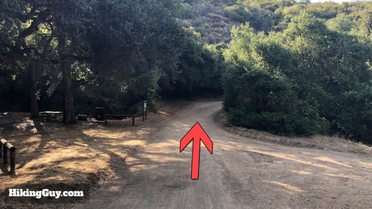
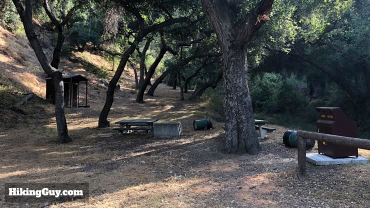
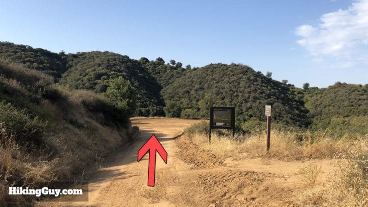
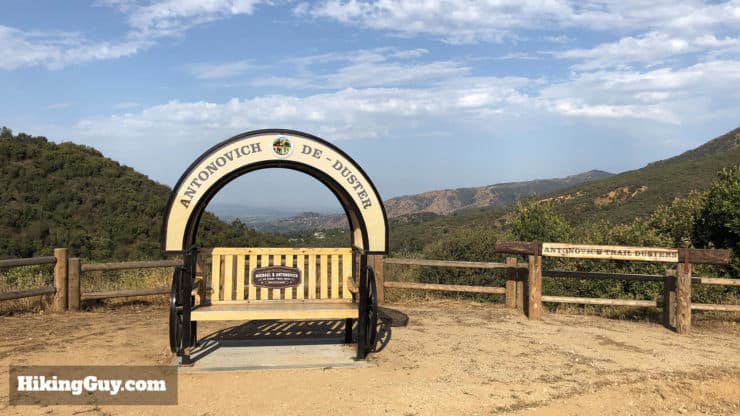
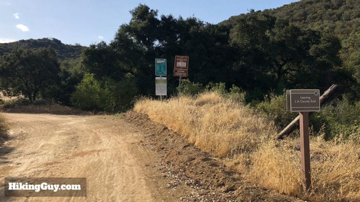
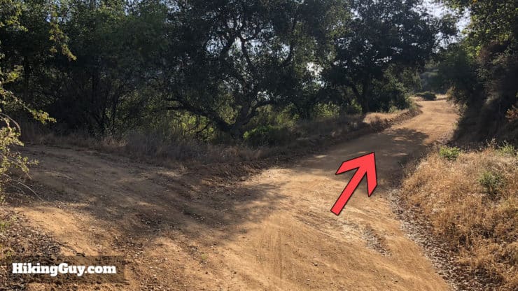
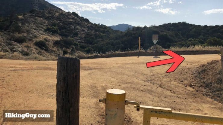
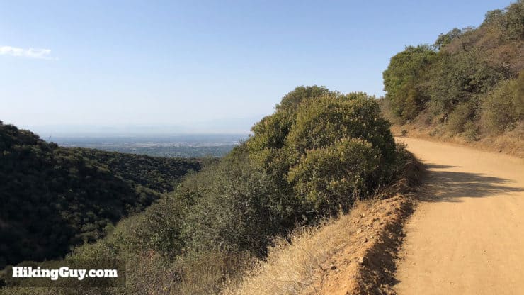
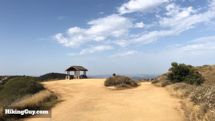
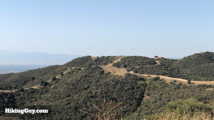
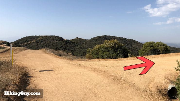
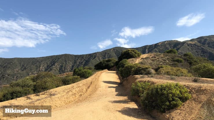
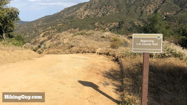
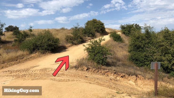
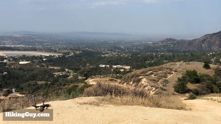
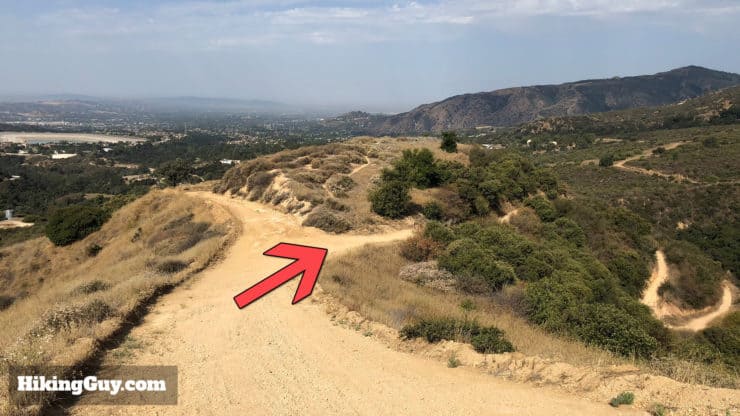
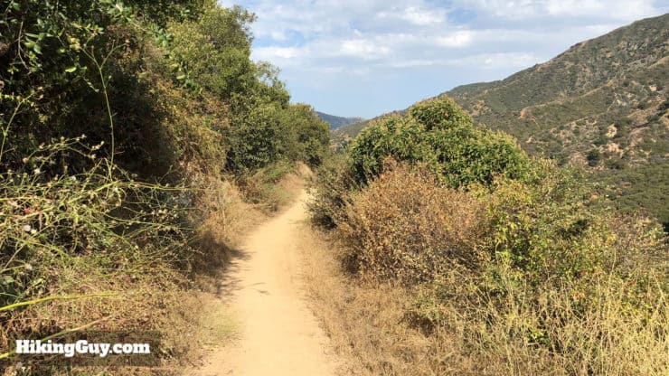
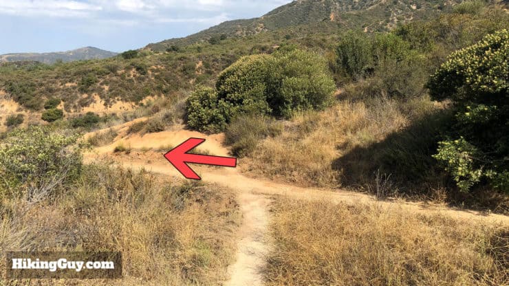
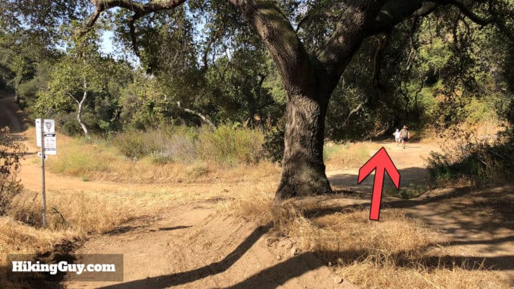
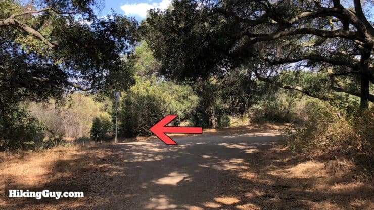
There's plenty of parking at Oak Mesa Park. Bathrooms are water fountains are by the baseball field.Getting from the parking area to the trailhead requires a little urban hiking. Here's the route.Follow the sidewalk through the field and schoolyard.Go up the steps and head right.Cross the bridge.After the sidewalk from the bridge, head right on Los Robles.At the end of Los Robles, make the quick right....... and head caddy-corner across the street to Orangewood Street.Shortly after you get on Orangewood St. the Marshall Canyon Trail will be on your left.Here's the start of the trail. Not too pretty, but it gets better, I promise.When you come to the large wash area, just walk straight through to the other side and you'll see the trail.After the wash the trail becomes "a trail" and offers seclusion as it winds through the neighborhoods of La Verne.The trail meanders next to Marshall Creek. There are some small stream crossing, but nothing that you can't hop across.At this fork, hike to the left.You'll see markers on the whole Marshall Canyon Trail. The mileage corresponds to the beginning of the trail, not where this guide started.At this fork, hike up to the right. You can go left too but you have to walk through the stream.Eventually the trail comes up alongside the golf course. Keep hiking along the trail next to the paved golf cart path.After a few minutes the trail dips back down to the creek and nature.Soon after that, you'll go through a tunnel. Keep your ears open for bikes and runners.The trail is popular and generally well marked. There are small spurs and bifurcations here and there, but in general the trail follows the maps.Soon after the tunnel there's a big trail junction. Hike straight through and bear to the left.Hike to the left at the fork here.And another fork, stay to the left.You'll climb a little hill and then come to the junction of the Stephens Ranch Spur Trail (sign to the left here). Go straight through and stay on the Marshall Canyon Trail.Keep straight through the large clearing.As the trail climbs you'll start getting views of the foothills.Avoid the bulldozed cutoff and hike on the trail.Keep hiking straight / left through this intersection, where some of the earlier trails to the right rejoin the main trail.Okay, here's the beginning of the lollipop section. If you just want the shorter, 7.2 mile hike, you can turn around here. Otherwise make the left up the hill.Hike to the left as the trail climbs.The Marshall Canyon Trail skirts around Camp Paige. Make the hard right at this intersection to continue on the trail.There's a sign at the intersection that confirms this is the way for the Marshall Canyon Trail.Hike to the right through the gate. The trail here is a wider dirt road.Again, bear to the right to stay on the main trail / road.The trail meanders up gradually, with some nice shaded sections.At this intersection with a trail board, bear left and hike straight through. The trail board has a nice trail map if you want to take a look.Continue hiking on the main trail, avoiding the trail to the right.Keep hiking straight on the Marshall Canyon Trail as it passes through and old campground.The campground has some tables and old bathrooms if you want a break. The shade makes it a nice halfway stopping point.This intersection marks the point where you will leave the Marshall Canyon Trail, which bears off to the right. You should hike straight on the Cobalt Canyon Trail We'll rejoin the Marshall Canyon Trail a little bit later.Local equestrians erected this bench which offers a nice photo opportunity with a view in the background.Signs mark the end of Marshall Canyon Regional Park and the beginning of Claremont Hills Wilderness Park.Hike right as the trail climbs the hill.When the trail dead-ends at the gate, make the right.The views along this stretch are great.If you want a break, there's a little pavilion where you can get some shade with nice views.As you continue straight, you'll see the trails of Claremont Hills Wilderness Park before you.At the first major intersection, make the right to head back into Marshal Canyon Regional Park.Keep hiking on the main (wide) trail, avoiding the side trails that mountain bikers use.Welcome back.Keep hiking straight. The trail to the right was the cutoff trail from the other side of the lollipop loop.Again, more great views. At this point you'll be able to see Camp Paige and the lower sections of Marshall Canyon Trail that you hiked up earlier.At this split, bear right to close the loop on the lollipop section.The trail is narrow again as you descend.At the junction, bear left.Bear right and straight at the larger intersection.And here you are, back at the start of the lollipop section. Make the left back onto the out-and-back section of the Marshall Canyon Trail and head back the way you came.After the loop section, the hike back to Oak Mesa Park is a gradual descent where you can enjoy the trail and descent.


 Using the Apple Watch for Hiking
 Garmin Fenix 7 & Epix Review For Hikers
 How To Read a Topographic Map
 Garmin GPSMAP 67i Review
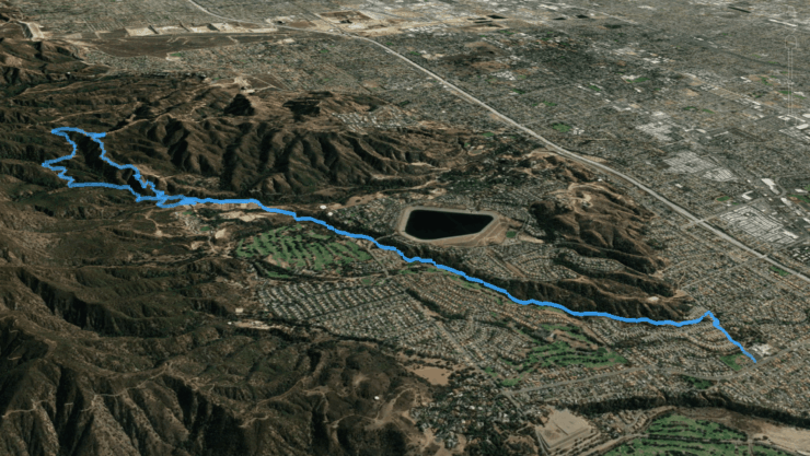

 Devil's Chair Hike (Devil's Punchbowl Natural Area)
 Hike the Etiwanda Falls Trail
 Potato Mountain Hike (Angeles National Forest)
 Los Angeles Hikes
 Best Hiking Gear 2024
 Hiking Boots or Shoes: Do I Really Need Hiking Boots?
 When to Hit SOS on inReach