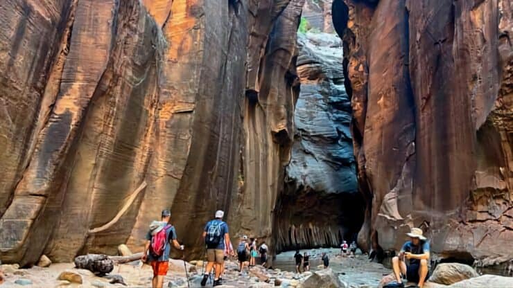

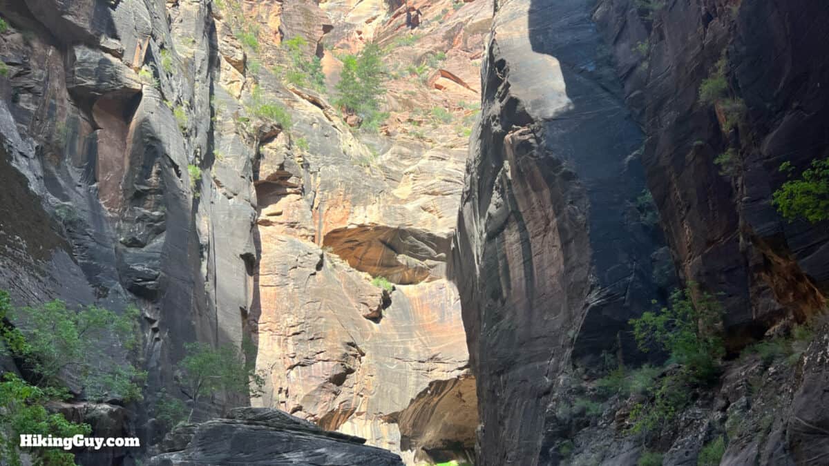
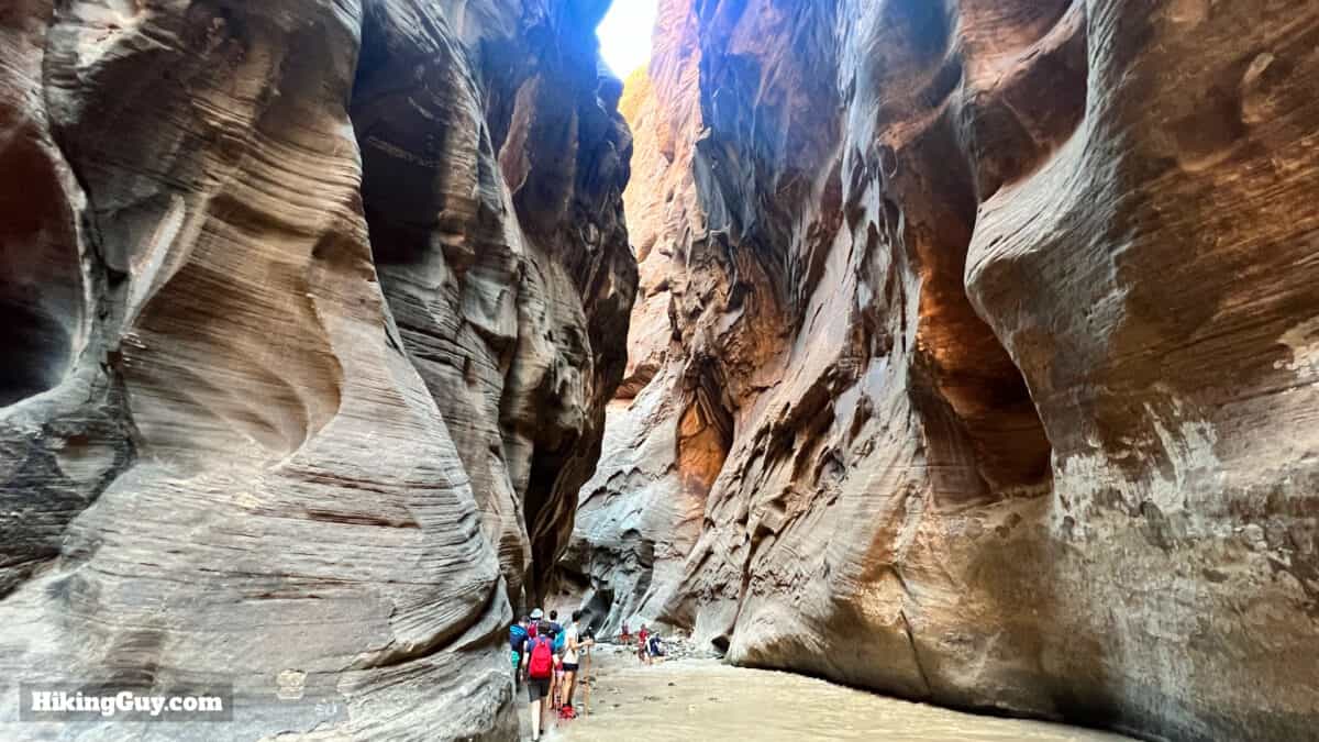
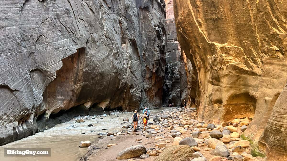
The Narrows hike is world-famous for a good reason. The dramatic scenery of thousand-foot sandstone cliffs, sometimes only twenty feet apart, is awe-inspiring and beautiful. But with all the information available, planning the hike can be intimidating. So in this simple guide, I'll cut through the fluff and make it easy for you, taking you on a "best-of" self-guided hike to the famous Wall Street section of The Narrows.
- Video and Turn-by-Turn Directions to Hike The Narrows
- Bottoms Up or Top Down?
- Insider Tips on Walking Through the River
- Special Gear You Need to Hike the Narrows
- How Far Up the Narrows You Should Hike
- When to Avoid Hiking the Narrows
Which Narrows Hike Should I Do?
If you've been looking around for information, you might have noticed several ways to hike The Narrows. This guide outlines what I think is the best experience for first-timers: a 3-4 hour hike up to and through the Wall Street section (and back). But there are other options you should be aware of.
| Name | Total Miles | Need Permit? | Description |
|---|---|---|---|
| Bottom-Up | 9.4 | No | Hiking from the shuttle stop at the Temple of Sinawava to Big Springs and back. You are allowed to hike as far as Big Springs without any special permit. |
| Top-Down | 16 | Yes | A challenging overnight or long day hike from Chamberlain’s Ranch that goes downstream on The Narrows one-way. Permits can be hard to land and you must arrange for a shuttle. |
| Bottom-Up to Wall Street | 7.5 | No | What I consider the "best of" hike that brings you to all the attractions and skips the deepest water |
| Bottom-Up to Mystery Falls | 3 | No | If you just want a taste of The Narrows hike to Mystery Falls which gets you in the river with some nice scenery at a short distance. |
| Riverside Walk | 2 | No | To get a taste of The Narrows without walking in the river take the paved Riverside Walk from the shuttle bus stop. You'll see some steep cliff walls and nice canyon scenery without needing to do anything special. |
Planning for the Narrows Hike
The good news is that you don't need a permit to hike bottom-up to Wall Street; show up and go. But you're going to want to make sure the conditions are right to hike it, and you're going to want to make sure you're prepared.
Seasons for Hiking the Narrows
| Season | Water Flow | Avg Water Temps | Special Gear | Risks |
|---|---|---|---|---|
| Summer | Low | 55-65F | None | Flash Floods During Monsoon |
| Fall | Lowest | 45-60F | None | None |
| Winter | Higher | 35-45F | Wetsuit or Drysuit | Hypothermia & Falling Ice |
| Spring | Very High | 40-55F | Drysuit - Neoprene Socks | Heavy Flow from Snowmelt and Hypothermia |
Summer
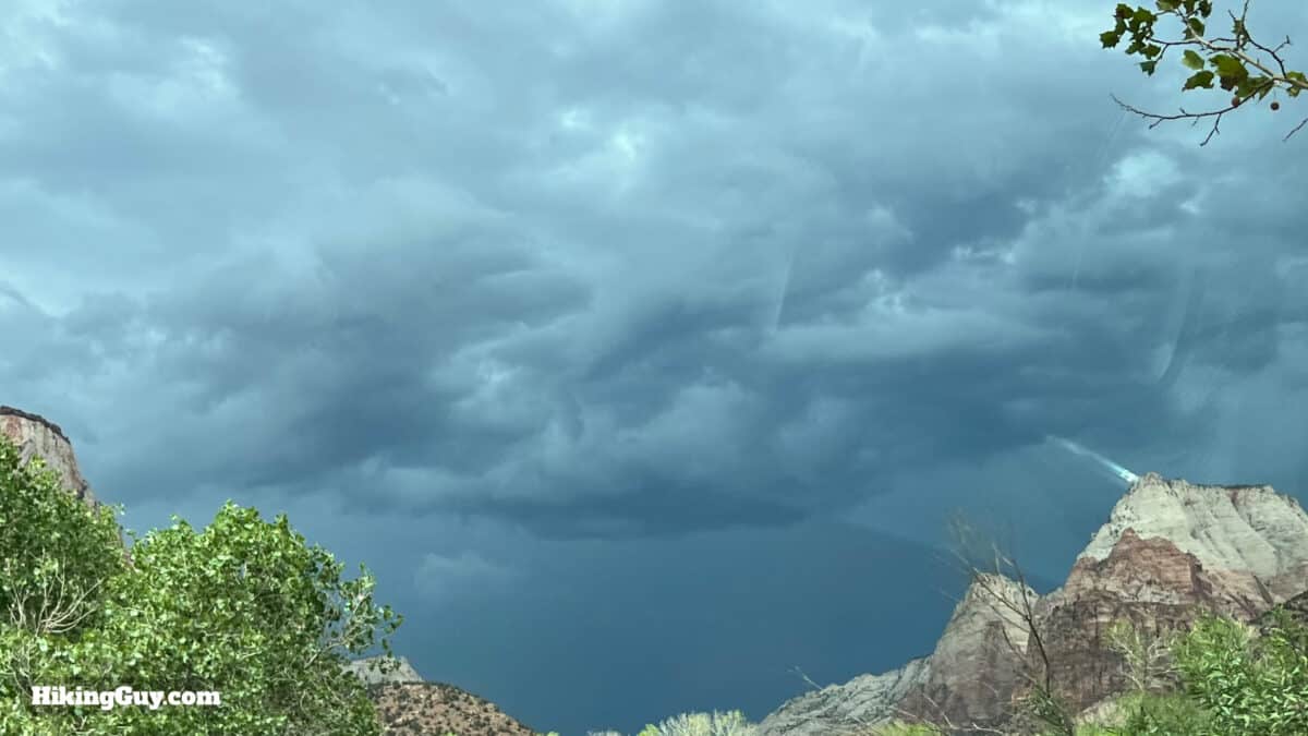
Most people visit the park and do The Narrows during the summer. Expect crowds at any time of day. The water is usually low enough to walk (relatively) easily, and the air and water temperatures are comfortable. The shaded canyon provides a welcome relief to higher summer air temperatures, which can easily be over 100F. The big risk in the summer is monsoon weather, which can produce sudden thunderstorms and flash floods in The Narrows. I'll go into detail later on how to check for this, but if you hike The Narrows in the summer, leaving in the early morning will be your best bet.
Fall
For me, the early fall is the best time to visit. The water levels are generally at their lowest, with warm temperatures, and the monsoon risk has passed. It doesn't mean that conditions can't be extreme, but typically, you have your best chances of a mellow experience. As fall progresses, the temperatures transition into winter, and it can snow in November.
Winter
Winter can be challenging in The Narrows, and I don't recommend hiking it during winter unless you have experience or are highly motivated. Snowmelt starts making the water very cold and high. Also, the Narrows can get snow and ice falling from the cliffs. You'll have to rent a dry suit and special gear to avoid hypothermia (more later).
Spring
The spring is generally the worst time to attempt The Narrows. Snowmelt is at its maximum, and the water levels are at their highest and strongest. The water is cold; you'll need some warm gear. The park generally closes The Narrows completely for periods when the water flow is too high. March and April are the worst, but by the end of spring, things start to get better.
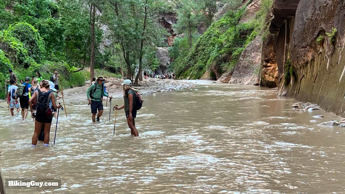
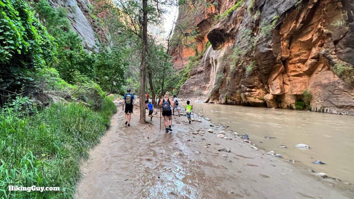
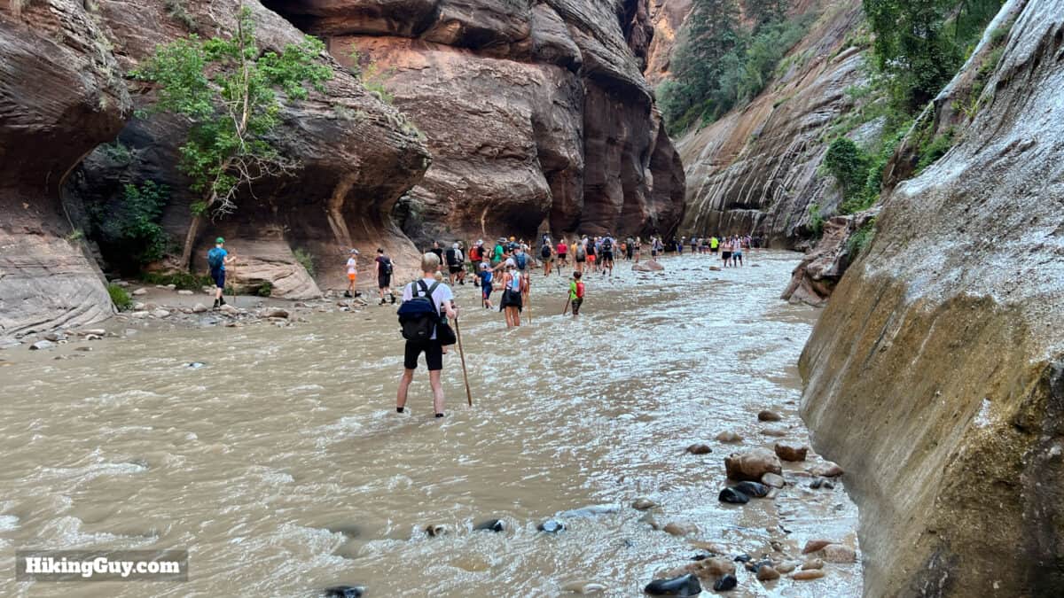
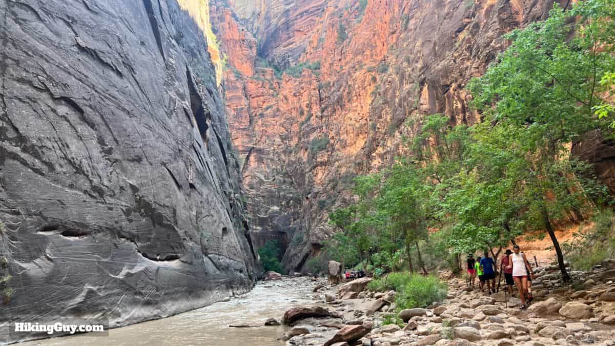
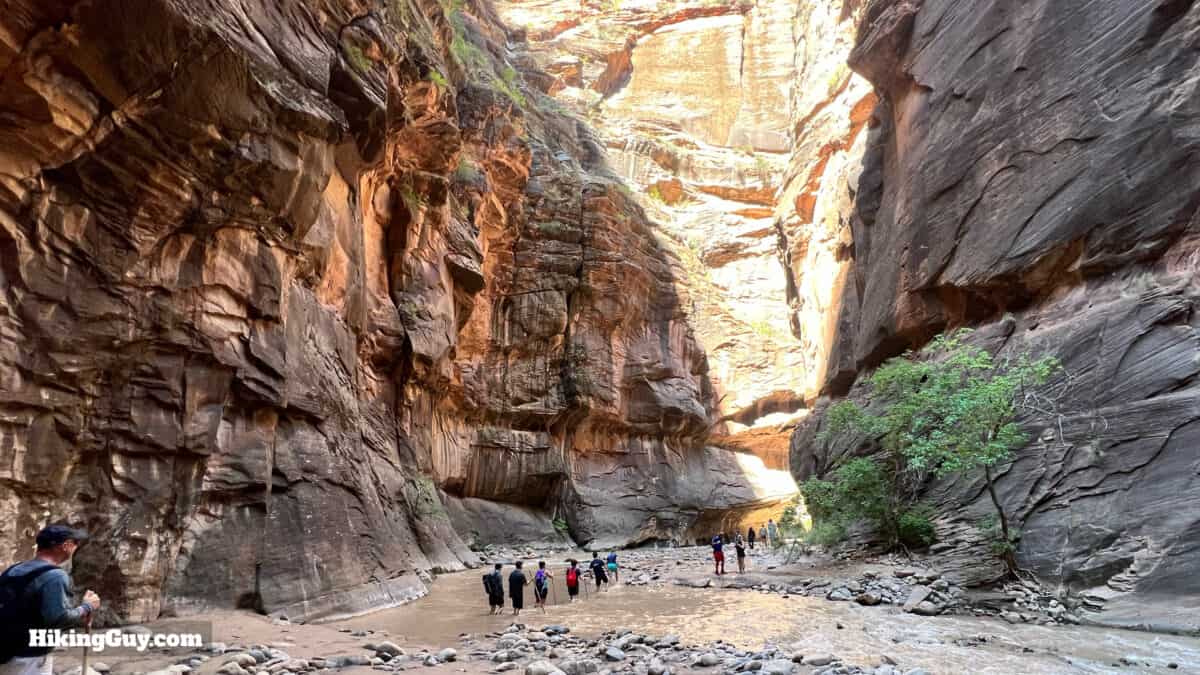
How Wet Should I Expect to Get?
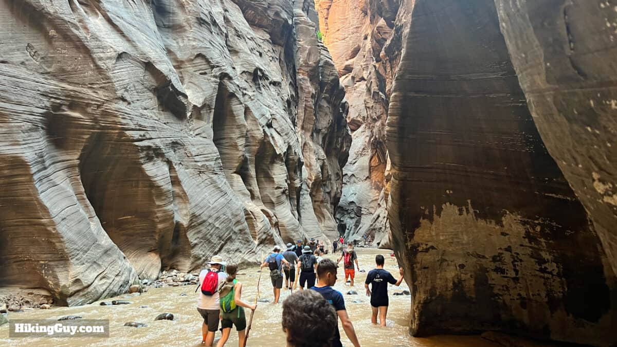
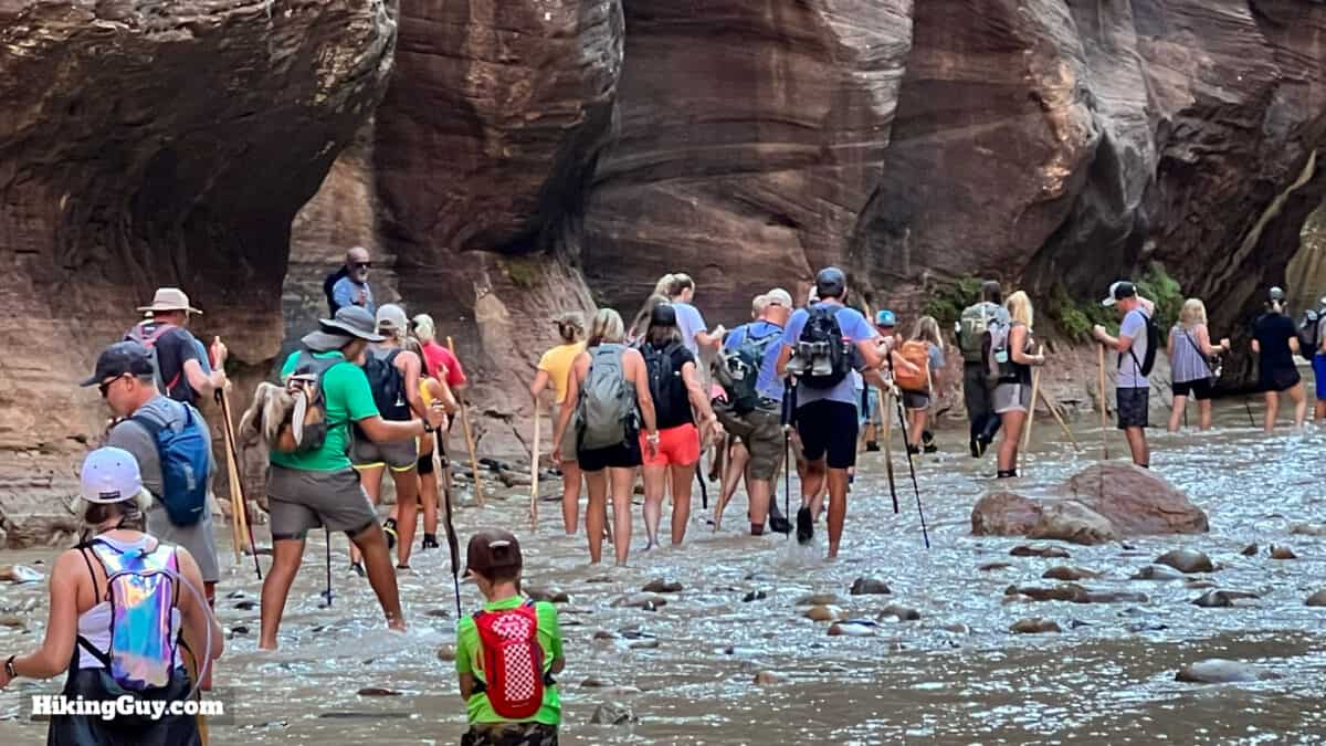
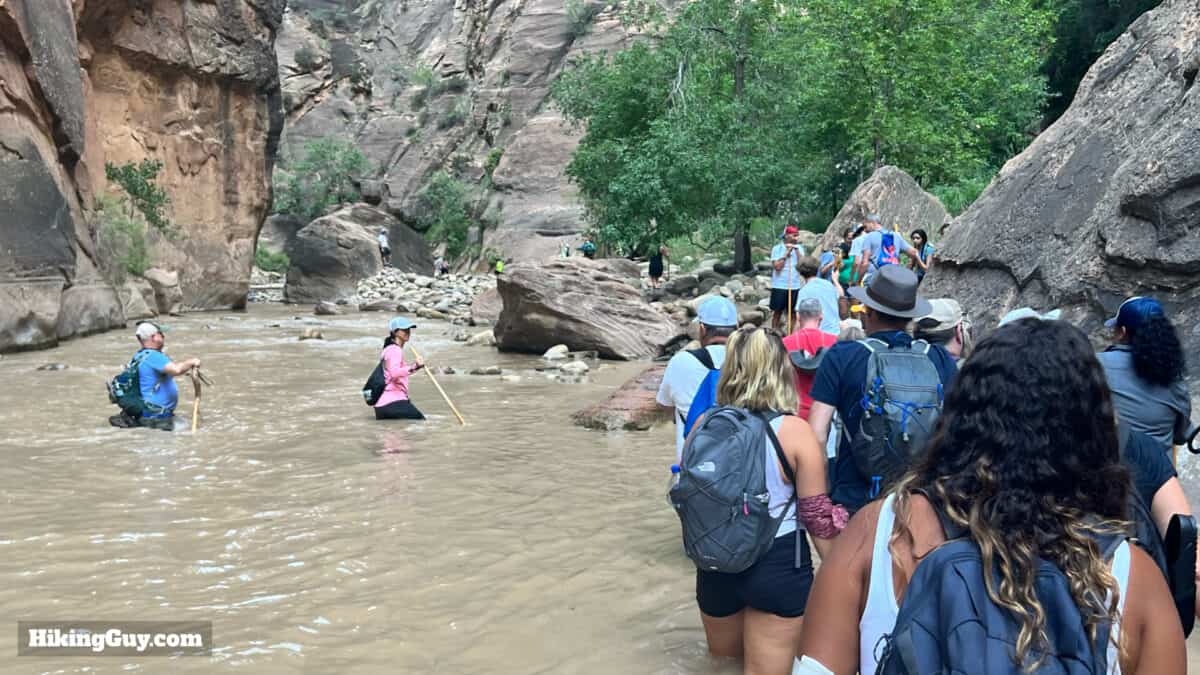
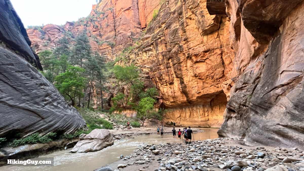
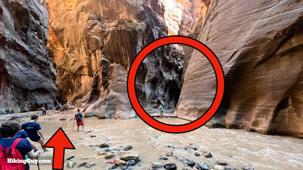
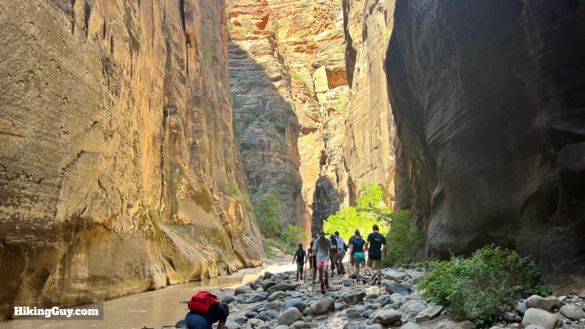
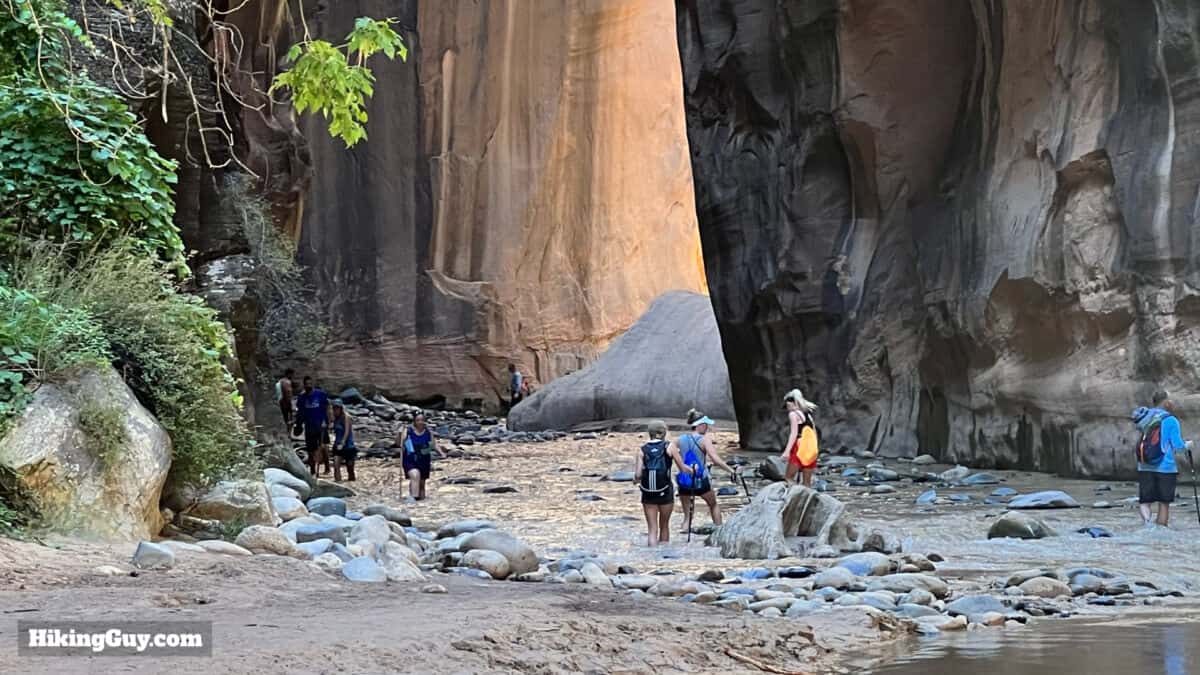
Here's how hiking The Narrows generally works. First, you start wading in the water, and then there is a mix of land and water as you hike upstream. Crowds usually bottleneck into shallow areas. The water is generally clear, so you can see how deep it is. Or it can be muddy, as in the previous picture, in which case you have to guess. Having trekking poles or a stick lets you sound the depth in front of you before you take a step.
Expect your pace to be much slower than hiking a typical trail. Walking through the water usually requires picking your step through rocks of many sizes. It takes a level of mental concentration that regular hiking does not.
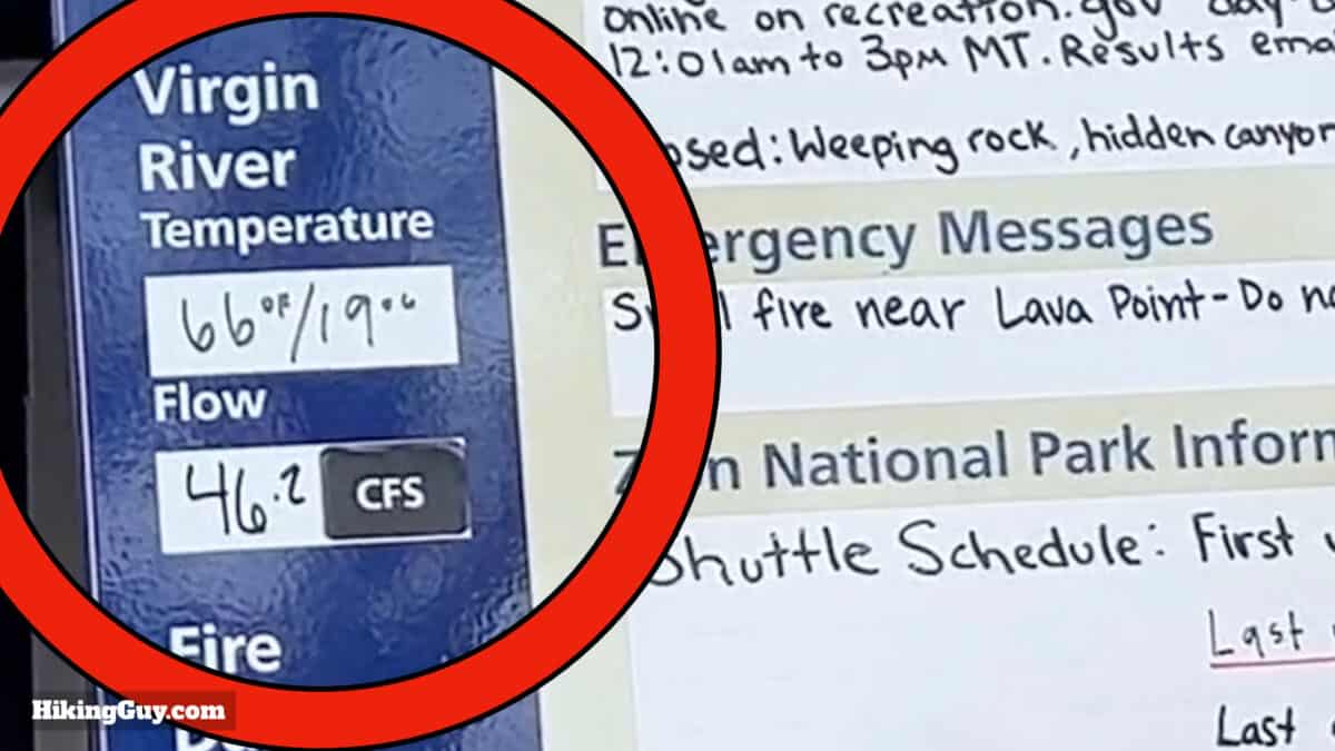
The constant flow of water means that the bottom of the river is always shifting. You can use the figures below to give yourself a rough estimate of how deep the water will be, but depending on your path or the recent shifts, there can be deeper sections.
| Flow Rating | Avg Water | Deepest to Cross | Conditions |
|---|---|---|---|
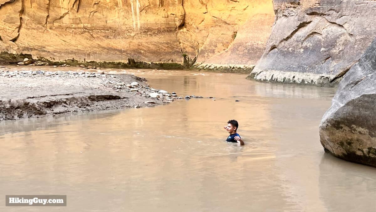
| 0-50 CFS | 1ft | 2-3ft | Expect to get wet up to your waist with casual wading. |
| 50-100 CFS | 1-2ft | 3-4ft | You'll feel the current and walking against it in swift sections can be challenging. |
| 100-150 CFS | 2-3ft | 4ft | Expect sections up to chest height with very slow going. I usually give The Narrows a skip when the flow is above 100. |
| Over 150 CFS | 3ft+ | 5ft+ | The Park Service closes The Narrows. |
Flash Floods
Flash floods kill people in The Narrows. When it rains anywhere in the Virgin River Narrow's 344-square-mile watershed, the water pours down the slick rock and eventually into The Narrows. The deluge comes in waves of higher and higher water, rushing downstream, carrying rocks, logs, and debris.. The water level in The Narrows can rise 12 feet in a matter of minutes. If there is a high risk of flash floods, you need to follow the advice of the Park Service and stay out of the area.
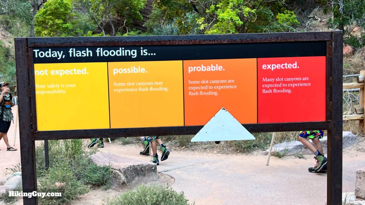
As the rangers say, "your safety is your responsibility," so here's what to do to stay safe.
- Keep your eyes open for thunderstorms in the distance. If you see dark clouds or hear thunder, get out of The Narrows. If it starts raining, get out of The Narrows.
- If the water goes from clear to muddy, if you hear roaring in the gorge, or if you start seeing debris floating by, turn around and get out.
- If the water starts rising while you are in the Narrows, immediately get to any high ground. Even getting a few feet higher can save you. Sheer cliff walls in some sections don't offer the possibility to get higher. Do your best to head downstream and find a spot.
- If you are swept into the water, try to keep your feet in front of you. Most deaths occur from blunt force trauma (probably followed by drowning).
- After a flash flood, water levels will stabilize and drop over the next 24 hours. Rangers will come up the canyon to save anyone stuck on higher ground. Stay put until a ranger arrives.

Statistically, the drive to Zion NP is much more dangerous than hiking The Narrows. So be cautious and prudent, but don't hike in fear.
Gear for Hiking the Narrows
There's a lot of hype around gear and gear rentals for hiking The Narrows. I've hiked it with specialized rental gear, and I've hiked it in trail runners with no poles. There are things you can do to make life easier, but you don't NEED to have anything fancy. Here's what I'd recommend and not recommend.
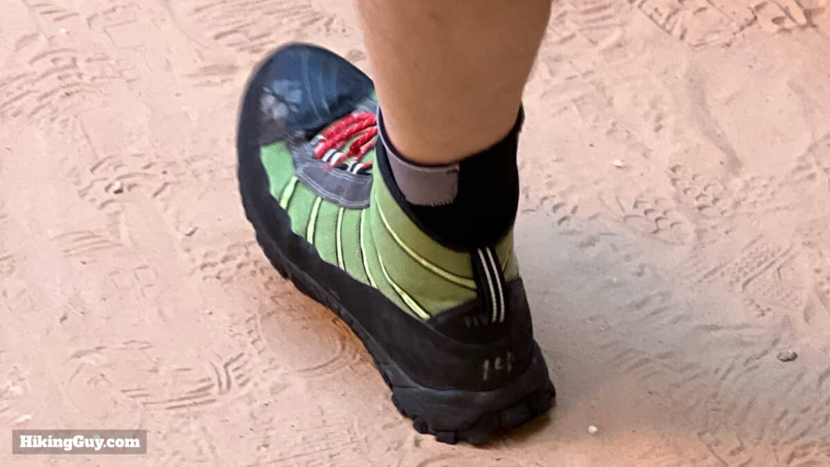
- Trail Runners or Hiking Shoes - You can rent specialized canyoneering water boots that offer ankle support from all the outfitters in nearby Springdale. I've done The Narrows with and without these. Doing the hike in my trail runners was fine; the rental boots didn't offer anything special. If you don't have trail runners, hiking shoes, or have very weak ankles, go ahead and rent the boots. Otherwise, use your regular hiking footwear. Don't get waterproof shoes for this hike; your feet will be underwater.
- Wood Stick or Trekking Poles - You can hike without a pole or stick, but it's much slower going. A pole will let you poke in front to check the depth and stabilize you as you put your weight onto the forward step. The beefy wood sticks that outfitters rent and sell are decent for beginners because they're impossible to break and dead simple. If you already have trekking poles, they'll work fine. Sometimes you can find discarded sticks at the beginning of the water portion of the hike. You can also buy them at the Visitor Center gift shop and supermarkets in Springdale. Or just find a nice stick somewhere for free.
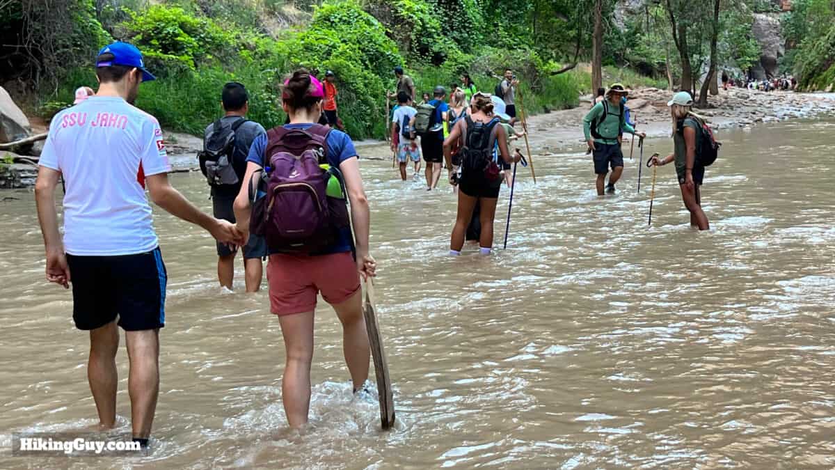
You'll notice that almost everyone has a pole or stick. If you choose not to use one, step slowly and don't commit all your weight onto the next step until your foot is secure. You can also try crossings by walking sideways with a wide stance, giving you more stability. - Plan on Getting Wet From the Waist Down When Under 70 CFS - A safe bet is to store your valuables in a Ziplock bag in a secure spot of your backpack. Use your phone for pictures and maps, keep it in a dry, floating necklace for easy access. Fitness or quick-dry clothing is your best bet at The Narrows. A backpack should keep your gear above the water in normal conditions; if it gets deeper, take the backpack off and hold it over your head.
- Neoprene Socks - When the water temperature is above 60F or so, just wear regular wicking socks (not cotton). When the water is cooler, say 50-60F, having neoprene wet socks will keep your feet warm. They're like a surfing wetsuit for your feet. I aslo use them on normal rainy and cold hikes with my trail runners.
- No GPS / Satellite Communicator - Even the best multi-band GPS units designed to work in canyons struggle in The Narrows. Don't rely on the distance shown on your GPS or smartphone app. It will probably be wrong (but it might be close). Likewise, emergency beacons that use satellites don't work well here. Instead, use landmarks along the hike with this guide to gauge your progress.
- Water - Just because you're in water doesn't mean you can drink it. Even regular hiking water filters won't filter out the deadly cyanotoxins found in the water here. Bring at least 1L of water, and if it's very hot, 2L. Bring snacks like nuts or granola bars while you're at it.
- Emergency Gear - The best thing you can do is carry a flashlight or headlamp (ideally LED). If you get caught out after dark, having a light will let you make your way out of the canyon, which gets very dark as the sun goes low. It's also smart to bring a set of dry layers in a Ziplock bag.
- Cold Weather Gear - My "don't bother renting" exception is when it's cold out. Then you'll want your body to be as warm as possible to prevent hypothermia. If it's a colder season or the water is below 55F, I'd recommend going to an outfitter in Springdale and renting whatever they recommend. They have dry suits and bibs to keep you warm. When in doubt, play it safe and rent. There are several outfitters in Springdale, and they all offer similar packages and prices.
Gear That I Love Right Now
Nothing is sponsored or promoted, just the actual gear that I use.


Check out the complete list here. ( Updated July 2024)
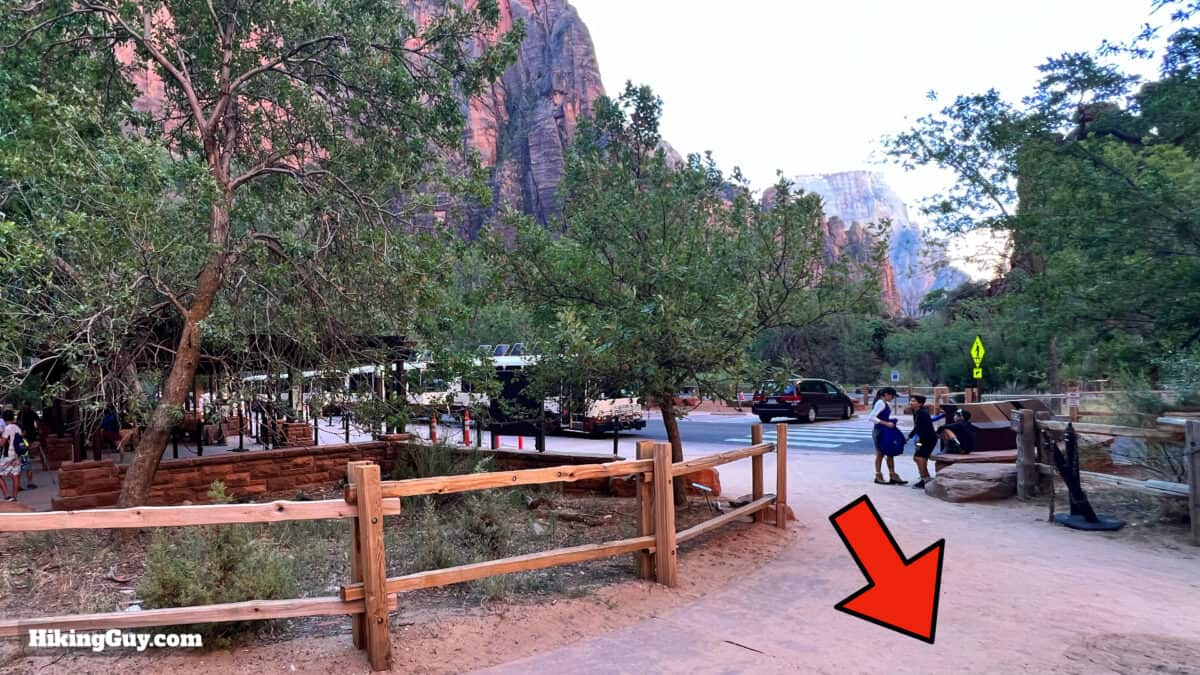
Getting to the Narrows Hike
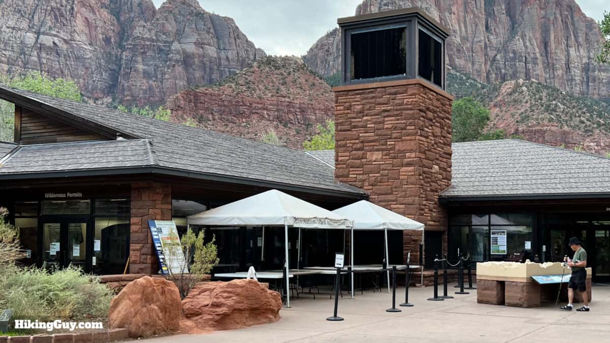
The Narrows hike starts at the end of the road in Zion Canyon, at the Temple of Sinawava. In most seasons, you'll have to take a shuttle bus to start the hike. Note that there can be a line for the first shuttle bus, usually comprised of hikers heading to The Narrows and Angel's Landing. To ensure you arrive on one of the first buses, get in line 30 minutes before the first scheduled departure.
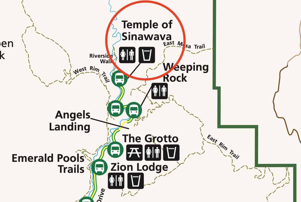
If you're driving to the trailhead (when the road is open), this is the address to use:
Temple of Sinawava, Zion Canyon Scenic Dr, Springdale, UT 84779
The Narrows Trail Maps
How Will You Navigate?
 Using the Apple Watch for Hiking
 Garmin Fenix 7 & Epix Review For Hikers
 How To Read a Topographic Map
 Garmin GPSMAP 67i Review
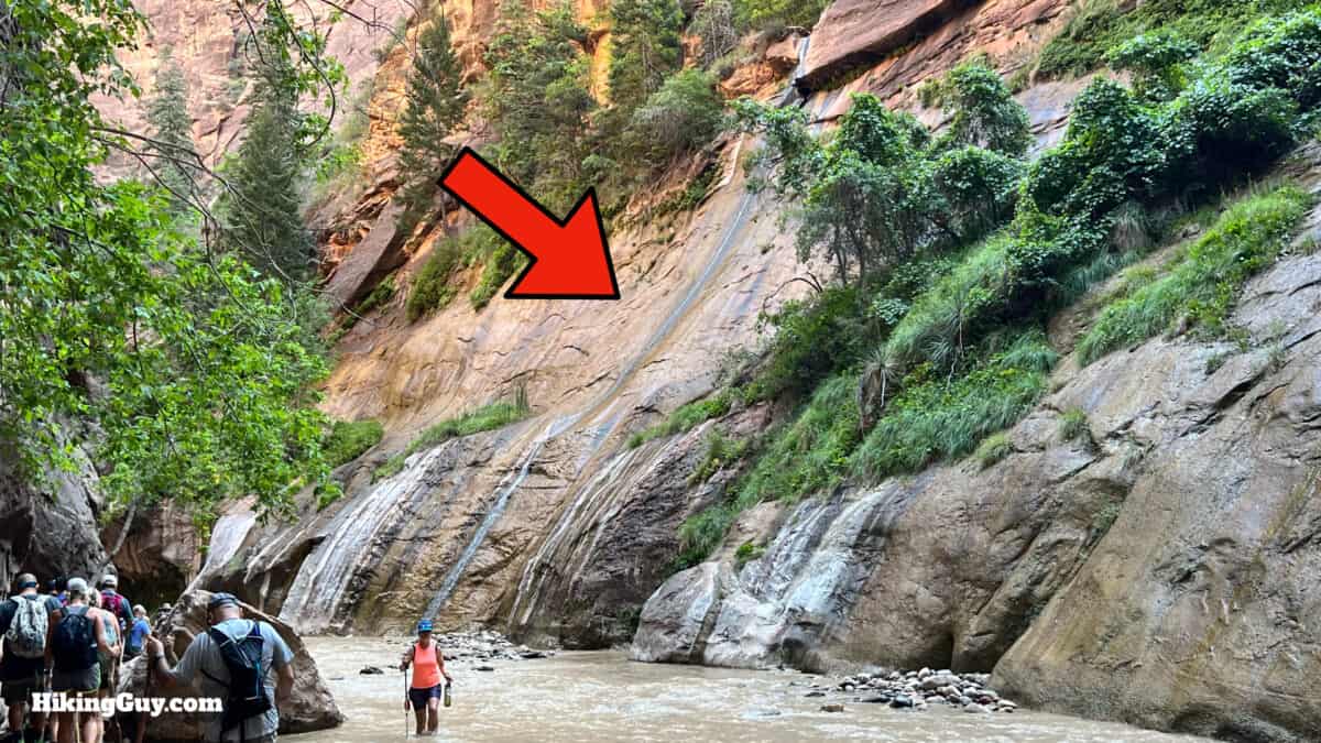
Landmarks on the Hike
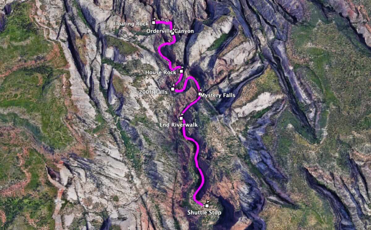
When looking at distances in The Narrows, they are based on a straight line of walking up the river. But the reality of The Narrows is that you'll be crisscrossing the river as you make your way upstream, adding to the overall distance. So the distances here are not based on the straight line but instead on a more realistic zigzagging pattern. They can vary based on how much you zigzag or don't.
| Landmark | Distance |
|---|---|
| Temple of Sinawava Shuttle | 0.0 |
| End of Paved Riverwalk | 1.0 |
| Mystery Falls | 1.3 |
| Narrows Alcove | 1.7 |
| House Rock | 2.0 |
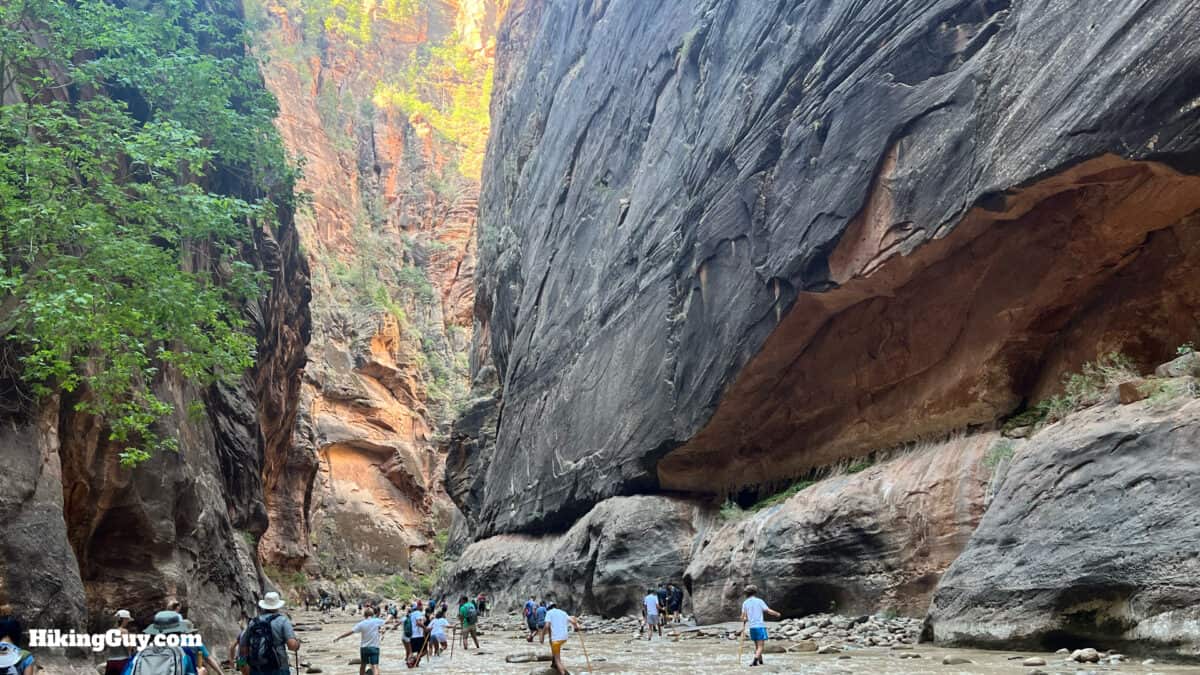
| Oderville Canyon / Wall St | 3.0 |
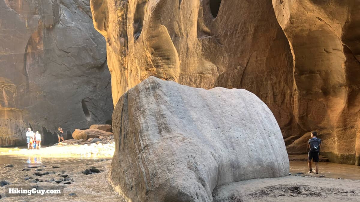
| Floating Rock | 3.7 |
Navigation Tips
The good news is that you don't have any navigation challenges. You're just walking up along the river. You can walk as far as Big Springs (about 4.5 miles from the shuttle) without a permit. This guide will bring you up to Floating Rock, in the heart of the Wall Street section and next to a small raised area ideal for a snack and rest. Your best bet for navigation is to take the PDF map below on your phone and save this guide's screenshots to your phone. Don't rely on a GPS distance.
The Narrows is about the journey, not the destination.National Park Service
If you've had enough, just turn around. This hike is not for everyone.
Bathrooms
There are none. There are no good places to hide and go. Use the toilet before you start hiking and then do your best.
3D Map
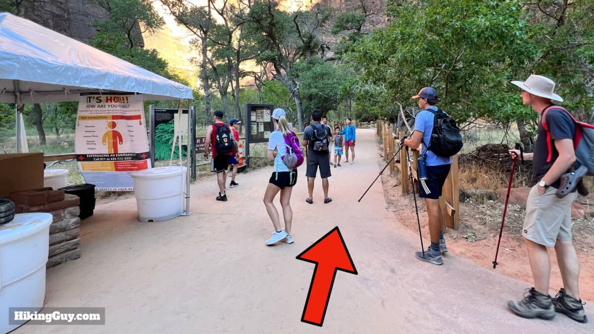
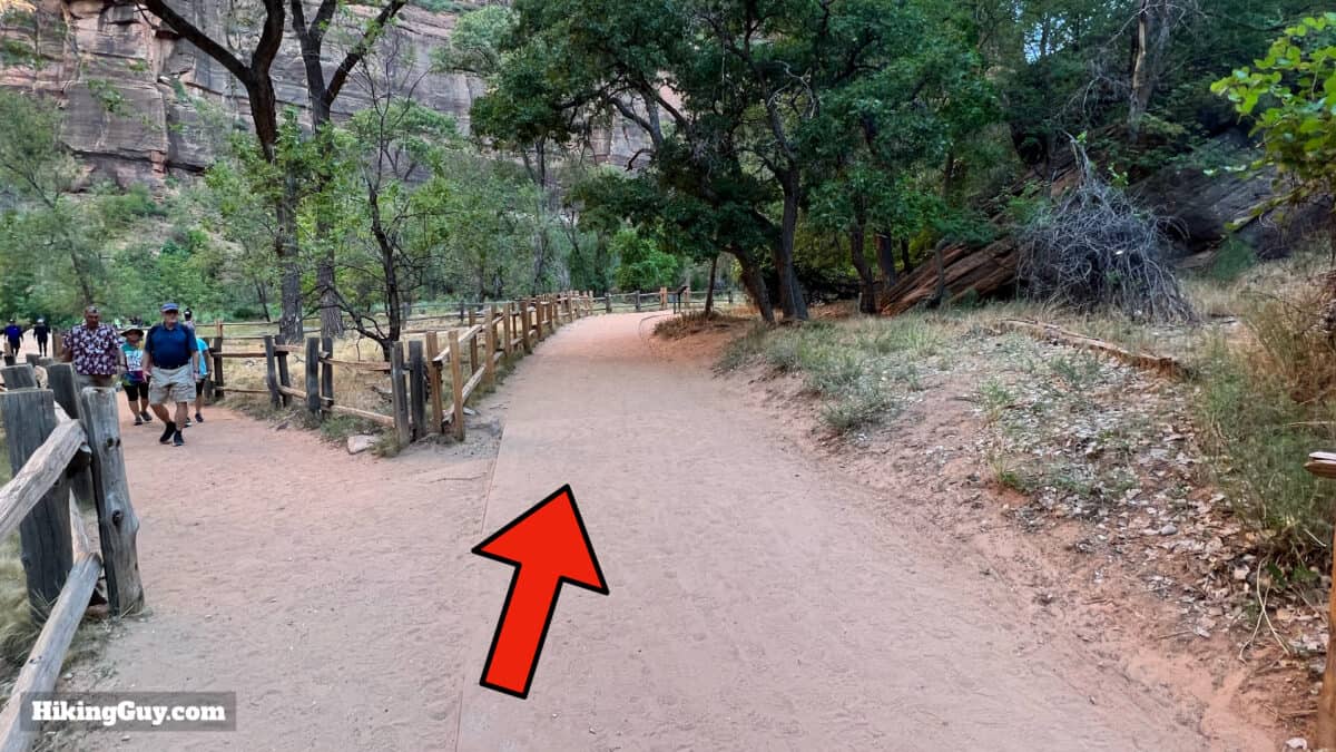
The Narrows Hike Directions
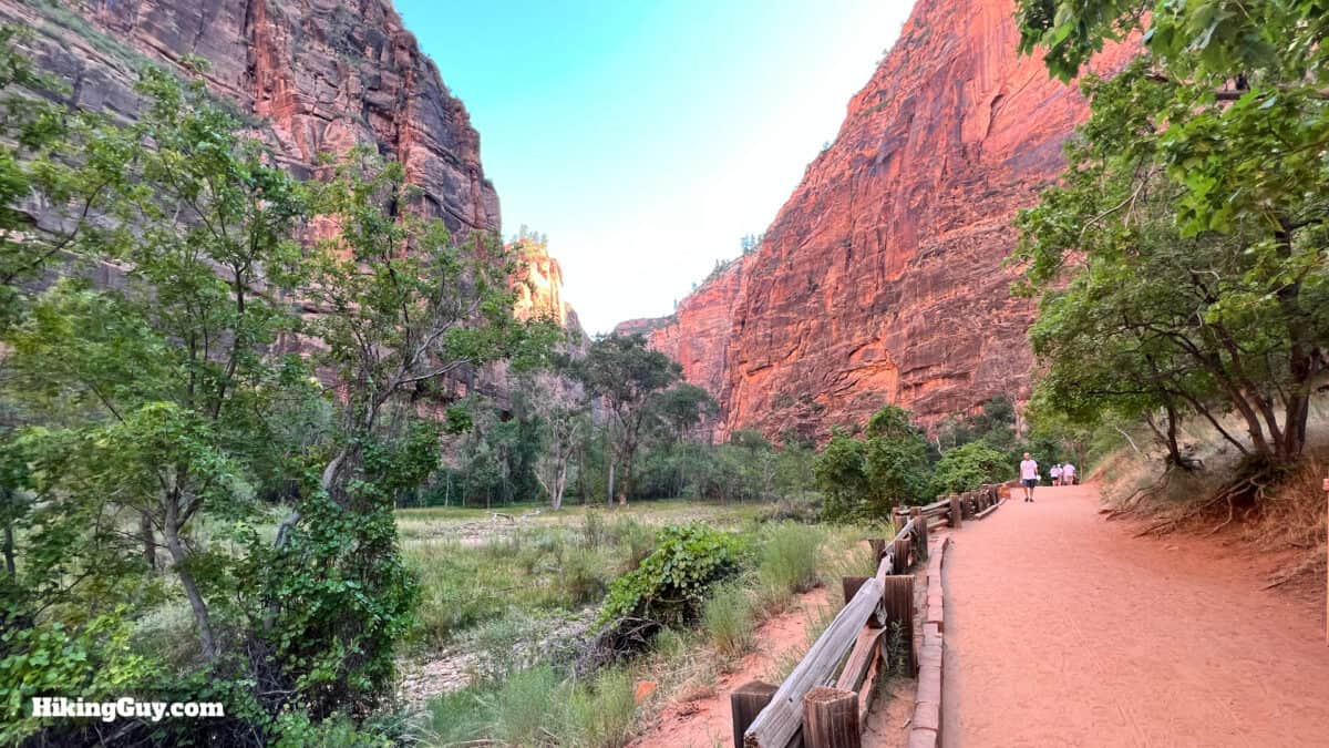
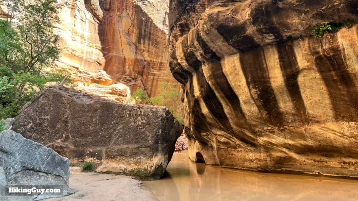
Riverside Walk to Narrows Gateway
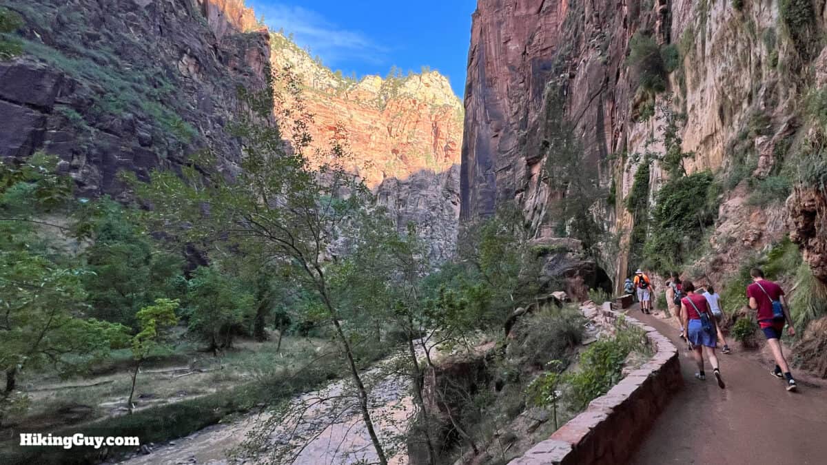
Narrows Gateway to Mystery Falls
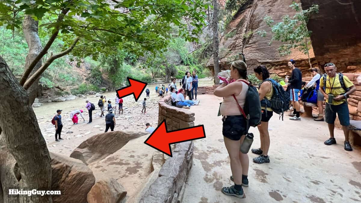
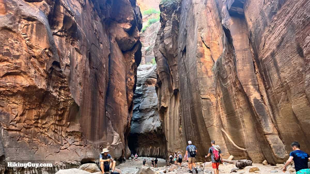
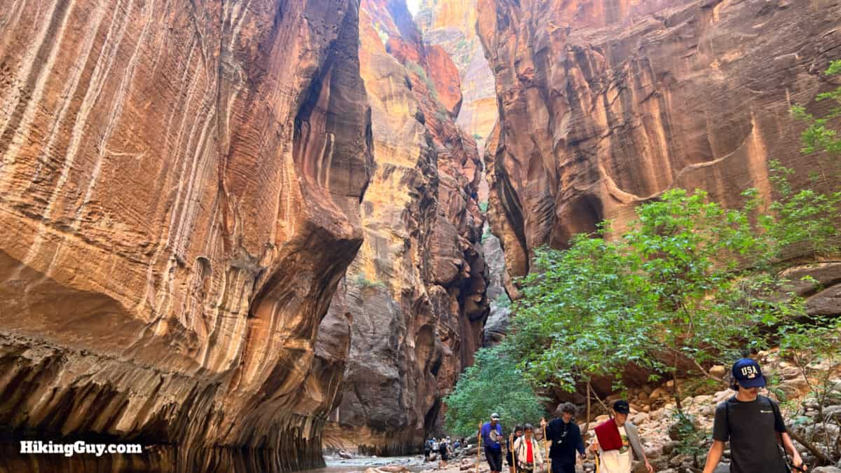
Mystery Falls to Wall Street
Need More Info?
- Have a question about the guide? Join my Patreon and ask me a question.
- When planning, always check the park website and social media to make sure the trails are open. Similarly, check the weather and road conditions.
- Do you have an update to this guide? View the Youtube comments for this video. Leave a comment and I will do my best to update the guide.
 Hike Scout Lookout (Zion)
 Canyon Overlook Trail (Zion)
 Zion National Park
Popular Guides
 Best Hiking Gear 2024
 Hiking Boots or Shoes: Do I Really Need Hiking Boots?
 When to Hit SOS on inReach
This Guide Was Written by Cris Hazzard

Hi, I'm Cris Hazzard, aka Hiking Guy, a professional outdoors guide, hiking expert, and author based in Southern California. I created this website to share all the great hikes I do with everyone else out there. This site is different because it gives detailed directions that even the beginning hiker can follow. I also share what hiking gear works and doesn't so you don't waste money. I don't do sponsored or promoted content; I share only the gear recommendations, hikes, and tips that I would with my family and friends. If you like the website and YouTube channel, please support these free guides (I couldn't do it without folks like you!). You can stay up to date with my new guides by following me on YouTube, Instagram, or by subscribing to my monthly newsletter.