

The Lone Mountain Trail takes you to an isolated, rocky peak that offers great views of Las Vegas and the surrounding mountain ranges, including a peak at Mt Charleston. The hike is only minutes from downtown Las Vegas and is a popular workout spot for locals. There are a few trail options up Lone Mountain. This guide takes you up the main Lone Mountain Trail, a safe but tough little hike. Lone Mountain Trail is a great place to take a break from the hustle and bustle of Las Vegas.
- Turn by Turn Hike Directions & Video
- Maps For the Hike
- How to Get to Lone Mountain Trail
Getting To Lone Mountain Trail
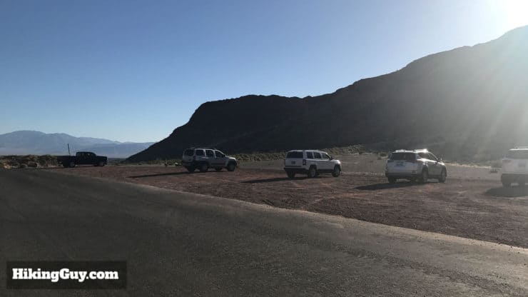
Here's the address to the trailhead: 15 Vegas Vista Trail, Las Vegas, NV, 89129, USA. There are multiple places to park and multiple trailheads, this is the best (and big) parking lot for the main Lone Mountain Trail hike. You don't enter through the official entrance to Lone Mountain Regional Park.
The parking lot is large and has plenty of room, although the hike itself does get crowded at times. Parking is free.
There are no bathrooms on the hike. The closest options are fast food restaurants nearby.
Don't expect pristine wilderness. You'll see some graffiti and probably trash. Just remember that you're in Las Vegas. If you have the time to go a little farther out, the hikes in Red Rock Canyon are incredible.
What You Need For The Hike
Check the weather. It can be in the 100s here in the summer, in which case you should give this hike a skip. Otherwise fitness clothing is fine, you don’t really need any specialized hiking gear. Bring plenty of water, even though it's a short hike.
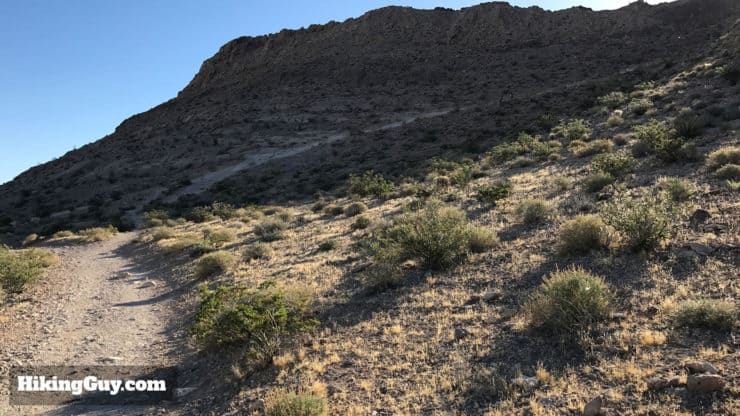
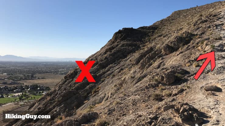
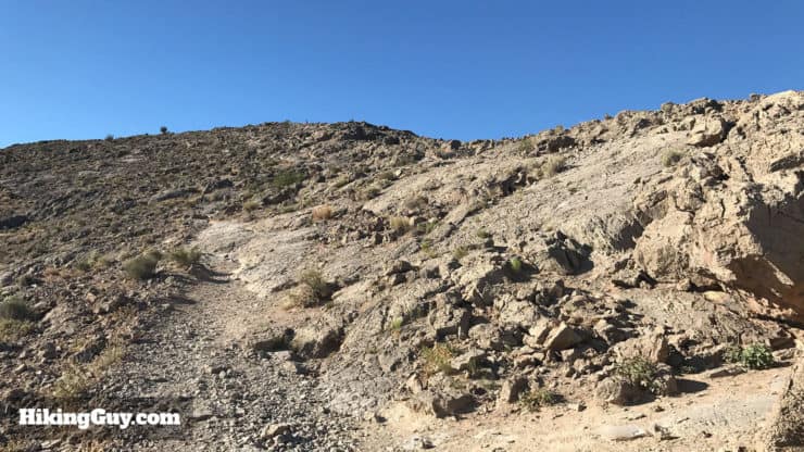
Lone Mountain Trail is very steep with loose gravel on the descent. Take your time and don't be ashamed to shimmy down on your butt if you need to. Dress appropriately.
Gear That I Love Right Now
Nothing is sponsored or promoted, just the actual gear that I use.


Lone Mountain Trail Maps
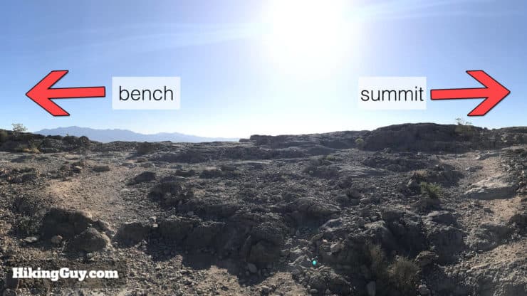
Note, there are several trails up Lone Mountain. This guide covers the easiest to follow (and most popular) "regular route." There are other options that are less-used and a little more dangerous, so I don't recommend them unless you've been here before and are familiar with the mountain.
There's also a nice (flat) loop hike around Lone Mountain that you can do. Just follow the wide loop path around the mountain.
How Will You Navigate?
 Using the Apple Watch for Hiking
 Garmin Fenix 7 & Epix Review For Hikers
 How To Read a Topographic Map
 Garmin GPSMAP 67i Review
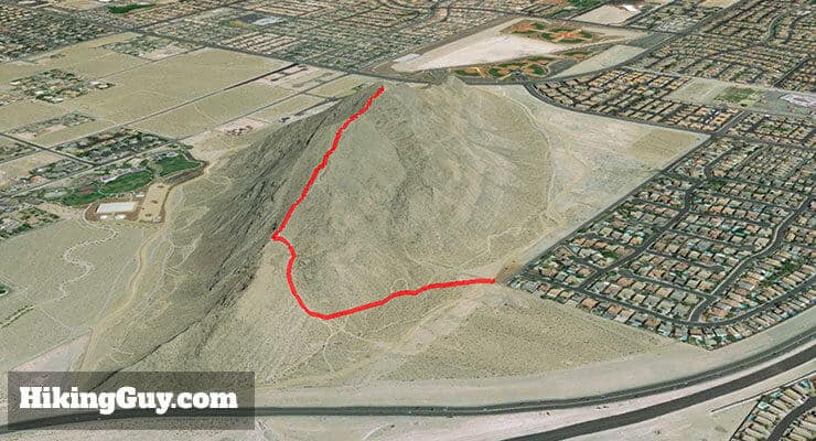

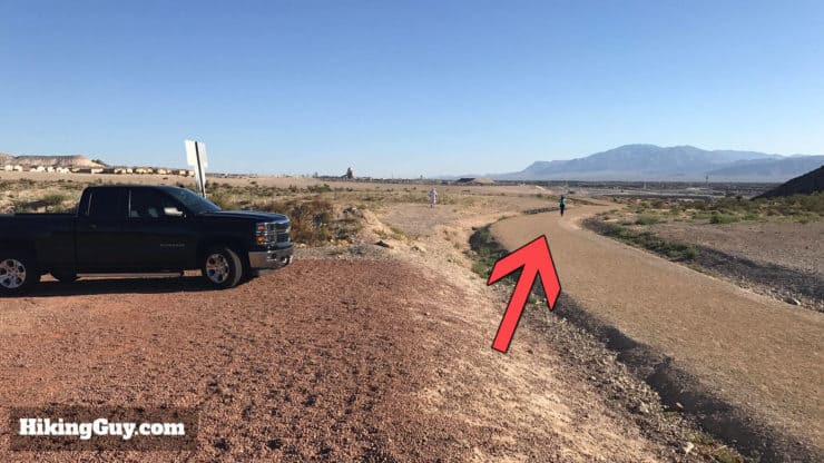
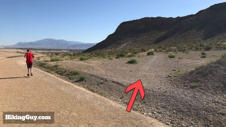
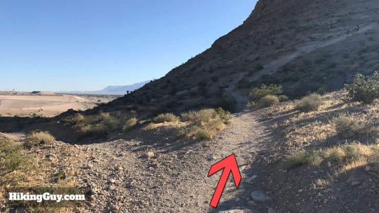
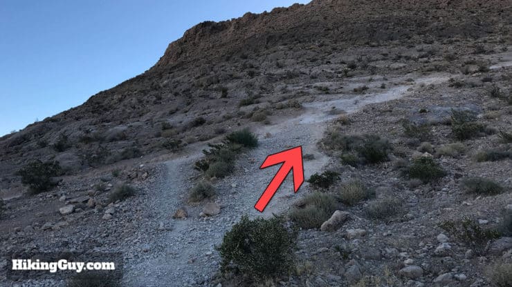
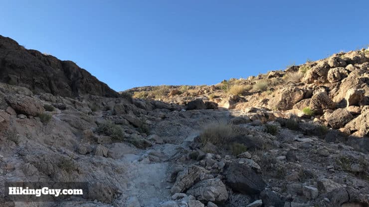
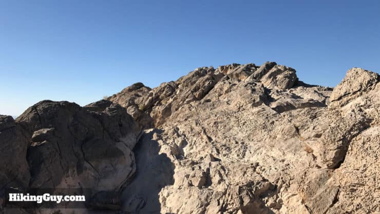
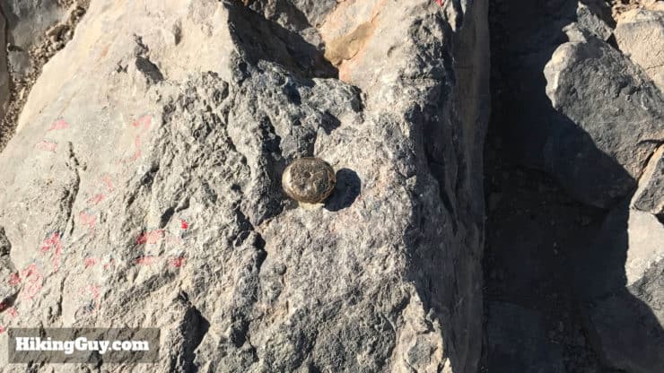
Lone Mountain Trail Hike Directions
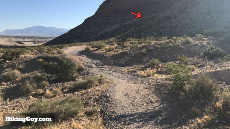


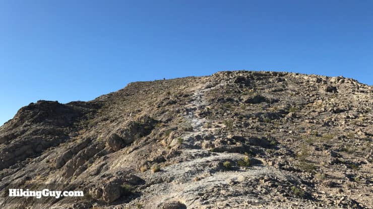
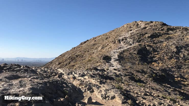


Once you've had enough of the summit, just go down the way you came. It's steep, so watch your footing.
Need More Info?
- Have a question about the guide or want to see what other people are saying/asking? View the Youtube comments for this video. Leave a comment and I will do my best to respond.
- When planning, always check the park website and social media to make sure the trails are open. Similarly, check the weather and road conditions.
Related Guides
 Turtlehead Peak Trail
 Calico Tanks Trail
 Mt Charleston Peak Hike - South Loop Trail
 Las Vegas Hikes
Popular Guides
 Best Hiking Gear 2024
 Hiking Boots or Shoes: Do I Really Need Hiking Boots?
 When to Hit SOS on inReach
This Guide Was Written by Cris Hazzard

Hi, I'm Cris Hazzard, aka Hiking Guy, a professional outdoors guide, hiking expert, and author based in Southern California. I created this website to share all the great hikes I do with everyone else out there. This site is different because it gives detailed directions that even the beginning hiker can follow. I also share what hiking gear works and doesn't so you don't waste money. I don't do sponsored or promoted content; I share only the gear recommendations, hikes, and tips that I would with my family and friends. If you like the website and YouTube channel, please support these free guides (I couldn't do it without folks like you!). You can stay up to date with my new guides by following me on YouTube, Instagram, or by subscribing to my monthly newsletter.