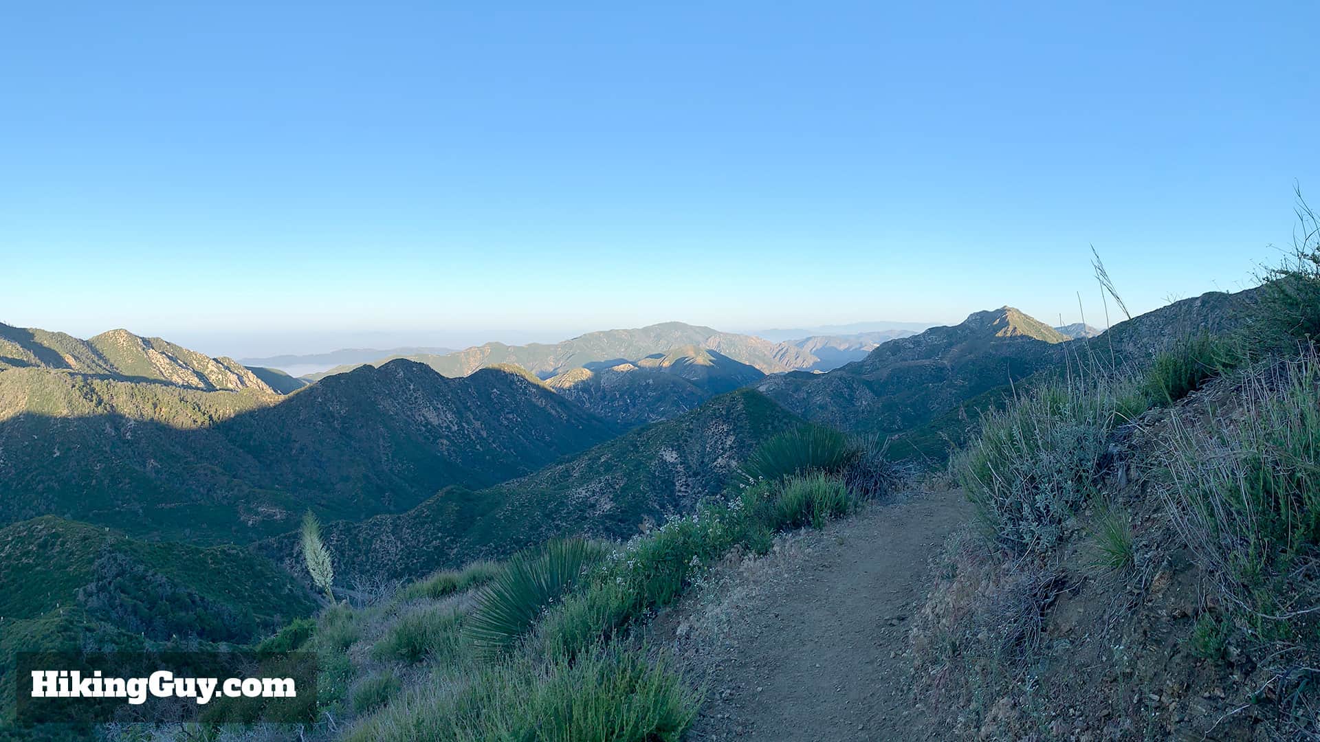
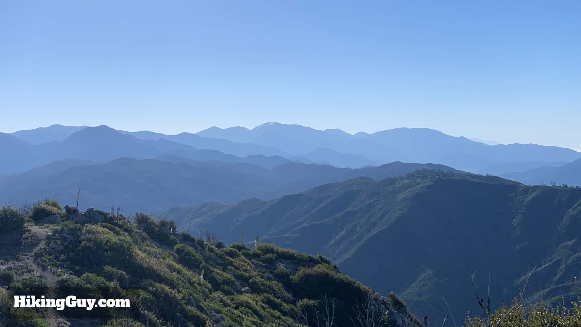
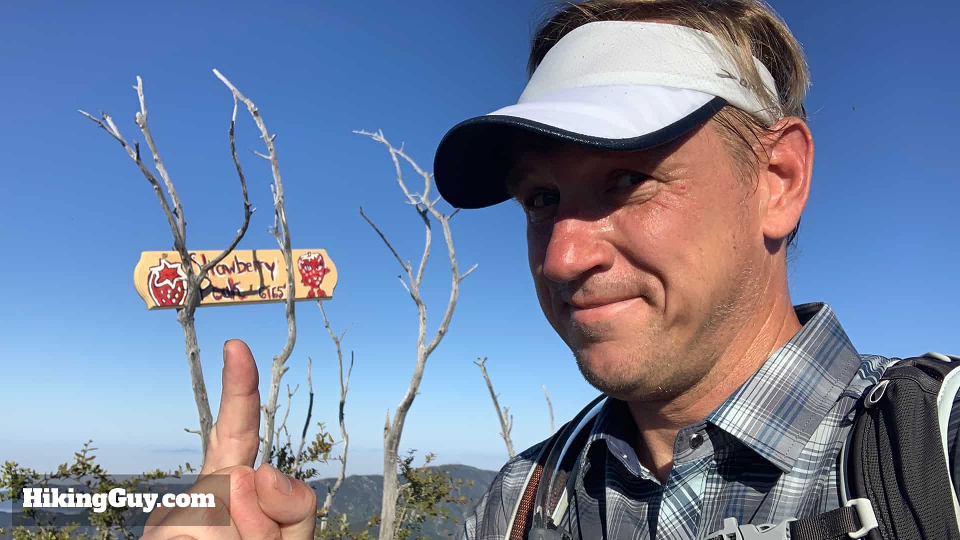
This Strawberry Peak hike offers a ton of great scenery in a relatively short distance. You wind around a ridge on Mt Lawlor with spectacular views, then do a short but tough climb to Strawberry Peak, the highest point in the front range of the San Gabriels at 6,164ft. You'll earn great views of LA, Mt Wilson, and Mt Baldy. It's a fun hike on its own, but even more attractive if you want to get a mountain climb in to build confidence for the higher peaks in the area.
Why is it called Strawberry Peak? Because it looks like an upside-down strawberry. So there's that.
Where is Strawberry Peak?
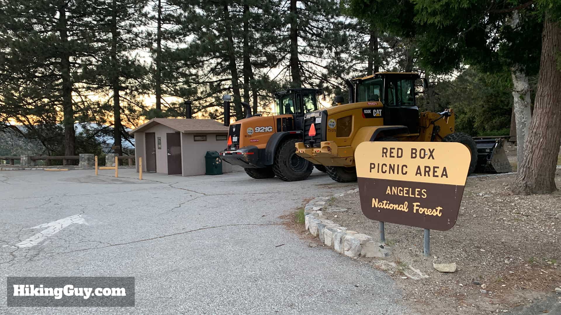
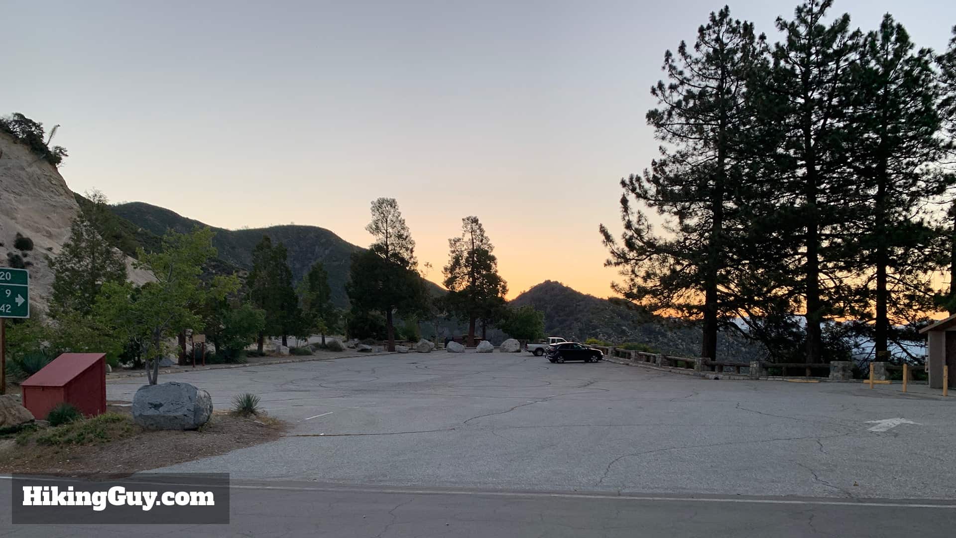
The trailhead for Strawberry Peak is in the easy to find Red Box Picnic area. You need a National Parks Pass or Adventure Pass to park here. There are primitive bathrooms and picnic benches, but no other services.
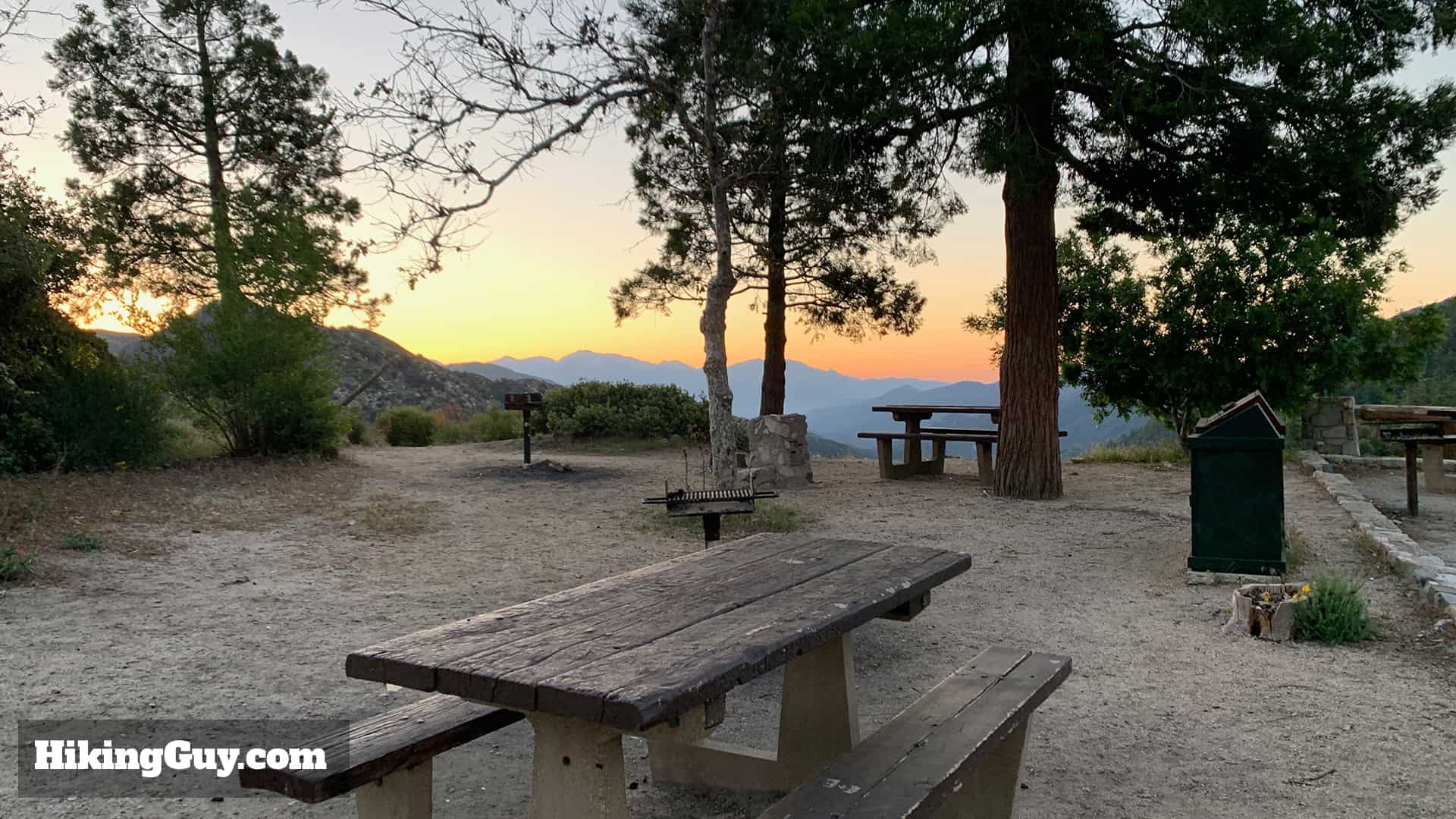
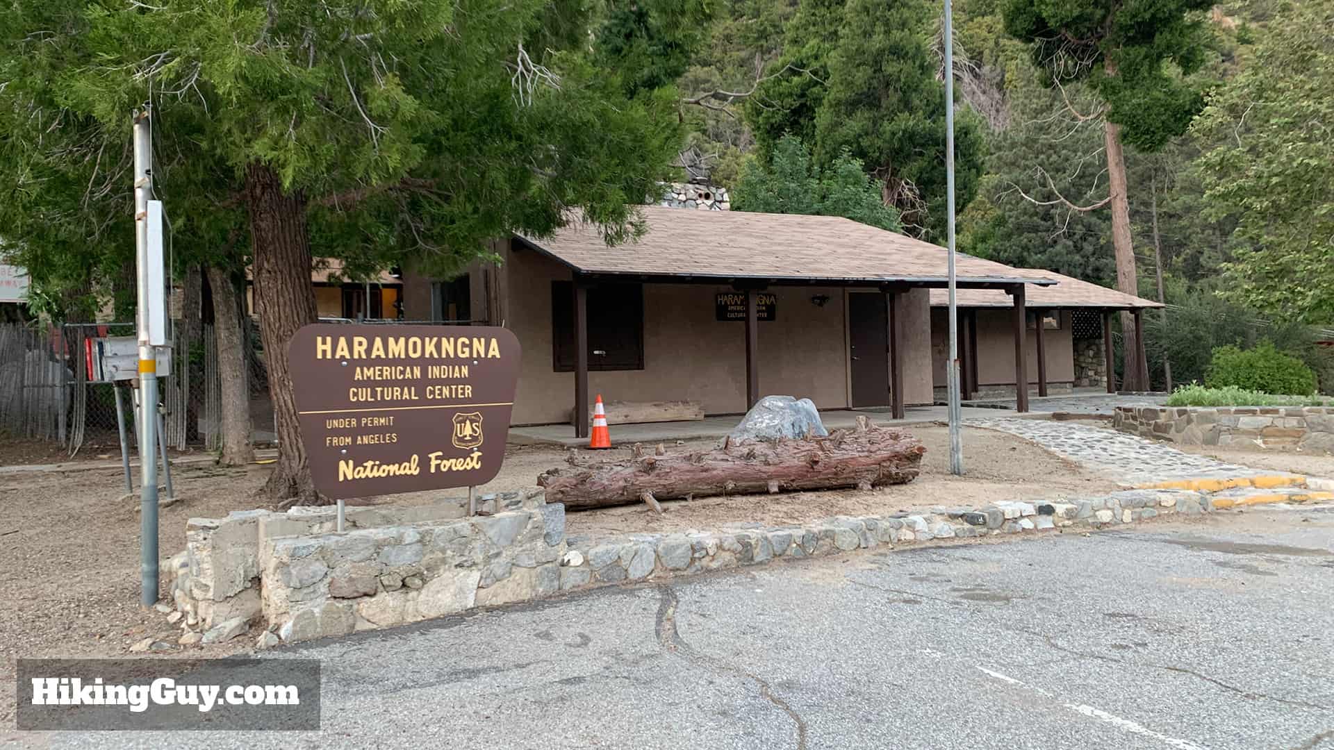
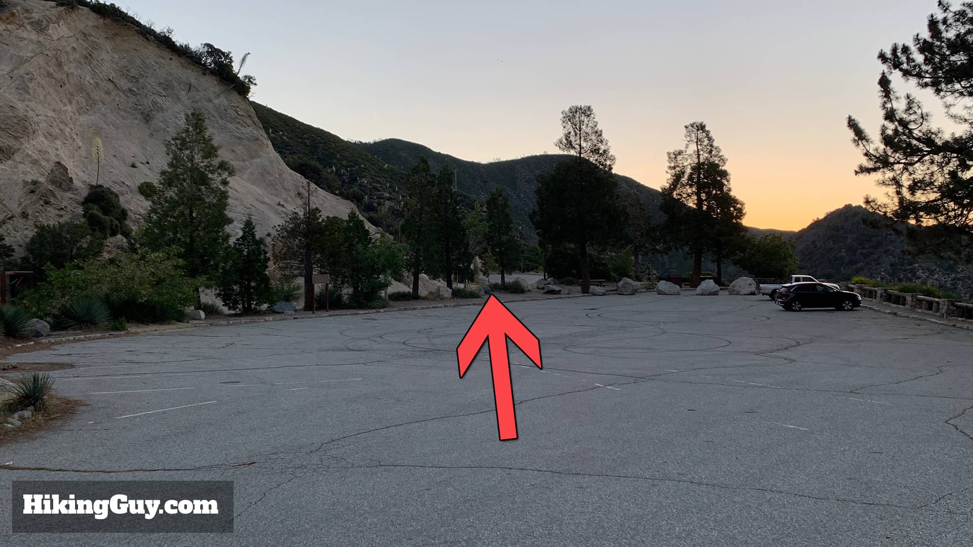
The Red Box Picnic Area trailhead is at the junction of Angeles Crest Highway and Mt Wilson Red Box Road. Mt Wilson Red Box Road is a popular road for people working on Mt Wilson, so you might see more traffic than you expect.There's a decent amount of parking here. It can get crowded later in the day.Red Box Picnic Area is a pretty awesome place for a picnic. I generally come early and eat my breakfast with the sunrise, but it's also a great place for a post-hike lunch.Right next to the picnic area is Haramokngna American Indian Cultural Center which celebrates the culture and history of the first peoples of Los Angeles County,
Gear For the Hike
One of the convenient things about Strawberry Peak is that you can generally climb it year round. It does occasionally get snow, but it tends to melt quickly. A more common scenario is sun and heat; there's minimal cover on this hike. It's generally best to leave very early when it's cool in the warmer month. Sunscreen and 2L of water are a safe bet here.
The last section is steep and if you like trekking poles on climbs or descents, this is a great place to have them.
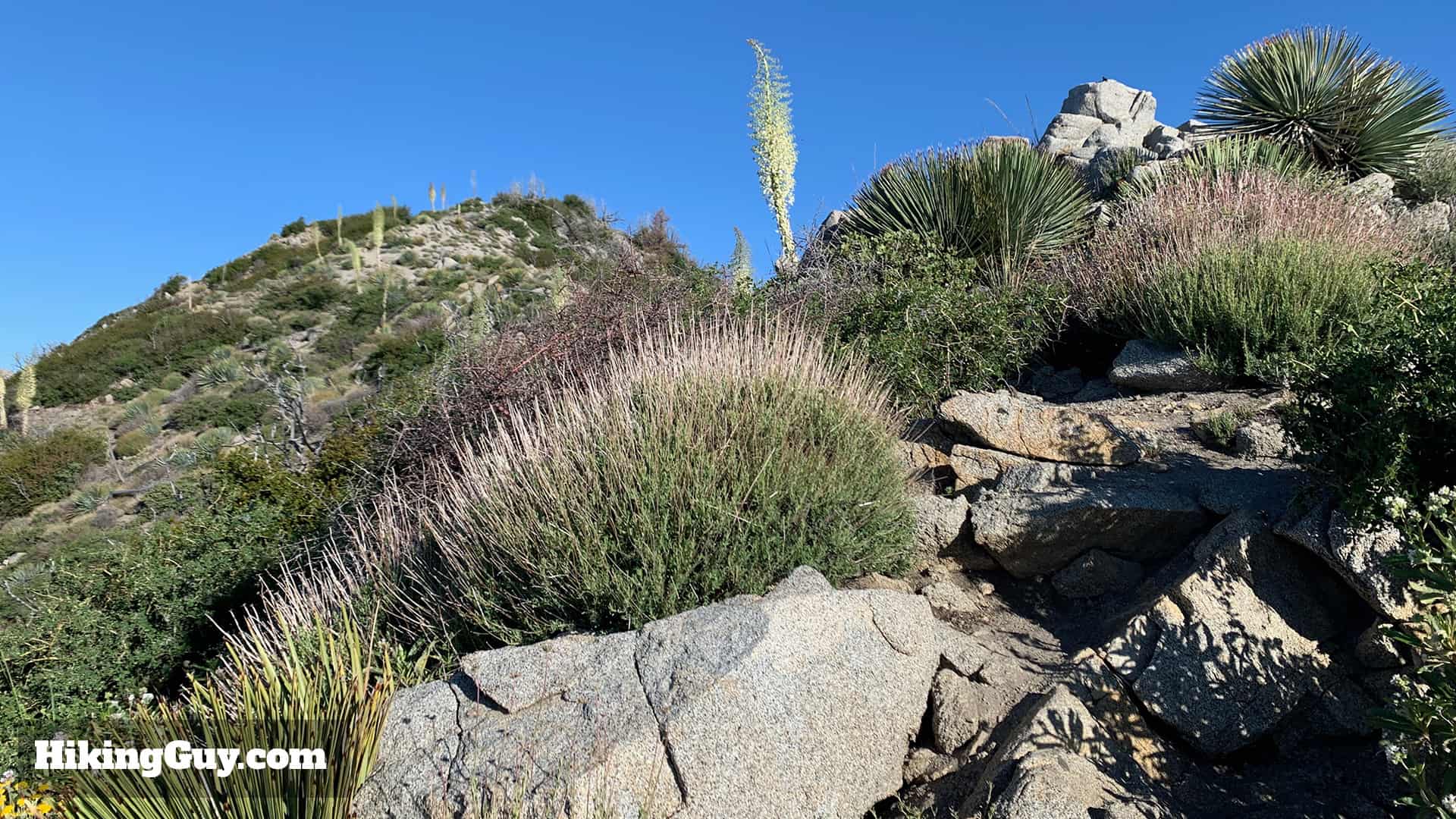
There's also a decent amount of brush along the trail, so long hiking pants are nice unless you have lizard skin legs like me.
If you want to check if there's snow on your hike, read this guide.
There are a few ways to hike Strawberry Peak, but this route from Red Box Picnic Area is probably the most common route and doesn't involve any scrambling. I highly recommend this route because you have great parking, bathrooms, and a very scenic route to the summit.
There are also some small side trails to Mt Lawlor and other points. In general, the side trails off this hike are pretty rough, so if you decide to improvise and mix up the route, just a heads up.
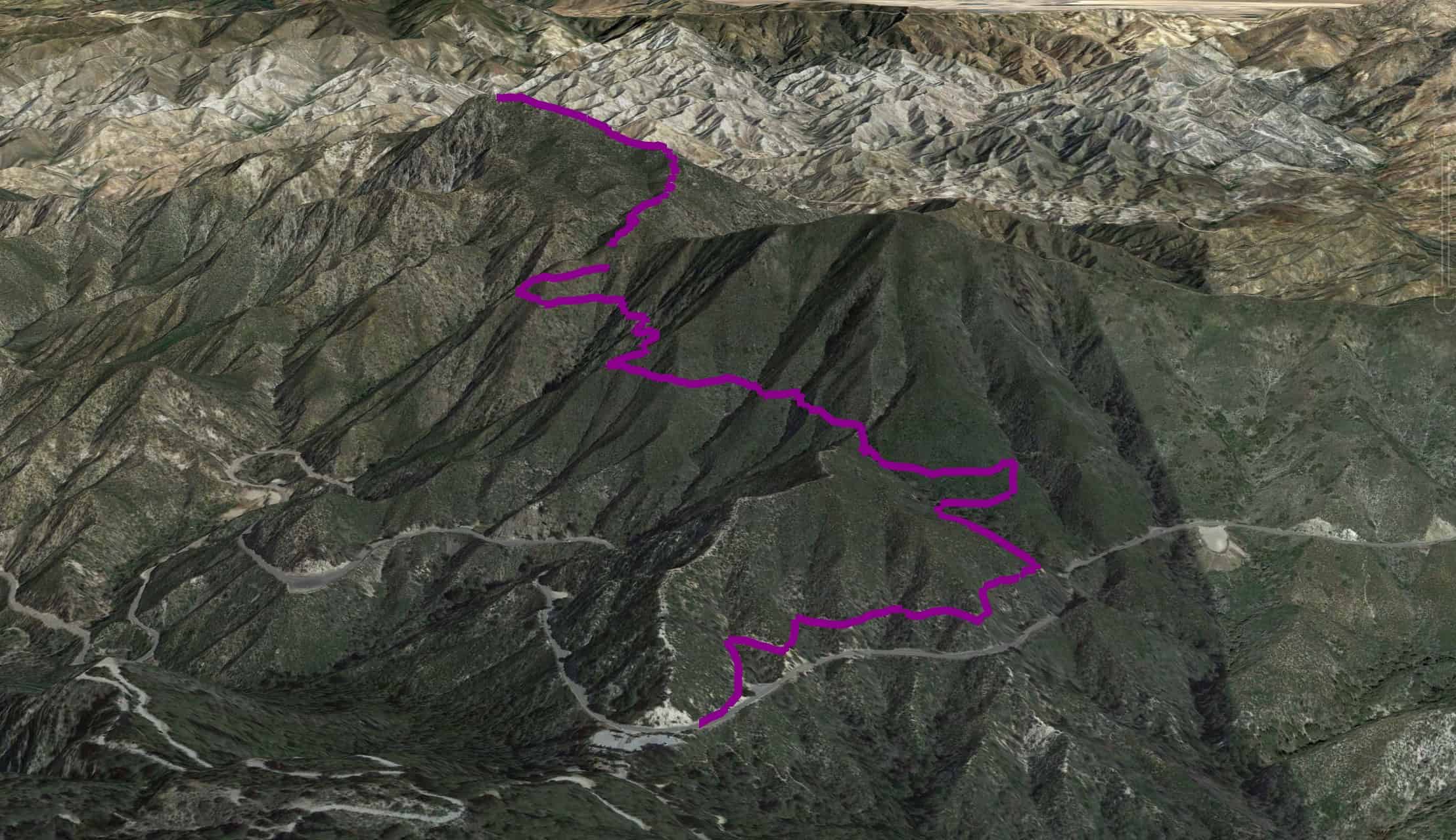
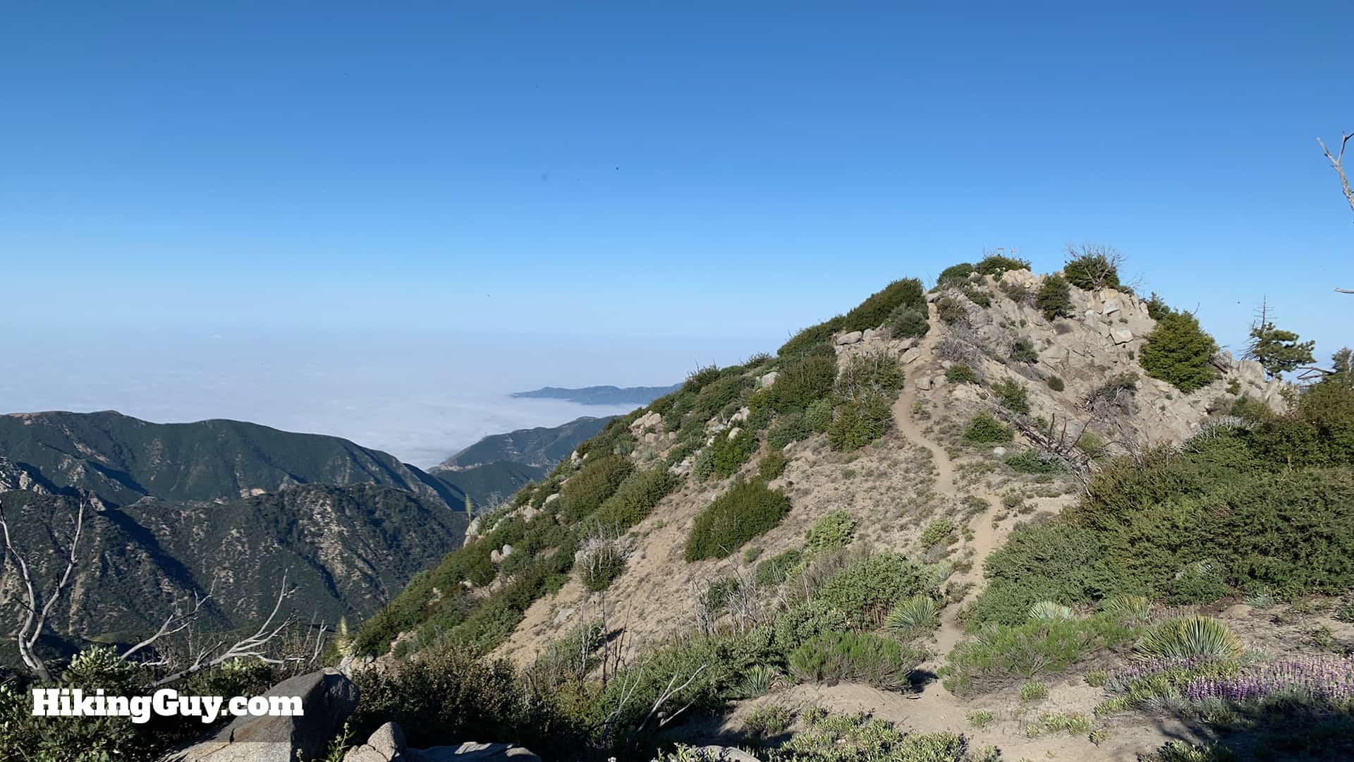
After a short uphill section in the beginning, the trail levels out for a bit before a final steep climb to the summit.From the 3d map you can easily see the sections: the initial climb from the trailhead, the mellow ridge along the side of Mt Lawlor, and then the steep climb to Strawberry Peak at the end.
Strawberry Peak Hike Directions
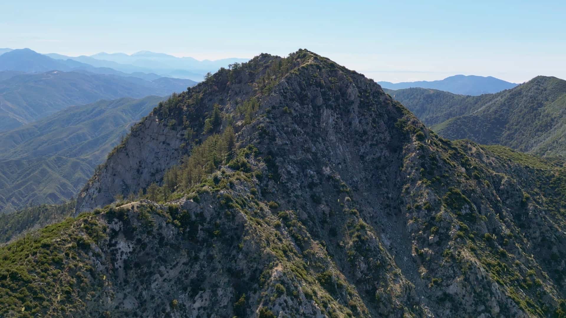
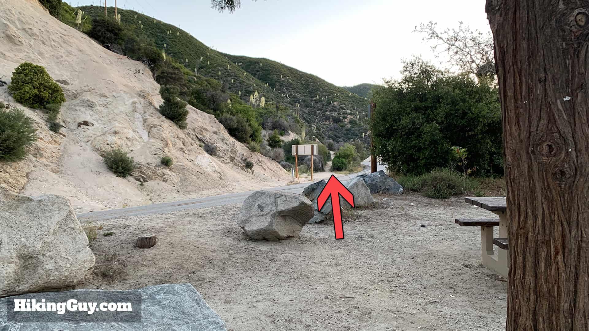
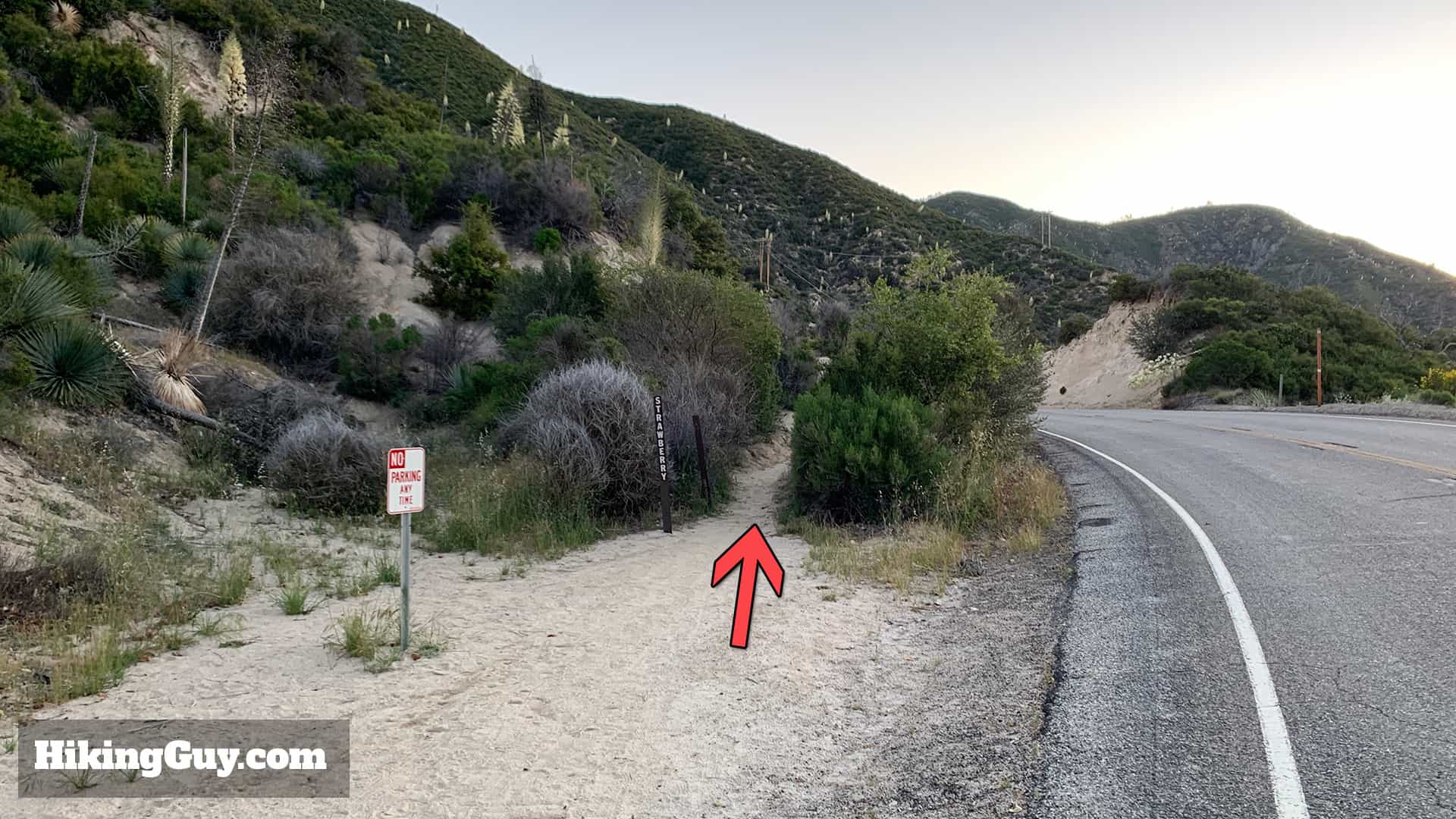
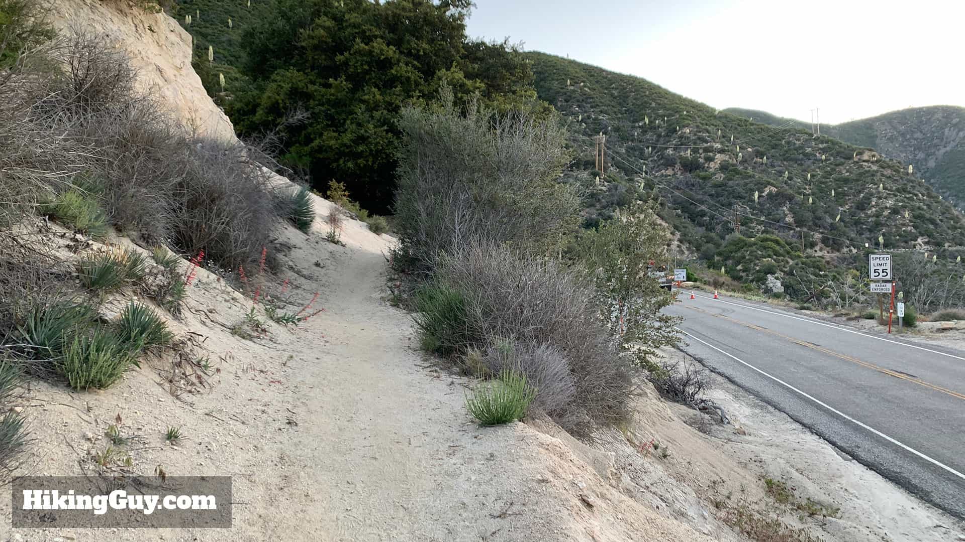
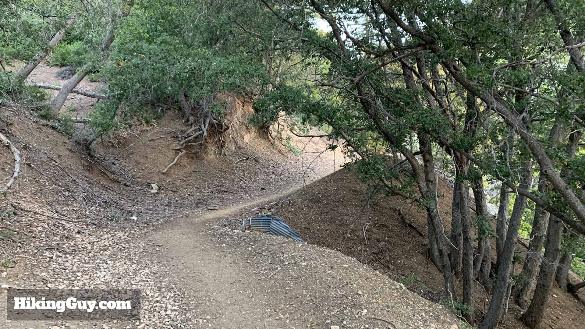
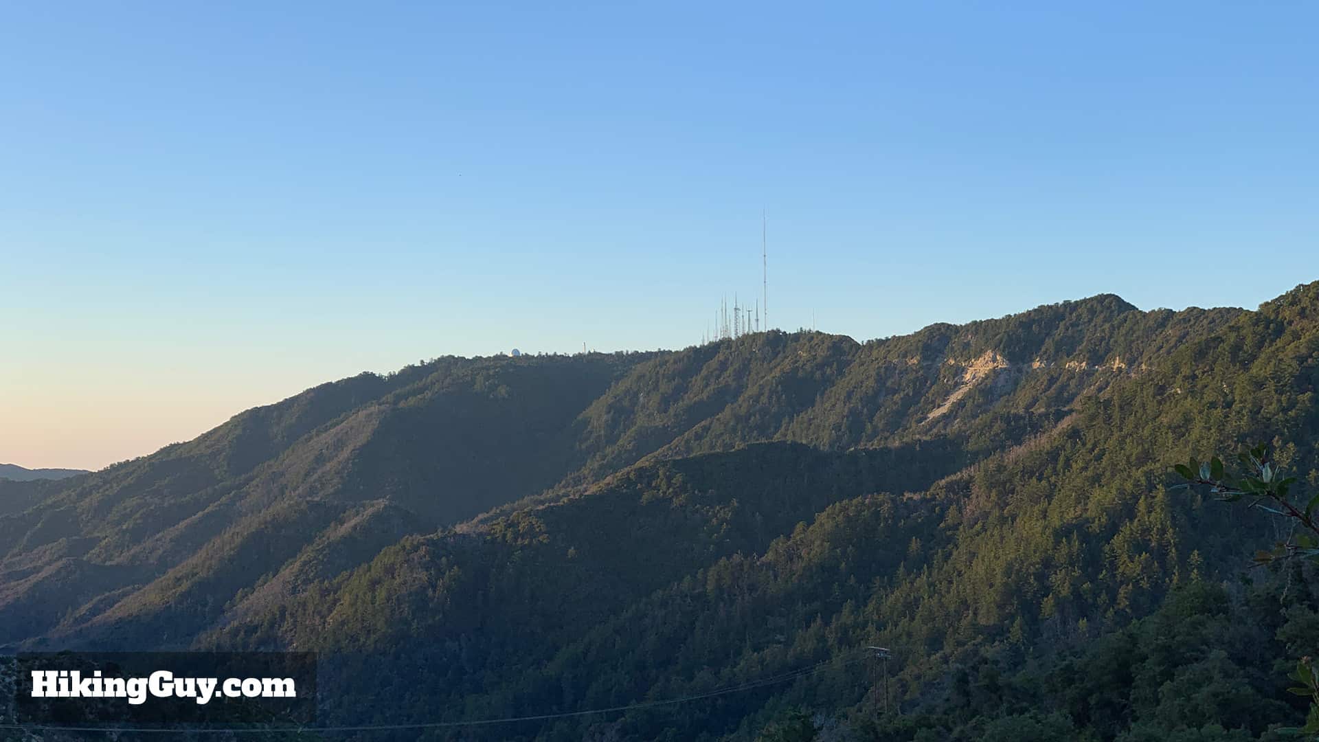
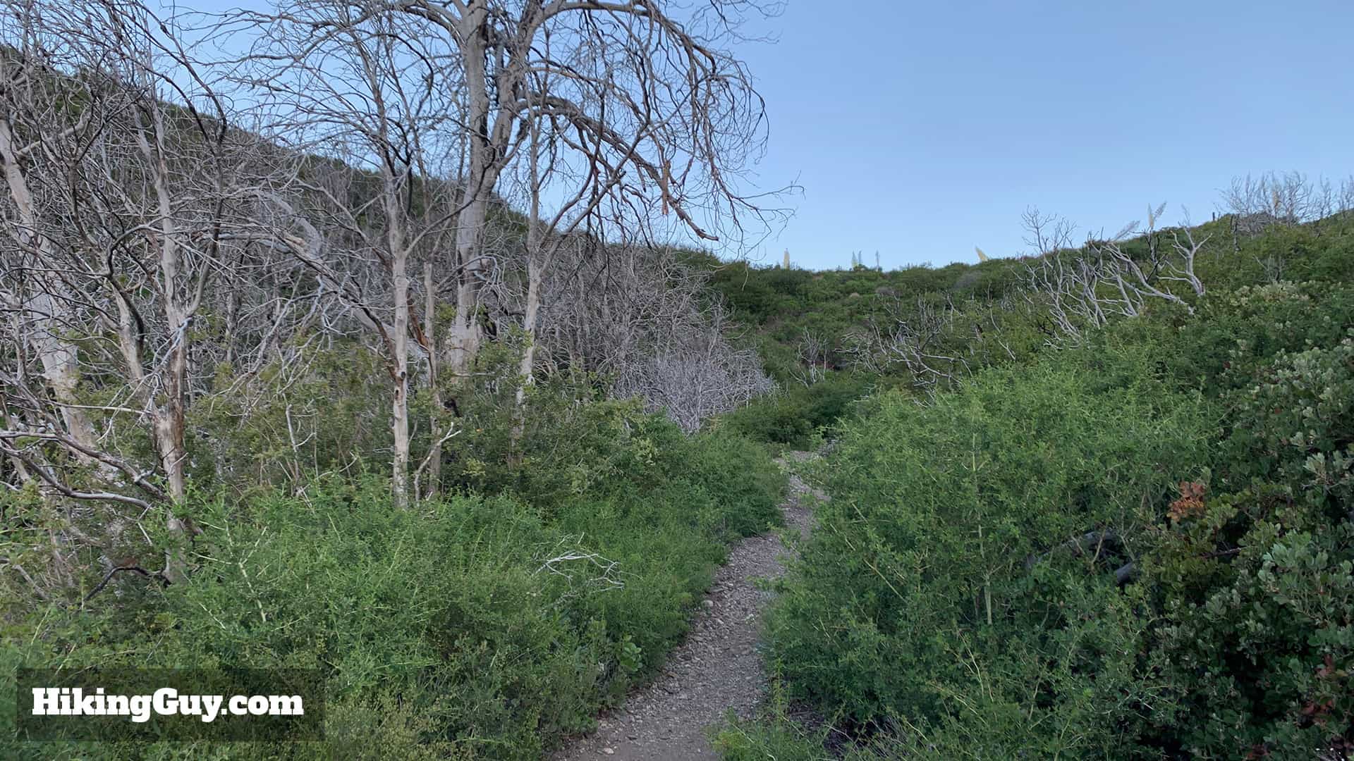
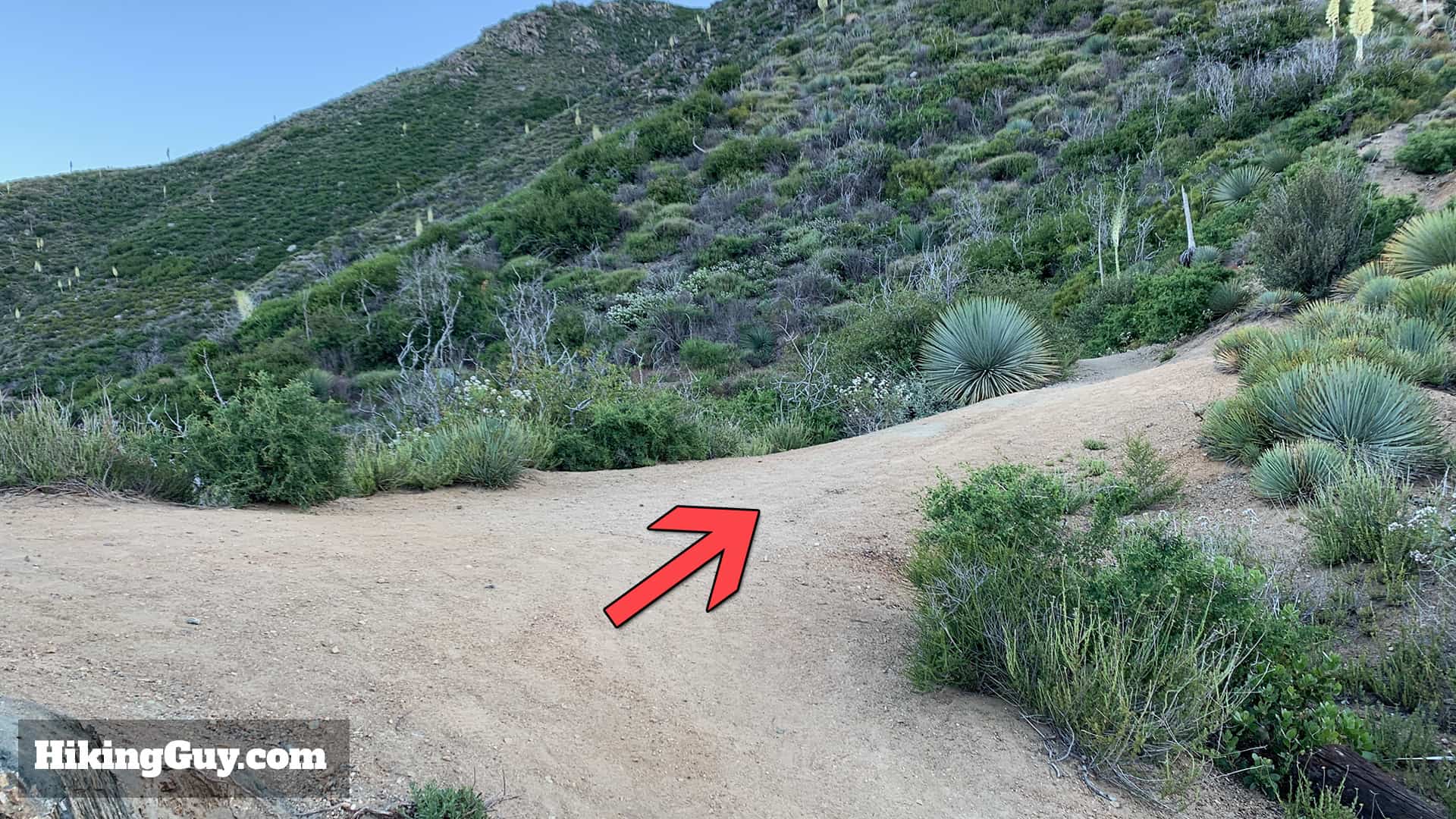
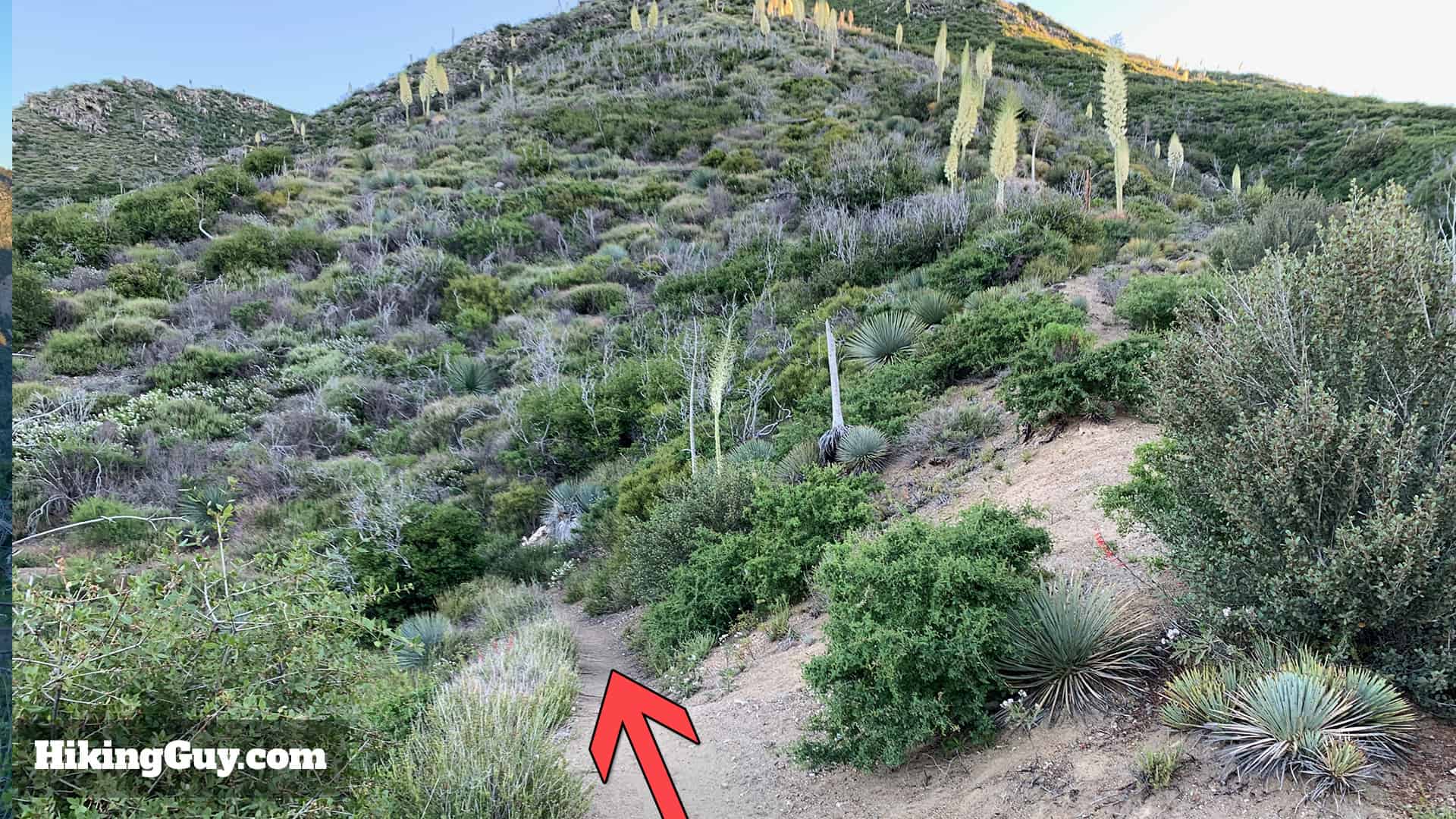
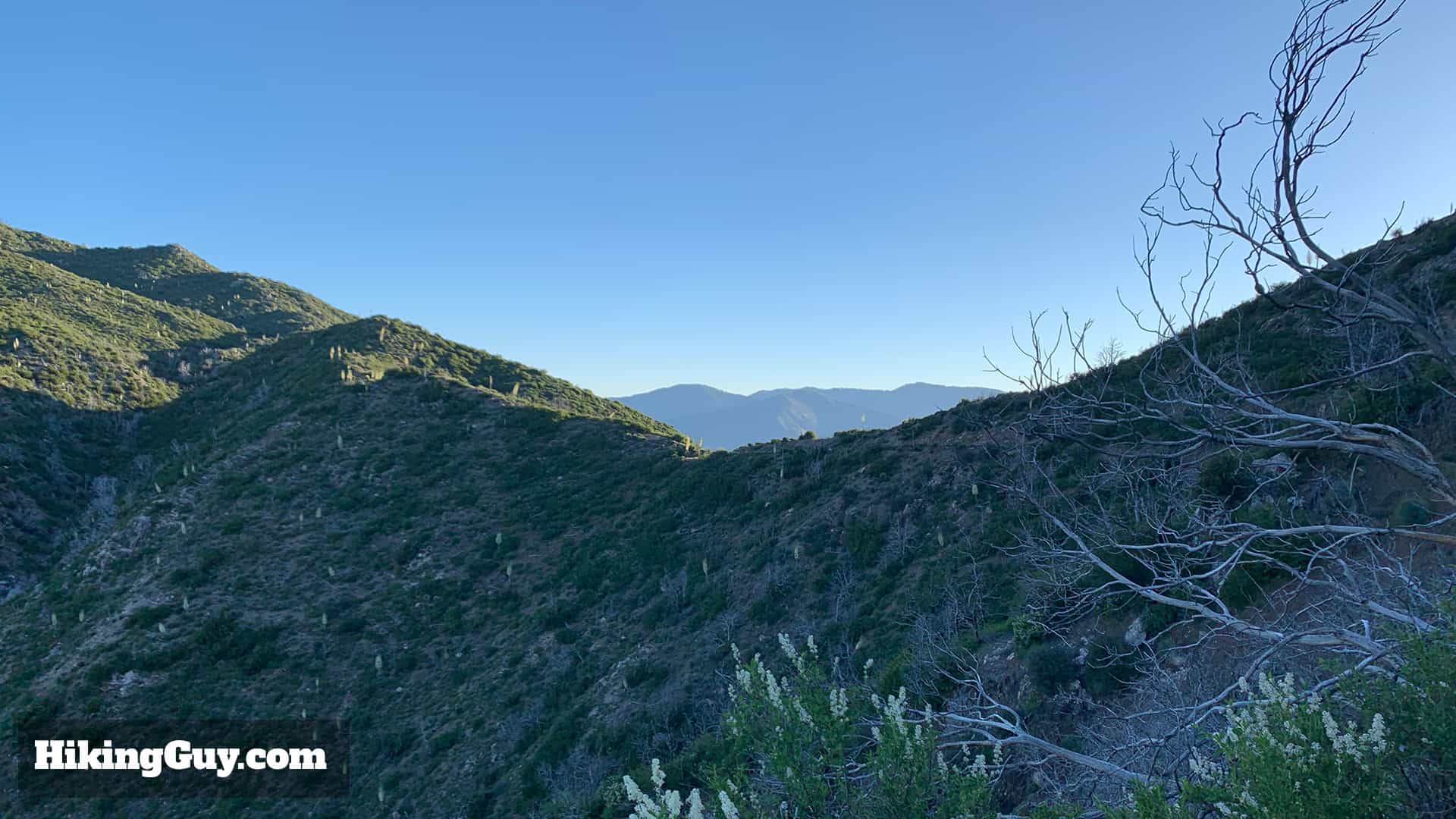
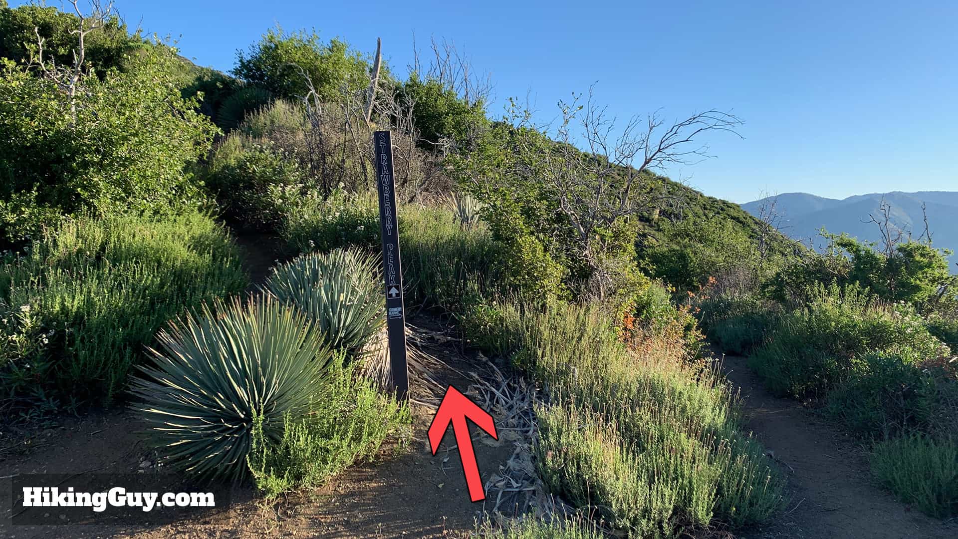
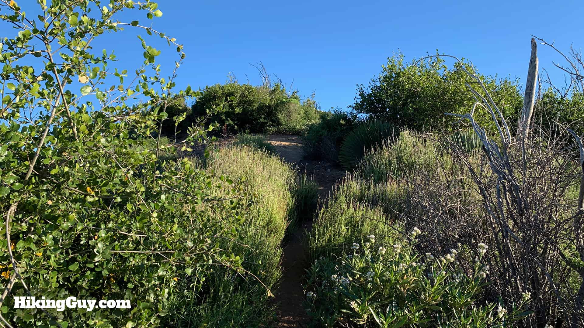
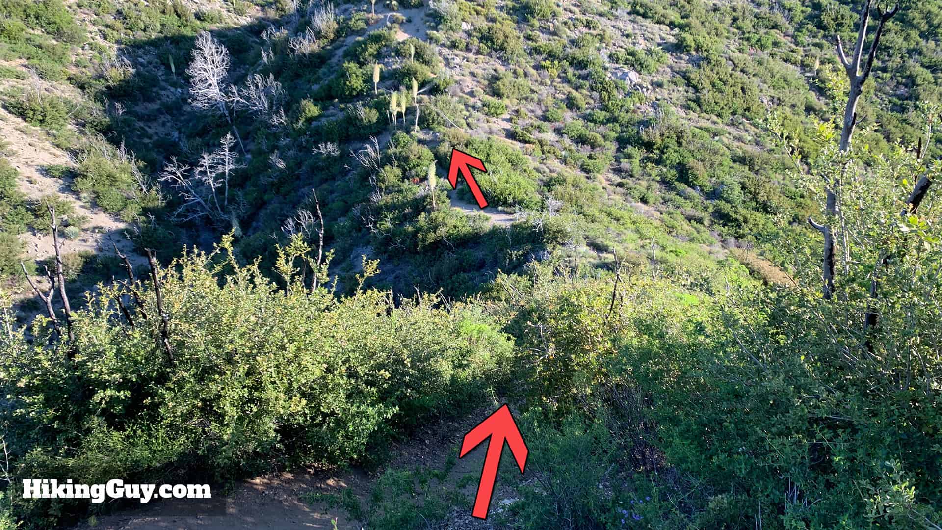
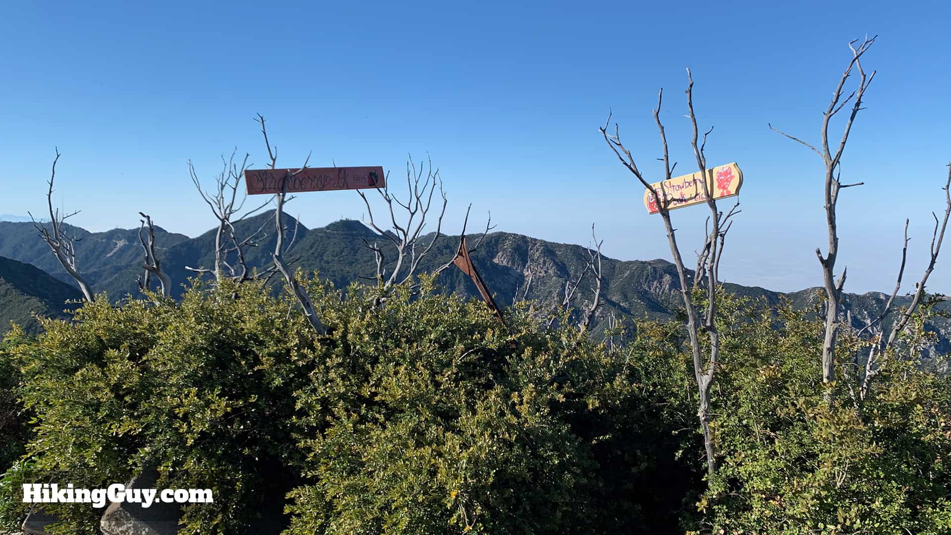
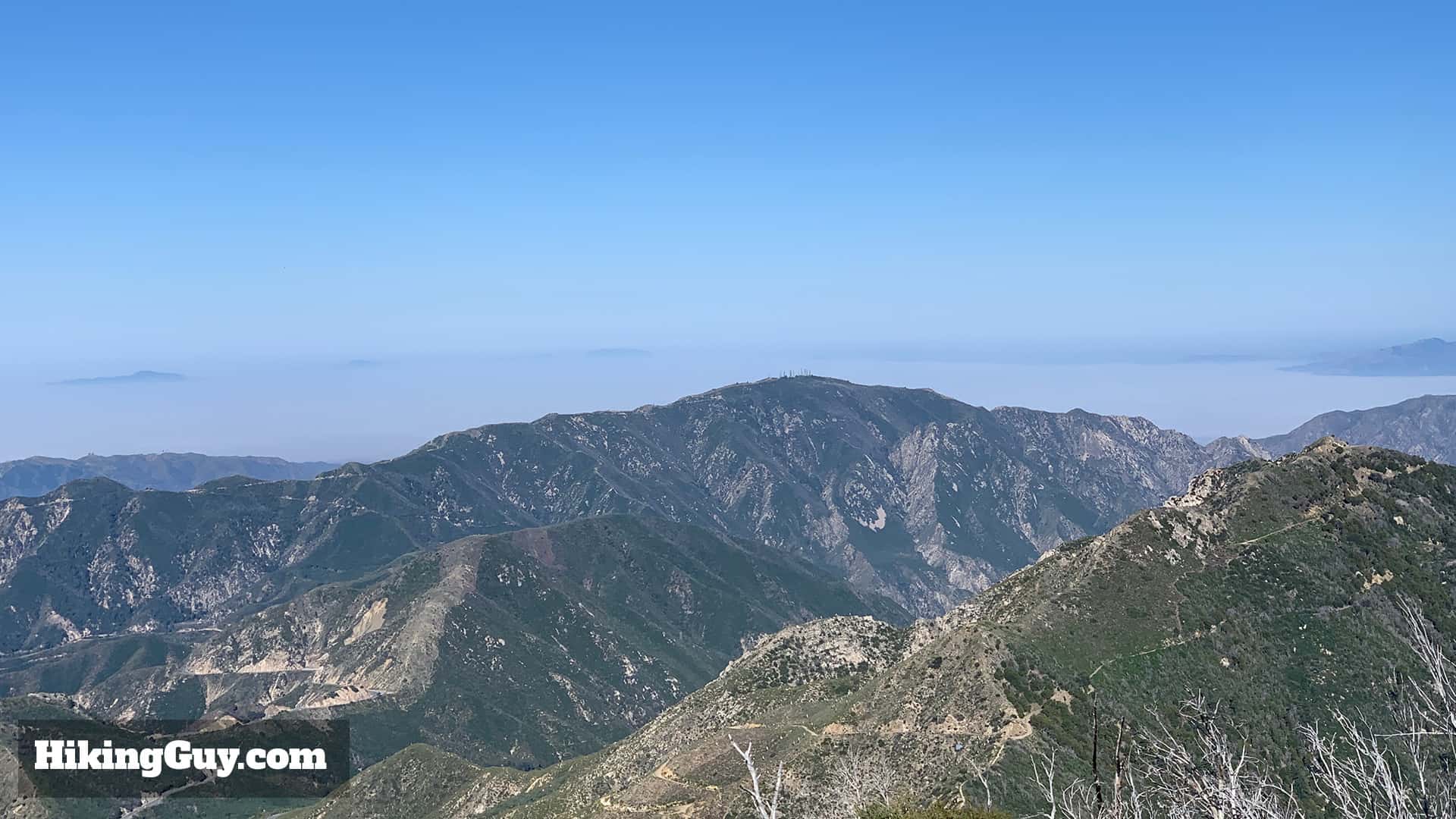
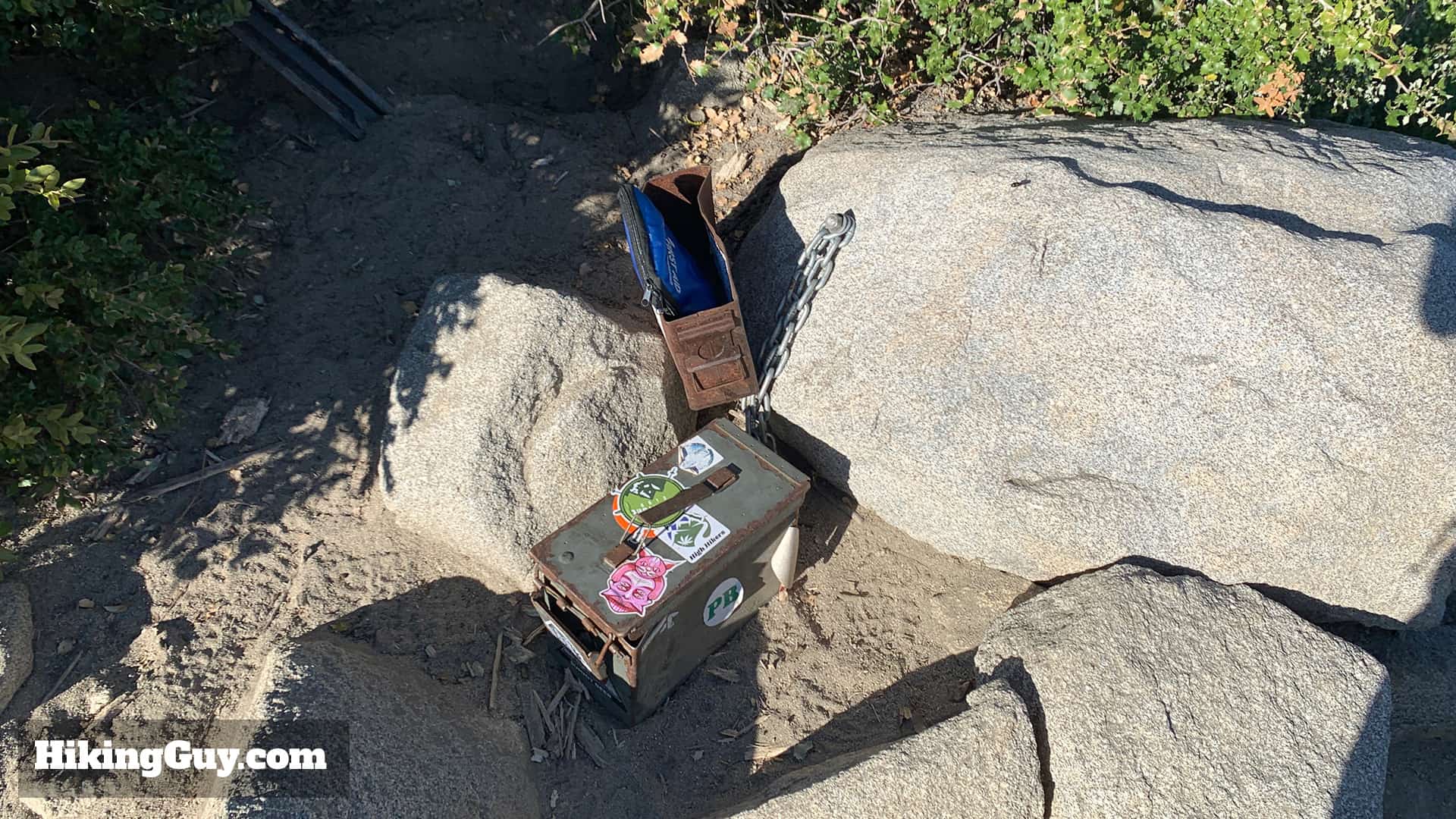
Head to the far end of the Red Box Picnic Area parking lot.The trailhead is right across the street from the picnic area.Once you cross the street the trailhead is easy to spot, and there's a sign marking the trailhead as well.The trail starts to hike up above Angeles Crest Highway.The trail starts winding away from the road.You'll get some nice views of Mt Wilson as you climb this section.The trail eventually turns away from the highway and starts heading through some brush. You'll see some burnt trees here from the massive 2009 Station Fire.When you come up a small hill to this junction, make the right.And shortly after that, bear left along the ridge. The small path to the right ascends Mt Lawlor.After that last turn you'll be hiking along the side of Mt Lawlor with incredible views to the West. Keep your eyes open for a peak with antennas on it, which is Mt Lukens, also a great hike.Eventually the trail winds around the ridge and you'll see Strawberry Peak and the saddle in front of you. You're heading to that saddle.At the saddle you'll be at a junction. Head on the trail going up the hill, not the trail to the right going to Strawberry Meadow. NOTE THE SIGN ISN"T HERE ANYMOREIt gets steep right away. Until you get to the peak it's mainly uphill.After the first uphill you're rewarded with a little downhill that you'll probably hate on the way back.And you start climbing again. That's a false peak in front of you. There's a few of them, so set your expectations accordingly. There's nothing like thinking that you're about to summit, only to see more climbing ahead of you.The trail is steep and rocky, but there are no major scrambles. I see some the biggest lizards on this stretch of the hike. I don't know why but there are some whoppers around here.BINGO! After a few false peaks, you'll see the actual Strawberry Peak with the trail winding up it.You did it, this is the peak. There are peak signs here most of the time, hopefully when they get stolen someone will replace them.You'll be able to see Mt Baldy and the high peaks of Angeles National Forest.And on the other side, LA, Josephine Peak and Mt Lukens.There's also a trail register if you want to sign in.From here, you just head back down the way you came. See you out there!
Check out the nearby Switzer Falls hike for a mellow, post-Strawberry Peak experience.