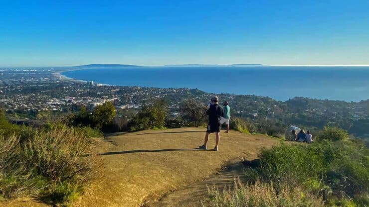
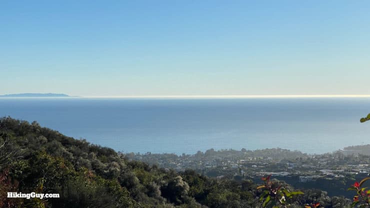
The Temescal Canyon hike, tucked into the hills of LA's west side in the Pacific Palisades, is one of the great Los Angeles city hikes. The hike starts in serene Temescal Gateway Park, climbs up a shaded oak and sycamore canyon, and then returns along a ridge high above the Pacific Ocean. On a clear day you can see from the San Gabriel Mountains to Catalina. The trail is easy to follow, the route isn't long, and I highly recommend it.
In this Guide:
Temescal Canyon Hike Turn-by-Turn Directions & Video
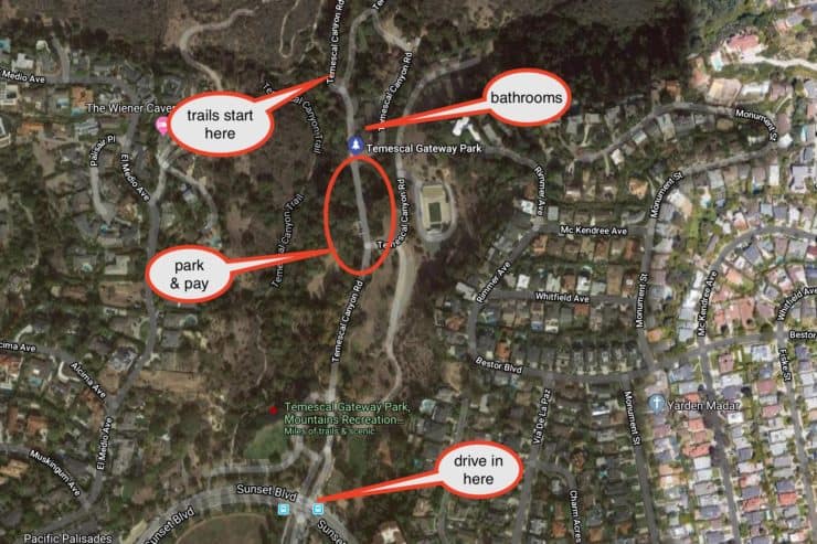
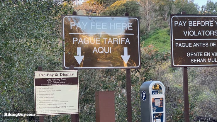
There is a parking fee for the parking lots at the trailhead. You can also park on Sunset and just walk in the park for free.
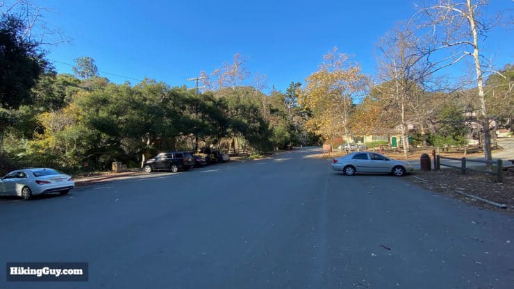
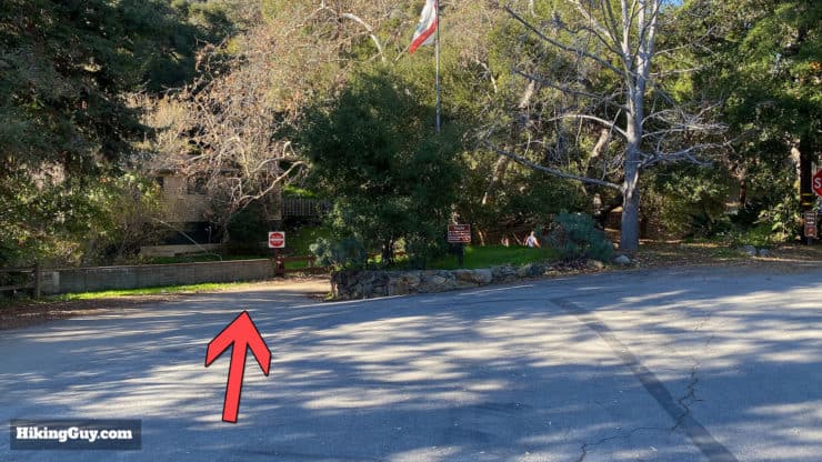
The GPS address will bring you to the park entrance. Keep driving straight in until the road is lined with parking spaces. This is the closest lot to the trailhead. From here you can start your hike.Pay at the kiosk and leave the parking ticket on your windshield.The lot closest to the trailhead has a decent amount of spaces.
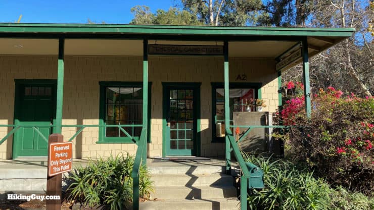
You'll also see some of the buildings of the Temescal Canyon Conference and Retreat Center, which is available for events and retreats. The buildings are from the 1920s and were originally home to Chautauqua retreats, a Methodist version of TED Talks, popular from the 1880s to 1930s. The local PBS website has an interesting article on this organization designed “to prepare and protect Christian believers in a modern and changing world.” Who knew?
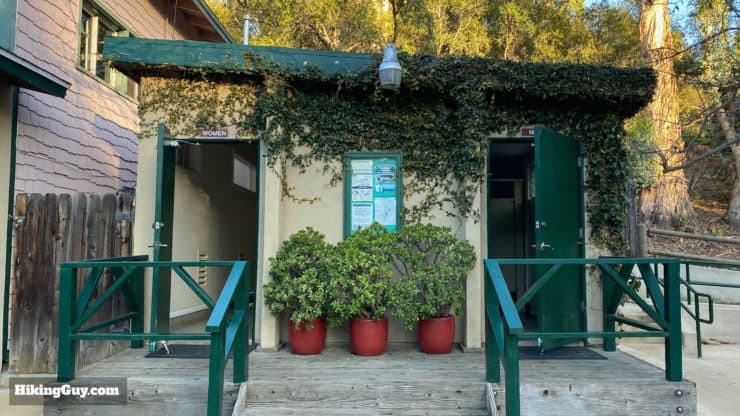
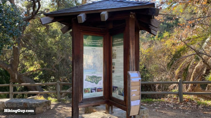
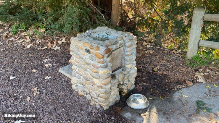
There is a small store here that serves the retreat center when it's open. The bathrooms are hidden back to the right of this building.Here are the cute bathrooms located to the right of the general store.At the end of the parking lot you'll find an interpretive display with trail maps you can take along with you.There's a water fountain at the end of the parking lot next to the trail sign.
Gear For the Hike
Most people on the trail wear fitness gear, and you can certainly get away with that as well. I use light hiking gear and bring 1L of water. Trekking poles come in handy on the steep sections. Bugs can be intense at times, so bring repellent.
Nothing is sponsored or promoted, just the actual gear that I use.
Garmin InReach Mini 2Hit SOS or just tell loved ones that you're running late where your cell phone has no service. Review here.
Topo MTN RacerAggressive and fun with a wide toe box (=no blisters). Get them wet, they dry quickly. Lots of cushion and comfort.
Osprey Hikelite 26Lightweight, carries all your gear, and your back doesn't get sweaty. Oh yea, it's also one of the most inexpensive packs you can get.
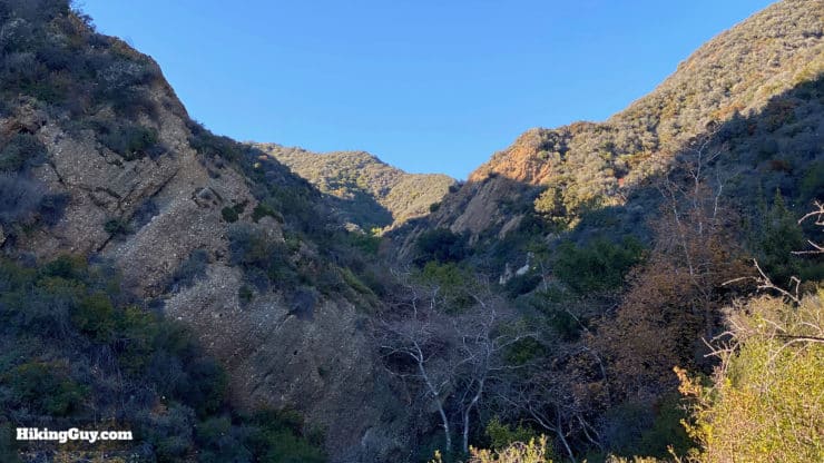
The climb up the canyon is gradual with a little steep section before the ridge and then offers a nice downhill with non-stop views.
3d Map
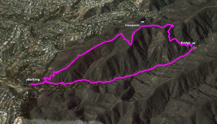
This loop hike brings you up the shady and serene Temescal Canyon, and then back down along the ridge trail.
Temescal Canyon Hike Directions
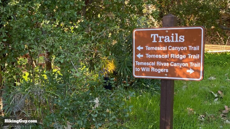
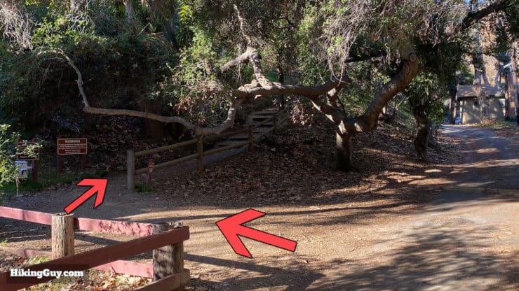
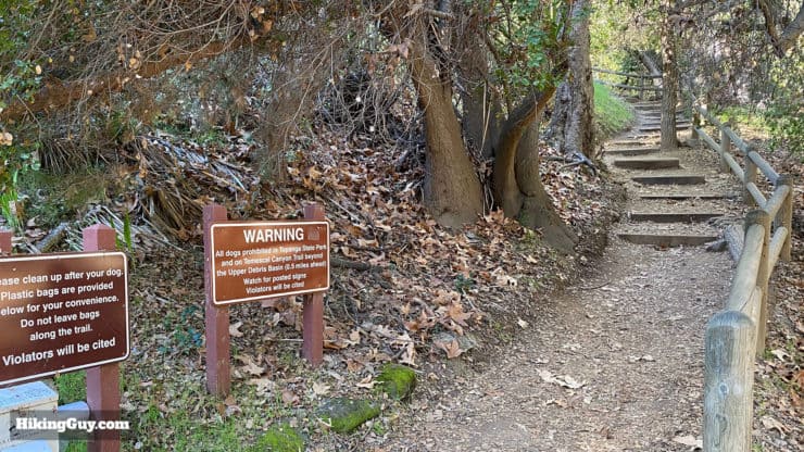
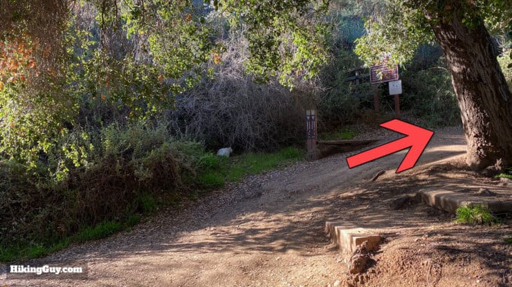
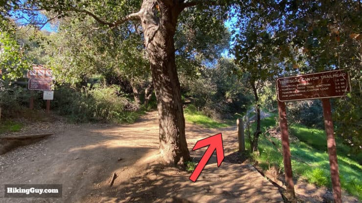
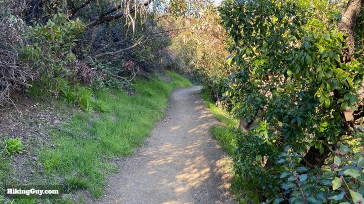
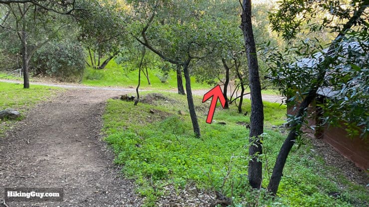
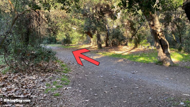
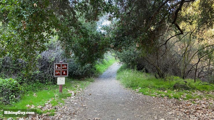
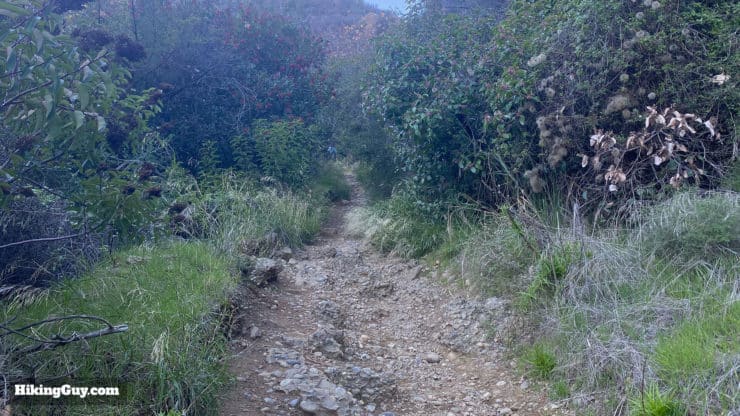
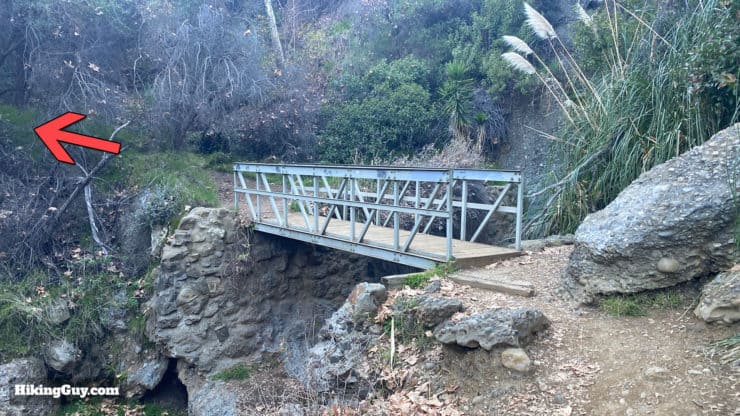
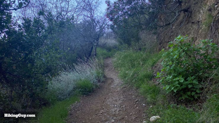
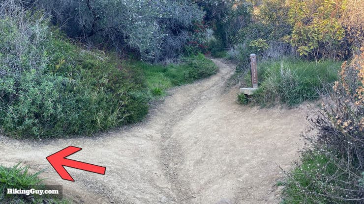
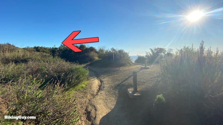
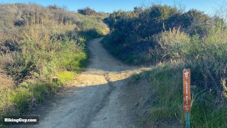
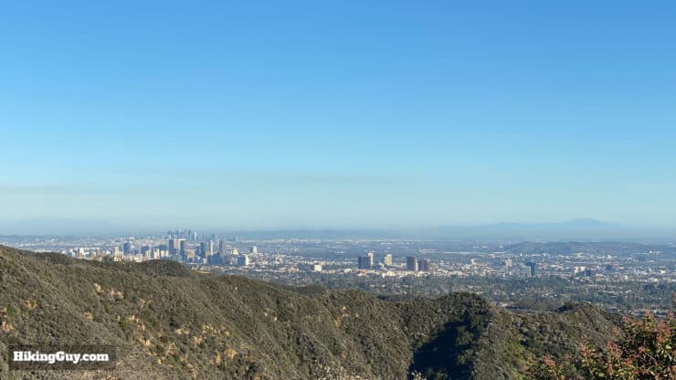
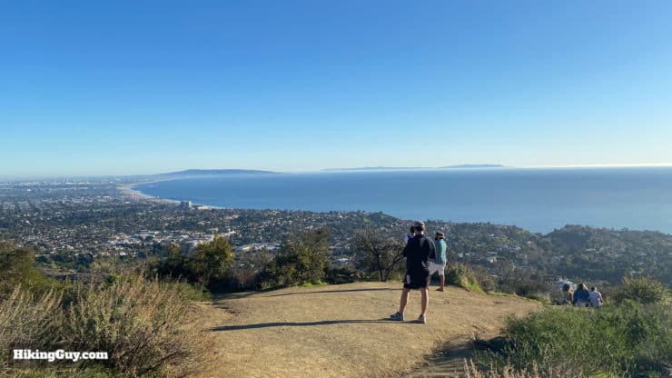
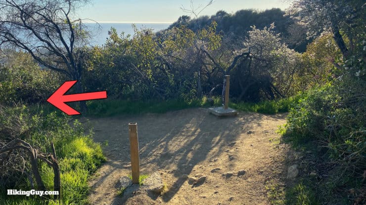
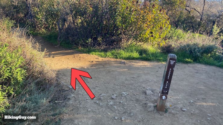
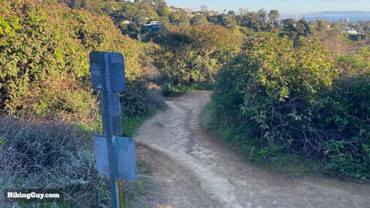
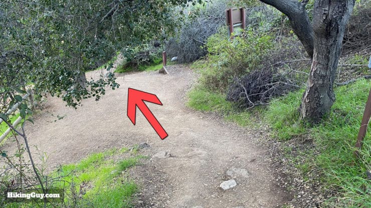
Walk to the end of the parking lot and then bear to the left.You'll see this sign at the end of the parking lot. We're heading to the Temescal Canyon Trail (and then coming back down on the Temescal Ridge Trail).Just past that last trail sign, bear left to find the trailheads which are up these steps.Hike up the steps.At the top of the steps you come to a big junction. Turn right.And then take the trail to your right, Temescal Canyon Trail.The trail starts off shady and scenic as it travels above the buildings, which will be down the ridge to your right.When you come out at the building, there are multiple trail crossings. Head straight through to the right.And then bear left to join the trail.After the confusion of the last intersection, the trail becomes a trail again and is easy to follow. Soon you'll see the "no dogs" sign which is where you enter Topanga State Park.There are nice views up Temescal Canyon.The Temescal Canyon Trail climbs gently and is easy to follow.After about 1.2 miles you'll reach the bridge over Temescal Canyon Falls, which are about 100 feet downstream. The falls are usually just a trickle. Once over the bridge, head left (and up).From the bridge to the ridge the trail gets steeper, but it's not too crazy.When you get to the trail junction, make the left to continue on the last little stretch to the ridge.You made it to Temescal Ridge Trail! Make the left at the junction.From that last junction on, the views will be pretty spectacular. That's Catalina in the distance.Temescal Ridge Trail is easy to follow. You'll often see signs pointing the way to Sunset Blvd at Temescal Gateway Park.In addition to the Pacific Views, you'll also be able to see most of LA and the mountains that surround it.At around 2 miles in, you'll hit this big open area that's a popular sunset viewpoint offering unobstructed sweeping views from west to east. Keep left on the trail and head downhill.The trail is well-defined and easy to follow and you descend.At the intersection make the left to continue on the Temescal Ridge Trail toward Sunset Blvd.At the next intersection continue left.And soon you'll be able to see the buildings where you started in Temescal Gateway Park.And then you'll reach the trail start at the top of the stairs. From here just head down the stairs back to the parking lot. That's the hike!


 Using the Apple Watch for Hiking
 Garmin Fenix 7 & Epix Review For Hikers
 How To Read a Topographic Map
 Garmin GPSMAP 67i Review
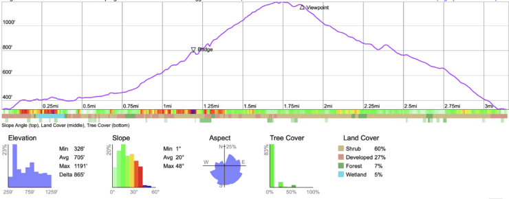

 Wisdom Tree Hike (+ Cahuenga Peak and Hollywood Sign)
 Runyon Canyon Hike Guide
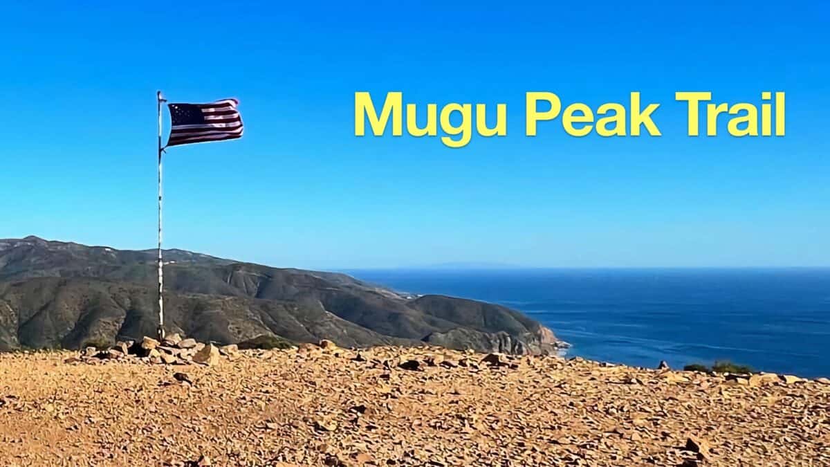 Hike Mugu Peak Trail
 Hike Malibu Creek Rock Pool + MASH Site
 Los Angeles Hikes
 Best Hiking Gear 2024
 Hiking Boots or Shoes: Do I Really Need Hiking Boots?
 When to Hit SOS on inReach