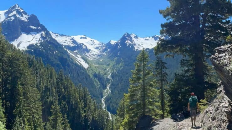
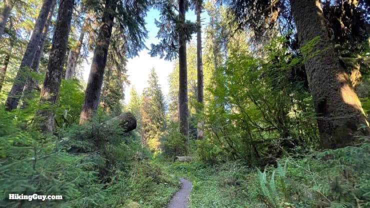
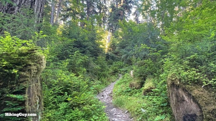
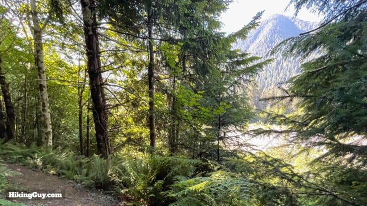
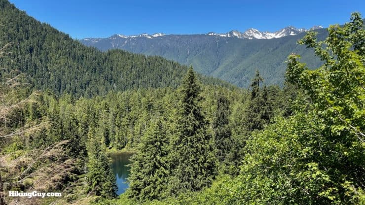
The Hoh River Trail in Olympic National Park is a bucket-list worthy hike. You'll start the adventure by hiking along the Hoh River, which is fed directly from glaciers, making it a cold, milky-gray color. The trail winds through what most consider is the best-preserved rain forest in the northern hemisphere, also located in one of the most remote areas of the United States, the middle of the Olympic Peninsula. The temperate rainforest is covered in ferns, mosses, and massive trees, some of which are over 1000 years old. And then the Hoh River Trail turns upward, over a spectacular whitewater gorge, climbing through alpine scenery until it reaches the spectacular Blue Glacier at the foot of Mt Olympus. Most people take two to four days to backpack the Hoh River Trail, and in this guide, I'll give you all the information you need to plan and enjoy this epic hike.
In this Guide:
Video and Turn-by-Turn Directions for the Hoh River Trail to Blue Glacier
Itineraries, Planning, and Permits for Campsites
Insider Tips and Gear Recommendations for the Hoh River Trail
The remoteness of the Hoh Rain Forest park entrance combined with the abundance of campgrounds means that snagging a permit is much easier than other popular quota-controlled hikes.
First off, if you just want to hike a portion of the Hoh River Trail as a day hike, you don't need a permit. You only need a permit if you are camping overnight along the route. However, there are a few things to figure out before you hit the trail.
Picking the Right Season
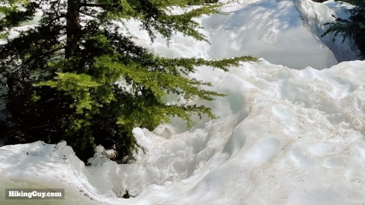
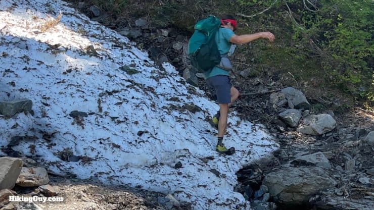
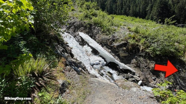
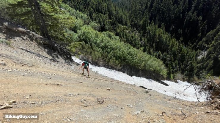
In the colder months, the upper sections (roughly the second half) of the Hoh River Trail are often covered in snow. You can see that the snow here (located just after Glacier Meadows) can be crossed, and it is easier with trekking poles and micro-spikes. But many of these upper sections on the trail cross steep avalanche chutes and shouldn't be attempted unless you are an experienced mountaineer. The trail is usually clear and good for hikers after July.
As you might have guessed from seeing the term "rain forest" thrown around a few times already, it can get very wet here. And when it's wet at the higher elevations, you get snow and ice. The Hoh's position right next to the wet and wild Pacific means that it can get clobbered with precipitation; the area gets between 12 and 14 feet of rain every year, the most in the lower 48. The sweet spot to do this hike is later summer, when the area is driest and the snow covering the higher elevations is gone.
Season
Pros
Cons
Winter
No Crowds
Upper Trail Not Passable - Lots of Precipitation - Occasional Snow in Rainforest
Spring
Less Crowds
Upper Trail Not Passable - Lots of Precipitation - Cool and Mild - Very Muddy
Summer
Route Passable to Blue Glacier - Driest Season
Crowded - Thunderstorms Possible
Fall
Less Crowds - Route Passable in Early Fall - Salmon Spawning
Wet Season - Upper Camps Close
Note that even if the upper reaches to Blue Glacier are not passable, the first half of the hike in the rain forest is still fun to do on its own. Simply hike along the Hoh River, camp, and return.
Suggested Itineraries
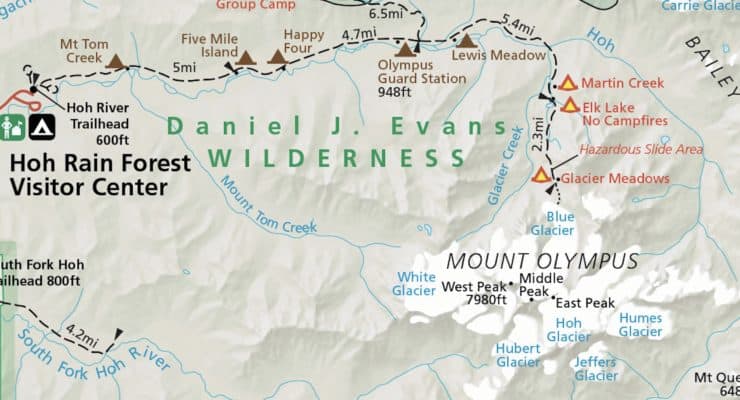
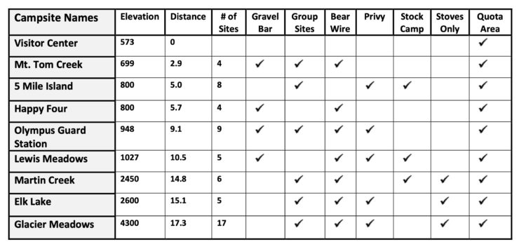
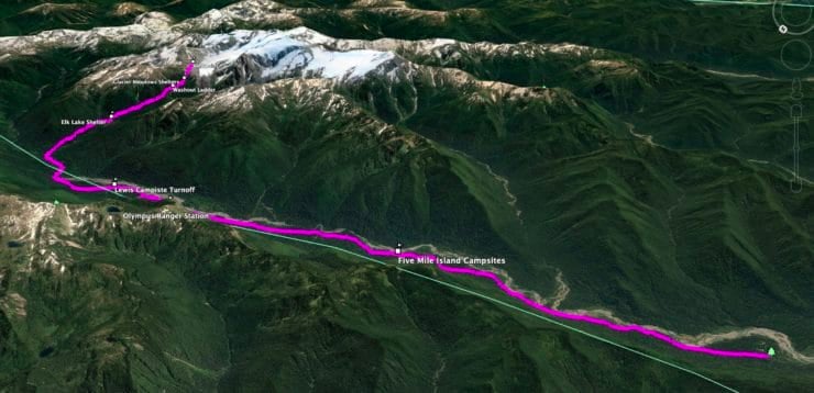
Here are the campsites along the Hoh River Trail for reference. The trail starts on the left side of the map at the Visitor Center. The red/orange campsites don't permit open campfires, but you can use stoves there.
The abundance of campgrounds on the route means that you have options, but here are the most common itineraries for the Hoh River Trail. And unless it's an emergency, you must stay at one of the designated camping areas to reduce your impact on the environment.
3 Days
Hike to Lewis Meadow
Leave tents and gear setup at Lewis Meadow and hike up to Blue Glacier and back with lighter packs
Hike out from Lewis Meadow
2 Days
Hike to Glacier Meadows and overnight
Visit Blue Glacier with light gear, then hike back down and out
4 Days
Hike to Lewis Meadow
Hike to Glacier Meadows
Visit Blue Glacier, then hike down to Olympus Guard Station (campsite)
Hike out
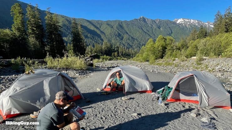
Camping along the Hoh River is a highlight of this experience, with the ice gray water next to you and high peaks above. The hike along the river is generally flat and easy with a backpack. Many people choose to set up a basecamp at a campground like Lewis Meadows, just before the climbing starts, and then do the uphill section to Blue Glacier with just a light pack.
Booking a Campground & Permit
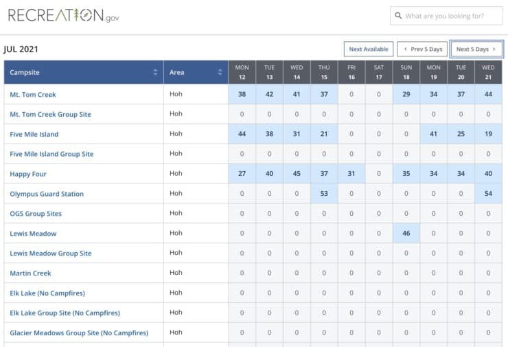
Booking a campsite on the Hoh River Trail serves as your wilderness permit. As long as you have your campsite booked, you have a permit to stay overnight there. There are quotas for all the campsites along the Hoh River Trail, but the abundance of sites usually means that something is open. You can book up to 6 months in advance, and right up to the day of the hike. All of the booking is done through the Recreation.gov website. A few days before your start, you'll get an email letting you know that you can download and print your permit / reservation. Print it out and take it with you, it's as easy as that. If you can't make your trip, pay it forward and cancel your reservation so that other people can use it.
As you would suspect, there is better availability on weekdays. The higher elevation campsites like Martin Creek, Elk Lake, and Glacier Meadows fill quickly, and are closed in the winter months.
Permit Availablity
Can't get a permit for your date? Try OutdoorStatus.com and get a text message as soon as a cancelled permit opens up!.
Getting to the Hoh River Trail
The Hoh River area of Olympic National Park is remote, and the only way to get there is from the west coast of the Olympic Peninsula. From Seattle it's about 4 hours in normal conditions, and you'll either go the north or south route, depending on whether you want to take ferries or not. Expect a good amount of tourist traffic. The roads have occasional passing opportunities, and a one-lane construction closure can add time to the trip. Whichever way you go, it's a beautiful trip. Facilities are limited as you leave Seattle behind, so plan your gas and supermarket stops in advance.
You need to pay an entry fee to get into Olympic National Park. I highly recommend buying a National Parks Pass, which gets you in all federal land and attractions for a year.
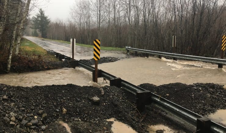
Even if it's the "dry season," it can still rain heavily. Occasionally the road into the Hoh Rain Forest Visitor Center gets washed out. Check the park closures page before you make the drive out here. Photo Olympic NP Twitter
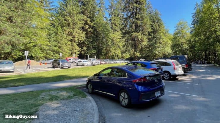
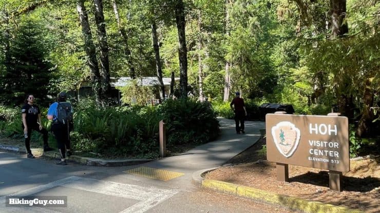
Get to the trailhead early (before 8am) if you can. There's a single entry booth at the Hoh River area and the traffic can back up to an hour or more during peak times.
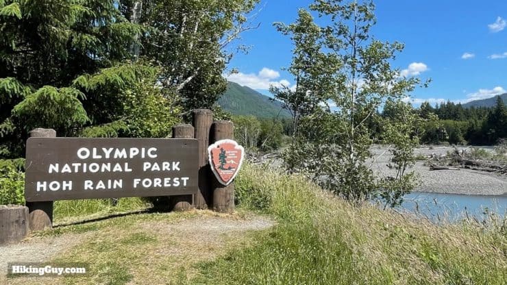
There's a parking lot right next to the trailhead and Visitor Center, which is where you should try to park. If it's full, there are other lots around the campsite area where you can park.There is a bathroom and water refill by the Visitor Center.
Gear For the Hike
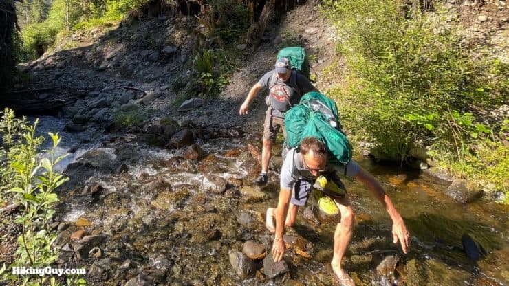
If you don't have trekking poles, the numerous stream crossings can be tricky.
The local forecast will give you the temperatures that you have to dress for. Bring extra layers for the Glacier Meadows / Blue Glacier area, which are usually about 10-20F cooler than at the start of the hike.
The trail is frequently overgrown, if you don't like brushing against leaves, wear long pants. There are ticks and bugs, but no reports of Lyme Disease. A sprayer of insect repellant is a good idea.
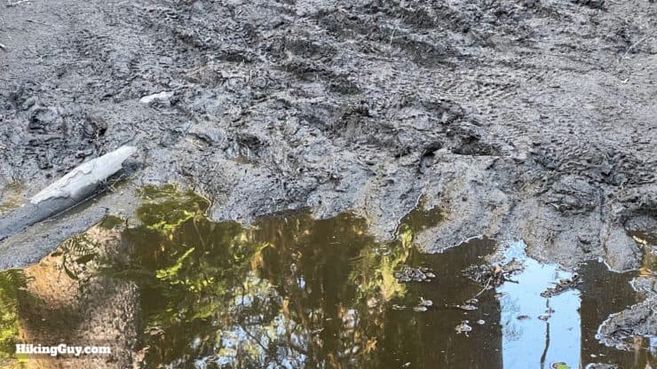
There are a lot of stream crossings and muddy sections. I use trail runners that drain quickly with wool socks and just plan on getting wet and muddy. Keeping water out of your boots is tough if not impossible. You can read about my thoughts on waterproof versus breathable footwear here. When my trail runners are muddy I just rinse them off in the numerous water crossings.
There's plenty of water along the route to refill. The easiest thing for me is a water filter attached to a bottle. Just fill the bottle and drink from it. There's no need for any complicated system of clean and dirty water storage.
Bring a zip-lock bag to pack out your trash.
If you are at a campsite where campfires are permitted, roll cotton balls in Vaseline and keep them in a zip-lock bag. Use them to start a fire in damp conditions. Don't forget the Bic lighter.
Lightweight flip-flops are great after a long day of hiking. Don't forget to dip your feet into the ice-cold Hoh River, which feels incredible. Swimming in the Hoh River is not recommended, it's swift, rocky, and visitors have died doing it.
If there's a possibility of snow on the upper sections, having micro-spikes is smart.
Nothing is sponsored or promoted, just the actual gear that I use.
Garmin InReach Mini 2Hit SOS or just tell loved ones that you're running late where your cell phone has no service. Review here.
Topo MTN RacerAggressive and fun with a wide toe box (=no blisters). Get them wet, they dry quickly. Lots of cushion and comfort.
Osprey Hikelite 26Lightweight, carries all your gear, and your back doesn't get sweaty. Oh yea, it's also one of the most inexpensive packs you can get.
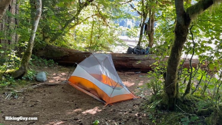
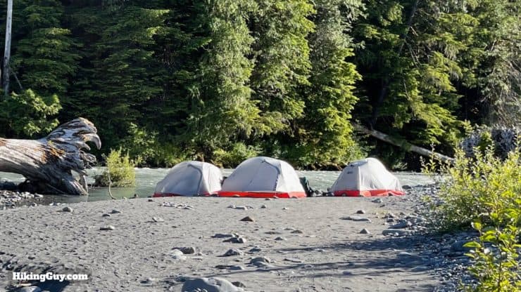
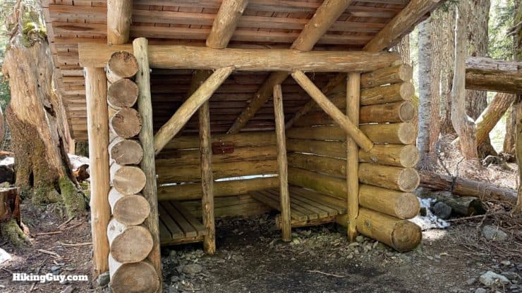
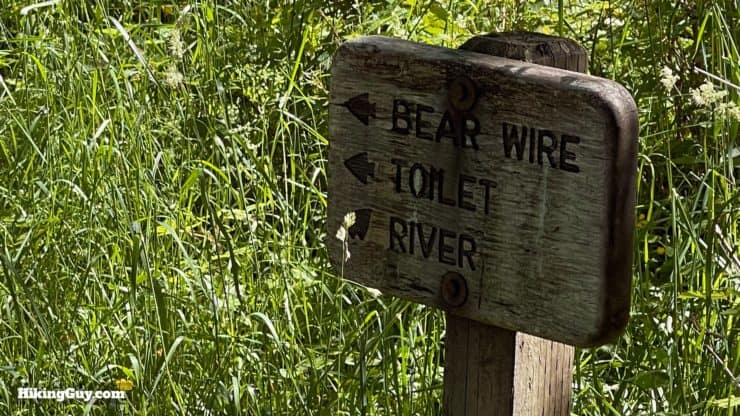
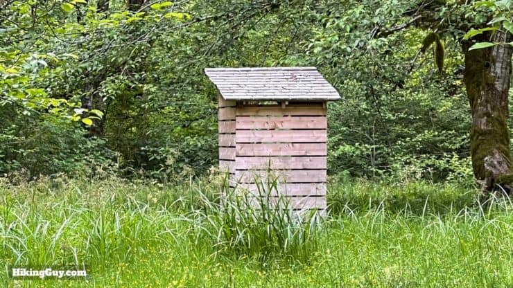
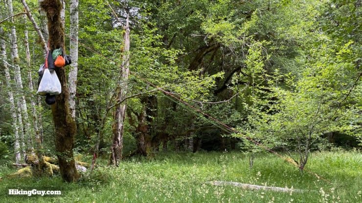
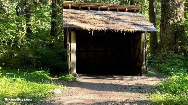
All the campsites have clearings where you can pitch your tent. You must camp in established campsites when hiking along corridor trails like the Hoh River Trail. The sites are not numbered, just pick any site that is open.The Parks Service also lets you camp on the gravel river bars at campgrounds that have access to it. Pick a spot that has no impact on the surrounding vegetation. Don't worry about the rocks. Camping on the river beaches is one of my favorite things about this hike.Some campsites have shelters, which can be used on a first-come, first-serve basis. Some shelters are reserved for emergency use. Make sure you read any notices posted near the shelter. The shelters are nice when it's raining heavily.The campsites along the Hoh do a good job of dispersing and hiding the tent sites and facilities. Look for signs like this to help you find your way around.Some sites have a primitive toilet. Bring your own toilet paper.Check the trail conditions page of the Olympic NP website for the specific requirements of each campsite. Depending on animal activity, you may be required to use a campsite bear hang (as seen here), or bring your own bear canister. Some Olympic NP offices loan out canisters for free, and you can also rent them from REI (the closest one is in Silverdale).
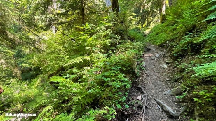
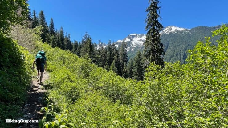
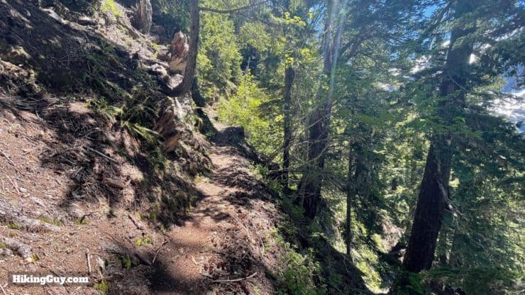
You can mentally break the hike into two sections: a flat stretch through the rainforest for the first 12.4 miles, and then a climb to Blue Glacier for the last 5 miles (which feels much longer).
Challenges on the Trail
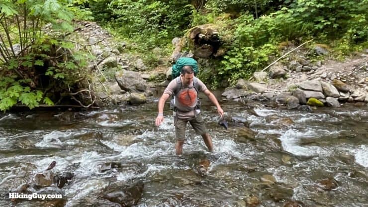
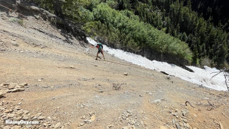
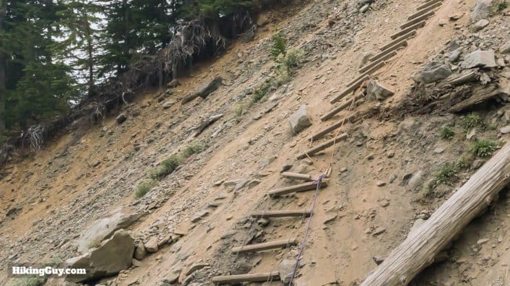
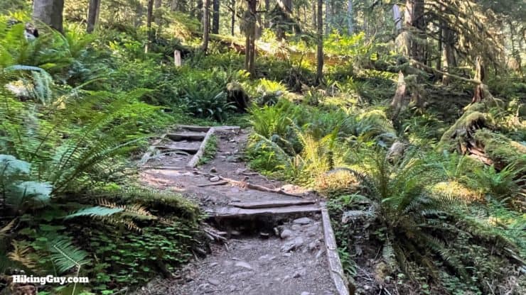
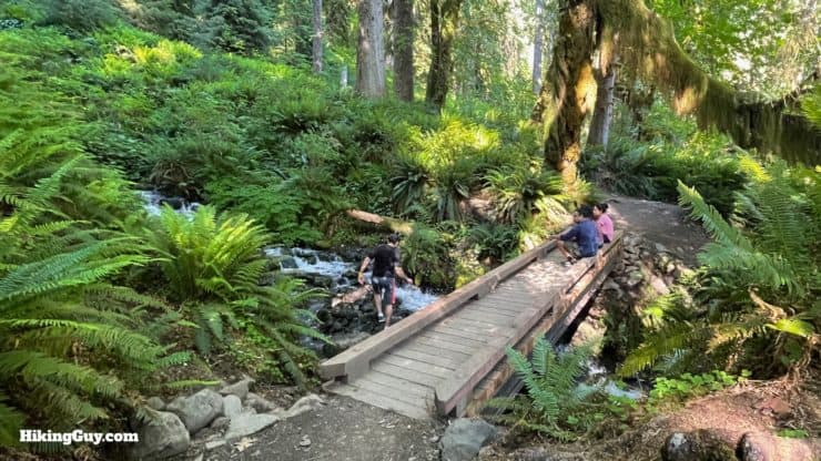
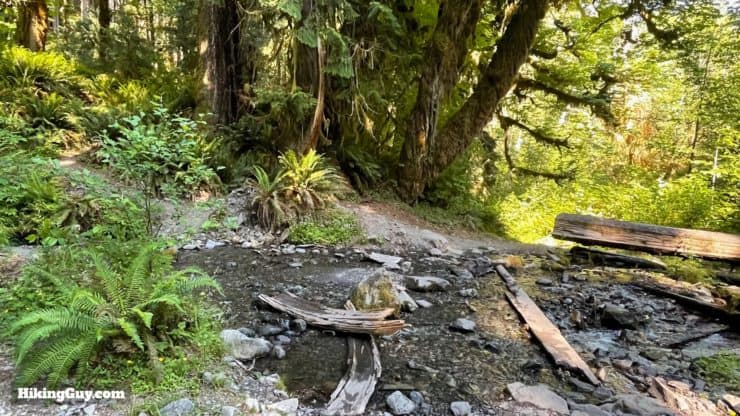
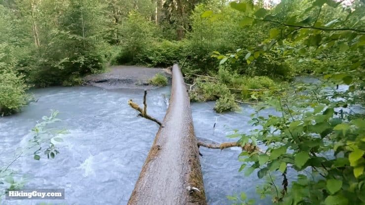
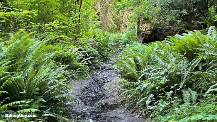
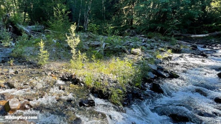
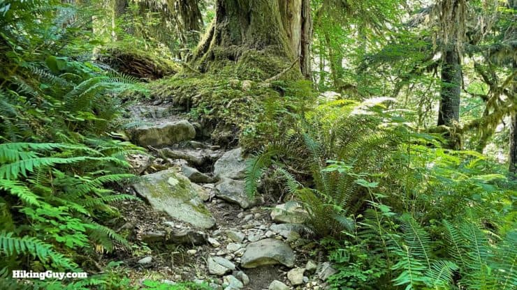
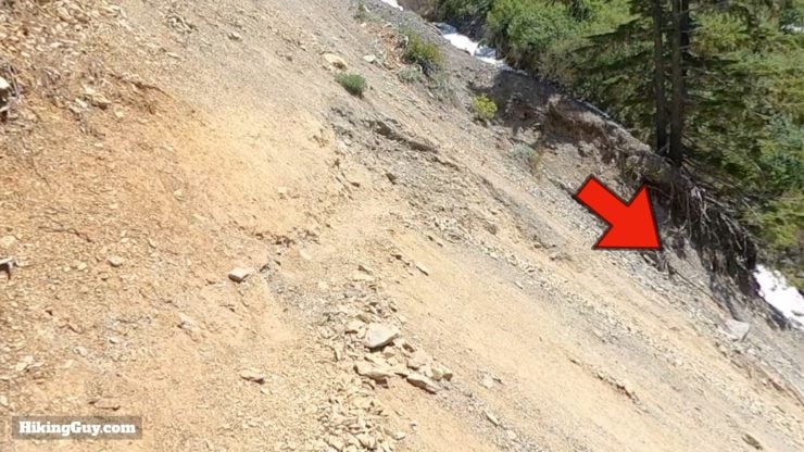
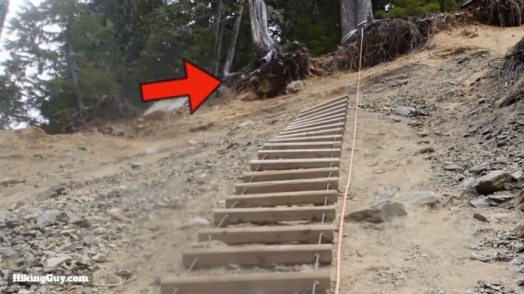
There are a lot of stream crossings. Some crossings have bridges, some have logs to walk across, and some you will have to ford. If you have vented trail runners, which are your best bet, you can just plow through. Your shoes wlll dry as you hike on.Mud is probably the biggest downside of the Hoh River Trail. Usually there is a way around the worst mud holes. Otherwise go through and rinse your feet off at the next stream crossing. If it's raining and muddy overall, expect a slower than normal pace.The toughest challenge for most folks is the ladder going down a slide area, about 0.25 miles before reaching Glacier Meadows, known as the Jemrod Gully Ladder. The ladder is about 100 feet and is supplemented by a rope that you can hold on to walk up and down the ladder.The ladder can be in sad condition and there are rungs missing. You can walk up and down the slope by just holding onto the line and walking at an angle. In general it looks scarier than the actual experience. I've seen folks of all shapes and sizes on the ladder, including those with huge packs.
The Jemrod Gully Ladder should be experienced one hiker at a time. Don't climb up or down if there is someone else on the ladder. There is a lot of very loose debris in the slide area, and it's easy to send rocks below onto someone's head.
3D Map
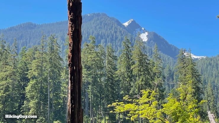
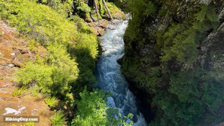
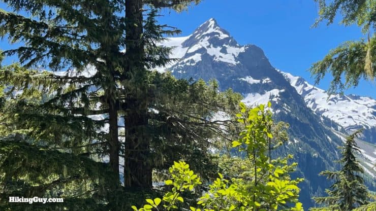
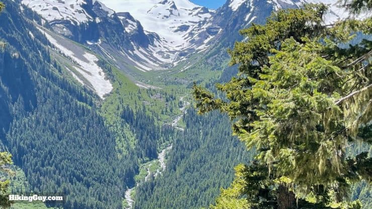
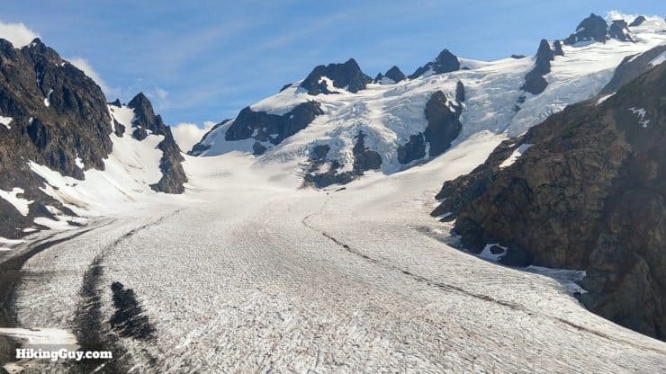
The first 12 miles follow the Hoh River through the rainforest. Then the trail turns right and climbs up to the glacier fields just under Mount Olympus, the highest point in Olympic National Park.
Hike Brief
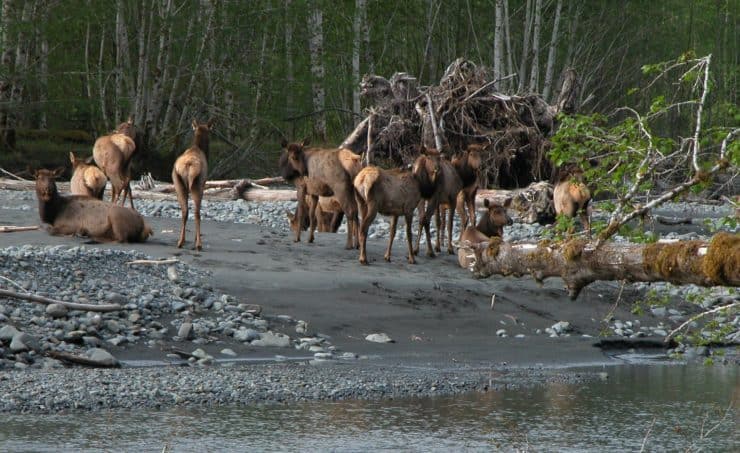
The Hoh River Trail is noted for its rich assortment of wildlife, including blacktail deer, black bear, cougars, coyotes, and, pictured here on the Hoh River, Roosevelt elk. Don't feed them, keep your distance, and you'll be fine. Some campgrounds have animal-specific requirements which are listed on the park's trail condition page. Read it before you go. Photo Olympic NP Twitter
"Hoh" is pronounced "hoe" and comes from the native Quileute word for "snow water."
The Hoh Rainforest is one of the last remaining large areas of primeval forest in the lower 48. Protected when it became part of Olympic National Park in 1936, the area you will hike through was never logged, and some of the trees are over 1000 years old. This pristine forest is also a UNESCO International Biosphere Reserve and World Heritage Site.
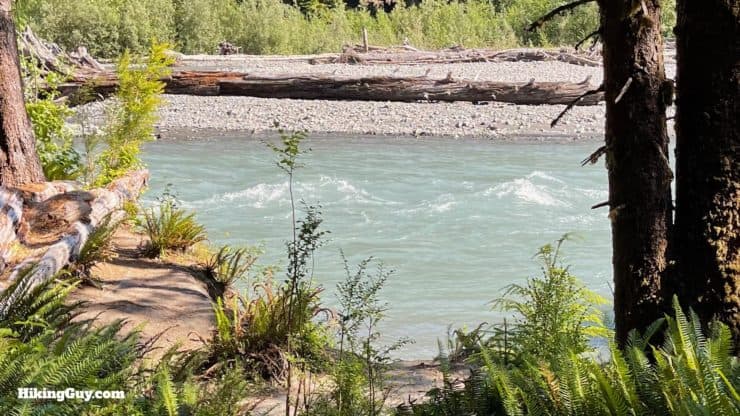
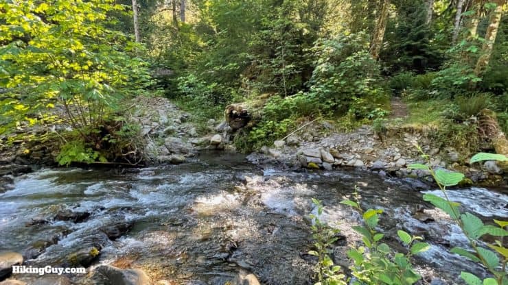
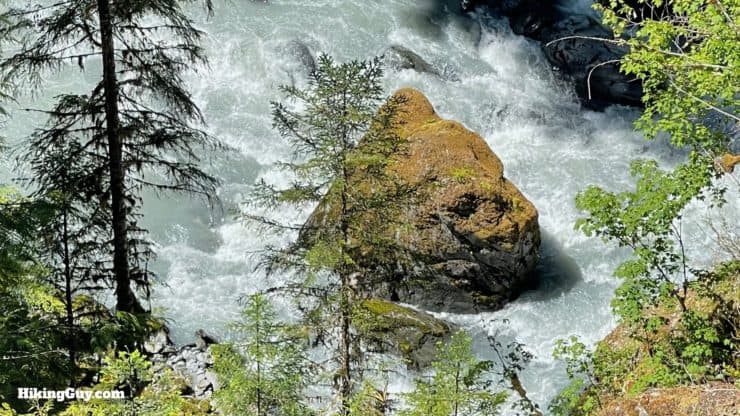
Your hike traces the Hoh River to its origin at the Blue Glacier. The Hoh River is usually a milky-gray color from something called glacial flour, small rock ground down by the movement of Blue Glacier. The Hoh River is home to some of the healthiest Steelhead trout in the country. In the fall, keep your eyes open for Coho Salmon that spawn and die here.
There is evidence that native peoples inhabited this area from 12,000 BC. Back then, mastodon roamed the area.
In 1787 British fur trader Charles Barkley (no, not that Charles Barkley) sent men up the Hoh River, and it went downhill for the native peoples from there. The tragic but too common pattern of disease, "treaties" and relocation have isolated the native peoples to smaller reservations along the coast.
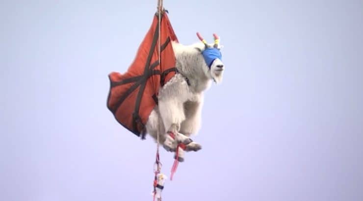
I mentioned earlier that you don't really have to worry about animal attacks here. That wasn't always the case, and in 2010 a visitor was killed by a 370 pound mountain goat. Most animals need salt, and get it from licking mineral-rich rocks. But salt is also in human urine, and the abundance of urine from hikers along the Hoh River Trail proved too attractive for the mountain goats, who learned to get aggressive with humans in search of it. The mountain goats, which are not native and were introduced in the 1920s, are currently being relocated to the Cascades. As their numbers here dwindle, there's not much to worry about, but check the park's trail conditions page for any updates. A mountain goat airlifted to urine rehab in the Cascades.
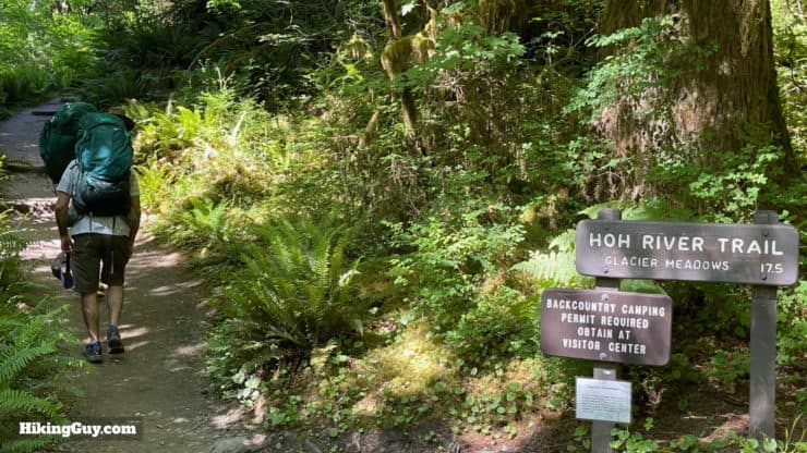
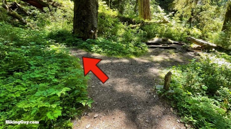
Hoh River Trail Hike Directions
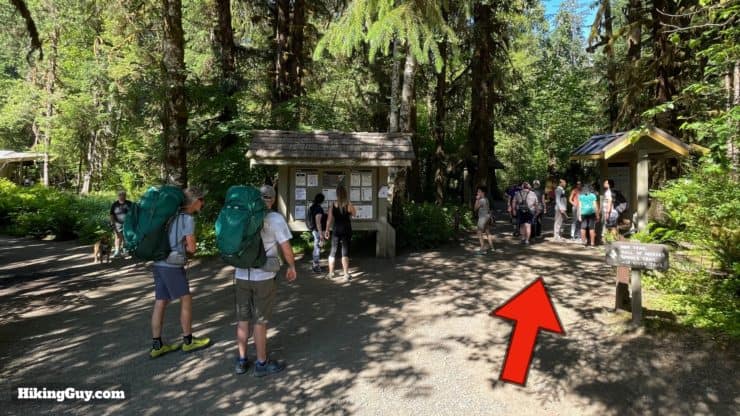
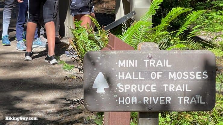
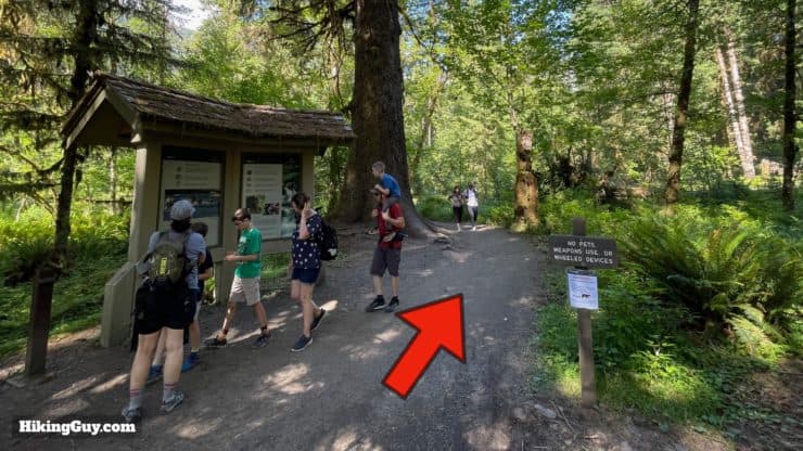
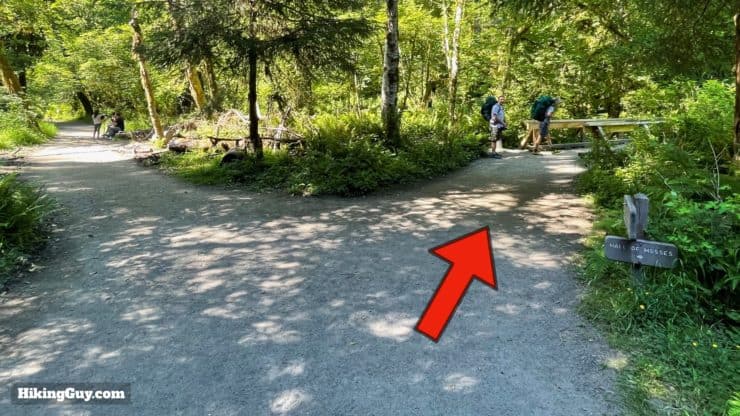
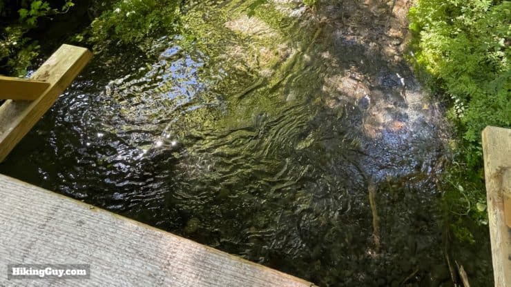
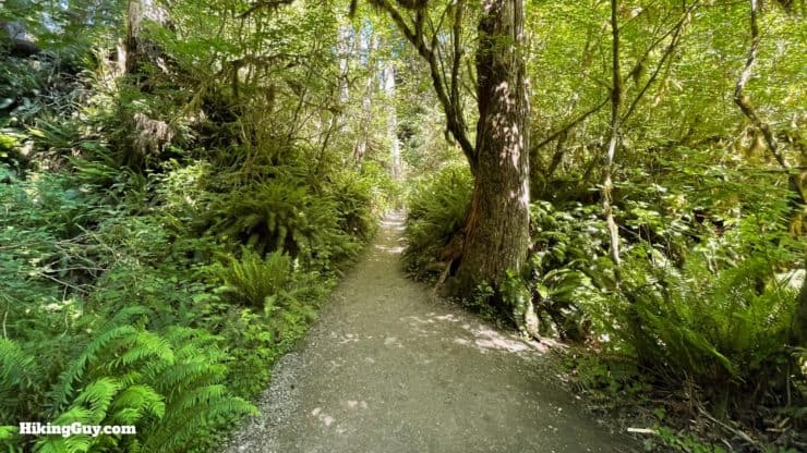
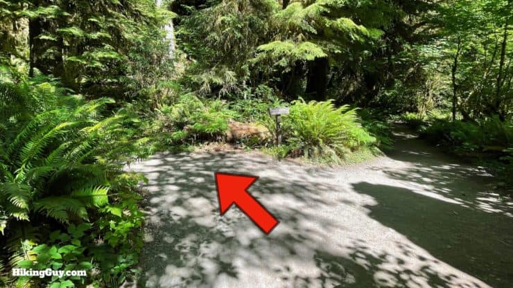
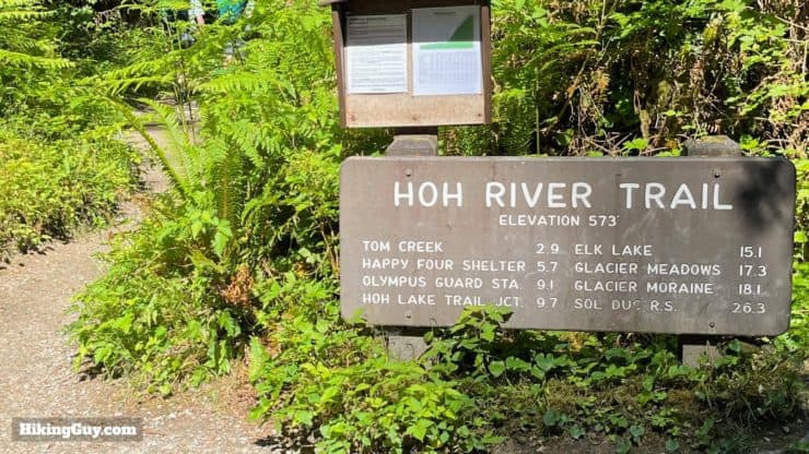
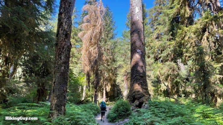
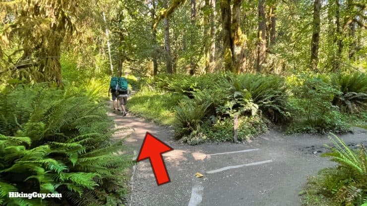
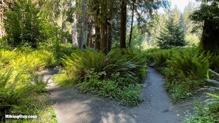
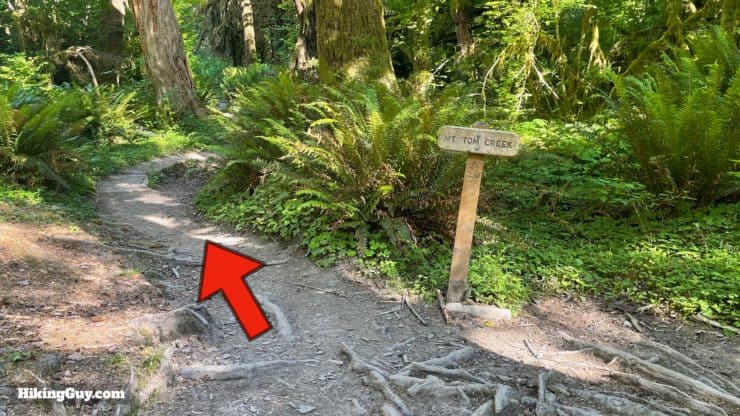
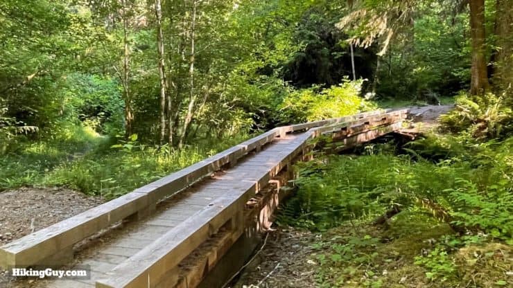
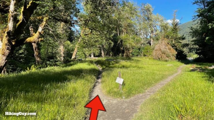
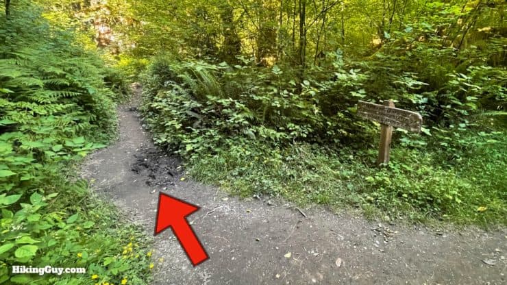
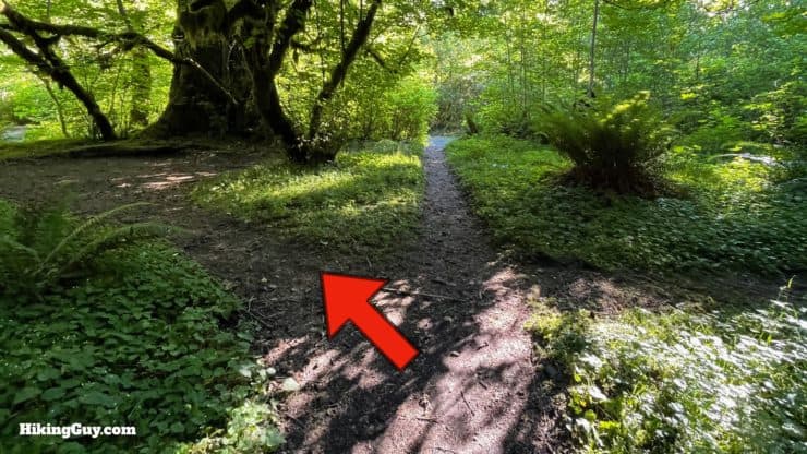
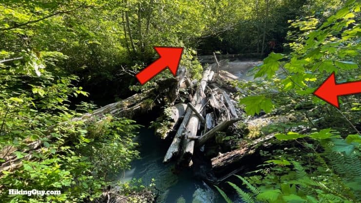
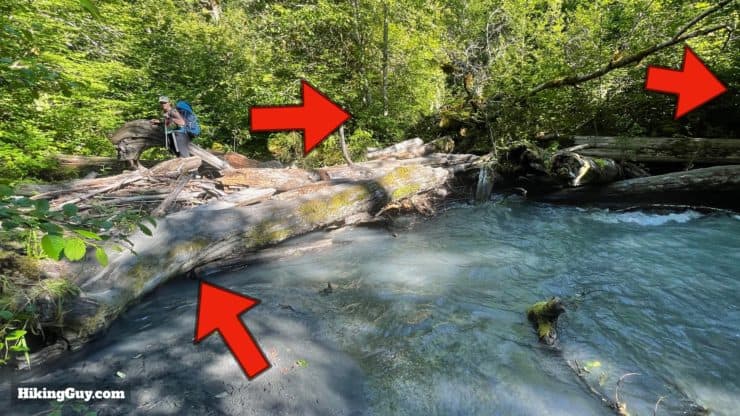
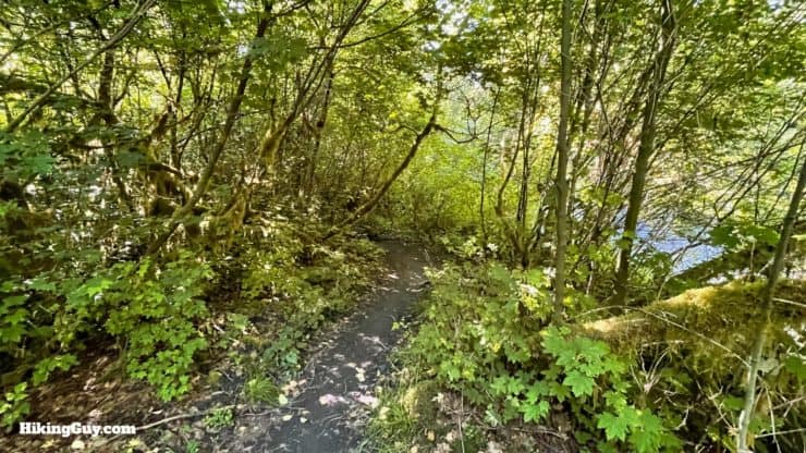
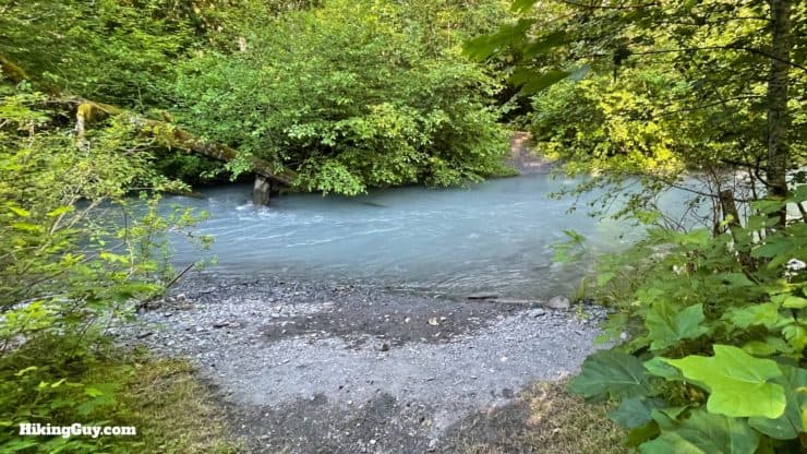
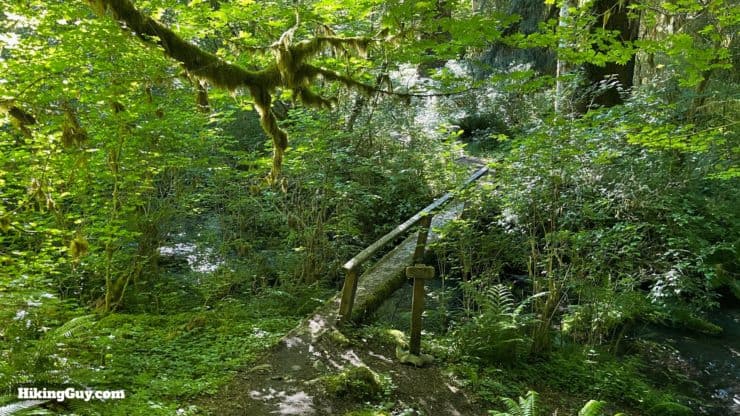
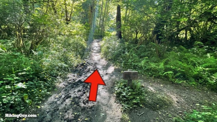
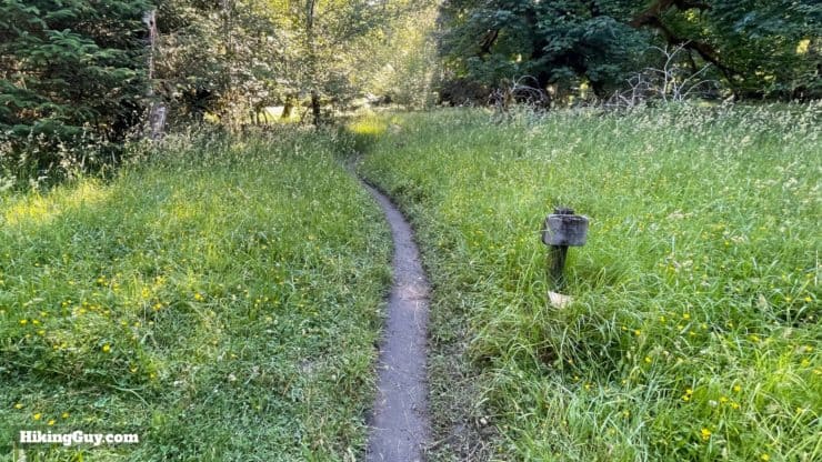
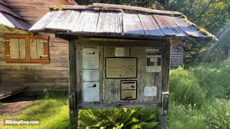
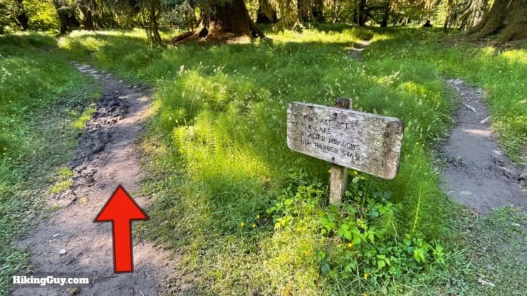
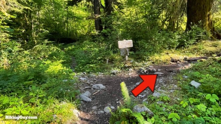
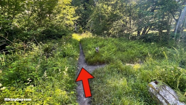
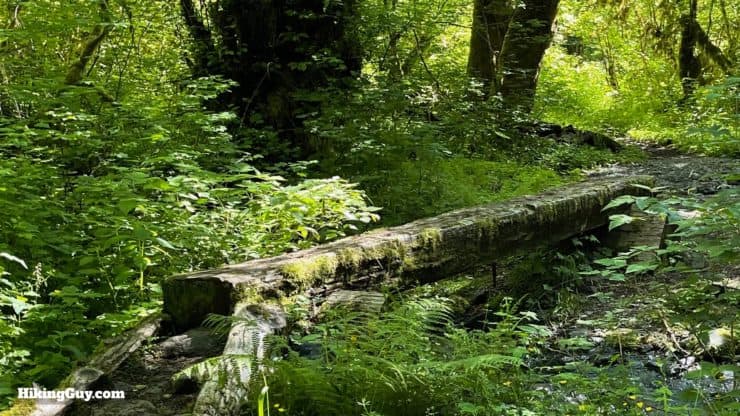
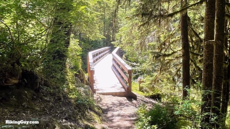
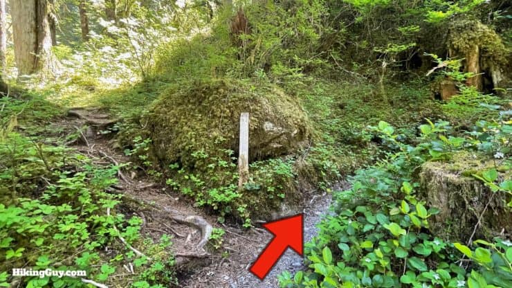
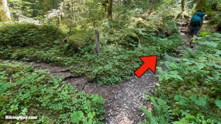
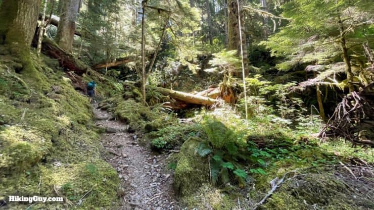
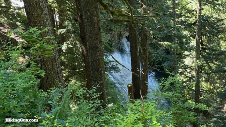
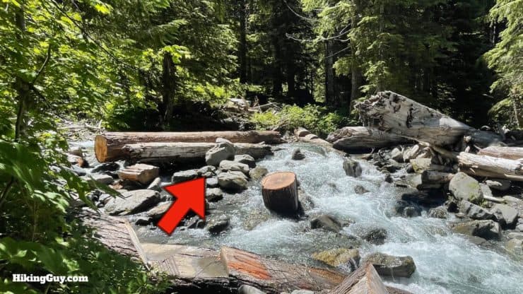
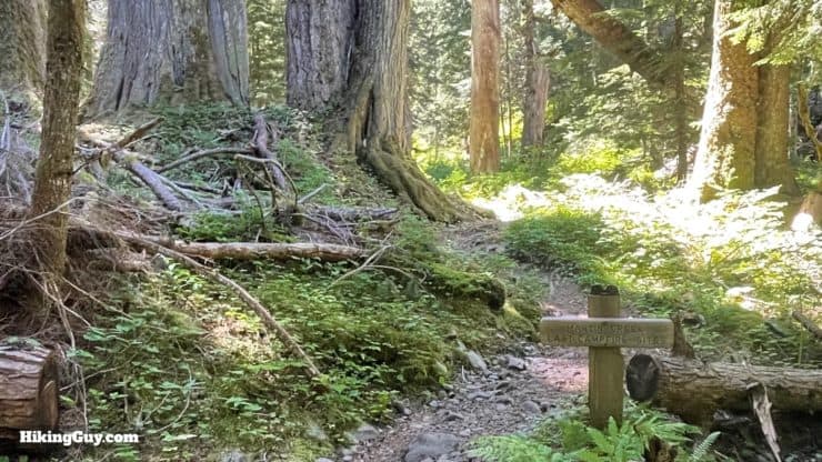
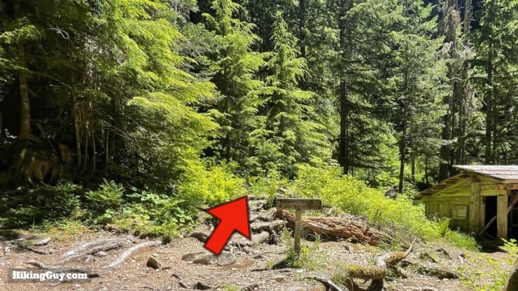
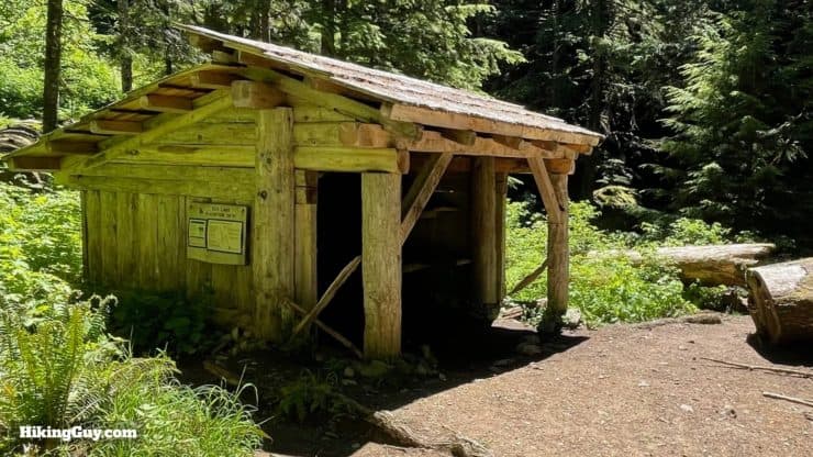
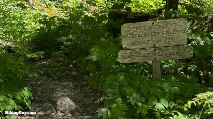
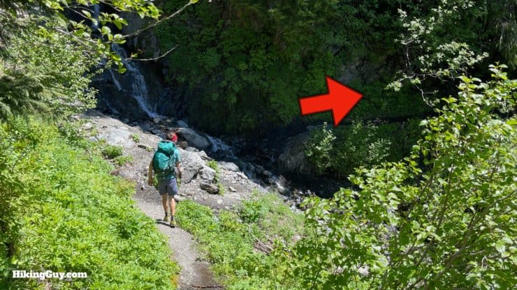
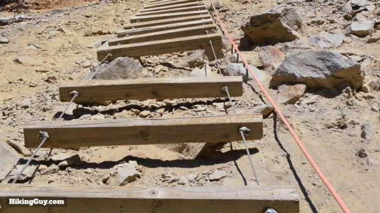
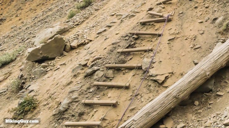
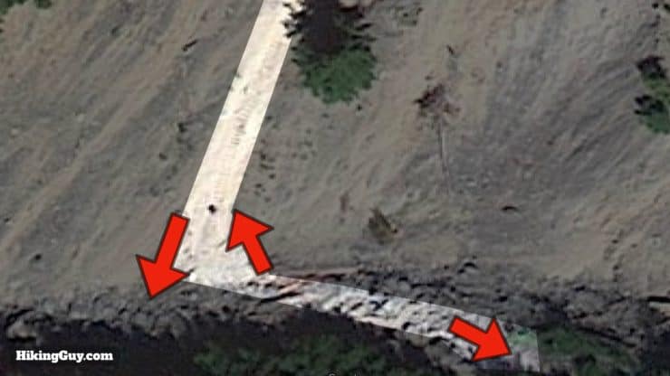
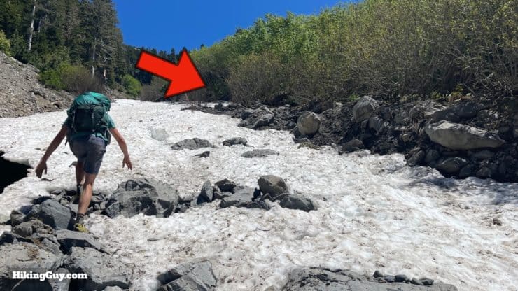
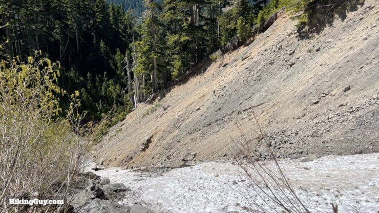
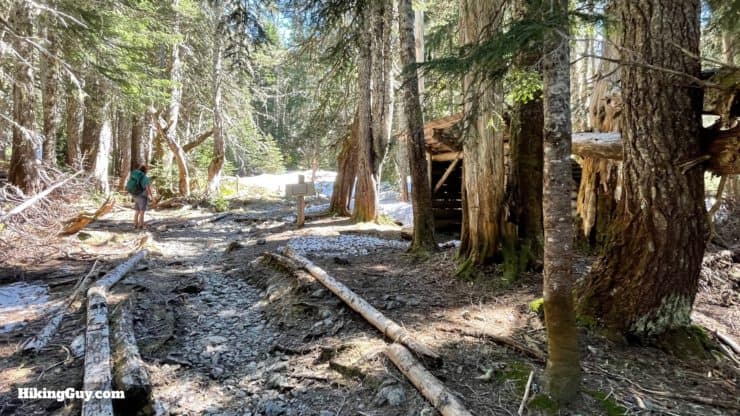
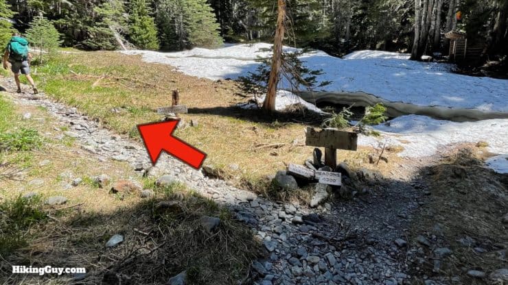
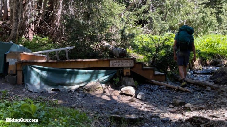
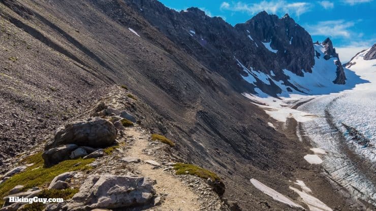
The trail starts just next to the Visitor Center.There are a couple of short loop trails by the Visitor Center. Head toward the Hoh River Trail.Hike past the trail board.And then bear right to head over the small bridge.The water is clear and beautiful, but nothing compared to what you will see on the trail in a mile or so.The crowds thin out and you start hiking into the rainforest.At the split, head left onto the Hoh River Trail.And you'll see a sign for the Hoh River Trail.And then a larger sign listing out the distances.Immediately you're among the giant trees, some of which are over 200 feet tall.You'll see several cut-offs down to the river on the right, mainly used by day hikers to catch a glimpse of the river. Continue straight unless you want to sneak a peak.You'll also see some splits like this. The safe bet is to stay left to continue down the Hoh River Trail. Sometimes these rejoin, sometimes the right dead-ends at the river.Soon you'll start getting glimpses of the Hoh River on your right.Overall the trail climbs a few hundred feet in the first 12 miles, but in practice is full of ups and downs.Cross the Mineral Creek Footbridge. To the left is a waterfall.And some streams to ford.And at about 2.9 miles you'll see the turnoff for the Mt Tom Creek campsite.Keep heading straight down the Hoh River Trail.You'll have several bridge and stream crossings.By this point you will have left the crowds behind and can really enjoy the enormity of the rainforest fauna.Logically, at about 5 miles, you'll pass the turnoff for 5 Mile Island campground.Keep straight past the turnoff into the campground.Shortly after that, you'll pass the Happy Four shelter and campsite.There are sections of the trail that get dense as you approach the banks of the Hoh.And then you have a wide log crossing of one of the braids of the Hoh River.Once over the water, you'll head left and up on the island.This part is important. Keep your eyes open for this intersection. If the water level is low, you can walk straight through the stream ahead. But if it's high, make the left here.You'll come to a pile of logs across the braid which you'll need to cross. Take a look, and then go back and approach it from the beach upstream for an easier way to climb up.Here's what it looks like from the beach upstream. Climb up and over.The trail is narrow just after the crossing, then gets back to normal.If you were able to walk across the water, you'll come out on this little beach.As you hike upstream you'll be able to see some of the higher peaks through the trees.You'll continue past the crossing, again over bridges and smaller streams.Hike straight past the sign.And around 9 miles in you'll see a turnoff for the Olympus Guard Station campsites.And then you'll see the ranger station at Olympus.Check out the trail board for any notices.And continue straight up the Hoh River Trail out of the campsite toward Elk Lake.At the junction with the Hoh Lake Trail, stay right to continue on the similarly named Hoh River Trail.Hike over the Hoh Creek (lots of Hoh going on around here...).And then cross Slide Creek.And at about 10.5 miles you'll pass the turnoff for Lewis Meadows.Continue up the Hoh River Trail - more bridges.As you continue you'll see the high peaks off to the right.Okay, here's where the business end of things starts. When you see the 12.4 mile marker by the river, the trail makes a hard left and starts climbing.The first mile is uphill, but not too steep.But as you continue to climb, the slope ticks up and the trail gets rockier.At around 13 miles you'll approach the High Hoh Bridge.The Hoh River rushes through a gorge, 100 feet below on the left.On the right, you'll see Glacier Creek flowing into the Hoh River.Just past the bridge you'll pass a non-reservable campsite. They're there in case you need to bail out and spend the night.Shortly after the first campsite, you'll pass the second (and last) non-reservable campsite.Now you climb. And then climb. And then climb some more. If you have a heavy pack, this can be really tough. The good news is that it's totally shaded.A little over a mile up from the bridge you'll start to hear, and then see, the Martin Creek falls.And then you'll cross Martin Creek.And then through the Martin Creek campsite, which is dispersed to the left of the trail.0.25 miles past Martin Creek you'll arrive at Elk Lake. To continue on the trail, hike straight through and continue up. You're about halfway up the climb.Here's the Elk Lake Shelter. Elk Lake is down to the right if you want to visit. Otherwise we'll see it as we climb.As you pass through Elk Lake there's a sign for Glacier Meadows, the next landmark on the hike.The views on this section are some of my favorites, with a line of sight to the high peaks. The high point in the distance is called Panic Peak. My Olympus is hidden behind it, and you can catch occasional glimpses of Olympus from behind Panic Peak as you climb.And if you look down as you climb, you'll see Elk Lake nestled in the forest. Behind you, across the Hoh valley, is Bogachiel Peak.More stream crossings, which can also be snow crossings when it's cooler out.As you climb the views of Panic Peak become more spectacular.There's also a beautiful "hidden" hanging valley with the wild Glacier Creek flowing down to the Hoh River.Keep climbing. It's tough, but still shaded.Another crossing at a creek that feeds Elk Lake.And then you reach the famed Jemrod Gully Ladder. You are going to climb down about 100 feet to the gully below.You start the descent by crossing a thin strip of trail over to the ladder.Here's the view from the top of the ladder. Notice that the top of the ladder is missing rungs; you have to walk down the bare slope there (using the rope).So the best move is generally to hold the rope and walk backward down the ladder and slope. In some sections there are rungs missing so you just have to walk down the bare slope. It's normal for debris to fall as you are on the ladder; it's all very loose here.At the bottom you'll notice another (purple) line off to the side.I've found that at the bottom it's easiest to butt-slide straight down to the gully. On the way back, the slope is too steep, so grabbing the (purple) side line from the last shot and climbing up to the bottom of the ladder is the move.Once you get down to the creek, make the left uphill and look for the trail to continue on the right side of the gully.Here's a view looking back at the ladder from the continuation of the trail. The first time you see all this it can be intimidating, but everyone does it and you can too. Just take your time and think ahead.A few minutes after the ladder, you reach Glacier Meadows, which has some shelters and campsites.At the junction in Glacier Meadows, make the left and continue uphill.You'll pass the seasonal ranger station.And after a bit of climbing you'll emerge on the moraine above the glacier.And then off to your right is the Blue Glacier and the three peaks of Mt Olympus above.
That's it! From here, you just return the way that you came up.


 Using the Apple Watch for Hiking
 Garmin Fenix 7 & Epix Review For Hikers
 How To Read a Topographic Map
 Garmin GPSMAP 67i Review
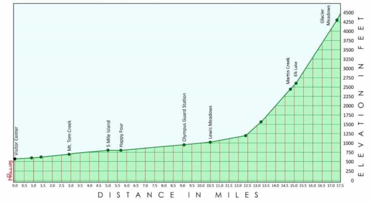


 Timberline Trail Guide (Mt Hood)
 Eagle Creek Trail Guide
 How to Hike the Lost Coast Trail
 Peter Skene Ogden Trail Guide
 Best Hikes in the US
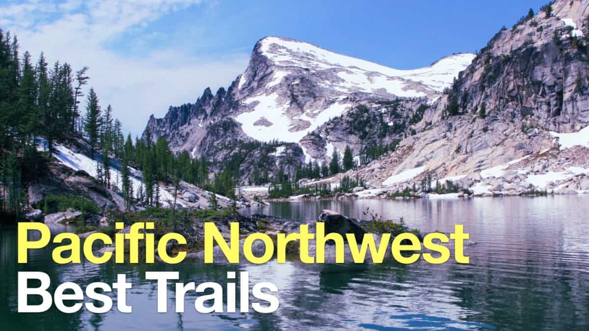 Pacfiic Northwest Hikes
 Backpacking Trips
 Best Hikes in the World
 Best Hiking Gear 2024
 Hiking Boots or Shoes: Do I Really Need Hiking Boots?
 When to Hit SOS on inReach