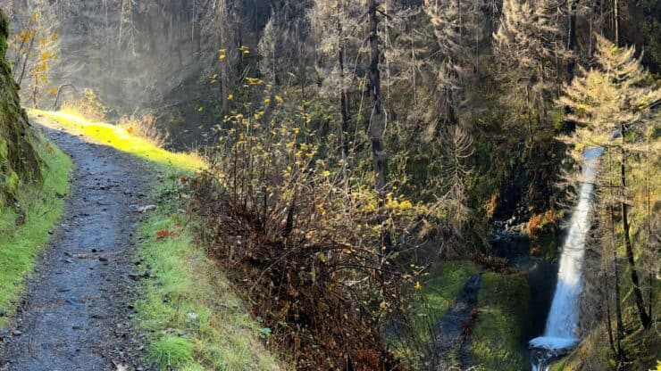

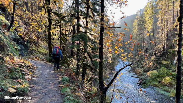
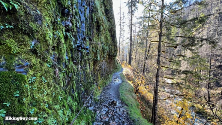
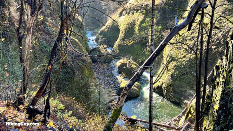
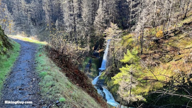
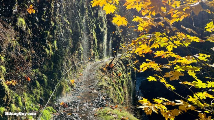
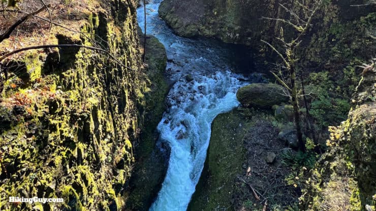
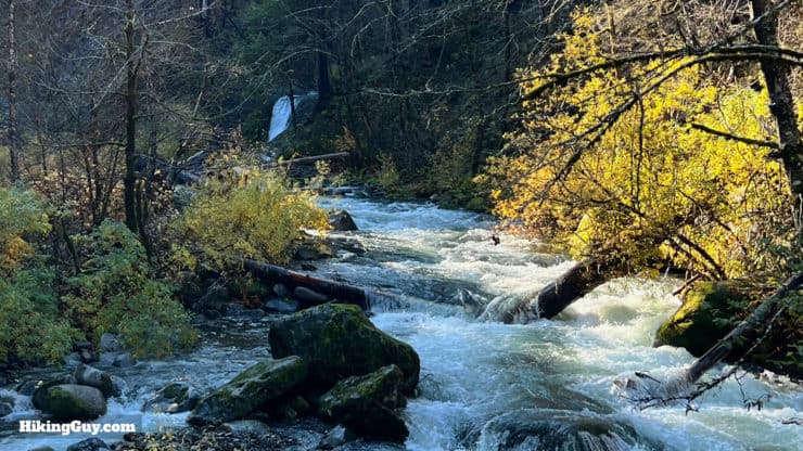
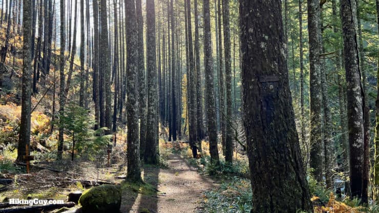
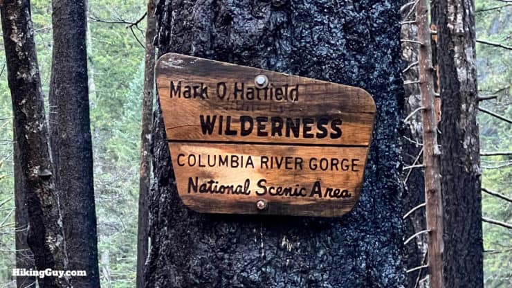
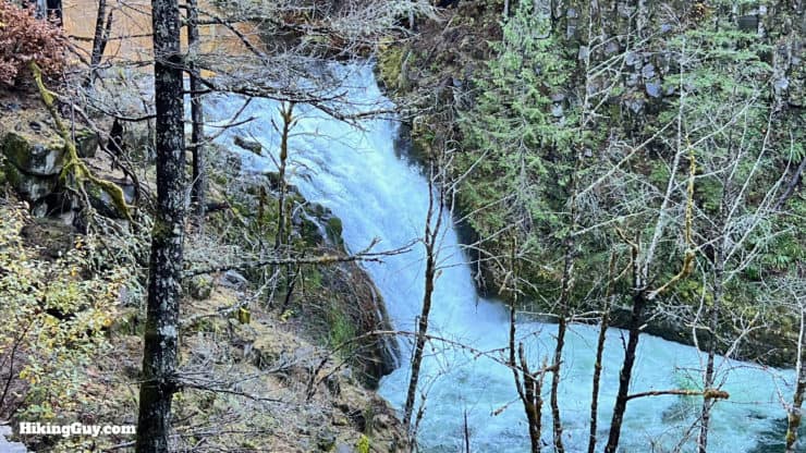
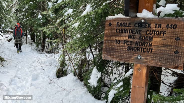
You can't go wrong with a hike on the Eagle Creek Trail, considered the signature trail of the Columbia River Gorge. Right from the start, the Eagle Creek Trail offers dramatic views of waterfalls, a raging mountain stream, dense PNW forest, and towering basalt cliffs. Most hikers enjoy the short 4.2-mile roundtrip hike to Punchbowl Falls, but I highly recommend going farther if you have the fitness. You can even make it an overnight backpacking trip, ideally hiking to the end of the Eagle Creek Trail at Wahtum Lake, high in the mountains. Whatever option you choose, you can't go wrong here.
- Video and Turn-by-Turn Directions to Hike Eagle Creek Trail
- How to Hike to Punchbowl Falls, Tunnel Falls, and Wahtum Lake
- Parking Permits for Eagle Creek Trail
- Insider Tips and Recommendations for the Hike
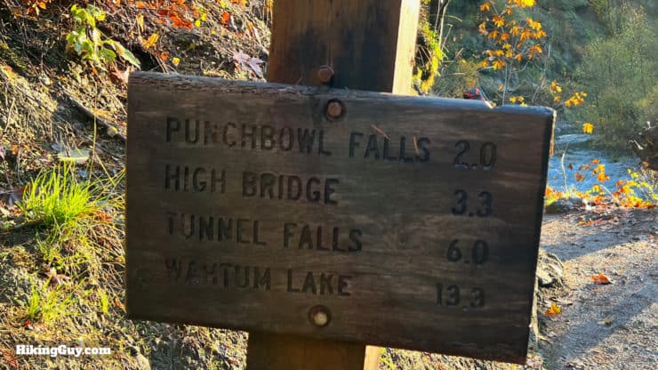
| Destination | Roundtrip Distance | Climbing | Features |
|---|---|---|---|
| Punchbowl Falls | 4.2 miles | 525 ft | Waterfalls - Cliffs |
| High Bridge | 6.4 miles | 800 ft | Dramatic River Gorge |
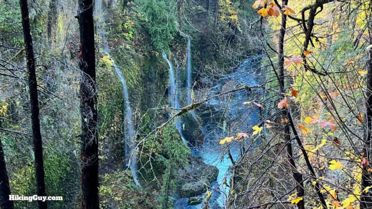
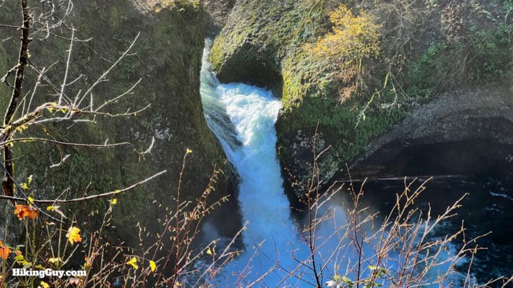
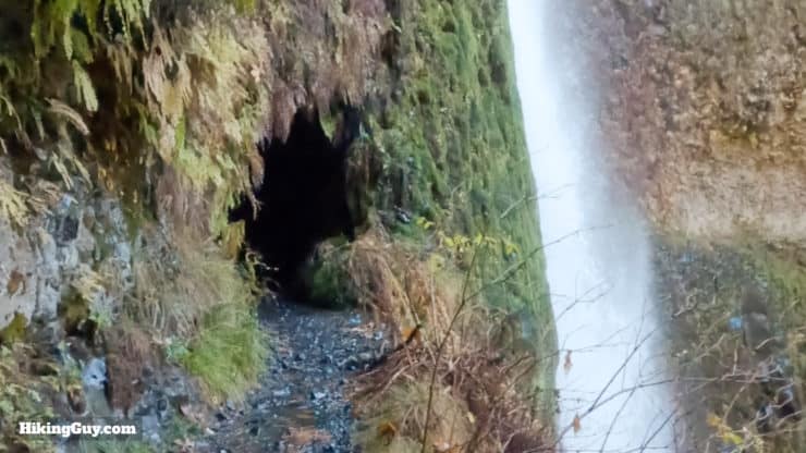
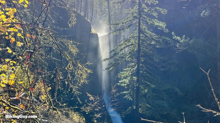
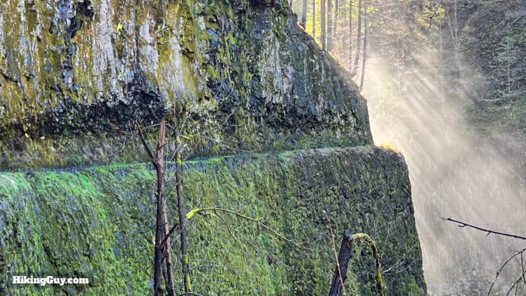
| Tunnel Falls | 12 miles | 1600 ft | Tunnel Behind Falls |
| Wahtum Lake | 26.6 miles | 3700 ft | Alpine Lake - Uphill Trail |
Where is the Eagle Creek Trail?
The Eagle Creek Trailhead is about a 45 minute drive east of downtown Portland on Interstate 84. Once you exit the highway, drive the short ways up Eagle Creek Loop, past the salmon hatchery, to find the trailhead parking. Use this trailhead address:
Eagle Creek Trailhead, NE Eagle Creek Loop, Cascade Locks, OR 97014
Beating the Crowds
Before you even think about going to the Eagle Creek Trail, know that you'll have to contend with crowds. Even back in 1919, when the trail was built, it had about 150,000 visitors a year. Today, it's many more, mainly limited by the lack of parking (more on that in a sec). The best time to visit without a crowd is to arrive at sunrise. In the late afternoon, parking tends to open up as well. And obviously, weekdays are better than weekends, although the lots do fill up on weekdays too. So if you show up at 9 am on a Saturday, don't expect to do the hike.
Parking for the Eagle Creek Trail
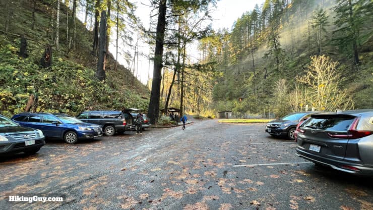
Farther down from the trailhead, there is a parking area along the road, with space for about 10 cars. The last option for parking is at Eagle Creek Day Use Area, by the salmon hatchery, right at the turn off for Eagle Creek Loop road. That lot has about 30 parking spaces. This lot also has bathrooms (in fact, the bathroom is named "Big John").
Park along the side of the road at your own risk, illegally parked cars are towed.
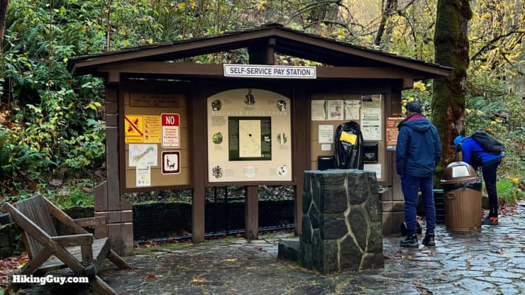
You need a parking pass here. You can self-pay at the trail board, use a Northwest Forest Pass, or simply display a (worth every penny) National Parks pass.
Another option is to stay at the historic Eagle Creek Campground, which is by the hatchery. If you stay at the campground you can park your car there while you hike.
Lastly, don't leave any valuables in your car. As is the case with many trailheads, there are occasional break-ins. The Forest Service recommends parking in the larger parking lot by the hatchery if you are camping overnight. I just leave my glove box open and show potential thieves that I don't have anything good to take.
And if you visit in the fall, keep your eyes open for coho and chinook salmon spawning in Eagle Creek.
Gear For the Hike
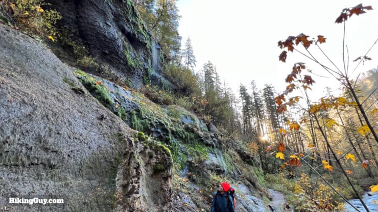
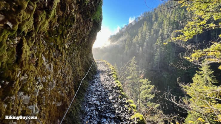
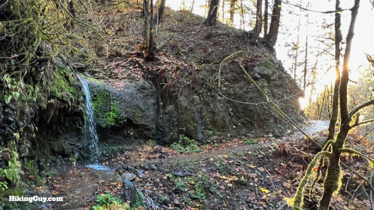
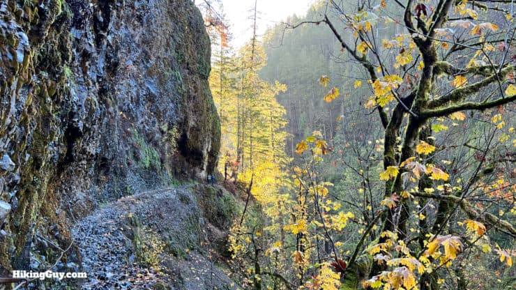
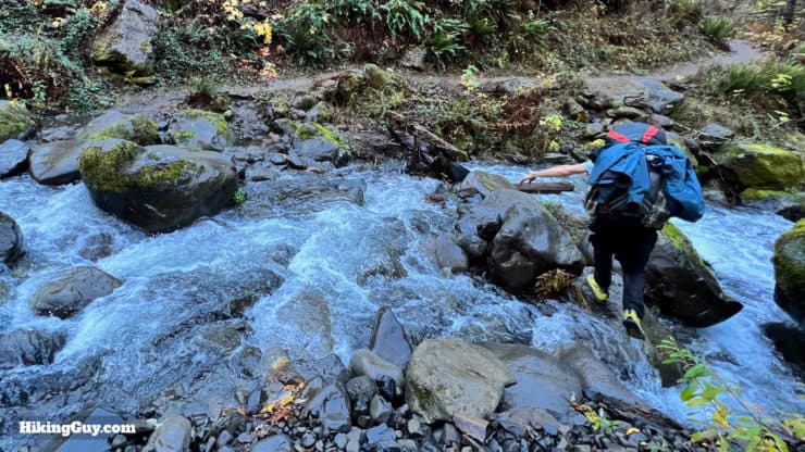
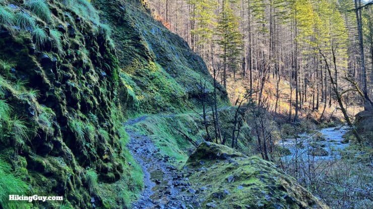
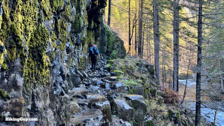
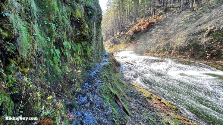
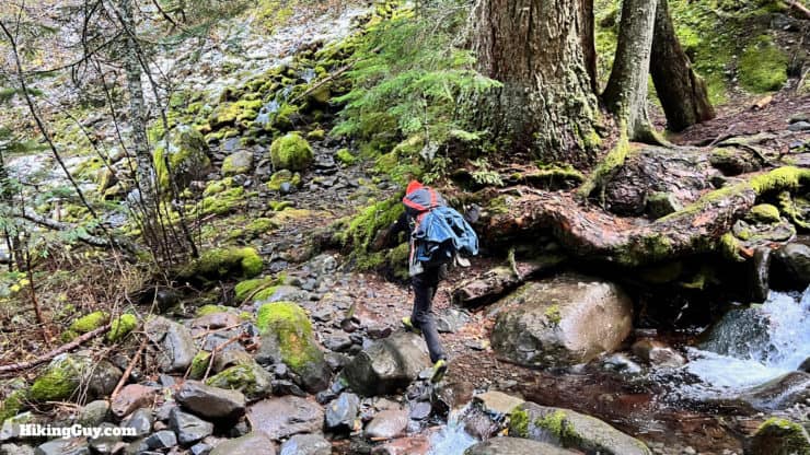
- As you would expect in the Pacific Northwest, it can get very wet here. There are stream crossings, water runoffs, and mud. It's a safe bet to wear shoes that you're comfortable getting wet in. The trail surfaces, which are sometimes raw rock blasted out of the cliff, can be slippery. I recommend good trail runners.
- If you use trekking poles, I'd recommend just using one. On the various cables sections you will be able to hold the cable with one hand, and a trekking pole with another. The trail is very gentle in terms of slope; I leave my poles in the car here.
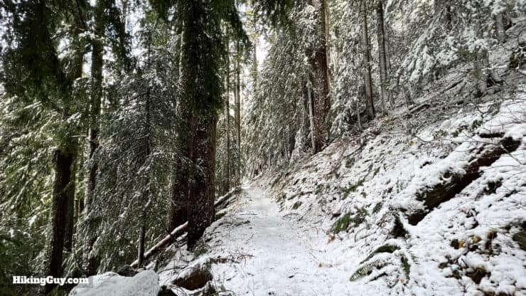
- In the winter, the trail can be snowy and icy, in which case I don't recommend doing it (and the Forest Service may also close it if that's the case). There are sheer cliff walls that you do not want to slip off of (more later). And the upper part of the Eagle Creek Trail, past 7.5 mile camp toward Wahtum Lake, is generally snow-covered and often impassable during the winter.
- GPS can be inaccurate when you are hiking along the cliff faces. Luckily the trail is easy to follow without any tricky navigation.
- There are a lot of side creeks feeding into Eagle Creek. It's usually easy to access water to refill your bottles. Just make sure you use a water filter before you drink anything from here.
Gear That I Love Right Now
Nothing is sponsored or promoted, just the actual gear that I use.


Check out the complete list here. ( Updated October 2024)
Eagle Creek Trail Camping
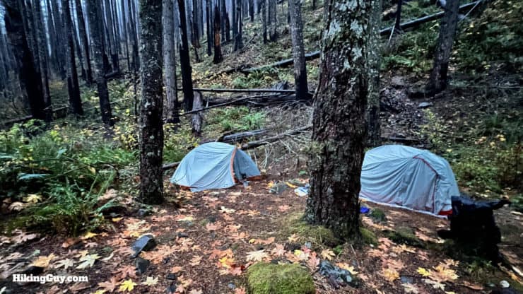
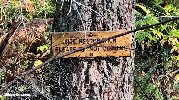
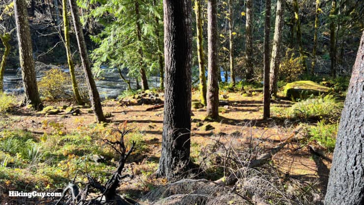
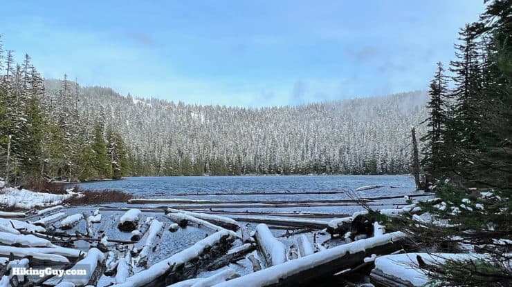
Before the 2017 fire here (more later), camping was more plentiful. Today there are a limited amount of primitive campsites along the trail, and they fill up quickly given the popularity of Eagle Creek. Your best bet for an overnight camping trip is to hike up to Wahtum Lake, which has multiple tent sites. Also note that no camping is permitted before the first campsite, Tenas Camp. And campfires are not permitted, even though you'll find fire rings at some sites.
Here are the campsites, in order from the trailhead:
- Tenas Camp - 3.8 miles
This site is very overgrown, and the tent sites you can find are sloped and not great. I wouldn't recommend camping here. - Wy'East - 4.7 miles
Recently opened after the 2017 fire. Spots on either side of the trail. - Blue Grouse Camp - 5.3 miles
This site has been damaged by the fire, and is a bit overgrown. It has about 2-3 tent sites, as well as good water access. - 7.5 Mile Camp - 7 miles (yea)
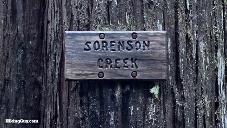
You'll first spot some tent sites between the creek and the trail with good water access (my favorites), and then as you continue up into the woods, there are some spots along the trail and a few side trails down toward the creek with tent sites. Overall there are about 10-12 tent sites here. - Unnamed / Indian Springs Creek - 11 miles
There are some great tent sites between the trail and the (informally named) Indian Springs Creek, on the upper slopes off the trail. There's good water access and you are far away from any crowds. I put the waypoint in the map and GPX file. - Wahtum Lake - 13.3 miles
There are a few dozen nice sites in the vicinity of the lake, with most of them set back from the lake. The PCT circles the lake and there are spots along the PCT as well.
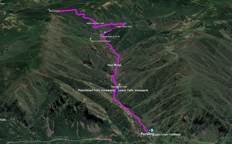
Eagle Creek Maps
How Will You Navigate?
 Using the Apple Watch for Hiking
 Garmin Fenix 7 & Epix Review For Hikers
 How To Read a Topographic Map
 Garmin GPSMAP 67i Review
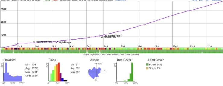
Elevation Profile
Landmarks on the Hike
| Landmark | Distance | Elevation |
|---|---|---|
| Trailhead | 0 | 110 |
| First Cables | 0.7 | 260 |
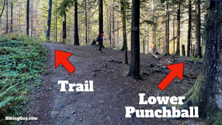
| Lower Punchbowl Trail | 1.8 | 500 |
| Punchbowl Viewpoint | 2.1 | 500 |
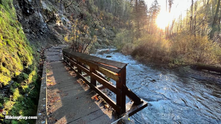
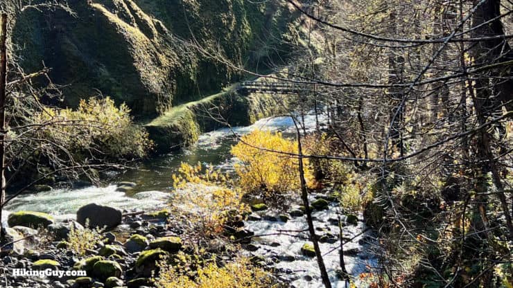
| High Bridge | 3.3 | 570 |
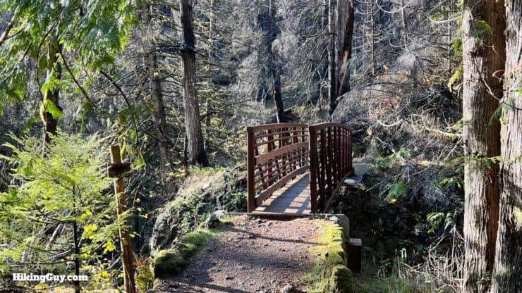
| 4.5 Mile Bridge | 4.1 | 700 |
| Tunnel Falls | 6 | 1040 |
| Twister Falls | 6.2 | 1120 |
| Start of Climb / Eagle Tanner | 7.5 | 1580 |
| Indian Springs Junction | 9.5 | 2320 |
| Wahtum Lake | 13.3 | 3725 |
3D Map
Trail Conditions
Hike Brief
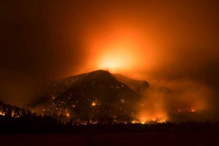
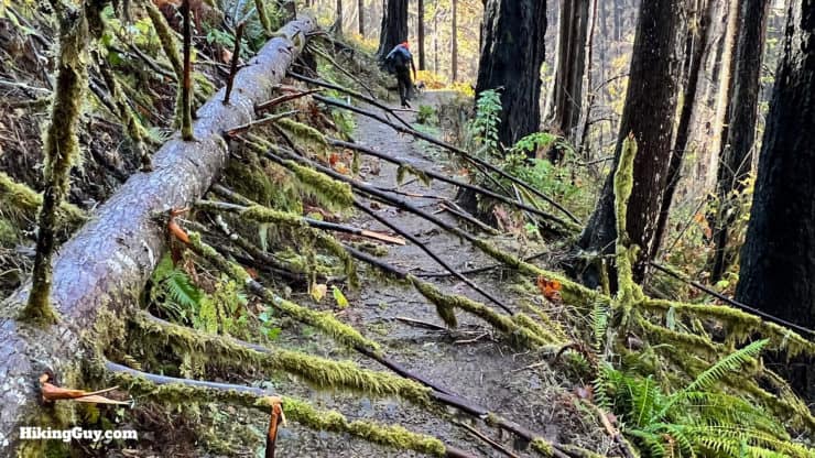
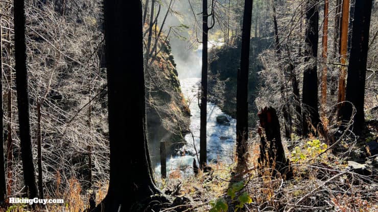
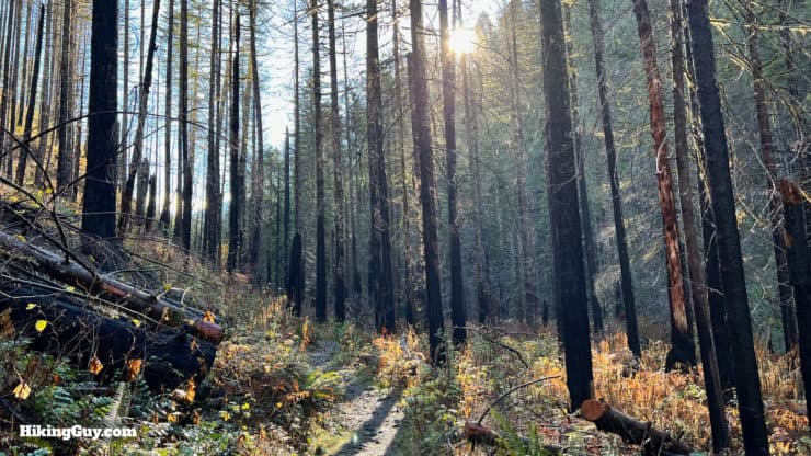
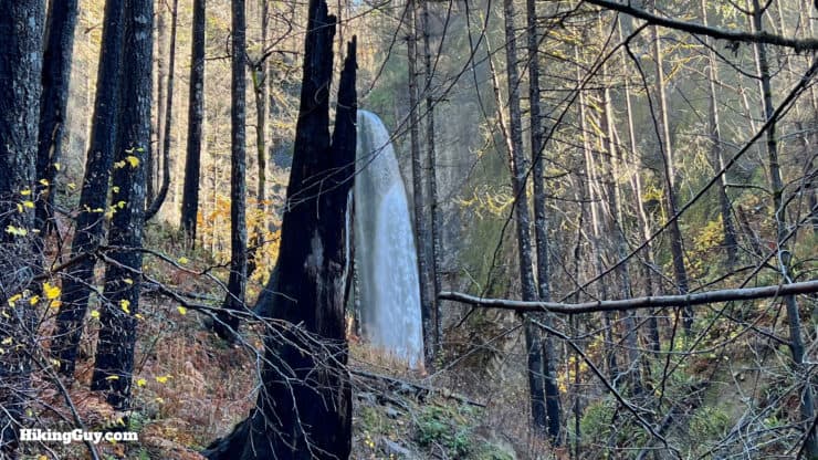
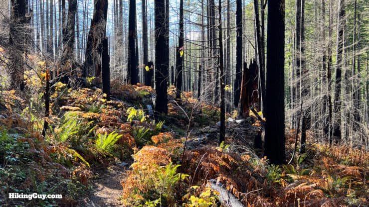
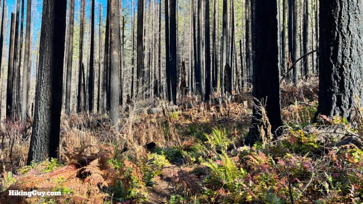
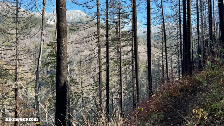
- The trail was closed for several years after the 2017 fire, and you can still see the damage from the fire as you hike the trail today, although the first 7 miles of the trail (where most of the attractions are) still have the same feel as they did before. Much has been documented about the fire, and I recommend watching an excellent short documentary that tells the story of 150 hikers stuck on the trail when the fire started. You can dive deeper into this fire and wildfires in general in an REI podcast series on the subject.
- The park you'll hike through has been here for over 100 years. In fact, when the Columbia River Gorge Park was established in 1915, it was the first time the Forest Service had dedicated an area to purely recreational use. Shortly after its establishment, the Eagle Creek Campground was built, and then the Eagle Creek Trail was completed in 1919
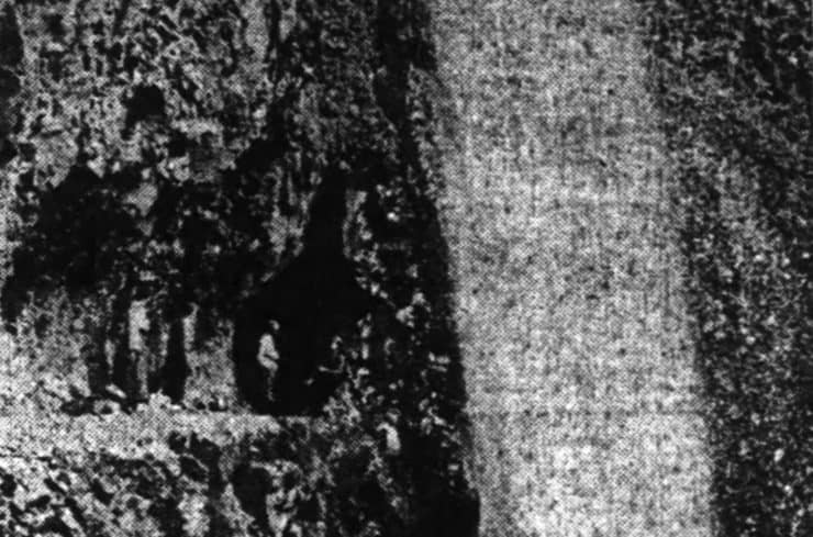
Here's Tunnel Falls when it was first blasted through in 1917. At the time, the trail cost $1000/mile to build. In today's dollars, that's about $21,000 a mile, which seems pretty reasonable given the terrain. Photo Oregon Daily Journal, 18 Nov 1917 - And don't forget Eagle Creek's namesake, the bald eagle. In the 1960s the bald eagle was threatened with extinction, and was one of the impetuses for creating the Endangered Species Act of 1973. In 2007 the bald eagle was no longer endangered, and today they visit the Columbia River Gorge in the winter to nest.
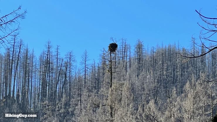
Given all the incredible scenery at ground level, it can be easy to forget to look up. But try to remember; maybe you'll see a bald eagle. Here's a nest along the beginning of the trail.
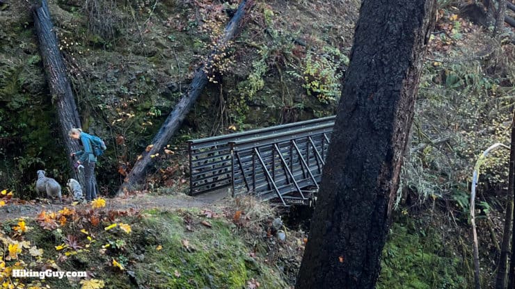
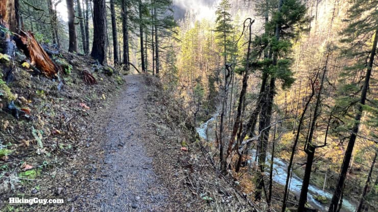
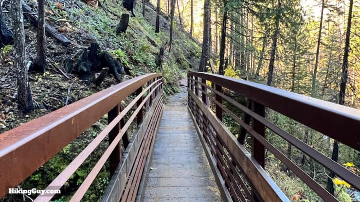
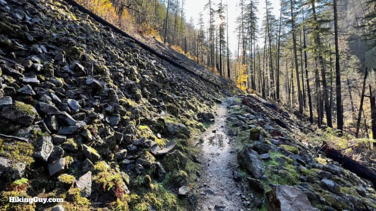
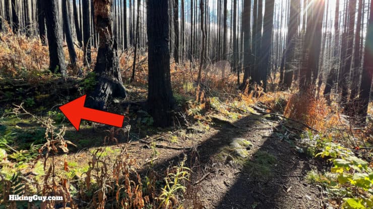
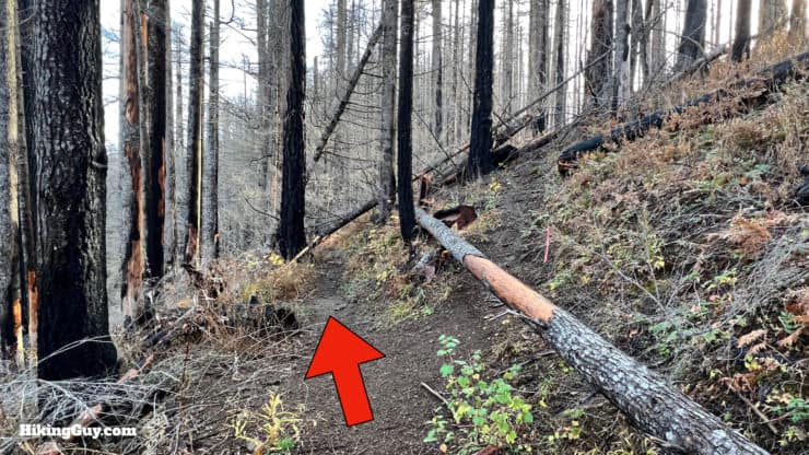
Eagle Creek Trail Hike Directions
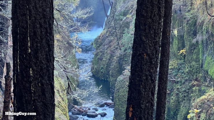
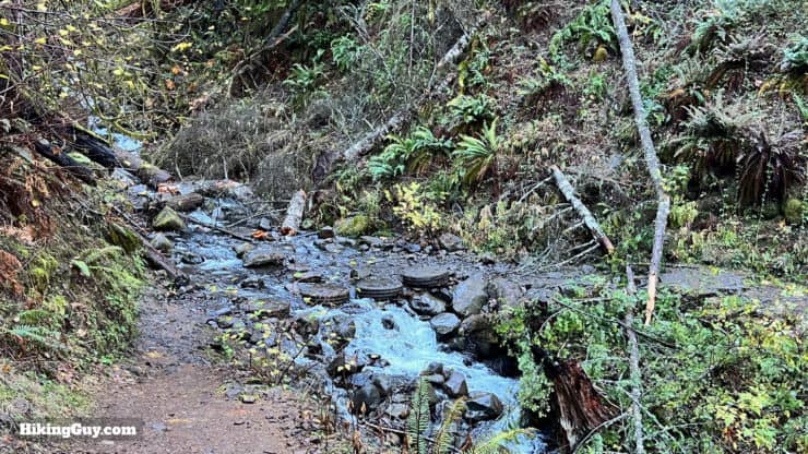
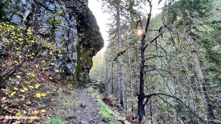
Eagle Creek Trail to Punchbowl Falls
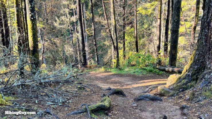
Let's head back up to the last junction.
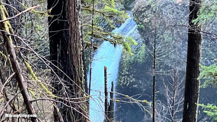
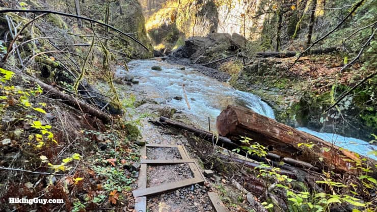
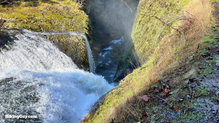
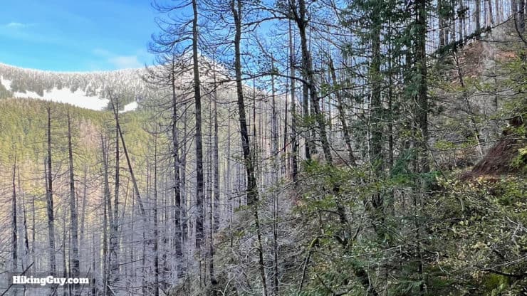
Punchbowl Falls to Tunnel Falls
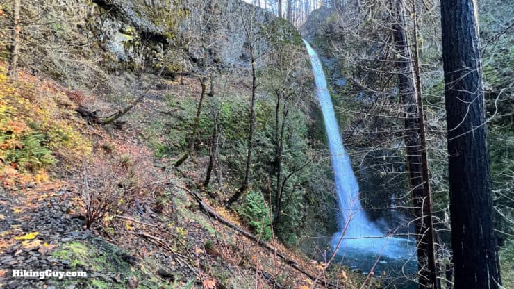
If you've hiked to Tunnel Falls, I highly recommend doing the short section up to Twister Falls before you turn around, it's worth it.
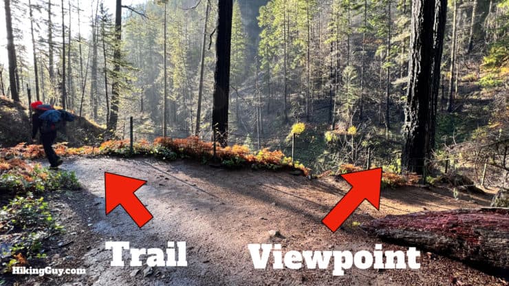
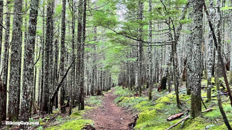
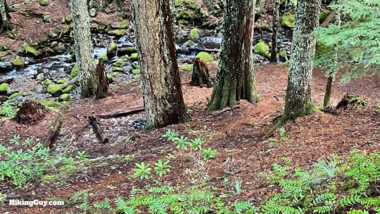
Tunnel Falls to Wahtum Lake
Need More Info?
- Have a question about the guide? Join my Patreon and ask me a question.
- When planning, always check the park website and social media to make sure the trails are open. Similarly, check the weather and road conditions.
- Do you have an update to this guide? View the Youtube comments for this video. Leave a comment and I will do my best to update the guide.
Related Guides
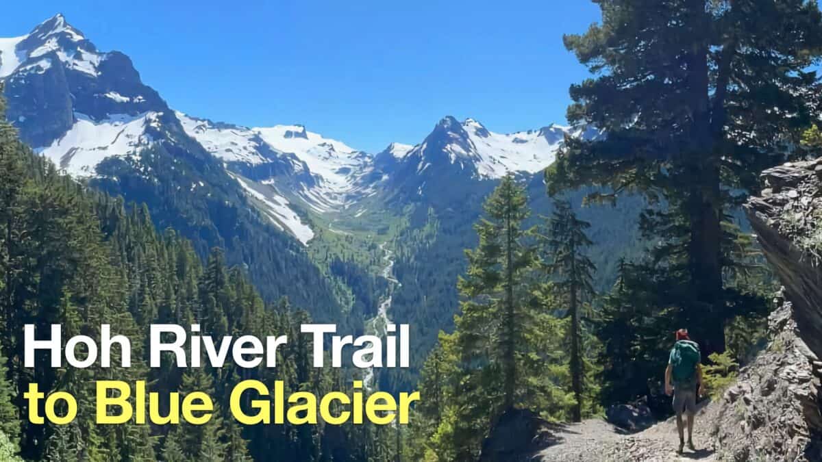 Hoh River Trail to Blue Glacier Hike Guide
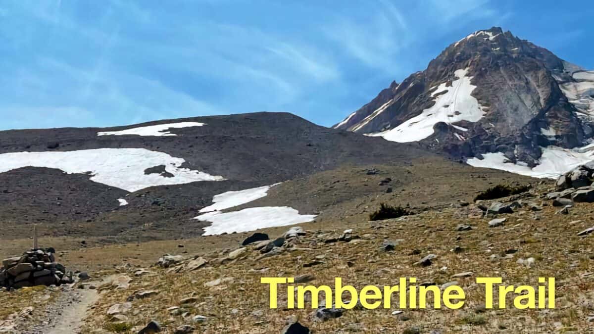 Timberline Trail Guide (Mt Hood)
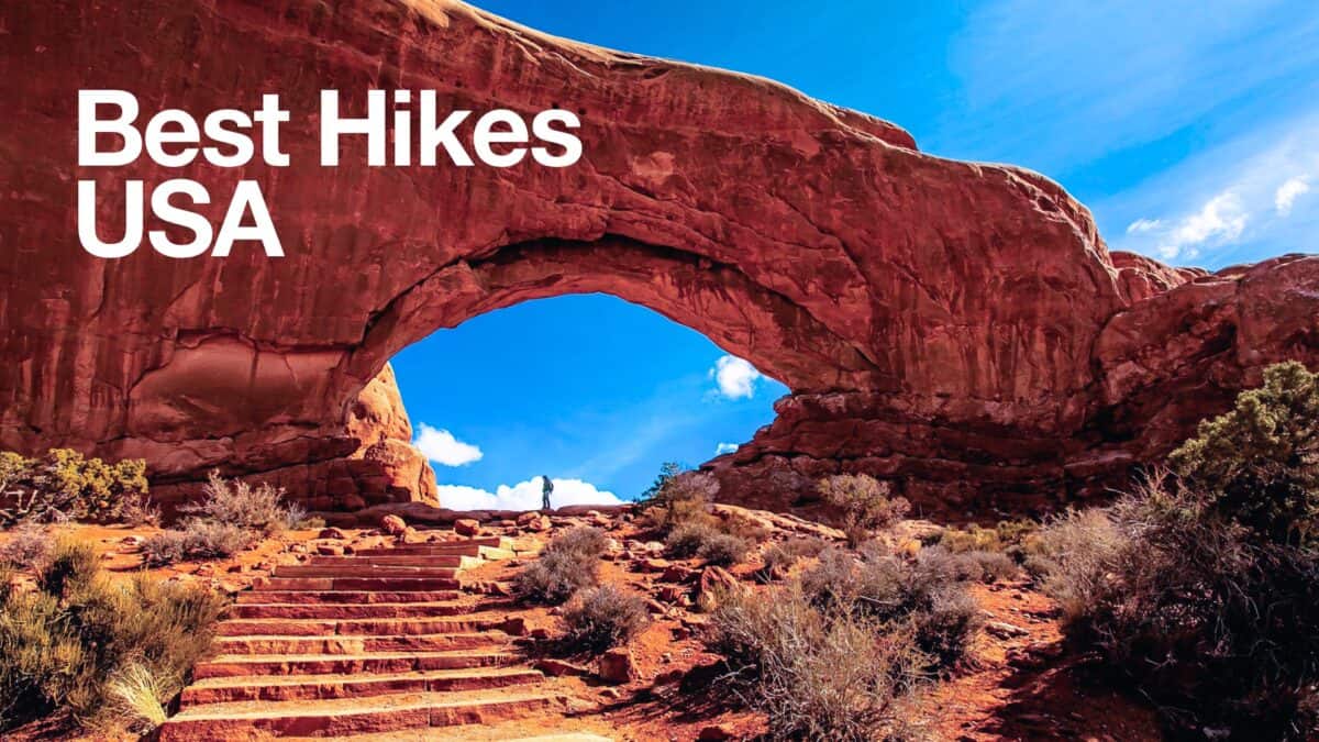 Best Hikes in the US
 Pacfiic Northwest Hikes
 Backpacking Trips
 Best Hikes in the World
Popular Guides
 Best Hiking Gear 2024
 Hiking Boots or Shoes: Do I Really Need Hiking Boots?
 When to Hit SOS on inReach
This Guide Was Written by Cris Hazzard

Hi, I'm Cris Hazzard, aka Hiking Guy, a professional outdoors guide, hiking expert, and author based in Southern California. I created this website to share all the great hikes I do with everyone else out there. This site is different because it gives detailed directions that even the beginning hiker can follow. I also share what hiking gear works and doesn't so you don't waste money. I don't do sponsored or promoted content; I share only the gear recommendations, hikes, and tips that I would with my family and friends. If you like the website and YouTube channel, please support these free guides (I couldn't do it without folks like you!). You can stay up to date with my new guides by following me on YouTube, Instagram, or by subscribing to my monthly newsletter.