
Garmin GPSMAP 66sr Review & Test
The Garmin GPSMAP 66sr is the best handheld GPS out there. There, I said it. I spent several weeks using the GPSMAP 66sr on the hiking trails, and in this review, I'll tell you what my experience has been. I've even tested the 66sr within the walls of the Grand Canyon, and I'll share my results in this review.
- GNSS / Multi-Band Performance
- Grand Canyon Test Results
- Battery Life, Mapping, and Other Notable Features
- Which GPSMAP Model Should You Get?
You can support this website and these independent reviews by using the links above to purchase this or anything. I receive a small commission that helps offset website costs; you pay nothing extra.
I was not paid by Garmin to do this review. All reviews on this site and independent and unsponsored.
Garmin GPSMAP 66sr GPS Performance
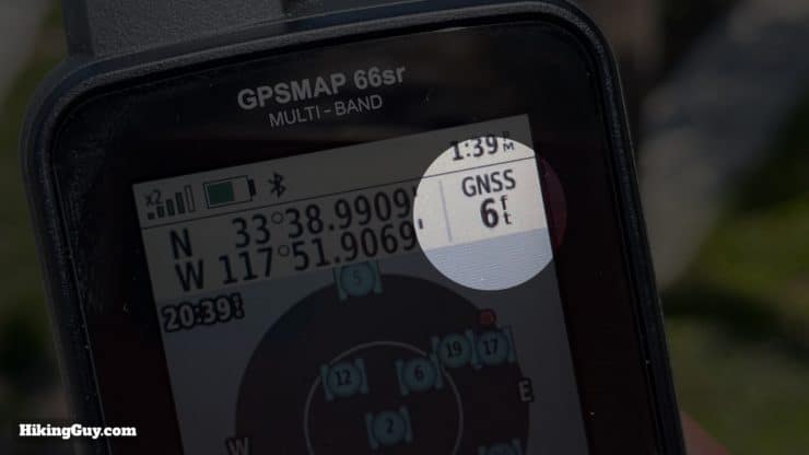
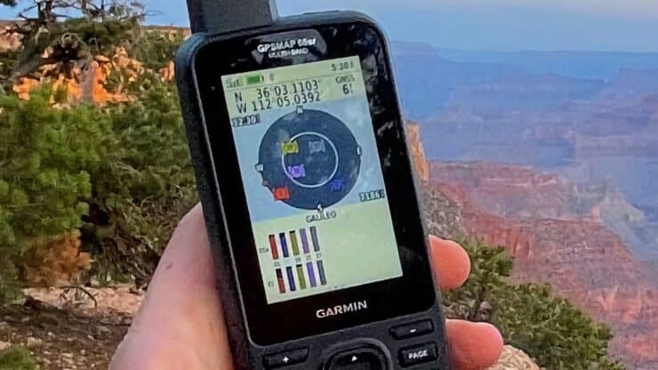
Since the positioning on the 66sr is likely the main draw, let's jump right into it. Overall the positioning accuracy and reliability was the highlight of this device. The 66sr can get a position very quickly and often with a 6ft (1.8m) level of accuracy. If you consider that most trails are about 4 ft wide, and a human with their arms outstretched is generally around 6ft wide, this should be more than enough for navigating the backcountry. Although there are always variables when using a GPS unit, overall, the tracks you record on the 66sr should be the most accurate.
If you're not familiar with how GPS works from a technical perspective, I highly recommend checking out my article explaining the concepts here. It will help you understand how to get the most out of your GPS.
Multi-GNSS Functionality
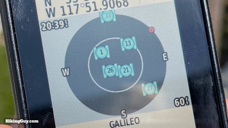
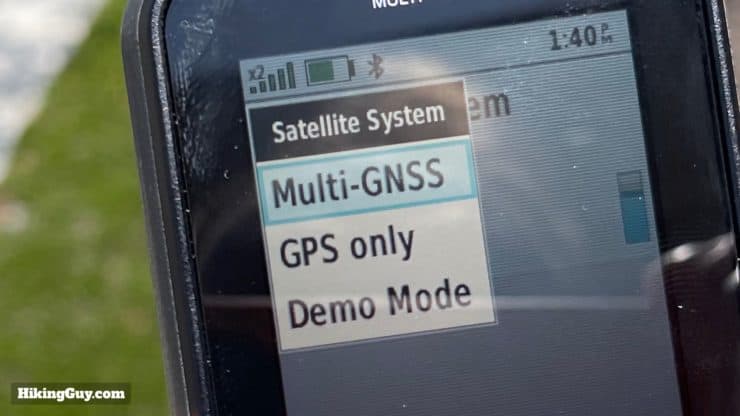
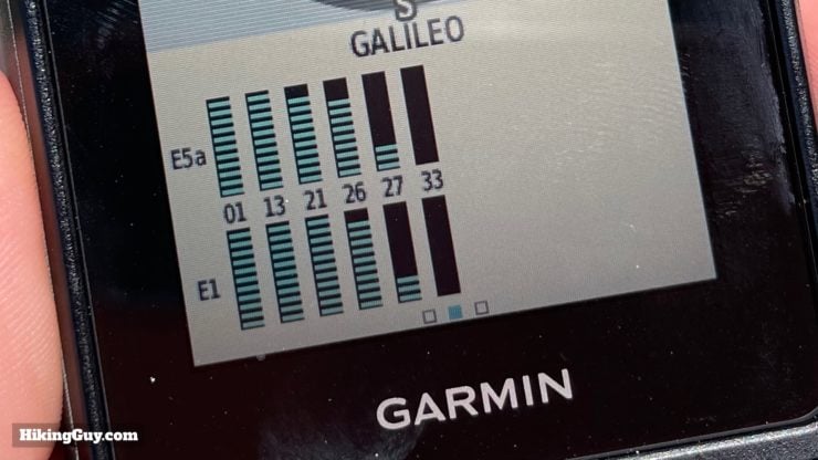
The 66sr is a multi-GNSS receiver, and it can pick up signals from multiple satellite systems: GPS (USA), GLONASS (Russia), GALILEO (Europe) QZSS (Japan), and IRSS (India). The practical application of this is to have more satellites in the sky to choose from, making a fix quicker and allowing the chipset to select the best quality signals.
The only (public) satellite constellation that is missing is BeiDou (China). You can find BeiDou support on many smartphones, but not on Garmin GPS units (yet). It's not a big deal; the GNSS systems that the 66sr supports allow it to choose from over 100 satellites orbiting the earth.
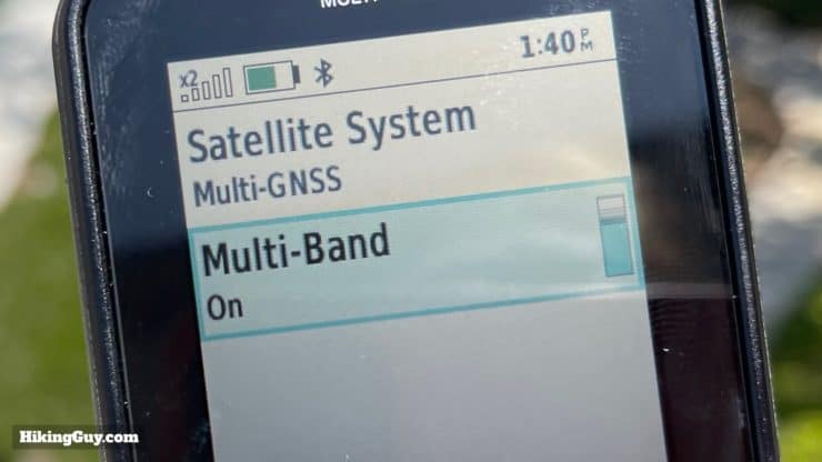
Multi-Band Functionality
The 66sr is multi-band. Think of bands on GPS like the radio station bands of AM and FM. The original GPS satellites broadcast on the L1 band, and you can think of it like AM radio. You can listen to it, but if there's interference, it doesn't sound great. The L1 band is the most prone to interference, which leads to incomplete positioning data received, and therefore a less accurate position fix.
Since the original GPS satellites went up in 1993, many new and improved satellites have been launched. New signal bands have been a part of the technological advances on these satellites. One of these new bands is the L5 band, first launched in 2010. If the old L1 band is AM radio, think of L5 as FM radio. The signal quality is better, and the data received is generally of better quality.
And the GNSS satellites broadcast on both the L1 and L5 bands at the same time. When the 66sr receives multi-band from a satellite, it can use those multiple signals to do quality analysis and correction, reducing the error introduced by bouncing signals (multi-path error) and the earth's atmosphere.
Accuracy and Consistency
Getting a fix to within 6 feet when standing still is just half of the equation. You want a GPS unit to consistently have that level of accuracy as you move through tree cover, canyons, valleys, etc. After using the 66sr in a wide variety of terrain, including heavy PNW canopy and deep canyons, I can say that the many satellite and band options available to the 66sr have meant that I consistently get a good (often 6ft) level of accuracy, regardless of the terrain.
I would highly recommend getting this if your outdoor activity involves dense foliage, metropolitan areas with tall skylines, or deep canyons. This GPS will give you better accuracy than any other handheld outdoor GPS currently on the market REI Reviewer
GPS Altitude
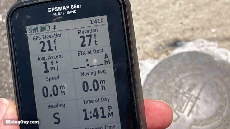
I've never relied on elevation readings on handheld or watch GPS units. In the past, they've been up to hundreds of feet off the mark. But the multi-band and multi-GNSS systems on the 66sr have been usually within 10 feet of known elevations. I set the altimeter auto-calibration to once when the weather is stable and continuous if the weather is changing. The auto-calibration uses a combination of GPS and DEM map info (Digital Elevation Model) to guess your current elevation and calibrate from that. Given that the 66sr positioning is more precise, it probably positively affects the barometric altimeter calibration.
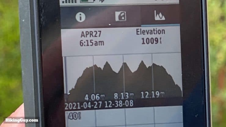
GPS Test
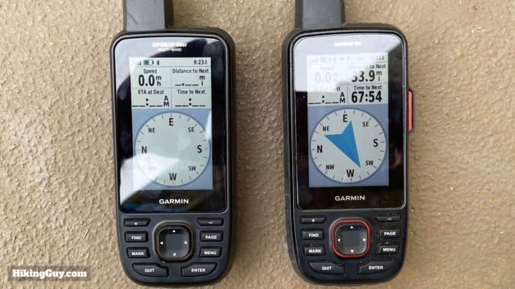
For this GPS test I was lucky enough to be able to bring the 66sr to the Grand Canyon for a Rim 2 Rim 2 Rim hike. I compared it to recordings made on the GPSMAP 66i (GPS + Galileo), Fenix 6x Pro Solar (GPS + Galileo), and Gaia GPS on an iPhone 12 Pro Max (GPS, GLONASS, Galileo, QZSS and BeiDou).
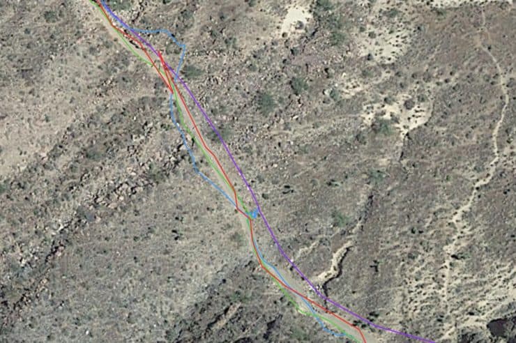
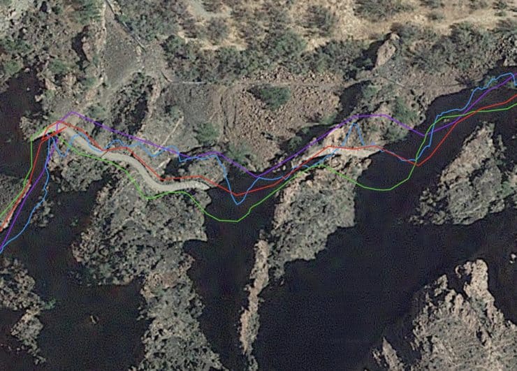
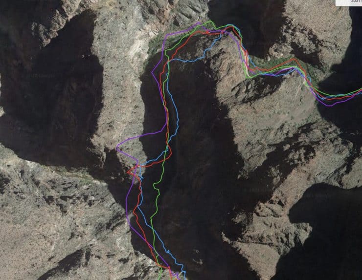
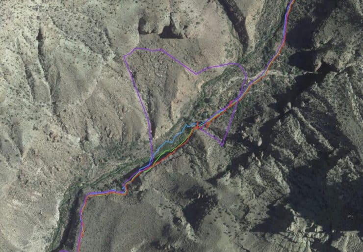
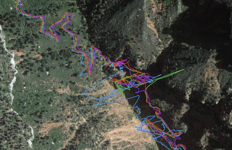
Overall I don't expect any GPS to give me a super-accurate track when traversing the Grand Canyon, but the 66sr came the closest. Whenever there is a freakout along a canyon wall and the GPS tracks you as far away and then magically back the next second, it adds distance onto the track.
- Official NPS distance - North Kaibab > River Trail > Bright Angel - 22.7 miles + 0.5 farting around = 23.2 miles
- GPSMAP 66sr - 24.6 miles - 4,987 ft ascent
- GPSMAP 66i - 25.4 miles - 4,993 ft ascent
- Fenix 6x Pro Solar - 24.96 miles - 4,831 ft ascent
- iPhone 12 Pro Max - 26.7 miles - 5,033 ft ascent
GPS Test 1
GPS Test 2
Other GPS Notes
- The GPSMAP 66sr support WAAS/EGNOS, and I'm guessing it's because it doesn't add much to the accuracy it can achieve with multi-GNSS and multi-band.
- Disabling multi-GNSS or multi-band didn't have any noticeable effect on prolonging battery life.
- Here in the Southern California area, I've noticed that Galileo almost always gets multi-band from all the satellites, whereas GLONASS and GPS only have multi-band from a few satellites.
- You can also save your track to a RINEX file on the 66sr.
- Make sure you sync your GPSMAP 66sr with Garmin Connect before heading out, which will preload satellite information onto the device in the form of an EPO file. The EPO file has orbit information for all the GNSS satellites, compiled from the internet. This saves the 66sr some work in decoding and processing that information directly from the GNSS signal.
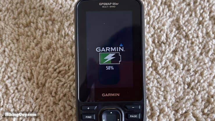
GPSMAP 66sr Battery Life
First off, unlike the GPSMAP 65s, the lithium-ion battery on the 66sr is internal, and you can't swap it out or use AAs. I know that for some, this is a deal-breaker. But in a world where you probably carry other devices (like a smartphone) with internal batteries, I think it's fine. In fact, for me, carrying a smartphone, 66sr, and headlamp, all of which have internal batteries, I end up just carrying one inexpensive USB charger and it takes care of them all. So in that respect, I find the internal battery easier than having to carry extra AA batteries.
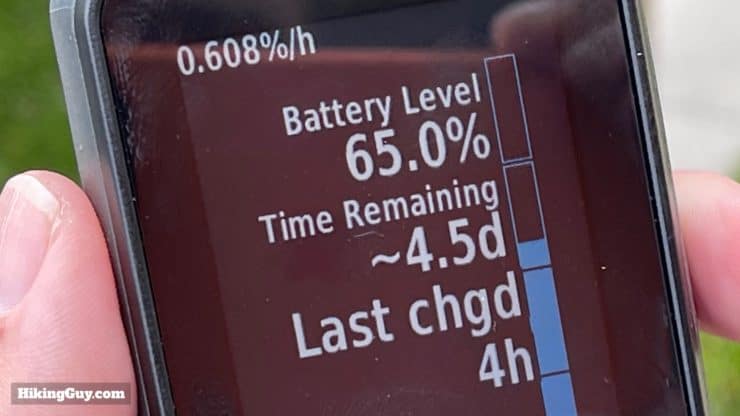
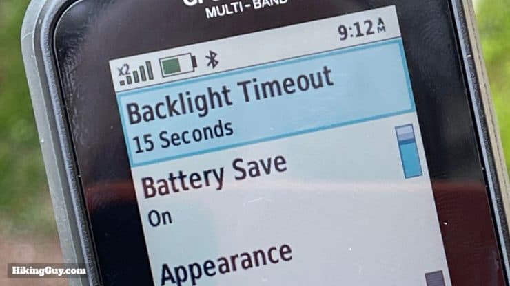
Overall the 66sr battery will be great for most hikers and backpackers. Garmin reports that you can get 36 hours of run time in GPS mode, and that was just a few hours more than I was getting in real-world usage. Generally when hiking, checking the device and dropping waypoints about 3-4 times an hour, I was getting around 32 hours of battery life. This was with the backlight at 100% and battery save mode on with a 15 second timeout. Tweaking other settings only had a minimal effect on battery life. If you notched the backlight down you can probably squeeze another hour or two out of the battery.
Similar to other Garmin GPS devices, there is an "Expedition Mode" where the screen turns off, the device goes into low power mode, and only occasional GPS track points are recorded (about once an hour). I've found the tracking interval not to be very helpful as a hiker, so I don't use it. But if Expedition Mode fits into your workflow, you can allegedly get 450 hours of battery life using it.
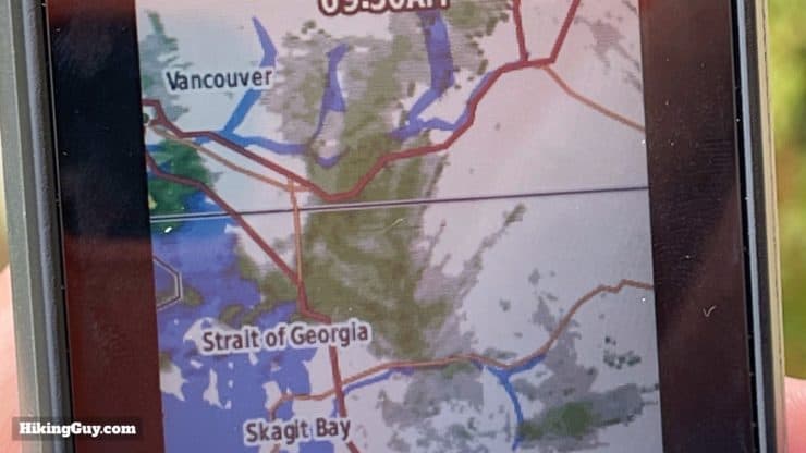
Maps on the 66sr
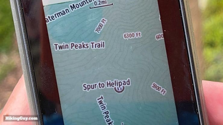
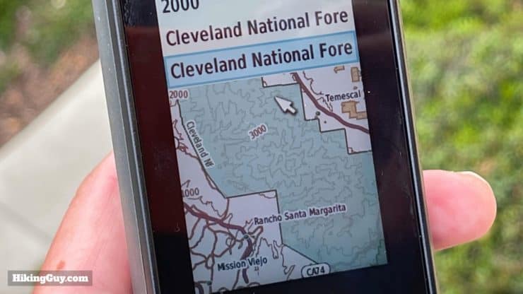
The GPSMAP 66sr comes pre-loaded with Garmin TopoActive maps, and they work well for the outdoors. A few years ago TopoActive maps didn't include many trails, but today they are based on Open Street Maps (OSM) and I've found that the Garmin cartography team does a respectable job of including documented trails in the map set. The maps are updated fairly often and include a list of POIs to search for (like hospitals, etc.).
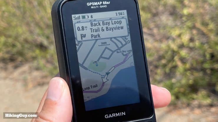
The TopoActive maps are routable, meaning that you can search for a destination and the 66sr will give you turn by turn instructions on how to get there. It's a good feature to have, but if you want to plan a hike, I'd do so with tools beforehand to ensure that you're on a hiking trail and not a less attractive option like a fire road.
And like other Garmin outdoors units with maps, you can't search for a street address unless you install the optional CityNavigator maps, an additional purchase. If you know the ballpark of where you want to go, an easy workaround is to move the map cursor over the spot and hit "GO" from there.
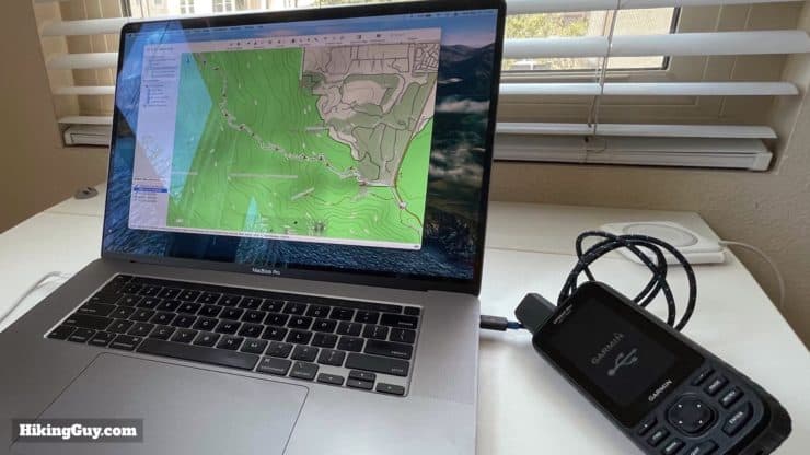
If you want a more detailed map, you can purchase Garmin's Topo 24k maps and load them on the device, or just load free OSM maps on there, which I recommend. The 16gb internal memory has about 5gb of space left for extra maps, and you can pop up to a 32GB Class 10 MicroSD card in there for more capacity. If you will save a lot of data on the device, make sure you check out the (not too shabby) data limitations for the 66sr.
Notable Features on the 66sr
First off, you might be asking yourself why get a dedicated GPS unit when you can just use your phone, and it's a good question, especially as phones get more durable. For me, the answer is easy. A dedicated GPS like the 66sr is built for the outdoors, and that includes rain. I never have a problem using a device like the 66sr with one hand, regardless of the conditions, unlike a touch screen. I also know that I can drop it, sit on it, whatever, and it still works.
Should You Get the GPSMAP 66sr?
Everyone is different, and the alphabet soup of Garmin model numbers can be confusing, but here's what I would recommend for most outdoors folks.
- If you need the best accuracy available in a consumer handheld GPS, then get the GPSMAP 66sr. It's great for geocaching, hunting, and documenting land features.
- If you want that same level of accuracy with AA batteries at a lower price, get a GPSMAP 65s.
- If you want acceptable GPS performance combined with InReach communications, get a GPSMAP 66i,
- If you want to the best of both worlds, get a GPSMAP 66sr and a separate InReach Mini.
- If you don't care about GPS accuracy or outdoor durability, and just want something to navigate with in fair weather, try a smartphone with Gaia GPS.
- If you are considering a GPSMAP 66s (no maps, no multi-band) or a GPSMAP 66st (no multi-band), I'd say you be much better off spending the incremental extra cost and getting the GPSMAP 66sr.
Tips for Using the GPSMAP 66sr
GPSMAP 66sr Resources
- Online Manual
- 66sr Support Articles
- 66sr Firmware Updates
- Free OSM Maps for Garmin
- Garmin Forum on Reddit
- Understanding Your GPX File
- Understanding How a GPS Works
- Creating Custom Maps for the 66sr
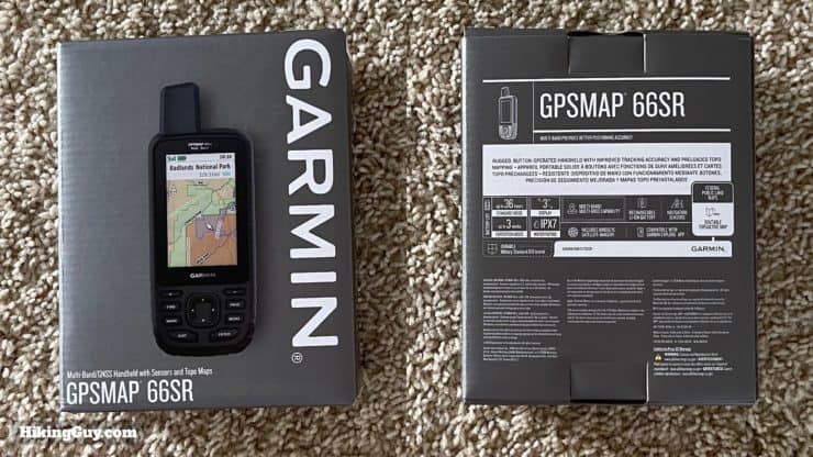
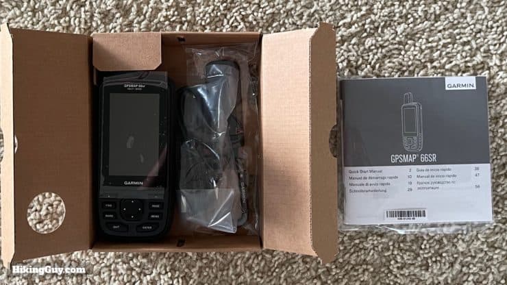
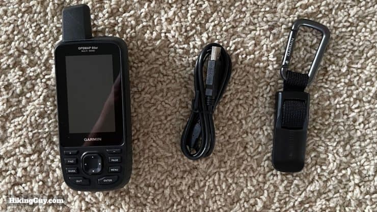
GPSMAP 66sr Unboxing
Basic GPS Concepts in Use
Copying Device Maps to Computer
Need More Info?
- Have a question about the guide? Join my Patreon and ask me a question.
Related Guides
 Garmin GPSMAP 66i Review & Guide
 How Does GPS Work? GPS for Dummies
 In-Depth Garmin GPSMAP 65s Review & Guide
 Hiking Gear & Outdoor Technology
Popular Guides
 Best Hiking Gear 2024
 Hiking Boots or Shoes: Do I Really Need Hiking Boots?
 When to Hit SOS on inReach
This Guide Was Written by Cris Hazzard

Hi, I'm Cris Hazzard, aka Hiking Guy, a professional outdoors guide, hiking expert, and author based in Southern California. I created this website to share all the great hikes I do with everyone else out there. This site is different because it gives detailed directions that even the beginning hiker can follow. I also share what hiking gear works and doesn't so you don't waste money. I don't do sponsored or promoted content; I share only the gear recommendations, hikes, and tips that I would with my family and friends. If you like the website and YouTube channel, please support these free guides (I couldn't do it without folks like you!). You can stay up to date with my new guides by following me on YouTube, Instagram, or by subscribing to my monthly newsletter.