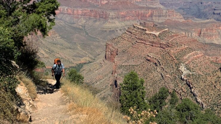

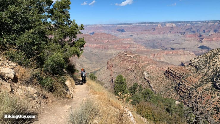
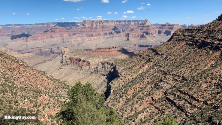
Easily the toughest and most rugged of the Grand Canyon Park Service's recommended day hikes, the Grandview Trail to Horseshoe Mesa is not for the faint of heart. The trail was built in 1893 by miners, and after a few minutes on the Grandview, you'll realize that people were a lot tougher back then. The route is an engineering marvel, with steep cobbled sections and wood cribs hugging the cliffside that lead down to an abandoned mine site at Horseshoe Mesa. This day hike offers expansive views, natural beauty, and a break from the Grand Canyon crowds.
- Turn-by-Turn Hike Directions & Video
- Fitness Level and Gear to Hike to Horseshoe Mesa
- Tips on Weather, Parking, and Planning for Grandview Trail
Don't forget to check out my Grand Canyon hiking tips here!
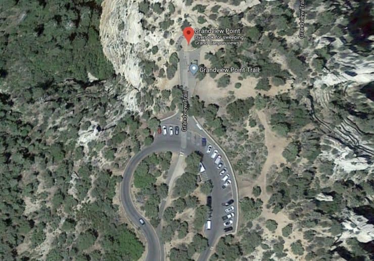
How to Get to the Grandview Trail
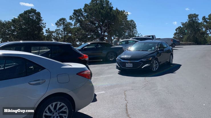
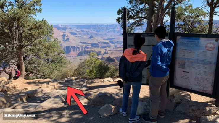
The Grandview Trail is located at Grandview Point, about a 15 minute drive east from the Grand Canyon Visitor Center (South Rim). The trailhead at Grandview Point is at the scenic overlook; expect lots of tourists. But it's far enough away from the main South Rim attractions that there's almost always parking at the trailhead area.
Use this trailhead address:
Grandview Point, Grand Canyon Village, AZ 86023
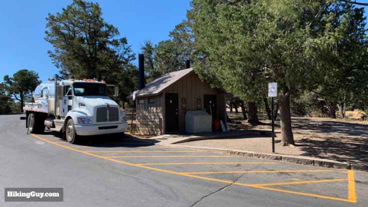
There is no water at the trailhead or on the Grandview Trail, so fill up before you get here.
Gear for the Hike
Even though it's only 6 miles, this is a tough hike and I recommend having backcountry hiking gear. In the warmer months I bring 2-3L of water. There is no water source along the trail and the springs that are close to the Grandview Trail are not reliable and/or contain arsenic. Trekking poles will help on the steep sections of the Grandview, of which there are many. And because this is a more remote trail, I bring enough gear in case of an emergency.
As the Parks Service says in their literature, "Know how to rescue yourself. YOU are responsible for your safety and the safety
of your family and friends. Rescue is not guaranteed, and assistance may take hours or days due to weather or other emergencies."
In the winter or colder months this trail is not a good option unless you've had experience on it already. Ice can make the already steep and slick sections treacherous. I hiked the Grandview Trail in May once, when the temperatures were high, and there was still ice on some of the shady sections. And even with micro-spikes, it was dangerous, so I turned around. Summer and Fall are great times to do this hike.
Gear That I Love Right Now
Nothing is sponsored or promoted, just the actual gear that I use.


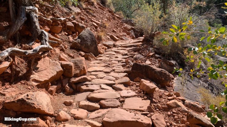
Grandview Trail Condition
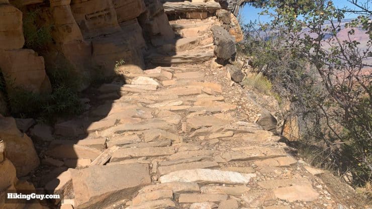
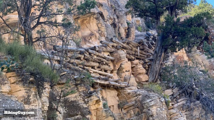
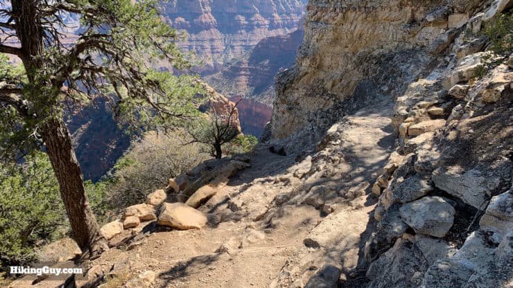
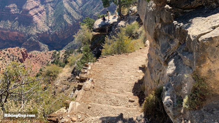
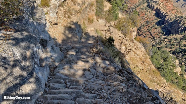
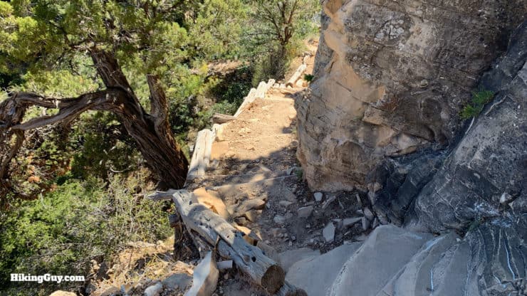
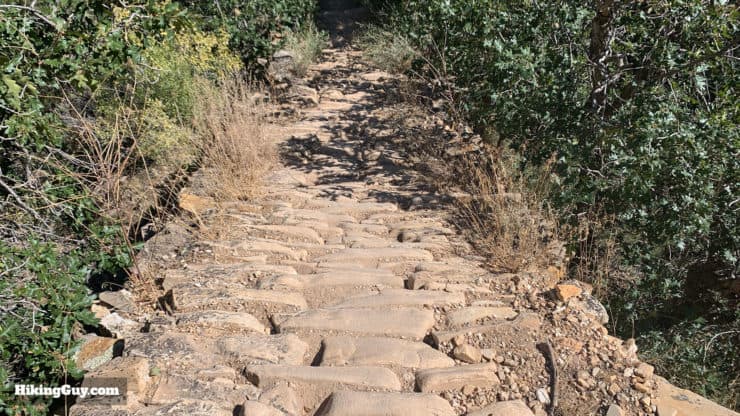
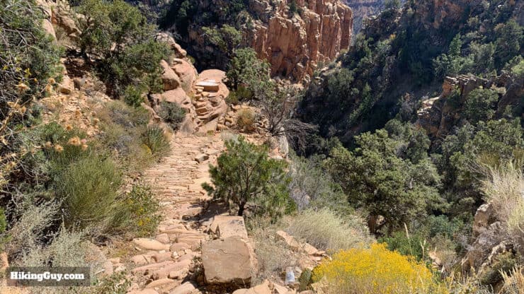
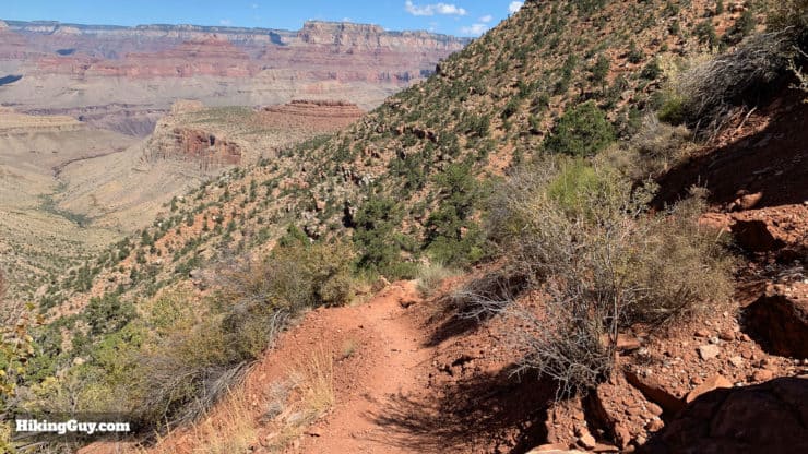
Before we dive into the maps, let's talk about the condition of the trail. The trail was built by miners in the early 1890s and is an engineering marvel that cost $12,000 (about $350,000 in today's dollars). While most native trails follow natural fault lines or natural features to the bottom of the Canyon, the Grandview Trail was built to get miners up and down as quickly as possible. They built a cobblestone ramps on the steep sections from Grandview Point. On sections where no path was possible, they created "cribbing" out of logs and added a path to the side of the cliff.
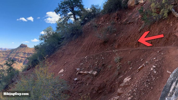
I already mentioned that you shouldn't try this in winter or cooler months unless you have previous experience here, but even in good conditions this trail can be challenging. At some points the Grandview is about 18 inches wide and some points have drops of 100 feet or more down the side. Unlike the main corridor trails (Bright Angel, South & North Kaibab), the Grandview Trail is not actively maintained or built to any standards. However, it is looked after by the Parks Service and when sections get damaged or washed out, they fix them.
This hike is listed as a recommended day hike in the official Grand Canyon National Park publications, but it still has its hazards. People have fallen and died here, although more people die taking selfies from the rim. I mention it because you need to be focused and vigilant when on the trail, watch your footing, and take care if passing other hikers.
Because the trail is so steep in tricky, plan on going down at the same rate as you climb back out.
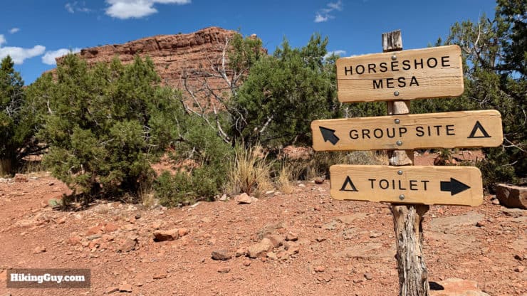
Camping at Horseshoe Mesa
You can overnight at Horseshoe Mesa; there are 3 regular campsites, 1 large group campsite, and primitive toilets. You need a backcountry permit to overnight here. If you want water, it's a steep descent (and climb back) to the only reliable water sources at Hance Creek and Page Spring (aka Miners Spring). Page Spring has high arsenic levels, so have fun with that. Both sources should be treated with a water filter.
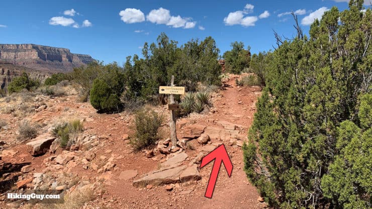
Other nearby camping options include Cottonwood Creek Campground (not to be confused with Cottonwood Campground on the North Kaibab Trail) and a dispersed area beside Hance Creek just below the Tonto Trail.
If you camp, you need rodent protection. Ravens will also make quick work of unattended packs and can open zippers with their beaks.
Grandview Trail Maps
How Will You Navigate?
 Using the Apple Watch for Hiking
 Garmin Fenix 7 & Epix Review For Hikers
 How To Read a Topographic Map
 Garmin GPSMAP 67i Review
Hike Landmarks
| Landmark | Distance | Elevation |
|---|---|---|
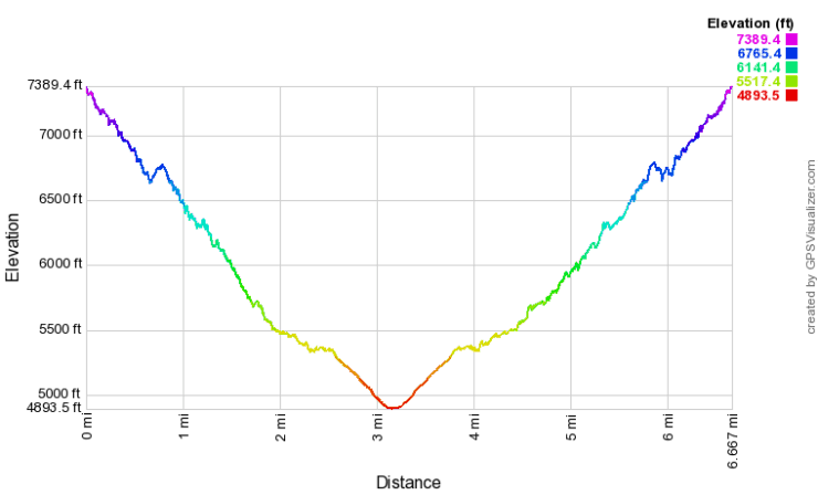
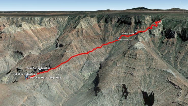
| Grandview Point | 0 | 7400 |
| Coconino Saddle | 1 | 6400 |
| Steep Section End | 1.3 | 5670 |
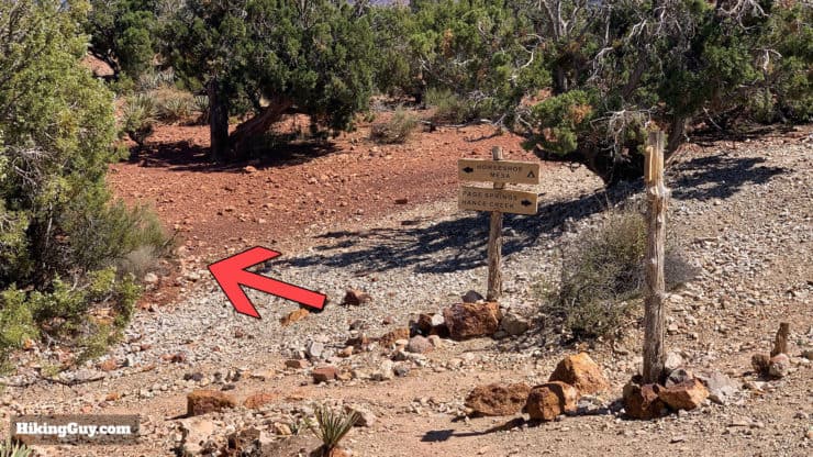
| Page Spring Junction | 2.6 | 4970 |
| Horseshoe Mesa | 3 | 4900 |
Elevation Profile
3d Map
A Quick Grandview Trail History
- The trail was built when miner Pete Berry and the Cameron brothers (of Bright Angel Trail notoriety) discovered copper at Horseshoe Mesa. Berry helped build this trail and the Bright Angel Trail, but later split from the Camerons to focus on Grandview.
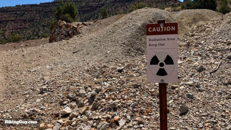
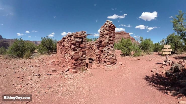
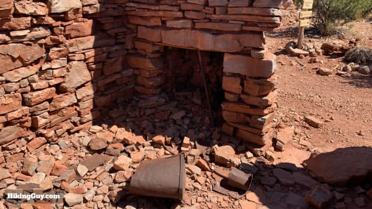
- The mine at Horseshoe Mesa was called the Last Chance Mine, and was one of the only profitable mines in the Canyon. It's copper ore won the 1893 World’s Fair's top prize for purity. The mine operated from 1893-1907. You can still see relics from the mine (like the old cookhouse) and there are still mines and old equipment in the area. You are not allowed to enter any of the (very dangerous) mines without a permit, and you have to leave any miner gear where you find it.
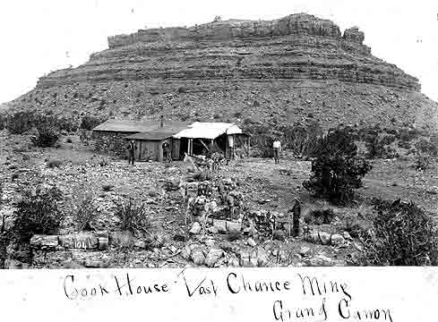
You can still see the walls of the Last Chance Mine cookhouse when you reach Horseshoe Mesa. The cookhouse fed about 5-6 men a day. - At the height of the mining days, 10 mules did one and a half trips a day, hauling 200 pounds of ore out on the way up.
- In 1897 when Berry realized that tourism was the way to go, he built the Grandview Hotel at was is now Grandview Point. The hotel was billed as the "only first-class hotel at the Grand Canyon" and had a regular stagecoach service from Flagstaff. But when the railroad was built to the Bright Angel Trail, visitors by stagecoach stopped and the hotel closed in 1913. It was torn down in 1929.
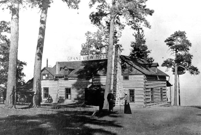
After the Grandview Hotel closed it was bought by William Randolph Hearst. He wanted to use it as a family retreat but it just ended up being land for his cattle to graze on. Photo NPS
How to Hike the Grandview Trail to Horseshoe Mesa
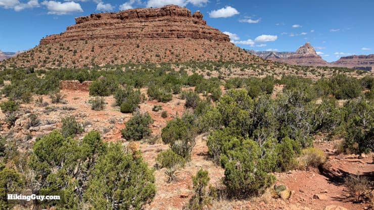
There are use trails up to the mesa and some overlook areas if you have the energy. You can also explore Cave of the Domes on the left side of the mesa and down a small trial market by cairns. It's the only officially "open" cave in Grand Canyon without a permit. Otherwise from here you turn around and head back up the way you came.
Need More Info?
- Have a question about the guide or want to see what other people are saying/asking? View the Youtube comments for this video. Leave a comment and I will do my best to respond.
- When planning, always check the park website and social media to make sure the trails are open. Similarly, check the weather and road conditions.
Related Guides
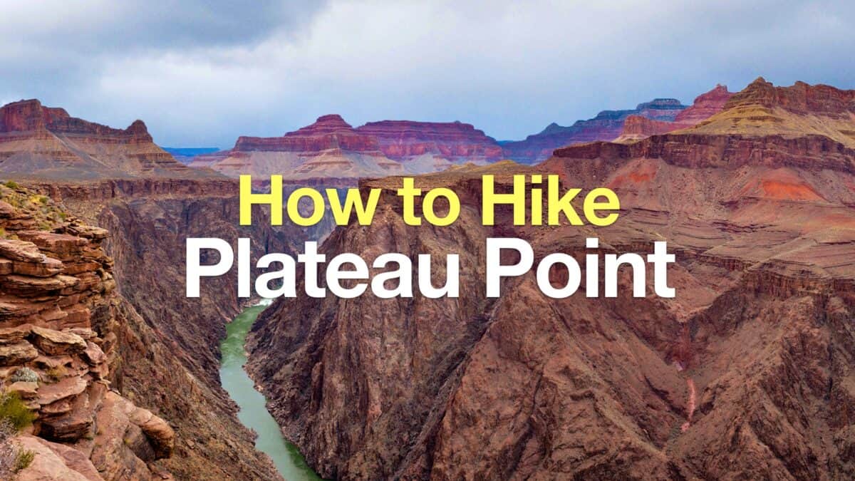 Bright Angel Trail to Plateau Point Hike
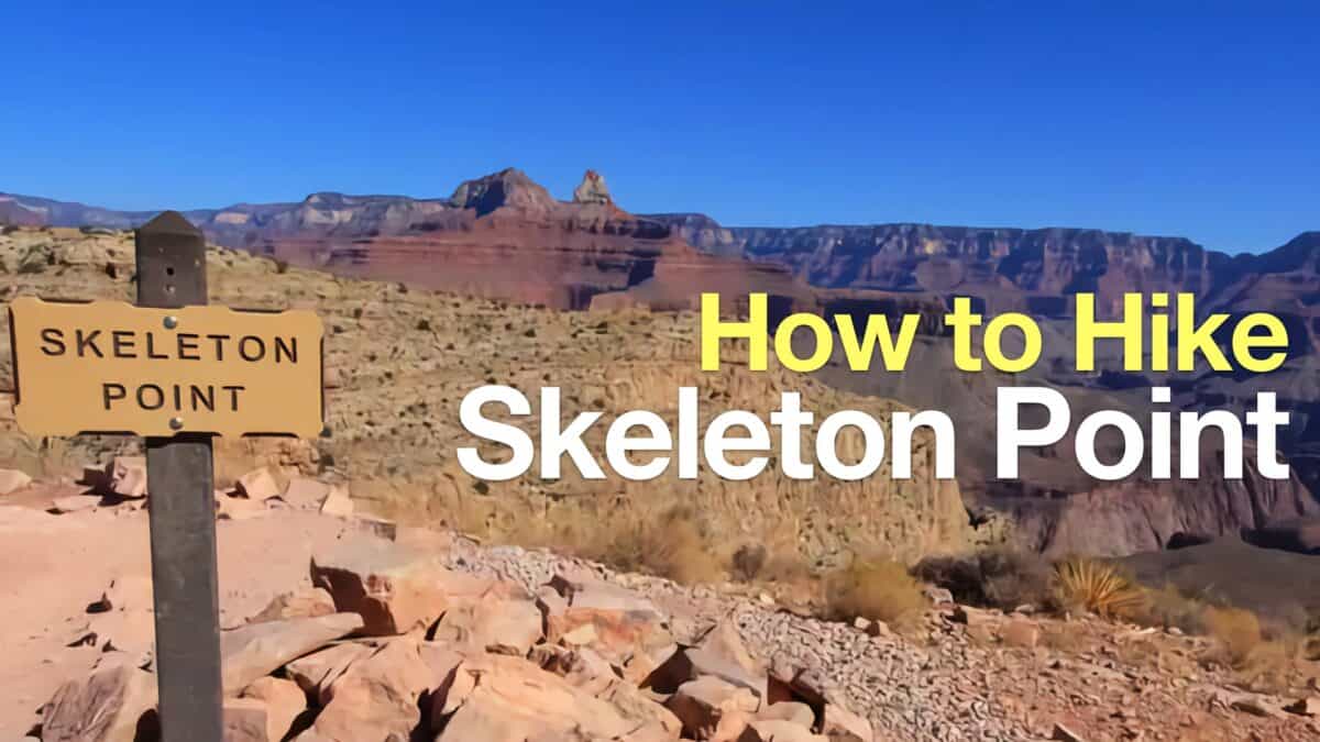 Hike Skeleton Point
 Hike Hermit Trail to Dripping Springs
 Grand Canyon Hiking Tips
 Grand Canyon Rim to River Hike Guide
 Grand Canyon Hikes
Popular Guides
 Best Hiking Gear 2024
 Hiking Boots or Shoes: Do I Really Need Hiking Boots?
 When to Hit SOS on inReach
This Guide Was Written by Cris Hazzard

Hi, I'm Cris Hazzard, aka Hiking Guy, a professional outdoors guide, hiking expert, and author based in Southern California. I created this website to share all the great hikes I do with everyone else out there. This site is different because it gives detailed directions that even the beginning hiker can follow. I also share what hiking gear works and doesn't so you don't waste money. I don't do sponsored or promoted content; I share only the gear recommendations, hikes, and tips that I would with my family and friends. If you like the website and YouTube channel, please support these free guides (I couldn't do it without folks like you!). You can stay up to date with my new guides by following me on YouTube, Instagram, or by subscribing to my monthly newsletter.